Mohawk Indian Camp & Ampitheater Lookout |
 |
| |
| |
|
|
|
Maps |
 |
|
 |
|
|
|
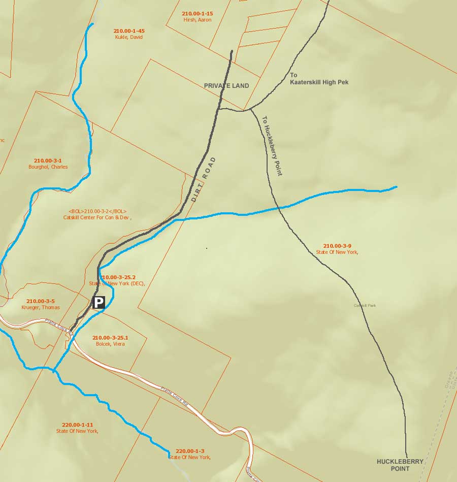
| | DIRECTIONS TO TRAIL HEAD |
| | DEC Parking Lot WGS84 (DEC): 42.133667, -74.0827 - Elevation is approximately 1,872 feet |
| | DEC Parking Lot Deg/Min/Sec: N42 08 01, W74 04 57 - Elevation is approximately 1,872 feet |
| | DEC Parking Lot GPS: N 42 08.020, W 74 04.962 - Elevation is approximately 1,872 feet |
| | DEC Parking Lot UTM: 18N 575810 4665024 - Elevation is approximately 1,872 feet |
| |
|
| | Take New York State Thruway to Exit 21 (Catskill). |
| | Take a left out of the NYS Thruway entrance road. |
| | Go approximately 1/2 mile |
| | Take a right onto Route 23 West |
| | Go approximately 5 miles on Route 23. |
| | Take a left onto Rt 32 (McDonalds on corner). |
| | Go approximately 7-8 miles on Route 32. |
| | Take right onto Rt 23A. |
| | Go approximately 7-8 miles on Rt 23A . |
| | When you come into Tannersville, take LEFT at the red light onto RailRoad Ave (Rt 16), which will turn into Spruce Street, which will turn into Platt Clove Road. Follow this road approximately 7-8 miles |
| | The DEC parking lot is on the LEFT side of the road. |
| | It is approximately 1/2 mile past Josh Road (on left side of the road). |
| | If you start to go down the hill to the valley, then you have gone too far. The downhill section of the road is closed in the winter. |
| | Do NOT block the gate entrance - there is a house at the end of this road. |
| | Do NOT drive up the dirt entrance road to the trail head - this is PRIVATE property - AND there is NO place to park or turn around once you get to the trail head. |
|
|
SPECIAL CIRCUMSTANCES ABOUT THIS HIKE |
| | The first part of the hike goes up a steep dirt road. The road is on private property until the first turn. Stay on the dirt road once you reach the first turn. |
|
|
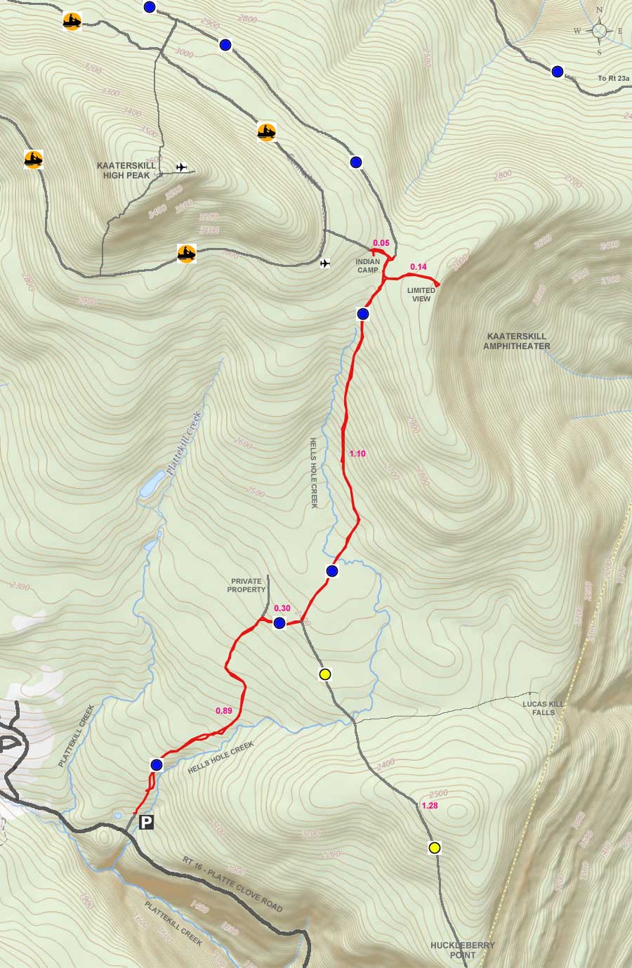
MILEAGE CHART |
| | Mile Point | Altitude | Notes |
| | 0.00 | 1,872Â | DEC Parking Lot. |
| | 0.89 | 2,366Â | Road & Trail Junction - On Right side of road - easy to miss this junction - N42 08.553 W74 04.467. |
| | 1.21 | 2,412' | Trail Junction - Left goes to Kaaterskill High Peak - Right goes to Huckleberry Point - N42 08.544 W74 04.325. Go LEFT. |
| | 2.31 | 2,977' | Trail Junction - Left on unmarked trail goes to Mohawk Indian Camp - Straight continues on the Long Path. As soon as you stop climbing in elevation, start looking for a faint trail on the left. It will have a small rock cairn next to it. N42 09.502 W74 04.006 . After several hundred feet, you will come to a round circle of about 150' in diameter. This is the old Mohawk Indian Camp. |
| | 2.36 | 2,992Â | Mohawk Indian Camp |
| | 2.41 | 2,977Â | Reverse course back to Long Path |
| | 2.46 | 2,985Â | Walk across the trail and bushwack to the Ampetheater Lookout |
| | 2.51 | 2,977Â | Return back to Long Path |
| | 4.82 | 1,872Â | Return to Parking Lot |
|
|
Hike to Mohawk Indian Camp & Ampetheater Lookout |
 |
The image on the LEFT is the DEC Parking Lot with off-road parking. You want to walk pass this metal gate and up the Road. The Owner of the road closes the gate at sunrise and sunset. If the gate is closed, you can walk around it. Do NOT drive up the road, even if you have a 4WD truck. There is NO place to park near the trail head.
The image on the RIGHT shows the road you will be walking up. The road is on PRIVATE property until the first turn to the left. Please stay on the road until then. |
 |
|
 |
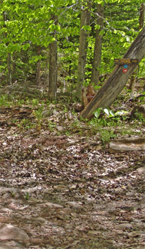
The Picture on the LEFT shows a 'Y' in the road. Stay on the main road and go RIGHT. The path on the left will take you to private property.
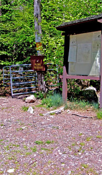
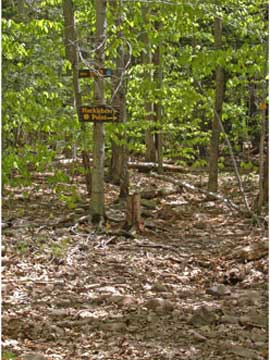
The picture on the RIGHT shows the very little sign that signals that you need to leave the road for the Trail Head. 50% of the people who hike this trail for the first time miss the Trail Head. If you follow the road up further, you will see signs telling you to turn around. Look for the sign on the RIGHT side of the road. |
 |
|
 |
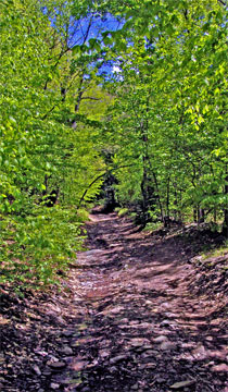
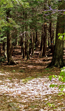
The picture on the LEFT show a picture of the trail after the Trail Head
The picture on the RIGHT shows the next Trail Junction. It is only a short distance from the Trail Head. If you go LEFT, you will go to Kaaterskill High Peak, the Snowmobile Loop Trail, Indian Camp, Ampetheater Lookout, Poet's Ledge, Twilight Park, Long Path. This is also part of the Long Path. If you go RIGHT, you will head to Huckleberry Point. Go LEFT. |
 |
|
 |
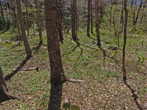
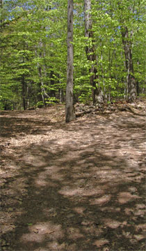
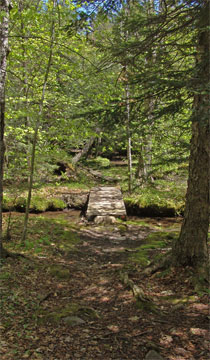
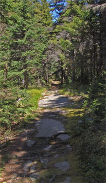
The beginning of the trail is flat. The picture on the LEFT show what the trail looks like.
You will walk over two small streams. There is also a small section that is very wet. |
 |
|
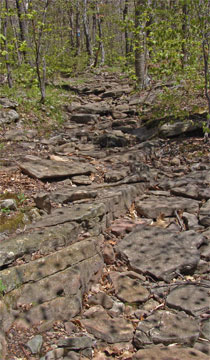 |
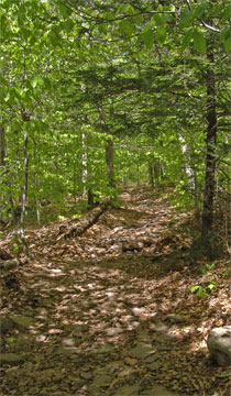
As the trail starts to turn slightly west, the trail will start to ascend upward.
Once the trail starts to level off, start looking for an ancient faint trail used by the Mohawk Indians. This is a non-DEC trail. The access to the trail will be on your LEFT. |
 |
|
|
The trail to the Indian camp starts out by going over a flat section. It will cross several small streams and wet sections. Then it will start ascending uphill at a moderate and steady incline.
When you stop ascending around 3,000 feet elevation, start looking on the LEFT side of the trail for a faint trail. There is a small pile of rocks near the faint trail. Follow the trail about 300' feet to reach the Indian Camp. The Indian camp has a 150' level grassy section with some trees starting to grow in the middle.
When you return back on the faint trail and hit the Long Path again, continue across the Long Path and walk about 300' feet. You will come to the top of a very large amphitheater. There are a couple small rock ledges that will give you a good view of the Hudson Valley.
Reverse back to the Long Path to return back to the DEC parking lot.
You can also continue the hike by hiking past the Indian camp, which will hit the snowmobile path in another couple hundred feet. Once you hit the snowmobile path, you can go right for the North side ascent to Kaaterskill High Peak. If you go left, you can do the South side ascent to Kaaterskill High Peak. The south side ascent is very difficult and exceedingly steep. |
|
|
S E C T I O N S
|
W E A T H E R
|
O T H E R
|