Sleepy Hollow Trail |
 |
|
|
Overview of this Hike: |
| Distance: 5.05 from parking lot at South Lake dam to Mountain House Road. |
| Time: 3.5 hours round trip (hiking time) |
| Elevation Loss: 1,439' loss from NSL parking lot to Mountain House Road |
| Best Time to Hike: In the Morning |
| Difficulty: Easy |
| Highest Elevation: 2,189' |
| Lowest Elevation: 750' |
| Digital Mapper:
Topo
Terrain
Satellite |
| Access Methods: Foot, snowshoe, horse, or snowmobile. |
|
Maps |
 |
|
|
Directions to Trail Head from New York State Thruway (Easist, not the shortest): |
| Take New York State Thruway to Exit 21 (Catskill). |
| Take a left out of the NYS Thruway entrance road. |
| Go approximately 1/4 mile |
| Take a right onto Route 23 West |
| Go approximately 6.6 miles to Cairo, NY |
| Take a LEFT onto Rt 32. McDonalds Rest. on corner. |
| Go approximately 7.7 miles on Rt 32 |
| Take a RIGHT onto Rt 23A |
| Go approximately 2.6 miles to park your FIRST car in the DEC Palenville Parking Lot |
| Go appoximately another 4.25 miles to North Lake Road. |
| Take a RIGHT onto North Lake Road (DEC sign on corner of road). |
| Follow North Lake Road until you reach the DEC booths. |
| Stay RIGHT after going thru DEC booths |
| Park at the parking lot by the outflow of South Lake |
| NOTE: You can park inside North-South Lake Campgrounds for free in the Winter. |
| NOTE: In the summer you have to pay to go into North-South Lake Campgrounds to hike OR you can park in the DEC Scutt Road Parking Lot (just before DEC booths for free. |
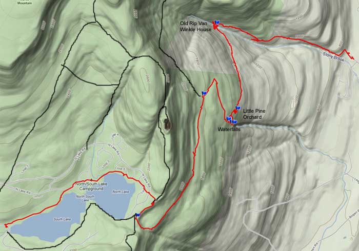
Mile Post Chart for South Lake to Sleepy Hollow Trail to Mountain House Road |
| Mile Post | Altitude | Notes |
| 0.00 | 2,150 | Parking - by South Lake outflow - Take trail on the north side of South Lake |
| 0.52 | 2,153' | DEC Service Road - Take a RIGHT. |
| 0.61 | 2,158' | Take a RIGHT at the Y in the road |
| 0.68 | 2,163' | Take a RIGHT onto Foot Trail |
| 0.94 | 2,156' | Take a RIGHT onto Road |
| 0.96 | 2,156' | Take a RIGHT at the T in the Road |
| 1.02 | 2,160' | Take a RIGHT at Campsite #153 onto gravel path. |
| 1.07 | 2,169' | Take a RIGHT onto Road |
| 1.15 | 2,175' | Take a LEFT at the Restrooms into grass field |
| 1.19 | 2,182' | Find narrow path across the road into woods - Straight Path into forest. |
| 1.28 | 2,189' | Cut about 50' through the woods to the Escarpment Trail by the fireplace (switch from yellow trail marker to blue trail markers) |
| 1.53 | 2,176' | Take a LEFT onto Sleepy Hollow Trail (Not marked with a sign). It does have a DEC snowmobile trail marker. |
| 1.90 | 2,039' | Trail Junction to Palenville Overlook. Right will take you to Palenville Overlook. You want to go STRAIGHT. |
| 2.74 | 1,866' | Trail Junction to Winter Clove. Left will take you on an un-marked trail to Winter Clove. |
| 3.50 | 1,600' | Little Pine Orchard Picnic Area with a view. |
| 4.15 | 1,314' | Old Rip Van Winkle homestead site at creek. |
| 5.05 | 750' | DEC Registraion box and Mountain House Road. |
|
|
Hike the Sleepy Hollow Trail from South Lake |
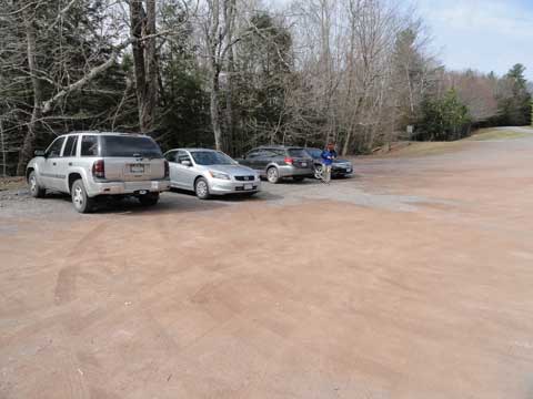 |
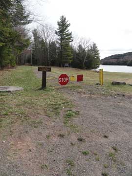
This is the Parking Lot at the outflow of South Lake in the North-South Lake Campgrounds. In the Winter you can park there for free. In the summer you can park there, but you must pay to park and hike in the Campground. If you do not want to pay, you can park at the DEC parking lot on Scutt Road (road on the right just before the DEC booths to the North-South Lake Campground. |
|
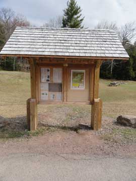 |
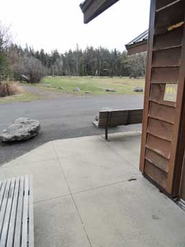
There is a DEC kiosk that has information about the region and hiking in the area.
This is the start of the hike. You will find it across the street and a little bit up the hill from the DEC kiosk. This is also the old railroad track bed. One of the old water towers exist higher up in the woods. But, you cannot see it from the trail. |
 |
|
 |
This trail is the final section of the old rail road tracks to North-South lake.
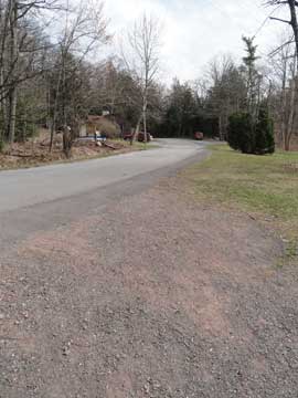
At the end of the old rail road track trail, take a RIGHT onto the asphalt road. |
 |
|
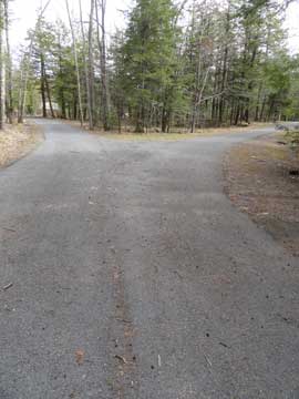 |
As you walk up the road a little ways you will come to a Y in the road. You want to go RIGHT.
As you walk up the road, you will see a dirt trail on the RIGHT side of the road. You want to take a RIGHT onto this trail.
 | |
|
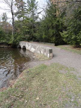 |
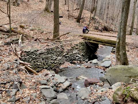
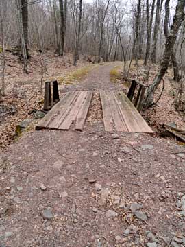
As you walk down the dirt trail, you will cross over this bridge. This picture was taken while looking back. This stream helps feed North-South Lake with water.
At the end of the trail, you want to head towards the dark brown fence you see in the picture.. |
 |
|
 |
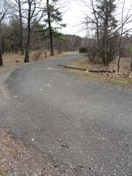
After a very short distance, you will come to a road juction. You want to take a RIGHT.
This is a picture of the trail you want to take. |
|
 |
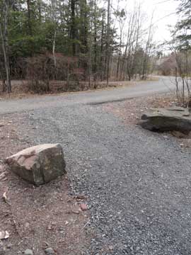
At campsite #153, you want to leave the road onto the gravel path. You want to walk between the two large rocks on the side of the trail.
At the end of the gravel trail, you want to take a RIGHT onto the asphalt road. |
 |
|
 |
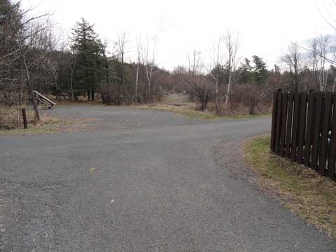
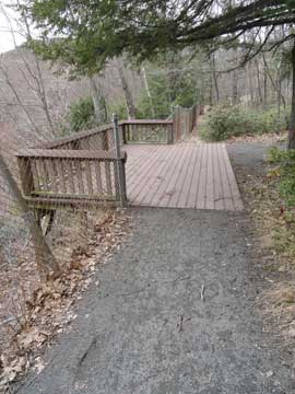
You want to continue up the road until you reach the bath rooms. You will see a field on the left. You want to take a LEFT and walk up the field to the main road. |
|
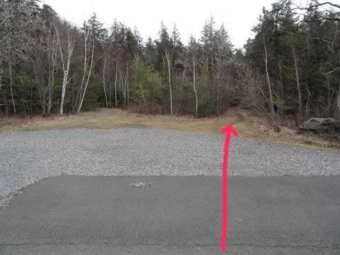 |
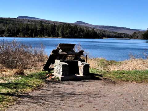
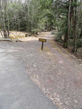
At the main road, you will see a very small trail opening across the street. It is on the left of the large rock. Walk down this trail. When the trail turns to the right start looking for a fire place. |
|
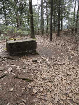 |
When you arrive to the fire place, you want to take a LEFT and bushwhack through the woods to cut across to the Eastern Escarpment Trail. Maybe 30-50' throught the woods. Then take a RIGHT onto the Eastern Escarpment Trail
After a short distance, you will see a wooden overlook of the Hudson Valley. After you pass this point, start looking for a trail on the LEFT. Maybe 100-200' after the overlook. |
 |
|
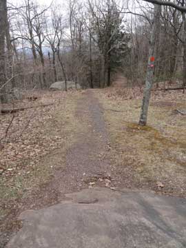 |
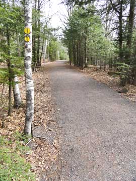
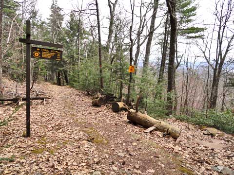
This is the beginning of the Sleepy Hollow Trail. Sometimes called the Mountain House Road. Take a LEFT onto this trail. The trail is also marked with a Snowmobile marker and a Horse Trail Marker.
This is a sample of the trail. |
 |
|
 |
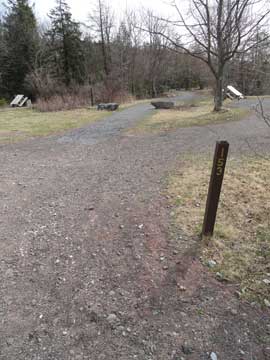
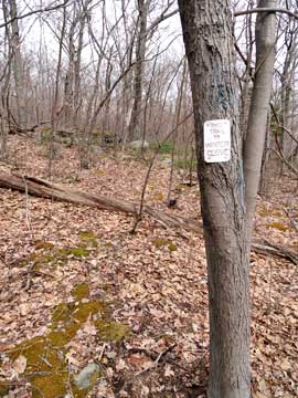
After a little ways down the Sleepy Hollow Trail, you will see a trail junction on the right.. |
|
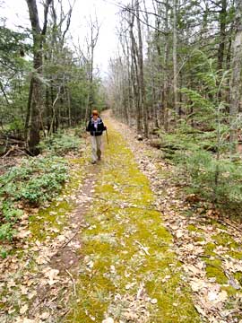 |
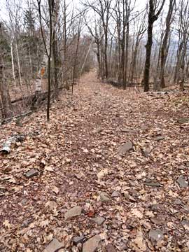
A little further down the Sleepy Hollow Trail
Just before you get to the first big hairpin turn on the Sleepy Hollow Trail is a small side trail on the left. This is an umarked trail that will take you to Rip's Ledge and Winter Clove. This side trail is difficult to follow, so if you should want to take this trail, you need to be prepared for some bushwhacking. |
 |
|
 |
After you go around the first hairpin turn, you will walk south along a fairly level path. Then you will come to the second hairpin turn. There are some small waterfalls by the hairpin turn. Not very big waterfalls, and they can dry up in the summer. |
|
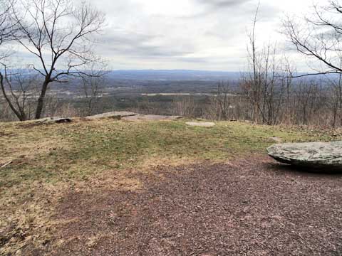 |
After the second hairpin turn is the a small area called the Little Pine Orchard Picnic Area. You would think that there would be a small conifer forest like the one you see at Pine Orchard near North-Southe Lake. But, there are NO conifer forest here. Maybe there was many years ago. But, it does have a nice overlook of the Hudson Valley. |
|
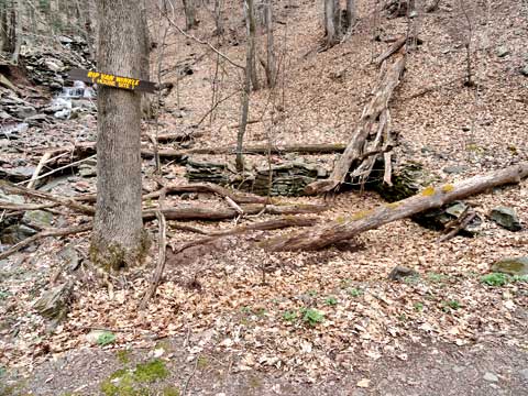 |
After you leave Little Pine Orchard Picnic Area, you will pass through an region of Private Property, so stay on the trail. You will even see a cabin on the left. Do NOT go near the house. Then you will come to a turn in the road. This is the old Rip Van Winkle House. The house burned down in 1919. Only the foundation remains. |
|
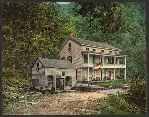 |
This is a historic picture of the old Rip Van Winkle House from the Library of Congress around 1900. The stream flowed between the two buildings.. |
|
 |
This is a picture of the old Rip Van Winkle House site from upstream. You can see the foundation well on the left side of the stream. |
|
 |
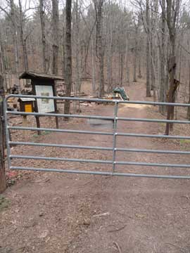
A little further down the Sleepy Hollow Trail is the Black Snake Bridge. You will hear waterfalls on the right, but they are on private property.
When you arrive at the metal gate, this is the end of the hike. Make sure that you register or check out. |
 |
|
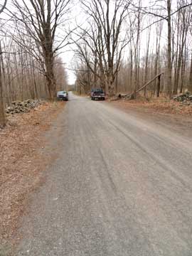 |
You need to park your car BEFORE the barn on the right side of the road. You can park on either side of the bridge. Don't be a bother the home owners at the trail head. . |
|
|
S E C T I O N S
|
W E A T H E R
|
O T H E R
|