The weather was nice, it was 70s and not that humid and there was a little bit of a breeze, however there was some haze which restricted the visibility limit, and things further than 10 miles were quite hazy. I still got some nice shots, and added 2 more peaks to my list.
Looks like this bridge actually stood up to Irene, amazing with all the rocks piled against it.

Was basically this for 1.75 miles:

Then this for .25 miles

After turning onto the yellow trail, we finally made it to the conifers

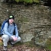
Summit rock

What's engraved and painted on the summit rock:

Summit cabin and fire tower

There were a lot of panes of glass in the way, but the view in person was amazing. It was a bit scary climbing the tower with the wind above the treeline

The cabin from the tower

Burrough's Range from the southern viewpoint

Devil's Acre lean-to

Summit canister on Southwest Hunter

John gave up on trying to figure out which direction we were heading...these signs offered no solice.

The steep rocky descent down the becker hollow, that neither of us remembered climbing on the way up. The rocks here are very loose and the dirt is dry so everything gives way easily. We slipped and fell on our rears several times, and caused many small rock slides, but nothing serious

Last shot I took before we just got down to the cars.
