Historic Hike Around North-South Lakes
|
|
|
|
Overview of this Hike: |
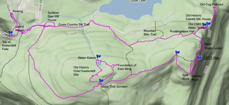
| Distance: 6.39 round trip from parking lot on Laurel House Road to multiple historic sites and back. Sites include
Kaaterskill Falls,
Laurel House Site,
Kaaterskill Hotel Site,
Boulder Rock, Eagle Ledge, Spinx, Puddingstone Hall, Old water towers of
Catskill Mountain House,
Pine Orchard, Mill House, Kaaterskill Hotel Laundry House |
| Time: 3.0 hours round trip (hiking time) |
| Elevation Gain: 326' gain from parking lot |
| Side Trips: North and South Lake |
| Best Time to Hike: Anytime of day |
| Difficulty: Easy |
| VO Map No: Unmarked trail - #12 - #96 - #16 - #12 - unmarked trail - road - #12 - ummarked |
| Catskill Highest: 100+ |
| Highest Elevation: 2,482' |
| Digital Mapper: Topo
Terrain
Satellite |
| Attractions: Good views from Boulder Rock, Eagle Ledge, and Catskill Mountain House Site. |
| Attractions: Lots of Historic sites |
| Unattractions: Need to cross Lake Creek - If water is high it cannot be crossed. |
| Unattractions: Easy to get lost - 30% of the people get lost here. |
| Unattractions: Lots of people visit this trail |
| Dangers: Black Bears |
| Common Animals: Coyotes, bears, birds, and deer. |
| Risky Animals:
Rattlesnakes and Copperheads (none known),
Bears (high) |
| Access Methods: Foot, snowshoe, and skiing on some trails. |
|
Maps, Profile, and GPS files |
 |
|
|
Directions to Trail Head from New York State Thruway (Easist, not the shortest): |
| GPS location of Parking Lot at the end of Laurel House Road is: N42 11.743 W74 03.781 |
| Take New York State Thruway to Exit 21 (Catskill). |
| Take a left out of the NYS Thruway entrance road. |
| Go approximately 1/4 mile |
| Take a right onto Route 23 West |
| Go approximately 6.6 miles to Cairo, NY |
| Take a LEFT onto Rt 32. McDonalds Rest. on corner. |
| Go approximately 7.7 miles on Rt 32 |
| Take a RIGHT onto Rt 23A |
| Go appoximately 7-8 miles to the intersection of Rt 23a and North-South Lake Road. |
| Climb up the windy mountain road (Rt 23A). When you reach the top, you will then be in Haines Falls. |
| Take a RIGHT onto North Lake Road (DEC sign on corner of road). |
| Follow North Lake Road until you reach Laural House Road. |
| Take a RIGHT onto Laurel House Road. |
| Drive to the end of the road, and park. Can get crowded on busy weekends. |
| GPS location of Parking Lot at the end of Laurel House Road is: N42 11.743 W74 03.781 |
| Mile Post | Altitude | Notes |
| 0.00 | 2,028 | Parking at the end of Laurel House Road. |
| 0.24 | 1,937' | Top of Kaaterskill Falls. |
| 0.38 | 1,982' | Laurel House Site |
| 0.46 | 1,993' | Trail Junction with the DEC Trail and old bridge - DEC registration box |
| 0.65 | 2,075' | 4-way Trail Junction - Take a RIGHT and go uphill. |
| 0.90 | 2,199' | Trail Junction with Horse Trail and trail to Escarpment Trail (Sunset Ledge and Inspiration Point). |
| 1.64 | 2,451 | Trail Junction - Continue Straight. |
| 1.65 | 2,455 | Trail Junction - Take a LEFT on the Kaaterskill Hotel Loop |
| 1.94 | 2,485 | Kaaterskill Hotel site - Take left on west side of pond |
| 2.06 | 2,450 | Water Cistern for Kaaterskill Hotel. - Continue on loop - Take two lefts and continue on Escarpment Trail. |
| 3.11 | 2,460 | Trail Junction - Take a RIGHT to Boulder Rock |
| 3.23 | 2,423 | Trail Junction - Unofficial trail to Palenville Overlook and Indian Head. Plane crash due west. Continue Straight) |
| 3.25 | 2,431 | Split Rock. |
| 3.31 | 2,443 | Boulder Rock |
| 3.46 | 2,452 | US Coast Survey Signal - Steel Post (Now USGS) |
| 3.58 | 2,443 | Return back to Boulder Rock |
| 3.67 | 2,474 | Trail Junction - Go RIGHT |
| 3.84 | 2,431 | Eagle Ledge |
| 3.90 | 2,431 | Sphinx |
| 3.99 | 2,405 | Puddingstone Hall |
| 4.07 | 2,352 | Water Towers for the old Catskill Mountain House. |
| 4.13 | 2,306' | Run back on to the Escarpment Trail. |
| 4.25 | 2,211 | Catskill Mountain House site and Anvil Ledge |
| 4.38 | 2,158 | Old Cog Railroad - END of HIKE - Return back to Puddinghouse Hall |
| 4.77 | 2,405 | Puddingstone Hall |
| 5.15 | 2,356 | Trail Junction to old Hotel Road - Take RIGHT down the hill. |
| 5.37 | 2,256 | North-South Lake Road |
| 5.51 | 2,220 | Trail Junction on Left. This is the Cross-Country Ski Trail - Leave South Lake Road for the ski trail | | 5.65 | 2,171' | Trail Junction - Right onto this Unoffical Road will take you to Scribner's Mill House. Go Right |
| 5.68 | 2,147 | Saw Mill House / Kaaterskill Hotel Laundry (stone house with metal roof) |
| 5.74 | 2,148 | Trail Junction - Take RIGHT back towards Kaaterskill Falls. |
| 5.93 | 1,993 | Leave DEC Trail and cross Lake Creek - Follow trail back to car |
| 6.39 | 2,153 | Laurel House Road Parking Lot |
|
|
Hike to Historic Sites in the North/South Lake Region |
 |
You can park at the end of Laurel House Road. All of the land at the end of the road is State owned land. On busy weekends, this parking lot can get quite full. The GPS location of the Parking Lot is: N42 11.743 W74 03.781
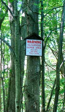
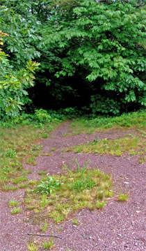
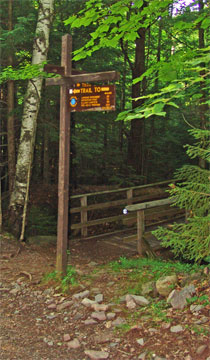
The picture on the right is a safety zone sign by the trail down to Kaaterskill Falls. I cannot tell you how important this sign is. Well over 100 people have died after falling off Kaaterskill Falls. Only one person has lived after falling off the upper 167' Falls. A dog did survive after falling off of Kaaterskill Falls back in the 1800's. But, everyone else died. The land near Kaaterskill Falls slopes downhill, and many people have slide off the Falls. People like to jump across the water near the top of the Falls. The rocks in the water are VERY slippery. Fall here and you can easily be sweep off the Falls. In the Winter you should NEVER get anywhere close to the edge of the Falls. There is an unofficial trail to the bottom of the Falls. This trail is VERY dangerous. Drive to the bottom of the Falls and hike up to the bottom of the Falls. |
 |
|
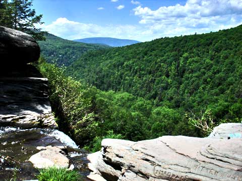 |
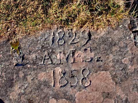
At mile post 0.24, you will come to the top of Kaaterskill Falls. There are a lot of engravings on the rocks near the top of Kaaterskill Falls. There is a Survey marking from 1825 engraved into the rock. When the Laurel House was present, there was a house on top of the large rock on the right side of the Falls as you look over the valley. The name of this house was called the, "Spray House".
Please do not engrave anything into the rocks! |
|
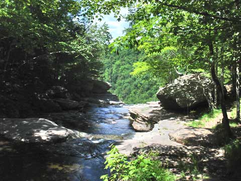 |
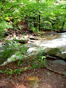
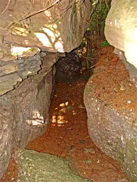
Here is a picture about 75' up Lake Creek looking towards the top of Kaaterskil Falls Dam. Back when the Laurel House existed, there was a dam about 100' above the Falls. People would pay 25 cents to see the dam released, and witness a large amount of water going over the Falls. Prior to this dam, they used to use the dam up near the end of Schutt Road by the Saw Mill. There is no longer any evidence of the old dam.
Laurel House was located close to the edge of the Falls. You can read more information about the Laurel House here. If you walk up the side of the creek you will see part of the foundation of the old Laurel House. |
|
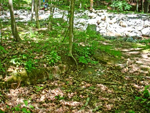 |
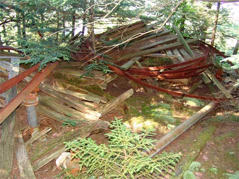
The next stop will be the Laurel House Laundry House. After you walk up a couple hundred feet you will come to an old bridge piers. It is concrete on the Laurel House side and stones on the other side. The bridge is long gone. Before we cross Lake Creek here, we will walk up a little further and visit the old Laurel House Laundry Building. The old Laurel House Laundry building was on the corner where Spruce Creek joined in with Lake Creek. The picture on the left shows one of the foundation corners. The Laundry House for the Laurel House was quite large (approximately 3,000 sf - 78.5' x 38.5'). Once you get done with the Laundry Building walk back to the bridge piers and cross Lake Creek. If Lake Creek water level is too high, drive to Schutt Road, and get across the creek that way. But, do not cross Lake Creek during high water! |
|
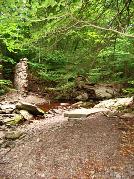 |
The picture on the left shows the concrete bridge pier on the Laurel House Side.
The picture on the right is the stone bridge pier for the old road. In this picture the water is too high to cross it. If you cannot step on dry rocks to cross the creek it is too high. Once you climb up the small hill to the top of the stone pier you will come to the DEC trail. You want to continue up the trail that runs parallel with Lake Creek. |
 |
|
 |
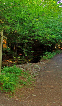
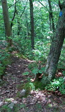
After you cross Lake Creek and walk up the bank, you will encounter the DEC Escarpment Trail. The picture on the left shows the trail AFTER you pass the trail junction. The path up the steeper hill will take you to Layman's Monument and Council Bluff. We want to continue up the trail that runs parallel to Lake Creek. After a couple hundred feet, you will see a DEC Registration Box. Please Register here. |
|
 |
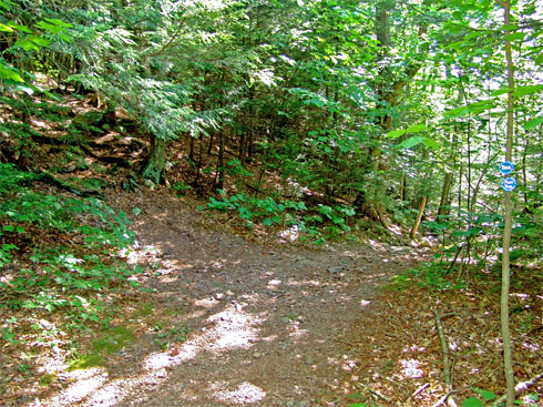
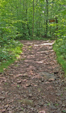
Once you get to the major 4-way intersection, take a RIGHT, and head up the hill. Left would take you to Schutt Road or the Saw Mill / Laundry House. Straight would take you to South Lake on the Cross-Country Ski Trail. But, to get to Hotel Kaaterskill, you need to make a RIGHT. There is a DEC registration box part way up the hill.
At mile post 0.90, you will encounter a Trail Junction. If you go Right (yellow marker trail), it will take you to the Escarpment Trail near Sunset Ledge, and the Horse Trail. If you continue Straight, you will continue to the old Kaaterskill Hotel Site. Continue STRAIGHT. |
 |
|
 |
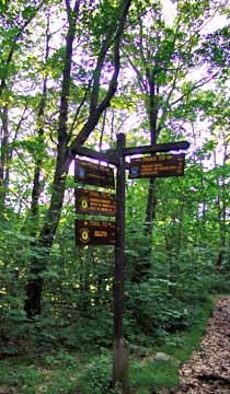
At mile post 1.64 miles, you will come to a 3-way intersection. You want to continue STRAIGHT for another 50'. Right will take you to the Escarpment Trail.
Here is another picture of the trail sign 100' south of the 3-way intersection. There are two 3-way intersections within 100' of each other. You can see both from this spot.
Afte walking straight for another 50' take a LEFT onto the small path. This small path will take you to the old Hotel Kaaterskill Site. Just before you reach the old hotel site, the land to the left is where the old barns were located. If you look carefully, you can find the old foundations to the Hotel Kaaterskill Barns. There were two barns that we know of. |
 |
|
 |
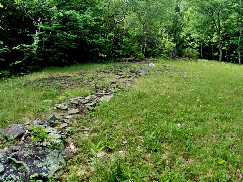
At approximately mile post 1.94, you will encounter the Kaaterskill Hotel site (see picture on left). 100 years ago, the official name was Hotel Kaaterskill. Today everyone calls it Kaaterskill Hotel. The GPS location of approximately the Kaaterskill Hotel is here: N42 11.361 W74 03.051
This trail will loop around the old Kaaterskill Hotel site. Sadly, the site is NOT maintained by the New York DEC.
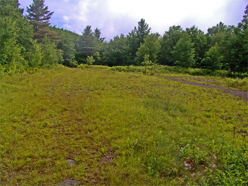
If you continue across the flat opening, you will find the continuation of the trail on the left corner. On right is a field (next picture), which was also part of the old Kaaterskill Hotel. |
|
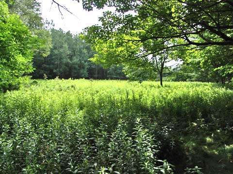 |
This field also represents part of the old Kaaterskill Hotel. Back in the 1970's most of the foundation sill existed. But, at some times, the DEC brought in heavy equipment and destroyed all the history of the old hotel. If you walk around you can still found some parts of the foundation. Some parts are in the woods. |
|
 |
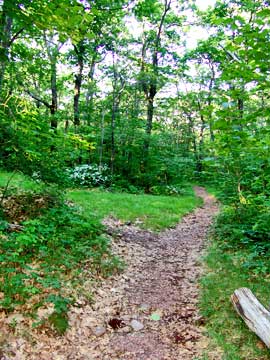
If you continue across the flat opening, you will find the continuation of the trail on the left corner of the site. See picture on LEFT.
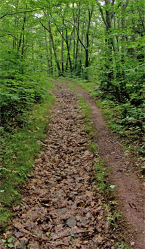
100 feet after entering the woods, you will see a trail junction on the LEFT. Take a LEFT. The picture on the right shows what the trail looks like in the summer. |
 |
|
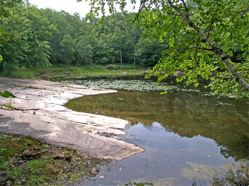 |
At mile post 2.06 (elevation 2,530') you will encounter the pond near the Kaaterskill Hotel. This pond supplied the water for the hotel.
If you walk around the area, you can still find parts of the old hotel. The Barns used to be west of the hotel. |
|
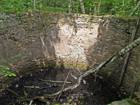 |
At Mile post 2.06 (elevation 2,530') you will see the old water cistern that held the water for the hotel. The water cistern for Hotel Kaaterskill is right next to the pond, but on the north side of the pond. The GPS location is: N42 11.451 W74 03.051
There used to be a trail on the left side of the overflow, and followed the stream down to the cross-country ski trail. Today it is overgrown, but easy to follow the stream. |
|
 |
After you leave the pond and water cistern and start walking up the trail, you will see a small field off to the left. If you walk through the forest to the small field, you will find part of the eastern Annex of the Hotel Kaaterskill. You can see the foundation of old Annex. Some of the BX wiring is still around the site. This section burned to the ground just like the rest of the hotel. After visiting this section of the hotel, continue down the Kaaterskill Hotel Loop. You will come back out by the 3-way intersection. . |
|
 |
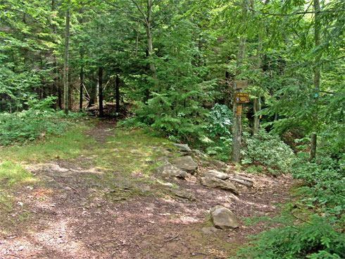
Once you complete the Kaaterskill Hotel Loop, you want to go LEFT. After walking about 100 feet, you want to take a SECOND LEFT. This will put you on the Escarpment Trail.
Part way down the trail, you will see an intersection on the left. This trail is the old Hotel Kaaterskill Carriage Road. It was one of three roads to the Kaaterskill Hotel. This trail will take you down to South Lake Road and South Lake. |
 |
|
 |
At mile post 3.11 (elevation 2,260') you will encounter another Trail Junction. If you continue Straight, this will by-pass Boulder Rock. By going Right, you will head towards Boulder Rock. You want to go RIGHT.
Boulder Rock was called Bowlder Rock for close to 200 years. Recently, the DEC changed the name to Boulder Rock. This was because of the changes of the English Language. Some people still fee that it should be called Bowlder Rock. |
|
 |
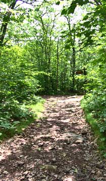
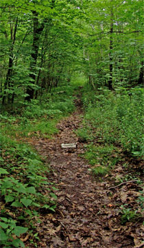
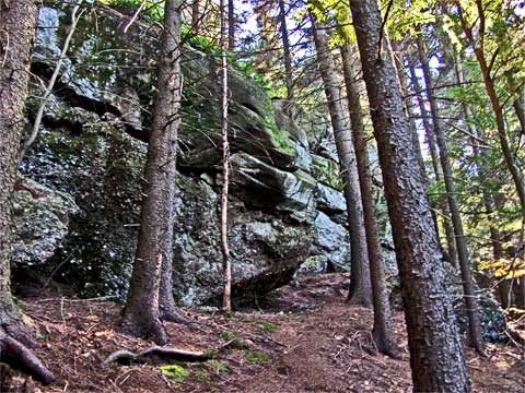
This is what the trail looks like to Split Rock, Boulder Rock, ledges, and the USGS post. |
|
 |
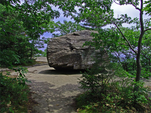
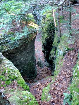
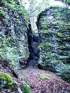
Just before you reach Boulder Rock, you will come to Split Rock. To get below Split Rock, take the faint trail to the right just before Split Rock. |
|
 |
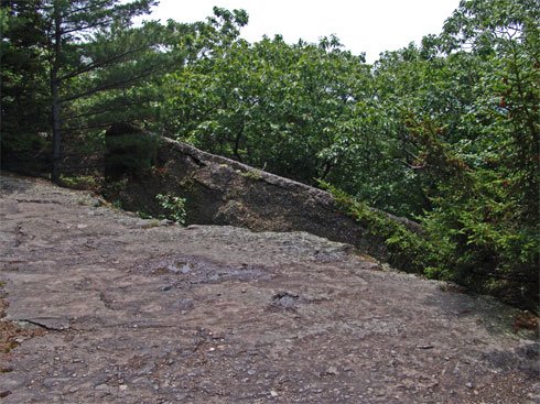
At Mile Post 3.31 (elevation 2,443') you will encounter Boulder Rock (previously called Bowlder Rock. Years ago, there was a stair way to the bottom of the ledge on the right side of Boulder Rock.
There are 3 sets of ledges near Boulder Rock. The first ledge is located under Boulder Rock. A little ways north will be the second ledge. After walking thru the woods another 350' you will encounter a larger Ledge. |
|
 |
This is a picture of the second ledge. It is the largest and nicest ledge. There are blueberry bushes near the ledge. If you continue further up the trail, you will come to a very small ledge with a metal post in it. This is the USGS post. |
|
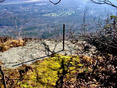 |
At Mile Post 3.46 (elevation 2,452') you will encounter the US Coast Survey Signal - Post marker. We believe that this is part of the 1825 survey of the area. You can also see the 1825 mark above Kaaterskill Falls. It is our understanding that this is one of the first USGS post that was used to measure all other peaks in the Catskill Mountains. After you get done, return back to Boulder Rock. When you get to Boulder Rock (mile 3.58), take the trail that is perpendicular to the ledge. This will take you up a moderate hill, and back to the Escarpment Trail. |
|
 |
At mile post 3.67 (elevation 2,474'), you will encounter another Trail Junction. This will put you back on the Escarpment Trail. Going Left will take you back to the Kaaterskill Hotel site. Going Right will continue on the Escarpment Trail to the Catskill Mountain House site. You want to go RIGHT.
You will encounter another Trail Junction. This unofficial trail on the right will take you below the escarpment trail to the USGS Post. The DEC doesn't want people to take this trail, because it is causing erosion. You want to continue STRAIGHT on the Escarpment Trail.
At the high point in the trail (has large rock on the left) you will encounter a faint trail leading into the woods. This unofficial trail will take you to Star Rock. Star Rock is the high point of South Mountain. It is located in the southern portion of Pine Orchards. Going to Star Rock is optional for this hike. Nothing that great to see. You want to continue STRAIGHT on the Escarpment Trail.
At mile post 3.84 (elevation 2,431') you will encounter Eagle Ledge. You can see this ledge in the picture on the right. It is a very nice ledge. |
 |
|
 |
At mile post 3.90 (elevation 2,431'), you will encounter The Sphinx.
Shortly after passing the Sphinx, you will come to a Trail Junction. The DEC Escarpment Trail will go down the hill on the right. Left will take you into the Pine Orchard. You want to go LEFT. The trail will split again after a short distance. You want to go LEFT again. |
|
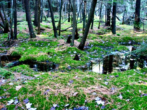 |
On the left as you enter the Pine Orchard, you might see a small bog next to the Pine Orchard. As you enter the Pine Orchard, you will no longer see DEC Trail Markers.
After walking into the Pine Orchard, you will come to the 3rd Ledge. At this point, you will be near Druid's Rock. You want to stop heading west, and start heading east along the 3rd ledge. The entrance to Puddingstone Hall is hard to find. But, it is not very far from Druid's Rock. |
|
 |
At mile post 3.99 (elevation 2,405'), you will encounter the entrance to Puddingstone Hall. You need to look carefully for the entrance. It is not obvious. Once you find the entrance, hike down the 3rd ledge. Then hike down the hill along the path. When you get down to the 2nd ledge, turn right along the ledge. |
|
 |
At mile post 4.07 (elevation 2,352'), you will encounter Catskill Mountain House Water Towers. There were two water towers. Please do not move any of the material around. Later research can be hurt by moving items. Do not take anything from the site.
After you get done, continue to head east and down the hill to the 1st ledge. Once you get down to the 1st ledge, you will come back to the Escarpment Trail. Then walk down to the old Catskill Mountain House site. The Catskill Mountain House was very close to Anvil Ledge. This ledge gives you a nice view of the Hudson Valley. |
|
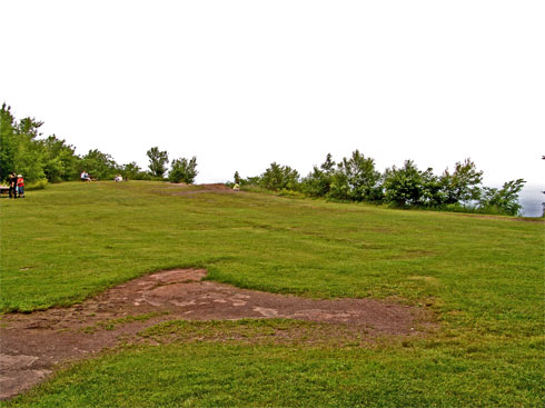 |
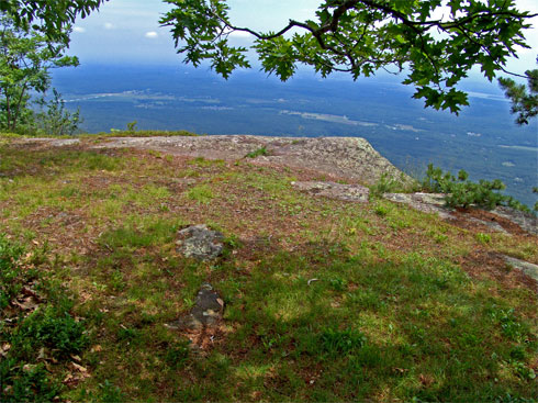
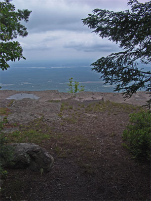
At mile post 4.25 (elevation 2,211') you will come to the old Catskill Mountain House Site. There is a beautiful view from the ledge overlooking the Hudson Valley. Approximately 400 years ago, the Mohawk Indians used to have a summer camp near the ledge. You can learn about this incredible story by reading about Lotowana. The Hotel existed from 1824 until the DEC burned it down in 1963.
Once you are done roaming around the Catskill Mountain House site, follow the edge of the ledge to the north. At the end of the ledge is a small trail. This small trail will lead you to the old Cog Railroad Station. |
|
 |
One of the oldest engravings on the Catskill Mountain House. Please do not make any engravings in the rock. |
|
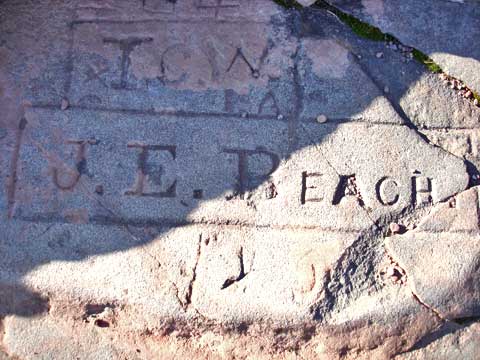 |
Engraving of the owner of the Catskill Mountain House. |
|
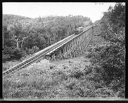 |
At mile post 4.38 (elevation 2,158') you will come to the old Catskill Mountain House Cog Rail Road Station site. The Station is now gone along with the Cog Rail Road. But, the power lines still follow the old rail bed up the mountain.
Once you are done reverse your course back the ledges. You want to head back past the Catskill Mountain House water towers to Puddingstone Hall. |
|
 |
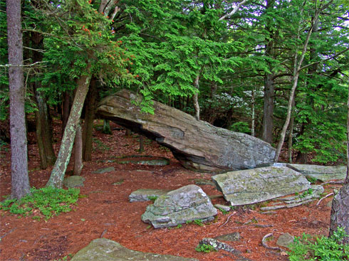
At mile post 4.77 (elevation 2,405') you will come back to Puddingstone Hall. Before you go up to the top of the 3rd ledge, take a walk around to the right side of Puddingstone Hall. You can see the bottom of Druid's Rock. There are some interesting sections. |
 |
|
 |
Another picture of Druid's Rock. Once you get done exploring, go up Puddingstone Hall to the top of the 3rd Ledge. Head down the trail westbound through Pine Orchard. The trail is fairly flat with the exception of one section. This section is the intersection of the Mountain Bike Trail. |
|
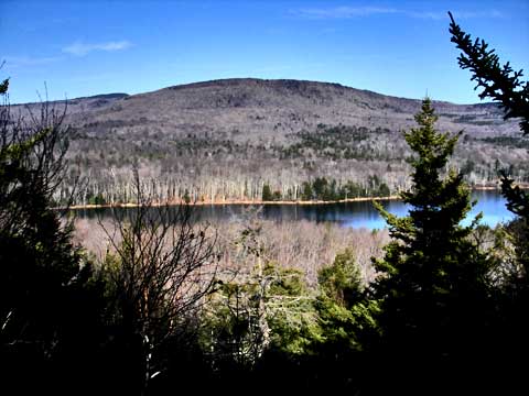 |
Part way across the top of the 3rd ledge you will see a view point. This has a limited view of South lake.
When you come to the old Kaaterskill Hotel Carriage Road. Take a RIGHT down the hill. This is mile post 5.15. (Elev 2356')
At mile post 5.37 (elevation 2,256'), you might see see an unofficial trail on the left. It has a large rock blocking the path. It is much easier to see in the Winter. You want to continue going down South Lake Road. When you get to South Lake Road, take a LEFT. |
|
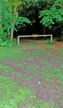 |
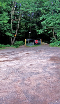
At mile post 5.51 (elevation 2,220'), you will come to a trail junction on the left side of the road. You can see it on the picture on the left. This is the Cross-Country Ski Trail. You want to leave South Lake Road for the Ski Trail. Take a LEFT, and walk around the barrier.
At mile post 5.65 (elevation 2,171'), you will encounter a Major Trail Junction. This is where you entered the Escarpment Trail. Left will take you to the Old Kaaterskill Hotel Site (trail you hiked up earlier in the day). Straight will take you back to the Parking Lot. Right will take you to the old Saw Mill & Kaaterskill Hotel Laundry House. You want to go RIGHT over the wooden bridge. |
 |
|
 |
After about 100' the trail will split. Left will take you to Scutt Road. Right will take you to the old Saw Mill / Kaaterskill Hotel Laundry House. Got RIGHT.
|
|
|
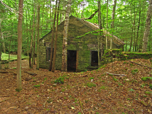
At mile post 5.68 (elevation 2,147'), you will encounter the old Saw Mill & Kaaterskill Hotel Laundry House. The building was originally a Saw Mill. The rock foundation on the left was about 4400 sf. The water reservoir on the right was held about 100,000 gallons of water. Scribner later sold the mill to Kaaterskill Hotel. It is believed that the stone building was built by them. Kaaterskill Hotel reduced the saw mill to about 900 sf. We believed that they built the stone building that you see in the picture.
Just below the Saw Mill is where the old Glen Mary house was located. Reverse your course back to your car.
|
|
|
|
Copyright 2001-2010 www.catskillmountaineer.com
ALL RIGHTS RESERVED
|