Southern Escarpment Trail |
 |
| Boulder Rock |
| |
| |
|
|
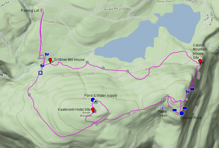
Overview of this Hike: |
| Distance: 5.73 round trip from parking lot to Kaaterskill Hotel site, Boulder Rock, Catskill Mountain House, and Mill House. |
| Time: 3.5 hours round trip (hiking time) |
| Elevation Loss: 396' loss from parking lot |
| Side Trips: Plane Crash near boulder rock and North/South Lake |
| Best Time to Hike: Anytime of day |
| Difficulty: Easy most of the hike |
| VO Map No: #12 - #16 - #12 - #122 |
| Catskill Highest: 100+ |
| Highest Elevation: 2,482' |
| Digital Mapper: Topo
Terrain
Satellite |
| Attractions: Good views from Boulder Rock, Eagle Ledge, and Catskill Mountain House Site. |
| Attractions: Lots of Historic sites |
| Unattractions: Parking lot is in a lousy place - Adds an extra mile to the hike. |
| Unattractions: Easy to get lost - 30% of the people get lost around North-South Lake - Get a good map. |
| Unattractions: Lots of people visit this trail |
| Dangers: Black bears walk up and down this trail during the night. You can sometimes see them at dusk and dawn, so keep this in mind. Make sure that you are up-to-date on bear encounters. |
| Common Animals: Coyotes, bears, birds, Hawks, frogs, butterflies (whites & swallowtails), and deer. |
| Risky Animals:
Rattlesnakes and Copperheads (none known),
Bears (high) |
| Access Methods: Foot. Skiing on some trails. |
|
Maps, Profile, and GPS files |
 |
|
|
Directions to Trail Head from New York State Thruway (Easist, not the shortest): |
| Take New York State Thruway to Exit 21 (Catskill). |
| Take a left out of the NYS Thruway entrance road. |
| Go approximately 1/4 mile |
| Take a right onto Route 23 West |
| Go approximately 6.6 miles to Cairo, NY |
| Take a LEFT onto Rt 32. McDonalds Rest. on corner. |
| Go approximately 7.7 miles on Rt 32 |
| Take a RIGHT onto Rt 23A |
| Go appoximately 7-8 miles to the intersection of Rt 23a and North-South Lake Road. |
| Climb up the windy mountain road (Rt 23A). When you reach the top, you will then be in Haines Falls. |
| Take a RIGHT onto North Lake Road (DEC sign on corner of road). |
| Follow North Lake Road until you almost reach the DEC booths. |
| Take a RIGHT onto Scutt Road. |
| Take a RIGHT into the DEC parking lot. The parking lot fills up quickly. If the parking lot is full, you can park on the side of the road. Do NOT park down by the two houses. |
| Mile Post | Altitude | Notes |
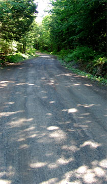
| 0.00 | 2,360 | Parking - Scutt Road DEC Parking Lot. There are TWO ways to the trail head. You can walk down the DEC trail across the street from the parking lot, OR you can walk down Scutt Road and take the old rail road tracks. For the purpose of this hike we will walk down the road at the start of the hike, and use the trail on the way back. Walk down Scutt Road |
| 0.29 | 2,212' | Take a LEFT and walk past the 6x6 wood barrier. This is the old rail road tracks. |
| 0.33 | 2,210' | Take a RIGHT back onto the trail (Blue markers) |
| 0.37 | 2,182' | Go across wood bride over Spruce Creek - rocks below bridge are slippery! |
| 0.43 | 2,190' | After walking across second wood bridge, you will come to a major trail intersection - Take a RIGHT and continued down the hill. |
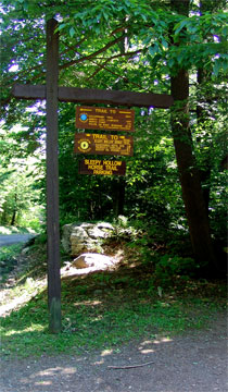
| 0.51 | 2,309' | Registration Box - Trail head |
| 0.72 | 2,388 | Trail Junction - Right is the old Laurel House Road bridge (now gone) - Straight will take you to the top of the Kaaterskill Falls - Left will take you to Escarpment Trail. Go LEFT up the hill. |
| 1.55 | 2,450 | Trail Junction - Straight goes to site - Right goes to Escarpment Trail |
| 1.60 | 2,485 | Kaaterskill Hotel site |
| 1.75 | 2,450 | Water Cistern. (There used to be a trail on the left side of the pond overflow - Goes to Cross-Country Ski Trail. Just follow the stream. |
| 2.32 | 2,450 | When you come back out of the loop - Take a left - then go 100' and take ANOTHER LEFT onto the Escarpment Trail. |
| 2.60 | 2,445 | Trail Junction - Keep going straight |
| 2.96 | 2,460 | Trail Junction - Take a RIGHT to Boulder Rock |
| 3.08 | 2,423 | Trail Junction - Unofficial trail to Palenville Overlook and Indian Head. Plane crash due west. Continue Straight) |
| 3.11 | 2,431 | Split Rock. |
| 3.17 | 2,443 | Boulder Rock |
| 3.24 | 2,442 | Eagle Ledge - To find Eagle Ledge just follow unofficial trail near ledge northward - REVERSE back to Boulder Rock to continue on Trail up Hill |
| 3.37 | 2,475 | Trail Junction - Left take you back to Kaaterskill Hotel site - Right takes you the Catskill Mountain House. Go RIGHT |
| 3.51 | 2,440 | You will encounter Eagle Ledge on the right |
| 3.53 | 2,440 | You will encounter the Sphinx |
| 3.56 | 2,430 | Trail Turns RIGHT down a moderate-to-steep hill - NOTICE: Many people get lost here by continuing straight. They then spend the next hour wondering around Pine Orchards. There used to be trails in Pine Orchards so it feels like they are on course. |
| 3.68 | 2,211 | Catskill Mountain House - Then head downhill towards the lake on the old dirt road. Then take a left on South Lake Road. |
| 4.56 | 2,050 | Trail Junction on left. This Unofficial trail will take you to a part of the Escarpment trail you have already been on. CONTINUE down South Lake Road. |
| 4.86 | 2,004 | Trail Junction on Left. This is the Cross-Country Ski Trail - Leave South Lake Road for the ski trail | | 5.07 | 2,010' | Trail Junction - Right onto this Unoffical Road will take you to Scribner's Mill House. Go Right |
| 5.17 | 2,011 | Saw Mill House (stone house with metal roof). This was later used as the Kaaterskill laundry house. |
| 5.24 | 2,022 | Trail Junction - Very easy to miss - Take a very sharp right (almost 180 degree) - If you go too far, you will encounter the 2nd wood bridge. |
| 5.29 | 2,045 | Trail Junction with Rail Road Track Trail - Left will take you to Schutt Road, then right (0.33 miles to parking lot) - Continuing straight will take you to the parking lot also (0.44 miles) |
| 5.73 | 2,360 | Schutt Road Parking Lot |
|
|
Hike to the Southeastern part of the Escarpment Trail in the North/South Lake Region |
 |
You can park in the DEC parking lot. The parking lot does fill up, so you can also park on the side of the road of Scutt Road.
From the parking lot there are several possible directions you can go. (1) You can walk across Scutt Road and take the Blue Trail. Unfortunately, the Blue trail is boring, full of roots, and had an odd path. It is 0.44 miles this way; (2) You can walk directly down Scutt Road and pick up the Rail Road Track trail and meet up the Blue Trail. It is 0.33 miles this way.
For the purpose of this instruction, we are going to walk down the road at the beginning of the hike, and return back on the Blue Path.
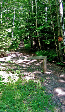
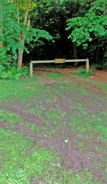
Walk down the road for 0.29 miles (1,500 feet). Just before you get to the second house, you will see the entrance to the old Rail Road Track Trail on the LEFT side of the road. It will have a 6x6 pressure treated barrier blocking the path. Take a LEFT onto the old Rail Road Track Trail (there are no longer any rails or rail road ties) |
 |
|
 |
At mile post 0.29, you will encounter the firest barrier. Walk around the barrier (6x6 pressure treated timbers), and walk about 200 feet (0.04 miles).
At mile post 0.33, you will come to a trail junction. This is the Blue Trail. Take a RIGHT onto the Blue Trail |
 |
|
 |
At mile post 0.37, you will come to a wood bridge over a creek (overflow from North/South lake). After walking down the hill about 0.04 miles (200 feet) you will encounter your first wooden bridge.
Please note: The rocks in the stream are very slippery.
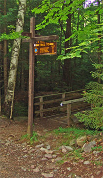
At mile post 0.48, you will come to a major trail junction. After walking another 0.06 miles (300 feet), you will encounter a second wooden bridge. After the bridge, you will come to a major trail intersection. Going left will put you on the cross-country ski trail. This trail will take you to North/South Lake (0.38 miles to North Lake Road). Going Straight will take you to the old Kaaterskill Hotel Site (1.17 miles). Going Right will take you to Kaaterskill Falls, Layman's Monument, and the Escarpment Trail. Go STRAIGHT up the hill.
At mile post 0.51, you will encounter the DEC registration box.
At mile post 0.72, you will encounter a Trail Junction. If you go Right (yellow marker trail), it will take you to the Escarpment Trail near Sunset Ledge, and the Horse Trail. If you continue Straight, you will continue to the old Kaaterskill Hotel Site. Continue STRAIGHT. |
 |
|
 |
At approximately mile post 1.55, you will encounter a Trail Intersection. If you go right it will take you to the Escarpment Trail. You need to continue about another 50'. You will see a small trail to the LEFT. Take the small trail to the LEFT.
This trail will loop around the old Kaaterskill Hotel site. Sadly, the site is NOT maintained by the New York DEC.
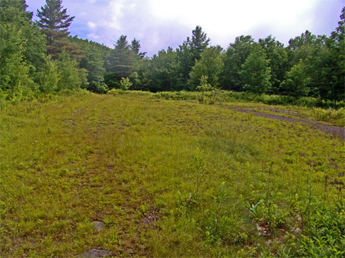
At mile post 1.60 (elevation 2,585'), you will be at the old Kaaterskill Hotel site (see picture on left). This is also the summit of South Mountain.
If you continue across the flat opening, you will find the continuation of the trail on the left corner.
Our mileage chart will include an extra 0.04 miles for roaming around the site. We presume that you will roam more then we did. |
|
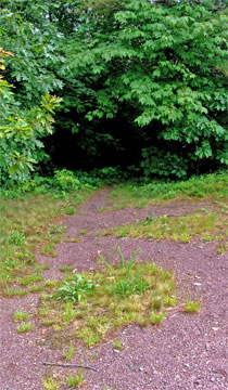 |
If you continue across the flat opening, you will find the continuation of the trail on the left corner of the site. See picture on LEFT.
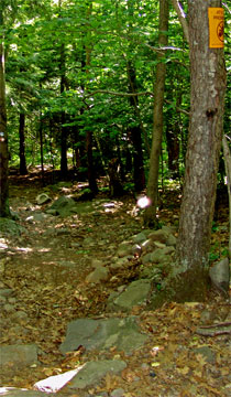
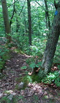
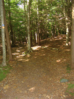
100 feet after entering the woods, you will see a trail junction on the LEFT. Take a LEFT. The picture on the right shows what the trail looks like in the summer. |
 |
|
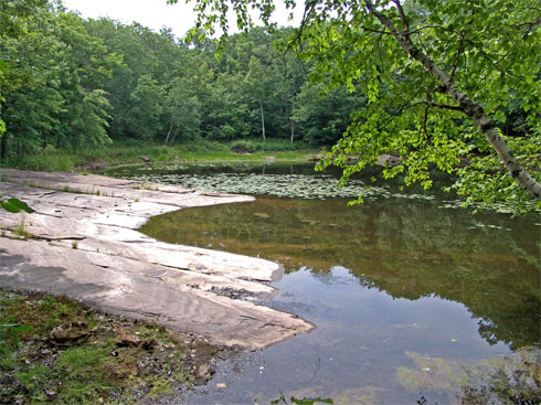 |
At mile post 1.75 (elevation 2,530') you will encounter the pond near the Kaaterskill Hotel. This pond supplied the water for the hotel.
If you walk around the area, you can still find parts of the old hotel. The Barns used to be west of the hotel. |
|
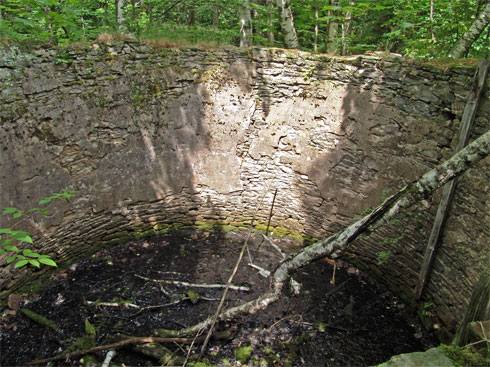 |
At Mile post 1.75 (elevation 2,530') you will see the old water cistern that held the water for the hotel.
There used to be a trail on the left side of the overflow, and followed the stream down to the cross-country ski trail. Today it is overgrown, but easy to follow the stream. |
|
 |
At Mile post 2.32 (elevation 2,450) you will loop back to the original trail. If go straight, you will return back to the parking lot. If you turn Left, you will continue on the Escarpment Trail. You want ot go LEFT. After walking about 100 feet, you want to take a SECOND LEFT.
At mile post 2.60 (elevation 2,245') you will encounter another Trail Junction. Going Left will take you to South Lake Road. This is an unofficial trail, which is heavily used. You want to continue STRAIGHT on the Escarpment Trail. |
|
 |
At mile post 2.96 (elevation 2,260') you will encounter another Trail Junction. If you continue Straight, this will by-pass Boulder Rock. By going Right, you will head towards Boulder Rock. You want to go RIGHT. |
|
 |
At Mile Post 3.08 (elevation 2,423') you will encounter another Trail Junction. This trail junction will be on the right. The trail on the RIght is an unofficial trail. It will take you down to Palenville Overlook and Indian Head. You can also trail junction to look for the plane crash. By continuing Straight, you will continue to Split Rock, Boulder Rock, and Eagle Ledge. You want to continue STRAIGHT. |
|
 |
At mile post 3.11 (elevation 2,431) you will encounter Split Rock |
|
|
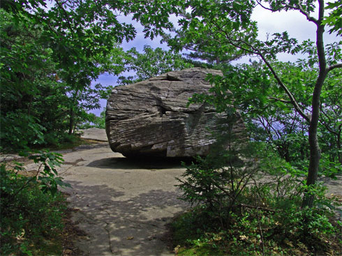
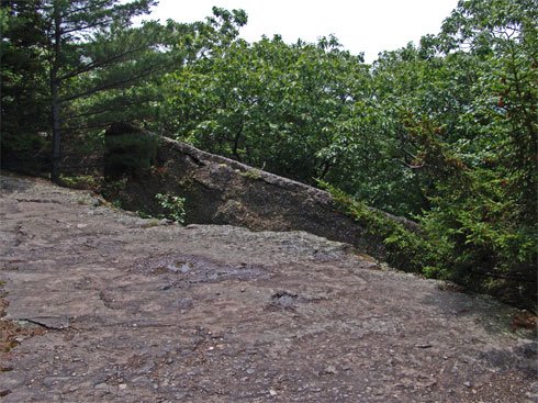
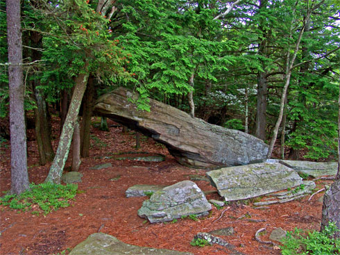
At Mile Post 3.17 (elevation 2,443') you will encounter Boulder Rock.
There are 3 sets of ledges near Boulder Rock. The first ledge is located under Boulder Rock. A little ways north will be the second ledge. After walking thru the woods another 350' you will encounter Eagle Ledge. |
|
 |
At Mile Post 3.24 (elevation 2,442') you will encounter the 2nd Ledge at Boulder Rock. If you continue further, you will come to a 3rd Ledge, and finally to a USGS Post. After visiting, back track on the same trail back to Boulder Rock. Then continue on the DEC trail UP the hill. |
|
 |
At mile post 3.37 (elevation 2,475'), you will encounter another Trail Junction. Going Left will take you back to the Kaaterskill Hotel site. Going Right will continue on the Escarpment Trail to the Catskill Mountain House site. You want to go RIGHT.
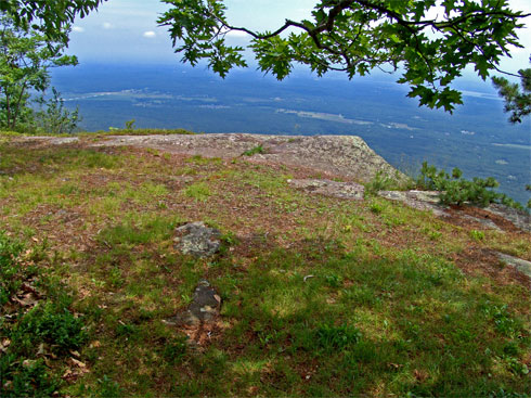
At mile post 3.51 (elevation 2,440') you will encounter Eagle Ledge. You can see this ledge in the picture on the right. |
 |
|
 |
At mile post 3.53 (elevation 2,440'), you will encounter the Sphinx.
At mile post 3.56 (elevation 2,430'), the trail will take a RIGHT turn and descend down a moderate-to-steep hill. NOTICE: Many people get lost here by continuing straight. Going straight will take youd deep inside Pine Orchards. Years ago there used to be trails in Pine Orchards. |
|
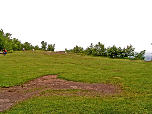 |
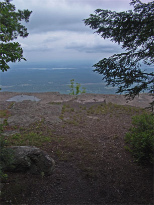
At mile post 3.68 (elevation 2,211') you will come to the old Catskill Mountain House site. There is a beautiful view from the ledge overlooking the Hudson Valley. Approximately 400 years ago, the Mohawk Indians used to have a summer camp near the ledge. You can learn about this incredible story by reading about Lotowana.
Once you are done roaming around the Catskill Mountain House site, you can continue on the hike by walking west towards North/South Lake. Take the wide road. Once you reach South Lake Road, take the road west. |
|
 |
At mile post 4.56 (elevation 2,050'), you might see see an unofficial trail on the left. It has a large rock blocking the path. It is much easier to see in the Winter. You want to continue going down South Lake Road.
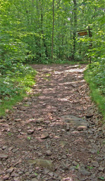
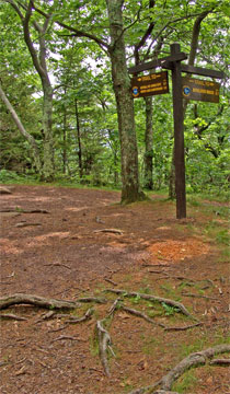
At mile post 4.86 (elevation 2,004') you will come to a trail junction on the left side of the road. You can see it on the picture on the left. This is the Cross-Country Ski Trail. You want to leave South Lake Road for the Ski Trail. Take a LEFT, and walk around the barrier.
At mile post 4.86 (elevation 2,004'), you will encounter a Major Trail Junction. This is where you entered the Escarpment Trail. Left will take you to the Old Kaaterskill Hotel Site. Straight will make you repeat this hike again - Yikes!. Right will take you back to the Scutt Road Parking Lot. You want to go RIGHT over the wooden bridge. |
 |
|
 |
At mile post 4.86 (elevation 2,004'), you will encounter another Trail Junction. Approximately 150' after going over the bridge you will come to the trail junction in the picture. Make sure that you go LEFT. Continuing straight will take you to the old saw mill / Kaaterskill Laundry House. Going Left will take you back to the Scutt Road Parking Lot. You want to go LEFT, and should encounter the second wooden bridge 150' later.
At Mile post 4.35 (elevation 2,168') you will encounter another Trail Junction. Going Left will take you to Scutt Road. Going Straight will take you back to the Scutt Road Parking Lot. You can go either direction. Going Left is 0.33 miles back to your car, and is an easier hike. Going Straight is 0.44 miles back to your car, and more difficult. If you go left, you want to go Right after reaching the Road 200' later.
|
|
|
|
Copyright 2001-2010 www.catskillmountaineer.com
ALL RIGHTS RESERVED
|