Belleayre Mountain from Lost Clove |
 |
| |
| |
|
|
|
Maps |
 |
|
|
|
| | DIRECTIONS TO TRAILHEAD |
| | GPS Coordinates to DEC Parking Lot: 42.105533, -74.470067 (DEC-WGS84) - Elevation is about 1,550 feet |
| | GPS Coordinates to DEC Parking Lot: N42 06 19, W74 28 12 (Degree, Min, Sec) - Elevation is about 1,550 feet |
| | GPS Coordinates to DEC Parking Lot: N 42 06.332, W 74 28.204 (GPS) - Elevation is about 1,550 feet |
| | GPS Coordinates to DEC Parking Lot: 18N 543815 4661629 (UTM) - Elevation is about 1,550 feet |
| | Take New York State Thruway to Exit 19 (Kingston). |
| | Take a right out of the NYS Thruway toll booths onto Rt 28. |
| | Go approximately 30.3 miles west on Rt 28 |
| | Take a left onto Rt 47 at Big Indiam |
| | Go 0.4 miles on Rt 47. |
| | Take a RIGHT onto Lost Clove Road |
| | Go approximately 1.3 miles on Lost Clove Road (almost to the end of road). |
| | Lost Clove Parking Area is on the RIGHT side of the road. |
|
|
Notes about Lost Clove Trail hike |
| | According to the USGS, Belleayre Mountain has three separate peaks that are similar in elevation. This hike guides you to the eastern peak. You can continue further on the Belleayre Ridge Trail to visit the other two peaks. The Bellayre Ridge Trail is fairly flat and easy walking. The western peak is considered to be the highest peak. But, some of that elevation comes from the chair lift mound.
Since this is a fairly short hike of 4+ miles, some people add another two miles by walking to the Western Belleayre Mountain peak. The trail from the summit of the eastern Belleayre Mountain Peak to the Western Belleayre Mountain Peak is 0.98 miles one-way, and is called Belleayre Ridge Trail. You will also get some views of the valley by adding on these additional peaks.
There are two Lean-to in this region. The first is the Hirschland Lean-to. It is located a 1/2 mile east of Belleayre Mountain (east). The second is the Belleayre Lean-to, which is located 1/2 mile west of Belleayre Mountain (east). Neither has a water sources. So, bring water with you.
This is basically a hike without a view.
While hiking up the Lost Clove Trail, you will find many logging roads that branch off the Lost Clove Trail, or cross it. You can follow some of them if you are curious.
In 2023 the DEC will be adding a number of new trails for hikers and bikers in Giggle Hollow. There is quite a bit of work to be done there. Once done, there will be some view points available.
|
|
|
MILEAGE CHART |
| | Mile Point | Altitude | Notes |
| | 0.00 | 1,550' | Lost Clove Trail Head |
| | 0.87 | 2,426' | 4-way Trail Junction - Continue Straight onto single track trail |
| | 0.90 | 2,410' | Go LEFT at Y-Trail Junction |
| | 1.37 | 2,835' | Go LEFT at Trail Junction - Right goes to Woodchuck Hollow Road |
| | 1.58 | 3,023' | Hirschland Lean-To |
| | 2.08 | 3,373' | Belleayre Mountain Summit (east peak). |
| | 4.16 | 1,550' | Lost Clove Trail Head & DEC Parking Area. |
|
|
Hike of the Belleayre Mountain Loop |
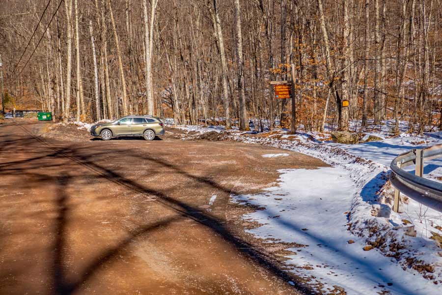 |
The picture on the above is the Lost Clove DEC Parking Area just before the end of Lost Clove Road.
The Parking Area hold about 5-6 cars. The Parking Area is plowed in the Winter Months. |
|
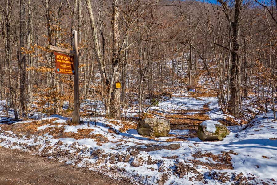 |
This is the Lost Clove Trail Head. If you look in the distance you will see the DEC Kiosk. Once you get the Kiosk, the trail splits left and right. You want to go LEFT. Right will take you to Giggle Hollow and the Lost Mountain Road. New trails will be constructed in 2023 in Giggle Hollow.
Once you register at the DEC Registration Box, the trail will immediately start climbing up an old logging road (2 track) at a very steady incline.
|
|
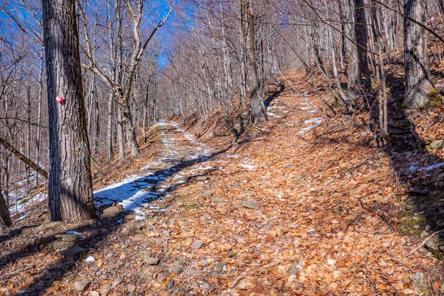 |
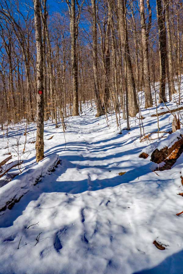
At this Trail Junction, stay LEFT. The Lost Clove Trail is marked with DEC RED Trail Markers.
This particular location in Lost Clove is littered with many logging roads. So, you need to pay attention to the RED Trail Markers. |
|
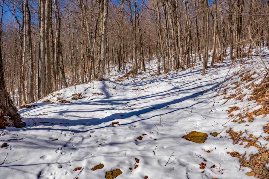 |
At mile post 0.87 you will come to a 4-way Trail Junction. You want to continue STRAIGHT.
Left would take you down into Lost Clove, and does have a trail that loops back to the Lost Clove Trail. Right will take you near the ridge.
|
|
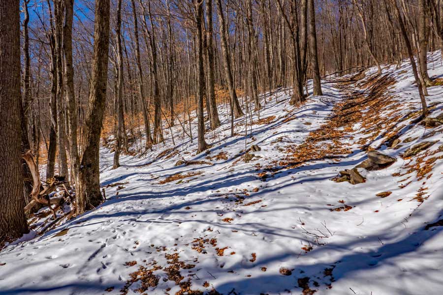 |
At this Y-Trail Junction, you want to take a LEFT onto the 1-track trail. You will be leaving the dual-track logging road. Logically continuing to follow the dual-track logging road appears to be the correct. But, it isn't. Take a LEFT here. |
|
 |
You want to continue to follow the Lost Clove Trail (single track trail) until it ends. The upper part of Lost Clove Trail is another 1/2 mile.
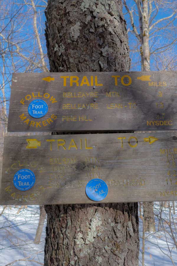
When you come to the end of Lost Clove Trail, you want to go LEFT to Belleayre Mountain and Hirschland Lean-to. The picture on the right is the Trail Junction for Lost Clove Trail and Woodchuck Hollow Trail (sometimes called Pine Hill Trail).
Right would take you to Woodchuck Hollow Road and Pine Hill, NY. Left will take you to the Hirschland Lean-to, Belleayre Mountain, and Balsam Mountain. |
 |
|
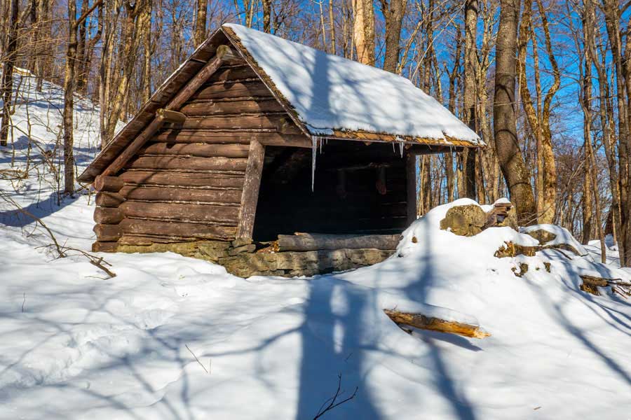 |
This is the Hirschland Lean-to. It is 1.58 miles.
There are no known water sources close to the Hirschland Leanto. So, bring water with you! There is a fire ring in front of the lean-to. People often use this lean-to for doing a weekend trail of hiking the entire western branch of Pine Hill Trail. There is another lean-to south of Big Indian Mountain Summit. |
|
|
This is the summit of the Eastern Peak of Belleayre Mountain. The actual peak is located just left of this picture.
Left will take you down the Western Branch of the Pine Hill Trail to Balsam Mountain. Right will take you to the other two peaks of Belleayre Mountain. The western peak of Belleayre Mountain has a chair lift located on it. |
|
|
S E C T I O N S
|
W E A T H E R
|
O T H E R
|