Big Indian Mountain from Seager PA |
 |
| |
| |
|
|
|
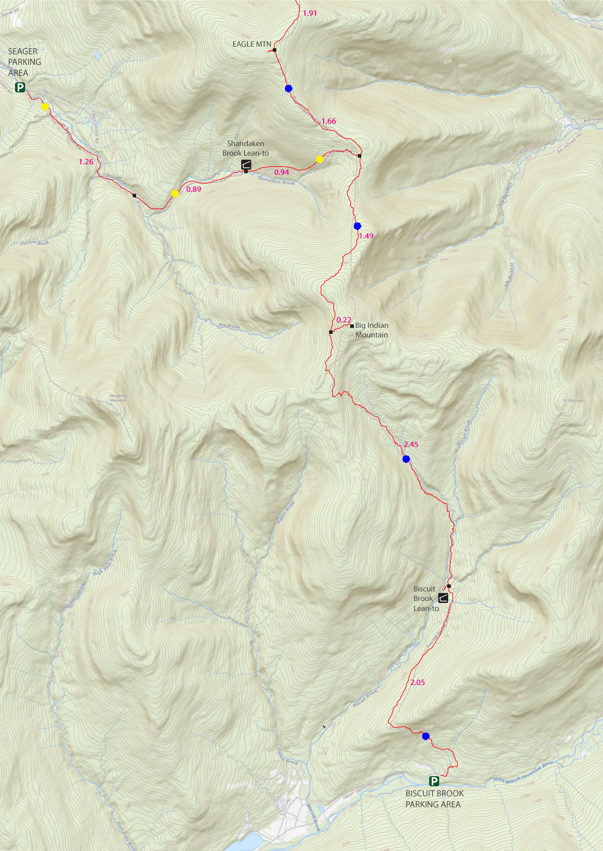
Maps for Big Indian Mountain |
 |
|
|
|
| | DIRECTIONS TO TRAIL HEAD |
| | GPS Coordinates to DEC Parking Lot: 42.05785, -74.539267 (DEC-WGS84) - Elevation is about 1,938 feet |
| | GPS Coordinates to DEC Parking Lot: N42 03.471 W74 32.356 (GPS) - Elevation is about 1,938 feet |
| | GPS Coordinates to DEC Parking Lot: 18N 538122, 4656302 (UTM) - Elevation is about 1,938 feet |
| | GPS Coordinates to DEC Parking Lot: N42 03 28, W74 32 21 (Degree, Min, Sec) - Elevation is about 1,938 feet |
| | Take New York State Thruway to Exit 19 (Kingston). |
| | Take a right out of the NYS Thruway toll booths onto Rt 28. |
| | Go approximately 34.4 miles west on Rt 28 |
| | Take a left onto Rt 49A at Highmount (Belleayre Ski Center) |
| | Go approximately 5.5 miles on Rt 49A to the end of the road. |
| | Take a LEFT onto Dry Brook Road |
| | Go approximately 5.6 miles on Dry Brook Road. |
| | The Seager DEC Parking lot is at the very end of Dry Brook Road |
|
|
NOTES for Big Indian Mountain from Seager PA |
| | PLEASE NOTE: For the first 1.95 miles, you are on PRIVATE PROPERTY! - PLEASE STAY ON THE TRAIL!
The hike to Big Indian Mountain is in Ulster county. The hike can be done in a number of different directions. It can be accessed from Rider Hollow Road, Dry Brook Road (Seager) (easiest to get lost), McKinley Hollow Road (most vertical), and Biscuit Brook (longest). There are pros and cons to each direction depending upon the time of year. Some trails to Big Indian Mountain are easy to get lost on, so some people like to hike it in the Winter with Snowshoes. The hike is moderate in ability. In the summer the numerous stream crossings are fun, but in the Winter and Spring they are a concern.
There are four issues with this route to Big Indian Mountain:
1. You can walk off the trail in a number of places.
2. Crossing Dry Brook Creek can be quite challenging certain times of the year.
3. Finding the spur trail off Pine Hill Trail can cause problems.
4. This hike is 9.6 miles long, but the incline is not bad.
While there are problems, most people are able to overcome the obstacles and get to the summit.
The first 1.95 miles from the Seager Trail Head is on PRIVATE PROPERTY. You are legally allowed to hike on the trail, but you may NOT leave the trail. You will see No Trespassing signs on both sides of the trail until the crossing of Dry Brook Creek. But, private property continues another 3/4 of a mile. Please respect the land owners!
Hiking it from Dry Brook Road can be difficult. It is easy to get lost on the Dry Brook route because of the trails and roads that shoot off the trail. The path from McKinley Hollow Road has some steep sections of vertical. That route is steeper and more difficult.
When you start out from the DEC parking lot at the very end of Dry Brook Road, the walk is fairly flat. You will be walking next to the creek, and will cross it. You need to pay attention on this route so that you don't get lost.
After you cross the Dry Brook Stream, you need to look for a sign on the right side of the trail. When you see the sign, there will be a trail on the LEFT side of the road. You want to take this trail up the steep hill. People do get lost at this point often, so pay attention to the mileage if you have a GPS.
When you leave the road and start walking up the trail, the incline will increase slightly. Almost a mile later, you will come to the Lean-to. There is a small stream by the Lean-to. This small stream has a ravine about 5-10' deep. There is a pipe that empties into the small stream. It is a very good water source. During the drought of 2012, it continued to flow well. Even after the stream completely dried up.
After the Lean-To, the incline increases to a moderate level to the col. Once at the col, you will take a RIGHT to Big Indian Mountain. The hike up to Big Indian is pretty easy. A couple small little climbs, but nothing difficult.
When you approach the summit of Big Indian Mountain, you will have to take an unmarked trail on the left to the summit of Big Indian Mountain. There are NO views on this hike. The summit isn't obvious, but you will see a small clearing. When you get done, reverse your course back to the car.
|
|
|
MILEAGE CHART for Big Indian Mtn from Seager PA |
| | Mile Point | Altitude | Notes |
| | 0.00 | 1,938 | Seager DEC Parking Area and Trailhead |
| | 1.26 | 2,252 | Cross Dry Brook Creek - Go Right on road - Then go LEFT up the hill |
| | 1.95 | 2,402' | Enter NYS Land. |
| | 2.15 | 2,435' | Shandaken Brook Lean-to |
| | 3.09 | 3,135' | Go RIGHT at Trail Junction - large rock at TJ. |
| | 4.58 | 3,613' | Go left on spur trail to summit. |
| | 4.80 | 3,702' | Summit of Big Indian Mountain - hard to tell that you are on the summit. |
| | 9.60 | 1,938 | Return back to Seager DEC Parking Lot on Dry Brook Road. |
|
 |
 |
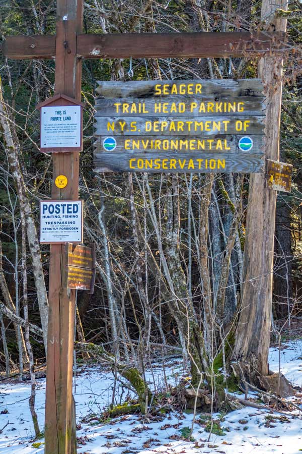
This is an image of the Seager DEC parking lot at the very end of Dry Brook Road. There is enough room for approximately 5 cars.
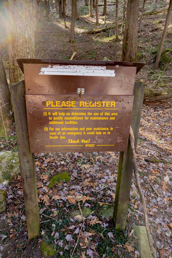
The DEC registration box is on the right side of the trail, and is located 150 feet from the Parking Area. Please Register before beginning your hike.
NOTE: The land around the parking area and 1.95 miles into the hike is on private land. You have permission to hike ONLY on the trail. So, stay on the trail. In many places you will see No Trespassing signs on both side of the trail. Just stay on the trail.
NOTE: If people abuse the generosity of the landowner, the owner will remove permission to hike on the trail. So, STAY ON THE TRAIL until you reach NYS land (1.95 miles down the trail)!
|
|
 |
 |
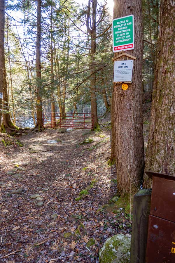
There is a red gate about 100' past DEC registration box. If you look at the picture on the left you will see No Trespassing signs on the trees on both sides of the trail. Just stay on the trail.
The dirt road leads up to the Dry Brook stream. You will not walk very far until you hit the stream. The trail continues up the RIGHT side of the Dry Brook stream.
|
|
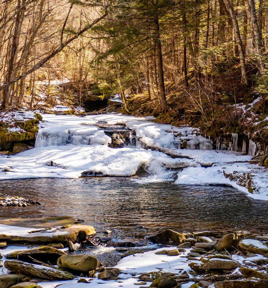 |
This is one of the waterfalls on Dry Brook Creek. It is an enjoyable place to stop for a break. You cannot swim here.
|
|
 |
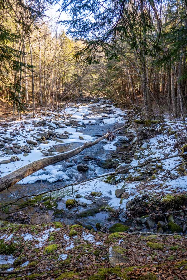
As you are hiking down the trail, it will come to the Dry Brook Creek. You need to cross Dry Brook Creek here. As of 2023, there were NO Trail Markers on the trees indicating that you cross here.
After you cross Dry Brook Creek, take a RIGHT on the road, and walk upstream about 100'. You will see another trail/road on your left. Take a LEFT and continue up the trail. After hiking about 3/4 of a mile, you will enter NYS Land. There is a DEC sign on the tree telling you that you are entering NYS land.
There is a side trail on the right before you cross Dry Brook Creek. Do NOT go up the side trail. This is an old trail that is no longer used. And, the owner does not want you to hike up the side trail.
NOTE: In the summer crossing the Dry Brook Creek is pretty easy. In the Winter and Spring, or after a large rain storm, it may not be possible to cross the Dry Brook Creek. There are a number of different routes across the creek. If you cannot get across the Dry Brook Creek here, your hike is over! When there is the possibility of water freezing make sure you bring microspikes or similar traction for icy rocks.
|
|
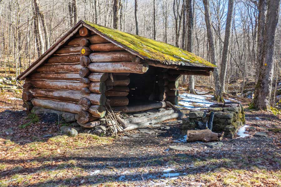 |
After 1,000 feet beyond the NYS Land sign, you will come to the Shandaken Brook Lean-to. You will have to cross the Shandaken Brook. Crossing the Shandaken Brook is pretty easy. There is a very good water source by the Lean-To. It is a pipe that drains into the brook. It continued to flow well during the drought of 2012. In the summer there are a lot of stinging nettles around the Lean-to. The Lean-to is approximately 2.15 miles from the DEC parking lot in Seager.
Continue past the Shandaken Brook Lean-to on the trail to the col between Eagle Mountain and Big Indian Mountain. There are a number of trees down along the trail, and the trails has been rerouted around some of those fallen trees.
|
|
 |
 |
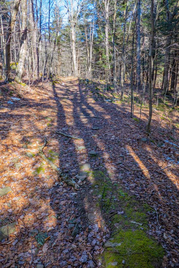
The image on the left was taken from the top of the Trail Junction of the Seager Trail and the Pine Hill Trail. The photo was taken looking down the Seager Trail.
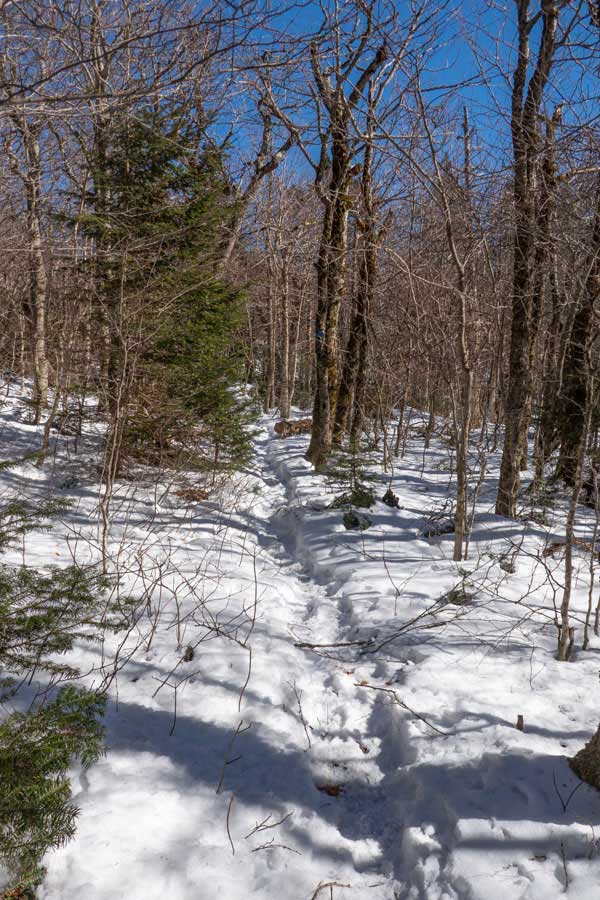
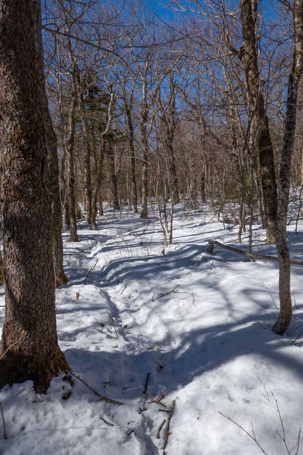
You want to take a RIGHT to go to Big Indian Mountain. Left will take you to Eagle, Haynes, Balsam, and Belleayre Mountains.
After you turn RIGHT onto Pine Hill Trail, the trail will start to climb in elevation. As you can see in these two photos elevation created more snow.
|
|
 |
The Pine Hill Trail from the Trail Junction with the Seager Trail to the spur trail that goes up to Big Indian Mountain is about 1.5 miles away. You need to pay attention to the elevation climb. As it levels off, look for the spur trail, on the left, to the Big Indian Mountain Summit. There are several herd trails that do go to the summit. The main spur trail is 1.49 miles from the Seager Trail. There are certain times of the year, where the spur trail is hard to find. If you start going down in elevation, then you have gone past the spur trail.
Once on the spur trail, the Big Indian Mountain summit is a little less then a 1/4 mile away.
|
|
|
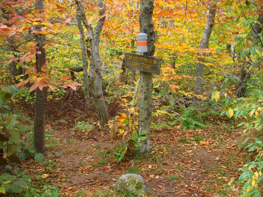
This image shows the summit of Big Indian Mountain. In the Winter the snow pack can reach up to the 3500 Club Canister. So, we show you what it looks like without a snow pack. Once done, reverse your course back on the same trails back to your car.
|
|
|
S E C T I O N S
|
W E A T H E R
|
O T H E R
|