Hike to the Balsam Lake Mountain from Beaver Kill Road |
 |
| View of the Balsam Lake Mountain in the Balsam Lake Mountain Wild Forest |
| |
| |
|
OVERVIEW |
| | Trail Name: |  Dry Brook Ridge Trail (From Balsam Lake Mtn PA to Balsam Lake Mountain)
 |
| | Trail Name: |  Balsam Lake Mountain Trail (Dry Brook Ridge Trail TO Balsam Lake Mountain)
 |
| | Trail Name: |
Dry Brook Ridge Trail (Balsam Lake Mountain to Balsam Lake Mountain PA |
| | | |
| | Forest: | Balsam Lake Mountain Wild Forest |
| | Parking Area : | 30 spaces directly off Beaver Kill Road |
| | Winter Access: | Hardenburgh Parking Area (1.8 miles away from Balsam Lake Mountain Parking Area) |
| | Camp sites: | NO Camp Site locations |
| | Lean-to sites: | One Lean-to (Balsam Lake Mountain Lean-to) |
| | Access: | Hike or snowshoe |
| | | |
| | Trail Length: | 4.41 (round-trip) |
| | Trail Type: | 24% Single-Track Trails - 74% Double-Track Trails |
| | Hiking Time: | Average 4 hours |
| | Lowest Elevation: | 2,575' (A) |
| | Highest Elevation: | 3,745' (A) |
| | Views : | One view spot - Balsam Lake Mountain Fire Tower |
| | Difficulty: | Moderate |
| | | | |
| | USGS Map: | USGS Seager Quad Maps |
| | | | |
| | DEC Trail Map: | DEC Balsam Lake Mountain Wild Forest Map (free) |
| | | | |
| | Digital Mapper: |
Topo
Terrain
Satellite |
|
|
Maps to Balsam Lake Mountain from Beaver Kill Road |
 |
|
|
|
| | Notes about Balsam Lake Mountain |
|
| | TRAIL |
|
| |
This is a favorite hike of many local hikers. It is fairly short compared to other hikes in the Catskill Mountains. Most of the hike is fairly easy, with about 3/4 of a mile of moderate incline and difficult. We like to hike it in the clock-wise direction.
Many people really like the Fire Tower, and it can become quite crowded on summer weekends.
| |
| | PARKING |
|
| |
Parking at the Balsam Lake Mountain can be difficult on summer weekends. As it can be quite crowded. There are about 25 spaces for cars. It is directly off the end of Beaver Kill Road.
The Beaver Kill Road is closed 1.88 miles before the Balsam Lake Mountain Parking Area during the Winter months. In the Winter park at the Hardenburgh Parking Area, which is located 1.88 miles from the BLM PA.
| |
| | OTHER INFORMATION |
|
| |
There is NO cell phone service as of 2023 at lower elevations. You may be get reception at higher elevations.
|
|
|
| | DIRECTIONS to BALSAM LAKE MTN Parking Area from Exit 18 (New Paltz) |
| | Balsam Lake Mtn Parking Area WGS84 (DEC): 42.0238, -74.60005 - Elevation is approximately 2,588 feet |
| | Balsam Lake Mtn Parking Area Deg/Min/Sec: N42 01 25, W74 36 00 - Elevation is approximately 2,588 feet |
| | Balsam Lake Mtn Parking Area GPS: N 42 01.428, W 74 36.003 - Elevation is approximately 2,588 feet |
| | Balsam Lake Mtn Parking Area UTM: 18N 533111 4652496 - Elevation is approximately 2,588 feet
|
| |
|
| | Get off New York State Thruway at Exit 18 (New Paltz). |
| | Take a LEFT out of the NYS Thruway onto Route 299 West. |
| | Go approximately 7.3 miles on Rt 299 West |
| | Take a RIGHT onto Rt 44 |
| | Go approximately 10.3 miles on Rt 44 |
| | Take a LEFT onto Rt 209 in Kerhonkson |
| | Go approximately 5.8 miles on Rt 209 |
| | Take a RIGHT onto Rt 52 |
| | Go approximately 19 miles on Rt 52 |
| | Take a RIGHT onto Rt 17 |
| | Go approximately 10 miles on Rt 17 |
| | Take a RIGHT on Debruce Road after getting off Rt 17 |
| | Go approximately 0.4 miles on Debruce Road |
| | Take a RIGHT onto Old Rt 17 |
| | Go approximately 1.3 miles on Old Rt 17 |
| | Take a RIGHT onto Beaver Kill Road (Rt 151) |
| | Go approximately 20.4 miles on Beaver Kill Road |
| | DEC Parking Area is at the end of Beaver Kill Road (on the RIGHT side of the road). |
| | NOTE: The Beaver Kill Road is closed 1.88 miles before the Balsam Lake Mountain Parking Area during the Winter months. In the Winter park at the Hardenburgh Parking Area, which is located 1.88 miles from the BLM PA. |
|
|
| | DIRECTIONS to BALSAM LAKE MTN Parking Area from Exit 19 (Kingston) |
| | Balsam Lake Mtn Parking Area WGS84 (DEC): 42.0238, -74.60005 - Elevation is approximately 2,588 feet |
| | Balsam Lake Mtn Parking Area Deg/Min/Sec: N42 01 25, W74 36 00 - Elevation is approximately 2,588 feet |
| | Balsam Lake Mtn Parking Area GPS: N 42 01.428, W 74 36.003 - Elevation is approximately 2,588 feet |
| | Balsam Lake Mtn Parking Area UTM: 18N 533111 4652496 - Elevation is approximately 2,588 feet
|
| |
|
| | Get off New York State Thruway at Exit 19 (Kingston). |
| | Take a RIGHT out of the NYS Thruway onto Route 28 West. |
| | Go approximately 45.4 miles on Rt 28 West |
| | Take a LEFT onto Spur to BWS Road No 10
(Look for Brown hiking signs for Huckleberry Loop & Kelly Hollow) |
| | Take a RIGHT onto BWS Road No 10 |
| | Go approximately 3.75 on BWS Road No 10 |
| | Take a LEFT onto Millbrook Road |
| | Go approximately 1.4 miles on Millbrook Road |
| | Take a RIGHT onto "Cross Mountain Road" (DO NOT take "Old Cross Mtn Road") |
| | Go approximately 4.3 miles on Cross Mountain Road (dirt road) |
| | Cross Mountain Road (dirt) will turn into Adler Creek Road (paved) |
| | Go approximately 2.2 miles on Adler Creek Road (paved) |
| | Take a LEFT onto "Beaver Kill Road" (No street sign - bridge on right) |
| | Go approximately 8.1 miles on Beaver Kill Road (paved then dirt) |
| | DEC Parking Area is at the end of Beaver Kill Road (on the RIGHT side of the road). |
| | NOTE #1: The Beaver Kill Road is closed 1.88 miles before the Balsam Lake Mountain Parking Area during the Winter months. In the Winter park at the Hardenburgh Parking Area, which is located 1.88 miles from the BLM PA. |
| | NOTE #2: Cross Mountain Road may be closed during the Winter months. Use an alternate route, like Barkaboom Road (further down BWS Road #10). |
| |
|
|
|
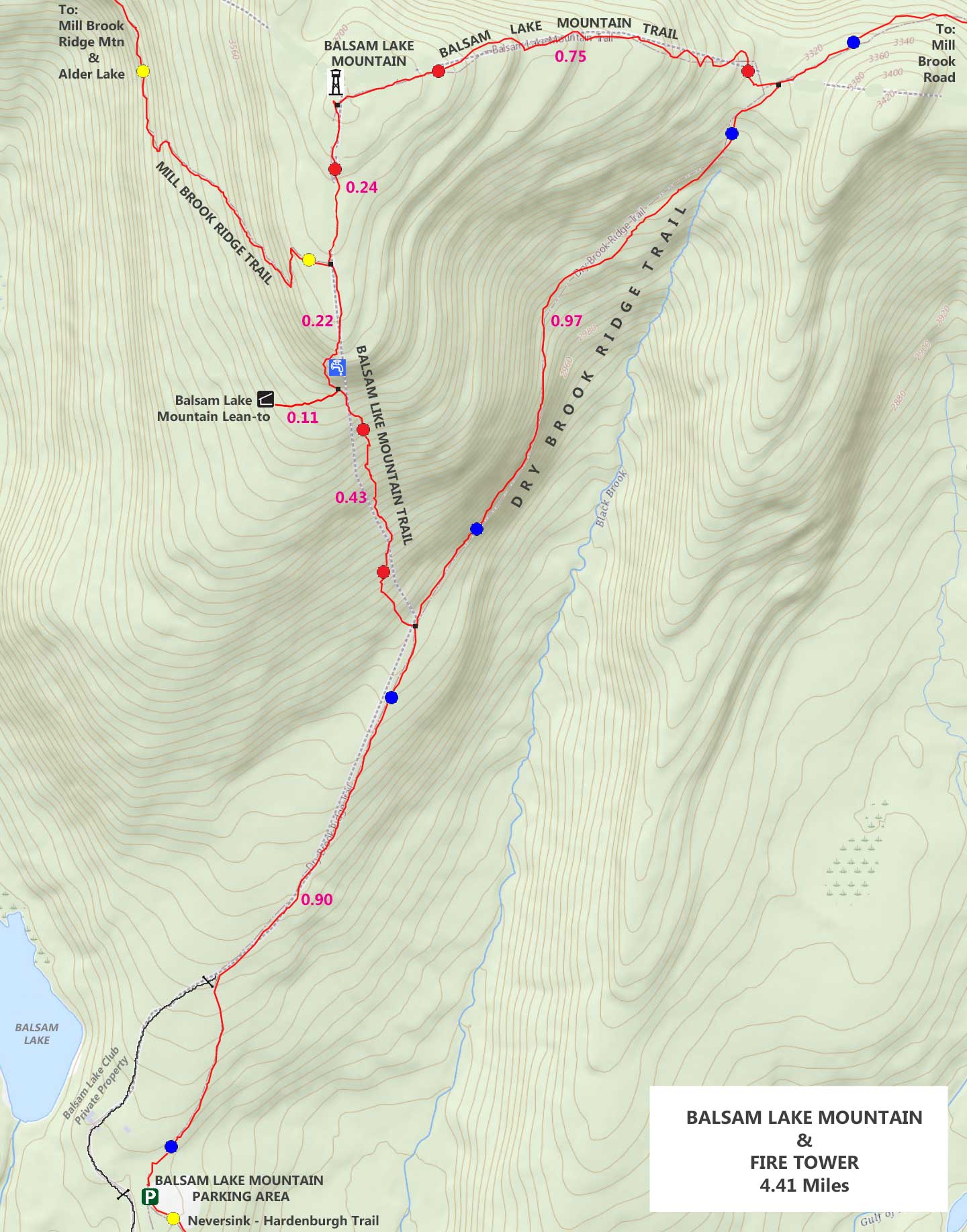
MILEAGE CHART - Hike from Beaver Kill Road TO Balsam Lake Mountain |
| | Mileage |
Mile Point |
Altitude |
Notes |
| | 0.00 | 0.00 | 2,575' | Balsam Lake Mountain Parking Area (25 cars) |
| | 0.10 | 0.10 | 2,595' | DEC Registration Box |
| | 0.90 | 0.80 | 2,938' | Trail Junction for Balsam Lake Mountain Trail |
| | 1.33 | 0.43 | 3,500' | Side trail to Balsam Lake Mountain Lean-to |
| | 1.55 | 0.22 | 3,673' | Trail Junction for Mill Brook Ridge Trail |
| | 1.79 | 0.24 | 3,745' | Balsam Lake Mountain Summit & Fire Tower |
| | 2.54 | 0.75 | 3,348' | Trail Junction for Dry Brook Ridge Trail |
| | 3.51 | 0.97 | 3,348' | Trail Junction for Balsam Lake Mountain Trail |
| | 4.32 | 0.81 | 3,348' | DEC Registration Box |
| | 4.41 | 0.09 | 3,348' | Balsam Lake Mountain Parking Area |
|
|
Hike to Balsam Lake Mountain fire Tower |
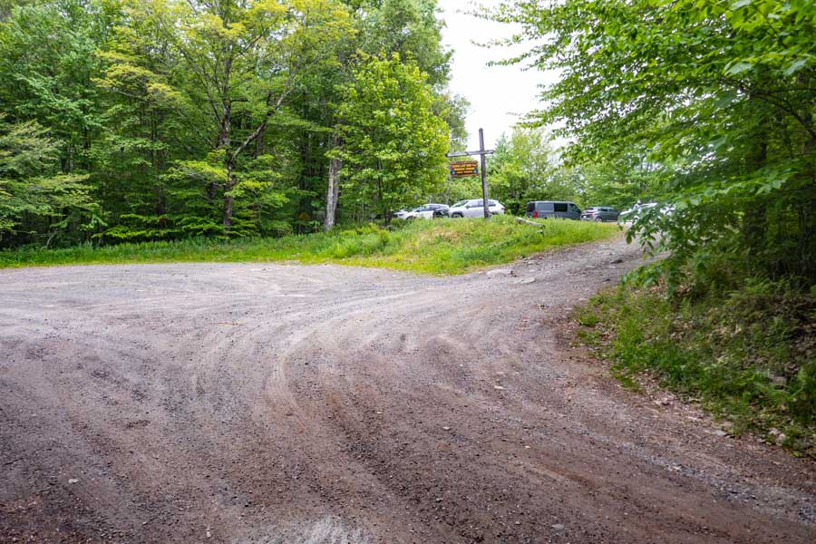 |
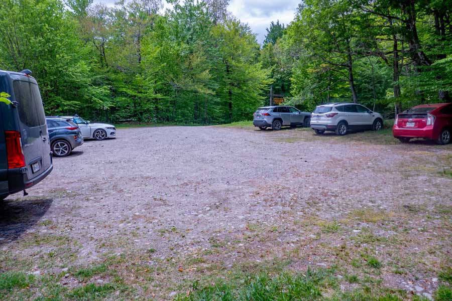
As you come to the end of Beaver Kill Road, you will see the Balsam Lake Mountain Parking Area on the RIGHT side of the road. That is where you will park.
On the left side of the Beaver Kill Road is the entrance to the PRIVATE Balsam Lake Club. Do NOT drive there!
|
|
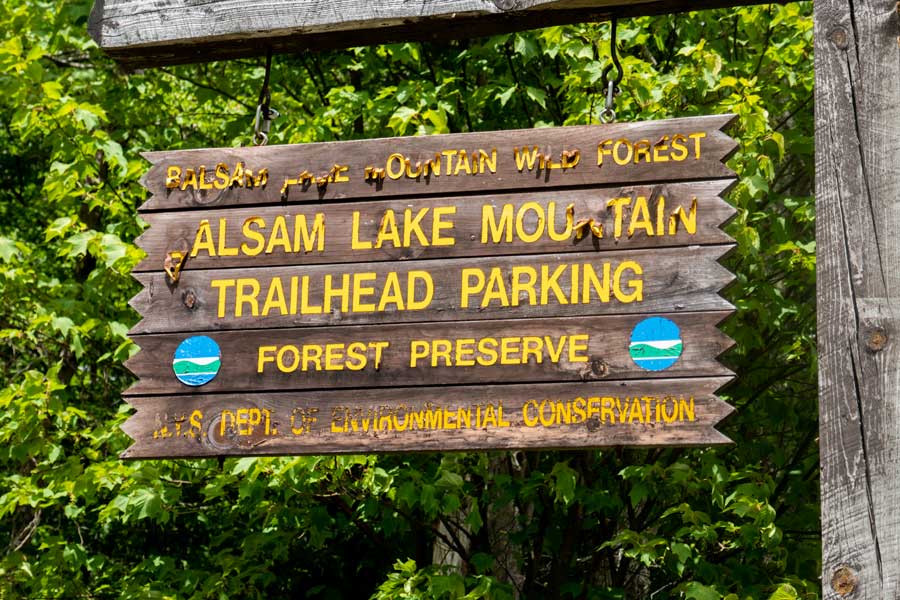 |
At the entrance of Balsam Lake Mountain Parking Area is the DEC sign marking the public parking area.
|
|
 |
This is the trailhead for the trail to the Balsam Lake Mountain. The trailhead is located at the end of the parking spot.
|
|
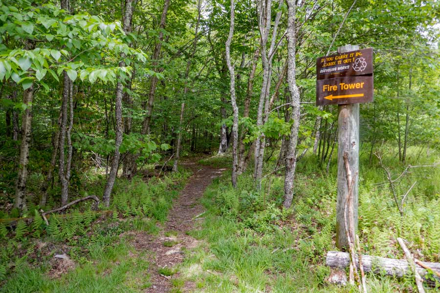 |
This is the trailhead for the Dry Brook Ridge Trail. There are two side trails that will take you to the summit of Balsam Lake Mountain. The trailhead is located at the end of the parking area.
The Dry Brook Ridge Trail will take you from this point to Mill Brook Road. The trail then continues to the Dry Brook Mountain Range, and finally ends close to Rt 28 in Margaretville, NY. The entire Dry Brook Ridge Trail runs about 13-to-14 miles long. But, for this hike, we will be taking one of two side paths up to Balsam Lake Mountain.
|
|
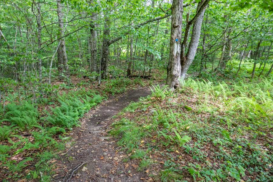 |
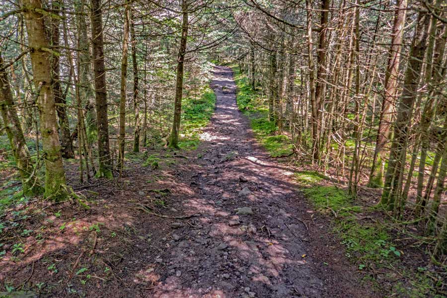
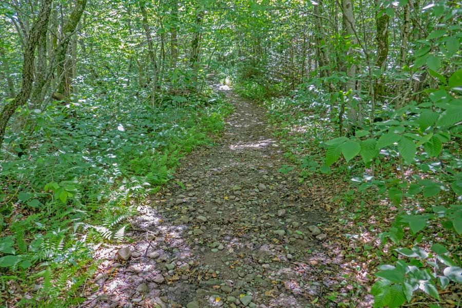
The beginning of the Dry Brook Ridge Trail, which starts out level, and then starts to climb elevation at a mild incline
|
|
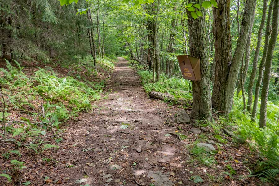 |
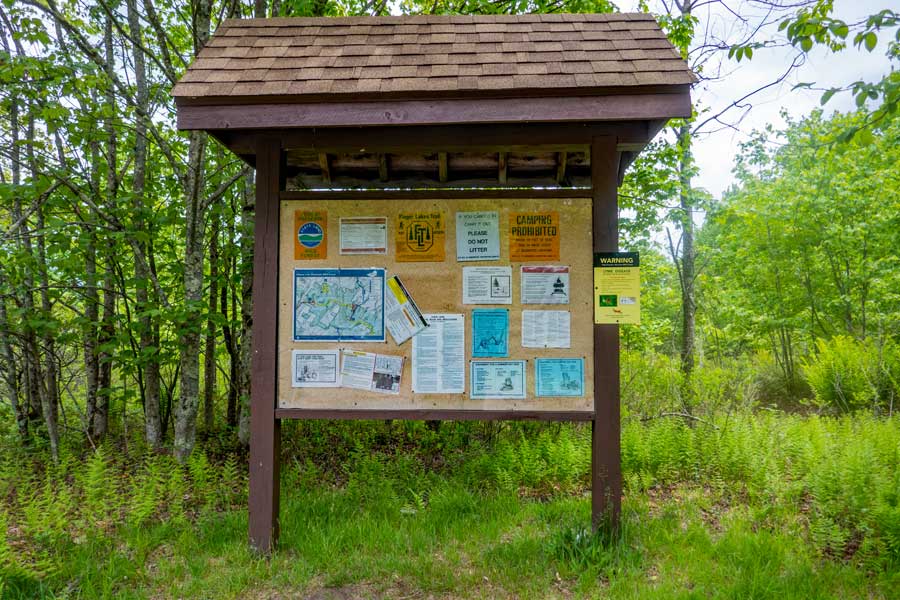
Around 500 feet from the Trailhead is the DEC Registration Box. Funds for maintenance of the regional trails depends upon how many people register for a hike in this region. Additionally, if you or someone else in your party have an emergency, Rangers and SAR will use the information in the registration box to find and help you. If someone goes missing, Rangers may call you to determine if you saw someone missing. Your life and someone else life may depend up you registering.
|
|
 |
The Dry Brook Ridge Trail (former logging road) will have a mild incline up the base of Balsam Lake Mountain.
|
|
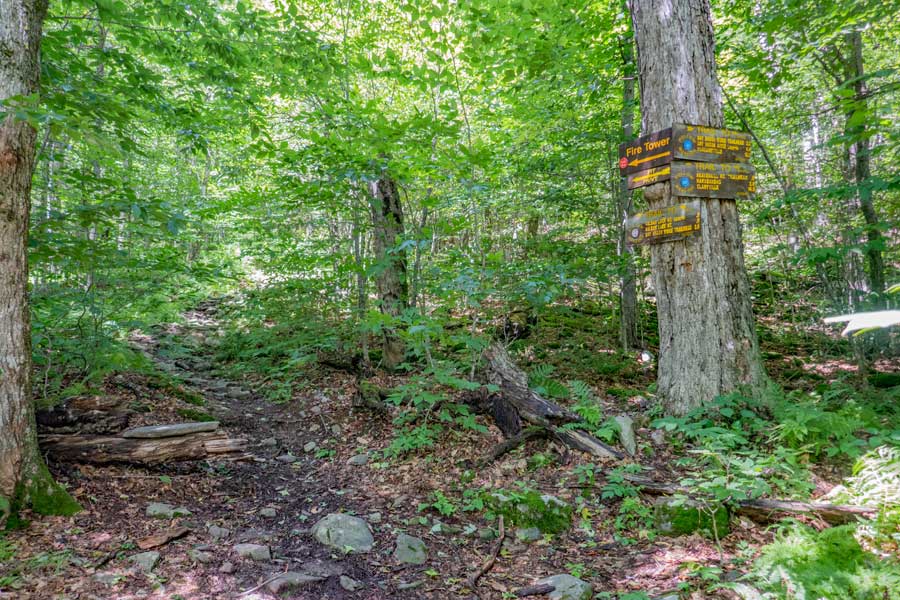 |
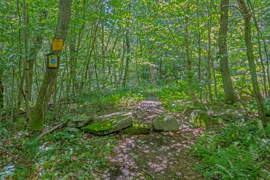
About 9/10 of a mile from the Trailhead is a Trail Junction. You want to make a LEFT here onto the Balsam Lake Mountain Trail. When you come back down from Balsam Lake Mountain Fire Tower, you will complete the loop here.
|
|
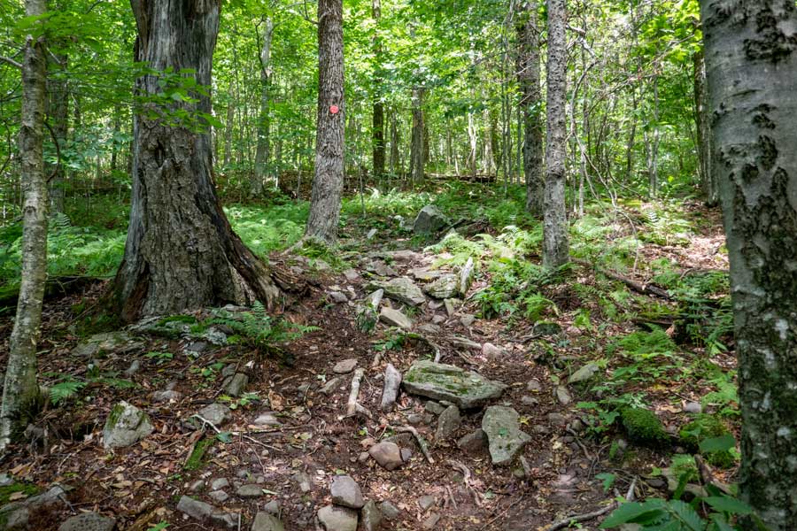 |
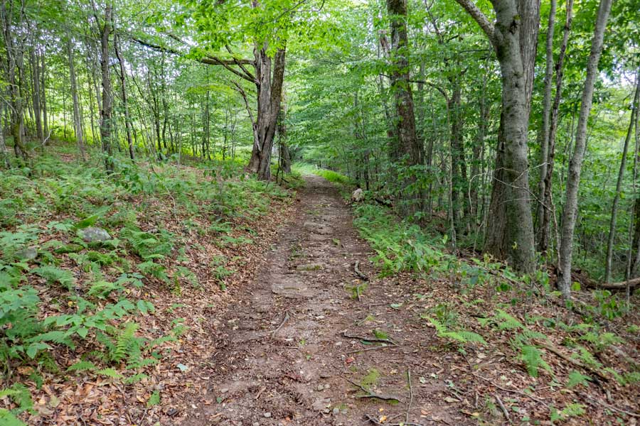
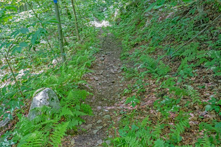
Balsam Lake Mountain Trail has a moderate incline that some call relentless for the next 3/4 of mile
|
|
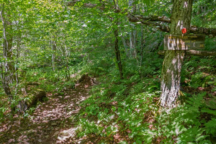 |
After over 4/10 of a mile, you will see a side trail on the left that will take you to the Balsam Lake Mountain Lean-to.
|
|
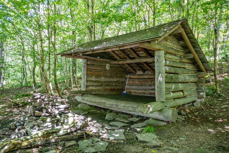 |
OPTIONAL VISIT: The Balsam Lake Mountain Lean-to is about 250-300 feet off the Balsam Lake Mountain Trail. It does not have a view over the valley due to tree leaves blocking the view.
|
|
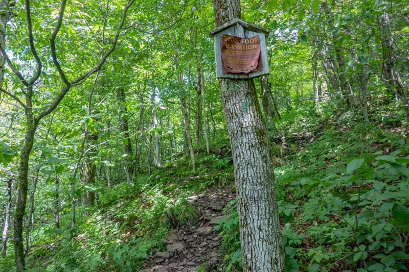 |
After the side trail to Balsam Lake Mountain Lean-to, the trail continues. In about 150 feet, you will encounter a DEC 3500 sign.
|
|
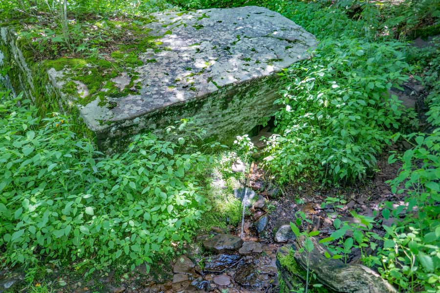 |
After another 100 feet past the 3500 sign is a Spring that flows fairly well. Easy to collect cold water from the pipe.
|
|
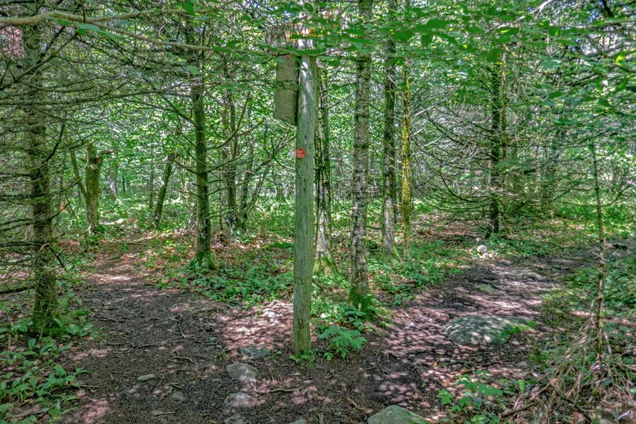 |
About 750-800 feet after the Spring on the Balsam Lake Trail is a Trail Junction. You want to go RIGHT (stay on the Balsam Lake Trail).
Left will put you on the Mill Brook Ridge Trail that goes to Alder Lake (about 6 miles away). The Mill Brook Ridge Trail is fairly wild, and some route finding is necessary to remain on the trail. The trail is not heavily used and the trail is often overgrown.
|
|
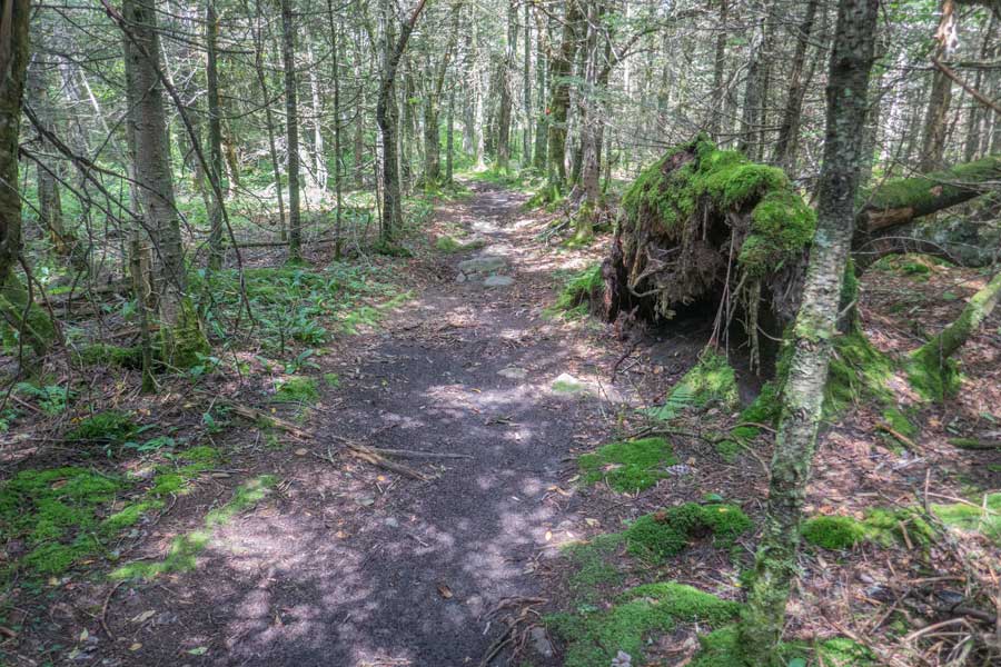 |
After the Mill Brook Ridge Trail Junction, the incline levels off to an easy hike. You are not that far from the summit of Balsam Lake Mountain and the fire tower.
|
|
 |
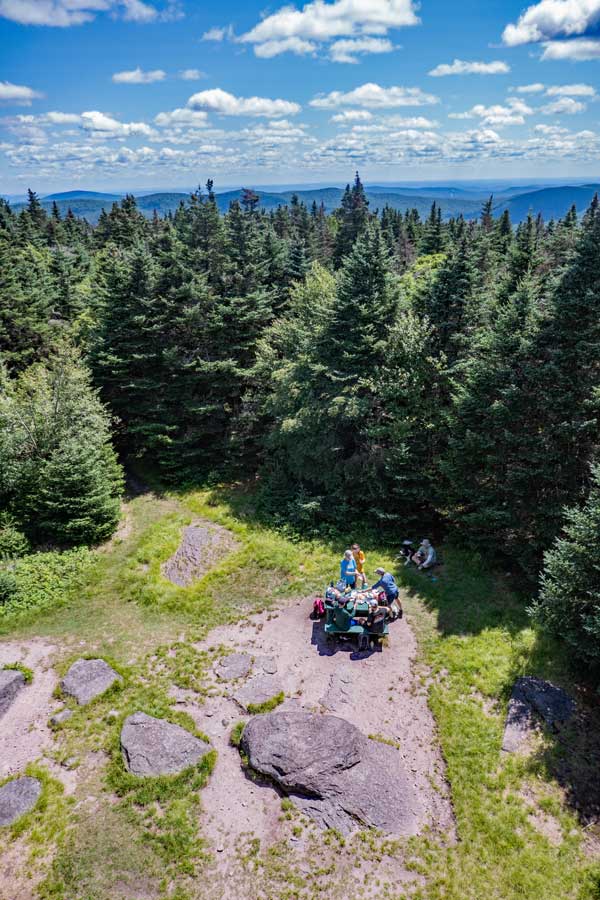 |
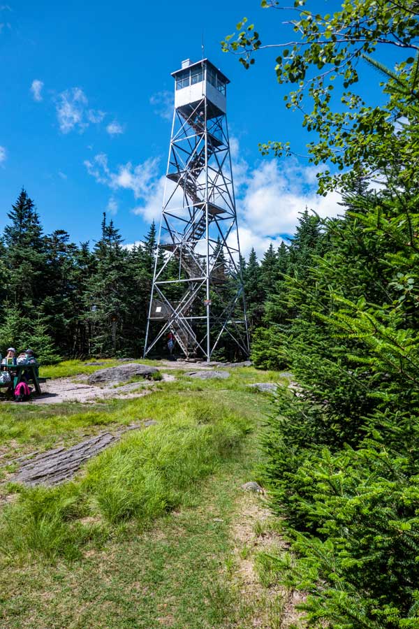
After a 1/4 mile from the Mill Brook Ridge Trail Junction, you will reach the summit of Balsam Lake Mountain and Fire Tower. You will enter the summit area from the southwest.
There is also a picnic table, along with a Ranger Station manned by volunteers on summer weekends.
If you climb the fire tower, there is a nice 360 degree view of the surrounding mountains and valleys in the southern Catskill Mountains. This is a favorite hike by many, so it can become crowded on summer weekends.
|
|
 |
Once you are done visiting the summit of Balsam Lake Mountaind and Fire Tower, you can exit on the southeastern side. You will hike next down past the Ranger Station. You will follow this old jeep trail for about 3/4 of a mile
|
|
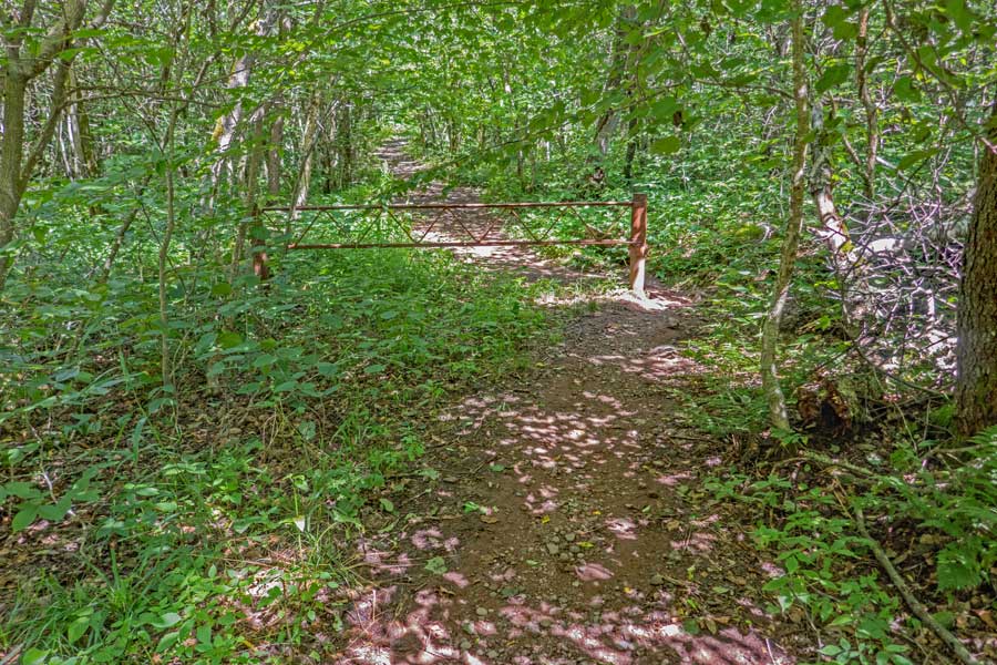 |
After about 3/4 of a mile, you will come to the end of Balsam Lake Mountain Trail. A short distance past the DEC gate, you will come to the Trail Junction for Dry Brook Ridge Trail. You want to take a RIGHT and head down the Dry Brook Ridge Trail.
Once you go past the DEC gate, you will be entering Private Property. The land owner has graciously allowed hikers to hike on the Dry Brook Ridge Trail on his land. So, please stay on the trail.
|
|
 |
This is the Dry Brook Ridge Trail headed back to the Balsam Lake Mountain Parking Area where you parked your car.
|
|
 |
After a short distance you will enter back onto New York State Land.
|
|
 |
This is an old logging road that is fairly wide and easy to hike down.
|
|
 |
After travelling about 9/10 of a mile on the Dry Brook Ridge Trail, you will complete the loop around the Balsam Lake Mountain summit and Fire Tower. You want to continue STRAIGHT.
|
|
 |
About 8/10 of a mile, you will come to the DEC Registration Box. Please check out. In about another 1/10 of a mile you will come back to the Balsam Lake Mountain Parking Area. I hoped that you enjoyed this hike.
|
|
|
S E C T I O N S
|
W E A T H E R
|
O T H E R
|