|
Hiking the Hog Hollow Trail |
 |
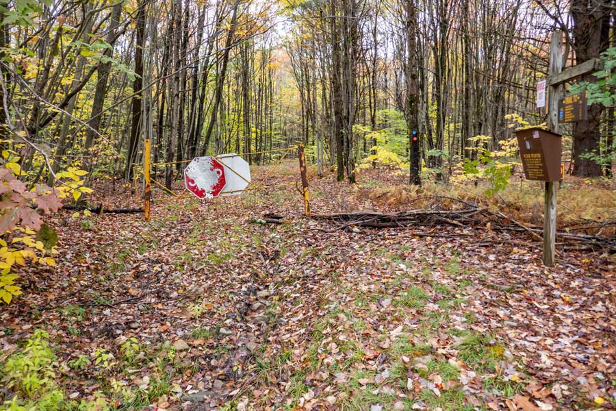
There is also a Campbell Mountain Road Parking Area. It is a DEC Parking Area that holds about 7 cars. It is directly off Campbell Mountain Road. It is 8/10 of a mile to the Hog Hollow Trail. It has significantly less elevation climb then the Cat Hollow Parking Area. It is the easiest and fastest way to access the Hog Hollow Trail.
|
|
 |
This is the Cat Hollow (Rt 206) Parking Area. It holds about 5 cars and is directly off Rt 206. It is 1.2 miles to the Hog Hollow Trail, and has more elevation climb then the Campbell Mountain Road Parking Area.
|
|
 |
This listing assumes that you will use the Campbell Mountain Road Parking Area, because it is the fastest and easiest way to the Hog Hollow Trailhead.
Across Campbell Mountain Road is the Trailhead for the Campbell Mountain Trail. The Campbell Mountain Trail will take you to the Hog Hollow Trailhead. The Hog Hollow Trailhead is 8/10 of a mile from this point.
NOTE: There is another trailhead in the Campbell Mountain Road Parking Area. It is for the Trout Pond Trail. Do NOT take that trail.
|
|
 |
This is the beginning of the Campbell Mountain Trail at the southwestern end of the trail. The beginning of the trail is rather flat in elevation. Please note the Blue Trail markers AND the Snowmobile Trail Marker.
|
|
 |
Once you arrive at the base of the Campbell Mountain Range, the elevation of the trail will begin to climb. It will only climb about 200 vertical feet to get over the Campbell Mountain Range.
|
|
 |
Once you climb up near the top of the Campbell Mountain Range, the trail will turn 90 degrees right and run along the mountain range to the east for a ways. The trail is nice and flat.
The trail will then turn left (northerly direction) to go over the top of the Campbell Mountain Range. It will then start to descend in elevation towards the northwest.
|
|
 |
After hiking 8/10 of a mile, up and over the Campbell Mountain Range on the Campbell Mountain Trail, you will come to a Trail Junction. You want to go LEFT onto the beginning of the Hog Hollow Trail (Snowmobile Trail #2). The Hog Hollow Trail is marked with Snowmobile Trail Markers and sometimes rectangles painted with white paint on trees on section of private property.
Right will take you down off the Campbell Mountain Range on the Western end of the Campbell Mountain Trail. About a 1/3 of a mile down the Campbell Mountain Trail is the Campbell Mountain Lean-to.
|
|
 |
 |
This the beginning of the Hog Hollow. The trail was once a road, so it is wider then most trails. Today, it doubles as a snowmobile trail and a hiking trails.
NOTE: ATV's are NOT allowed on DEC trails in the Catskill Mountains. Sometimes SAR and trail maintainers will use ATV's with a permit. |
Some sections will be more difficult to follow in the summer months as the vegetation can become overgrown. In this particular section there is a fern glade, so you need to have some route finding skills. Some hikers like these sections that give it a wild feel. |
|
 |
 |
In some locations the trail can be a little hard to follow, so use your route-finding skills, and look for trail markers. You will encounter a variety of trail conditions along the Hog Hollow Trail. |
Other sections have very wide trails. They may become overgrown with grass and weeds in the summer months. |
|
 |
About 1/2 mile down the Hog Hollow Trail, you will see part of a bog.
|
|
 |
After a short distance you will see a series of fields separated by small sections of forest. This one has a stone marker, and a stone wall crossing the path. There are some other logging roads in this particular region.
|
|
 |
This is a 180 degree panoramic picture of another field. This is the largest field in this region. Most hikers continue straight across, and cannot find the continuation of the trail. You want to hike slightly off to the right where you see the arrow.
|
|
 |
The trail continues down a nice wide trail.
|
|
 |
When you get to this section, you will be entering onto private property. Hikers and snowmobiles can legally follow the trail over private property. The trail makes a number of turns, so you need to pay attention. There are some other logging roads on this particular piece of private property. The trail on private property has rectangular white markers painted on the trees.
|
|
 |
The trail turns to the right and goes down this section of bluestone rock. You are still on private property, so stay on the trail.
|
|
 |
Oddly enough, there are some Blue Trail Markers in this section. The blue trail markers are not official, but they do mark the trail properly. You are still on private property, so stay on the trail.
|
|
 |
You will then come down a hill, and the trail will take a RIGHT turn. If you look carefully, you will see a White Trail Marker with a black arrow nailed to the tree. You are still on private property, so stay on the trail.
|
|
 |
After a short distance, you will see this trail junction. You want to go RIGHT where you see the wooden Downsville sign. You are still on private property, so stay on the trail.
|
|
 |
After a while, you will see some DEC signs. You will then be entering back onto DEC Public Land. Shortly after entering DEC land, the trail will take a turn to the left.
|
|
 |
The trail will then go straight for almost a mile along a nice forest trail. At the end of this very long straight stretch, the trail will then turn 90 degrees to the left.
|
|
 |
The Hog Hollow Trail will then go straight for another 1/2 mile before you encounter some old homesteads.
|
|
 |
One of the old homesteads is right next to the trail. You want to hike on the left side of the stone foundation you see in the picture. After the stone foundation, the trail will turn 90 degrees RIGHT and enter into some high weeds. Shortly after entering into the weeds, you will encounter a trail junction. Left will take you up to a large field. Right will take you further down the trail to another homestead.
|
|
 |
If you decide to take a detour (left at the trail junction), it will take you up to this large field.
|
|
 |
After going RIGHT at the trail junction in the weeds, you will encounter this old homestead stone foundation.
|
|
 |
After you pass by the second old homestead, the trail will continue downhill.
|
|
 |
After about 750 after the second old homestead, you will come to this trail junction. You want to continue to the right. Left is a second way to visit the large field. The trail junction is not so obvious in this picture, but it is there.
|
|
 |
Looking backwards, after you walk past the trail junction, the other trail is quite obvious. The side trail will take you to the Large Field.
|
|
 |
About 200 feet past the trail junction to the large field is another trail junction for the Finger Lakes Trail down to Downsville.
You should continue straight. 6/10 of a mile later the trail ends in the middle of the woods. You can then turn around and return back to your vehicle.
|
|
|
S E C T I O N S
|
W E A T H E R
|
O T H E R
|

