Catskill Mountaineer

Hiking at Morton Hill Swamp

Morton Hill Swamp
View of the Morton Hill Swamp


OVERVIEW

  Name: Morton Hill Swamp
  Trail Name: Unmarked Trail to Morton Hill Swamp
  Forest: Delaware Wild Forest
  Parking Area : 10 spaces (DEC) directly off Morton Hill Road
  Winter Access: Morton Hill Road PA
  Lean-to sites: 0
  Campsites : 0
   
  Views : Nice view of the swamp
  Access : Foot
  Size : unknown size
   
  DEC Trail Map: DEC Delaware Wild Forest Map (free)

  USGS Map: USGS Roscoe Quad Maps

  Digital Mapper: Topo     Terrain     Satellite

Maps of Morton Hill Swamp

Map of the Morton Hill Swamp in the Delaware Wild Forest


Notes About Camping at Morton Hill Swamp

 TRAIL
  There is a short 500 foot unmarked trail to the Morton Hill Swamp. It is fairly easy to follow. There is also a herd on the west side of the Morton Hill Swamp that is sometimes is difficult to follow. But, the west side goes through a conifer forest, so following the herd trail is not that important. Once you get to the head of the swamp, the forest becomes thick and difficult to push through.

The Morton Hill Swamp has a number of beaver homes. There are numerous beaver dams at the foot of the swamp, which has elevated the swamp.

The Morton Hill Swamp has a rich population of birds.


 OTHER INFORMATION
  There is limited cell phone service in some parts of the region (as of 2023).


DIRECTIONS to the Russell Brook Road Parking from Exit 19 (Kingston)

 
  • Russell Brook Road (DEC) - WGS84 (DEC): 42.017183, -74.924483 - Elevation is approximately 2,272'
  •  
  • Russell Brook Road (DEC) - Deg/Min/Sec: N42 01 01, W74 55 28 - Elevation is approximately 1,832'
  •  
  • Russell Brook Road (DEC) - GPS: N 42 01.031, W 74 55.469 - Elevation is approximately 1,832'
  •  
  • Russell Brook Road (DEC) - UTM: 18N 506252 4651687 - Elevation is approximately 1,832'

  •  
     
  • Get off New York State Thruway at Exit 19 (Kingston).
  •  
  • Take a RIGHT out of the NYS Thruway onto Route 28 West.
  •  
  • Go approximately 46.4 miles on Rt 28 West
  •  
  • Take a LEFT onto Rt 30
  •  
  • Go approximately 19.9 miles on Rt 30 around the Pepecton Reservoir
  •  
  • Take a LEFT onto Rt 206 (Cat Hollow Road)
  •  
  • Go approximately 2.8 miles on Rt 206
  •  
  • Take a RIGHT onto Jug Tavern Road
  •  
  • Go approximately 1.5 miles on Rt 206
  •  
  • Take a LEFT onto Campbell Mountain Road
  •  
  • Go approximately 0.4 mileson Campbell Mountain Road
  •  
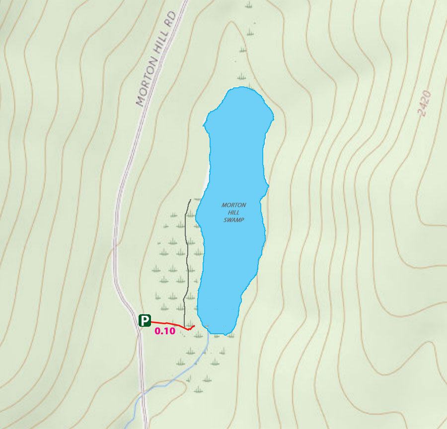
  • Take a LEFT onto Morton Hill Road
  •  
  • Go approximately 1.2 miles on Morton Hill road
  •  
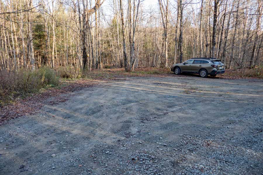
  • Take a LEFT into Morton Hill Swamp Parking Area
  • Camping & Hiking at Morton Hill Swamp

    The Morton Hill Swamp Parking Area and Trailhead
    This is the Morton Hill Swamp Parking Area on Morton Hill Road. The trail is just left of center on this picture.

    The Morton Hill Swamp Trail
    The Morton Hill Swamp Trail is an unmarked trail that takes you to theMorton Hill Swamp. The trail is quite short (500 feet).
    Foot of the Morton Hill Swamp
    This is the Morton Hill Swamp at the foot of the swamp. The swamp has been enlarged by beaver dams.
    west side of the Morton Hill Swamp
    This picture was taken on the west side of Morton Hill swamp. There is not a trail up the west side of the Morton Hill Swamp. But, there is a animal herd trail through a nice conifer forest.
    west side of the Morton Hill Swamp
    Another image of the Morton Hill Swamp from the west side.
     

      S E C T I O N S


      W E A T H E R


      O T H E R

    Copyright 2001-2024 www.catskillmountaineer.com ALL RIGHTS RESERVED