Hike Hunter Mountain from Notch Lake on Rt 214 |
 |
| |
| |
|
OVERVIEW |
| | Trail Name: | Devil's Path
 (Notch Lake off Rt 214 to Hunter Mountain Trail)
 |
| | Trail Name: | Hunter Mountain Trail
 (Devil's Path to Spurceton Valley Lookout)
 |
| | Trail Name: | Spruceton Trail
 (Spruceton Valley Lookout to Hunter Mountain Tower)
 |
| | |
| | | Distance: | 8.02 miles from the DEC Parking Lot on Spruceton Road |
| | Time: | Average 5.50 hours round trip |
| | Elevation Gain: | 2,044 feet from the DEC Parking Lot and the summit. |
| | Best Time to Hike: | Morning |
| | Difficulty: | Difficult |
| | Summit Elevation: | 4,046' |
| | Access Methods: | Foot and snowshoe |
| | |
| | | USGS Official Names: | Hunter Mountain (ID: 973354) |
| | USGS Past Names: | Greenland Mountain |
| | USGS Summit-Elevation: | 4,045' (USGS) |
| | USGS Fire-Tower-Elevation: | 4,026' (USGS) |
| | USGS Hunter-Summit-WGS84: | 42.1778662, -74.2304216 (DEC-WGS84) |
| | USGS Hunter-Summit-GPS: | N 42 10.672 W 74 13.825 (GPS) |
| | USGS Hunter-Summit-UTM: | 18N 563557 4669811 (UTM) |
| | USGS Hunter-Summit-Deg, Min, Sec: | N42 10 40 W74 13 49 (Degree, Min, Sec) |
| | |
| | | USGS Official Map: | Hunter Topographical Map (free) |
| | |
| | | DEC Trail Map: | DEC Hunter-Westkill Wilderness Map (free) |
| | |
| | | Digital Mapper: |
Topo
Terrain
Satellite |
|
|
Maps |
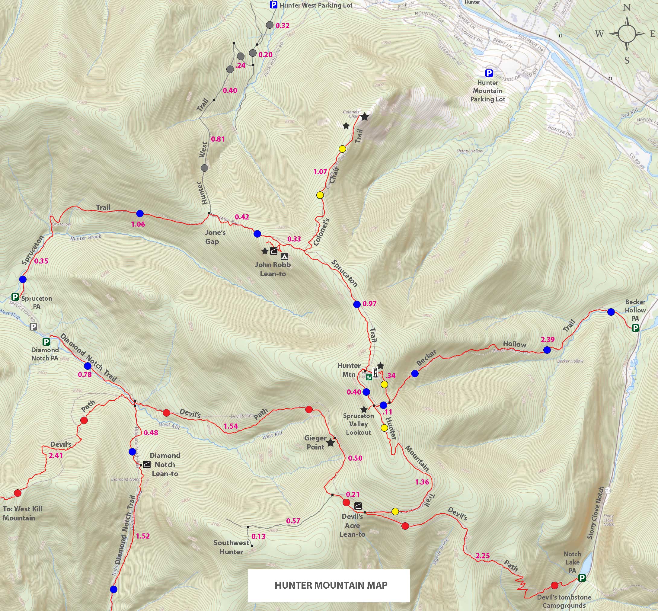 |
| The hike starts on the bottom right of the map above. Park at the Notch Lake PA. |
|
|
| | DIRECTIONS TO TRAIL HEAD |
| | DEC Parking Lot WGS84 (DEC): 42.159667, -74.203467- Elevation is approximately 2,001 feet |
| | DEC Parking Lot Deg/Min/Sec: N42 09 34, W74 12 12 - Elevation is approximately 2,001 feet |
| | DEC Parking Lot GPS: N 42 09.580, W 74 12.208 - Elevation is approximately 2,001 feet |
| | DEC Parking Lot UTM: 18N 565802, 4667811 - Elevation is approximately 2,001 feet |
| | Take New York State Thruway to Exit 21 (Catskill). |
| | Take a left out of the NYS Thruway entrance road. |
| | Go approximately 3/4 mile |
| | Take a right onto Route 23 West |
| | Go approximately 6.6 miles to Cairo, NY |
| | Take a LEFT onto Rt 32. McDonalds Rest. on corner. |
| | Go approximately 7.7 miles on Rt 32 |
| | Take a RIGHT onto Rt 23A |
| | Go approximately 11.5 miles to the intersection of Rt 23a and Rt 214. |
| | Take a LEFT onto Rt 214 |
| | Go approximately 2.8 miles on Rt 214 |
| | Take RIGHT into Notch Lake Parking Area (holds 25 cars). |
| |
|
| | PARKING NOTICE: When the Devil's Tomestone Campground opens in the Spring to when it closes in the fall, you MUST pay a Day Use Fee to parking at the Notch Lake Parking Area. The fee to park at this parking area are no longer listed on the DEC's web site, but expect to pay around $5-$10. |
|
|
Notes about hiking the Hunter Mountain from Notch Lake |
There are five routes to get to the summit of Hunter Mountain. This route is the most difficult route for hikers. It goes straight up the steep side of the mountain. So, the first half mile is difficult. Then the trail starts to slowly level out. The Fire Tower of Hunter Mountain provides great views. Many also like to picnic at the Hunter Mountain Fire Tower. There is a Ranger Station at the top of Hunter Mountain, but it is rarely open to the public.
This route might be the shortest route, but the most difficult. Other routes are only slightly longer. In the Winter, getting above the ledge can be difficult due to ice flows.
Hikers can also hike Southwest Hunter Mountain. Both peaks are common hikes for 3500 club members.
There are NO water sources on this particular route. |
|
|
MILEAGE CHART |
| | Mile Point | Mileage | Altitude | Notes |
| | 0.00 | 0.00 | 2,001' | Notch Lake Parking Lot - Start on south side of lot |
| | 0.02 | 0.02 | 2,003' | Hike on trail of Parking Lot to just past "TRAIL" sign |
| | 0.01 | 0.03 | 1,991' | DEC Registraion Box (Just after going over bridge) |
| | 2.22 | 2.25 | 3,540' | Trail Junction for Devil's Path & Hunter Mountain Trail |
| | 1.36 | 3.61 | 4,015' | Trail Junction for Hunter Mtn Trail & Becker Hollow Trail & Spruceton Trail. |
| | 0.40 | 4.01 | 4,025' | Trail Junction for Hunter Mountain Summit, Fire Tower and Ranger Station. |
| | 4.01 | 8.02 | 2,001' | Return to Notch Lake Parking Lot - Start on south side of lot |
|
|
Hike Hunter Mountain via Rt 214 - Notch Lake PA |
 |
This is the Notch Lake Parking Lot. It holds about 25 cars. When the Devil's Tombstone Campground is open you are required to pay the Day Use Fee. When the campground is closed you can park at the Notch Lake Parking Area for free. |
|
 |
On the south side of the Notch Lake Parking Lot, is the Trailhead for the hike to Hunter Mountain. This section of the route is called the Devil's Path. |
|
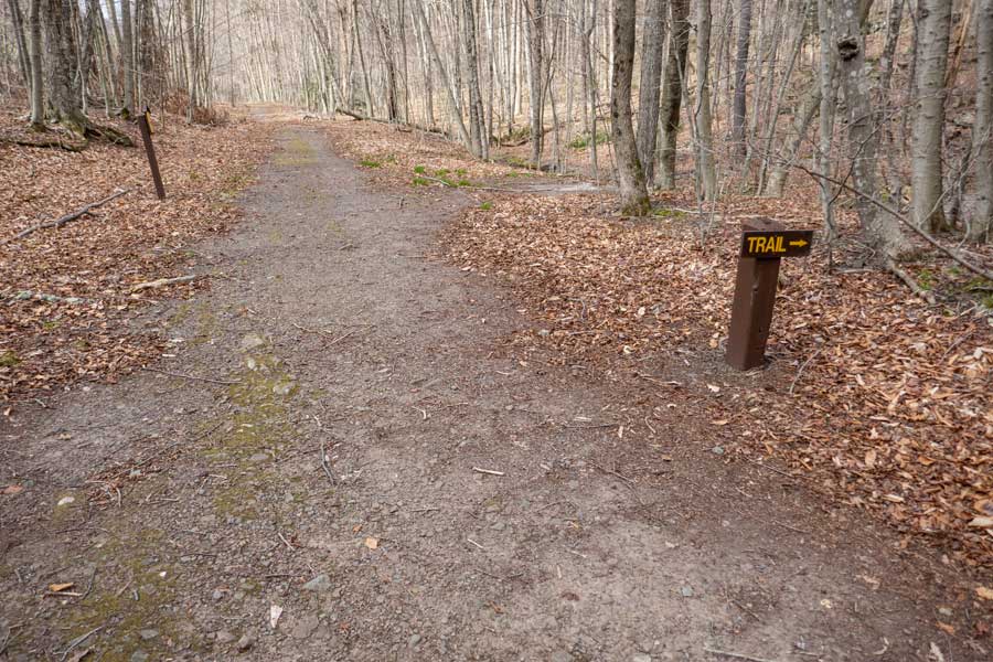 |
On the bottom right of the image above, the actual trail is about 15 feet past this sign, and around 200 feet from the Notch Lake Parking Area |
|
 |
 |
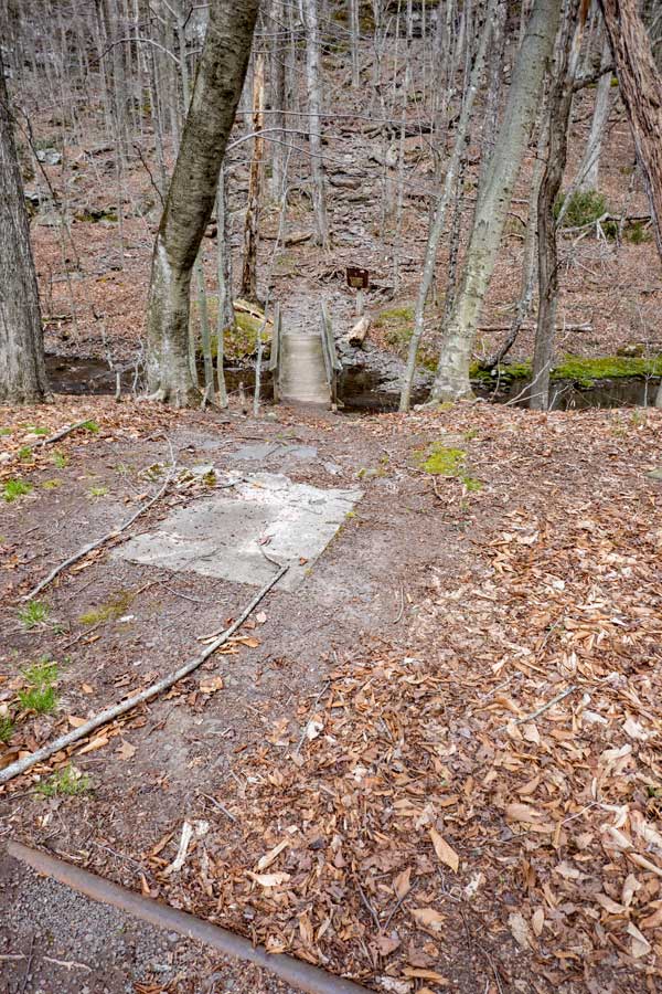
The picture above show the trail going over the creek from Notch Lake, and the DEC Registration Box for the hike to the summit of Hunter Mountain. |
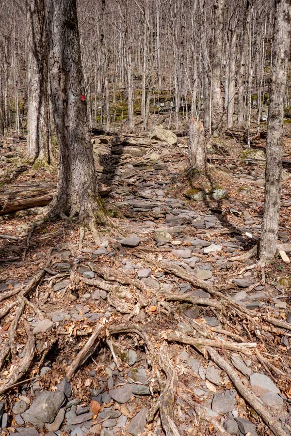
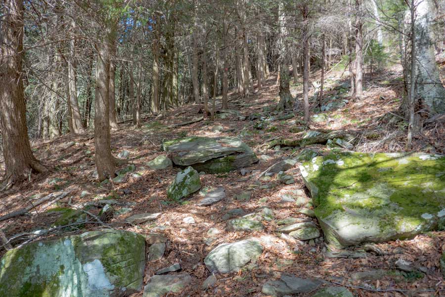
The trail then starts going straight up the mountain. This trail is quite rocky on the lower half the trail. The trail will then turn left, and go straight up the mountain again. The first 1/2 mile of the trail is very rocky and steep. |
|
 |
 |
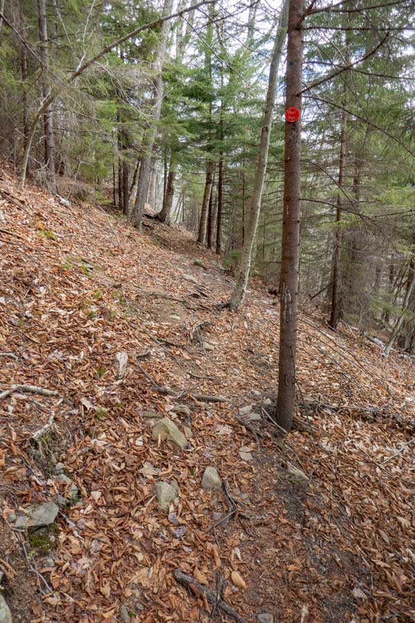
The trail continues to be steep and rocky. Make sure you watch for the Red Trail Marker disc on the trees. Some people have hiked off the trail
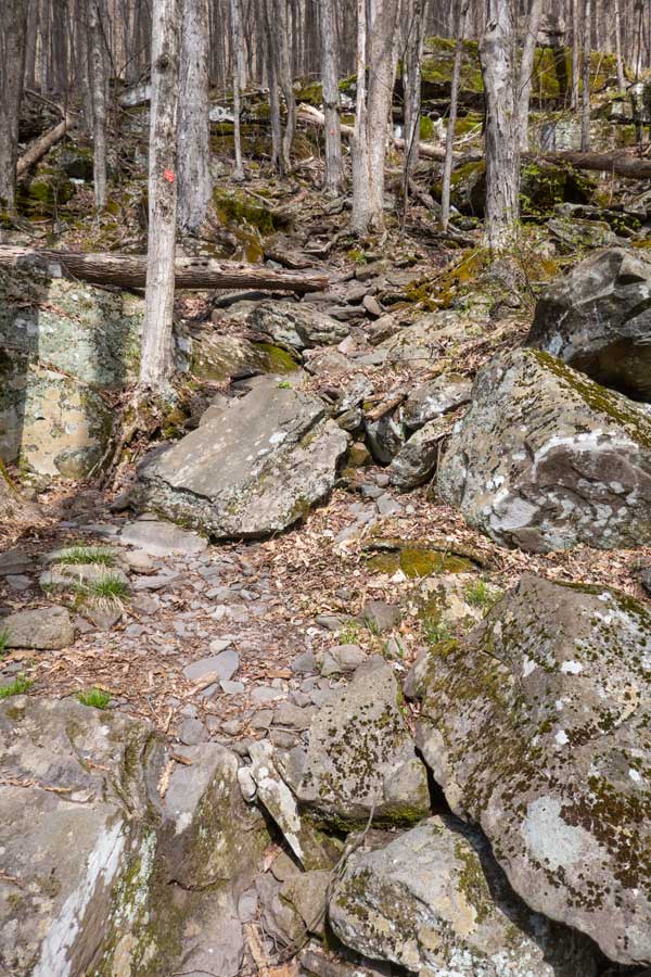
| The trail then comes to a ledge. Again you will move to the left along the base of the ledge until you get to a location that will allow you to get above the ledge. |
|
 |
This is the route go get above the first band of ledges. This rock is about 5-6 feet tall. Getting up the rock can be a little challenging, but doable. In the Winter, or below freezing, this section can be covered with ice, so bring your microspikes in the winter months. . |
|
 |
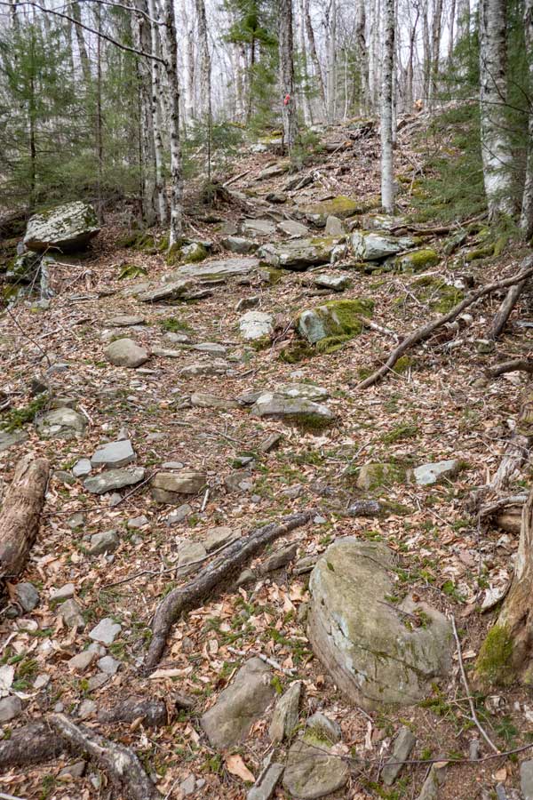
The incline starts to decrease after about 1/2 mile. In another 400 feet the trail move into a conifer forest. It will not stay in the forest too long. It will switch back in the other direction. |
|
 |
 |
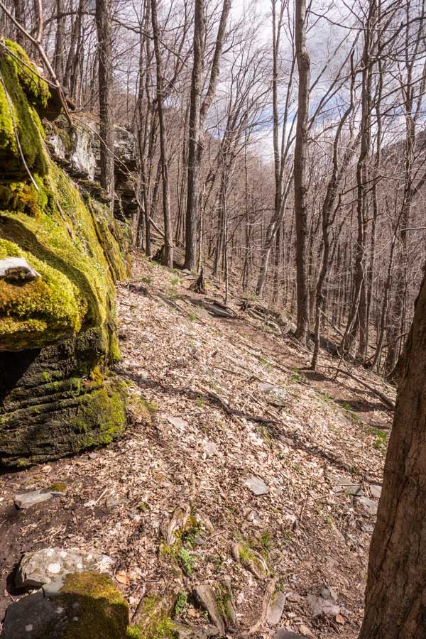
After a short distance, you will exit from the conifer forest and move across the side of the mountain. . |
The trail will turn and head straight back uphill. From the conifer forest forward the trail incline will not be as steep as the bottom section. It has a moderate incline. |
|
 |
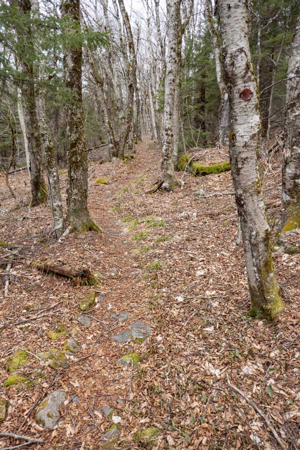 |
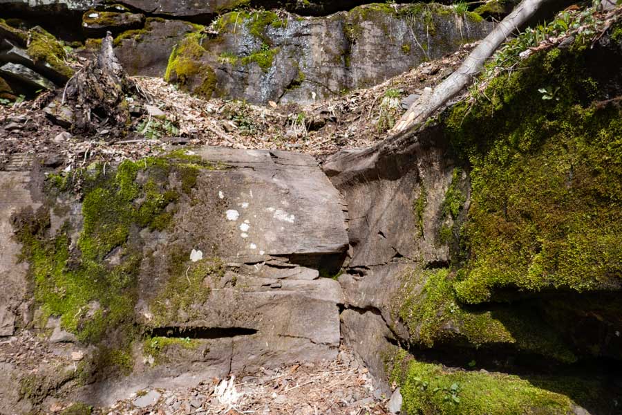
As you hike further, the incline starts to decrease to almost a level incline. |
This is one of the section that goes across ledge, and is almost level, and straight. This section is quite enjoyable . |
|
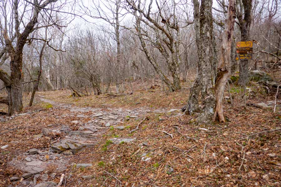 |
After hiking about 2-1/4 miles, you will come to a trail junction. You want to go RIGHT onto the Hunter Mountain Trail. Left will continue down the Devil's Path to Southwest Hunter and West Kill Mtn . |
|
 |
 |
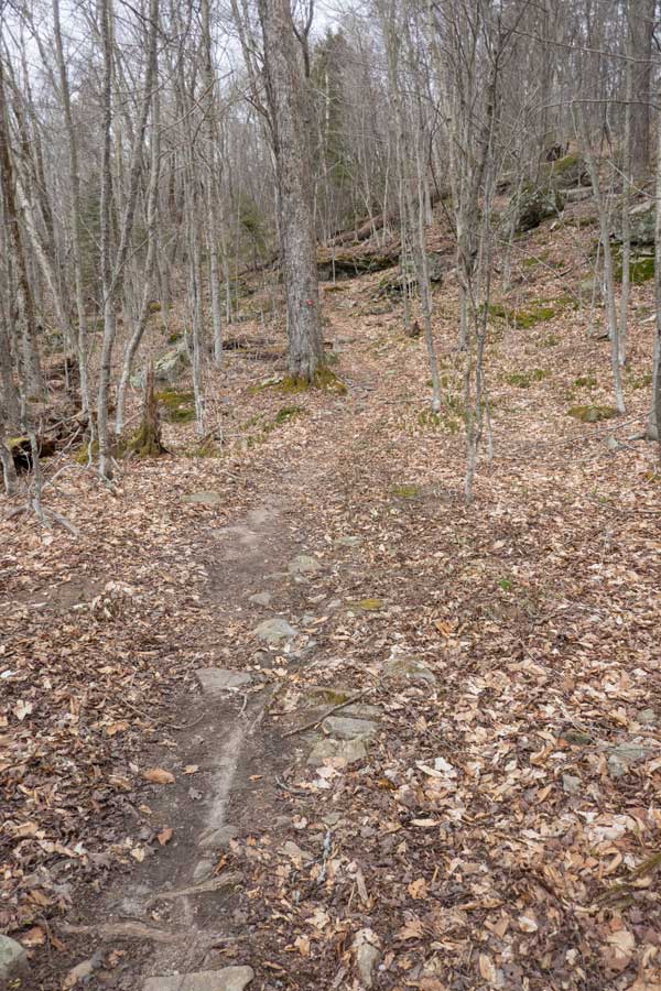
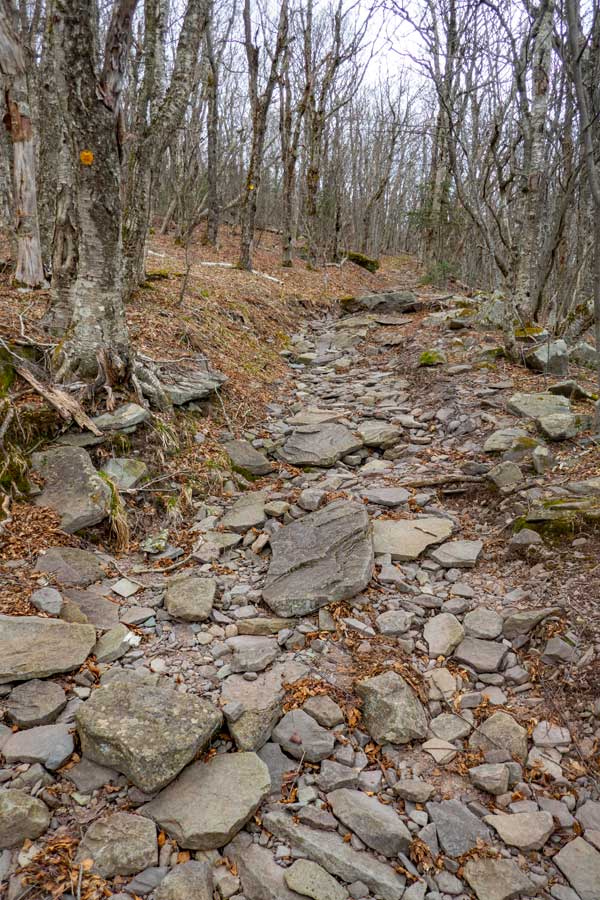
The Hunter Mountain Trail will start off on smooth dirt path. But, the smooth trail is short-lived. It then turns into a rocky trail until you get closer to the summit of Hunter Mountain. . |
The Hunter Mountain Path continues to be rocky. When there is a lot of rain, this trail is wet. |
|
 |
 |
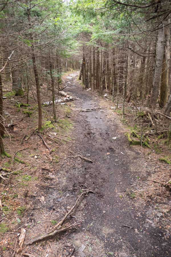
After you take a sharp left turn, the trail will start to become a muddy trail. In the summer months it is dry. . |
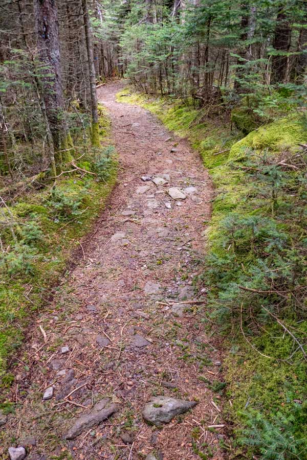
The Hunter Mountain Trail then becomes a beautiful hiking trail . |
|
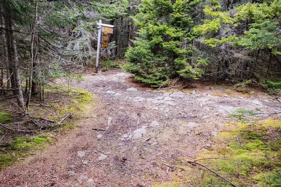 |
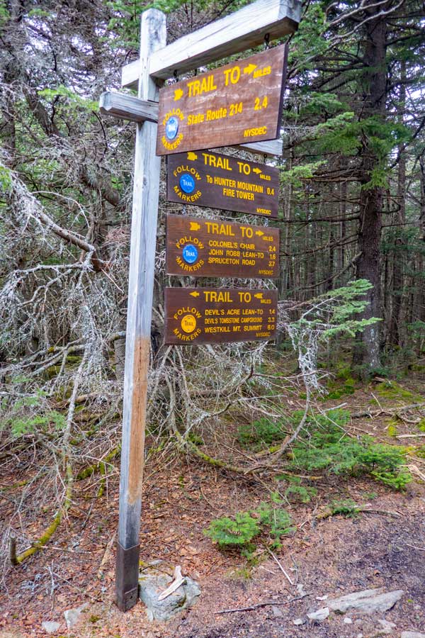
After hiking up the Hunter Mountain Trail 1-1/2 miles, you will come to this Trail Junction. You want to continue STRAIGHT onto the Spruceton Trail. Right will take you down the Becker Hollow Trail. Left will take you to the Spruceton Valley Lookout, which is now overgrown. |
|
 |
 |
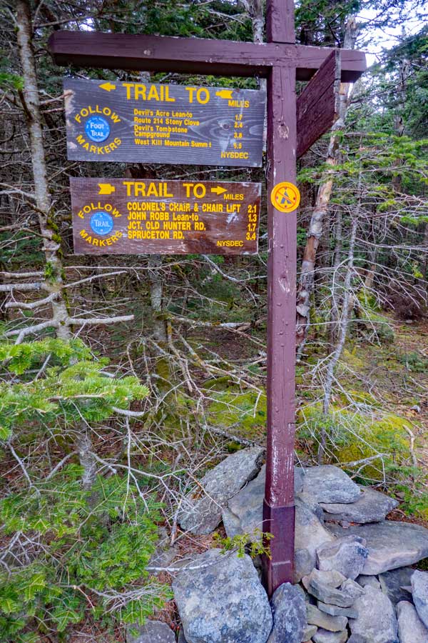
The DEC trail sign give you some direction to where you would like to go. |
The Spruceton Trail is nice and enjoyable. |
|
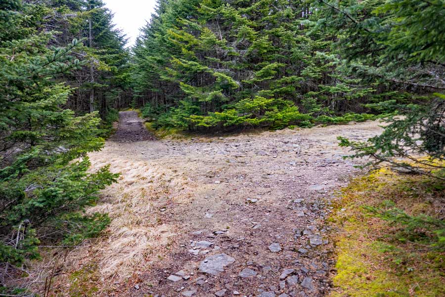 |
After 4/10 of a mile on the Spruceton Trail you will come to a second Trail Junction. You want to go RIGHT. Straight will take you to the Spruceton Valley. |
|
 |
 |
This is the DEC trail sign at this trail junction. You cannot camp on the summit of Hunter Mountain. |
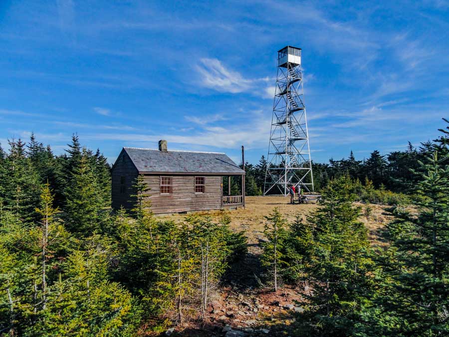
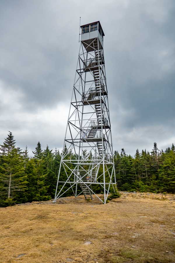
As you turn right, you will see the Hunter Mountain Tower. It is a couple hundred feet away. |
|
|
This is a picture of the Hunter Mountain Tower and Ranger Cabin. |
|
 |
 |
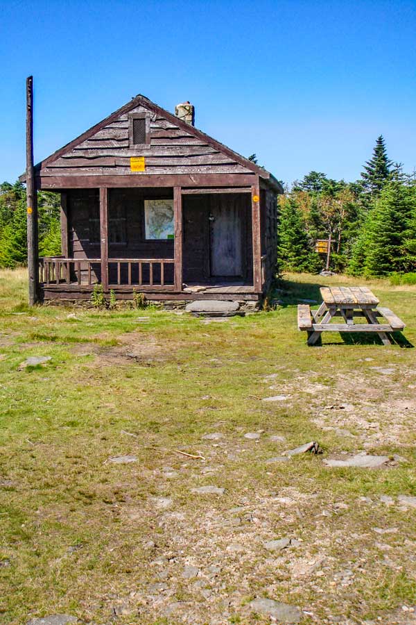
This is the Hunter Mountain Ranger Station. It is almost always closed. The picnic table is convenient for those who want to eat lunch here. |
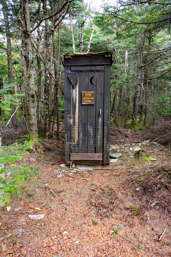
This outhouse is location on the southwest region of this open area . |
|
|
S E C T I O N S
|
W E A T H E R
|
O T H E R
|
|
Copyright 1994-2024 www.catskillmountaineer.com
ALL RIGHTS RESERVED
|