RoundTop and Kaaterskill High Peak |
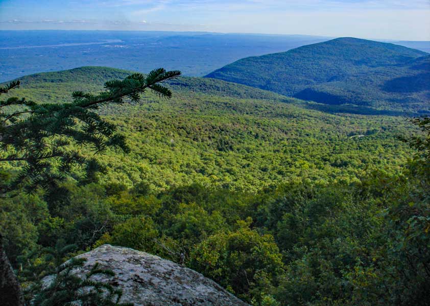 |
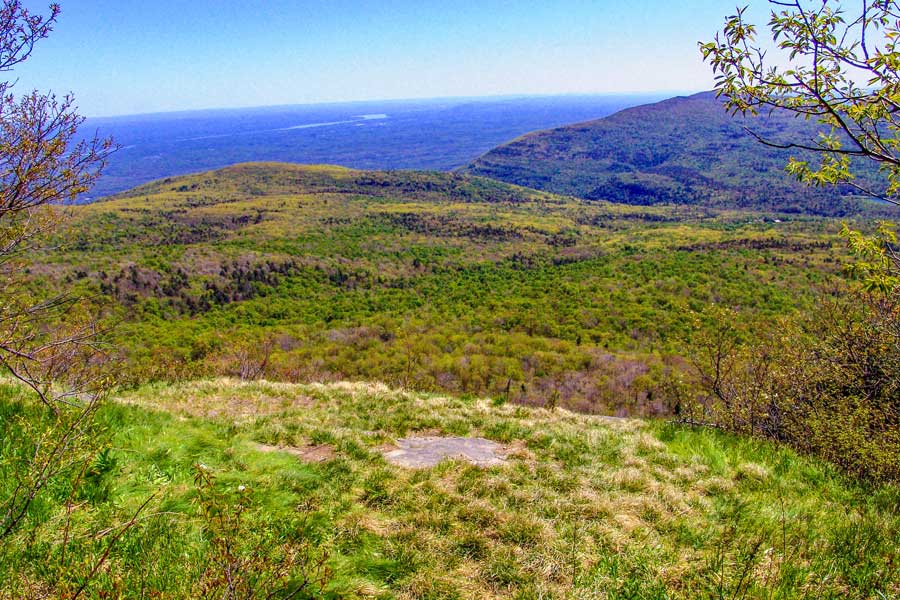
| View from the Northeast Ledge on Kaaterskill High Peak |
| |
| |
|
OVERVIEW |
| | Type of Trail: | 70% Bushwhacking - 30% DEC Trail |
| | Distance: | 8.16 miles round trip from DEP parking lot to RoundTop and Kaaterskill High Peak and
back. Add 1.5 miles if hiked from DEP parking lot #1 |
| | Notes: | Easiest and shortest trip to Kaaterskill High Peak, but on rarely used trails |
| | Time: | Average 6 hours round trip |
| | Elevation Gain: | 1,330 feet from parking lot to the summit of Kaaterskill High Peak. |
| | Best Time to Hike: | Anytime. |
| | Difficulty: | Difficult |
| | Catskill Highest: | #22 for KHP and #39 for RT |
| | Peak Elevation: | 3,655' for KHP and 3,450' for RT |
| | | |
| | | USGS Official Names: | High Peak (ID: 952749) |
| | USGS Alternate Names: | Kaaterskill High Peak, Liberty Cap, Round Top |
| | USGS Elevation: | 3,645' |
| | USGS KHP-WGS84: | 42.162033, -74.080138 |
| | USGS KHP-GPS: | N 42 09.722, W 74 04.808 |
| | USGS KHP-UTM: | 18N 575988 4668176 |
| | USGS KHP-Deg, Min, Sec: | N42 09 43, W74 04 48 |
| | | |
| | | USGS Official Names: | RoundTop Mountain (ID: 963044) |
| | USGS Alternate Names: | Kaaterskill High Peak, Liberty Cap |
| | USGS Elevation: | 3,451' |
| | USGS KHP-WGS84: | 2.168422, -74.094583 |
| | USGS KHP-GPS: | N 42 10.105, W 74 05.675 |
| | USGS KHP-UTM: | 18N 574787 4668873 |
| | USGS KHP-Deg, Min, Sec: | N42 10 06, W74 05 40 |
| | USGS Official Map: | Kaaterskill Topographical Map (free) |
| | |
| | | DEC Trail Map: | DEC Kaaterskill Wild Forest Map (free) |
| | |
| | | Digital Mapper: |
Topo
Terrain
Satellite |
| | |
| | | Digital Mapper for RT: |
Topo
Terrain
Satellite |
| | |
| | | Access Methods: | Foot, snowshoe, skiing, and snowmobile (part way). |
|
|
Maps |
 |
|
 Long Path Long Path |
 Harding Road Trail Harding Road Trail |
 Huckleberry Point Trail Huckleberry Point Trail |
 Escarpment Trail Escarpment Trail |
 Schutt Road Trail Schutt Road Trail |
 Poets Ledge Trail Poets Ledge Trail |
| |
 Palenville Overlook Spur Trail Palenville Overlook Spur Trail |
 Harding Road Spur Trail Harding Road Spur Trail |
| |
 Sleepy Hollow Trail Sleepy Hollow Trail |
 Yellow Horse Trail Yellow Horse Trail |
| |
|
 Yellow Crossover Trail Yellow Crossover Trail |
 Kaaterskill Trail (formally SMT) Kaaterskill Trail (formally SMT) |
|
 Observation Deck Trail Observation Deck Trail |
 KHP Trail (north) KHP Trail (north) |
|
 Kaaterskill Falls Trail Kaaterskill Falls Trail |
 KHP Trail (south) KHP Trail (south) |
|
 Kaaterskill Rail Trail Kaaterskill Rail Trail |
|
 Huckleberry Quarry Trail Huckleberry Quarry Trail |
 Lucas Kill Trail Lucas Kill Trail |
 Western KHP Trail Western KHP Trail |
 Twilight Park Trail Twilight Park Trail |
 Hawkeye Ledge Trail Hawkeye Ledge Trail |
 Palenville Quarry Trail Palenville Quarry Trail |
 Indian Camp Spur Indian Camp Spur |
 Brant Fort Trail Brant Fort Trail |
 DEP-SMT Spur DEP-SMT Spur |
|
| |
| |
| | DIRECTIONS TO TRAIL HEAD |
| | DEC Parking Lot WGS84 (DEC): 42.171417, -74.1137 - Elevation is approximately 2,336 feet |
| | DEC Parking Lot Deg/Min/Sec: N42 10 17, W74 06 49 - Elevation is approximately 2,336 feet |
| | DEC Parking Lot GPS: N 42 10.285, W 74 06.822 - Elevation is approximately 2,336 feet |
| | DEC Parking Lot UTM: 18N 573204 4669189 - Elevation is approximately 2,336 feet |
| |
|
| | Take New York State Thruway to Exit 21 (Catskill). |
| | Take a left out of the NYS Thruway entrance road. |
| | Go approximately 3/4 mile |
| | Take a right onto Route 23 West |
| | Go approximately 6.6 miles to Cairo, NY |
| | Take a LEFT onto Rt 32. McDonalds Rest. on corner. |
| | Go approximately 7.7 miles on Rt 32 |
| | Take a RIGHT onto Rt 23A |
| | Go approximately 7-8 miles on Rt 23A . |
| | When you come near Tannersville, Take a Left onto Clum Hill Road. Selena Diner is AFTER Clum Hill Road. |
| | Go approximately 1-1/2 miles - Road comes to a T intersection on level ground. |
| | Go LEFT onto Gillespie Road - When the road takes a sharp left, continue STRAIGHT down the dirt road onto DEP land. Please note that DEP Parking Lot #1, on the right. is on public land. |
| | DEP Parking Lot #2 is 1.4 mile at the end of the Gillespie Road. (This is the preferred parking area). |
| | Questionable if you can get to the end during the winter. |
| | Do NOT drive up Cortina Lane - This road goes to Private Property. |
|
|
SPECIAL CIRCUMSTANCES ABOUT THIS HIKE |
| | Today, the west access is least used trail to Kaaterskill High Peak. But, many years ago it was the most popular. The reason it was the most popular was because it has a very gentle grade to the top of the mountain. All other accesses are difficult. The reason why the west access died was because access to the trail was cut off when tort liability laws changed. This lead landowners to block access to this wonderful trail. But, in late 2008 New York City DEP purchased the property at the end of Gillipsie Road, and allowed hikers to access the land. This then lead to the increased use of the old trail. This trail can be done anytime of the year.
The trail starts off from the second parking lot on DEP land. You walk up the hill, while following the established trail. Once you get to the top of the hill, you can take a short cut, which will shorten the hike by 1-1/2 miles. Instead of following the trail LEFT, you will go STRAIGHT. At this point you will be bushwhacking. Look for the old horse trail that will take you up a moderately steep hill. This is actually the steepest part of the hike to Kaaterskill High Peak. Once you reach the trail, go RIGHT. You will come to an intersection. This is the Snowmobile Trail.
Once you get to the intersection of the Snowmobile Trail, that goes around Kaaterskill High Peak and RoundTop Mountain, take a left. Go up the hill until the trail levels off.
Then start looking for a faint trail on the right. Take this faint trail. The trail sort of zip-zags around a bit. At this point, you will be in a deciduous forest. But, in a short period of time, you will come to your first conifer forest. This will change back to a deciduous forest again. It will change back several times before you get to the base of RoundTop Mountain. It should be noted that there are quite a few black bears in this region. They like to forage for food in the conifer forest, so keep your eyes open.
Once you get to the base of RoundTop Mountain, you want to follow the trail to the northwest side of the base of RoundTop Mountain. You then want to climb to an elevation of approximatley 3,250'. There is a trail up to this ledge. Once you get on the ledge there is a well established trail on the edge of the ledge. Keep your eyes open for black bears. The walk across the ledge is very nice, and views can be enjoyed.
Once you get to the end, you will then climb back down 50 vertical feet to be on the saddle of RoundTop Mountain and Kaaterskill High Peak. Most of the saddle is in a conifer forest. There are quite a few paths across the saddle. To visit the Tory Fort, stick to the north side. This is also the easiest way across the saddle. If you see a rock ledge rising on your left, you have passed the access to the Tory Fort. Back track, and stay closer to the north side.
After the Tory Fort, the best way to continue is to continue on the north side through the thick conifer trees. You will then come to the base of Kaaterskill High Peak. There are two hanging ledges. Most people only see one hanging ledge. You want to hike up the path between both hanging ledges.
The climb up Kaaterskill High Peak is another gentle grade. The trail does zip-zag around. There are also a couple of grassy areas devoid of most trees. These sections make it easy to get lost. When you get close to the top of Kaaterskill High Peak, the forest will change back to a conifer forest. The trail will also get narrower and start to wind around the forest. There are several false trails, so backtrack if it comes to a dead end.
If you follow the trail correctly, you should come out about 50 feet south of the summit to Kaaterskill High Peak. We recommend that you take a trip down to Hurricane Ledge on the south side of Kaaterskill High Peak. The other side trip will take you down to the north-eastern side, which has a great view. There is a plane crash just before the view point. It is about 50' off the trail.
This hike requires good hiking and navigational skills. It is best done with a GPS loaded with a topo map. Bear populations is very high, so use caution. Crossing the ledge by RoundTop Mountain is the hardest part. Finding the proper access to the 3250 Ledge is the hard part. It is easy to get onto the wrong ledge. The 3250' ledge has a trail on the edge of the ledge. The other ledges don't have a trail. |
|
|
MILEAGE CHART |
| | Mile Point | Altitude | Notes |
| | 0.00 | 2,336 | DEC Parking Lot. N42 10.285 W74 06.822 |
| | 0.11 | 2,393 | Trail Junction. Right will take you up the side of the creek Straight will continue on the trail. Go STRAIGHT. |
| | 0.22 | 2,478' | Leave Trail and Bushwack up the hill. This bushwack will save you about 2 miles of hiking. Leave the trail once the trail stops climbing in elevation and turns 90 degrees left. |
| | 0.61 | 2,734' | Connect back onto the Snowmobile Trail. |
| | 0.75 | 2,769 | Trail Junction - Right will take you on the south side of the snowmobile trail. Left will take you on the north side of the snowmobile trail. Go LEFT. |
| | 1.05 | 2,923 | As soon as the elevation levels off on the Snowmobile Trail, a faint trail on the right will branch off (see picture below). The trail head is approximately at GPS: N42 10.663 W74 06.060 . There is a faint trail, but you can easily drift off of it. It is easier to follow during the summer when the leaves are on the trees. You will change from deciduous forest to conifer forest and back a couple times. When you get at the base of RoundTop Mtn, you need to go to the north side of the base of the mountain to find access to the 3250 ledge. The hardest part is finding the access to the right upper ledge. The access is between GPS: N42 10.248 W74 05.636 and N42 10.239 W 74 05.639. |
| | 1.80 | 3,230 | Once you get to the top of the hill to the 3250 ledge, you want to take a RIGHT to climb RoundTop. If you are going to skip RoundTop then you would take a left. When you get done with RoundTop, you will return to this spot. You want to walk around to northwest side (about 500 feet). There is thick shrubs and large rocks to get around. You will come to steep, but climbable section. Climb up here. Once up a ways, you may see an old trail that was created in the 1800's that will take you to the summit. |
| | 2.12 | 3,453 | Summit of RoundTop. The summit is fairly obvious. To the north and down a small ledge is a hidden view point that looks over North-South Lake and the Kaaterskill Clove. To the northeast is a spot where Thomas Cole painted one of his famous paintings. To the southwest of the summit is a trail that follows circles the summit. Once you get done, reverse your path back to the 3250 ledge. Cross the 3250 ledge and head towards KHP. After you navigate the ledge, you will have to drop down in elevation about 50 to reach the saddle betweeen the two mountains. To find the Tory Fort, you need to stay on the north side of the saddle. The Tory Fort is on the edge of the saddle, and on a 15 foot high ledge rock. It is closer to the base of Kaaterskill High Peak. Sometimes it can be a challenge to find. |
| | 3.30 | 3,245 | Tory Fort. It is almost gone, and the walls are very fragile. It can be found at GPS: N42 10.037 W74 05.321. When you leave the Tory Fort, stay on the north side of the saddle. There is a trail, but it can be hard to follow. You may have to push through some conifer trees. After approximately 600' you will hit the base of Kaaterskill High Peak. On the north side is the famous Hanging Ledge. There are actually two hanging ledges. The one you want to see is about 25' deep. |
| | 3.42 | 3,254 | Hanging Ledge. Shortly after you leave Tory Fort, you will come to a small ledge, which is the beginning of the climb to Kaaterskill High Peak. At this point you will find Hanging Ledge. Once you get done head towards the middle of the ridge line. You will find the trail. continue to KHP. The path is at GPS N42 09.999 W74 05.247. There is a smaller hanging ledge on the right of the trail. The trail is inbetween both hanging ledges. Most people only see one hanging ledge. The trail is in the middle of the saddle. The trail then zip-zags up the mountain. Most people get lost in the open fields. When you get to the fields, stick to the south side and walk through the fields. It is hard to find the trial in these sections. When you get near the top, the trail will zig-zag. |
| | 4.25 | 3,666 | Kaaterskill High Peak. The West Access trail comes out onto the north/south access trail about 100-200 feet south of the summit of Kaaterskill High Peak. From the summit walk south down to Hurricane Ledge. Hurricane Ledges are about 1/4 mile from the summit with spectacular views. The hidden Hurricane ledges are to the right of the trail and right on the ledge. Once you get done walk back up to the summit. Then take a RIGHT, which will take you to the Northeast ledge. Be careful around this ledge. It is very dangerous place. The plane crash is about 100' from the northeast ledge. It is about 50-100' from the trail on the north side. Once you get done hike back up to the summit, and take a RIGHT down the north side |
| | 4.79 | 3,029 | Trail Junction of the North Access Trail and the Snowmobile Loop Trail |
| | 8.16 | 2,366 | Parking Lot |
|
|
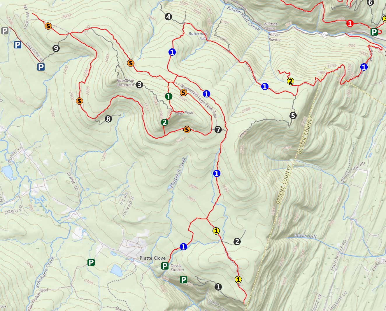
Hike to Kaaterskill High Peak (West Access) |
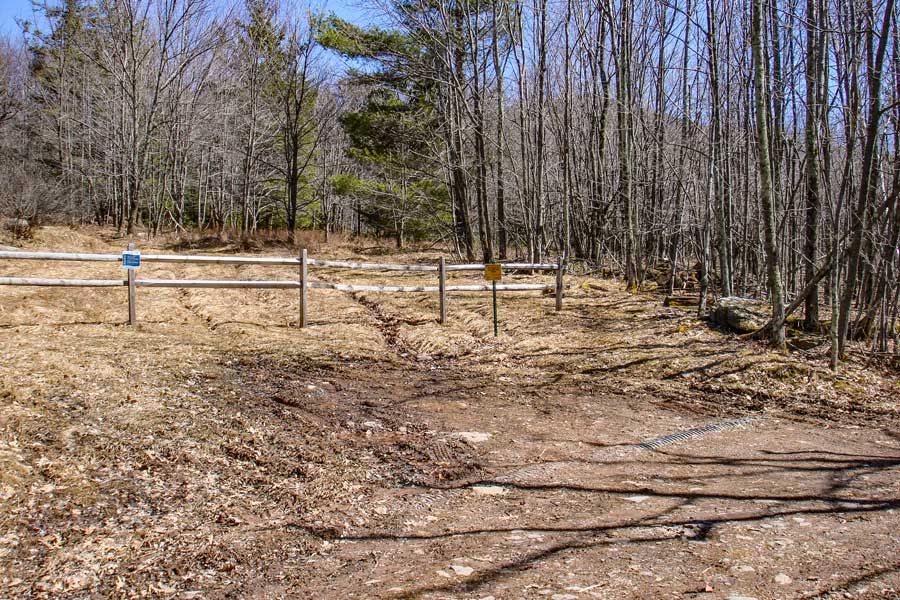 |
The image above is the DEP Parking Lot at the very end of Gillipsie Road. There are a small number of parking spaces available. There used to be a house at the end of this road, which is now gone. The DEP has improved the road. You don't need a 4WD.
Start your hike by walking up the hill in this picture. |
|
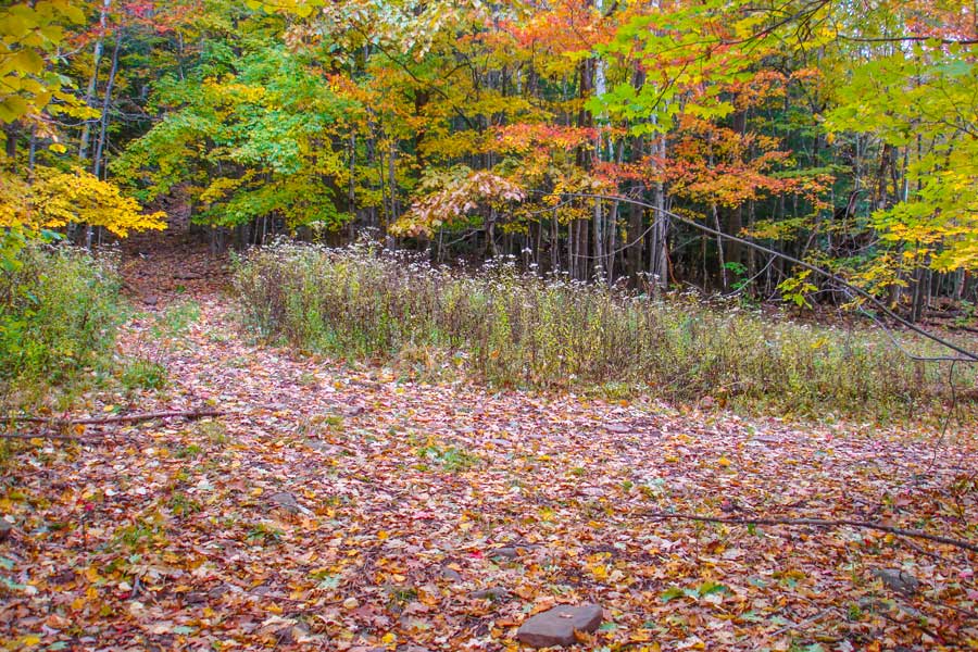 |
The picture above shows a 'Y' in the trail about 1/10 of a mile up the trail. Going to the right will take you up to a stream from the mountain. You want to continue STRAIGHT up the path.
Continue hiking up the trail. The incline will start to get a little steeper as you walk into the woods. |
|
 |
When you get to the top of the hill after the moderate incline, the trail will turn 90 degrees to the left. At this point you want to leave the trail and start bushwhacking. You want to continue straight towards the hill. |
|
 |
 |
The picture above shows the hill of rocks you will encounter shortly after leaving the trail. You can continue to hiking up the rocky hillside. Once on top of the hill continue to hike forward until you hit the access trail that goes to the Snowmobile Trail. |
This is the access trail to the Snowmobile Trail. It used to be a horse trail. You want to go right on the access trail. You will encounter the trail junction to the Snowmobile Trail shortly. |
|
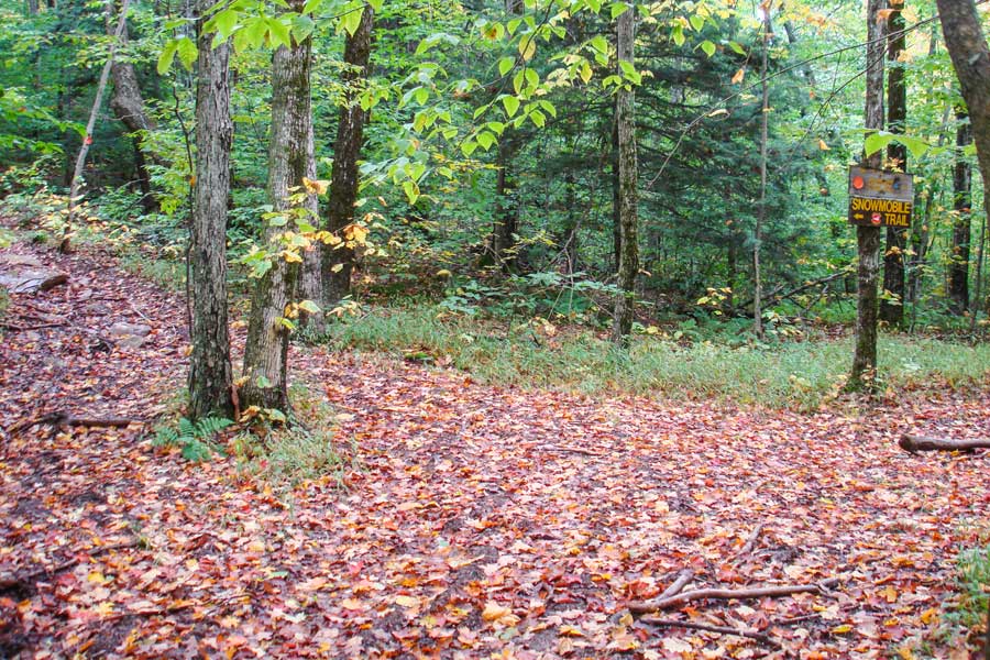 |
The picture above is the trail junction for the northwest side of the Kaaterskill Snowmobile Trail. You want to take a LEFT at this trail junction. Right will take you to the southern part of the Snowmobile Trail, which is very wet and sometimes overgrown. |
|
 |
 |
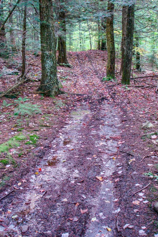
After the Trail Junction for the Snowmobile Loop Trail, you will climb in elevation for 3/10 of a mile. When the trail stops climbing, look on the RIGHT for a very faint trail that Y's off the trail. This is the old west access trail. It is easy to miss. The picture on the LEFT shows what the Snowmobile trail looks like where the Y is. |
The picture on the right shows the entrance to the West Access Trail. Some people call the tree next to the entrance to the trail the "Wish-bone" tree. The trail goes thru a number of sharp turns so you have to watch carefully. It is easy to walk off the trail. This used to be an official DEC Trail. Now it is a bushwhack. Sometimes you will be able to follow the old trail, and other times, you will be bushwhacking. Remember that this is a ridge, so do not start hiking off the side of the ridge. |
|
 |
 |
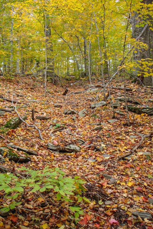
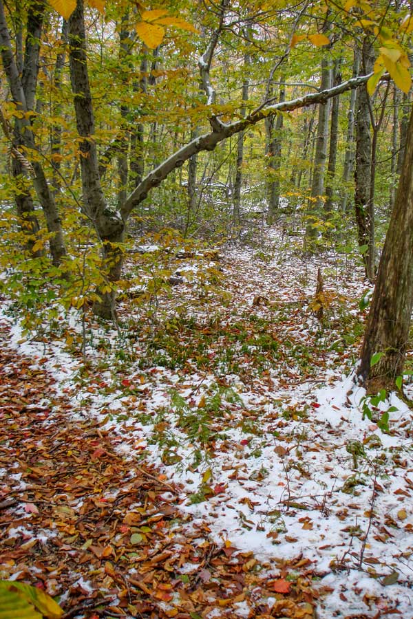
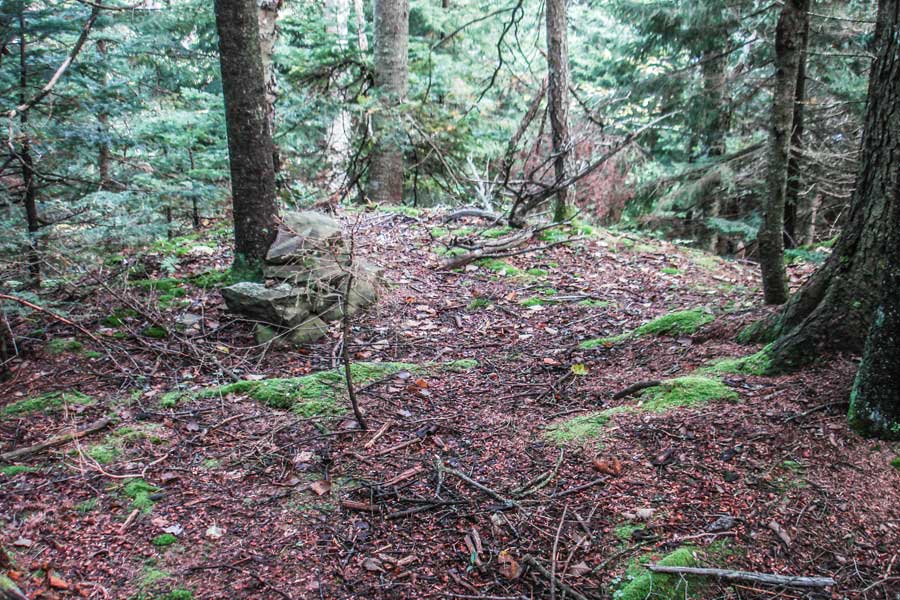
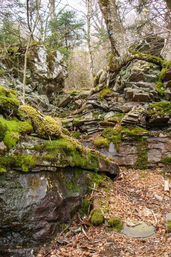
After you leave the Snowmobile Loop Trail, hike 1/3 of a mile through a deciduous forest. You will hike through the first conifer forest after the first ledge climb. It will then change back to a deciduous forest again. At 3,000' of elevation, you will arrive at a very nice conifer forest at is fairly level (picture on left). The best place to climb up the ledge to the 3,000' conifer forest is on the RIGHT side. After you get to the top of the ledge, the trail is about 250' to the LEFT (north). Follow the ledge until you find it. It is a fairly well defined trail thru the conifer forest. Try to stay towards the middle sections of the conifer forest. After a while the elevation will start to climb, and the conifer forest will change back to deciduous forest. Then you will come to some ledges (20-50' high). The way up the ledge is on the north side (very left). There is a location that will allow you to walk up the ledges, but it takes some searching. You want to climb up to about 3,250'. Some people refer to it as the "3250 Ledge". The ledge below this one will come to a dead end. A good topo GPS or altimeter is recommended. |
The picture on the RIGHT shows what it looks like just below the 3,250 Ledge in the summer. You want to hike up this steep hill until you reach the 3250' ledge. Once on the ledge you will see a faint trail.
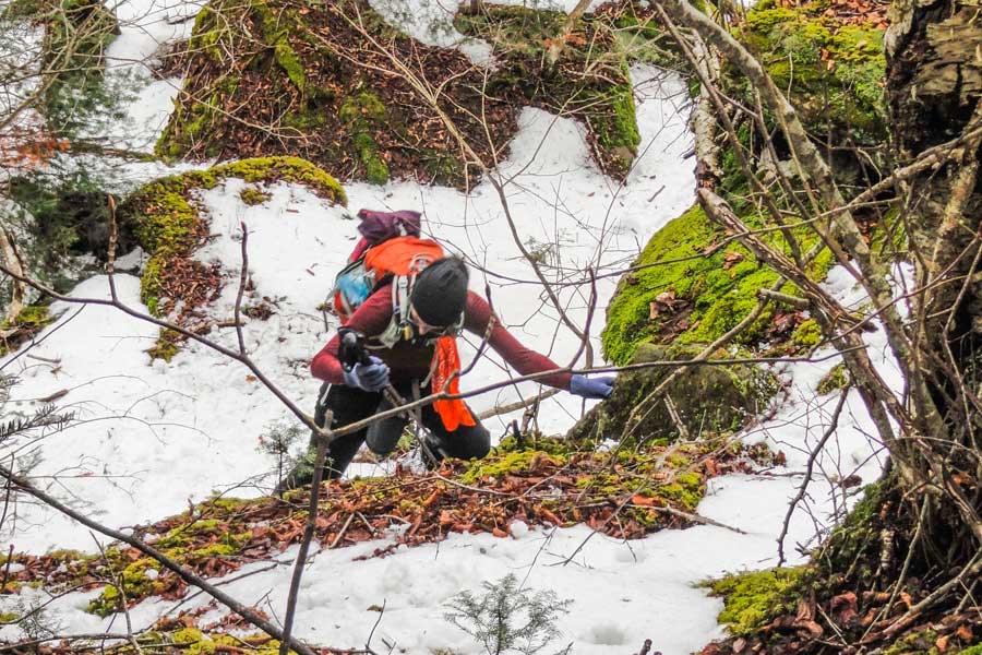
When you reach the top of the 3250 ledge you would normally go left across the ledge. But, if you are going to climb Roundtop Mountain, you need to go RIGHT. In the summer, the ground bushes and shrubs can be thick. Additionally, you need to walk around some large boulders, and the ground can be difficult to walk on. Once you get around to the west side, you will find the easiest place to climb up in the north side. The picture on the left shows the steep climb up. The picture looks more difficult then it really is. |
|
 |
When you hike around to the North side of Round Top Mountain, you will find the best spot to climb up the ledge that surrounds the mountain. There is not an easy access route that we have found. But, there are far more difficult spots. |
|
 |
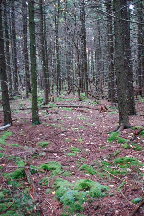
As you get further up the mountain the land levels off to a very easy hike. There is an established trail that runs up the mountain. In the Winter it can be hard to find. As you approach the summit of Round Top Mountain, you want to move to the north side of the mountain. |
|
 |
The summit is fairly obvious. The top of the mountain has a fairly large flat area. There is a trail that wraps around the flat round top. But, there really are not any additional view points on this trail. The summit of Round Top is quite large and relatively flat. |
|
 |
Near the summit is the spot where Thomas Cole painted the famous painting called "Sunrise-over-the-Hudson". You need to move to the northeast side of the top. The spot is about 75-100' from the summit. The spot is now overgrown. But, you will see a large rock near the edge where the painting was done. Once you get done visiting Round Top Mountain reverse your course back to the 3,250' ledge and you should walk across the ledge towards Kaaterskill High Peak. |
|
 |
Thomas Cole's painting, "Sunrise-over-the-Hudson" |
|
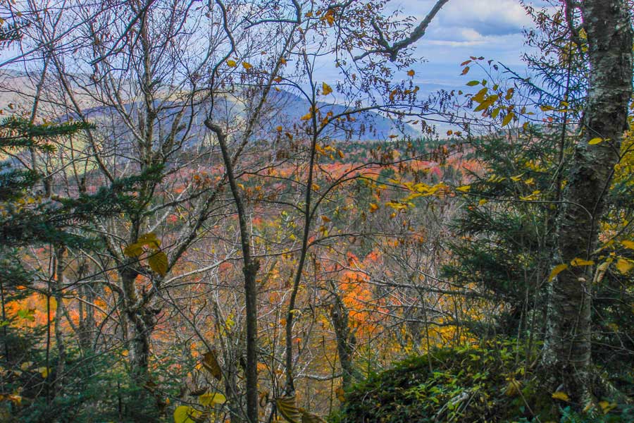 |
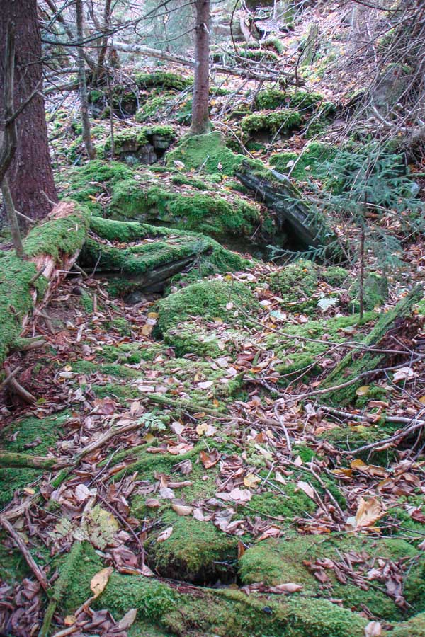
While walking across the 3250 Ledge, you can often get a good view when the leaves are not on the trees. You can see the tip of South Lake and the Hudson River. This trail follows the edge of the ledge. When you get near the end of the 3250 ledge, you will have to leave the edge of the ledge and climb closer to the upper ledge. Just climb over one of the large rocks and find the trail that weaves thru the large rocks. |
|
 |
After you have weaved thru the large rocks next to the upper ledge, you will then descend down about 20 feet. The picture on the LEFT shows what it looks like looking backwards. If you reverse your course, you will need to look for this entrance to find the trail across the 3250 Ledge.
This will lead you to what appears to the saddle between Kaaterskill High Peak and Round Top Mountain. It is not the saddle. After you walk about 250' you will discover that you have to climb down another ledge down to the saddle. We usually climb down the left side. Then you can find a trail in the middle of the saddle.
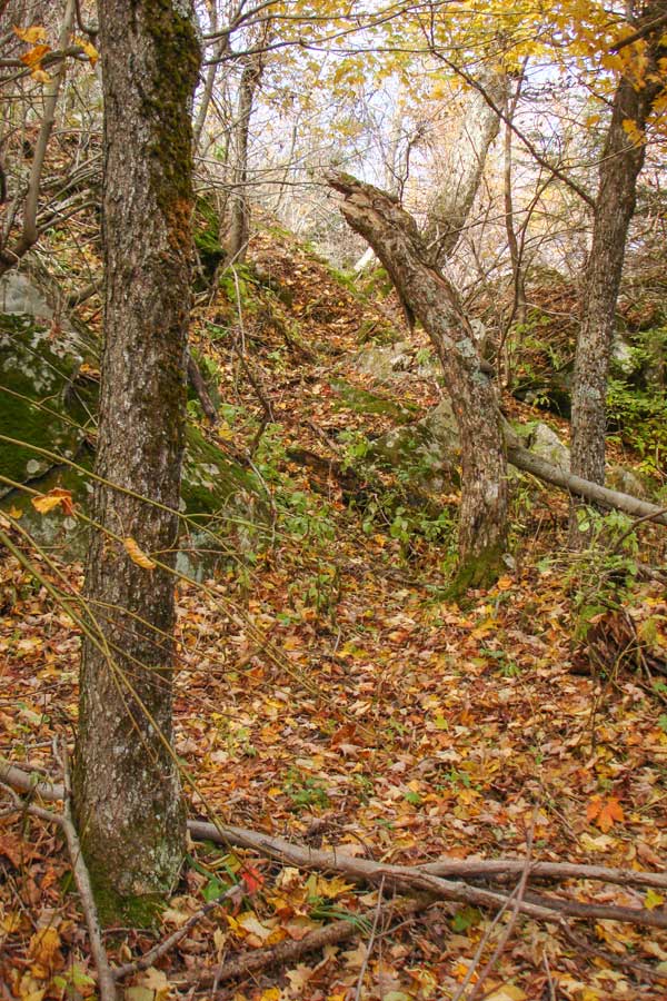
To find the Tory Fort, it is on the Northeastern side of the saddle up on a 10-15' high ledge. It is hugging the north side of Kaaterskill High Peak. If you walk too far, you need to walk back and then north to the edge of the saddle. There is a easy path that gently walked up on the ledge. You can find the Tory Fort at GPS: N42 10.037 W74 05.321 . The few remaining walls are very fragile, so be careful. Some of the walls have completely deteriorated, so you can only see the south and west walls. |
|
 |
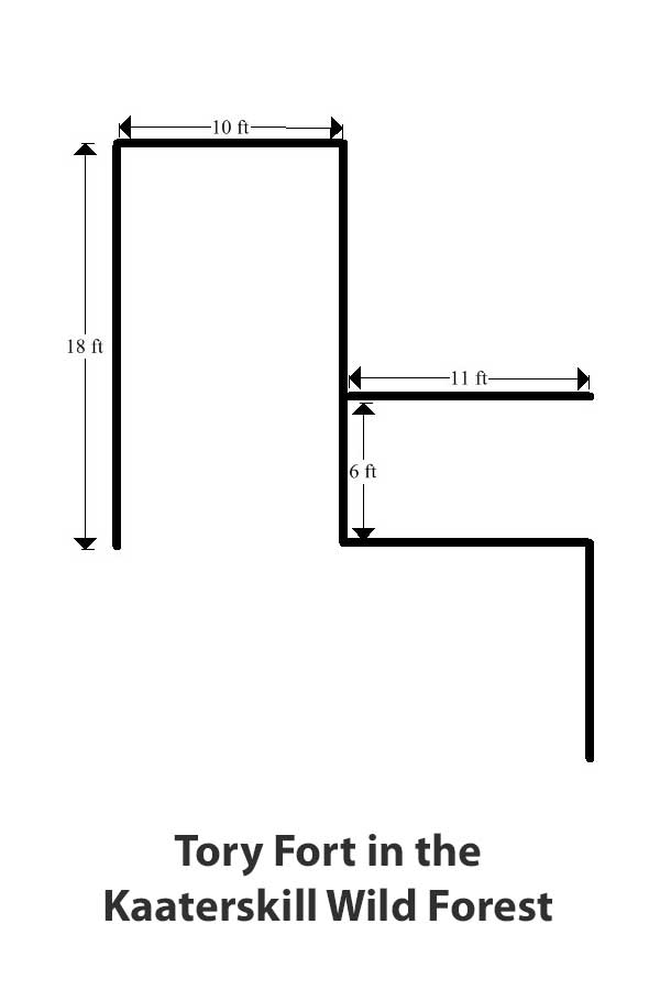 |
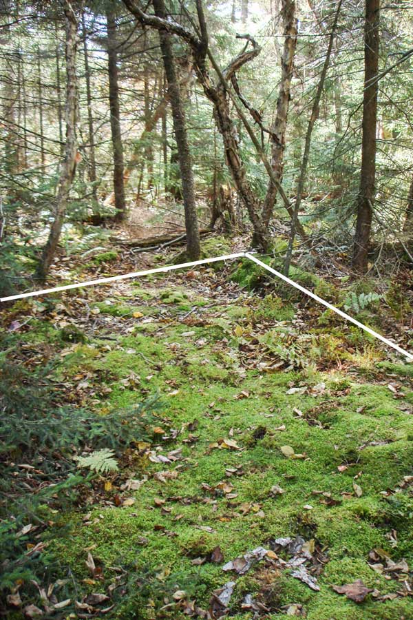
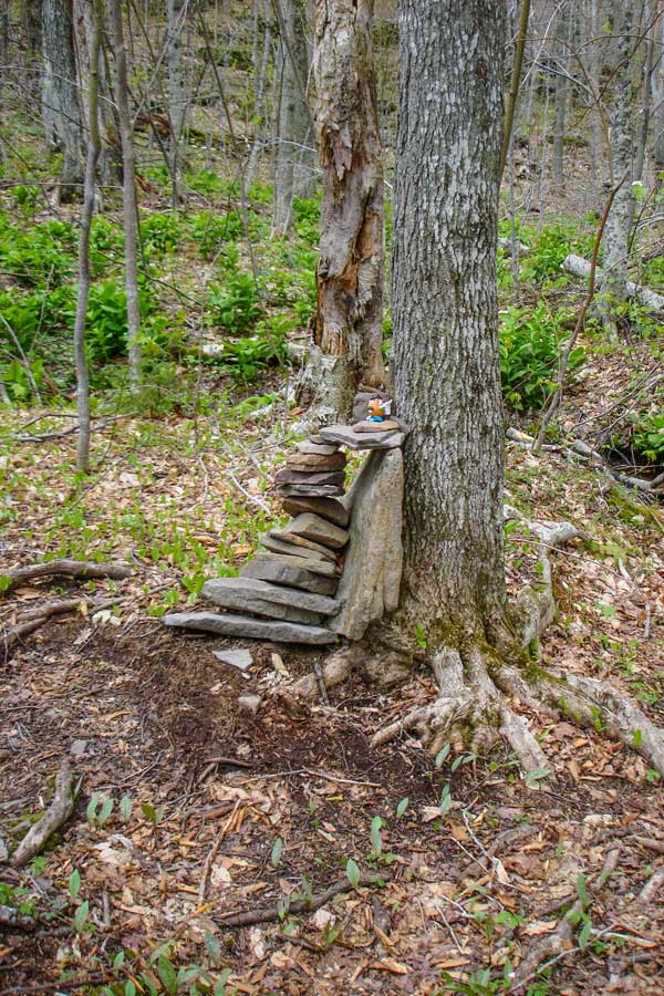
The picture on the LEFT is the Tory Fort at GPS: N42 10.037 W74 05.321 . In the picture, you can see the outline of one of the rooms of the Tory Fort. We don't know at this time the exact size of the Tory Fort. We do know that the purpose of the Tory Fort was to catch Revolutionary War Deserters. The Catskill Mountains were often used for outlaws to hide. There is a long history of outlaws hiding in the Catskill Mountains. |
The picture on the right is the floor plans for the surviving walls of the Tory Fort. The Tory Fort was obviously larger then the plans, but this is the only surviving part we know of.
After you leave the Tory Fort, you can take two different directions. You can reverse your course and take the trail in the middle of the saddle. The other way is to continue on the ledge east to Kaaterskill High Peak. The conifer trees are sort of thick, so you have to push your way thru them.
|
|
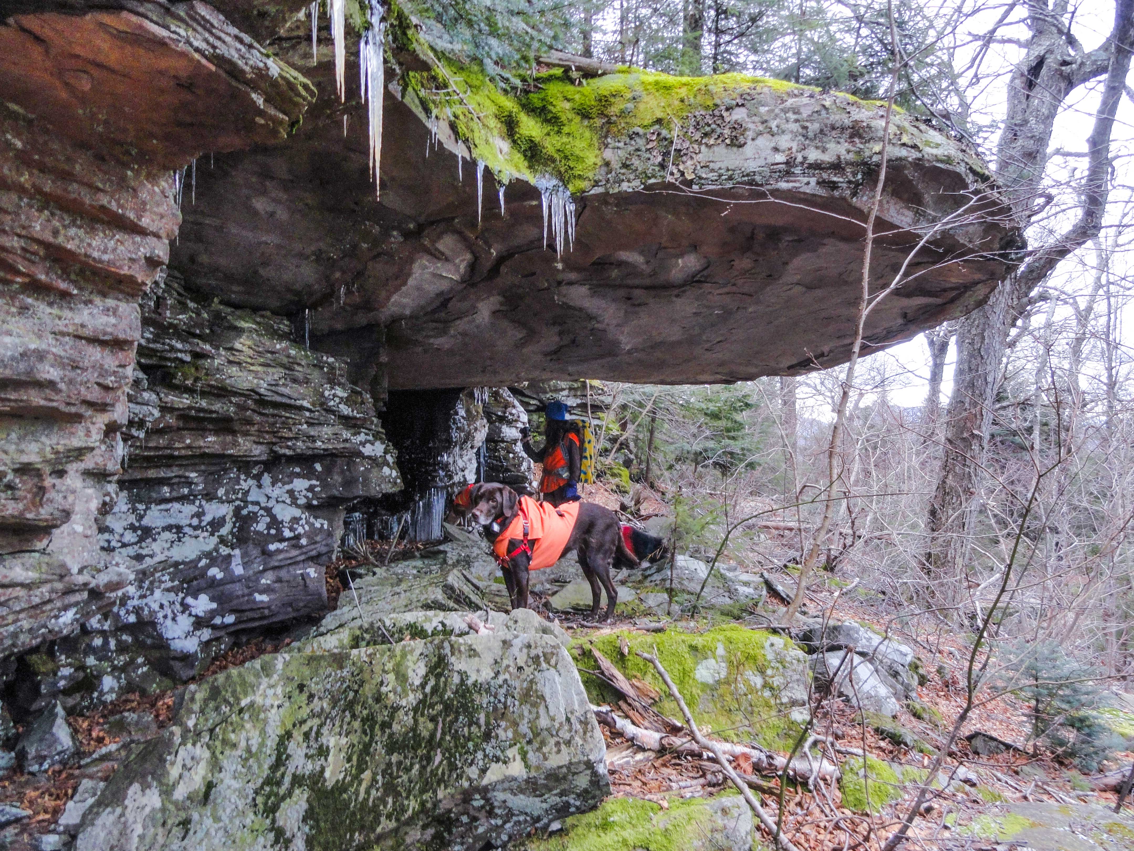 |
As you get to the base of Kaaterskill High Peak, you will see one of the "Hanging Ledge". Hanging Ledge GPS: N42 09.999 W74 05.247 . The trail is a little difficult to follow at this point. But, you want to hike above the hanging about 100 feet RIGHT of the largest Hanging Ledge. Here it is fairly easy to get up. Beyond the Hanging Ledge the trail will zig south thru some open grassy areas. Horses were kept in the grassy section. There is also a swampy area here. Black Bears like to sleep in these wet grassy areas in the Summer. It is easy to lose the trail, so pay attention.
The image above is called the "Hanging Ledge". It is located on the very eastern side of the saddle between Round Top Mountain and Kaaterskill High Peak. The largest Hanging Ledge is located on the north side. There is also a smaller Hanging Ledge in the middle of the saddle. The two hanging ledges are about 100 feet apart. The Hanging Ledge is about 6 feet above the ground and hangs out 20-25 feet. There is a rock fire ring under the hanging ledge. The hanging ledge is located about 150' east of the Tory Fort on the northeastern side of the saddle. |
|
 |
Part way up the mountain, there will be some view points with nice views over North/South lake and the Hudson Valley.
Once you get near the top, the deciduous forest will change to a full conifer forest. There are a number of false trails, so you have to be careful. If you follow the trails correctly, the trails will get smaller and more narrow near the top. If followed properly, the trial will come out approximately 50 feet south of the summit. The trail is very narrow near the trail over Kaaterskill High Peak. |
|
 |
This is the summit of Kaaterskill High Peak Mountain. There are no longer any views from the very top. But, you will have spectacular views from Hurricane Ledge and the northeastern ledge. Hurricane Ledge is 1/4 mile past the summit on the south side of Kaaterskill High Peak.
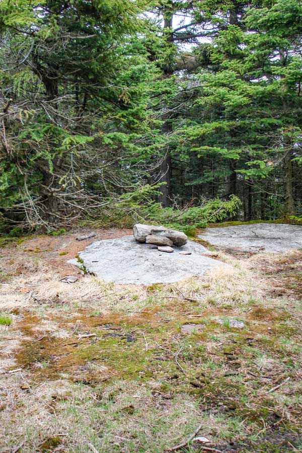
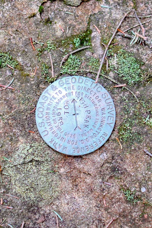
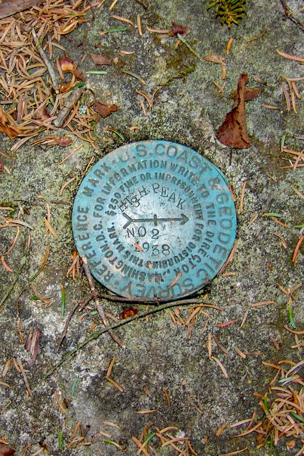
There are two USGS markers about 30 feet from the summit. The trail that goes east will take you to plane crash #2 and USGS marker #2. The trail that goes south will take you to USGS marker #1, and Hurricane Ledge.
If you look around, you can see that there was a building at the summit. The building was a 2-story building that was built in the late 1800's. It was taken down around 1921 when New York State purchased the Kaaterskill Mountain Range. About an acre of land was cleared for the building.
While the Mohawk Indians used Kaaterskill High Peak for thousands of years, the first European to ascend Kaaterskill High Peak was Peter DeLabigarre along with a friend on July 26, 1793. Peter DeLabigarre also was the first to summit Overlook Mountain on July 9, 1793. He climbed Overlook Mtn thinking he was climbing Kaaterskill High Peak. He also named Kaaterskill High Peak, "Liberty Cap". The names of Kaaterskill High Peak and Round Top Mtn were mixed up fairly often. After his death, the name fell out of favor, and people resorted to calling it High Peak because they believed that it was the highest peak in the Catskill Mountains. Today, High Peak is still the official name of Kaaterskill High Peak. Almost all hikers today call it Kaaterskill High Peak, so that is is not mixed up with Windham High Peak. Alf Evers dedicated an entire chapter (Liberty Cap - Chapter 37) of his book,The Catskills, to Peter DeLabigarre. Up to the 1870's KHP was believed to be the highest peak in the Catskills. Princeton geography professor Arnold Henry Guyot brought equipment up to the Catskills and started to measure all the higher peaks. He determined that KHP was actually the 23rd highest. His finding upset the hotels in the Kaaterskill Clove who used this fact to attract visitors. |
|
 |
 |
The picture on the LEFT is USGS marker #1. It is about 30 feet south of the peak on the path to Hurricane Ledge. |
The picture on the RIGHT is USGS marker #2. It is about 30 feet east (and slightly south) of the peak. It is location on top of a dome shaped rock. When you approach the peak from the north access route, take a left. Then take a right. The marker is about 10-15 feet inside the trees. |
You should also take a quick trip to Hurricane Ledge. It is just 1/2 mile round trip. The views are spectacular. |
|
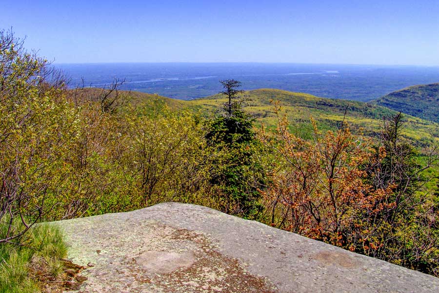 |
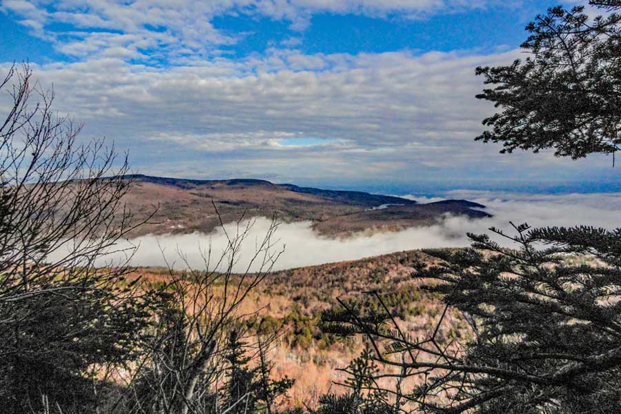
This is the upper portion of Hurricane Ledge looking to the east.
This is Hurricane Ledge. It is 0.25 miles from the peak. There are several places on Hurricane Ledge that will provide you with spectacular views. This ledge was caused by a storm on or about November 28, 1950, which had winds in excess of 100 mph. Ironically, there was another Hurricane Ledge created on the northeastern side of the peak at the beginning of the 1900's. It may have been created by one of the storms on November 8-10, 1913 or October 22-25, 1923. |
|
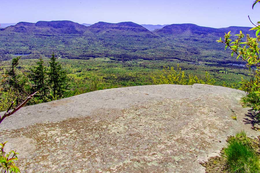 |
This is the upper portion of Hurricane Ledge looking to the south. The mountains in the distance is the Indian Head Wilderness. From this point, you can see Overlook Mtn, Plattekill Mtn, Indian Head Mtn, Twin Mtn, Sugarloaf Mtn, and Plateau Mtn. |
|
 |
This is the lower portion of Hurricane Ledge looking to the southeast.
If you want to take the very steep and dangerous south access route back down to the Loop trail, you just need to move to the very left side of this ledge to find the trail. |
|
 |
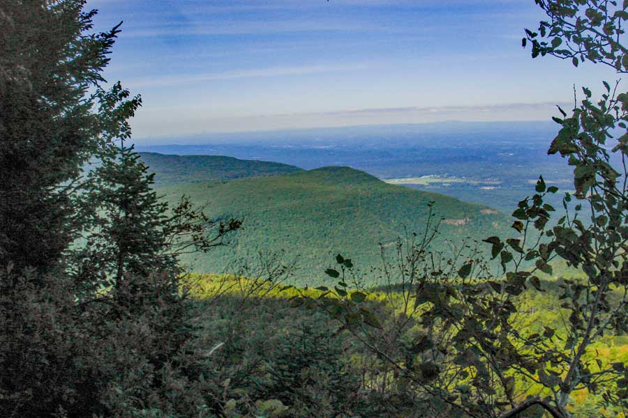
This is the view to the west, showing Round Top Mountain.
Reverse your course back to the KHP peak. Next we are going to visit the view point from the northeast side of Kaaterskill High Peak. There is an excellent view there. There is also a plane crash near the summit of Kaaterskill High Peak. |
|
|
After you return back to the summit of Kaaterskill High Peak, take a RIGHT. This short trail will take you down to a beautiful view point on the Northeastern corner of the mountain.
There is also a plane crash just before the view point on the northeastern corner of Kaaterskill High Peak. |
|
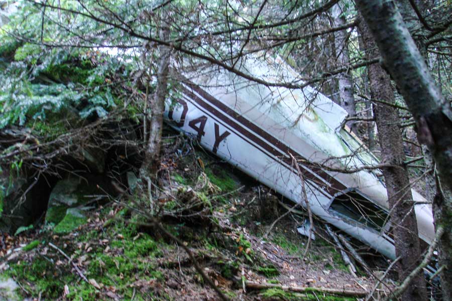 |
After about 490 feet, you will come to a flat section that is about 30 feet long. This section is just after a small steep descent. The plane crash is about 100 feet from the trail. Once you return from the plane crash, you can walk a little more down the trail to a beautiful view on the Northeastern Ledge. The Northeastern Ledge is about 100 feet past the turn off for the plane crash.
This plane crash occurred on Tuesday, June 13, 1967, and resulted in two fatalities. The impact was so severe that the crankshaft of the plane landed about 450 feet from the crash location. The Crankshaft has been sitting near summit for decades. Back in the Winter of 2009/2010 someone attempted to steal the crankshaft, and later abandon the crankshaft near the lower ledge of Hurricane Ledge. Two hikers from Catskill Mountaineer recovered the crankshaft and restored it to it's original location. PLEASE do not remove or move any of the wreckage. This often upsets the family of the victims. This is a sacred grave site.
To read the Aviation Report on the crash Click Here |
|
 |
This picture shows the debris field from the plane crash. The plane crashed head-on into the ledge. This plane crash occurred on June 13, 1967. The plane is a Piper PA-23 with registration N5604Y. The two occupants were killed instantly. The plane slammed into the ledge with such force that it was able to rip the crankshaft out of the engine and it flew approximately 450 feet and landed near the summit of KHP. The pilot was flying in bad weather with VFR. |
|
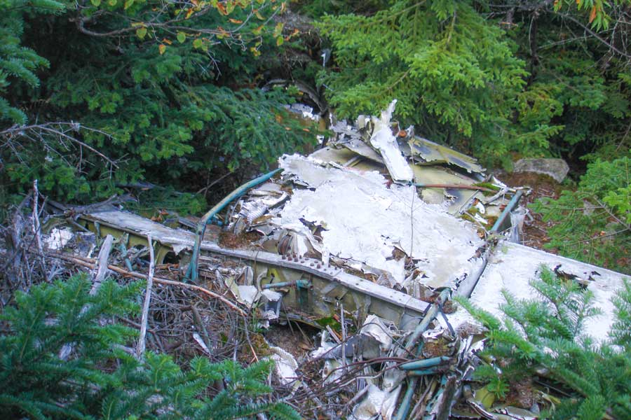 |
This picture shows the plane crash from the top of the ledge. PLEASE do not remove or move any of the wreakage. This often upsets the family of the victims. This is a sacred grave site. |
|
 |
After you get done visiting the Plane Crash, continue down the trail. After about 100 feet you will come to the end of the trail. At the end of the trail is the Northeasterly Ledge. Please be careful! It is easy to fall off this ledge. If you do fall, you will most likely be killed. This image is of the Northeast direction. It shows North-South Lake and South Mountain. In the far distance you can see Albany, NY. |
|
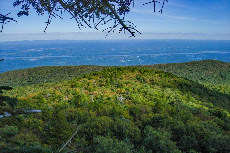 |
This image is of the Easterly direction. It shows the Kaaterskill Amphitheater and the Hudson River.The Taconic Mountain Range is in the distance. From this ledge you can see New York, Vermont, New Hampshire, Maine, Massachusetts, and New Jersey. |
|
|
This image is of the Southeastern direction. It shows Huckleberry Point, Devil's Kitchen, and Overlook Mountain. In the distance you can see the Hudson River, Kingston, Poughkeepsie, New Jersey, Connecticut, and Massachusetts.
Once you are done, return back to the summit of Kaaterskill High Peak. Once you arrive at the summit, take a RIGHT down the northern side of Kaaterskill High Peak. |
|
 |
 |
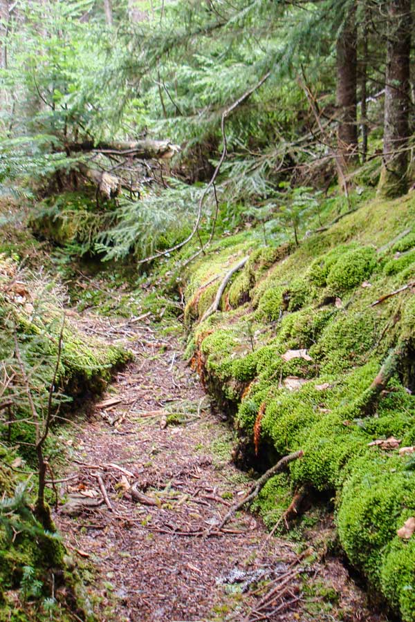
The picture on the left is is the nice mossy trail going down Kaaterskill High Peak on the North side.
| The picture on the RIGHT shows another picture of the beautiful path near the top of the mountain. |
|
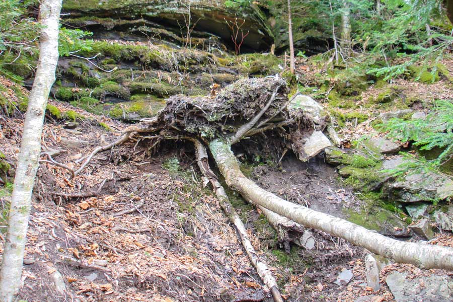 |
The picture above shows one of the steep climbs. In the summer months it is not so difficult, but in the Winter months it can be very dangerous. When you approach this section, the obvious path is on the right of this picture. It is a steep mossy rock ledge. The best path is actually the mud path on the left of this picture. Then walk across the top of the root base of the tree. |
|
 |
 |
The north access trail has three difficult sections. The picture on the left shows one of those sections. The section is not as difficult as it looks. |
When you get to the bottom, you need to take a LEFT on the Snowmobile Loop Trail. Follow it until you come to the Trail Junction on the west side. Then reverse course back to your car. |
|
 |
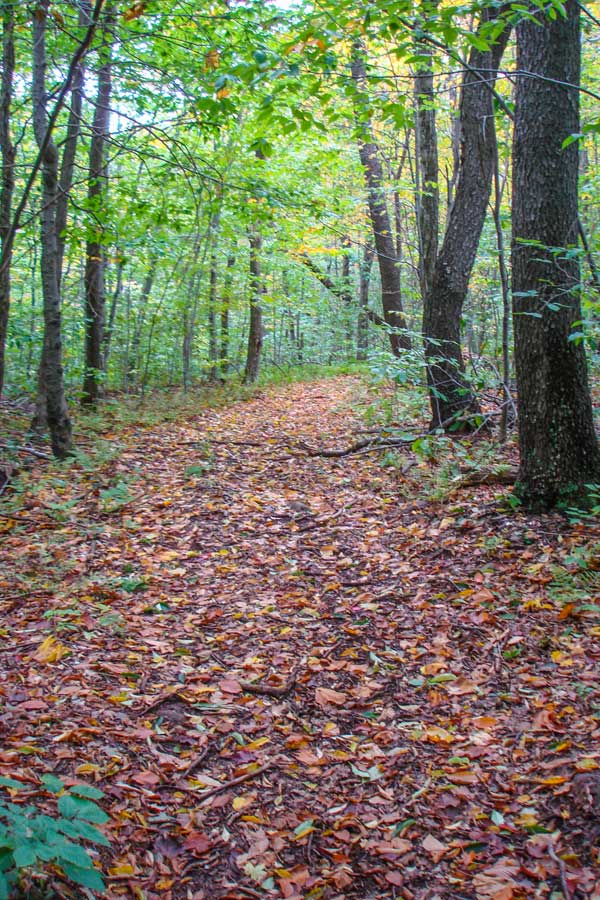
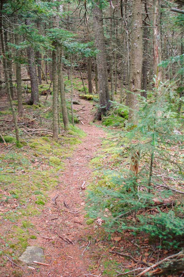
This is one of the nicer sections of the Snowmobile Loop Trail. |
|
|
When you reach the Trail Junction for the Snowmobile Trail and the western access trail to the Snowmobile Trail, take a RIGHT onto the Western Access Trail. Many hikers start bushwhacking from the this trail junction down to the lower trail or to their car. Others follow their GPS Tracks, or use a compass. |
|
|
S E C T I O N S
|
W E A T H E R
|
O T H E R
|