Kaaterskill High Peak from Rt 23a |
 |
| View of the Kaaterskill Clove from Poet's Ledge |
| |
| |
|
OVERVIEW |
| | Distance: | 16.24 miles round trip from Rt 23a to the summit of KHP and back. |
| | Time: | 10-to-14 hours round trip |
| | Elevation Gain: | 3,075' feet from Rt 23a to the Summit of KHP |
| | Best Time to Hike: | Anytime (with exceptions - See Special Circumstances) |
| | Difficulty: | Moderate - Trail to summit of KHP is Difficult |
| | Catskill Highest: | #22 |
| | Peak Elevation: | 3,655' |
| | | |
| | | USGS Official Names: | High Peak (ID: 952749) |
| | USGS Summit-Elevation: | 3,645' |
| | USGS KHP-Summit-WGS84: | 42.162033, -74.080138 |
| | USGS KHP-Summit-GPS: | N 42 09.722, W 74 04.808 |
| | USGS KHP-Summit-UTM: | 18N 575988 4668176 |
| | USGS KHP-Summit-Deg, Min, Sec: | N42 09 43, W74 04 48 |
| | |
| | | USGS Official Map: | Kaaterskill Topographical Map (free) |
| | |
| | | DEC Trail Map: | DEC Kaaterskill Wild Forest Map (free) |
| | |
| | | Digital Mapper: |
Topo
Terrain
Satellite |
| | |
| | | Access Methods: | Foot & snowshoe. |
| | Side Trips: | Hurricane Ledge, Northeastern Ledge, Poet's Ledge, and Hawkeye Ledge |
|
|
Maps |
 |
|
|
|
| | Directions to HARDING ROAD Parking Area |
| | Harding Road Parking Area WGS84 (DEC): 42.176236,-74.030495 - Elevation is about 680' feet |
| | Harding Road Parking Area Deg/Min/Sec: N42 10 34, W74 01 49 - Elevation is about 680' feet |
| | Harding Road Parking Area GPS: N 42 10.574 W 74 01.830 - Elevation is about 680' feet |
| | Harding Road Parking Area UTM: 18N 580071 4669799 - Elevation is about 680' feet |
| | Harding Road Parking Area (Google Maps)
|
| |
|
| | Take New York State Thruway to Exit 21 (Catskill). |
| | Take a left out of the NYS Thruway entrance road. |
| | Go approximately 1/4 mile |
| | Take a right onto Route 23 West |
| | Go approximately 6.6 miles on Route 23. |
| | Take a LEFT onto Rt 32 (McDonalds on corner). |
| | Go approximately 7.7 miles on Route 32. |
| | Take RIGHT onto Rt 23A. |
| | Go approximately 2.6 miles on Rt 23A . |
| | Take a Right into the DEC Harding Road Parking Area in Palenville |
| | Some people have parked at the Fernwood Resturant (with permission - they eat there once they are done with the hike). |
| | You cannot park at the trail head! |
| | Do NOT park by the red building next to the bridge. |
| | Do NOT park on Malden Ave or in someone's driveway on Malden Ave. |
| | Do NOT drive up the dirt entrance road to the trail head - this is PRIVATE property - AND there is NO place to park or turn around once you get to the trail head. |
|
|
NOTES ABOUT THIS HIKE |
| | The first 1.40 miles of this hike runs over public roads and private land. You will walk on public roads for 0.61 miles, and 0.79 miles on private land (dirt roads). The private lands provide the public with a "right-of-way". Most of the people in the area really don't want you to hike this trail, and present obstacles to make it as difficult as possible. You will also see numerous No Parking signs, No Trespassing signs, closed metal gates blocking the path, and guard rails to block you, overgrown paths, poison ivy, etc to discourage you. They go out of their way to make finding the trail head and accessing it as difficult as possible. But, if you follow our instructions, you have every legal right to hike this path. In spite of their actions, please respect the owners land, and do NOT leave the road, and be respectful to the owners.
30 years ago, Malden Ave was not blocked off at the Rt 23A end, and you could park on Malden Ave. When they closed sections of Malden Ave where people parked, this historic trail started to die. Now it is very rare that local people hike this trail. A very sad situation for such a great and historic hiking path.
The DEC has renamed the Snowmobile Trail to the Kaaterskill High Peak Trail. On this page we will just call it, "Kaaterskill Trail". Snowmobilers are still allowed to use part of the Long Path along with the Kaaterskill Trail. In 2024, some parts of the Kaaterskill Trail were overgrown.
The trail going from the Kaaterskill Trail up to the summit of Kaaterskill High Peak is not an official Trail. The trail has existed for over 100 years. It is believed to have been built by members of Twilight Park. As you approach the top, there is one difficult section.
You can shorten this hike by not hiking to Hurricane Ledge (0.50 miles), Northeastern Ledge (0.18 miles), and Poet's ledge (0.88 miles). If you do this, you hike will have very few views.
Once in a great while, someone sees a rattlesnake on the hike from Malden Ave to Poet's Ledge. There is a small den on one of the ledges below Hawkeye Ledge. |
|
|
MILEAGE CHART |
| |
Mile Point |
Altitude |
Notes |
| | 0.00 | 1,872' | DEC Parking Lot. 42.176236,-74.030495 |
| | 0.00 | 680' | Parking - From Route 23A turn onto Malden Ave - Walk past double guard rails (watch out for poison ivy on left side of road). |
| | 0.62 | 680' | Walk up wide dirt driveway about 250' ( look for green Long Path trail marker on tree - hard to see from Malden Ave) - Turn right and walk up narrow dirt driveway past metal gate (If gate is closed, walk around gate). |
| | 1.01 | | Road branch - Go straight |
| | 1.27 | | Road branch - Go Right |
| | 1.33 | 1,255' | Road Branch - Go Right - leave dirt road and continue onto the foot path |
| | 1.40 | | Leave private land onto public land |
| | 2.13 | 1,955' | Level off for a while |
| | 2.31 | 2,067' | Giant steps |
| | 2.34 | 2,102' | Ledge #1 (views) |
| | 2.44 | 2,264' | Rock-in-the-Path |
| | 2.52 | 2,325' | Reach top of moderate ascent - Levels off after this for several miles. Total ascent of 1,661'. |
| | 2.57 | 2,317' | Start of Boreal Forest (Watch for black bears at this point) |
| | 2.63 | 2,341' | Trail Branch - go right to Poet's Ledge (0.44 miles) - Yellow trail markers |
| | 2.98 | 2,187' | Mossy Notch |
| | 3.07 | 2,145' | POET'S LEDGE - Outstanding View! - Enjoy. Be careful of the opening between the rocks on the ledge. It is a 30' fall. |
| | 3.74 | 2,183' | Viola Falls |
| | 4.29 | 2,212' | Wildcat Falls |
| | 4.84 | 2,186' | Buttermilk Falls |
| | 5.24 | 2,250' | Trail Junction to Twilight Park * |
| | 6.17 | 2,250' | Return back from Twilight Park Dam/water tower |
| | 6.52 | 2,622' | Top of moderate climb - Junction of old Twilight Park Trail |
| | 7.13 | 2,936' | Trail Junction to Kaaterskill High Peak (RED Marker) |
| | 7.25 | 3,030' | Trail Junction for Snowmobile Trail - Take Right |
| | 7.31 | 3,043' | Trail Junction to Kaaterskill High Peak |
| | 7.87 | 3,655' | Kaaterskill High Peak Summit |
| | 8.12 | 3,460' | Trail to Hurricane Ledge |
| | 16.24 | 680' | Return to Parking Lot |
|
| |
Kaaterskill High Peak via Rt 23a (North Access Route) |
|
 |
Park at the DEC Harding Road Parking Area in Palenville. GPS (WGS84): 42.176236,-74.030495 (type in this GPS coordinate into your iPhone Maps program in the search box.
There is another off-road parking area about 1/2 mile up Rt 23a. But, it almost always fills up before the DEC Harding Road Parking Area in Palenville. |
|
 |
 |
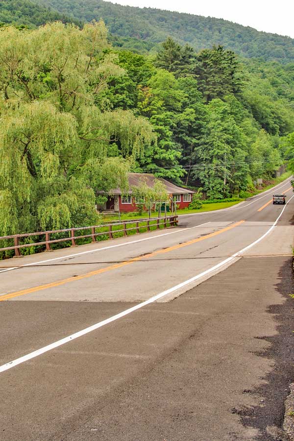
After parking at the DEC Harding Road Parking Area in Palenville, walk WEST on Rt 23a until you come to the bridge.
Walk over the bridge and take a LEFT onto Malden Ave (In front of the red building).
The mileage for this hike starts where you see the red building. It is the closest place to the trail head. |
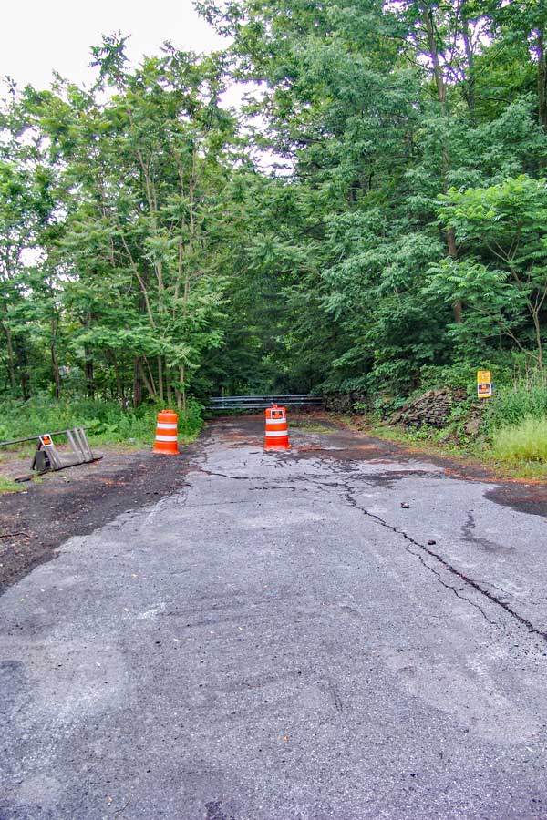
Walk around the barrier. You will have to wade thru the brush at the beginning of this barrier. Then you can continue walking on the road until you reach the barrier on the other side of Malden Ave. Continue down Malden Ave. The distance to the dirt road that is the beginning of the trail is 0.62 miles.
NOTE: Malden Ave is a PUBLIC road from Rt 23a to 32a. In spite of a section of Malden Ave being closed to vehicle traffic, it is still a public road. You are legally allowed to walk around the barrier. This has been verified by Greene County Records office that holds the deeds. There is one particular land owner that wants the public to think that he owns Malden Ave. He does not own any part of Malden Ave! |
|
 |
 |
From the other side of Malden Ave, this is the entrance to the Long Path/trails into the Kaaterskill High Peak region.Walk up this driveway.
Absolutely do NOT park here, or drive up this road. This road is private property, and you only have the rights to walk up the road to access the trail head. The trail head onto public land is 1.40 miles from the bridge. I can assure you that if you park here, your car will be towed.
If you look very carefully from Malden Ave, you might see the green Long Path trail marker on the tree. You have to look very carefully. |
After walking 150 feet up this driveway, turn RIGHT onto a smaller driverway. You will see a DEC sign denoting that this is the way to the trail. 30 feet after turning right you will see a steel gate. You can walk around the gate and continue up the road.
There is another metal gate further up the road. Walk around that one too, if it is closed.
The picture on the right shows the sign denoting the direction to the trail. The first metal gate blocking the road is just past the sign denoting the trail. |
|
 |
 |
At mile marker 1.01 (from the intersection of Rt 23a & Malden Ave), you will come to a 3-way intersection. GO STRAIGHT.
You will see trail markers, so follow them if you get confused.
There is another road on the right of the picture (which you cannot see in the photo). |
At mile post 1.27, you will encounter the second trail branch. You want to GO RIGHT. Again follow the trail markers. |
|
 |
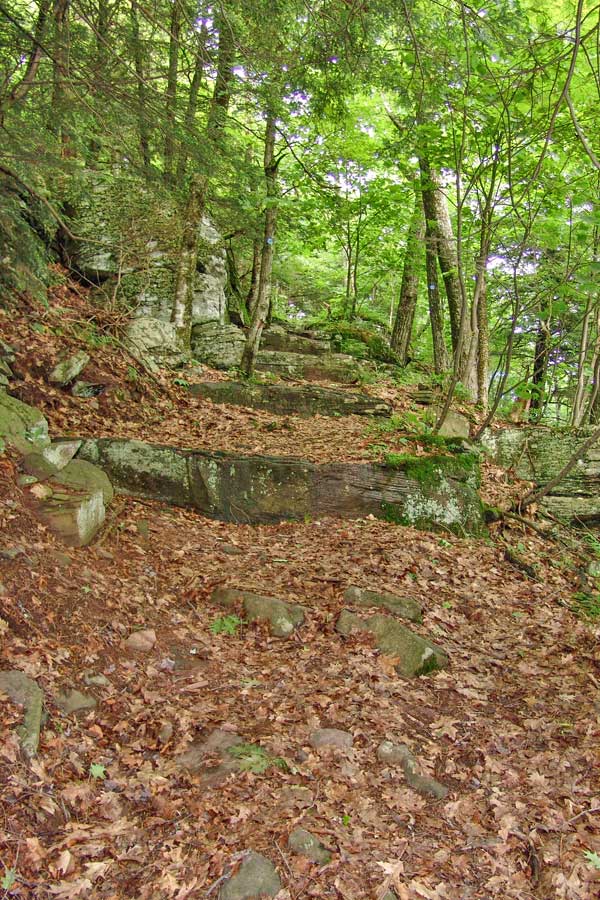 |
At Mile post 1.33 (elevation 1,250') the road will branch again. This time the branch will move off the road on to a foot path. If you were to continue further, you will run into the property owners house. So, try not to disturb them.
At Mile post 1.40, you will leave private land and will enter public land. At this point you can leave the path if you so choose.
The path will continue on a steady moderate uphill ascent. |
At Mile post 2.31 (Elevation 2,067) you will encounter The Giant Steps. These rocks tend to be slippery. |
|
 |
 |
At Mile post 2.34 (elevation 2,102) you will encounter the first ledge with a view. From this ledge you can clearly see Indian Head Ledge, Palenville Overlook Ledge, and Boulder Rock. You will also be able to see down into Palenville and the Hudson Valley. |
At Mile post 2.44 (elevation 2,264) you will encounter "Rock-in-the-Path".
At Mile post 2.52 (elevation 2,325) you will come to the end of the long ascent. (At this point you have completed the 1,645' vertical ascent. At this point, the trail will continue on a level path all the way to Twilight Park.
At Mile post 2.57 (elevation 2,317) you will enter the beautiful conifer forest that has old growth trees. Some are 3+ feet in diameter. |
|
POET'S LEDGE (Optional) |
 |
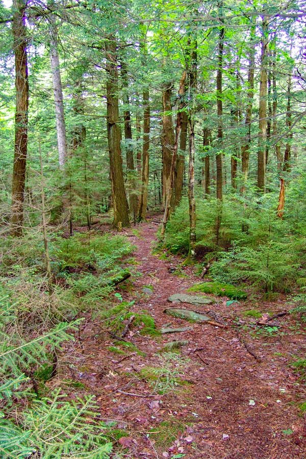 |
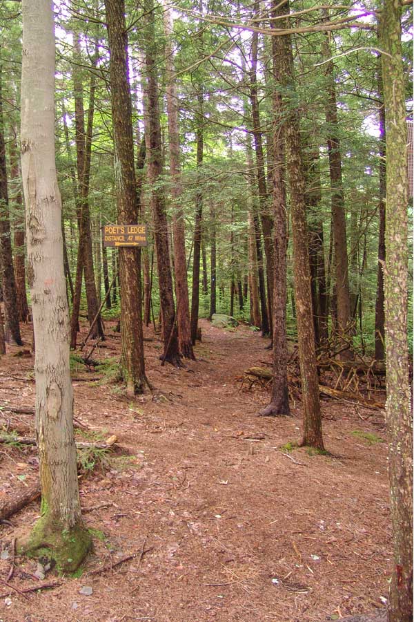
OPTIONAL SIDE TRIP: At Mile post 2.63 (elevation 2,341) you will encounter a Trail branch. If you go right it will lead to Poet's Ledge. The trail is marked with Yellow Trail Markers. The detour to Poet's Ledge is 0.44 miles one way or 0.88 miles round trip. Most consider Poet's Ledge the best part of the hike. If this is the end of your hike, your round trip mileage will be 6.14 miles. The trail will be a 196' drop in elevation from the trail junction down to Poet's Ledge. |
This is what the beginning of the trail to Poet's Ledge looks like |
|
 |
About 2/3 of the way down to Poet's Ledge, you will encounter two ledges. Neither of these ledges are Poet's Ledge. Continue on the path until the path absolutely ends. Then you will be at Poet's Ledge. |
|
|
This is the view of Poet's Ledge. While the photo is beautiful, it really does not do justice to the view you will get. On a clear crisp day, the vistas are awe inspiring.
Safety Note: There is a benign looking crack in the ledge. If you look carefully, there is a 30' drop into a cave.
The best time to arrive at Poet's Ledge is around noon time to 2 PM in the afternoon. Late in the afternoon is the worst time. The photo above was taken at 10 AM. It takes 2 hours and 15 minutes to get there.
The mileage from the Long Path to Poet's ledge is 0.44 miles, and the elevation at Poet's Ledge is 2,145'. There is a 197' drop in elevation.
After you return back to the original trail, take a RIGHT and continue down the path.
Optional side-trip (minor bushwhacking) - After you get back on the trail, you will cross a small little stream (Hillyer). Maps from 50-60 years ago show a trail branch by the stream that will lead up to Hawkeye Ledge. The trail to Hawkeye is now overgrown and not visible. If you follow the stream uphill, it will lead you to Hawkeye Ledge. Hawkeye Ledge is located on the corner of the eastern escarpment and Kaaterskill Amphitheater. There is a large flat ledge with some views into the Amphitheater. Most of the view is now overgrown. When the leaves are not on the tree, the view is nice. Some people do camp on the ledge. Great place to camp for the night. |
|
WATERFALLS |
 |
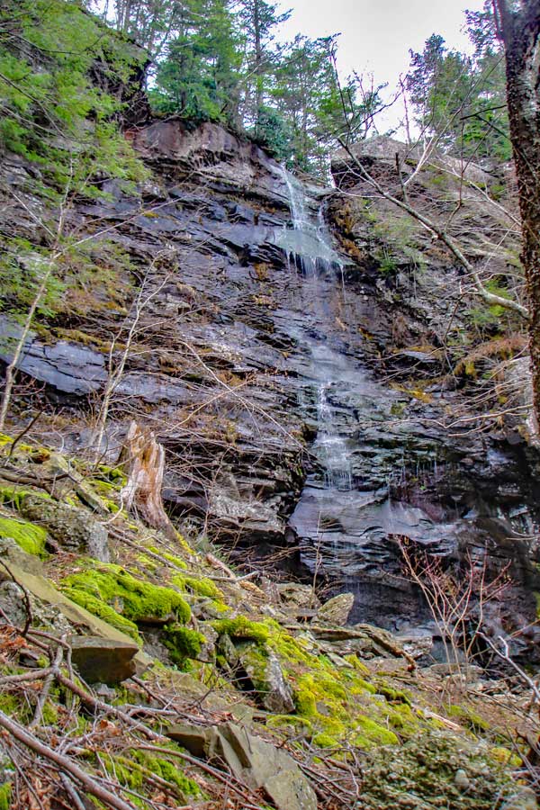 |
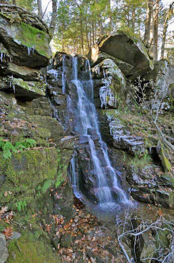
At mile 3.74 you will encounter Viola Falls. Elevation 2,183.
Below Viola Falls is Middle Viola Falls. Then below Middle Viola Falls is the 90' Lower Viola Falls. Middle Viola Falls and Lower Viola Falls are fairly close to Poet's Ledge. Lower Viola Falls is very difficult to get to. Hikers have been trapped between Middle Viola Falls and the top of Lower Viola Falls. Need a rope to get back out.
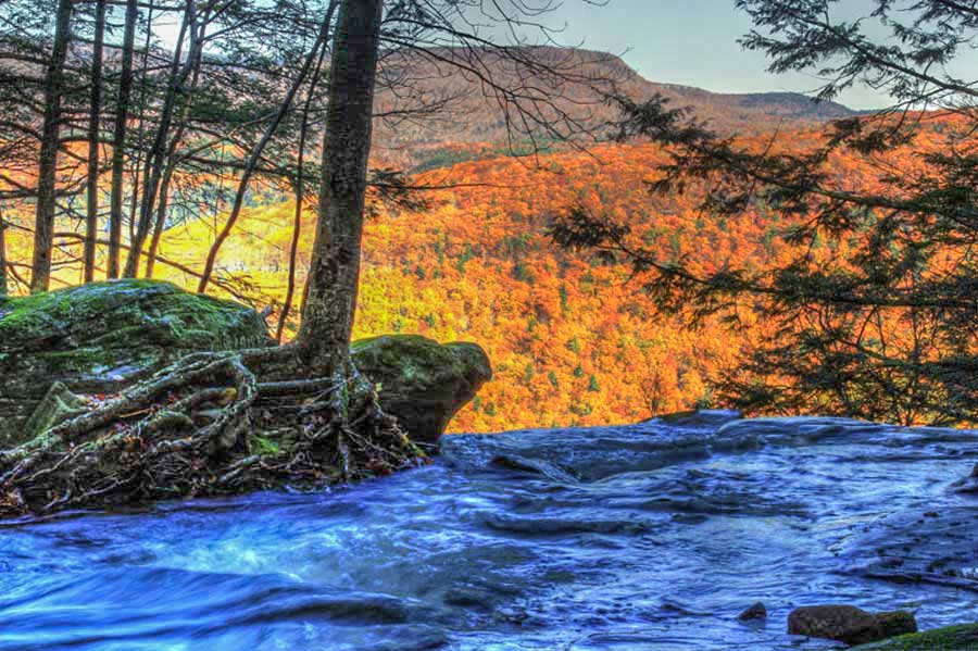
At mile 4.29 you will encounter Wildcat Falls. Elevation 2,212. There are another 2 water falls downstream from this one.
This picture was taken from the base of Wildcat Waterfall. You will be crossing the top of this waterfall. | |
|
 |
At mile 4.84 you will encounter Buttermilk Falls. Elevation 2,186. Buttermilk Falls has 9 drops with a total of 549'. Buttermilk Ravine is very difficult and dangerous to hike in the summer months. This is a popular ice climbing Falls.
Just before you reach Buttermilk Falls, there is a small unofficial campsite on the downhill side of the Falls (right side of the trail).
To learn more about the waterfalls in the Kaaterskill Clove, please visit the Waterfall Section of this site.
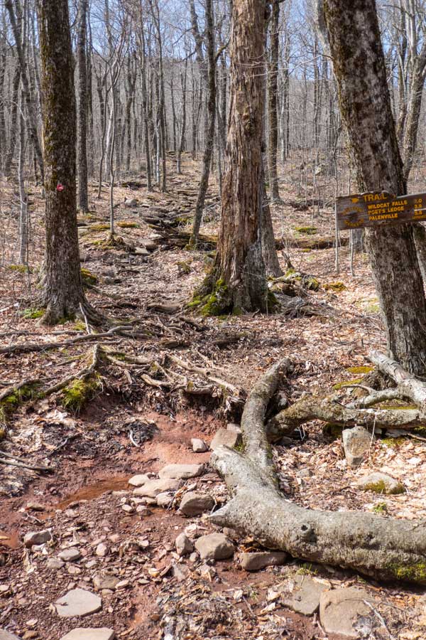
After hiking 4/10 of a mile past Buttermilk Falls you will come to a Trail Junction. You want to go LEFT and head uphill towards Kaaterskill High Peak. Straight goes onto private land of Twilight Park.
You will then hike almost another mile uphill towards Kaaterskill High Peak until you reach the Kaaterskill Spur Trail between the Long Path and the Kaaterskill Trail. (formally called the Snowmobile Trail). |
|
 |
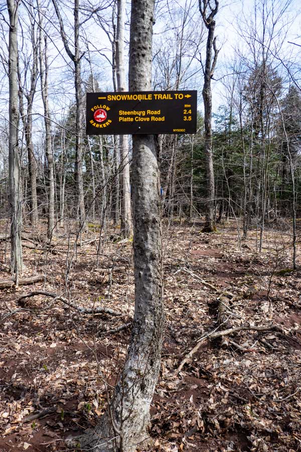 |
After hiking uphill for almost a mile, you will come to the Kaaterskill Spur Trail. You want to leave the Long Path and go STRAIGHT up the Kaaterskill Spur Trail. |
If you accidently go pass the Kaaterskill Spur Trail, you will see this sign on your left. Turn around and take the Kaaterskill Spur Trail. |
|
 |
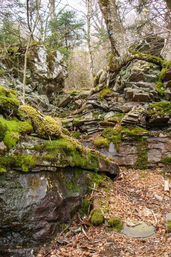 |
When you get to the bottom of the steep climb up to the summit, you need to take a continue STRAIGHT. Right will take to the west side of the Kaaterskill Trail and Round Top Mountain. |
The north access trail has three difficult sections. The picture on the left shows one of those sections. The section is not as difficult as it looks. |
|
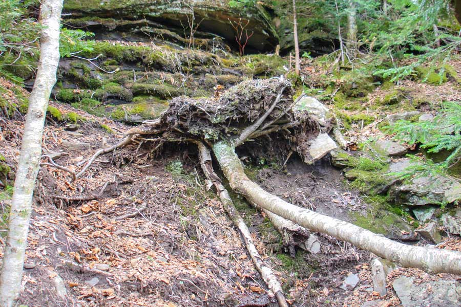 |
The picture above shows one of the steep sections. In the summer months it is not so difficult, but in the Winter months it can be very dangerous. When you approach this section, the obvious path is on the right of this picture. It is a steep mossy rock ledge. The best path is actually the mud path on the left of this picture. Then walk across the top of the root base of the tree. |
|
 |
 |
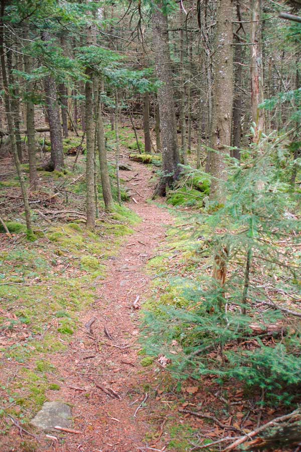
The picture on the left is is the nice mossy trail going up to Kaaterskill High Peak on the North side.
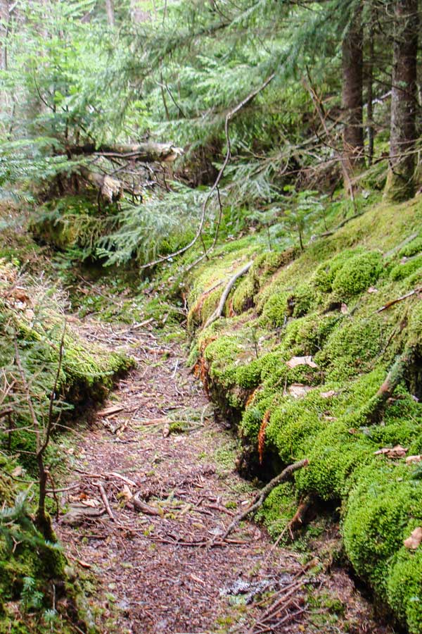
| The picture on the RIGHT shows another picture of the beautiful path near the top of the mountain. |
|
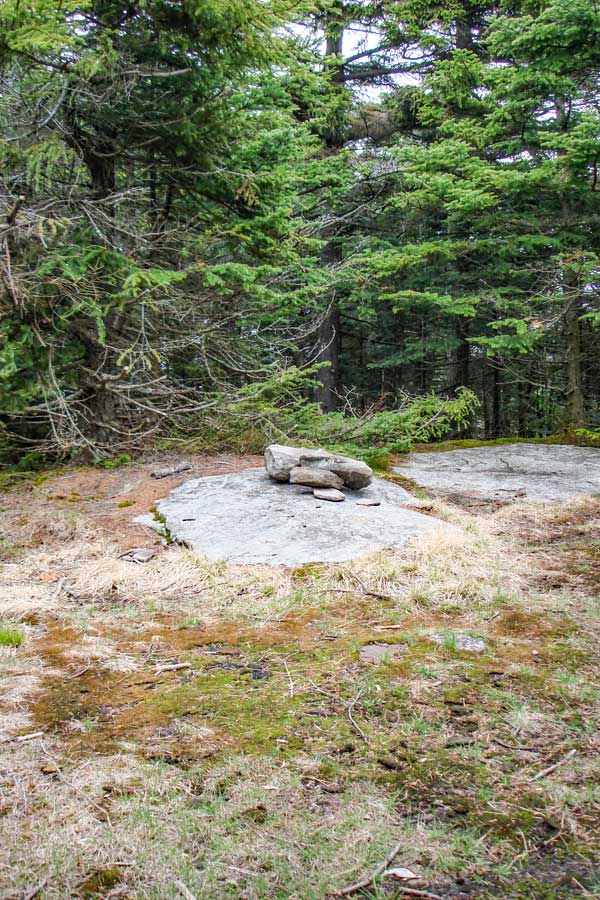 |
This is the summit of Kaaterskill High Peak Mountain. There are no longer any views from the very top. But, you will have spectacular views from Hurricane Ledge and the northeastern ledge. Hurricane Ledge is 1/4 mile past the summit on the south side of Kaaterskill High Peak.
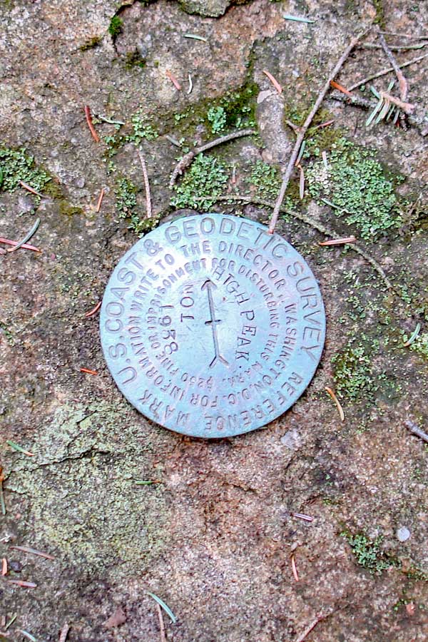
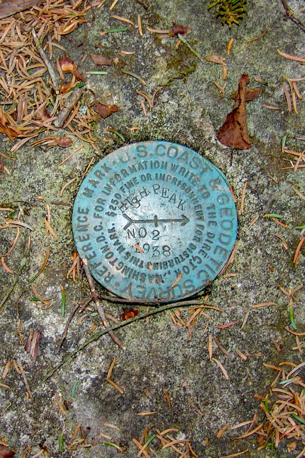
There are two USGS markers about 30 feet from the summit. The trail that goes east will take you to plane crash #2 and USGS marker #2. The trail that goes south will take you to USGS marker #1, and Hurricane Ledge.
If you look around, you can see that there was a building at the summit. The building was a 2-story building that was built in the late 1800's. It was taken down around 1921 when New York State purchased the Kaaterskill Mountain Range. About an acre of land was cleared for the building.
While the Mohawk Indians used Kaaterskill High Peak for thousands of years, the first European to ascend Kaaterskill High Peak was Peter DeLabigarre along with a friend on July 26, 1793. Peter DeLabigarre also was the first to summit Overlook Mountain on July 9, 1793. He climbed Overlook Mtn thinking he was climbing Kaaterskill High Peak. He also named Kaaterskill High Peak, "Liberty Cap". The names of Kaaterskill High Peak and Round Top Mtn were mixed up fairly often. After his death, the name fell out of favor, and people resorted to calling it High Peak because they believed that it was the highest peak in the Catskill Mountains. Today, High Peak is still the official name of Kaaterskill High Peak. Almost all hikers today call it Kaaterskill High Peak, so that it is not mixed up with Windham High Peak. Alf Evers dedicated an entire chapter (Liberty Cap - Chapter 37) of his book, The Catskills, to Peter DeLabigarre. Up to the 1870's KHP was believed to be the highest peak in the Catskills. Princeton geography professor Arnold Henry Guyot brought equipment up to the Catskills and started to measure all the higher peaks. He determined that KHP was actually the 23rd highest. His finding upset the hotels in the Kaaterskill Clove who used this claim to attract visitors. |
|
 |
 |
The picture on the LEFT is USGS marker #1. It is about 30 feet south of the peak on the path to Hurricane Ledge. |
The picture on the RIGHT is USGS marker #2. It is about 30 feet east (and slightly south) of the peak. It is located on top of a dome shaped rock. When you approach the peak from the north access route, take a left. Then take a right. The marker is about 10-15 feet inside the trees. |
You should also take a quick trip to Hurricane Ledge. It is and additional 1/2 mile round trip. The views to the south are spectacular. |
If you take a left, you can also go down to the Northeastern Ledge. There is also a plane crash just before the ledge. It is about an additional 1/5 of a mile round trip. |
|
HURRICANE LEDGE |
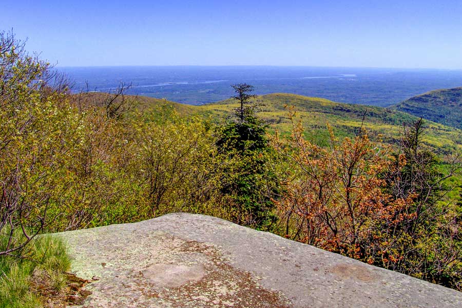 |
This is the upper portion of Hurricane Ledge looking to the east.
This is Hurricane Ledge. It is 0.25 miles from the peak. There are several places on Hurricane Ledge that will provide you with spectacular views. This ledge was caused by a storm on or about November 28, 1950, which had winds in excess of 100 mph. Ironically, there was another Hurricane Ledge created on the northeastern side of the peak at the beginning of the 1900's. It may have been created by one of the storms on November 8-10, 1913 or October 22-25, 1923. |
|
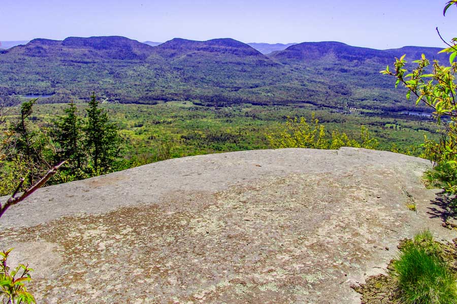 |
This is the upper portion of Hurricane Ledge looking to the south. The mountains in the distance is the Indian Head Wilderness. From this point, you can see Overlook Mtn, Plattekill Mtn, Indian Head Mtn, Twin Mtn, Sugarloaf Mtn, and Plateau Mtn. |
|
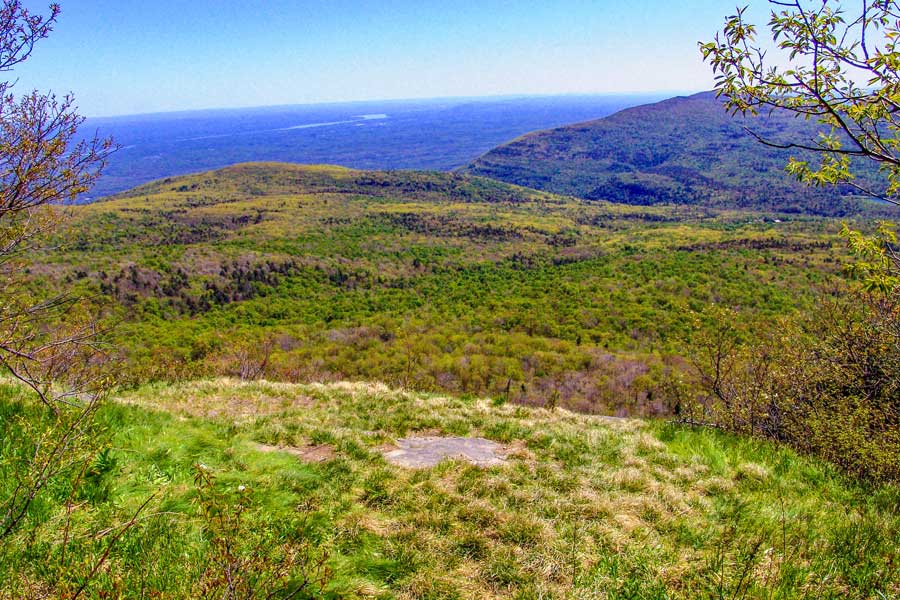 |
This is the lower portion of Hurricane Ledge looking to the southeast.
NOTE: If you want to take the very steep and dangerous south access route back down to the Loop trail, you just need to move to the very left side of this ledge to find the trail. Once you get down to the trail, you will encounter the southern portion of the Kaaterskill Trail. You want to go LEFT (east). It is often overgrown and hard to follow. You need to plan this out before arriving for your hike. Please have gotten lost here. |
|
 |
This is the view to the west, showing Round Top Mountain.
Reverse your course back to the KHP peak. Next we are going to visit the view point from the northeast side of Kaaterskill High Peak. There is an excellent view there. There is also a plane crash near the summit of Kaaterskill High Peak. |
|
|
After you return back to the summit of Kaaterskill High Peak, take a RIGHT. This short trail will take you down to a beautiful view point on the Northeastern corner of the mountain.
There is also a plane crash just before the view point on the northeastern corner of Kaaterskill High Peak. |
|
NORTHEAST LEDGE & PLANE CRASH |
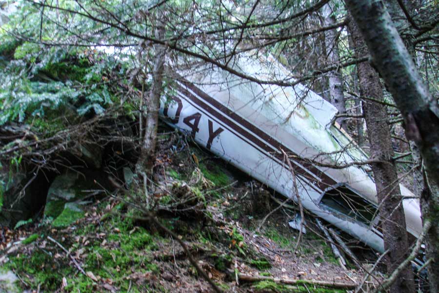 |
After about 490 feet, you will come to a flat section that is about 30 feet long. This section is just after a small steep descent. The plane crash is about 100 feet from the trail. Once you return from the plane crash, you can walk a further down the trail to a beautiful view on the Northeastern Ledge. The Northeastern Ledge is about 100 feet past the turn off for the plane crash.
This plane crash occurred on Tuesday, June 13, 1967, and resulted in two fatalities. The impact was so severe that the crankshaft of the plane landed about 450 feet from the crash location. The Crankshaft has been sitting near summit for decades. Back in the Winter of 2009/2010 someone attempted to steal the crankshaft, and later abandon the crankshaft near the lower portion of Hurricane Ledge. Two hikers from Catskill Mountaineer recovered the crankshaft and restored it to it's original location. PLEASE do not remove or move any of the wreckage. This often upsets the family of the victims. This is a sacred grave site.
To read the Aviation Report on the crash Click Here |
|
 |
This picture shows the debris field from the plane crash. The plane crashed head-on into the ledge. This plane crash occurred on June 13, 1967. The plane is a Piper PA-23 with registration N5604Y. The two occupants were killed instantly. The plane slammed into the ledge with such force that it was able to rip the crankshaft out of the engine and it flew approximately 450 feet and landed near the summit of KHP. The pilot was flying in bad weather with VFR. |
|
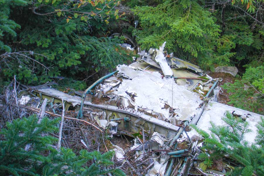 |
This picture shows the plane crash from the top of the ledge. PLEASE do not remove or move any of the wreakage. This often upsets the family of the victims. This is a sacred grave site. |
|
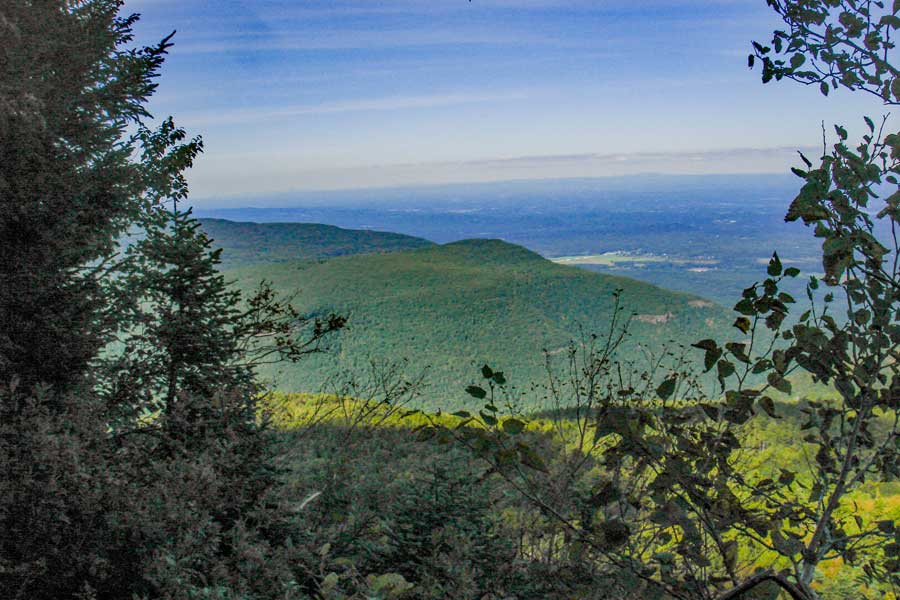 |
After you get done visiting the Plane Crash, continue down the trail. After about 100 feet you will come to the end of the trail. At the end of the trail is the Northeasterly Ledge. Please be careful! It is easy to fall off this ledge. If you do fall, you will most likely be killed. This image is of the Northeast direction. It shows North-South Lake campground region and South Mountain. In the far distance you can see Albany, NY. |
|
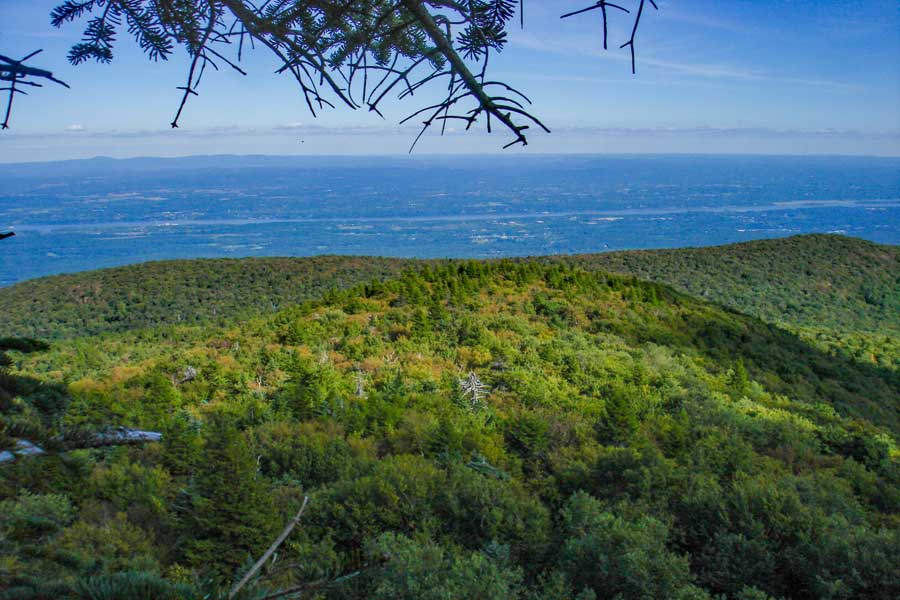 |
This image is of the Easterly direction. It shows the top rim of the Kaaterskill Amphitheater and the Hudson River.The Taconic Mountain Range is in the distance. From this ledge you can see New York, Vermont, New Hampshire, Maine, Massachusetts, and New Jersey. |
|
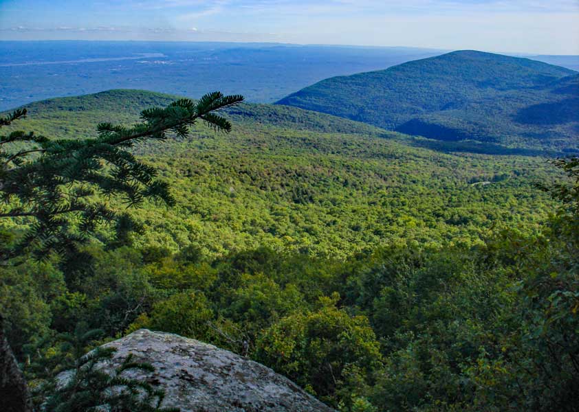 |
This image is of the Southeastern direction. It shows Huckleberry Point, Devil's Kitchen, and Overlook Mountain. In the distance you can see the Hudson River, Kingston, Poughkeepsie, New Jersey, Connecticut, and Massachusetts.
Once you are done, return back to the summit of Kaaterskill High Peak. |
|
|
After you return back to the summit of Kaaterskill High Peak, reverse your course back to your car. Hope that you enjoyed this hike!. |
|
|
S E C T I O N S
|
W E A T H E R
|
O T H E R
|
