Southern Escarpment Trail |
 |
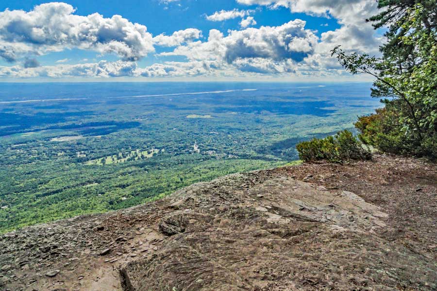
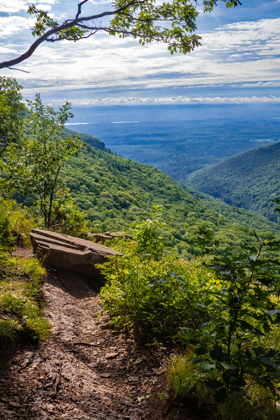
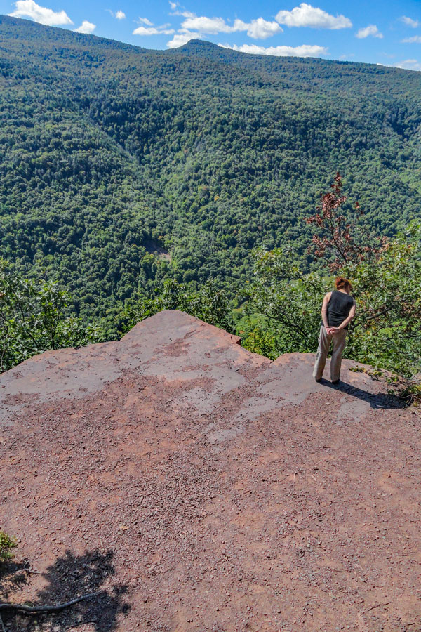
| View to the east from Boulder Rock |
| |
| |
|
OVERVIEW |
| | Type of Trail: | DEC Trails & campsite roads and trails |
| | Distance: | Approximately 7.26 miles round trip from Laurel House Road DEC Parking Area and back |
| | Distance: | Approximately 7.90 miles round trip from Scutt Road DEC Parking Area and back. |
| | Distance: | Approximately 6.80 miles round trip from South Lake Parking Area and back. |
| | Notes: | Parking Area on Laurel House Road is often full, so use Scutt Road Parking Area if needed |
| | Notes: | Trail runs along the very edge of ledges - Those with a fear of heights may not like this trail |
| | Time: | Average 2-3 hours round trip |
| | Best Time to Hike: | Any time of day in Spring, Summer, or Fall. Too dangerous to use in Winter. |
| | Difficulty: | Moderate |
| | | |
| | | DEC Trail Map: | DEC Kaaterskill Wild Forest Map (free) |
| | | |
| | | Digital Mapper: |
Topo
Terrain
Satellite |
| | | |
| | | Access Methods: | Foot only |
|
|
M A P S |
 |
|
Map Trail Index Chart |
 Long Path Long Path |
 Harding Road Trail Harding Road Trail |
 Huckleberry Point Trail Huckleberry Point Trail |
 Escarpment Trail Escarpment Trail |
 Schutt Road Trail Schutt Road Trail |
 Poets Ledge Trail Poets Ledge Trail |
| |
 Palenville Overlook Spur Trail Palenville Overlook Spur Trail |
 Harding Road Spur Trail Harding Road Spur Trail |
| |
 Sleepy Hollow Trail Sleepy Hollow Trail |
 Yellow Horse Trail Yellow Horse Trail |
| |
|
 Yellow Crossover Trail Yellow Crossover Trail |
 Kaaterskill Trail (formally SMT) Kaaterskill Trail (formally SMT) |
|
 Observation Deck Trail Observation Deck Trail |
 KHP Trail (north) KHP Trail (north) |
|
 Kaaterskill Falls Trail Kaaterskill Falls Trail |
 KHP Trail (south) KHP Trail (south) |
|
 Kaaterskill Rail Trail Kaaterskill Rail Trail |
| |
|
 Cross-Country Ski Trail Cross-Country Ski Trail |
|
Trails for this hike (starting from Scutt Road PA) |
| Observation Deck Trail |
| Escarpment Trail (east) |
| Schutt Road Trail |
| Horse Trail |
| Escarpment (west) |
| Observation Deck Trail |
|
| |
| |
| | DIRECTIONS TO TRAIL HEAD from Exit 21 (Catskill) |
| | NOTE: We do NOT recommend swimming in the middle pool of Kaaterskill Falls. If you would like to swim, get a Day-Use Pass at the Entrance Booths to North-South Lake Campgrounds. There are two beaches located inside the campgrounds that are quite nice. You can also park at the South Lake Parking Area and hike to Kaaterskill Falls.
|
| | Scutt Road Parking Lot WGS84 (DEC): 42.200817 -74.058417 - Elevation is approximately 2,240 feet |
| | Scutt Road Parking Lot Deg/Min/Sec: N42 12 02 W74 03 30 - Elevation is approximately 2,240 feet |
| | Scutt Road Parking Lot GPS: N 42 12.049 W 74 03.505 - Elevation is approximately 2,240 feet |
| | Scutt Road Parking Lot UTM: 18N 577734 4672502 - Elevation is approximately 2,240 feet |
| | Google Maps: Scutt Road Parking Area (Haines Falls, NY) |
| |  : Enter "42.200817,-74.058417" in the Maps Search Box : Enter "42.200817,-74.058417" in the Maps Search Box |
| |
|
| | Laurel House Road Parking Lot WGS84 (DEC): 42.19575, -74.063433 - Elevation is approximately 2,081 feet |
| | Laurel House Road Parking Lot Deg/Min/Sec: N42 11 44, W74 03 48 - Elevation is approximately 2,081 feet |
| | Laurel House Road Parking Lot GPS: N 42 11.745, W 74 03.806 - Elevation is approximately 2,081 feet |
| | Laurel House Road Parking Lot UTM: 18N 577326 4671935 - Elevation is approximately 2,081 feet |
| | Google Maps: Laurel House Parking Area (Haines Falls, NY) |
| | : Enter "42.19575,-74.063433" in the Maps Search Box |
| |
|
| | South Lake Parking Lot WGS84 (DEC): 42.196467, -74.0511 - Elevation is approximately 2,128 feet |
| | South Lake Parking Lot Deg/Min/Sec: N42 11 47, W74 03 03 - Elevation is approximately 2,128 feet |
| | South Lake Parking Lot GPS: N 42 11.788, W 74 03.066 - Elevation is approximately 2,128 feet |
| | South Lake Parking Lot UTM: 18N 578344, 4672026 - Elevation is approximately 2,128 feet |
| | South Lake Parking Area (Haines Falls, NY) (Google Maps) |
| | : Enter "42.196467,-74.0511" in the Maps Search Box |
| |
|
| | Take New York State Thruway to Exit 21 (Catskill). |
| | Take a left out of the NYS Thruway entrance road. |
| | Go approximately 1/4 mile |
| | Take a right onto Route 23 West |
| | Go approximately 6.6 miles to Cairo, NY |
| | Take a LEFT onto Rt 32. McDonalds Rest. on corner. |
| | Go approximately 7.7 miles on Rt 32 |
| | Take a RIGHT onto Rt 23A |
| | Go approximately 7.4 miles to the intersection of Rt 23a and North Lake Road. |
| | Take a RIGHT onto North Lake Road (DEC sign on corner of road). |
| | Go approximately 1.8 miles North Lake Road to Scutt Road. |
| | Take a RIGHT onto Scutt Road |
| | Go approximately 0.1 miles to Scutt Road Parking Area. |
| | Do NOT park on the side of the road. Your car will be TOWED if you do. |
| | |
| | |
| | DIRECTIONS TO TRAIL HEAD from Exit 20 (Saugerties) |
| | Scutt Road Parking Lot WGS84 (DEC): 42.200817 -74.058417 - Elevation is approximately 2,240 feet |
| | Scutt Road Parking Lot Deg/Min/Sec: N42 12 02 W74 03 30 - Elevation is approximately 2,240 feet |
| | Scutt Road Parking Lot GPS: N 42 12.049 W 74 03.505 - Elevation is approximately 2,240 feet |
| | Scutt Road Parking Lot UTM: 18N 577734 4672502 - Elevation is approximately 2,240 feet |
| | Google Maps: Scutt Road Parking Area (Haines Falls, NY) |
| | : Enter "42.200817,-74.058417" in the Maps Search Box |
| |
|
| | Laurel House Road Parking Lot WGS84 (DEC): 42.19575, -74.063433 - Elevation is approximately 2,081 feet |
| | Laurel House Road Parking Lot Deg/Min/Sec: N42 11 44, W74 03 48 - Elevation is approximately 2,081 feet |
| | Laurel House Road Parking Lot GPS: N 42 11.745, W 74 03.806 - Elevation is approximately 2,081 feet |
| | Laurel House Road Parking Lot UTM: 18N 577326 4671935 - Elevation is approximately 2,081 feet |
| | Google Maps: Laurel House Parking Area (Haines Falls, NY) |
| | : Enter "42.19575,-74.063433" in the Maps Search Box |
| |
|
| | South Lake Parking Lot WGS84 (DEC): 42.196467, -74.0511 - Elevation is approximately 2,128 feet |
| | South Lake Parking Lot Deg/Min/Sec: N42 11 47, W74 03 03 - Elevation is approximately 2,128 feet |
| | South Lake Parking Lot GPS: N 42 11.788, W 74 03.066 - Elevation is approximately 2,128 feet |
| | South Lake Parking Lot UTM: 18N 578344, 4672026 - Elevation is approximately 2,128 feet |
| | South Lake Parking Area (Haines Falls, NY) (Google Maps) |
| | : Enter "42.196467,-74.0511" in the Maps Search Box |
| |
|
| | Take New York State Thruway to Exit 20 (Saugerties). |
| | Take a left out of the NYS Thruway entrance road - Move to RIGHT lane. |
| | Go approximately 0.20 miles |
| | Take a right onto Route 32 |
| | Go approximately 5.9 miles to a Y intersection |
| | Take a LEFT (straight) onto Rt 32A (Gas Station on left side of road). |
| | Go approximately 1.8 miles on Rt 32A |
| | Take a LEFT onto Rt 23A |
| | Go approximately 5.2 miles to the intersection of Rt 23a and North Lake Road. |
| | Climb up the windy mountain road (Rt 23A). When you reach the top, you will then be in Haines Falls. |
| | Take a RIGHT onto North Lake Road (DEC sign on corner of road). |
| | Go approximately 1.8 miles on North Lake Road to Scutt Road. |
| | Take a RIGHT onto Scutt Road |
| | Go approximately 0.1 miles to Scutt Road Parking Area. |
| | Do NOT park on the side of the road. Your car will be TOWED if you do. |
|
|
MILEAGE CHART for the HIKE of the SOUTHERN ESCARPMENT TRAIL |
| | Mile Point | Altitude | Notes |
| | 0.00 | 2,275' | Scutt Road Parking Area - Go STRAIGHT across Scutt Road to the Trail (Blue Trail Marker) |
| | 0.55 | 2,135' | Registration Box & 4-way Trail Junction - Go LEFT and walk up Cross-Country Ski Trail |
| | 0.94 | 2,206' | Take a LEFT when you reach the paved road near South Lake |
| | 1.08 | 2,186' | Take a RIGHT the old railroad bed (across from Parking Area) |
| | 1.56 | 2,190' | Take a RIGHT onto the paved service Road |
| | 1.67 | 2,190' | Take a RIGHT onto the Loop 1 Intersection |
| | 1.74 | 2,190' | Take a RIGHT onto Foot Trail (paved in sections) |
| | 2.08 | 2,170' | Take a RIGHT at Camp Site #153 |
| | 2.14 | 2,181' | Take a RIGHT at the Road Intersection |
| | 2.21 | 2,185' | Take a LEFT at Camp Site #174 - Walk up lawn to North Lake Road |
| | 2.24 | 2,196' | Take a RIGHT onto North Lake Road. |
| | 2.32 | 2,185' | Take a LEFT by the TRAILS sign and follow path into woods |
| | 2.42 | 2,195' | Take a RIGHT by the fireplace |
| | 2.42 | 2,195' | Take a RIGHT by the DEC Registration Box |
| | 2.59 | 2,177' | Continue STRAIGHT (on left is trail junction to Sleepy Hollow Trail - takes you to the valley floor) |
| | 2.67 | 2,174' | Continue STRAIGHT across opening to gravel road (Left is the cog rail station - now gone) |
| | 2.80 | 2,221' | Take a LEFT at the Trail Junction and head EAST to the site of the Catskill Mountain House |
| | 2.93 | 2,240' | Catskill Mountain House - Take RIGHT onto the Trail into the forest (RIGHT side of the site) |
| | 3.18 | 2,424' | Eagle Ledge (nice view!) on your left |
| | 3.34 | 2,468' | Take a LEFT at the Trail Junction - Walk down hill to Boulder Rock |
| | 3.44 | 2,407' | Boulder Rock |
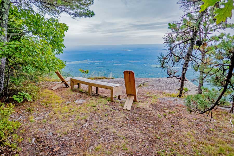
| | 3.57 | 2,414' | OPTION side trip. Go left from Boulder Rock and follow herd trail to a beautiful view with chairs, and further to the USGS Survey Post - Reverse your course back to Boulder Rock when done. |
| | 3.70 | 2,407' | Boulder Rock |
| | 3.76 | 2,398' | Split Rock (part of the ledge split off - Runs for quite a ways) |
| | 3.93 | 2,433' | Take a LEFT at the Trail Junction - Right will take you back to the Catskill Mountain House |
| | 4.27 | 2,436' | Continue STRAIGHT - Unofficial Trail on Right is the Old Hotel Road that will take you down to the paved road in North-South Campground & the 3rd Ledge Trail |
| | 4.55 | 2,457' | Take a LEFT at the Trail Junction - Right will take you to the old Kaaterskill Hotel site and further down to the 4-way Trail Junction back to your car (if you want to skip the best part of the hike, the Southwestern Escarpment) |
| | 5.07 | 2,226' | Take a RIGHT at the Trail Junction - Left will take you the Harding Road (to Palenville) & Palenville Overlook and Indian Head |
| | 5.13 | 2,218' | Take a LEFT at the Trail Junction onto the Southwestern part of the Escarpment Trail |
| | 5.78 | 2,106' | You will see multiple view point. Near the last one is Inspiration Point |
| | 5.91 | 2,050' | Sunset Ledge |
| | 6.15 | 2,120' | Go STRAIGHT at Trail Junction - Right is a Spur Trail that can lead back to the 4-way Intersection |
| | 6.44 | 1,898' | Small Ledge - This is NOT Council's Bluff |
| | 6.52 | 1,890' | Council's Bluff - Where Mohawk Indians performed ceremonies prior to the year 1650 |
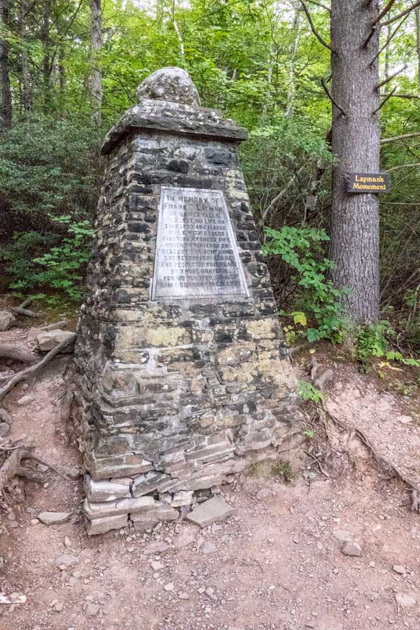
| | 6.61 | 1,836' | Layman's Monument |
| | 6.99 | 2,073' | Go STRAIGHT at the Trail Junction - Left will take you to the bottom of Kaaterskill Falls (250' elevation drop) |
| | 7.14 | 2,017' | Take a RIGHT at the Trail Junction IF you parked at Scutt Road - Take a LEFT if you parked at Laurel House Road (go over the bridge) - Take a RIGHT if you parked at South Lake or you are staying in the campgrounds. |
| | 7.30 | 2,135' | Take a LEFT at the 4-way Trail Junction IF you parked at Scutt Road - Go STRAIGHT if are parked at South Lake or staying in the campgrounds. |
| | 7.90 | 2,275' | Scutt Road Parking Area |
|
|
Hike the Southwestern Escarpment Trail |
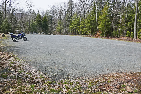 |
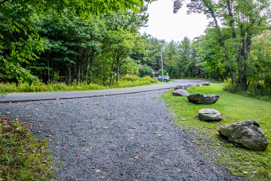
This is the SCUTT ROAD DEC PARKING AREA.
The picture shows the upper part of the Scutt Road Parking Area. There is also a lower Scutt Parking Area. There is an outhouse located in the lower lot.
To get to the trail head you need to walk to the lower lot. Across the street to the entrance to the Scutt Road Parking Area is the Trail Head. Look for the BLUE Trail Marker across the street. Walk down the trail 0.50 miles (1/2 mile) until you reach the DEC Registration Box and 4-way intersection. Skip down a few section to start at the 4-WAY INTERSECTION.
Do not leave trash in the Parking Area or outhouses!
|
|
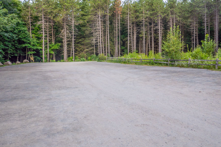 |
This is the LAUREL HOUSE ROAD DEC PARKING AREA.
If this Parking Area is full, do NOT park on the side of the road. The Town of Hunter WILL tow your car! Instead, drive back to North Lake Road. Take a RIGHT onto North Lake Road. Drive about 1/4 mile. Take a RIGHT onto Scutt Road. There is another DEC Parking Area near the top of Scutt Road.
The Trail Head starts at the bottom middle of the Parking Area. Skip over the next two section to start your hike.
Do not leave trash in the Parking Area or outhouses!
|
|
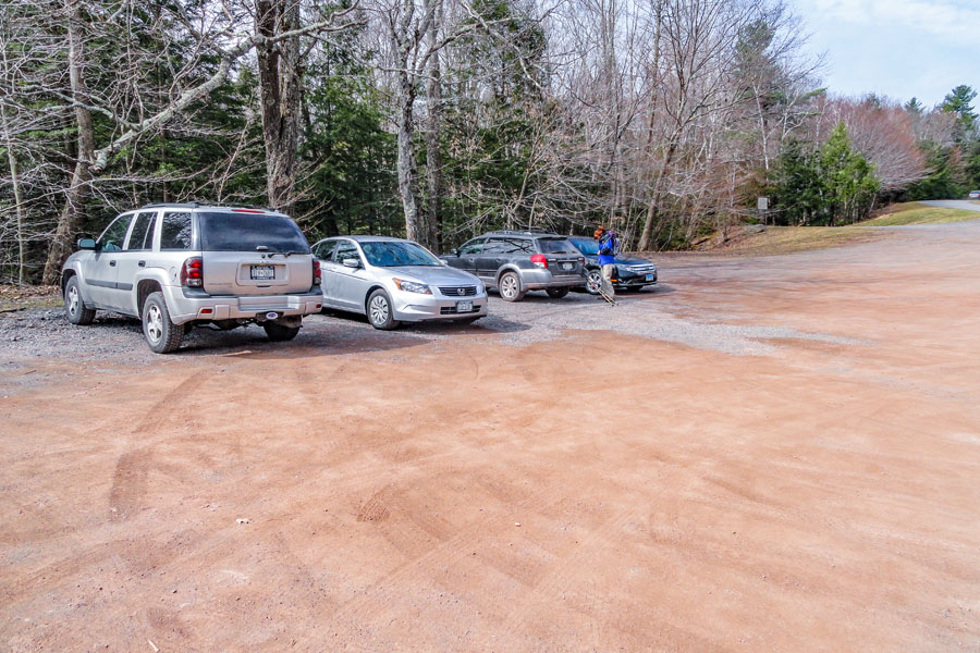 |
This is the SOUTH LAKE PARKING AREA inside the North-South Lake Campgrounds.
It is located by the South Lake outflow pipe on the western side of the campgrounds.
After parking your car, walk on the paved road. In the direction that goes OVER the overflow pipe (southerly direction). Walk on the paved road 0.12 miles (600 feet). On the right side of the paved road you will see a path with a wooden bar across the path. That is the Cross-Country Ski Trail. You want to take a RIGHT and Walk down the cross country ski trail 0.38 miles until you come to the 4-way intersection. At the 4-way intersection, take a LEFT and hike up the hill. Look at the map to get yourself oriented. Skip down a few section to start at the 4-WAY INTERSECTION.
Do not leave trash in the Parking Area or outhouses!
|
|
 |
 |
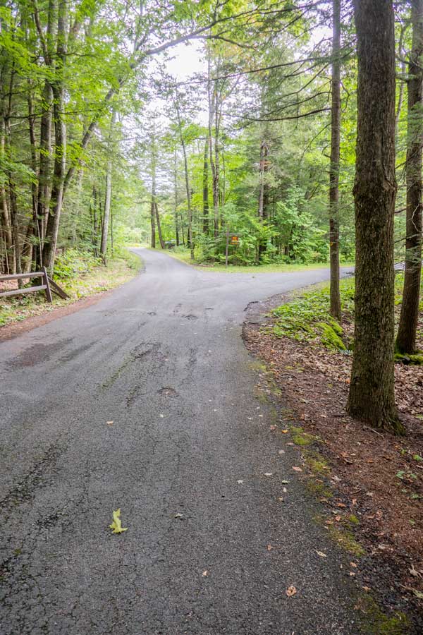
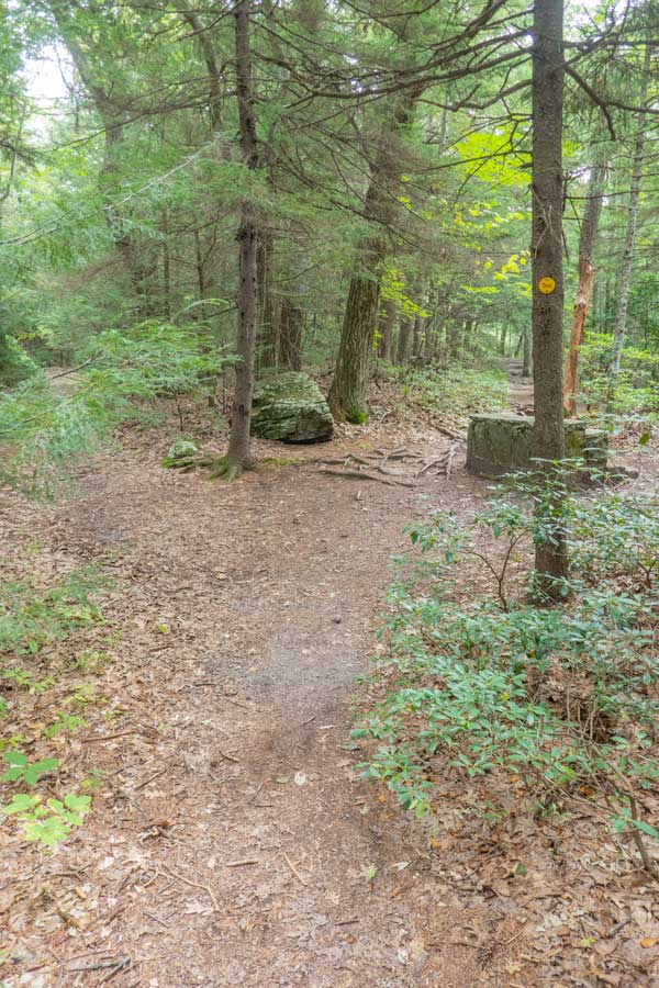
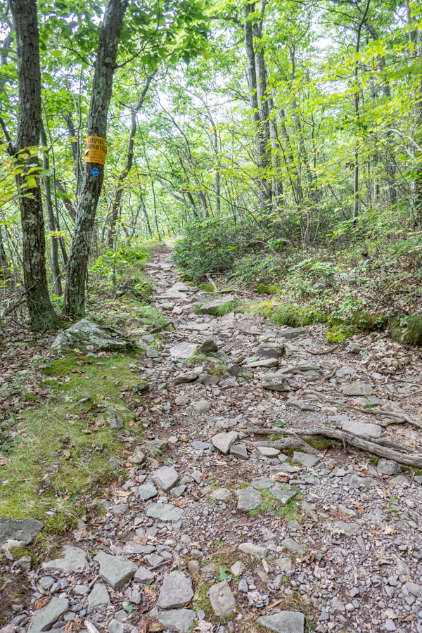
When you walk out of the lower parking area off Scutt Road, you will see the trail head for the Escarpment Trail directly across the street. You will also share this trail with horses. Horses have the right-a-way. Horses are rarely on this trail, but they are allowed here. This trail runs about 1/2 mile. |
This trail tends to be a little rocky and rooty most of the way down to Lake Creek and the 4-way Intersection. |
|
 |
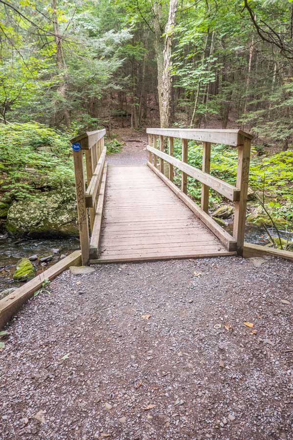 |
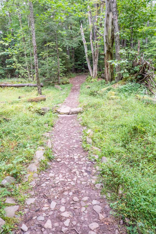
There is a small little field that tends to be wet during the Spring. |
This is the small bridge that runs over Lake Creek. Shortly you will come to the 4-way Intersection. |
|
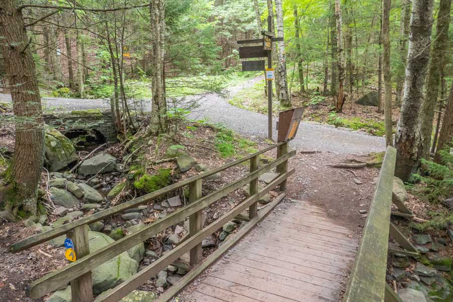 |
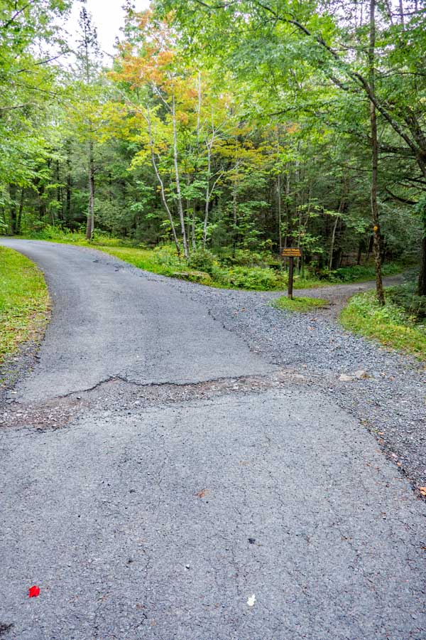
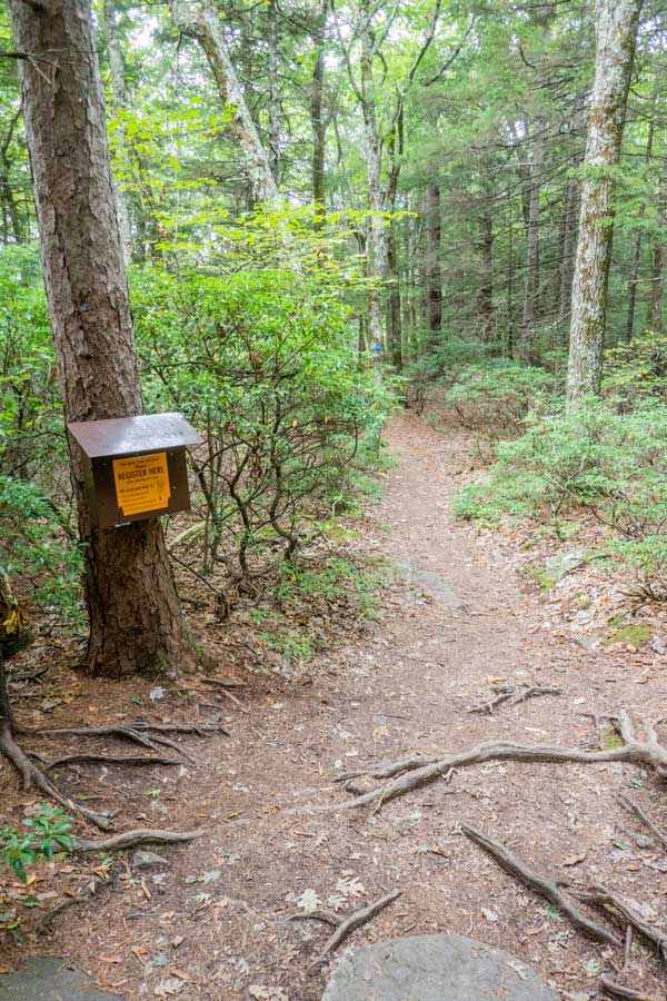
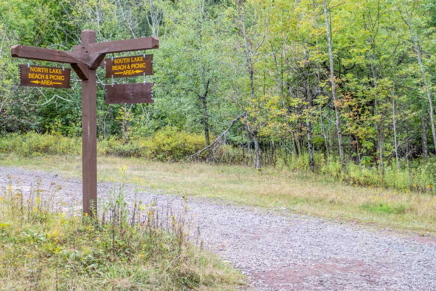
This is the 4-way Intersection. When you come to this point you want to take a LEFT onto the Cross-Country Ski Trail. Follow the Cross-Country Ski Trail up to South Lake for 4/10 of a mile.
Before you do that make sure you register at the box on the left.
If you go straight it will take you to the ruins of the Kaaterskill Hotel. Right will take you to Kaaterskill Falls and the Laurel House Road Parking Area. |
|
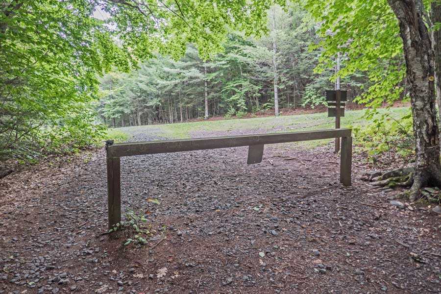 |
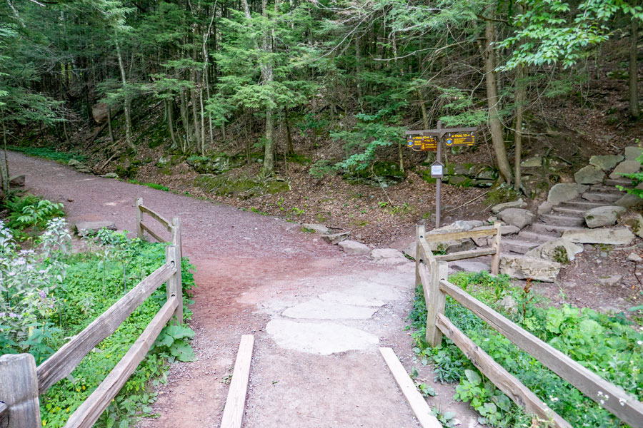
At the end of the Cross-Country Ski Trail,4/10 of a mile later, you will see this wooden barrier. Just beyond the woodend barrier is South Lake Road. You want to go LEFT and head down towards South Lake |
|
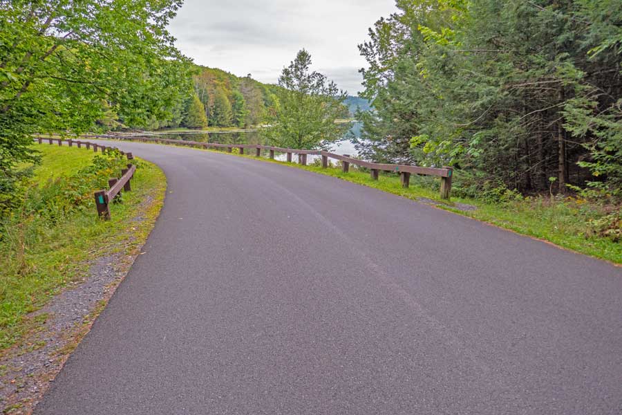 |
Continue STRAIGHT on South Lake Road and go over the dam.
On your right you will see a trail. This is the loop trail that runs around North and South Lake. On this route we are going to take the trail on the North side of North and South Lake. |
|
 |
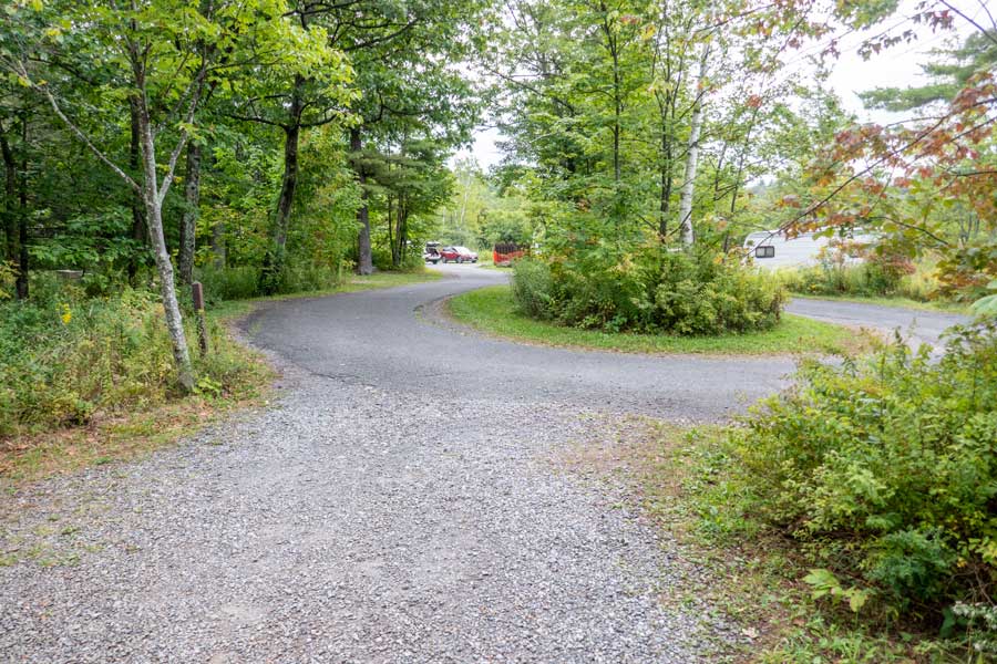
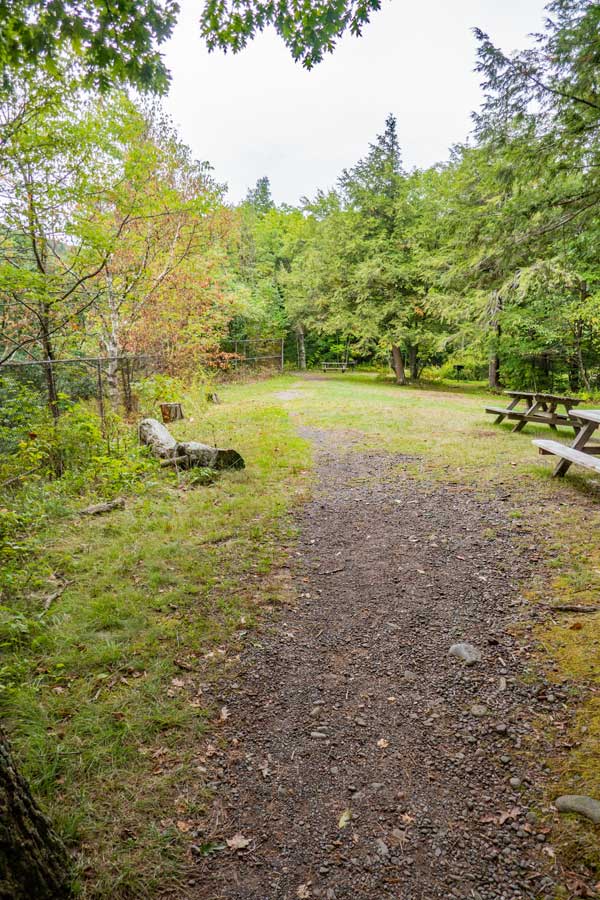
You want to continue on South Road until you reach the road on the left side of the picture. On your Right you will see another yellow gate. You want to go RIGHT onto this trail and hike about 1/2 mile. There are nice views of South Lake from this part of the trail.
This is part of the old rail road tracks back in the late 1800's and early 1900's. |
|
 |
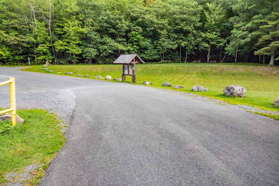
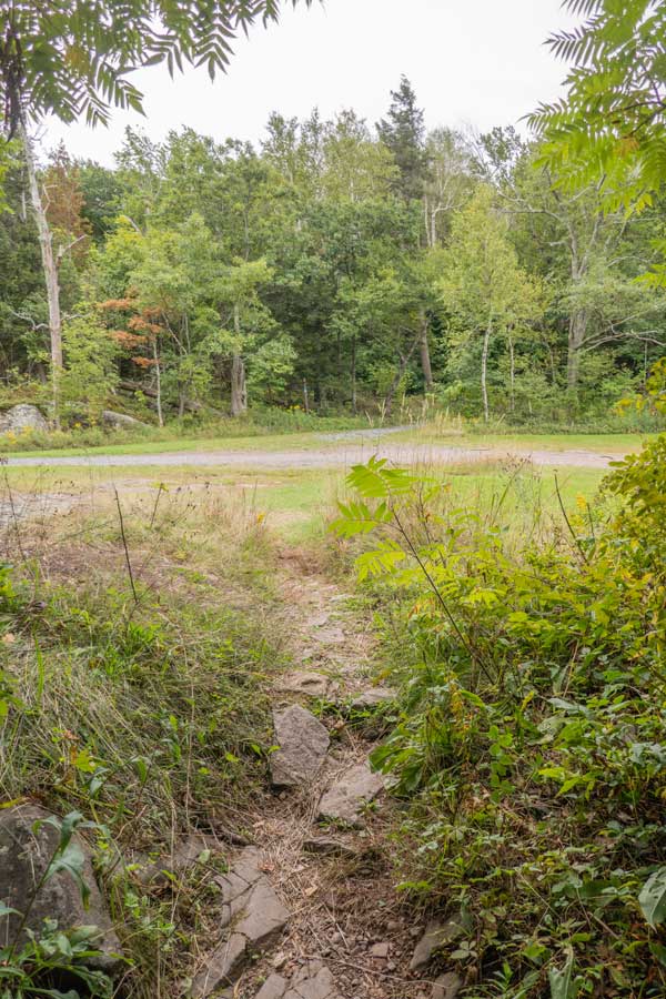
After walking up this trail for about a 1/2 mile, you will come to this intersection with a service road inside North-South Lake campgrounds. At this Intersection you want to take a RIGHT onto the Service Road.
You will continue up this road for about 500'.
On your right you will see a trail that runs down to the shores of the divide between North and South Lake. The road used to run all the way across, but was dug out when they created the campgrounds. |
|
 |
 |
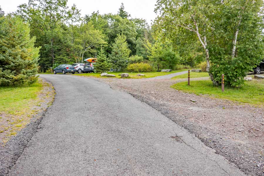
After walking up the service road 600 feet, you will come to a Y-Intersection for Loop #1. Take a RIGHT. |
After walking up the south side of Loop #1 375 feet, you will see a Foot Trail on your right. Take a RIGHT onto the foot trail
There are some very nice views and a great picnic area along this foot path. |
|
 |
Walk around this loop and continue on this paved road. It will turn towards the left as you are walking down it. |
|
 |
On your right you will see a small foot path with two rocks on each side of the path. It is located next to campsites #151 & #153. Take a RIGHT onto this foot path. The path is about 350 feet long. |
|
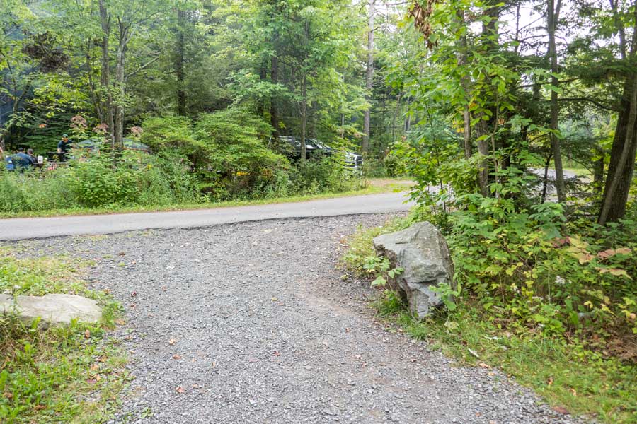 |
After walking up the foot path approximately 350 feet, take a RIGHT onto the paved road.
|
|
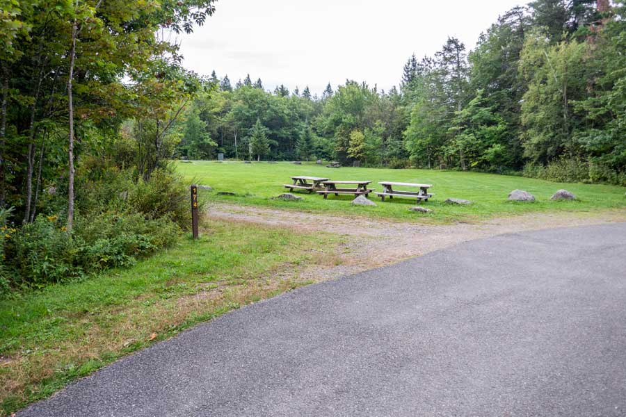 |
Then walk about 375 feet to campsite #174. Take a LEFT into the grass field.
Walk up grass lawn 150 feet to North Lake Road. Take a RIGHT onto North Lake Road. Walk 425 feet.
|
|
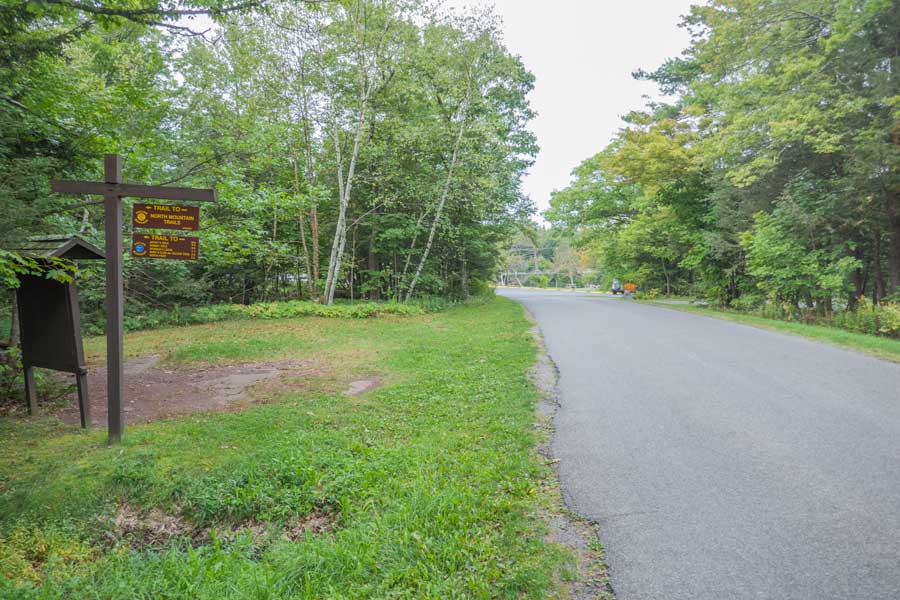 |
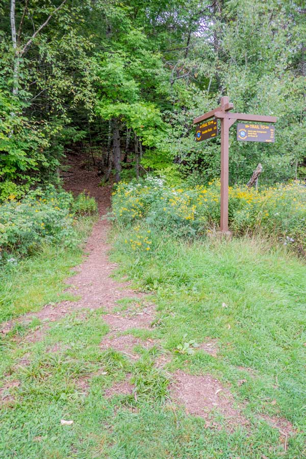
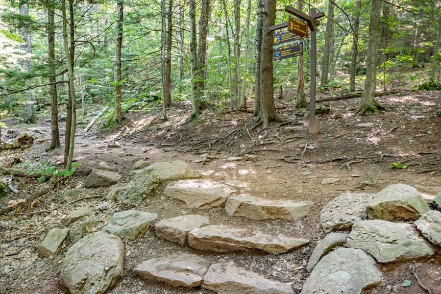
After walking down North Lake Road 425 feet, you will see trails on your left. Take a LEFT at the sign. |
|
 |
 |
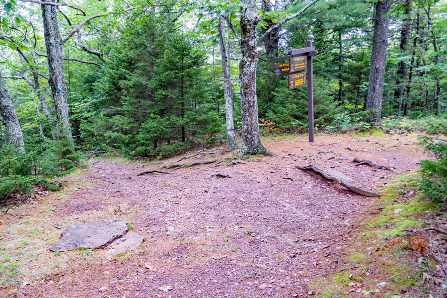
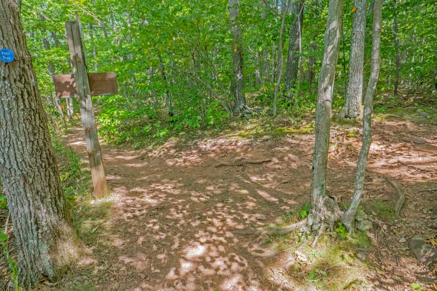
After turning left off North Lake Road onto the dirt trail, you will walk about 525 feet. You will come to a Y-intersection (in picture). You want to take a RIGHT by fireplace |
After a few steps, you will come to the Escarpment Trail and DEC Registration Box. You want to take a RIGHT and walk south about 1,000 feet. Left will take you to North Mountain. |
|
 |
 |
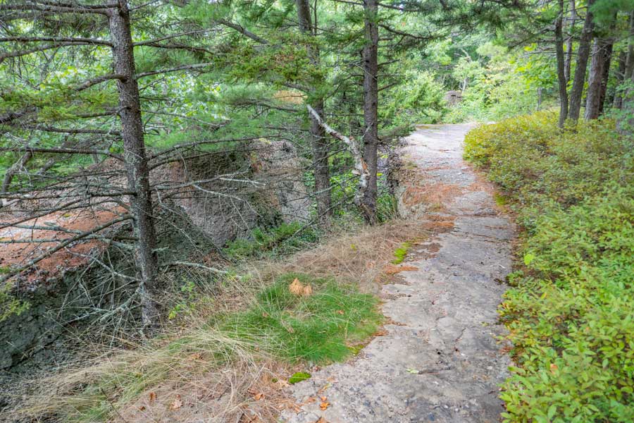
As you are walking south on the Escarpment Trail, you will encounter some picnic areas that are part of the North Lake Beach area. Keep going STRAIGHT down the Escarpment Trail. |
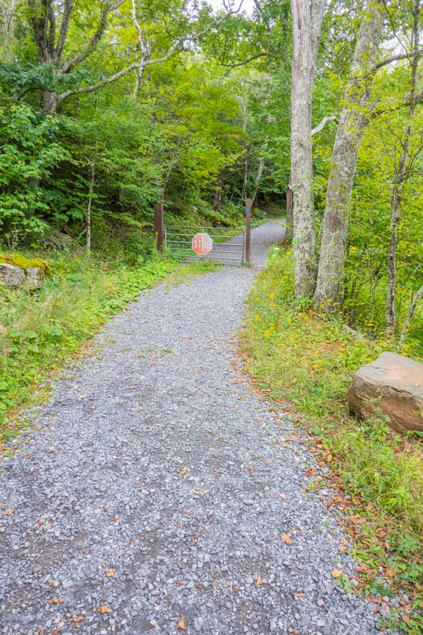
The trail will come to his opening. On your left (in the opening) is the old Cog Train Station. You want to walk STRAIGHT across the opening to the gravel road that goes up the hill. There is a gate with a stop sign on it. Sometimes the gate is open. |
|
 |
This is what the Cog Railway looked like 100-200 years ago. Today there is nothing left of it.
The opening is you are located at is top of the hill in this picture where the train stopped.
|
|
 |
 |
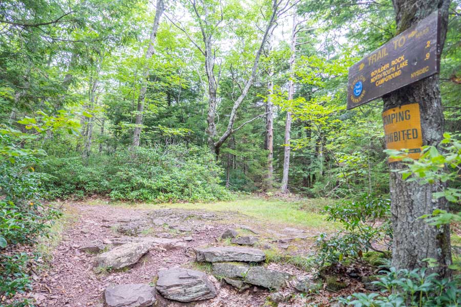
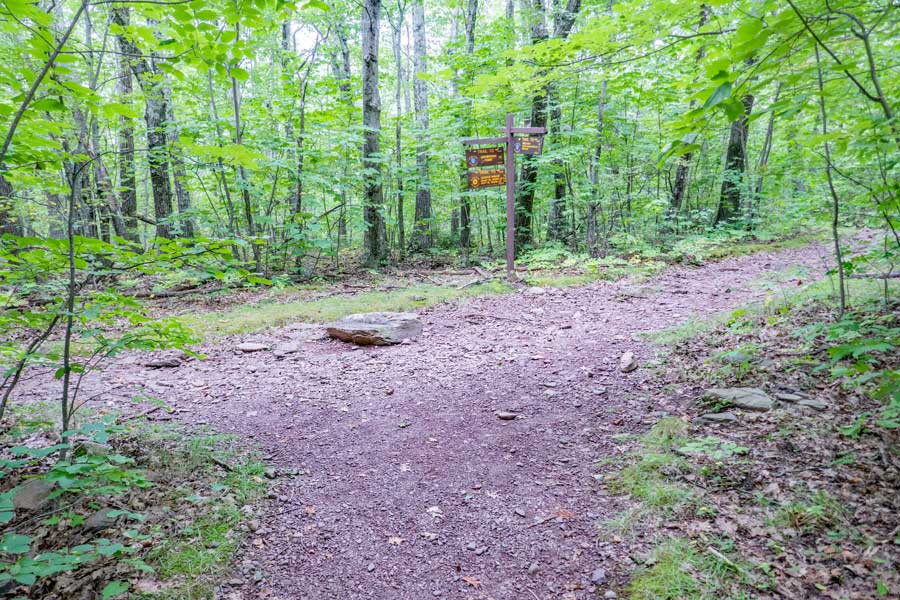
There is a gate with a stop sign on it. Walk around the gate and walk up the hill. Sometimes the gate is open. This gravel path is about 700 feet long.blockquote> |
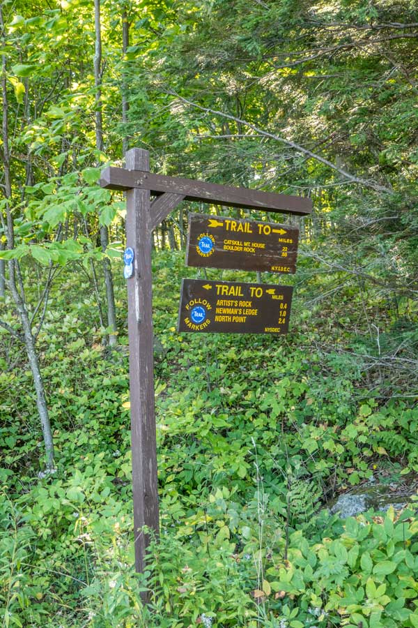
On the left side of the gravel road is a DEC Trail Sign |
|
 |
Take a LEFT at the Trail Junction. This road will lead you to the ruins of the Catskill Mountain House in about 700'
|
|
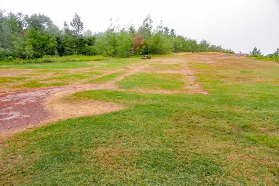 |
This is the ruins of the Catskill Mountain House. A few years ago part of the foundation still existing. But, today it is just a lawn where a large Hotel used to sit.
This picture was taken from the south side of the site looking north. To the right is a ledge that overlooks the Hudson Valley and Hudson River. |
|
 |
This is what the Catskill Mountain House used to look like 100-200 years ago. It was burned to the ground in the 1950's by the New York DEC. |
|
 |
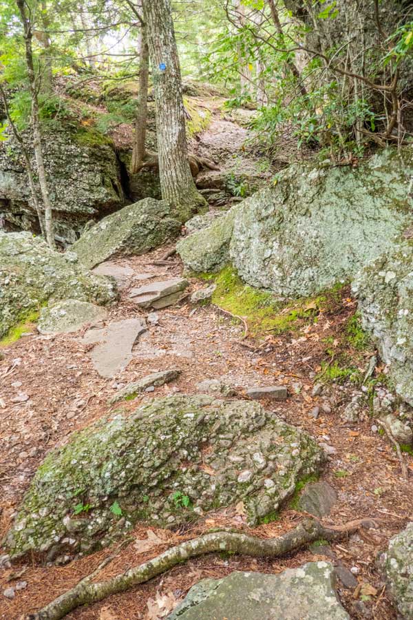 |
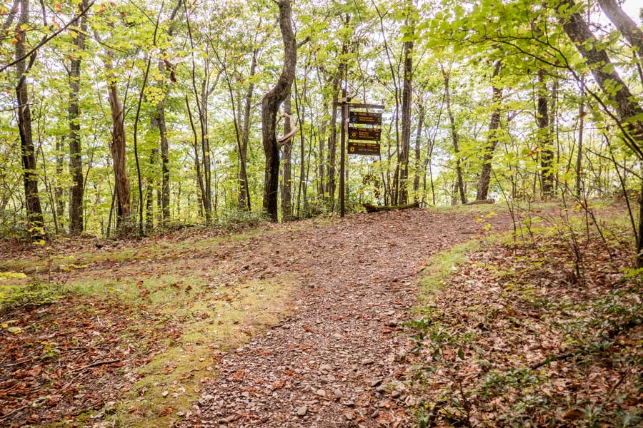
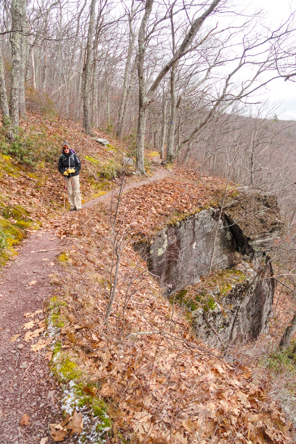
You will find that the Escarpment Trail continues into the wood on the SOUTH side of the Catskill Mountain House site. |
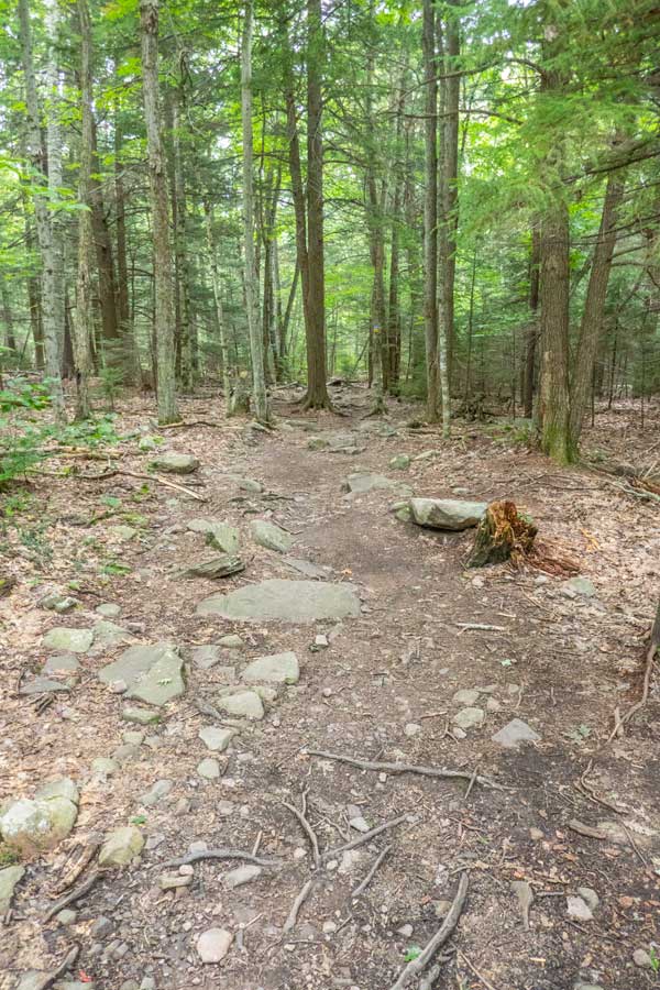
You will see a DEC Registration Box within the first 100 feet. The image on the right shows that the climb up the hill is fairly steep and rocky. But, it does not last long. In the Winter there are often ice flows, so bring microspikes or crampons. |
|
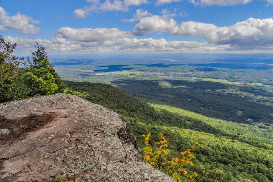 |
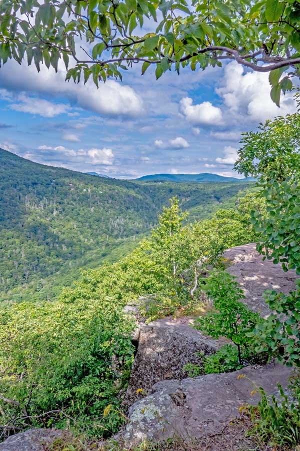
This picture is part of Eagle Ledge looking North over the Hudson Valley.
It is located about 1/3 of a mile from the site of the Catskill Mountain House. |
|
 |
This picture is part of Eagle Ledge looking North over the Hudson Valley. On a clear day you can easily see parts of the Hudson River from Kingston up to Albany. Further in the distance is the Berkshire Mountains. |
|
 |
About 850 feet south of Eagle Ledge is the Trail Junction for Boulder Rock. You want to take a LEFT to go to Boulder Rock. Right will bypass Boulder Rock. |
|
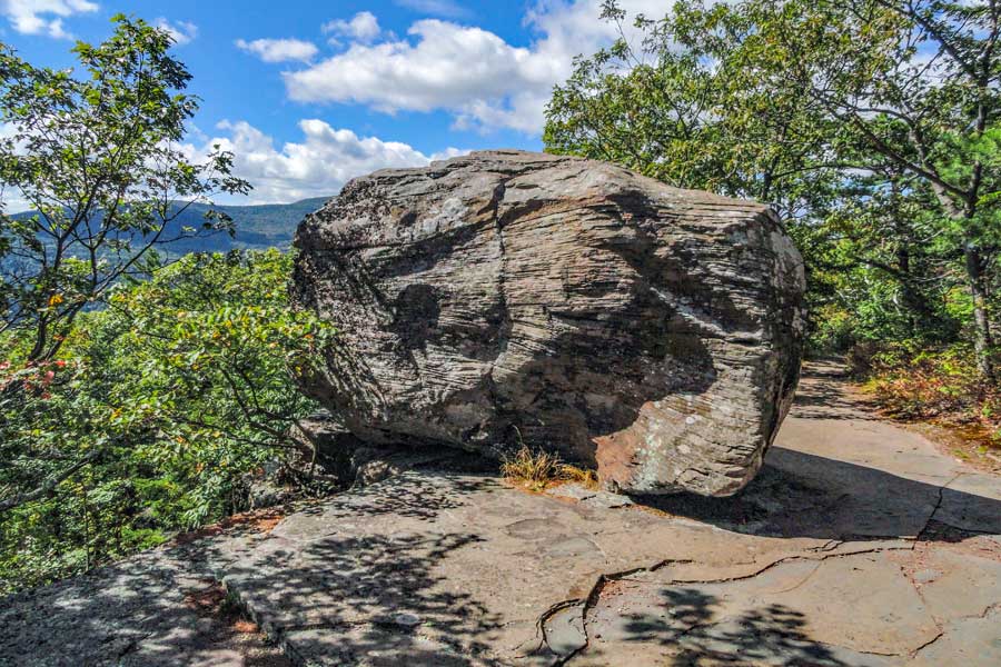 |
Boulder Rock is located approximately 500 feet south of the Trail Junction. It is a huge boulder that sites on a ledge. |
|
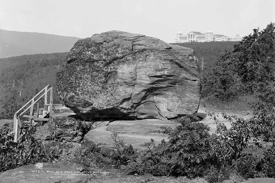 |
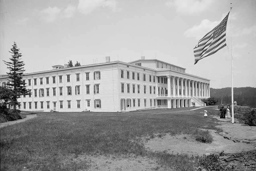
This is a historic picture of Boulder Rock 100+ years ago. Kaaterskill Hotel sits in the background. At the time it was one of the largest hotels in the world with 1,200 rooms. The stairs by Boulder Rock took you down a trail to Palenville Overlook. |
|
|
Very close to Boulder Rock is another view over the Hudson Valley. This is a great view spot, and a great place for lunch when you visit Boulder Rock. It is located about 250' from Boulder Rock.
When you get done hike back to Boulder Rock. Then hike past Boulder Rock and follow the edge of the ledge. The Escarpment Trail continues past Boulder Rock. |
|
 |
After a short distance you will see a large rock that has split off from the ledge you are walking on. This is Split Rock. The split rock goes for quite a ways down the trail. Just continue walking along the ledge. |
|
 |
After leaving Boulder Rock, you will walk almost a 1/4 mile. You will then come to a Trail Junction of the Escarpment Trail. You want to go LEFT towards the Kaaterskill Hotel Ruins.
Right would take you back to Eagle Ledge and the Catskill Mountain House ruins. |
|
 |
 |
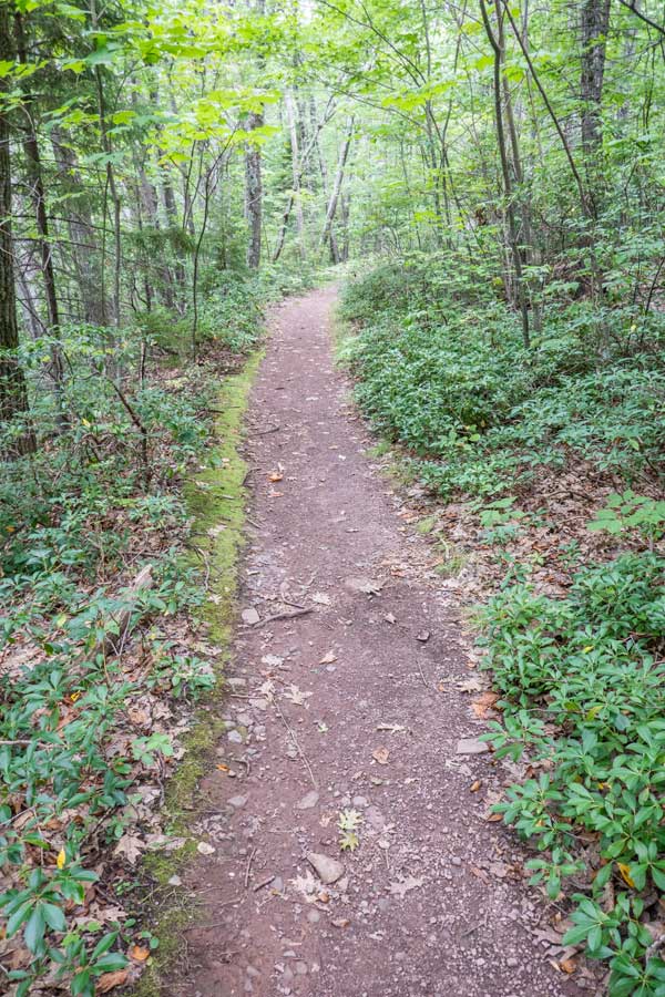
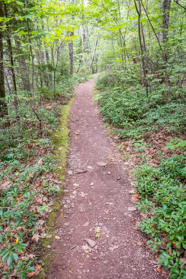
The trail between Boulder Rock and Kaaterskill Hotel Ruins is fairly good and easy walking. |
After hiking approximately 1/3 of a mile, you will see small trail on your right. Keep going STRAIGHT. This is the old Kaaterskill Hotel Road. It will take you down to the 3rd Ledge, and finally to South Lake Road. |
|
 |
After another 1/4 mile, you will come to the next Trail Junction near the ruins of the Kaaterskill Hotel.
At this Trail Junction you want to go LEFT and hike down the hill.
Right will take you up about 50' to another Trail Junction. This trail junction will take you on a loop around the ruins of the old Kaaterskill Hotel. Not much is left of the old Hotel. But, the water Cistern is still there along with a pond. At the time, it was the largest hotel in the United States with 1,200 rooms. It burned to the ground on September 11, 1924. |
|
 |
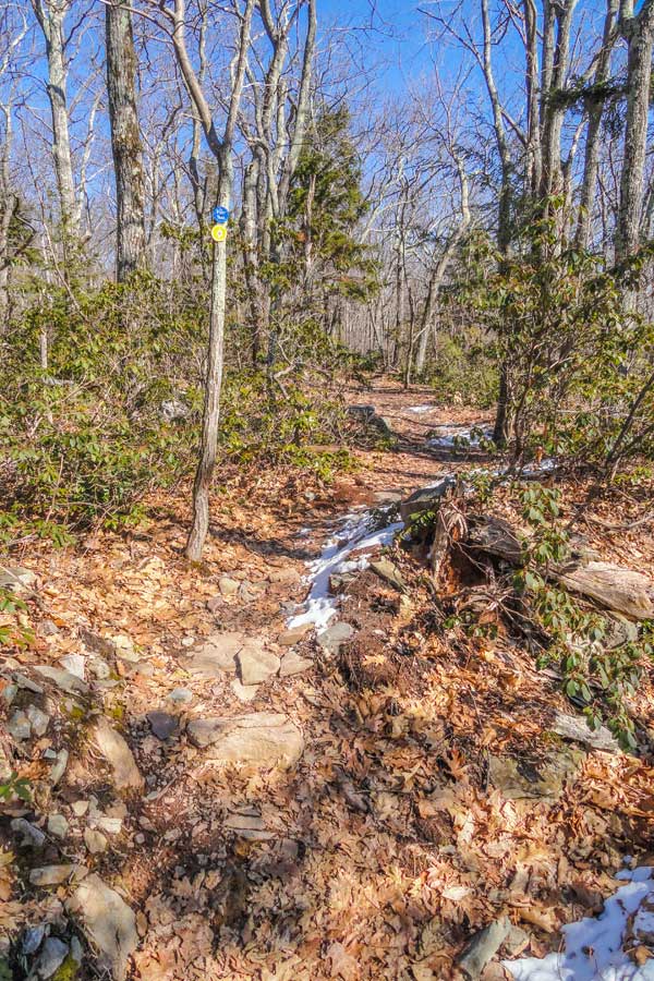 |
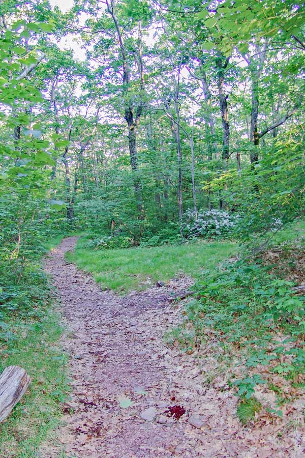
The trail down from the trail junction at the Kaaterskill Hotel and the Harding Road is sometimes smooth, and other times rocky and rutted. The trail drops over 200 feet in a 1/2 mile. |
The trail runs through some Mountain Laurel, and then descends down at a little steeper pace. |
|
 |
After walking down a 1/2 mile, you will come to this Trail Junction. Take a RIGHT.
Left will take you the Palenville Overlook & Indian Head. But, you can also take a side road down the Harding Road to Palenville, NY. |
|
 |
After walking 300 feet you will come to this trail junction. Take a LEFT onto the Southwestern section of the Escarpment Trail.
Straight will eventually take you back to the 4-way trail junction that leads to the Laurel House Road Parking Area, Scutt Road Parking Area, and the South Lake Parking Area. You can take this road to skip the Southwestern section of the Escarpment Trail. |
|
 |
 |
This is the beginning of the Southwestern section of the Escarpment Trail. This trail has a number of places where there is exposure. |
In the Fall season, fallen leaves give you more views, but are also slippery. |
|
 |
This is Inspiration Point. The views are best in the early morning and later in the afternoon.
Before you reach Inspiration Point, you will see a number of nice view points. The one in the picture is the best one, and also the last view point before you come to Sunset Ledge.
|
|
 |
 |
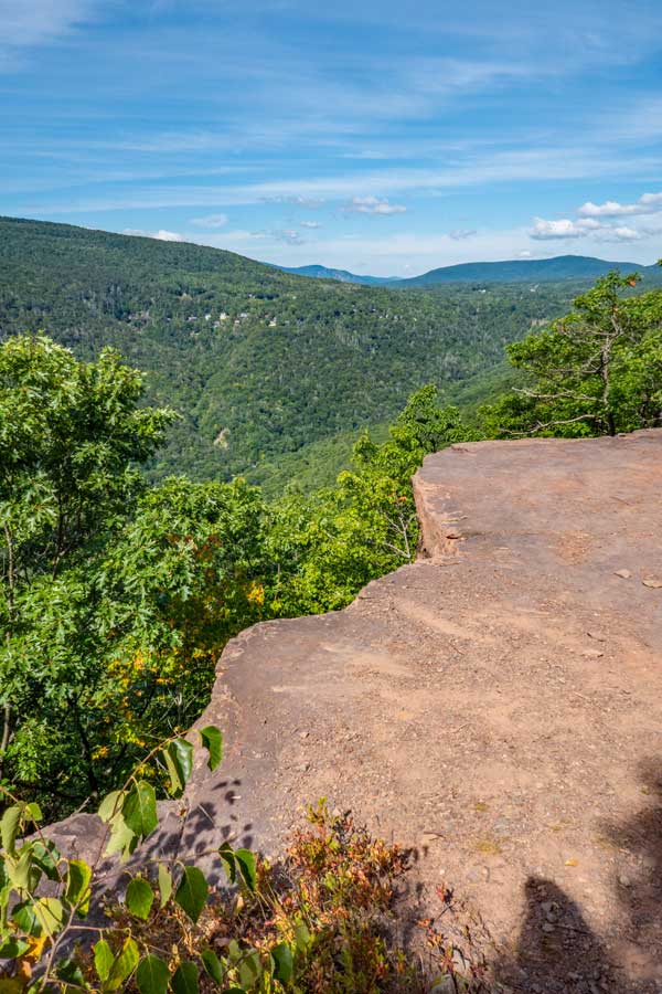
About 650' past Insipration Point, you will encounter Sunset Ledge.
The ledge is actually much bigger then what you see in the images. |
Many consider Sunset Ledge the best part of the hike, so take some time to enjoy this view point.
After you get done here, you need to hike up the rocky and moderately steep section to continue you hike. |
|
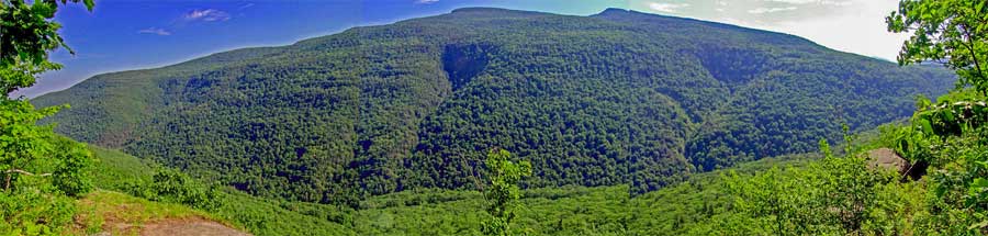 |
From several view points along this hike, you will be able to enjoy a wide view of the Kaaterskill Mountain Range. The peak on the left is Kaaterskill High Point, and the peak on the right is Round Top Mountain.
The Kaaterskill Clove has over 55 waterfalls in it. While most people only see Kaaterskill Falls, Kaaterskill Falls isn't the tallest, nor is it best one. Buttermilk Falls has 9 drops for a total of 549 feet. Many of the waterfalls are very difficult to get to. Some are exceedingly dangerous. |
|
 |
After enjoying the views at Sunset Ledge, you will climb up a steep and rocky hill. About 1/4 mile later you will come to this Trail Junction.
Go STRAIGHT. It will lead you to Council's Bluff, Layman's Monument, and the trail junction to the bottom of Kaaterskill Falls. The next 1/2 mile is the most difficult part of the hike. It goes down a steep and rocky path to Layman's Monument, and then climbs back up a steep and rocky path.
Some people will take a right onto the Short-Cut Path to exit back to their car. Look at the map for how to return back to your car. |
|
 |
 |
Along the way you will come to this small ledge that gives you a nice view of the Kaaterskill Clove. |
A little further down you will come to Council's Bluff. This is where the Mohawk Indians would perform ceremonies in the years prior to 1650. The North-South Lake was abandon by the Mohawk Indians between the years 1650 and 1825. Some Mohawk Indians did live in the general region during that time period. After 1825, the Catskill Mountain House was built. |
|
 |
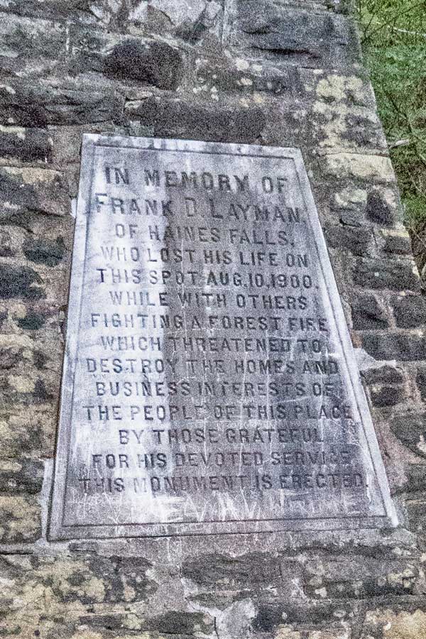 |
At the bottom, you will come to Layman's Monument. It states, "IN MEMORY OF FRANK D LAYMAN, OF HAINES FALLS, WHO LOST HIS LIFE ON THIS SPOT AUG 10, 1900, WHILE WITH OTHERS FIGHTING A FOREST FIRE WHICH THREATENED TO DESTROY THE HOMES AND BUSINESS INTEREST OF THE PEOPLE OF THIS PLACE BY THOSE GRATEFUL FOR HIS DEVOTED SERVICES THIS MONUMENT IS ERECTED."
In recent years, people have been defacing the monument. Please do not do that. It is disrespectful. |
200 men fought the fire that day. Frank Layman was 25 years old when he died on August 10, 1900. He was paid $5/day to fight the fire. Another worker who jumped off a ledge into jagged rocks to escape. Frank Layman was engulfed in flames before he could get to the ledge. Twilight Park Association paid for the monument to be built. During the summer of 1900, the Summer was hot and exceedingly dry. There was only 18 inches of water left in South Lake. Frank Layman's monument was built where his charred body was found. He had to be indentified by his watch. |
|
 |
After you leave Layman's Monument, you will hike up a steep and rocky hill before it levels out. You will encounter this Trail Junction about 4/10 of a mile later. This Trail Junction is for going to the bottom of Kaaterskill Falls.
For this hike, you want to continue STRAIGHT.
If you want to do a side trip, then you can go left down to the bottom of Kaaterskill Falls. It has several hundred steps and decends down 250-300' in elevation. This is a difficult side trip. You can also do a side trip to the viewing platform at the top of Kaaterskill Falls. If you choose the later choice, then continue straight. |
|
 |
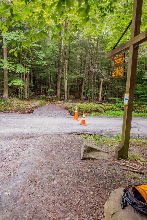
About 750 feet later, you will come down the steps in this picture.
If you parked at the Laurel House Road DEC Parking Area, take a LEFT. About 1/4 mile. Also, if you want to see the Kaaterskill Falls from the viewing platform, take a left, and look for the sign that points you to the viewing platform.
If you parked at Scutt Road DEC Parking Area, you want to take a RIGHT. When you encounter the 4-way Trail Junction, you then want to take a left (Look for the Registration box). Then follow the trail back to your car. Look at the map. About 2/3 mile.
If you parked at the South Lake Parking Area, you want to take a RIGHT. When you reach the paved road in the campground, then take a left back to your car. About 2/3 mile.
|
|
|
S E C T I O N S
|
W E A T H E R
|
O T H E R
|