Mt Tobias |
 |
| |
| |
|
OVERVIEW of Hike to MT TOBIAS |
| | Trail Type: | BUSHWHACK to summit - unofficial trail on Lower Loop |
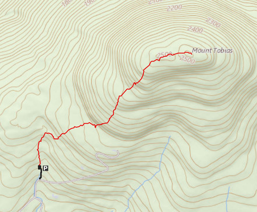
| | Distance: | About 1.5 miles round trip from DEC parking lot to the summit of Mt Tobias. |
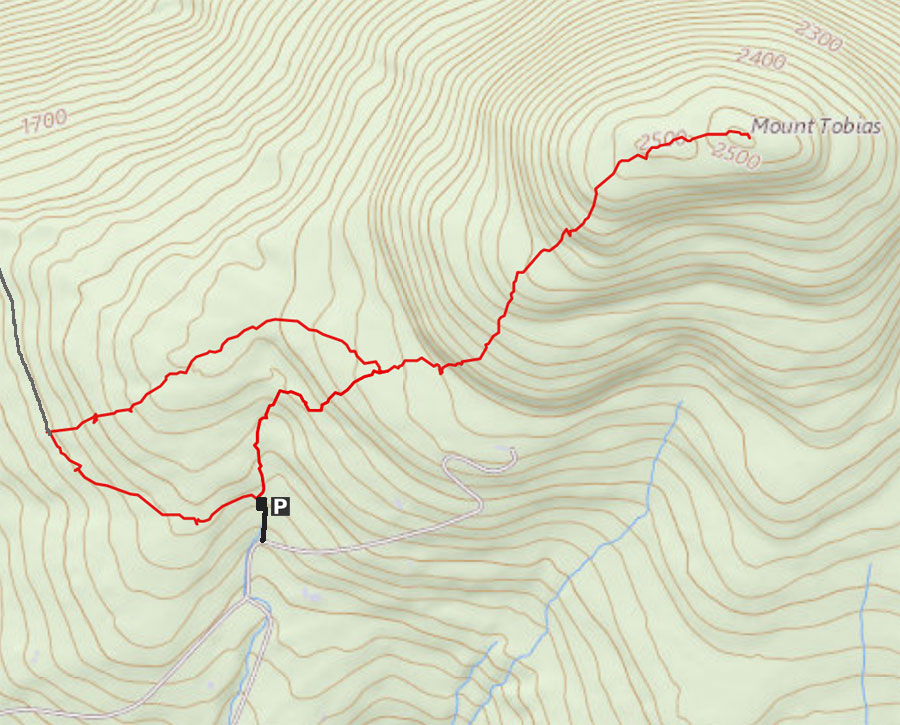
| | Distance: | About 3.2 miles round trip from DEC parking lot via loop trail & summit of Mt Tobias. |
| | Time: | Average 2.25-to-3.50 hours round trip |
| | Elevation Gain: | 717 feet from parking lot to the summit. |
| | Best Time to Hike: | Anytime - Difficult in the Winter - Parking Area not plowed. |
| | Difficulty: | Difficult - BUSHWHACK |
| | Peak Elevation: | 2,549' |
| | |
| | | USGS Official Names: | Mount Tobias (ID: 967590) |
| | USGS Elevation: | 2,526' (USGS) |
| | USGS Tobias-WGS84: | 42.0584244, -74.2157003 |
| | USGS Tobias-Lat-Long: | N42 03 30, W74 12 56 (Degree, Minute, Second) |
| | USGS Tobias-GPS: | N N 42 03.505, W 74 12.942 |
| | USGS Tobias-UTM: | 18N 564895, 4656561 |
| | USGS Official Map: | Bearsville Topographical Map (free) |
| | |
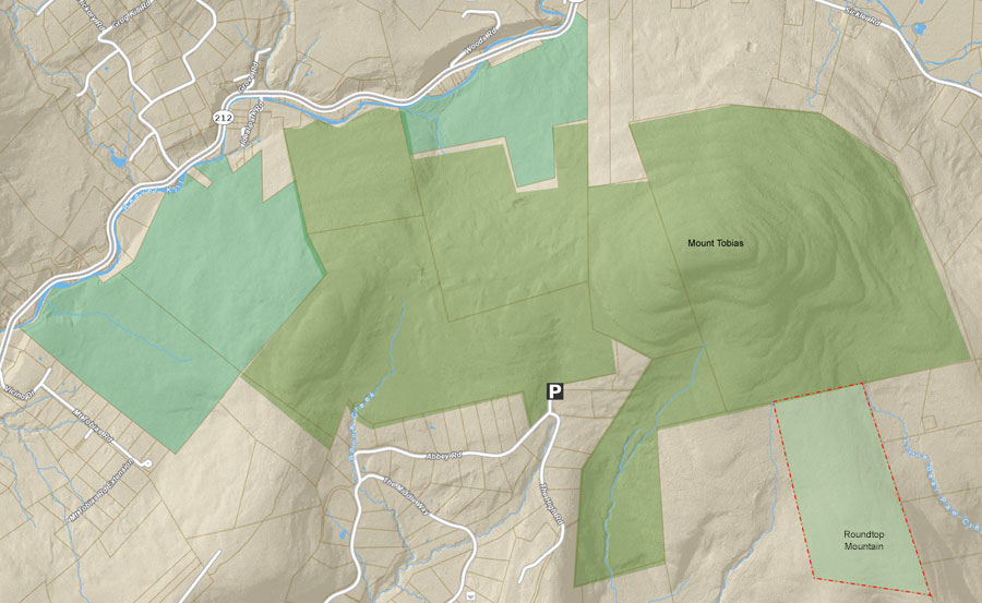
| | | DEC Information: | NYS DEC information on Phoenicia - Mt Tobias Wild Forest |
| | |
| | | DEC Trail GIS Map: | DEC GIS Map of Phoenicia - Mt Tobias Wild Forest (free) |
| | |
| | | Digital Mapper: |
Topo
Terrain
Satellite |
| | |
| | | Access Methods: | Foot and snowshoe. |
|
|
|
| | DIRECTIONS TO TRAILHEAD |
| | DEP Parking Lot WGS84 (DEC): 42.052283, -74.2269 - Elevation is approximately 1,855 feet |
| | DEP Parking Lot Deg/Min/Sec: N42 03 08, W74 13 36 - Elevation is approximately 1,855 feet |
| | DEP Parking Lot GPS: N 42 03.137, W 74 13.614 - Elevation is approximately 1,855 feet |
| | DEP Parking Lot UTM: 18N 563974 4655870 - Elevation is approximately 1,855 feet |
| |
|
| | Take New York State Thruway to Exit 19 (Kingston). |
| | Take a RIGHT out of the NYS Thruway entrance road on Traffic Circle to Rt 28 West |
| | Go approximately 17.3 miles to Winnie Road |
| | Take a RIGHT onto WINNINE Road |
| | Go approximately 7/10 of a mile on Winnie Road to Wittenberg Road. |
| | Take a RIGHT onto WITTENBERG Road. |
| | Go approximately 1.2 miles on Wittenberg Road to Abbey Road. |
| | Take a LEFT onto ABBEY Road. |
| | Go approximately 2.3 miles on Abbey Road to the DEC Parking Area. |
| | The DEC Parking Area is HARD to find - Look for a DEC Forest sign on a tree with a very rough driveway |
| | If you come to the end of Abbey Road, you have gone 1/2 mile too far - turn around and go back 1/2 mile |
| | Please note that the road to the DEC parking area is VERY ROUGH - minimum would be a Subaru Outback (AWD needed) |
| | Take LEFT into the DEC/DEP Parking Area (room for 5 cars). |
|
|
NOTES ABOUT THIS HIKE |
| | The hike is BUSHWHACK! There are NOT official DEC Trails on this hike. There is a small trail that goes for about 1/3 of a mile, and then disappears. You need to have skills of route finding and bushwhacking skills. You should hike with a partner. It is easy to become disoriented or lost on this hike.
There is also a loop trail you can do if you find the hike too short.
Some think of this hike to the summit of Mt Tobias as a Mini-North-Dome hike. Just as steep, but less climbing. |
|
|
MILEAGE CHART |
| | Mile Point | Altitude | Notes for hike to Mt Tobias |
| | 0.0 | 1,855 | DEC Parking Area |
| | 0.75 | 2,549 | Summit of Mt Tobias |
| | 1.50 | 1,855 | DEC Parking Area |
| |
|
| | Mile Point | Altitude | Notes for hike to Loop Trail & Mt Tobias |
| | 3.20 | - | Loop Trail & Summit of Mt Tobias |
|
|
Hike to Ticetonyk View Point in the Phoenicia - Mt Tobias Wild Forest |
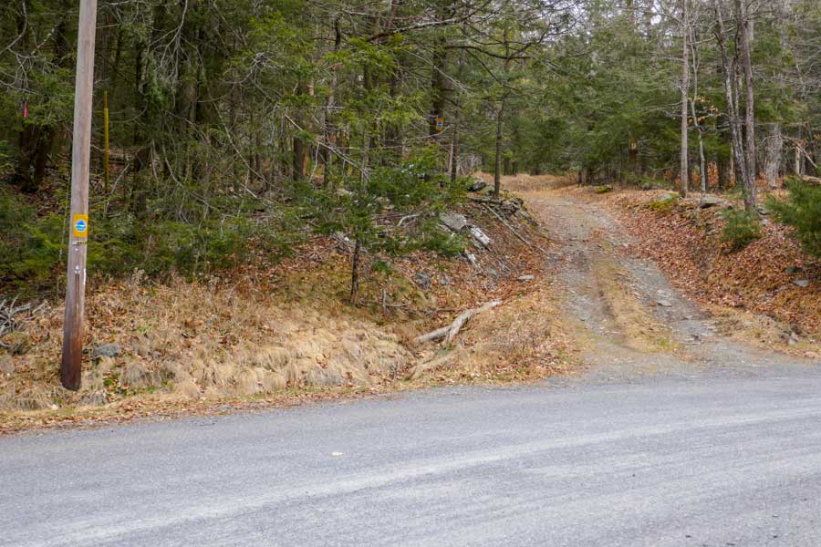 |
The image on the LEFT is the entrance to the DEC Parking Lot with off-road parking. Look for the DEC sign on the telephone pole. The entrance to the Parking Area is VERY rough. You need a vehicle with high ground clearance to get up the driveway. Unlikely it is plowed in the Winter. If you come to the end of Abbey Road, then you have gone 1/2 mile too far. |
|
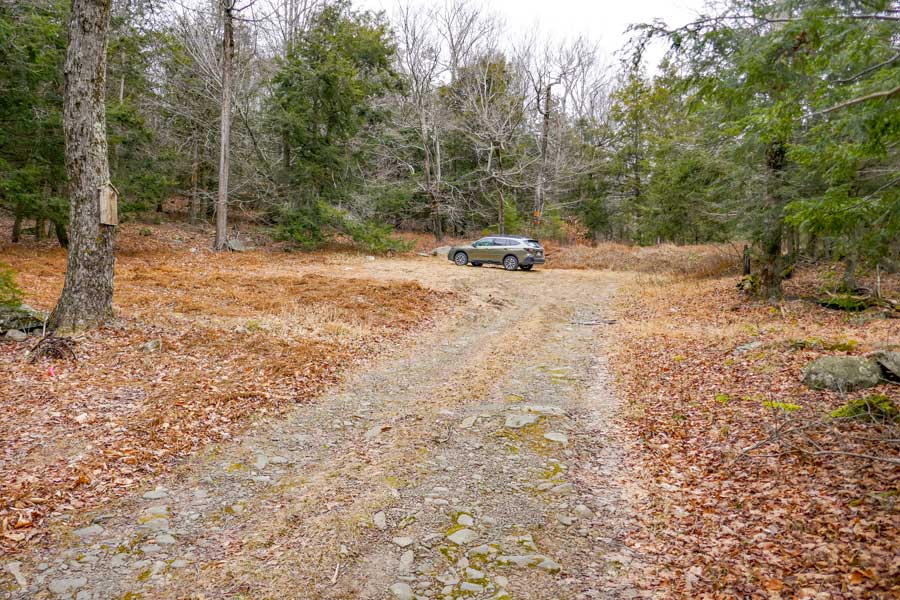 |
This is the DEC Parking area. It holds 4-5 cars. |
|
 |
 |
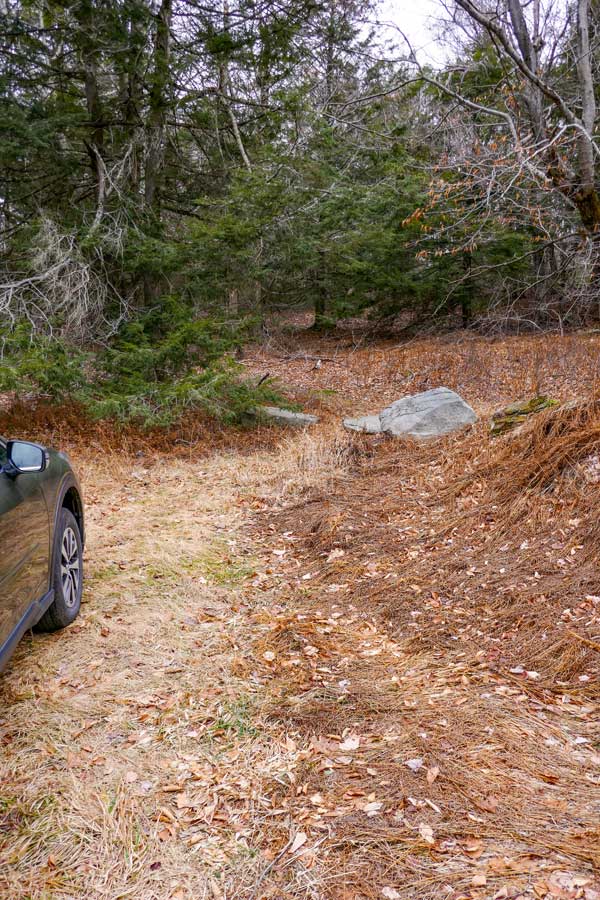
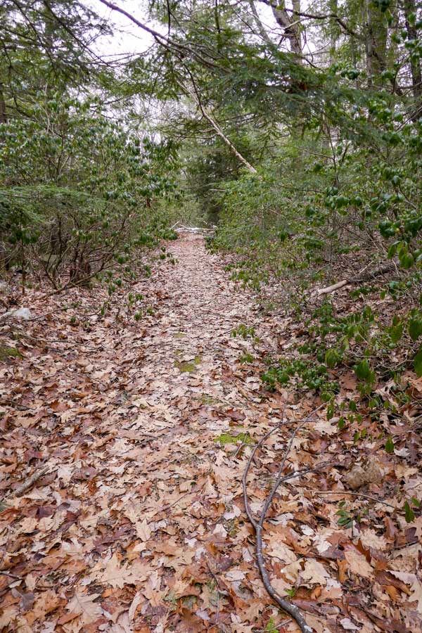
The picture on the LEFT show the Trailhead to the Loop Trail and the Summit of Mt Tobias. LEFT will take you on the Loop Trail. RIGHT will take you to the summit of Mt Tobias.
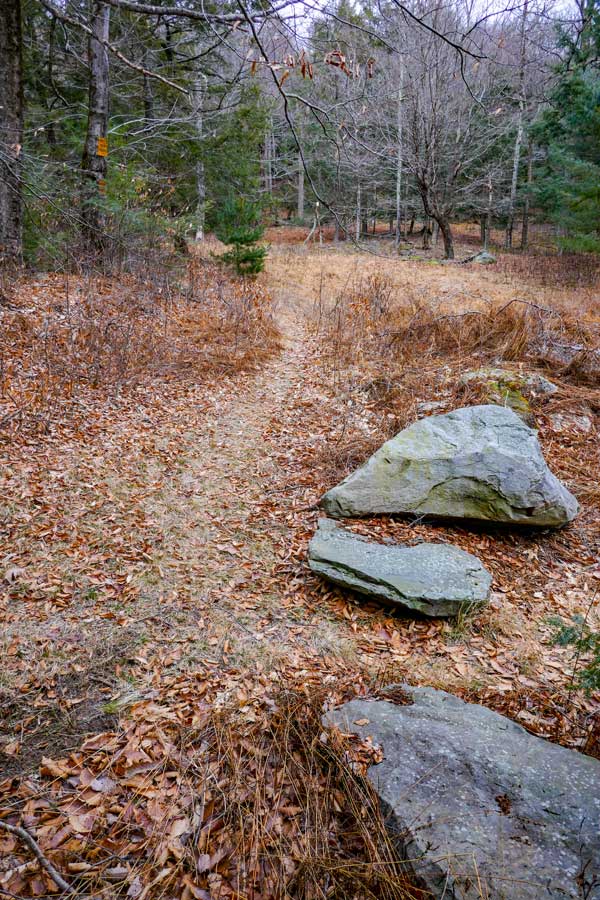
The picture on the RIGHT shows the trail to Mt Tobias. Trail ends within 1/4 of a mile.
|
|
 |
THIS PICTURE IS ONLY FOR THE HIKE ON THE LOOP TRAIL - In the beginning, it is a "Jeep Trail". But, it then changes to an overgrown "Jeep Trail" (see picture on left).
As you are hiking down the trail, you need to look closely for the Trail Junction. It is a side trail that goes up the hill. It is on the RIGHT side of the trail. Very easy to miss the side trail. If you go too far, you may see water in the trail.
Once on the side trail, it goes up a steep hill for a ways. You will find trees blown over the trail that you have to get around. You will come to a section where there are less trees and brush. As you walk through the half-open area, you should see the steep "step-ledges" on the LEFT that go up to Mt Tobias. To go back to the DEC Parking Area, you need to go RIGHT. Finding the way back to the DEC Parking area is difficult. The entrance back to the Parking Area goes around the beginning of a stream down in a small gully. It is still in the half-open area, but not in the conifer forest.
|
|
|
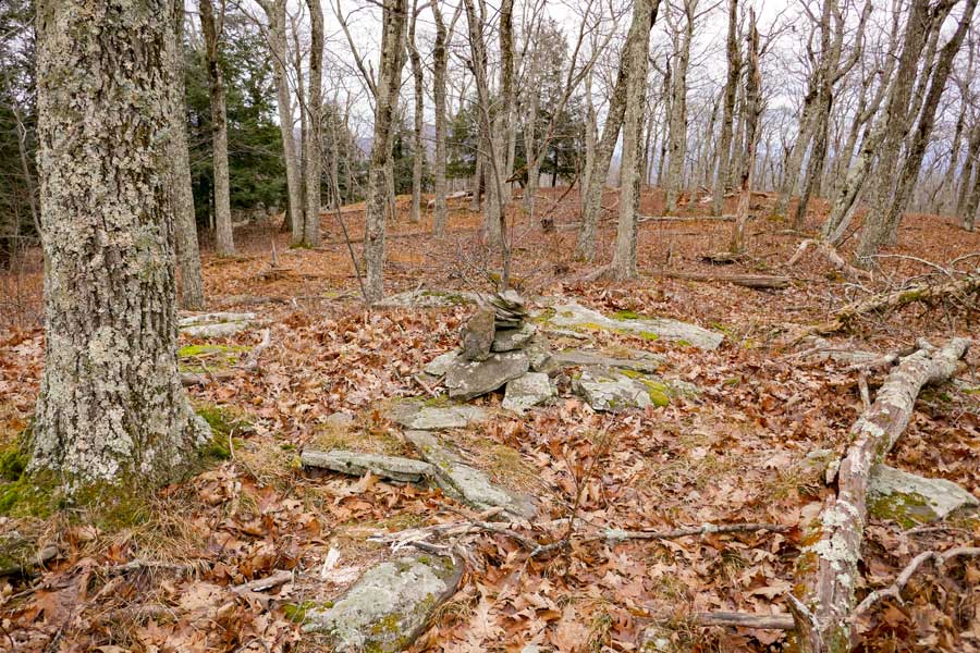
This is the summit of Mt Tobias The summit is on the EAST side of the top of the mountain. There are NO views. In the winter months you can see down into the valley.
|
|
|
S E C T I O N S
|
W E A T H E R
|
O T H E R
|