OVERVIEW of Hike of the Warner Creek Trail |
| | Trail Name: | Phoenicia Trail
 (Mt Tremper Parking Area TO Mt Tremper Fire Tower)
 |
| | Trail Name: | Warner Creek Trail
 (Mt Tremper Fire Tower TO Plateau Mtn
 |
| | Trail Name: | Devil's Path
 (Plateau Mtn TO Rt 214 or Mink Hollow)
 |
| | |
|
| | Trail Type: | Official DEC Trail |
| | Forest: | Phoenicia - Tobias Wild Forest |
| | Forest: | Indian Head Wilderness |
| | Distance: | 15.93 miles (Mink Hollow PA - North) OR 16.48 miles(Rt 214)
Warner Creek Trail is 13.64 miles(Including Phoenicia Trail) |
| | Time: | Average 1-2 days |
| | Elevation Gain: | 750 feet TO 3,824' = 3,074' total elevation gain. |
| | Mtn names: | Mount Tremper to Edgewood Mtn to Plateau Mtn |
| | Best Time to Hike: | Summer |
| | Difficulty: | Moderate |
| | Peak Elevation: | 3,824' |
| | |
|
| | USGS Official Names: | Tremper Mountain (ID: 967788) |
| | USGS Elevation: | 2,710' (USGS) |
| | USGS Tremper-WGS84: | 42.074535, -74.278202 |
| | USGS Tremper-Lat-Long: | N42 04 28, W74 16 41 (Degree, Minute, Second) |
| | USGS Tremper-GPS: | N 42 04.472, W 74 16.692 |
| | USGS Tremper-UTM: | 18N 559708 4658304 |
| | |
|
| | USGS Official Names: | Plateau Mountain (ID: 973359) |
| | USGS Previous Names: | Stony Mountain (changed in 1928) |
| | USGS Summit-Elevation: | 3,845' (USGS) |
| | USGS Plateau-Summit-WGS84: | 42.1378671, -74.1743088 (DEC-WGS84) |
| | USGS Plateau-Summit-GPS: | N 42 08.272, W 74 10.459 (GPS) |
| | USGS Plateau-Summit-UTM: | 18N 568234, 4665414 (UTM) |
| | USGS Plateau-Summit-Deg, Min, Sec: | N42 08 16, W74 10 27 (Degree, Min, Sec) |
| | |
|
| | USGS Official Map: | Phoenicia Topographical Map (free) |
| | |
|
| | USGS Official Map: | Bearsville Topographical Map (free) |
| | |
|
| | USGS Official Map: | Hunter Topographical Map (free) |
| | |
|
| | DEC Information: | NYS DEC information on Phoenicia - Mt Tobias Wild Forest |
| | |
|
| | DEC Trail GIS Map: | DEC GIS Map of Phoenicia - Mt Tobias Wild Forest (free) |
| | |
|
| | Digital Mapper: |
Topo
Terrain
Satellite |
| | Access Methods: | Foot & snowshoe |
|
|
| | DIRECTIONS TO TRAIL HEAD |
| | DEP Parking Lot WGS84 (DEC): 42.066017, -74.303167 - Elevation is approximately 750 feet |
| | DEP Parking Lot Deg/Min/Sec: N42 03 57, W74 18 11 - Elevation is approximately 750 feet |
| | DEP Parking Lot GPS: N 42 03.961, W 74 18.190 - Elevation is approximately 750 feet |
| | DEP Parking Lot UTM: 18N 557651 4657341 - Elevation is approximately 750feet |
| |
|
| | Take New York State Thruway to Exit 20 (Saugerties). |
| | Take a LEFT out of the NYS Thruway toll booths onto Rt 32 South. |
| | Go approximately 0.2 miles west on Rt 32 |
| | Take a RIGHT onto Rt 212 at the red light (Hess gas station across the road) |
| | Go 9 miles into the Village of Woodstock, NY |
| | Continue 1.8 miles to Berarsville, NY |
| | Take a RIGHT at Bearsville and stay on RT 212 to Phoenicia |
| | Continue 9.2 miles on Rt 212 |
| | Take a RIGHT onto Rt 40 |
| | Go 2.0 miles on Rt 40 |
| | The DEC Parking lot is on the RIGHT side of the road. |
|
|
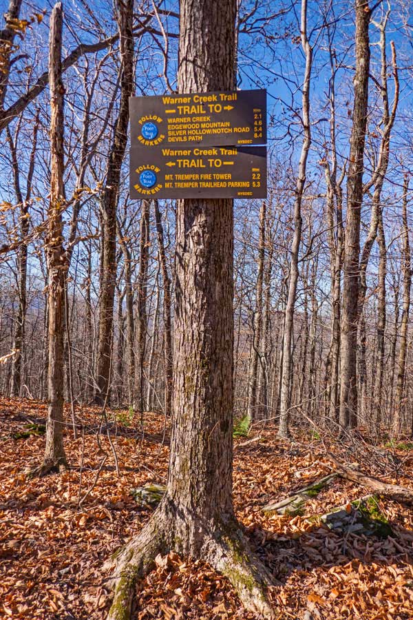
Notes About the Warner Creek Trail |
| | The Warner Creek Trail is great hike for the experienced hiker. The hike has a number of long climbs. Nothing too technical. During the hike you will be required to get across Warner Creek. There is NO bridge across Warner Creek. In the summer, you can find your way across it. In the colder months, when the water level is higher, you will need to find an old tree across the creek. You may have to search for a while to find one. If the temperatures are down or below freezing, you will need microspikes. If the creek is raging after a major storm, it probably will not be safe to cross or ford.
If you plan on shortening the hike, there are two trails that join to the Warner Creek Trail. The first one is is the Willow Trail. It can shorten the hike by approximately 3.4 miles. The second one is from Notch Inn Road Trail from Edgewood off Rt 214. Some people use this as a shorten version of the Warner Creek Trail. But, it misses the section of the trail up Plateau Mountain, which is exceptionally wild. Some consider it the best part of the hike.
The section of the Warner Creek Trail that goes up the trail from Silver Hollow Notch to the Devil's Path is exceptionally wild and beautiful. There is a beautiful view point near the top.
Most people hike the Warner Creek Trail from the South to the North. But, you can hike it in the other direction.
Hiking Warner Creek Trail is a nice hike up the old jeep trail to the Warner Creek Trail Fire Tower. The parking lot has been moved 3/10 of a mile down the road. The DEC parking lot is right next to the Rt 40. The trail head starts next to the DEC sign. Walk over a couple wooden bridges. The hike immediately climbs up 100 vertical feet up the stairs made out of rocks. Then for the next 1/2 mile the trail goes over fairly level ground.
After 3/10 of a mile, you will be joined with the old jeep trail to the Warner Creek Trail Fire Tower. The DEC registration box is at the junction of the trail and jeep trail. Make sure that you register for the hike. Then head up the old jeep trail.
NOTICE: Timber Rattlesnakes can be found anywhere near or on the Phoenicia Trail. There is a Rattlesnake den about 100 feet off the trail in the old blue stone quarry at elevation 1,450' (on trail - actual quarry is around 1,500'). It has been reported that there are approximately 100 Timber Rattlesnakes in the den at the old blue stone quarry on Mount Tremper. There is an old road that leads into the quarry. Picking up rocks in the quarry is an easy way to get bit. Rattlesnakes will come down and sit on the side of the trail, or even in the trail. They can be found anywhere on the mountain from Spring until late Fall. But, most are found around 1,450'. Before you do this hike, you should become knowledgeable about Rattlesnakes. Click here to learn about them.
The old jeep trail zig-zags up a number of switch backs. It is a fairly rocky path. When the rocks are wet, they are particularly slippery. From time-to-time you will drift in-and-out of conifer forest. Around 2,600' the old jeep trail will level off to a very easy grade.
There are two lean-to on Phoenicia Trail. The first Lean-To on Tremper Mountain is the Baldwin Lean-To at 2,100 feet. The second Lean-To on the Phoenicia Trail is at 2,700 feet. The second Lean-To on the Phoenicia Trail is called the Tremper Mountain Lean-To. The second Lean-To is 250 feet away from the Tremper Mountain Fire Tower. There is also a Spring around 2,200 feet. The Tremper Mountain Fire Tower has been restored. Also the Tremper Mountain Fire Tower is limited to a maximum of six people at one time. Most of the trees around the Fire Tower have now grown up to almost the full height of the tower, so the view is becoming limited.
Prior to 1836 Phoenicia Trail had a significant amount of Hemlock Trees. Between 1836 and 1879, they removed virtually all of the Hemlock trees from Phoenicia Trail. the Hemlock trees were harvested for the bark. They used the bark for tanning leather. Tremper Mountain has had a number of forest fires. They had forest fires in the years 1881, 1888, 1916, and 1917. The large Tremper House Hotel was built in 1979. It was located near Phoenicia Trail. The first part of the Phoenicia Wild Forest was first acquired between 1906 and 1910.
The Tremper Mountain Fire Tower was built in 1917, and was built to replace the fire tower on Slide Mountain. It was used up until 1971. After 1971, the fire tower was abandon, and fell into disrepair. The Tremper Mountain Fire Tower was restored and opened to the public on June 9, 2001. The Tremper Mountain Fire Tower is 47 feet high.
Warner Creek Trail got it's name from the owner and founder of the Tremper House Hotel. His name was Major Jacob Tremper. |
|
|
MILEAGE CHART |
| | Distance | Mile Point | Altitude | Notes |
| | 0.00 | 0.00 | 750' | DEC Parking Lot on Rt 40 |
| | 2.84 | 2.84 | 2,741' | Tremper Mtn Fire Tower |
| | 2.20 | 5.04 | 2,410' | Trail Junction for Willow Trail |
| | 2.32 | 7.36 | 1,485' | Cross/Ford Warner Creek |
| | 2.13 | 9.49 | 2,982' | Edgewood Mountain Summit |
| | 1.13 | 10.62 | 2,341' | TJ to Warner Creek Tr & Notch Inn Road Tr |
| | 3.02 | 13.64 | 3,824' | End of Warner Trail - Devil's Path |
|
|
Hike Phoenicia Trail & Warner Creek Trail |
 |
 |
The DEC Parking Lot is located right next to Rt 40. The parking lot holds approximately 10 cars. There is another parking lot about 2/10 of a mile towards Phoenicia, which holds approximately 8 cars. |
The trail head is right next to the DEC message board. It starts by crossing several wooden bridges. You will then climb 100 vertical feet up a steep hill that has stone steps.. |
|
 |
 |
This is a picture of the steep climb, looking backwards. There are stone steps up the steep climb. When they are wet, they are quite slippery. |
After you climb the steep hill, you will then walk down a fairly level path for 1/4 mile. This hike will link you up with the Jeep trail that will take you to the top of Mount Tremper and Warner Creek Trail Fire Tower. |
|
 |
 |
At mile post 0.30 miles, the trail will meet with the jeep trail. At this intersection is a DEC Registration box. Please register for the hike. |
Like many of the fire tower hikes, the jeep trail to the Mount Tremper Fire Tower has a steady incline that never seems to stop. This trail does the same. |
|
 |
At mile post 1.18 miles and elevation 1,450' feet you will see a large blue stone quarry on your left. It is about 50 vertical feet up the side of the mountain. There is a Timber Rattlesnake den in this quarry. It is possible to see a Timber Rattlesnake anywhere on the mountain, but you are most likely to see one at this particular location. Timber Rattlesnake's body are as thick as a man's forearm. They usually sit coiled up waiting for prey. They usually will not rattle until you are very close to them. If you step within 3 feet of them, or step on them, they will strike. They like to be left alone. |
|
 |
 |
Here are two more pictures of the steady uphill climb up the Jeep trail. There are a number of switchbacks to keep the grade steady. |
|
 |
Here is a picture at one of the western switchbacks that shows the valley floor below. |
|
 |
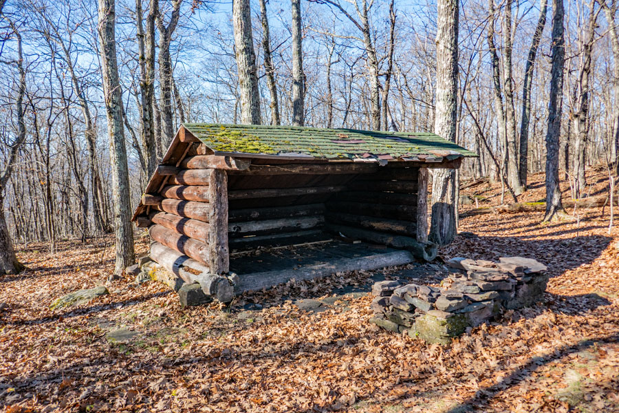
At mile post 2.03 (elev 2,100') you will see a side trail on the RIGHT that leads to the Baldwin Memorial Lean-To. The Lean-to is hard to see when the leaves are on the trees. It is even harder to see when there are ground plants growing. The Baldwin Memorial Lean-To is 200 feet off the trail. The Baldwin Memorial Lean-to also has a nice fireplace pit. It looks to the south for morning sunlight to enter. Porcupines and Timber Rattlesnakes do visit this Lean-to. |
|
 |
 |
The picture on the LEFT is a picture of the Baldwin Memorial Lean-to from the Phoenicia Trail in the Winter. In summer you often cannot see the Baldwin Memorial Lean-to from the Phoenicia trail. |
The picture on the RIGHT shows the outhouse (picture taken in 2009). |
|
 |
 |
At mile post 2.22 (elev 2,196'), there is a sign on the right side of the trail telling you that a water spring exist. |
The picture on the right shows the water spring. The water comes out of the ground at a fairly good rate from two sources.
|
|
 |
 |
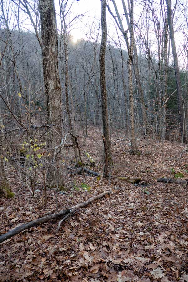
The Phoenicia Trail runs through a small conifer forest. |
At mile post 2.60 (elevation of 2,600') the Phoenicia Trail to the Mount Tremper Fire Tower levels off to an easy hike. |
|
 |
At mile post 2.94 (Elev 2,700) you will see a second lean-to on the LEFT. This lean-to is called the Tremper Mountain Lean-to. It is 250 feet away from the Tremper Mountain Fire Tower. |
|
 |
At mile post 2.99 n(elev 2,712) you will come to the Tremper Mountain Fire Tower. The fire tower can only hold 6 hikers at a time.
The fire tower is also located in the region of the summit of Tremper Mountain. This is where the Phoenicia Trail ends and the Warner Creek Trail begins.
Continue STRAIGHT to start at the beginning of the Warner Creek Trail. |
|
 |
 |
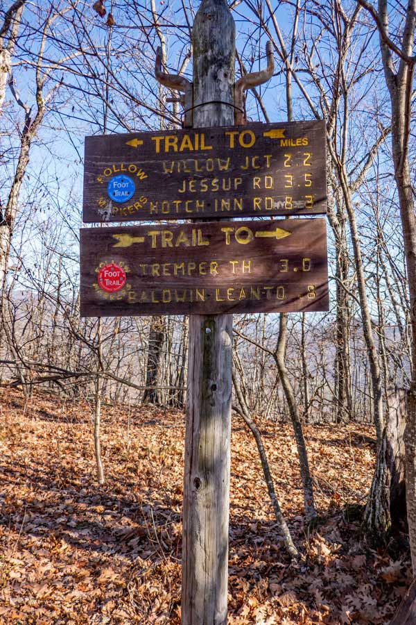
This is the DEC trail sign for the beginning of the Warner Creek Trail. The trail markers will change from Red to Blue. |
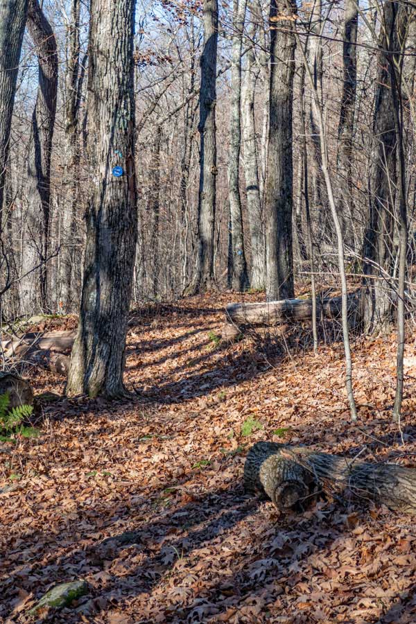
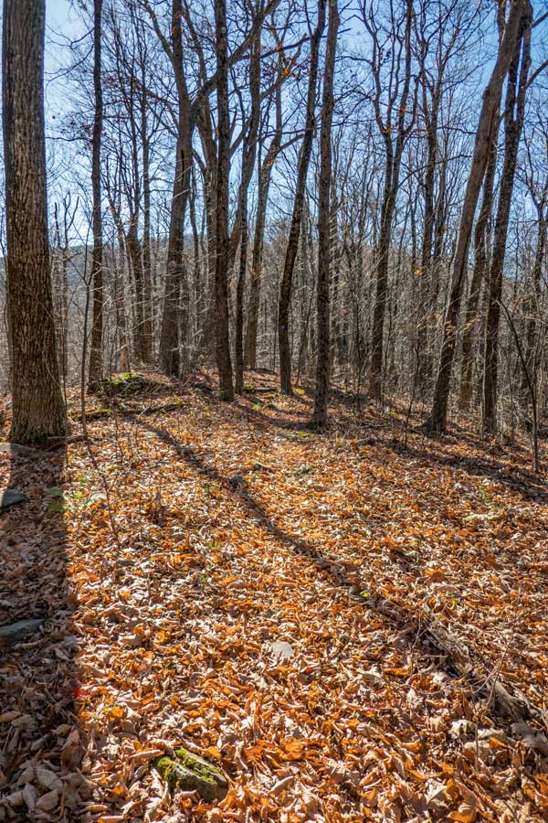
The trail weaves across the ridge line until you reach the Trail Junction for the Willow Trail . |
|
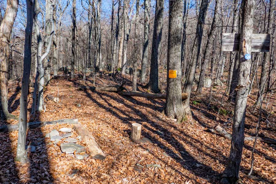 |
This is the Trail Junction to the Willow Trail. It is located a little less then 2-1/4 miles from Tremper Mountain Fire Tower. You want to continue STRAIGHT past the Willow Trail junction. Sometimes the Willow Trail Junction is not obvious. |
|
 |
 |
On the tree is the DEC trail sign. You want to head towards the Stoney Clove Creek. |
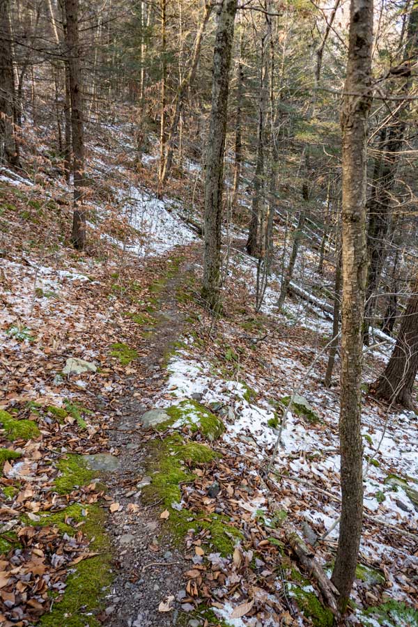
The trail is level for a short period of time. It then starts to descend down the northwest side of Carl Mountain. It is 2.32 miles from the Willow Trail Junction to Warner Creek. |
|
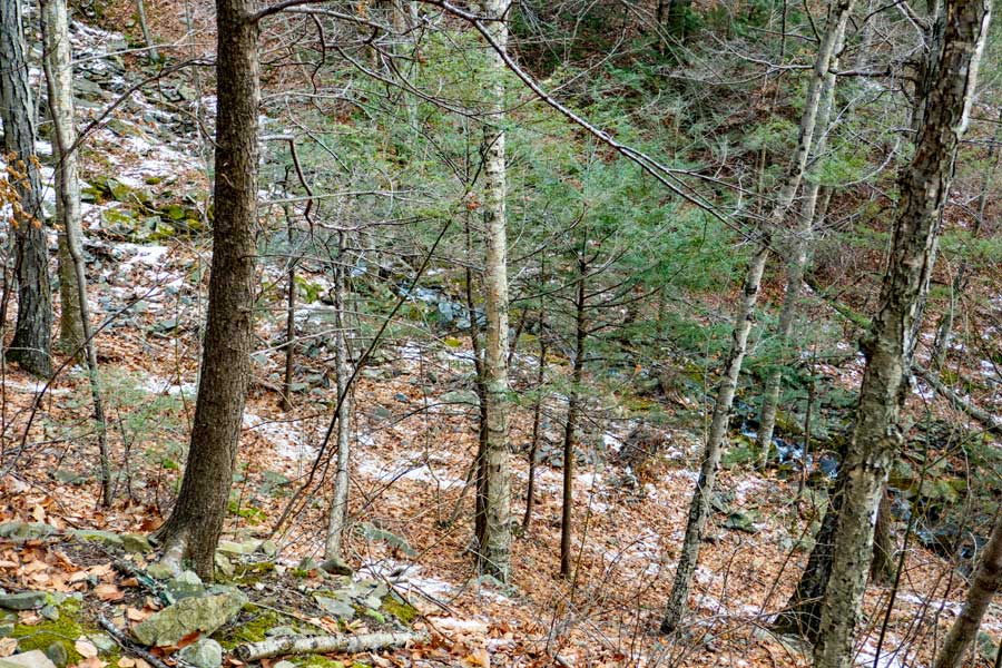 |
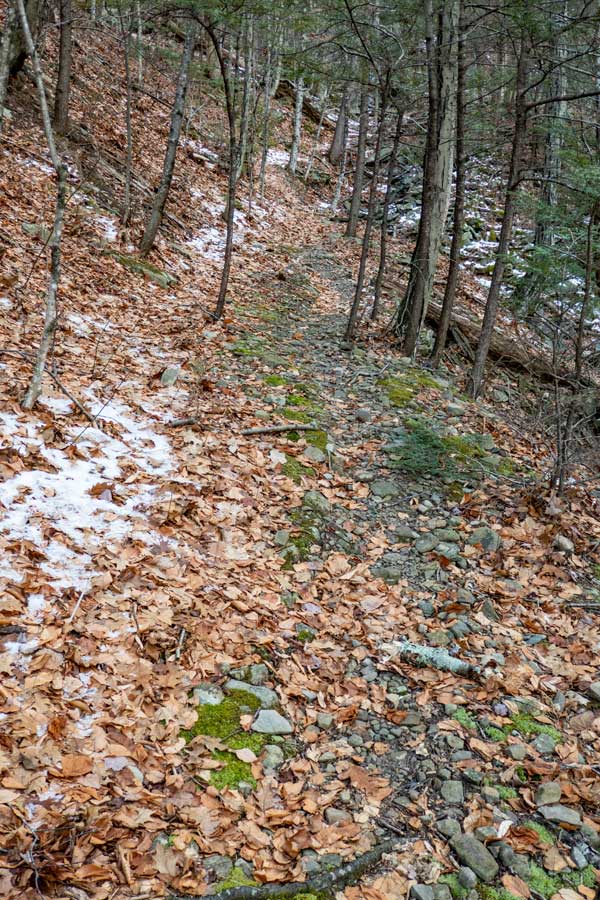
As you descend down the Warner Creek Trail, you will see water crashing down the steep slopes of the northwest side of Carl Mountain. As you descend down the steep slopes of the Warner Creek Trail, you will go through numerous switchbacks.
. |
|
 |
 |
One of the many switchbacks down the Warner Creek Trail. |
When you get near the bottom, the trail will turn and then turn around and head north along Warner Creek . |
|
 |
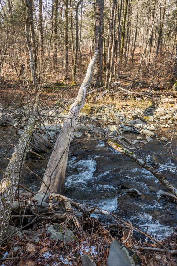 |
The Warner Creek Trail as you approach the crossing of Warner Creek. |
There is NO bridge over Warner Creek. Crossing the Warner Creek can be challenging depending upon the water level and the temperature. In the summer months most people can hop across the creek. But, when the water levels during the rest of the year can make crossing the creek difficult. Often times there are logs laying across the creek that some hikers use. NOTE: If the creek is raging, it may not be safe to cross. You need to use good judgment. Better safe then sorry.
Once across the creek, walk up the bank until you see the trail that runs parallel to the creek. Then turn right and follow the trail until you hike up the side of Edgewood Mountain. Once up near the summit, the trail will level out. |
|
 |
 |
As you get on the ridge line you will come to Edgewood Mountain. The summit is not obvious. Many hikers actually pass the summit without realizing it. |
Another example of the trail on Edgewood Mountain. |
|
 |
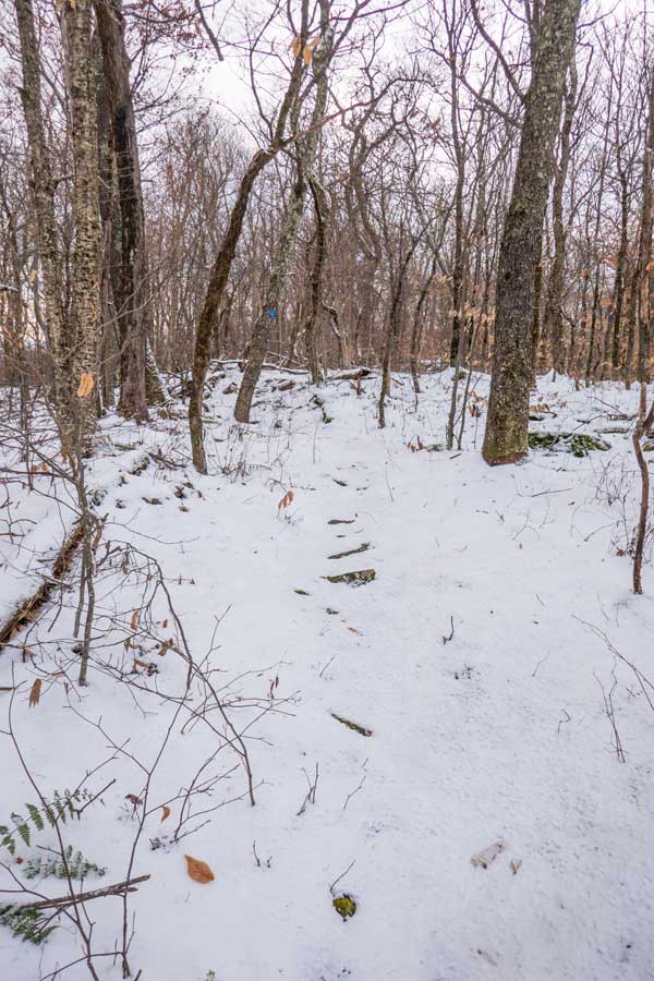
The Warner Creek Trail winds down the ridge line until it hit the Notch Inn Road Trail (Old Silver Hollow Road). There you will take a left and go less then 25 feet and take a right to continue on the Warner Creek Trail up Plateau Mountain.
. |
|
 |
In the picture, you will see a pile of logs. The trail comes out there. You then walk 25 feet, and turn right by the big rock on the left side of the image. |
|
 |
 |
The northern portion of the Warner Creek Trail will start out with a flat incline. |
The trail will then start to get a little rocky . |
|
 |
 |
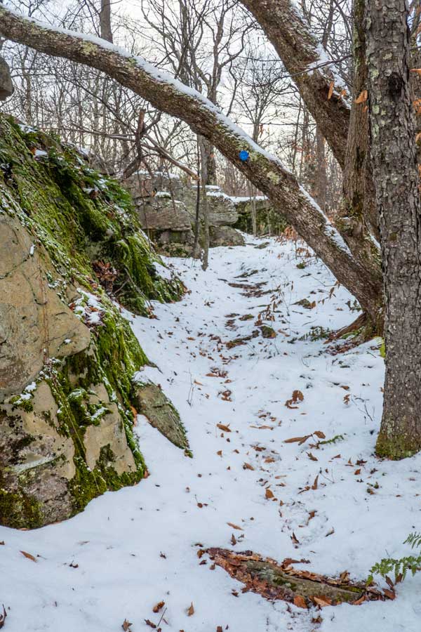
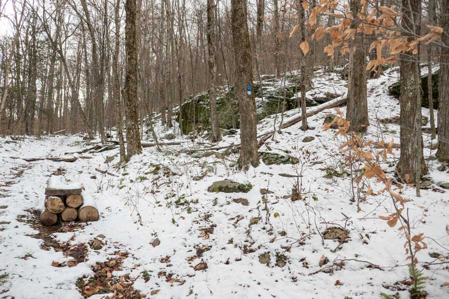
You will then hit the first ledge of the Warner Creek Trail. While the trail does not look obvious, there is a blue trail marker on the upper large rock. |
Once above the first section of the ledge, it gets easier. |
|
 |
 |
You will then ascend into a conifer forest where the trail is a little rooty. |
The trail then goes under this massive bluestone rock. |
|
 |
 |
As you get in the middle section of the northern portion of the Warner Creek Trail on Plateau Mountain, the incline gets much easier. |
About 3/4 of the way up Plateau Mountain on the Warner Creek Trail, there is a small side trail to a beautiful view point. You are now 1/2 mile from the ridge line of Plateau Mountain. |
|
 |
3/10 of a mile after the view point is a side trail that take you to a spring near the top of Plateau Mountain. The spring is located several hundred feet off the trail.
This is also the 3,500' elevation marker. In the spring, summer, and fall you cannot camp above 3,500 feet in the Catskill Mountains. |
|
 |
After another 2/10 of a mile after the side trail to the Spring, you will come to the Devil's Path on the ridge line of Plateau Mountain. This is the end of the Warner Creek Trail
If you want to go to the summit of Plateau Mountain, you want to go RIGHT. You could then continue to the Northern Parking Area of Mink Hollow Road.
Left will take you to Orchard Point and Danny's Lookout, and finally to Notch Lake on Rt 214.
We hope that you enjoyed the Warner Creek Trail. It does not get a lot of traffic, but has a lot to offer. It is a favorite of many experienced hikers. |
|
|
S E C T I O N S
|
W E A T H E R
|
O T H E R
|


