Ashokan High Point
|
|
|
OVERVIEW |
| | Trail Name: |  Ashokan High Point Trail
 |
| | | |
| | Forest : | Sundown Wild Forest |
| | Parking Area : | Kanape Valley Parking Area |
| | Primitive Campsites: | Near Trailhead off Peekamoose Road |
| | Access: | Hike, bike, ski, snowshoe |
| | | |
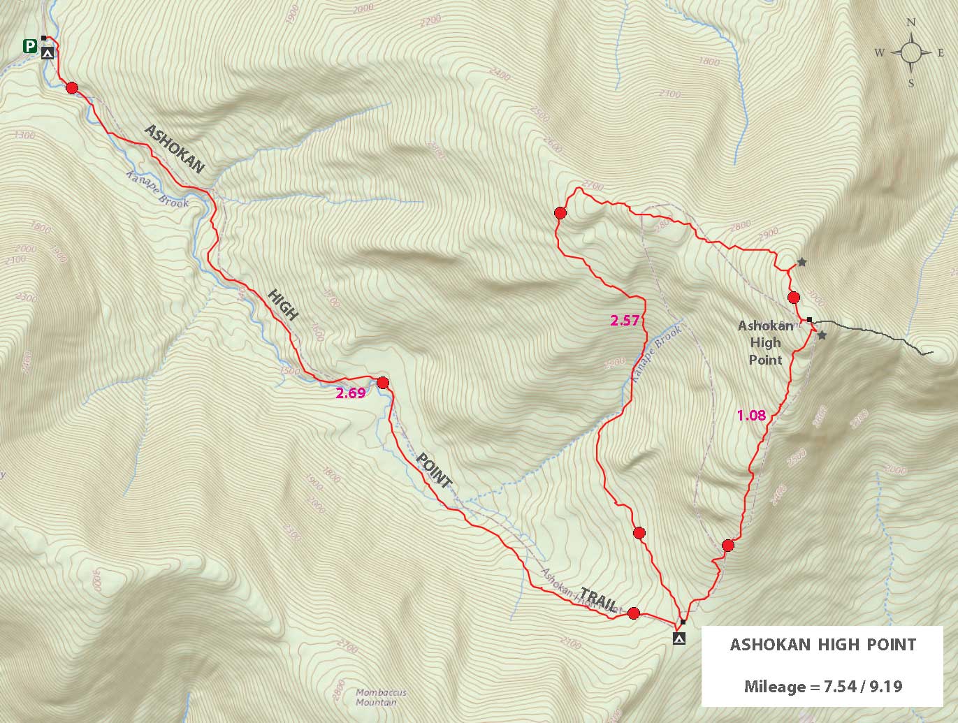
| | Trail Length: | 9.19 miles (including loop) |
| | Trail Length: | 7.54 miles (without loop) |
| | Trail Type: | 100% Single-Track Trail |
| | Hiking Time: | About 5-6 hours |
| | Lowest Elevation: | 1,128' (A) |
| | Highest Elevation: | 3,091' (A) |
| | Views : | Summit of Ashokan High Point |
| | Difficulty: | Easy |
| | | |
| | USGS Map: | USGS West Shokan Quad Maps (free) |
| | | | |
| | DEC Trail Map: | DEC Sundown Wild Forest Map (free) |
| | | | |
| | Digital Mapper: |
Topo
Terrain
Satellite |
|
|
Maps |
 |
|
|
| | DIRECTIONS from Exit 19 (Kingston) |
| | Kanape Valley Parking Area WGS84 (DEC): 41.951, -74.707183 - Elevation is about 1,128 feet |
| | Kanape Valley Parking Area Deg/Min/Sec: N41 57 03, W74 42 25 - Elevation is about 1,128 feet |
| | Kanape Valley Parking Area GPS: N41 56.139 W74 19.692- Elevation is about 1,128 feet |
| | Kanape Valley Parking Area UTM: 18N 524269 4644377 - Elevation is about 1,128 feet
|
| | GPS Coordinates to DEC Parking Lot: N41 56.139 W74 19.692 - Elevation is approximately 1,128 feet |
| | Take New York State Thruway to Exit 20 (Saugerties). |
| | Take a left out of the NYS Thruway entrance road. |
| | Take a right onto Rt 212 towards Woodstock |
| | Go 8.5 miles west on Rt 212 |
| | Take a left onto Rt 375 south |
| | Go 3 miles to the end of Rt 375. |
| | Take a RIGHT onto Rt 28 |
| | Go approximately 9.7 miles to Boiceville NY. |
| | Take a LEFT onto Rt 28A (just as you are entering Boiceville) |
| | Go approximately 2.8 miles on Rt 28A |
| | Take a RIGHT onto Rt 42 (Peakamoose Road) |
| | Go up the road 4.0 miles. You will find the Kanape DEC parking lot on the right side of the road. |
|
|
|
| | Notes About Hiking to Ashokan High Point |
| | TRAILHEAD |
| |
Many years ago this hike started from Freeman-Avery Road. The beginning of the trail passed over private land. Sadly today, land owners are afraid of being sued by people looking for a quick buck by harming people who are trying to be generous. This is why you must hike from Peekamoose Road, which makes this a much longer hike.
|
| | BEES |
| |
This mountain has a LOT of bees on them. If you decide to bushwhack, please keep this in mind. Bees are the most active and aggressive in August and September. But, you can get a bee sting in other months. If you are allergic, you need to bring an Epi Pen, or hike this mountain in colder months.
|
| | WATER |
| |
After a large rain storm, the lower part of the trail that runs parallel to the creek can become flooded. The western section also runs through a stream. Be prepared to get wet.
|
| | WESTERN SECTION |
| |
As of 2024, the western section of the Ashokan High Point Trail was very overgrown. It is particularly difficult to get through the Mountain Laurel. Many people have a problem finding the continuation of the trail from the Fire Ring. This entrance is overgrown too.
|
| | HISTORY |
| |
Fifty years ago, the top of Ashokan High Peak had a great view of the Ashokan Reservoir and the surrounding valley. Over the years, the view points have not been cut back. Now we only have one view point that will be gone if it is not cut back. At the Fire Ring, you could see the Ashokan Reservoir clearly. This view point is completely gone. You can barely see the mountains from the Fire Ring.
|
|
|
MILEAGE CHART for Ashokan High Point |
| | Miles | Total | Altitude | Notes |
| | 0.00 | 0.00 | 1,128 | Kanape Valley Parking Lot |
| | 0.07 | 0.07 | 1,117 | Walk down road - look carefully for trail entrance on the other side of the road - easy to miss (NO sign). |
| | 0.07 | 0.14 | 1,135' | Registration Box. |
| | 2.51 | 2.65 | 2,041' | Trail Junction. Straight proceeds to Freeman-Avery Road on PRIVATE PROPERTY. Left takes you to Ashokan High Point. Go LEFT. |
| | 0.04 | 2.69 | 2,045 | 200' you will see another trail junction. Left takes you on the much longer trail to the peak. Right takes up to the peak. Go RIGHT. |
| | 0.34 | 3.03 | 2,300 | Side trail. Takes you to a view spot that has overgrown about 300' from the trail. |
| | 0.23 | 3.26 | 2,550 | Rock stairs. |
| | 0.43 | 3.69 | 3,010 | Nice view point |
| | 0.08 | 3.77 | 3,091 | Summit. |
| | 2.57 | 6.34 | 2,128 | Trail Junction - closes loop trail. |
| | 0.03 | 6.37 | 2,119 | Trail Junction - Go Right back to Peekamoose Road |
| | 2.82 | 9.19 | 1,129 | Kanape Valley Parking Lot. |
|
|
Hike the Ashokan High Point Trail |
 |
This is the Kanape Parking Area for the hike to Ashokan High Point. It can hold about 30 cars. To find the trail walk to the South-Eastern corner (where this picture was taken) of this Parking Area.
|
|
 |
 |
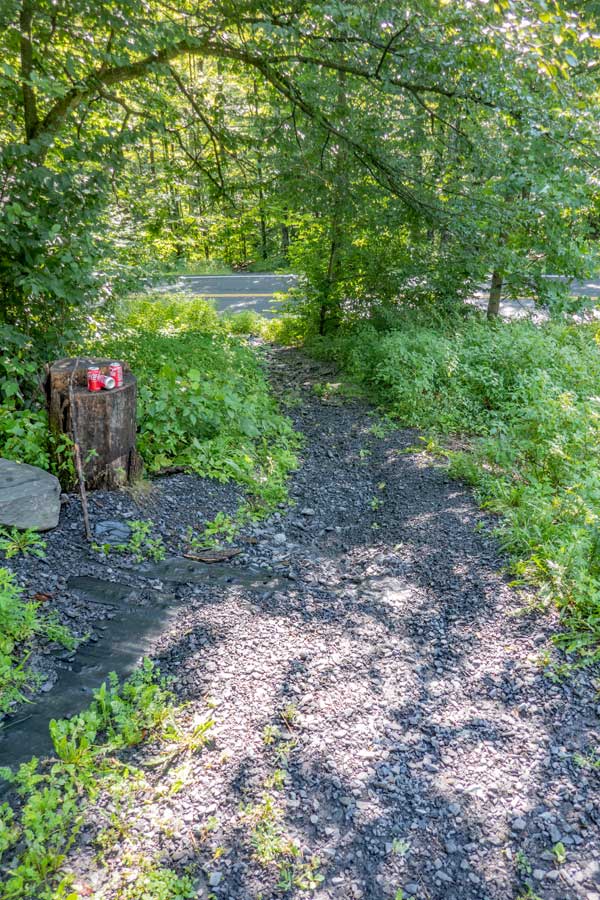
The trailhead for the hike to Ashokan High Point starts in the South-eastern side of the Kanape Parking Area. When you arrive at the south-eastern corner of the Kanape Parking Area, you will see the trail down to Peekamoose Road. When you reach Peekamoose Road, walk directly across Peekamoose Road to continue on the trail. |
After you have walked across Peekamoose Road, you will see these stairs near the road. Unfortunately there is not a sign showing where the trail continues on the other side of Peekamoose Road. Look for DEC RED trail markers for this hike to Ashokan High Point. |
|
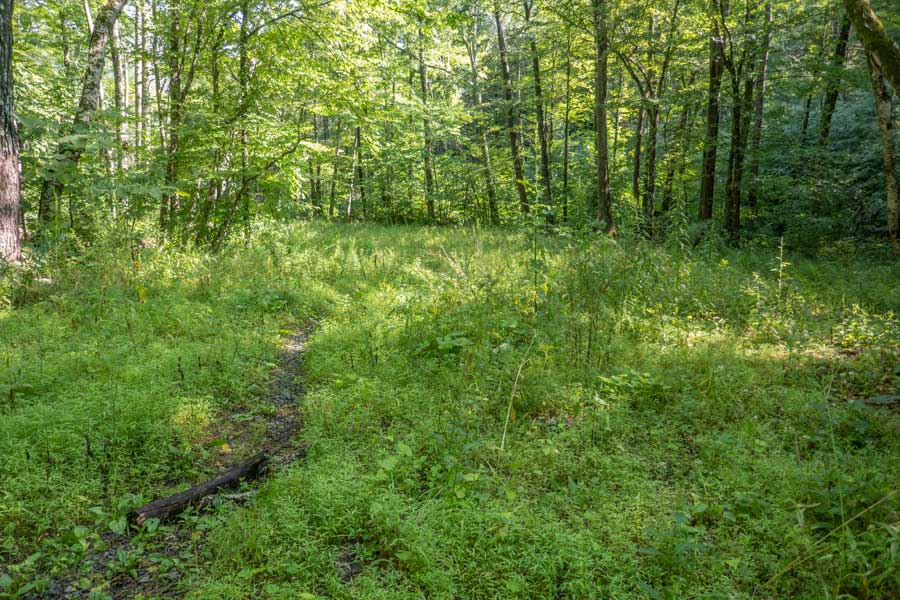 |
When you get to the bottom of the stone stairs, you will see this field on your left. You CANNOT camp in or around this field.
|
|
 |
 |
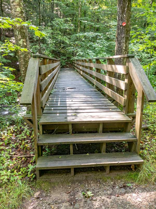
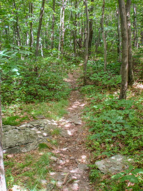
About 100' from the road is a the bridge you see on the picture on the left. |
This picture shows you what the trail looks like in the beginning of the hike. In the beginning, the trail is very mellow. |
|
 |
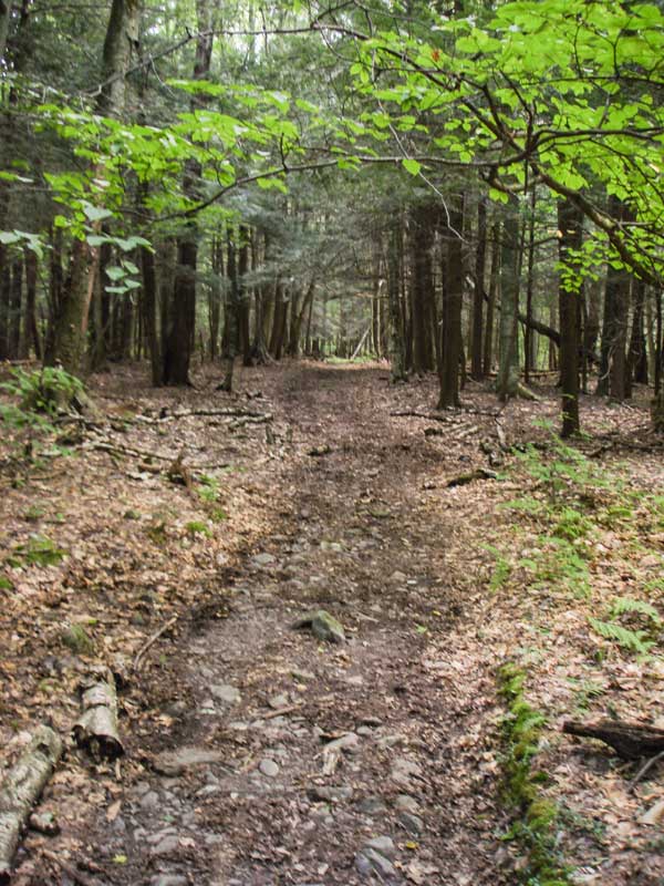 |
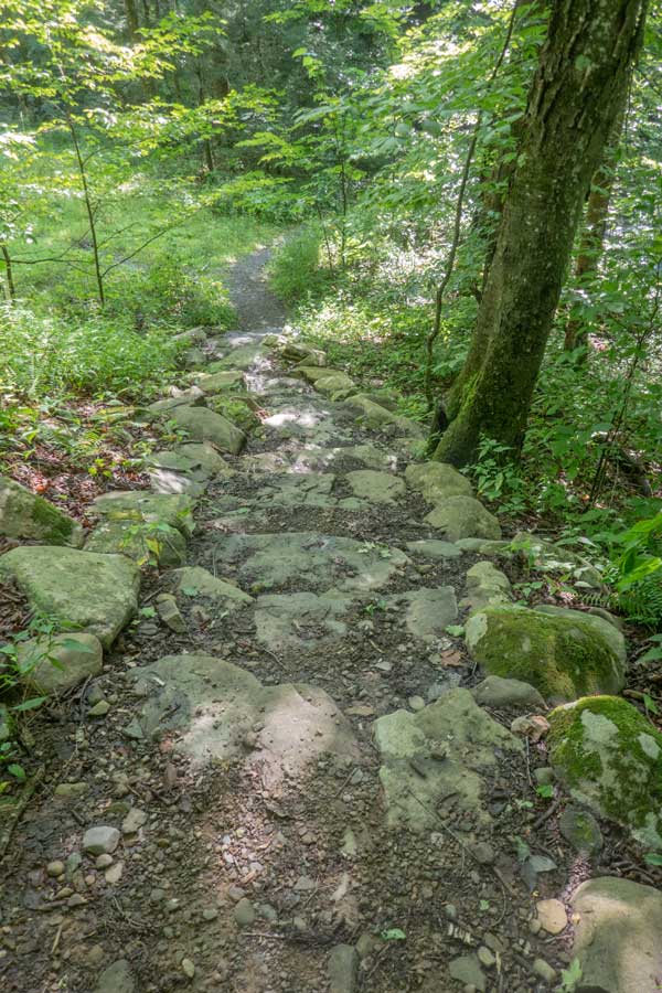
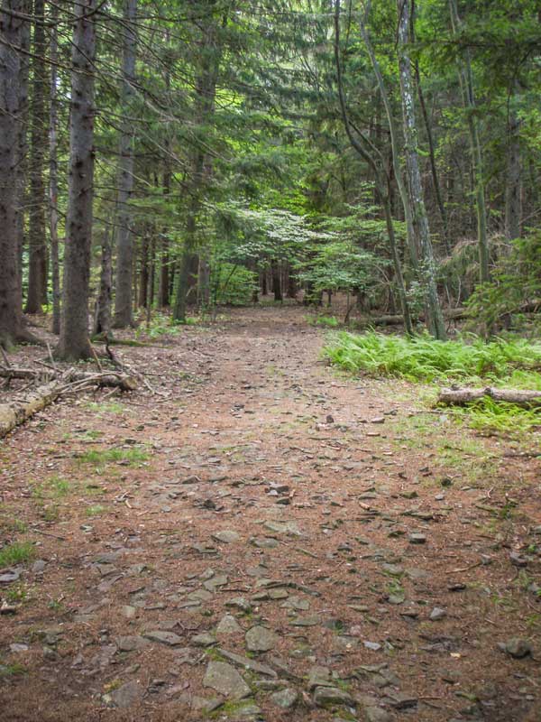
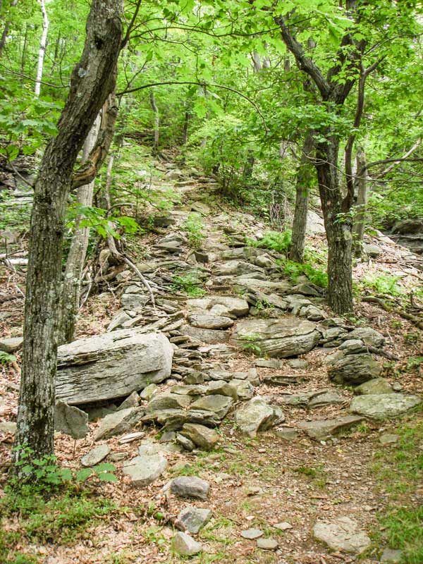
About a mile up the trail, you will walk through a nice conifer forest you see in the pictures. |
After a big rain storm, sections of the trail can be underwater about 2 miles up the trail. |
|
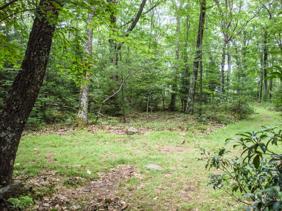 |
At mile post 2-3/4 miles you will come to the trail junction in the picture on the left. You want to go LEFT. Straight, will take you off NY State land, and will enter onto private land. You are NOT welcome on the private land, and it is posted with No Trespassing signs. Years ago the land owners allowed hikers to hike from Freeman-Avery Road. But, due to legal liability, they had to close the trail.
|
|
 |
After going up the trail another 200' - continue STRAIGHT past the trail junction (on your left) for the Western section of the Loop. Going Straight will take you up the Eastern section of the Loop to the summit. The north section of the Loop is about 2-1/2 miles long. The south section of the Loop is a little over 1 mile long. Most people have a hard time finding the route of the North section of the Loop when they reach the Fire Ring, so it is not used as much. The south section of the loop is the original trail and more commonly used.
|
|
 |
 |
The picture on the LEFT shows the "steps" that go up a small ledge on the way to the summit. Years ago, someone put in some steps up this ledge. The steps are in poor shape, but they help significantly. |
The picture on the RIGHT show what the trail looks like before the summit. |
|
|
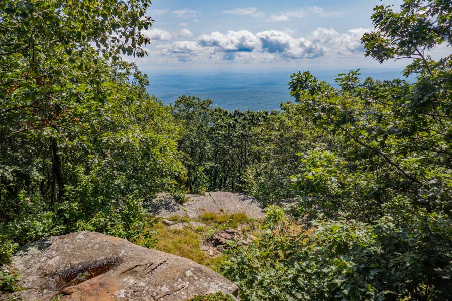
At a little more then 3-3/4 miles, you will come to a view point on your RIGHT. Years ago there were not any trees on the summit. You had a wide expensive view of the Ashokan Reservoir and surrounding mountains and vally. Today, you cannot even see the Ashokan Reservoir.
After you have finished looking over the valley from this ledge, walk back of the trail and turn LEFT and follow the small trail through the forest of Oak trees to the next view point. Finding the continuation of the trail may be a little difficult. |
|
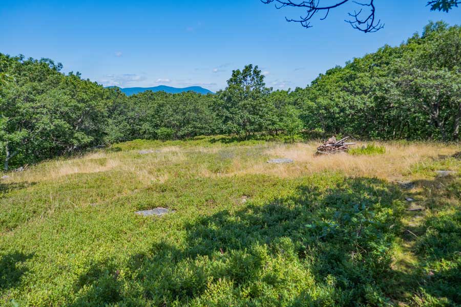 |
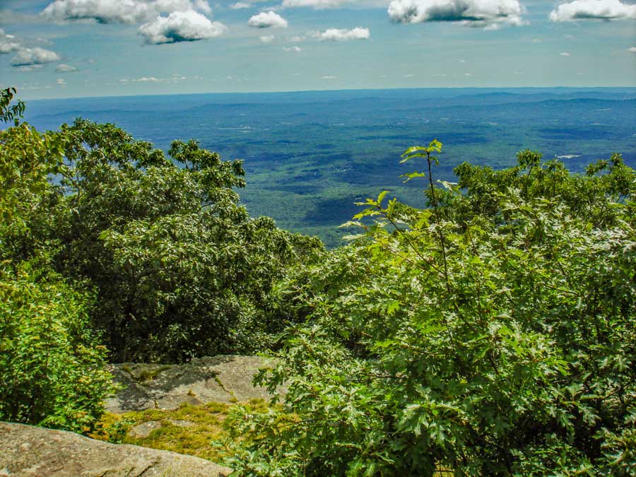
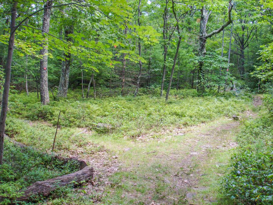
After hiking another 1/4 mile through the oak forest, you will come to this field and view of the mountains. This field has blueberry bushes covering it. On your right you will see a fire ring.
On the right side of this picture is where the last spot where you used to be able to see the Ashokan Reservoir during the summer. You may be able to see a limited view of the Ashokan Reservoir when the leaves are not on the trees.
To continue down the Western section of the Loop, turn LEFT in the field by the Fire Ring and head down towards to the forest. When you arrive near the edge of the forest you should see the Western section of the Loop trail. |
|
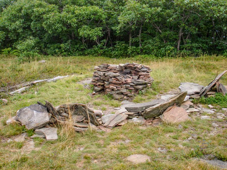 |
This is the Fire Ring in this field. It is illegal to camp within 150 feet of a trail, many camp nearby.
If you do use this fire ring make sure the fire is completely out before leaving. There is NO water nearby. |
|
 |
 |
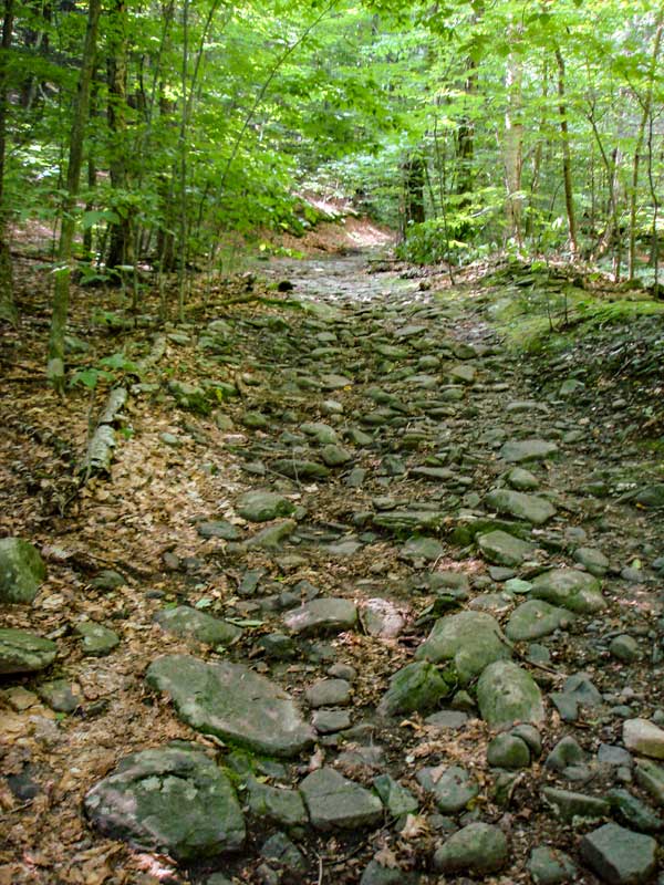
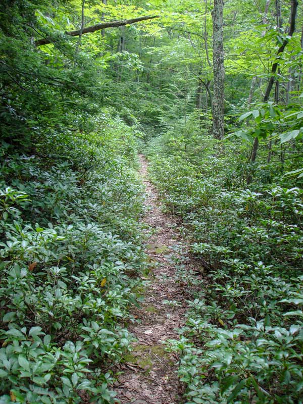
After walking thru the fields it can be easy to lose the trail. Some of the sections of the Western section of the Loop trail will require some route finding skills. Especially where there is Mountain Laurel. Make sure that you pay attention to the Red trail markers as you hike down the Western section of the Loop trail. This picture here show what to expect. Some sections are better then this. And, some sections are worse then this. |
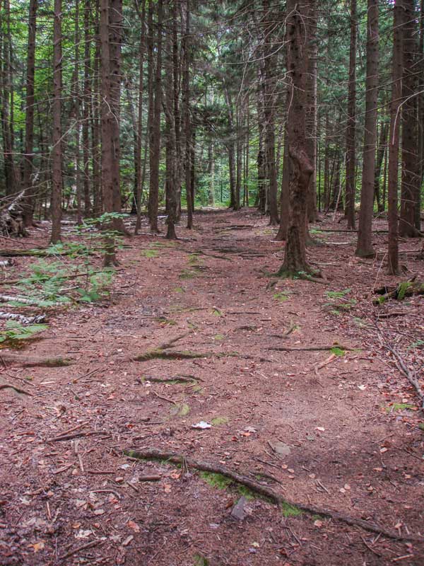
After you get through the thick Mountain Laurel, near the end of the Western section of the Loop trail, it will enter into a conifer forest on a wide logging road. Near the end of the conifer forest, you will encounter a little more Mountain Laurel before coming back to the Eastern section of the Loop Trail.
When you encounter the Eastern section of the trail, take a RIGHT.
200 feet later you will come to the Kanape Valley. Take a RIGHT at the trail junction.
Then you will hike down the Kanape Valley for about 2-3/4 mile back to the Kanape Parking Area where your vehicle is location. |
|
|
S E C T I O N S
|
W E A T H E R
|
O T H E R
|