Hike Giant Ledge & Panther Mountain from Woodland Valley Road |
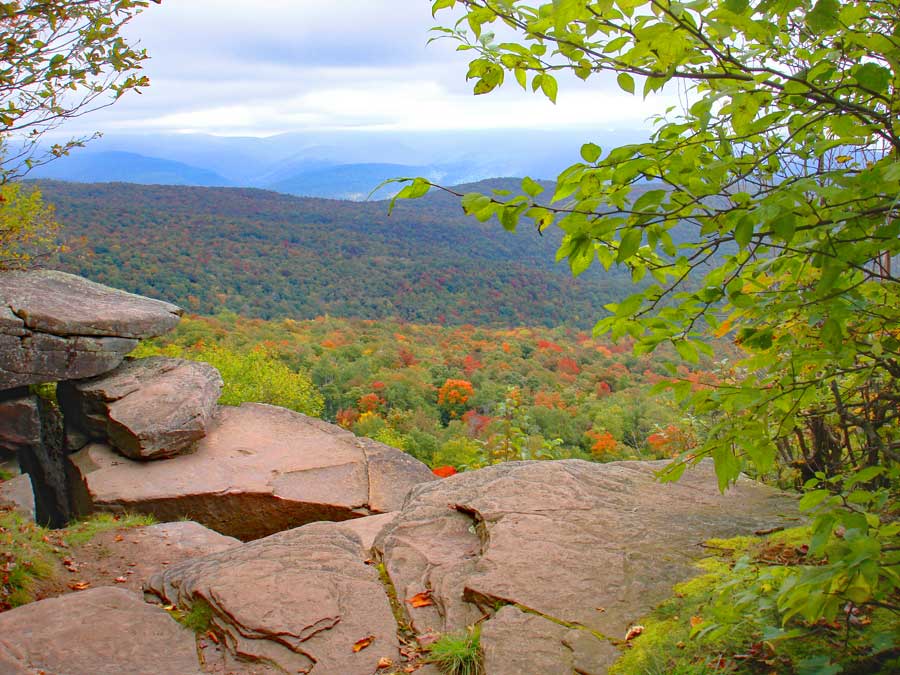 |
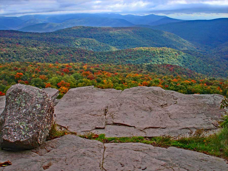
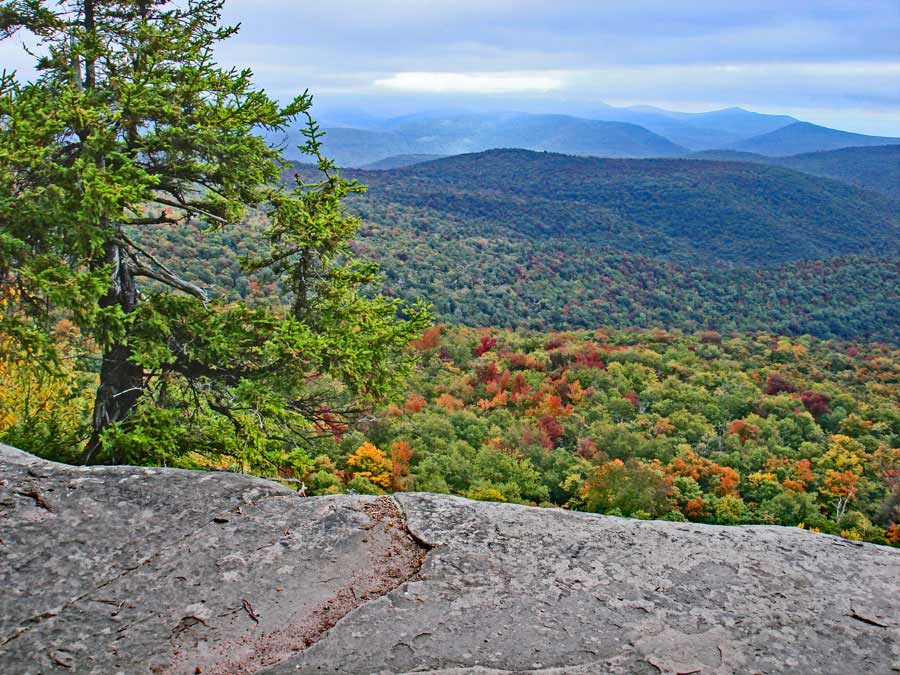
| View from Giant Ledge |
| |
| |
|
OVERVIEW |
| | Type of Trail: | 100% DEC trails |
| | Trail Name: | Phoenicia East Branch Trail
 (Woodland Valley to TJ to Giant Ledge)
 |
| | Trail Name: | Giant Ledge - Panther Mtn - Fox Hollow Trail
 (TJ to Giant Ledge to Panther Mtn
 |
| | Parking Area : | Parking at Woodland Valley Parking Area |
| | Winter Access: | Parking Area is Plowed in the Winter |
| | Camp sites: | 4 Camp Site locations |
| | | |
| | | Trail Length: | 5.30 miles (one-way) or 10.60 (round-trip) |
| | Trail Type: | single-track trail |
| | Hiking Time: | Average 6-7 hours round trip |
| | Summit Elevation: | 3,725' (A) |
| | Elevation Gain: | Gain of 2,322 feet |
| | Views : | Many spots on Giant Ledge and Panther Mountain |
| | Difficulty: | Moderate |
| | |
| | | Panther Mountain Summit: | 42.056517, -74.39425 (DEC-WGS84) |
| | Panther Mountain Summit: | N42 03 23, W74 23 39 (Degree, Min, Sec) |
| | Panther Mountain Summit: | N 42 03.391, W 74 23.655 (GPS) |
| | Panther Mountain Summit: | 18N 550122 4656229 (UTM) |
| | | |
| | | USGS Map: | USGS Shandaken Quad Maps |
| | |
| | | USGS Map: | USGS Phoenicia Quad Maps |
| | |
| | | DEC Trail Map: | DEC Slide Mountain Wilderness Map (free) |
| | | |
| | | Digital Mapper: |
Topo
Terrain
Satellite |
| | |
|
|
|
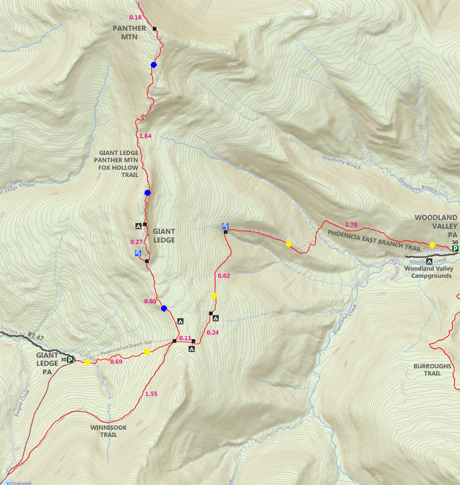
Maps for Giant Ledge & Panther Mountain in the Slide Mountain Wilderness |
 |
|
|
|
| | Notes About Giant Ledge & Panther Mountain |
|
| | OTHER INFORMATION |
|
| |
The trail from Woodland Valley to the trail junction of Giant Ledge is quite rugged and rocky. It is significantly harder then other routes.
Giant Ledge is not a safe place for small children. The ledge is quite high in elevation, and easy for small children to fall off.
Giant Ledge has become quite popular over the years. Today, it is very crowded. So, you may consider hiking it in the off season. Most people who visit Giant Ledge never visit Panther Mountain. The hike over to Panther Mountain is quite nice. The conifer forest walk is exceptional when it is dry. |
|
|
| | DIRECTIONS to Giant Ledge & Panther Mountain Trail Head from Exit 19 (Kingston) |
| | Woodland Valley Parking Area WGS84 (DEC): 42.03615, -74.35745 - Elevation is approximately 1,399 feet |
| | Woodland Valley Parking Area Deg/Min/Sec: N42 02 10, W74 21 26 - Elevation is approximately 1,399 feet |
| | Woodland Valley Parking Area GPS: N 42 02.169, W 74 21.447 - Elevation is approximately 1,399 feet |
| | Woodland Valley Parking Area UTM: 18N 553184 4653990 - Elevation is approximately 1,399 feet
|
| |
|
| | Get off New York State Thruway at Exit 19 (Kingston). |
| | Take a RIGHT out of the NYS Thruway onto Route 28 West. |
| | Go approximately 23.1 miles on Rt 28 West |
| | Take a LEFT onto Woodland Valley Road (after Phoenicia exits) |
| | Go approximately 0.2 miles on Rt Woodland Valley Road |
| | Continue RIGHT onto Woodland Valley Road after going over bridge) |
| | Go approximately 4.8 miles on Woodland Valley Road |
| | DEC Parking Area is on the RIGHT side of the road. Large Parking Area - Holds 50 cars |
|
|
MILEAGE CHART from Woodland Valley to Giant Ledge & Panther Mountain |
| | Mile Point | Altitude | Notes |
| | 0.00 | 1,403' | Woodland Valley PA - Trail Head to Giant Ledge & Panther Mountain |
| | 0.07 | 1,472' | DEC Registration Box |
| | 1.78 | 2,353' | Spring on right side of trail |
| | 1.82 | 2,372' | Mossy Stream |
| | 2.44 | 2,659' | Campsite #1 - LEFT side of trail |
| | 2.67 | 2,807' | Campsite #2 - LEFT side of trail |
| | 2.79 | 2,812' | Trail Junction to Giant Ledge & Panther Mountain - Go RIGHT |
| | 3.39 | 3,000' | Side trail to Spring |
| | 3.55 | 3,162' | Giant Ledge View Spot #1 |
| | 3.60 | 3,167' | Giant Ledge View Spot #2 |
| | 3.66 | 3,171' | Side Trail to Campsite |
| | 3.72 | 3,183' | Giant Ledge View Spot #3 |
| | 3.81 | 3,173' | Giant Ledge View Spot #4 |
| | 3.92 | 3,159' | Giant Ledge View Spot #5 |
| | 4.78 | 3,456' | DEC 3500' elevation sign |
| | 5.27 | 3,722' | View spot from top of large rock |
| | 5.30 | 3,725' | Panther Mountain Summit |
| | 5.48 | 3,700' | View spot past summit |
|
|
Hike to Giant Ledge & Panther Mountain from Woodland Valley in the Slide Mountain Wilderness |
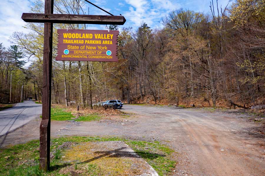 |
This is the entrance to the DEC Parking Area for Woodland Valley. It can hold about 50 cars. The Woodland Valley Parking Area services two DEC Trails. One to Giant Ledge and Panther Mountain. And, the other for the Wittenberg, Cornell, and Slide Mountains. Terrace Lean-to is also across the street.
|
|
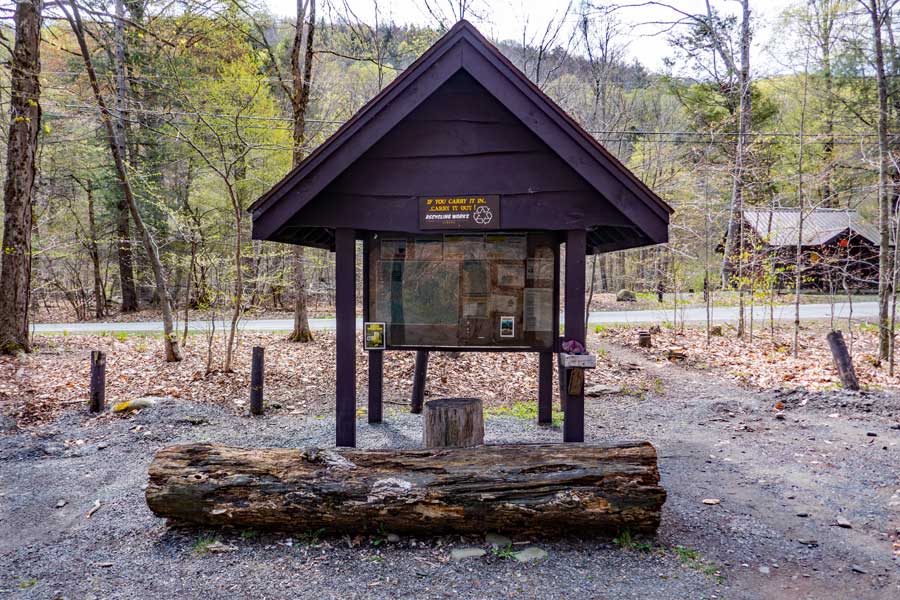 |
This is the New York State Kiosk for the Woodland Valley Parking Area. It will have important information about the hikes directly off this parking area. Always a good idea to use your cell phone to take a picture of the Emergency Contact phone numbers in case you are hurt. Cell phone reception may exist in some areas.
|
|
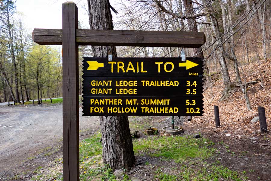 |
This is the sign located at the Trail Head for the hike to Giant Ledge and Panther Mountain. Please note that Trail Junction to Giant Ledge is 2.8 miles, and the trail up to Giant Ledge is another 3/4 of a mile for a total of 3.55 miles to the first View Spot on Giant Ledge.
. |
|
 |
This is the Trail Head to Giant Ledge and Panther Mountain. It is located directly in the Woodland Valley Parking Area. There is another Trail Head across the street from the Woodland Valley Parking Area to access Wittenburg, Cornell, Slide, Cross, Romer, Pleasant Mountains. The trail to Terrace Lean-to is also across the Street.
Please note that the Trail Markers will be YELLOW from Woodland Valley to the Trail Junction to Giant Ledge and Panther Mountain.
Please note that the Trail Markers will be BLUE from the Trail Junction to Giant Ledge to Fox Hollow.
|
|
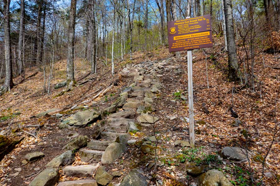 |
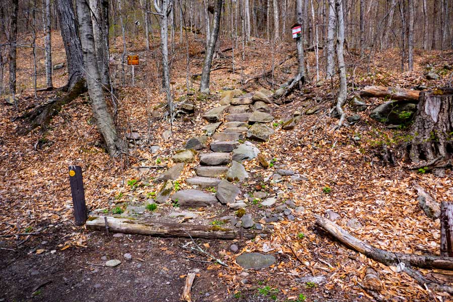
At the beginning of this hike, you will climb a number of stairs up the steep hill. And, the hike will continue to climb in elevation for about 500 vertical feet. The beginning of the hike will have the steepest climb. |
|
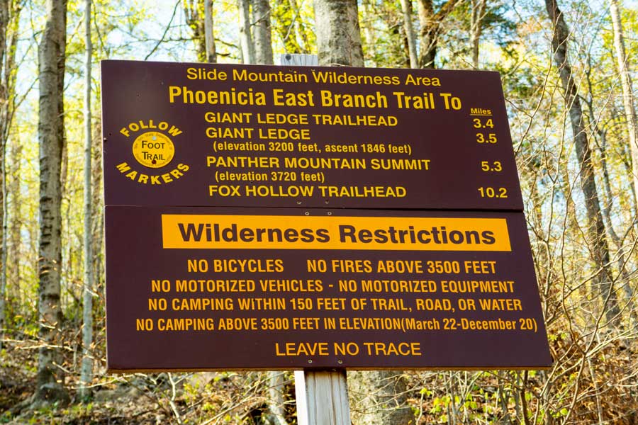 |
There is a second New York State DEC sign on the stairs at the beginning of this hike. Pay attention to the Wilderness Restrictions to avoid getting a ticket from the NYS Rangers. There are 3 camping areas on this hike, and they are the best places to camp overnight.
|
|
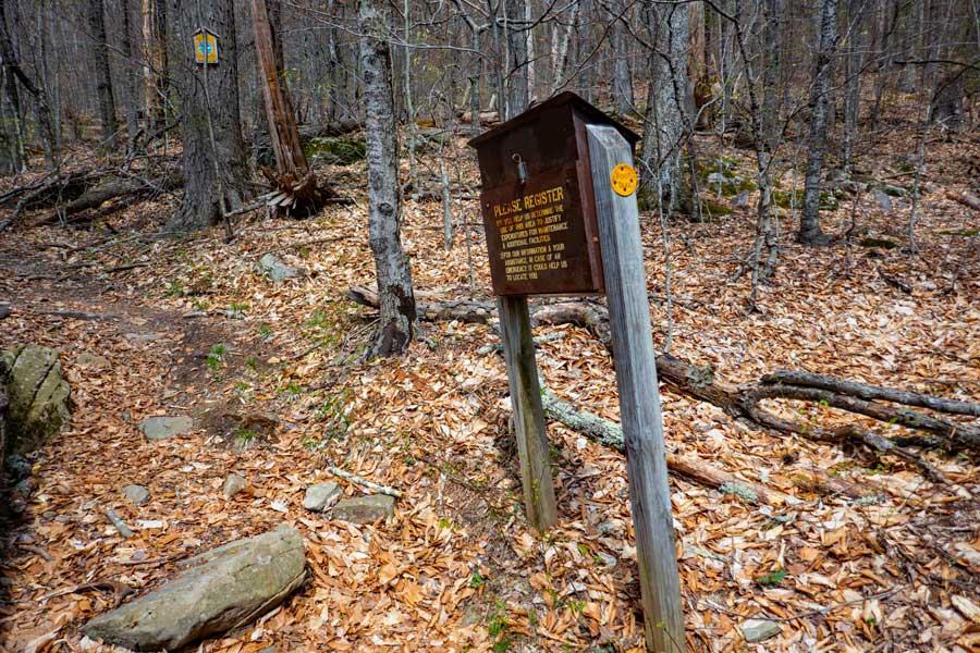 |
About 375' up the steep trail, you will find the DEC Registration Box. Please register. If you get hurt and go missing, this information is vital for the NYS Rangers and Catskill SAR to find you. Your life could depend on this information. Additionally, the more people that register for this trail, the more money will be used to maintain the trail.
|
|
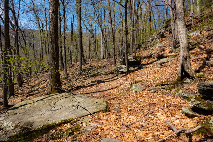 |
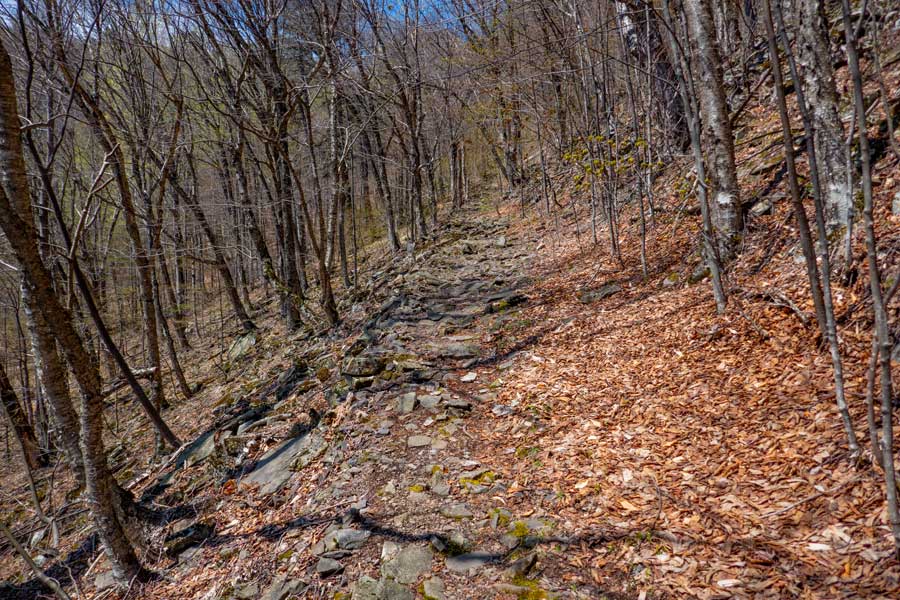
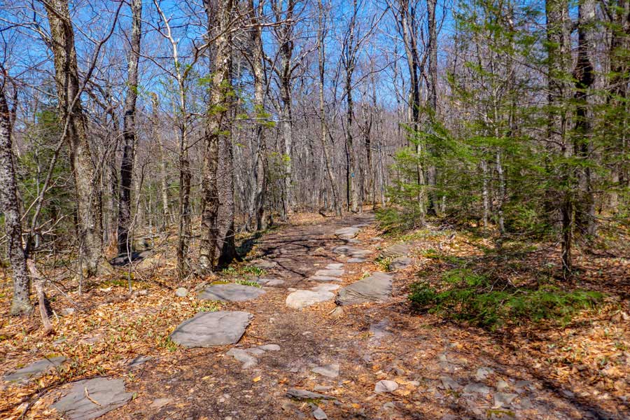
Once you get up to about 1,800' in elevation, the incline of the trail will level out. In some places the trail is a little rocky.
|
|
 |
Then the trail will become almost completely level, and the trail becomes a nice walk.
|
|
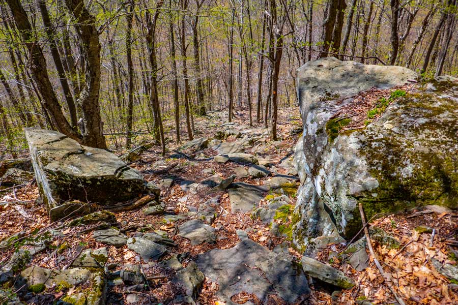 |
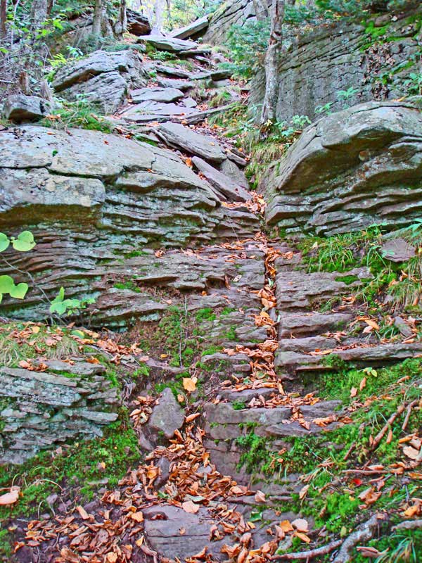
Then the trail takes a 90 degree turn to the left and plunges down to the valley floor. The trail down to the valley floor is quite rocky and steep.
|
|
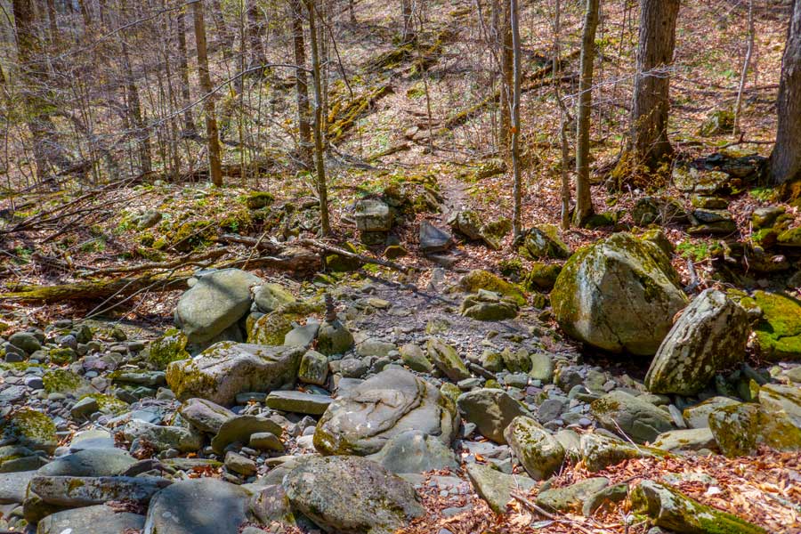 |
At the valley floor is a stream that flows down the middle of it. It is dry most of the year. Only when there is a large rain storm does this stream fill up with water.
|
|
 |
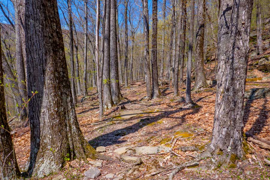
After you have crossed the stream, the trail will then begin to ascend up the mountain again to an elevation of 2,800'. The incline is not that steep.
|
|
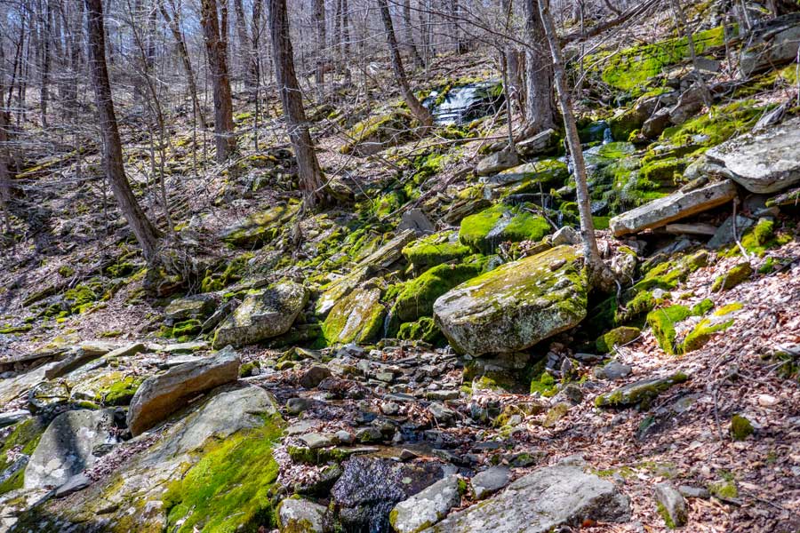 |
As you are ascending the Phoenicia East Branch Trail, there is another steep stream bed that runs across the trail. This steam is usually not hard to get across. This stream runs more often then the stream on the Woodland Valley floor. In the colder months, you should expect ice to be here.
If you plan on camping overnight at Campsites #1 and #2, you should collect water here. In the drier months, this stream and spring may be dry. There is also a spring just before the stream.
|
|
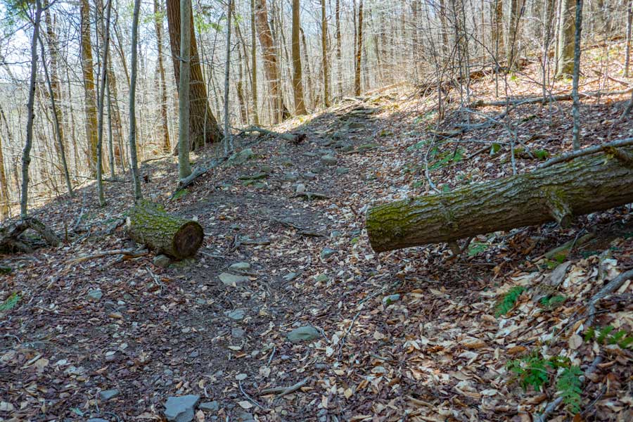 |
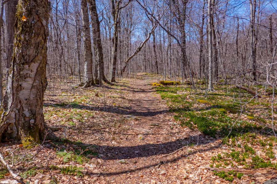
As you ascend up further the incline will start to level off, and turn slightly to the right.
|
|
 |
This is the first official DEC primative campsite on the Phoenicia East Branch Trail between Woodland Valley and the trail junction to Giant Ledge. It is a little closer to a water source then the next campground.
If this campsite is full, there is another campsite about 1/4 up the trail.
|
|
 |
About 2/10 of a mile up the trail, the trail will completely flatten out. On your LEFT, you will notice a small trail that takes you the Campsite #2
|
|
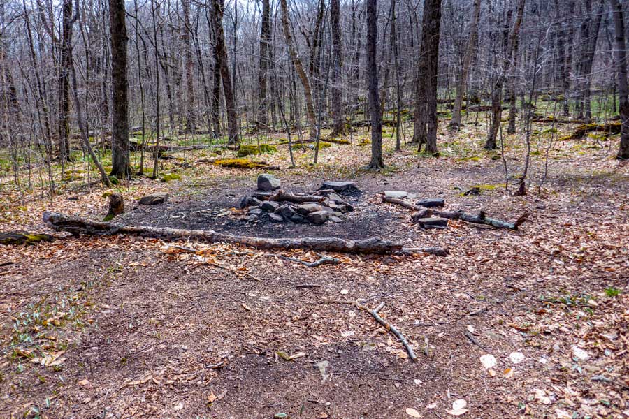 |
This is Campsite #2 on the Phoenicia Branch Trail. The land is fairly flat with a nice fire ring. If you show up without water, you will need to walk 6/10 of a mile up the Giant Ledge - Panther Trail to get water at the spring (425' elevation gain). Some people just bring water with them.
If this campsite is full, there are two more campsite locations on the Giant Ledge Panther Trail.
|
|
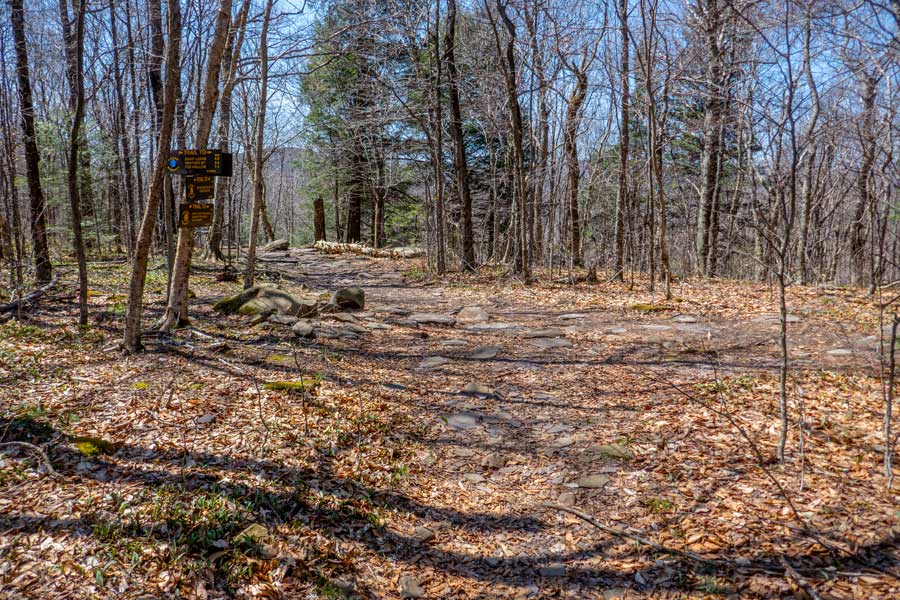 |
This is the Trail Junction to Giant Ledge and Panther Mountain. You want to take a RIGHT here to get to those locations.
The DEC Trail Markers will change to BLUE on the Giant Ledge Panther Trail.
|
|
 |
This is the beginning of the Giant Ledge - Panther - Fox Trail. Most just call it the Giant Ledge Trail. For a ways the trail will remain fairly flat.
Just after you start up the trail, there is a NY State DEC primitive campsite on the RIGHT. There are 4 campsites in the region.
The DEC Trail Markers will change to BLUE on the Giant Ledge Panther Fox Trail.
|
|
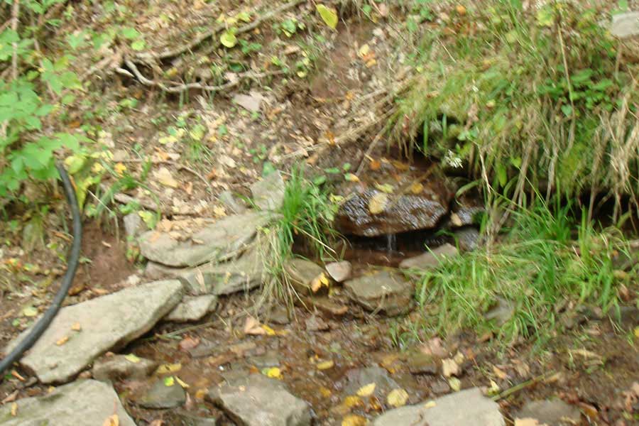 |
There is a spring located on the south side of Giant Ledge. After you hike up the Giant Ledge Trail 6/10 of a mile, there is a side trail on the LEFT that will take you to the Spring. It does flow most of the year.
|
|
 |
After you hike 3/4 of a mile from the beginning of the Giant Ledge - Panther - Fox Trail, you will come to your first view point. There are about 5 major view points along Giant Ledge.
|
|
 |
This is the 2nd View Spot on Giant Ledge
|
|
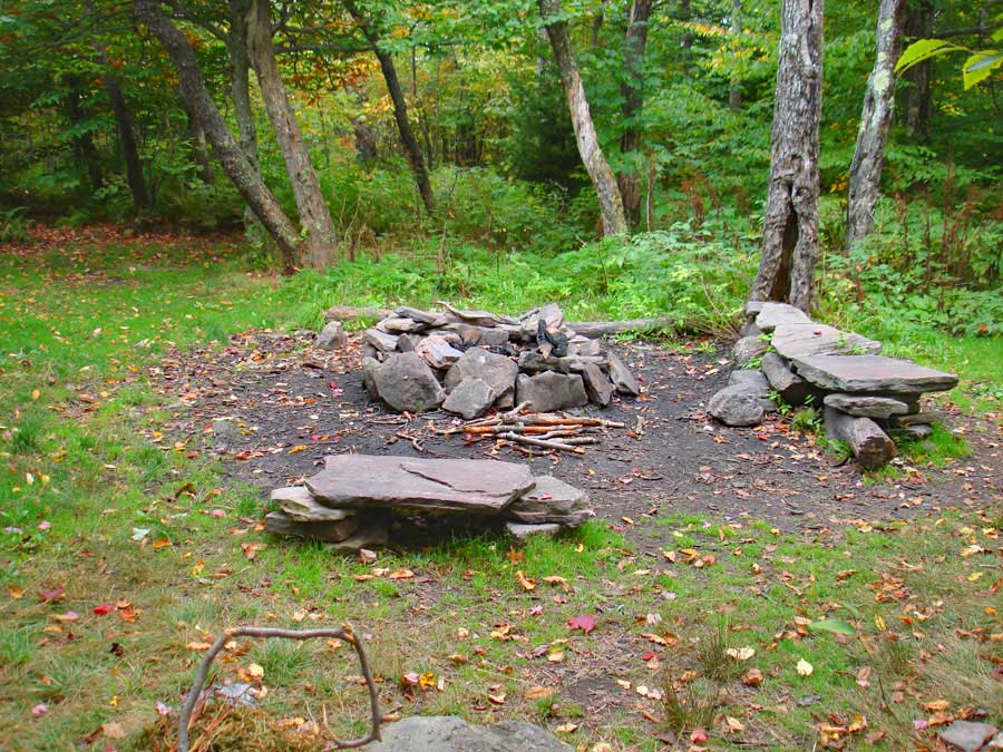 |
After the 2nd view spot there is an official NY State DEC primitive campsite on the left side of the trail. It is a well liked campsite due to it's location.
|
|
 |
After the campsites, there are 3 more view spots that are commonly visited..
|
|
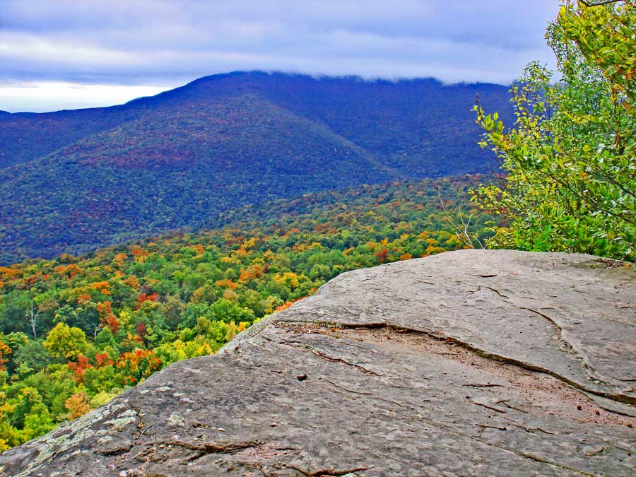 |
View Spot on Giant Ledge. That is Slide Mountain in the distance.
|
|
 |
View Spot on Giant Ledge. That is Slide Mountain in the distance.
If you are only visiting Giant Ledge, you are done. You can turn around and hike back to your car. If you plan on visiting Panther Mountain, continue down the trail.
|
|
 |
 |
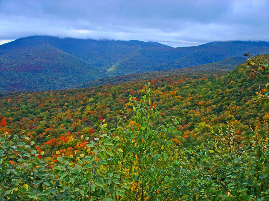
After you hike across the col between Giant Ledge and Panther Mountain, there are a few spots, where there is some elevation gain. Nothing very difficult.
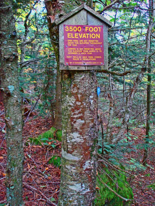
About 3/4 of a mile after leaving Giant Ledge, you will encounter the 3,500' elevation sign. You cannot camp overnight above 3500' in the Catskills outside of the Winter months.
|
|
 |
 |
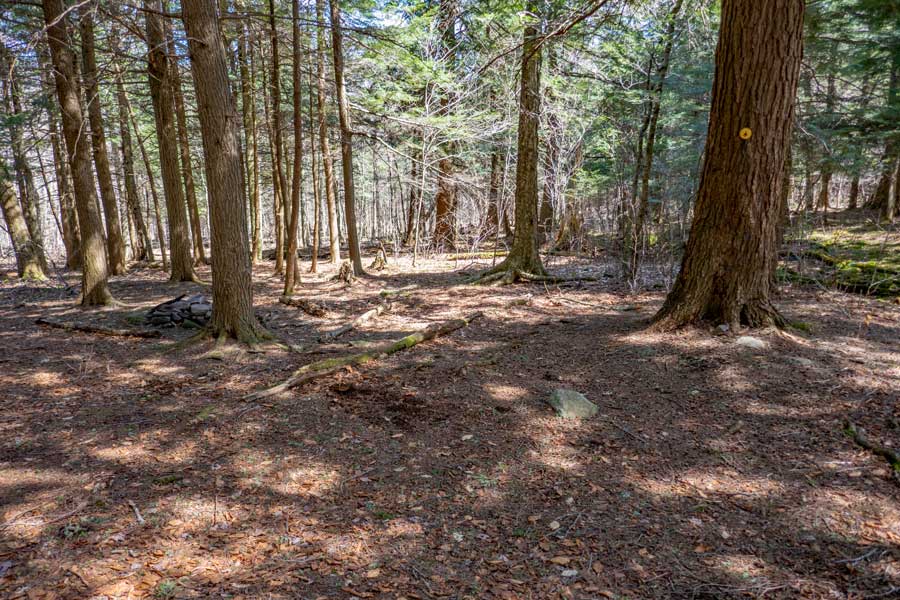
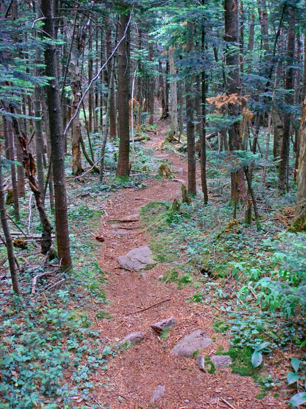
There are some beautiful conifer forest past Giant Ledge. And, even after the summit of Panther Mountain you will find some nice conifer forest.
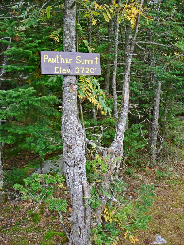
The summit of Panther Mountain has a sign designating the summit. Over the years, the sign sometimes needs to be replaced. Most Catskill Summits do not have signs.
There is another view spot worth visiting on Panther Mountain. It is about 0.18 miles past the Panther Summit.
|
|
|
S E C T I O N S
|
W E A T H E R
|
O T H E R
|