Hike Giant Ledge & Panther Mountain from Slide Mtn Parking Area |
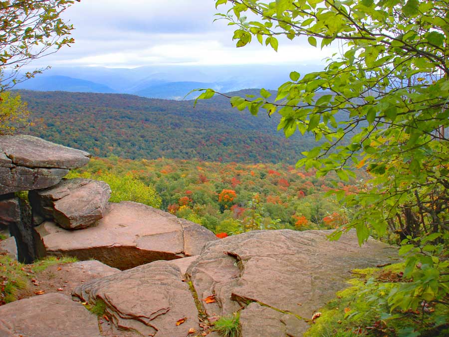 |
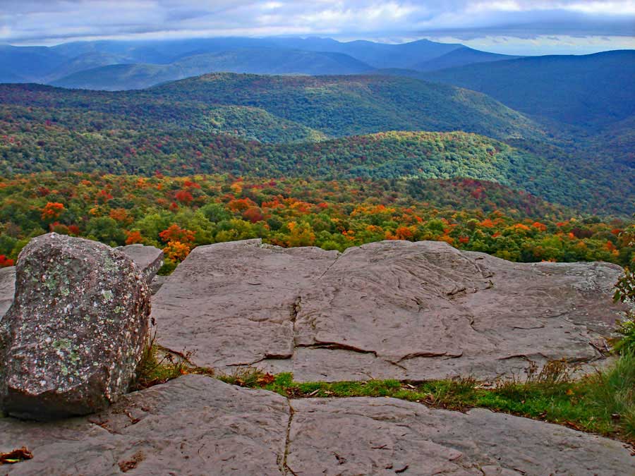
| View from Giant Ledge |
| |
| |
|
OVERVIEW |
| | Type of Trail: | 80% DEC trails - 20% road walk |
| | Trail Name: | Winnisook Trail
(Rt 47 to TJ to Giant Ledge) |
| | Trail Name: | Giant Ledge - Panther Mtn - Fox Hollow Trail
 (TJ to Giant Ledge to Panther Mtn
 |
| | Parking Area : | Parking at Slide Mountain Parking Area |
| | Winter Access: | Parking Area is Plowed in the Winter |
| | Camp sites: | 4 Camp Site locations |
| | | |
| | | Trail Length: | 5.12 miles (one-way) or 10.24 (round-trip) |
| | Trail Type: | Double-track trail on Winnisook Trai, and single-track trail rest of the way |
| | Hiking Time: | Average 6-7 hours round trip |
| | Summit Elevation: | 3,725' (A) |
| | Elevation Gain: | Gain of 1,290 feet |
| | Views : | Many spots on Giant Ledge and Panther Mountain |
| | Difficulty: | Easy-to-Moderate |
| | |
| | | Panther Mountain Summit: | 42.056517, -74.39425 (DEC-WGS84) |
| | Panther Mountain Summit: | N42 03 23, W74 23 39 (Degree, Min, Sec) |
| | Panther Mountain Summit: | N 42 03.391, W 74 23.655 (GPS) |
| | Panther Mountain Summit: | 18N 550122 4656229 (UTM) |
| | | |
| | | USGS Map: | USGS Shandaken Quad Maps |
| | | |
| | | DEC Trail Map: | DEC Slide Mountain Wilderness Map (free) |
| | | |
| | | Digital Mapper: |
Topo
Terrain
Satellite |
| | | |
|
|
|
Maps for Giant Ledge & Panther Mountain in the Slide Mountain Wilderness |
 |
|
|
|
| | Notes About Hiking to Giant Ledge & Panther Mountain from Woodland Valley |
|
| | OTHER INFORMATION |
|
| |
The trail from Slide Mountain Parking Area to the trail junction of Giant Ledge is easy. There is very little incline to the beginning of the hike. The only disadvantage is the road walk from Slide Parking Area to the beginning of the Winnisook Trail (about a mile).
Giant Ledge is not a safe place for small children. The ledge is quite high in elevation, and easy for small children to fall off.
Giant Ledge has become quite popular over the years. Today, it is very crowded. So, you may consider hiking it in the off season. Most people who visit Giant Ledge never visit Panther Mountain. The hike over to Panther Mountain is quite nice. The conifer forest walk is exceptional when it is dry. |
|
|
| | DIRECTIONS to Slide Mountain Parking Area from Exit 19 (Kingston) |
| | Slide Mountain Parking Area WGS84 (DEC): 42.00893, -74.427704 - Elevation is approximately 2,435 feet |
| | Slide Mountain Parking Area Deg/Min/Sec: N42 00 32, W74 25 39 - Elevation is approximately 2,435 feet |
| | Slide Mountain Parking Area GPS: N 42 00.536, W 74 25.662 - Elevation is approximately 2,435 feet |
| | Slide Mountain Parking Area UTM: 18N 547390 4650926 - Elevation is approximately 2,435 feet
|
| |
|
| | Get off New York State Thruway at Exit 19 (Kingston). |
| | Take a RIGHT out of the NYS Thruway onto Route 28 West. |
| | Go approximately 30.4 miles on Rt 28 West |
| | Take a LEFT onto Rt 47 in Big Indian |
| | Go approximately 9.3 miles on Rt 47 |
| | DEC Parking Area is on the LEFT side of the road. Large Parking Area - Holds 40 cars |
|
|
MILEAGE CHART from Slide Mountain Parking Area to Giant Ledge & Panther Mountain |
| | Mile Point | Altitude | Notes |
| | 0.00 | 2,421' | Slide Mtn PA |
| | 0.00 | 2,418' | Hike north up Rt 47 (towards Rt 28) |
| | 1.05 | 2,709' | Winnisook Trail - RIGHT side of Rt 47 - just past Winnisook Lake |
| | 2.60 | 2,808' | Trail Junction to Giant Ledge PA - Go STRAIGHT |
| | 2.61 | 2,812' | Trail Junction to Giant Ledge & Panther Mountain - Go RIGHT |
| | 2.61 | 2,812' | Trail Junction to Giant Ledge & Panther Mountain - Go RIGHT |
| | 3.21 | 3,000' | Side trail to Spring |
| | 3.37 | 3,162' | Giant Ledge View Spot #1 |
| | 3.42 | 3,167' | Giant Ledge View Spot #2 |
| | 3.48 | 3,171' | Side Trail to Campsite |
| | 3.54 | 3,183' | Giant Ledge View Spot #3 |
| | 3.63 | 3,173' | Giant Ledge View Spot #4 |
| | 3.74 | 3,159' | Giant Ledge View Spot #5 |
| | 4.60 | 3,456' | DEC 3500' elevation sign |
| | 5.09 | 3,722' | View spot from top of large rock |
| | 5.12 | 3,725' | Panther Mountain Summit |
| | 5.30 | 3,700' | View spot past summit of Panther Mtn |
|
|
Hike to Giant Ledge & Panther Mountain from Slide Mountain Parking Area |
 |
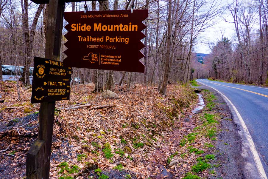
This is the DEC Parking Area for Slide Mountain. It can hold about 40 cars. The Trail Head you see in the Parking Area is for Slide Mountain. You do NOT want to take this trail. Instead walk back to the road (Rt 47). That is where you will start your hike.
|
|
 |
You want to walk along the road (RT 47) towards Rt 28 (Big Indian) for 1.05 miles. Please watch for cars coming towards you. Walk on the shoulder, or step off the road to let cars past you.
|
|
 |
After walking north on the shoulder of Rt 47 (towards Rt 28), you will walk past Winnisook Lake. Once you are just past Winnisook Lake, you will see a driveway (far right of picture), an old logging road (center of the picture), and Rt 47 (left of the picture). You want to take the old Logging road at the center of the picture. This is the Winnisook Trail. It is NOT an official DEC trail, but does get maintenance.
NOTE: The first 1/4 mile of this hike is on private property. The DEC has obtained an easement from the owner for the public to walk on the trail.
. |
|
 |
The first 1/4 mile of the trail belongs to the Winnisook Club. The DEC has obtained an easement for the public to hike over this easement. Please stay on the trail, and be respectful to the land owners.
|
|
 |
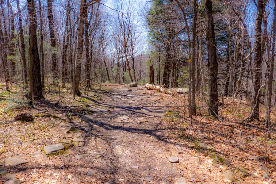
The Winnisook Trail was a former logging road. For the next 1.55 miles, it is mainly flat and easy walking. |
|
 |
There are a few small water crossing. Most of the year they may be dry. In the Spring and after large storms there may be a few muddy spots. The trail does get some maintenance, but there may be times where there are trees across the trail.
|
|
 |
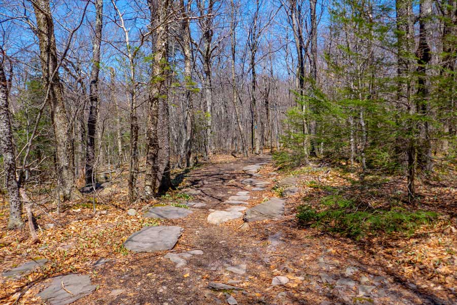
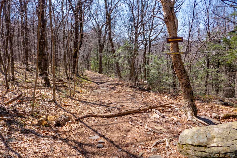
As you approach the Trail Junction for Giant Ledge, you will notice the trail now has a slight uphill climb. This tells you that you are approaching the trail Junctions.
The first Trail Junction will be on your LEFT. The trail drops off the side of the hill down a rocky trail. You want to continue straight for another 50' until you reach the NEXT Trail Junction.
Once you reach the 2nd Trail Junction on the LEFT, you should see several DEC signs on the RIGHT. This is the trail junction for Giant Ledge, Panther Mountain, and Fox Hollow. You want to take a LEFT at this Trail Junction.
|
|
 |
This is one of the DEC sign at the Trail Junction to Giant Ledge Panther Fox Trail. You want to take a LEFT at the trail junction where this sign is located.
|
|
 |
IMPORTANT NOTE: Before you start to head up the Giant Ledge Panther Fox Trail, stop and turn around. You should see this view behind you. In the distance you will see a rock on the path. When you return from your hike to Giant Ledge, you want to continue STRAIGHT!. There is even a sign on the tree behind the rock telling you to go right. Do NOT go right! Right will take you to the Giant Ledge Parking Area. Your car is located in the Slide Mountain Parking Area! Sometime when hikers return back down the mountain they accidentally end up in the Giant Ledge Parking Area, which is 2 miles from you car!
|
|
 |
This is the beginning of the Giant Ledge - Panther - Fox Trail. Most just call it the Giant Ledge Trail. For a ways the trail will remain fairly flat.
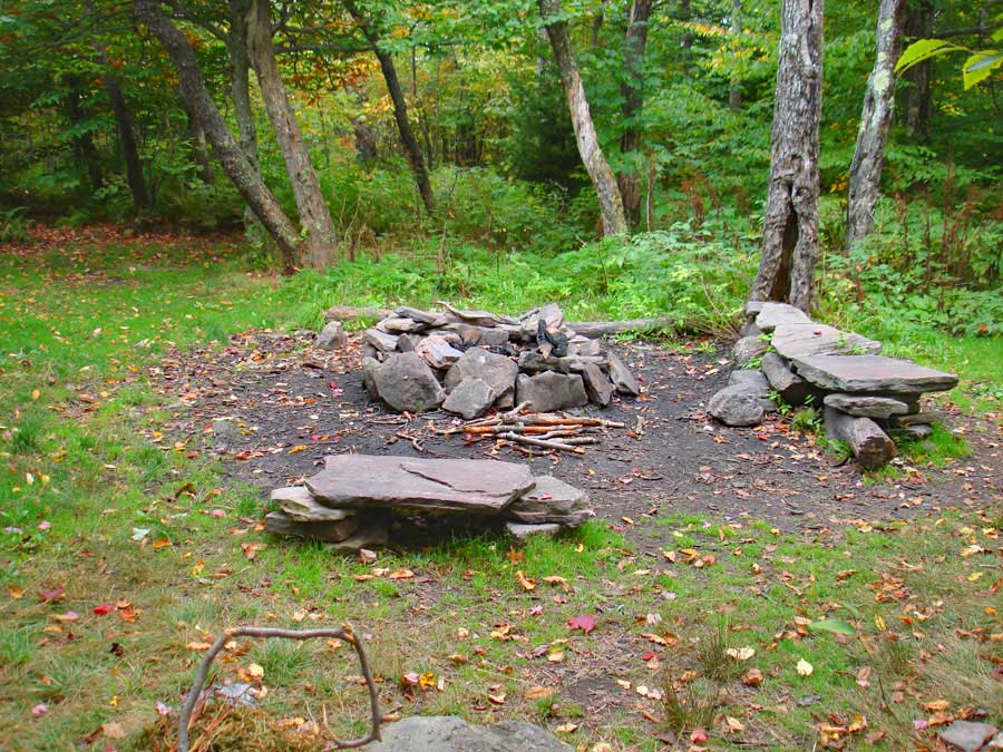
Just after you start up the trail, there is a NY State DEC primitive campsite on the RIGHT. There are 4 campsites in the region.
The DEC Trail Markers will change to BLUE on the Giant Ledge Panther Fox Trail.
|
|
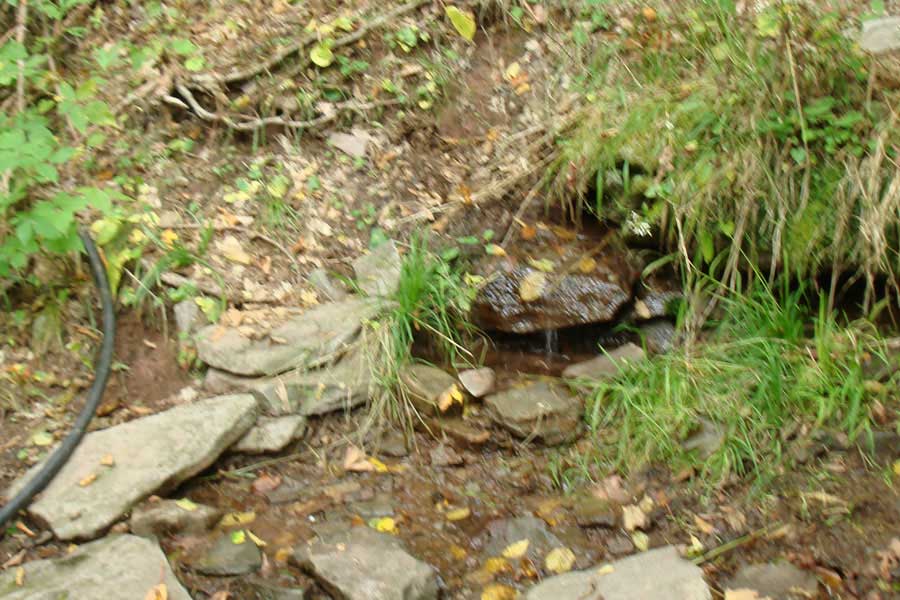 |
There is a spring located on the south side of Giant Ledge. After you hike up the Giant Ledge Trail 6/10 of a mile, there is a side trail on the LEFT that will take you to the Spring. It does flow most of the year.
|
|
 |
After you hike 3/4 of a mile from the beginning of the Giant Ledge - Panther - Fox Trail, you will come to your first view point. There are about 5 major view points along Giant Ledge.
|
|
 |
This is the 2nd View Spot on Giant Ledge
|
|
 |
After the 2nd view spot there is an official NY State DEC primitive campsite on the LEFT side of the trail. It is a well liked campsite due to it's location.
|
|
 |
After the campsites, there are 3 more view spots that are commonly visited..
|
|
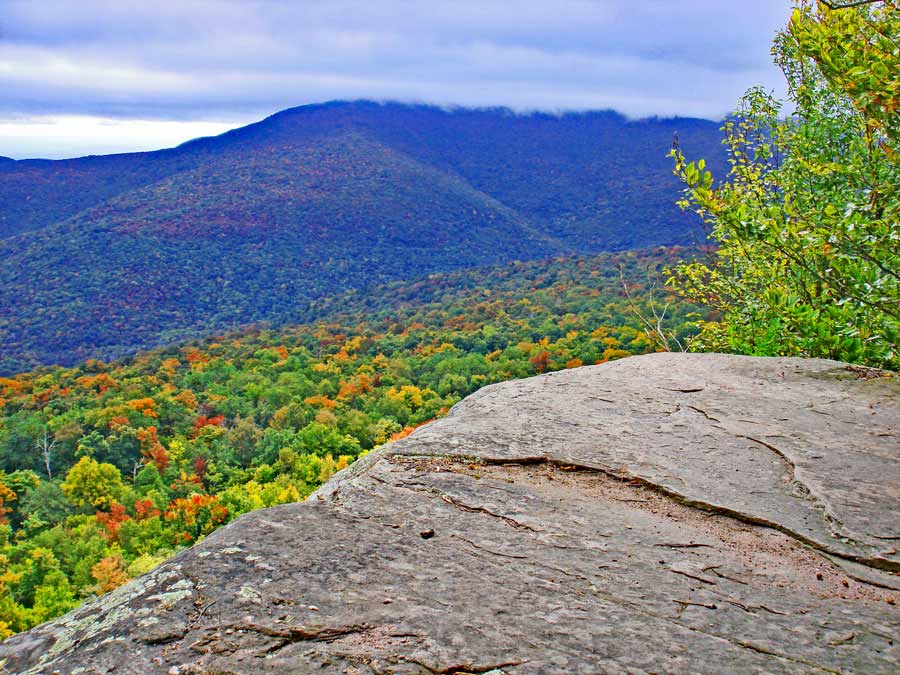 |
View Spot on Giant Ledge. That is Slide Mountain in the distance.
|
|
 |
View Spot on Giant Ledge. That is Slide Mountain in the distance.
If you are only visiting Giant Ledge, you are done. You can turn around and hike back to your car. If you plan on visiting Panther Mountain, continue down the trail.
|
|
 |
 |
After you hike across the col between Giant Ledge and Panther Mountain, there are a few spots, where there is some elevation gain. Nothing very difficult.
About 3/4 of a mile after leaving Giant Ledge, you will encounter the 3,500' elevation sign. You cannot camp overnight above 3500' in the Catskills outside of the Winter months.
|
|
 |
 |
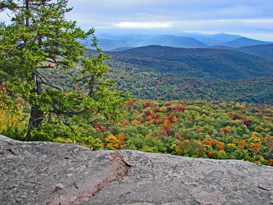
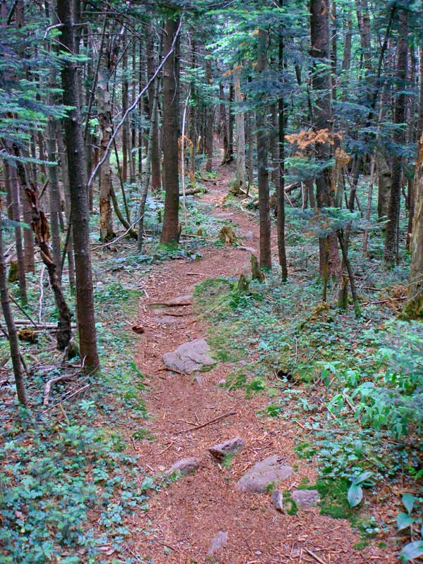
There are some beautiful conifer forest past Giant Ledge. And, even after the summit of Panther Mountain you will find some nice conifer forest.
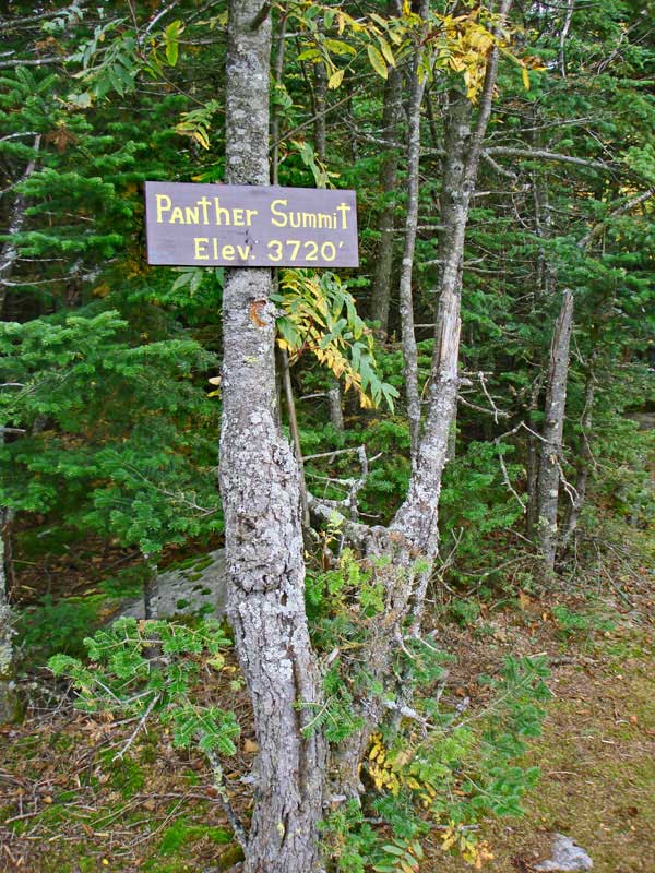
The summit of Panther Mountain has a sign designating the summit. Over the years, the sign sometimes needs to be replaced. Most Catskill Summits do not have signs.
There is another view spot worth visiting on Panther Mountain. It is about 0.18 miles past the Panther Summit.
When you get done return back to your car in the Slide Mountain Parking Area. You will return the same way you came up the trail. Listed below will help from from getting lost at the two trail junctions at the beginning of the Giant Ledge Panther Fox Trail
|
|
 |
When you come back down from Giant Ledge, you will see this sign at the end of the Giant Ledge Panther Fox Trail. You want to take a RIGHT here.
While the sign states that you are 2.8 miles from your car, you are actually 2.6 miles from your car.
|
|
|
Hike down about 50' to where you see the rock in the path. STRAIGHT will take you to the Slide Mountain Parking Area. Go STRAIGHT! Right will take you to Giant Ledge Parking Area.
|
|
 |
You will see a sign on the tree behind the rock pointing to the right. Do NOT go right! Ignore the sign and go STRAIGHT! Hike approximately 1.55 miles to Rt 47.
|
|
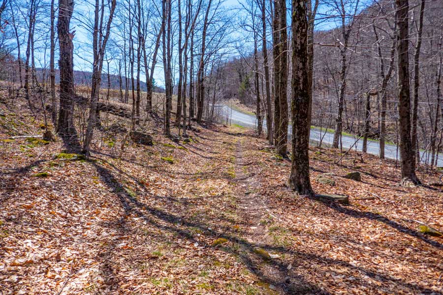 |
From the end of the Winnisook Trail, hike SOUTH on the shoulder of Rt 47 for approximately 1.05 miles to the Slide Mountain Parking Area.
|
|
|
When you arrive at the slide Mountain Parking Area, take a LEFT into the parking area where your car is located. Hope you enjoyed the hike!
|
|
|
S E C T I O N S
|
W E A T H E R
|
O T H E R
|