Hike Peekamoose Table Trail from Peekamoose Road |
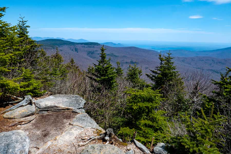 |
| View is very close to the summit of Peekamoose Mountain |
| |
| |
|
OVERVIEW |
| | Type of Trail: | 100% DEC trails |
| | Trail Mileage: | 3.95 miles (one-way) or 7.90 (round-trip) |
| | Trail: | 2-track trail on logging road at beginning - 1-track to summit |
| | Views Points: | 4 view points - excellent views to the east and south |
| | Difficulty: | Moderate |
| | Hiking Time: | Average 5.00 hours round trip in the Summer |
| | Elevation - Summit: | 3,845' (A) |
| | Elevation Gain: | Gain of 2,589 feet from the Peekamoose DEC Parking Lot to summit of Peekamoose Mountain. |
| | |
| | | Best Time to Hike: | September 16th to May 14th |
| | Permit Needed: | May 15th to September 15th |
| | Catskill Highest: | #11 |
| | Parking Area : | DEC Parking Areas off Peekamoose Road |
| | Winter Access: | Plowed in the Winter |
| | Camp sites: | Many Camp Sites located in the Peekamoose Valley |
| | |
| | | USGS Previous Names : | Mount Peak o' Moose, Peak o' Moose - Changed to Peekamoose in 1981 |
| | USGS Summit Elevation: | 3,813'(L) - 3,843' (A) |
| | USGS Peekamoose Summit: | 41.95305, -74.398067 (DEC-WGS84) |
| | USGS Peekamoose Summit: | N 41 57.183, W 74 23.884 (GPS) |
| | USGS Peekamoose Summit: | 18N 549887 4644739 (UTM) |
| | USGS Peekamoose Summit: | N41 57 10, W74 23 53 (Degree, Min, Sec) |
| | |
| | | USGS Map: | USGS Peekamoose Quad Maps |
| | | |
| | | DEC Trail Map: | DEC Sundown Wild Forest Map (free) |
| | | |
| | | Digital Mapper: |
Topo
Terrain
Satellite |
|
|
Maps - for Peekamoose Mountain |
|
 |
|
|
Notes - Peekamoose Mountain |
| PEEKAMOOSE MOUNTAIN |
| Many people claim that this is the harder of the two routes to the summit of Peekamoose Mountain. The climb up the ridge line is harder then the other route. But, the views and route is actually better. But, everyone has a different opinion. |
| |
| PARKING |
| Any use (Blue Hole, Camping, Parking, etc) in the Peekamoose Valley REQUIRES a permit between May 15th to September 15th. We STRONGLY advise you to avoid the Peekamoose Valley during these summer months. If you want to hike Peekamoose Mountain in the Summer months, we recommend that you hike it from the Neversink, and park at the Denning Parking Area. After September 15th to May 14th (Fall, Winter, and Spring months) does NOT require a permit to park, and it is a good time to visit the Peekamoose Valley and hike Peekamoose Mountain, Bangle Hill, or the waterfall hikes during the Fall, Winter, and Spring months. |
| |
| HISTORY |
50 years ago, the Peekamoose Valley was a location for locals to camp and swim. Back then most local swam at what is known as the "Blue Hole". Back then, there was a large blue stone ledge above the Blue Hole, that was 20 feet high. Locals kids would off the ledge into the Blue Hole. The Blue Hole was believed to be 50+ feet deep. No one was ever able to reach the bottom of the Blue Hole. You could not see the bottom of the Blue Hole. All you saw was blue water. This is how the Blue Hole was named. Back around 1980 a large storm broke off the 20' ledge. The large blue stone ledge fell into the Blue Hole, and ruined it forever. Locals could no longer swim there. Over the decades, the water broke up part of the large blue stone ledge, and a much smaller shallow swimming hole developed. Some people promote the current Blue Hole, as the Legendary Blue Hole. That is NOT true. Today, it is just another swimming hole. Locals no longer visit the current Blue Hole, acknowledge that the Legendary Blue Hole is gone forever.
Around 2010, a Swimming Hole website promoted the Blue Hole, which drove large groups of people to visit this swimming hole, thinking that they were swimming in the Legendary Blue Hole. This caused a massive inflow of people to the Peekamoose Valley to camp and swim based up that information.
Today, the Peekamoose Valley has become over commercialized, and the large crowds of people have ruined the beauty of the Peekamoose Valley. Today you have to pay money to visit this area. This has driven virtually all local people to other areas. Some of the hiking clubs have warned it's members to avoid the Peekamoose Valley in the summer months. There are estimated to be 40-50 waterfalls in the Peekamoose Valley. Some are on private property. Other waterfalls have unofficial trails going to them. Some you have to bushwhack to find them. 95% of visitors will only see a few of Peekamoose Valley's waterfalls. |
|
|
| | DIRECTIONS - Peekamoose Parking Area |
| |
|
| | Get off New York State Thruway at Exit 19 (Kingston). |
| | Take a RIGHT out of the NYS Thruway onto Route 28 West. |
| | Go approximately 16.1 miles on Rt 28 West |
| | Take a LEFT onto Rt 28A just before Boiceville |
| | Go approximately 3.0 miles on Rt 28A |
| | Take a RIGHT onto Rt 42 in West Shokan (Watson Hollow Road which turns into Peekamoose Road) |
| | Go approximately 10.2 miles on Rt 42 (Peekamoose Road) |
| | DEC Parking Area (80-car) is on the RIGHT side of the road. |
| | If this Parking Area is full or closed - continue further to the other Parking Areas for an available space. |
|
|
MILEAGE CHART - Peekamoose Mountain TH |
| | Mile Point | Altitude | Notes |
| | 0.00 | 1,256' | Peekamoose Table Trail Head |
| | 0.18 | 1,458' | DEC Registration Box |
| | 2.39 | 2,944' | Reconnoiter Rock |
| | 3.09 | 3,523' | 3500' DEC sign |
| | 3.12 | 3,508' | View Point #1 |
| | 3.16 | 3,563' | View Point #2 |
| | 3.41 | 3,532' | Water Source - Spring |
| | 3.94 | 3,800' | View Point #4 |
| | 3.95 | 3,845' | Summit of Peekamoose Mountain |
|
|
Hike to Peekamoose Mountain from Peekamoose TH |
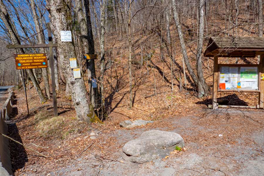 |
This is the Trail Head for the trail from Peekamoose Valley to the summit of Peekamoose Mountain. The Parking Area has been moved 3/10 of a mile west of it's past location in 2024.
|
|
 |
 |
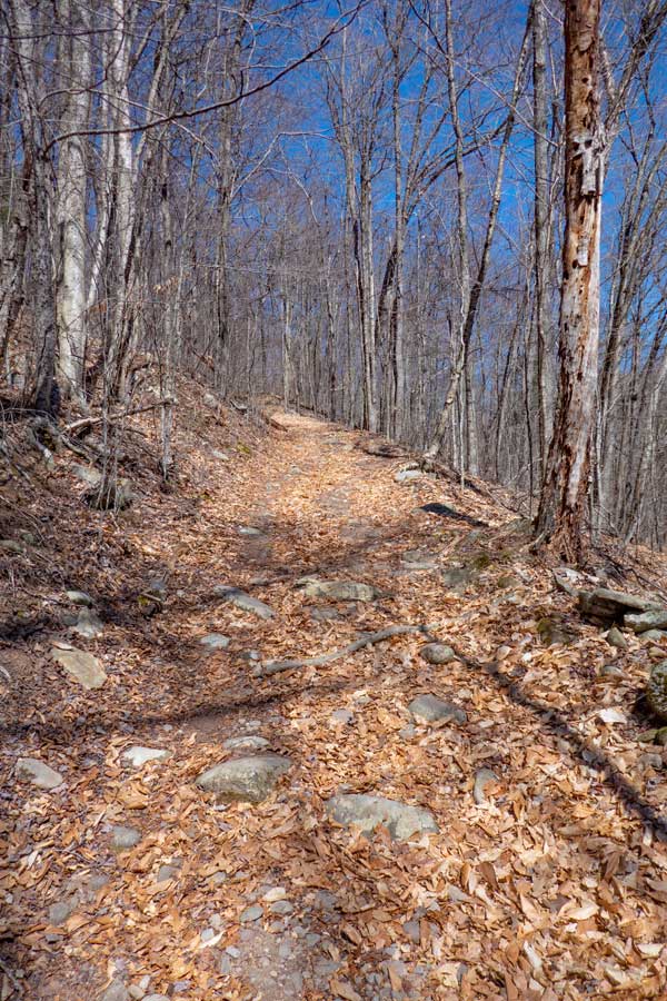
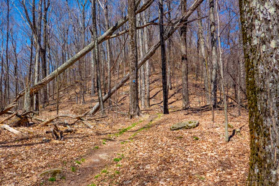
The image on the left shows the old logging road that went up the mountain. It is now the DEC Trail to the summit.
The trail has a very consistent incline up this side of the mountain. Once on top of the hill, the incline will decrease to almost level. |
|
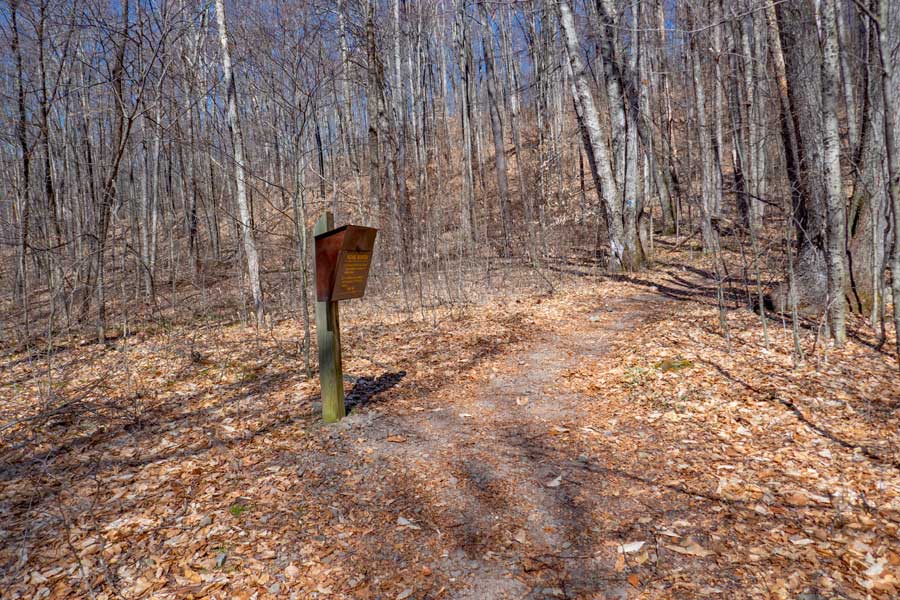 |
The DEC Registration Box for the hike from Peekamoose Valley to the summit of Peekamoose is about 2/10 of a mile from the Peekamoose Trail Head. Please register for your hike.
. |
|
 |
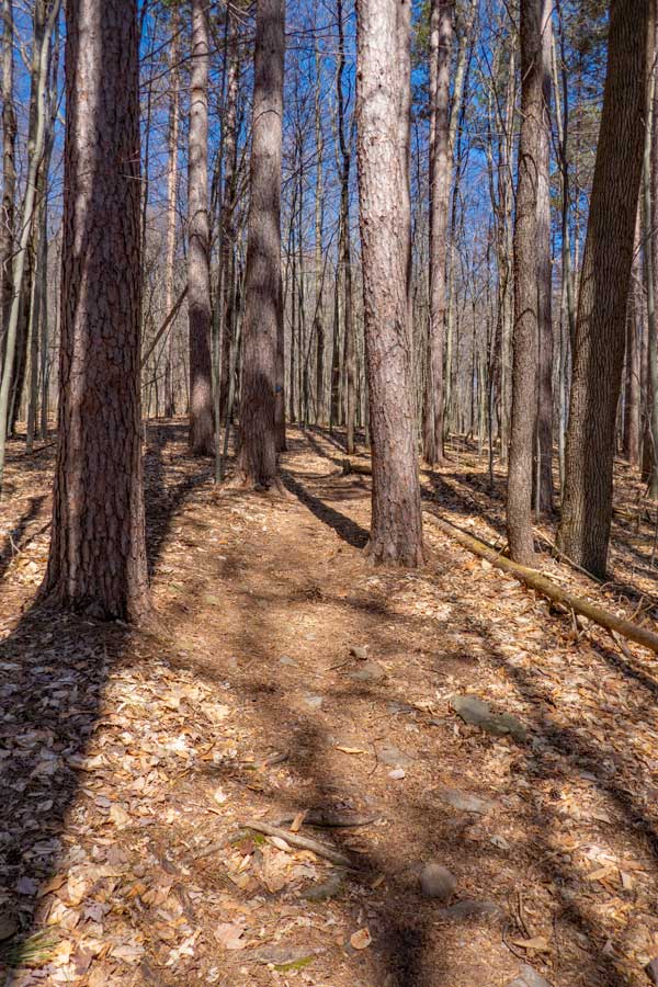 |
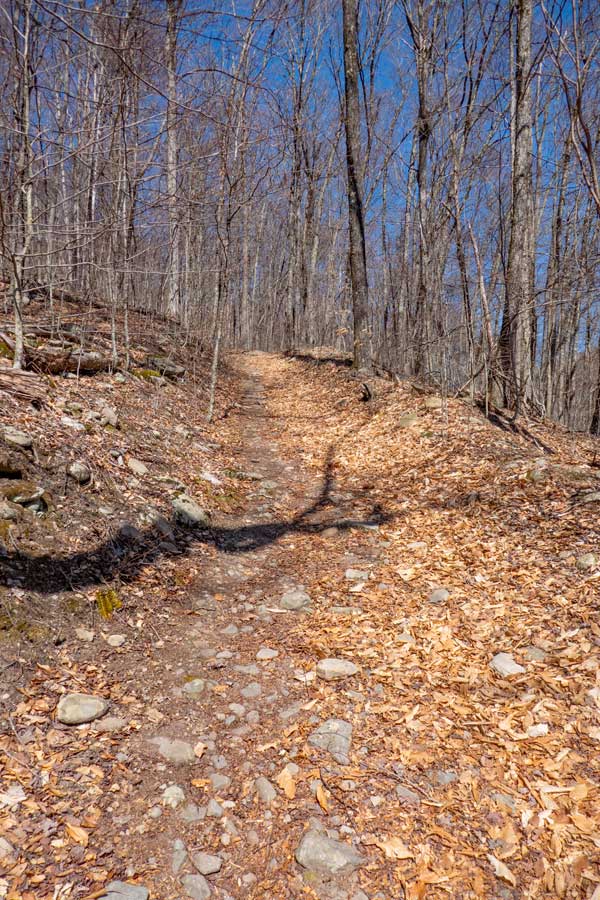
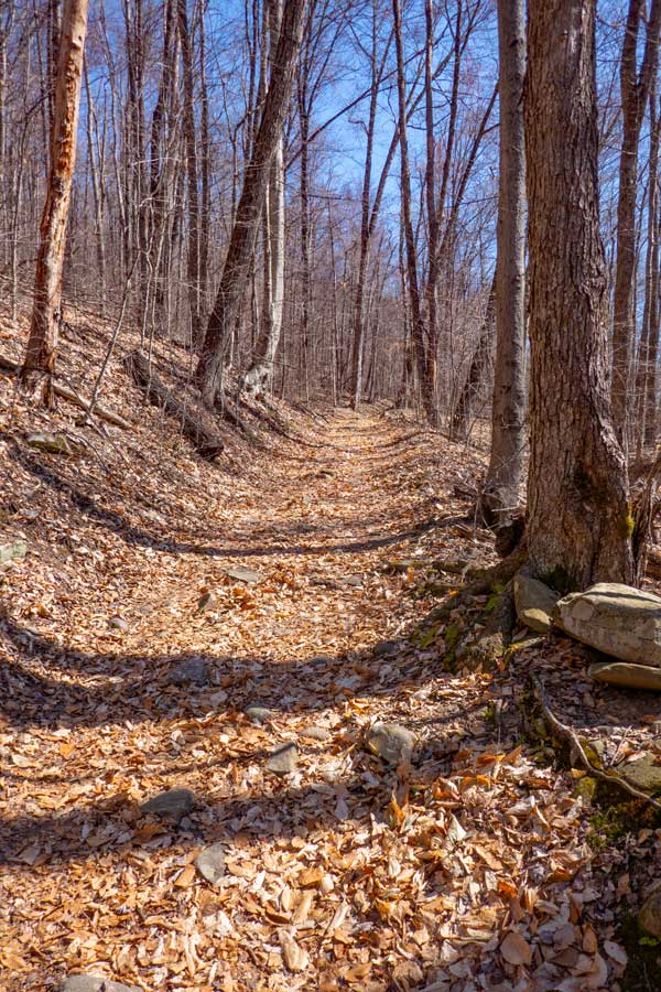
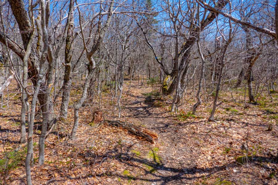
The trail will continue on the old logging road at a slight incline. Easy hiking here.
There is a small long-needle pine forest on this long section of fairly flat land. At this point the logging road has ended, and you will hike the rest of the way to the Peekamoose Mountain summit on a single-track trail. |
|
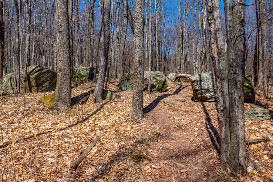 |
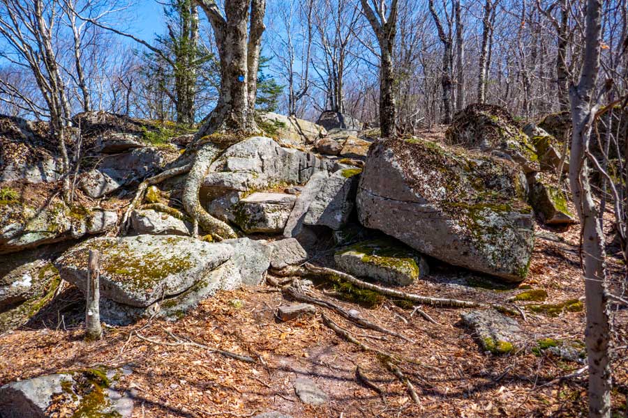
Not long after you hike through the pine forest, you will encounter some Glacier Erratics sitting on the forest floor. This is a good indication that steeper inclines are nearby.
|
|
 |
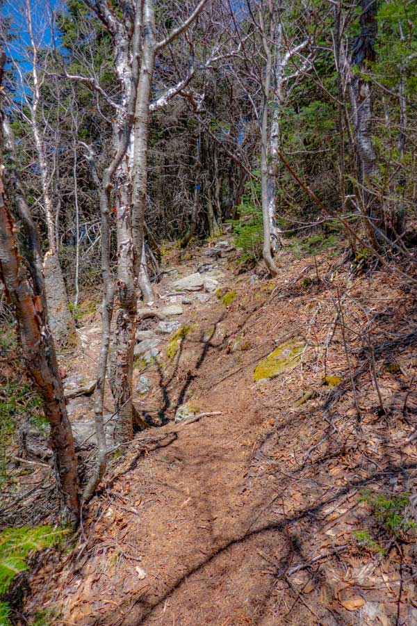
This is the beginning of the steepest part of the hike. You will follow a ridge line up the mountain. The ridge is generally about 200-250' wide. During this section, you will encounter rock ledges, loose rocks, and smooth trails. The incline will stay fairly steady until you reach Reconnoiter Rock.
|
|
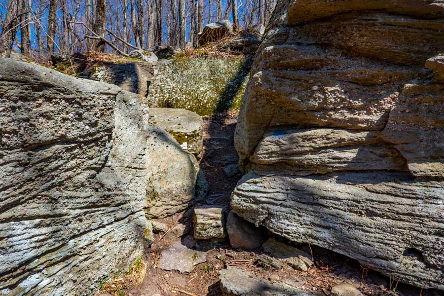 |
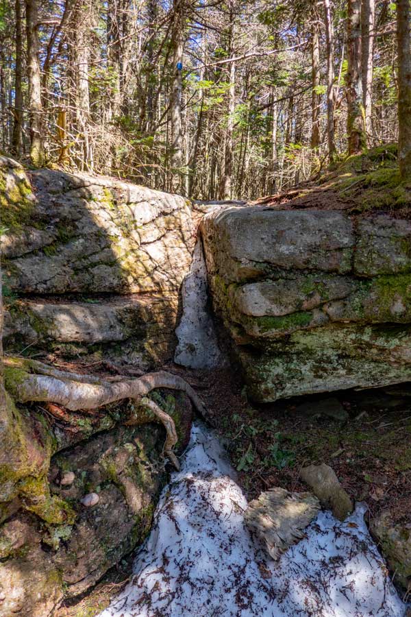
This is one of the small ledge rocks along the ridge line. After you hike up this small section, turn LEFT for a couple feet, and then turn RIGHT to climb up the crack in the ledge wall. The crack (visible in the image) is just wide enough for your boot to fit.
|
|
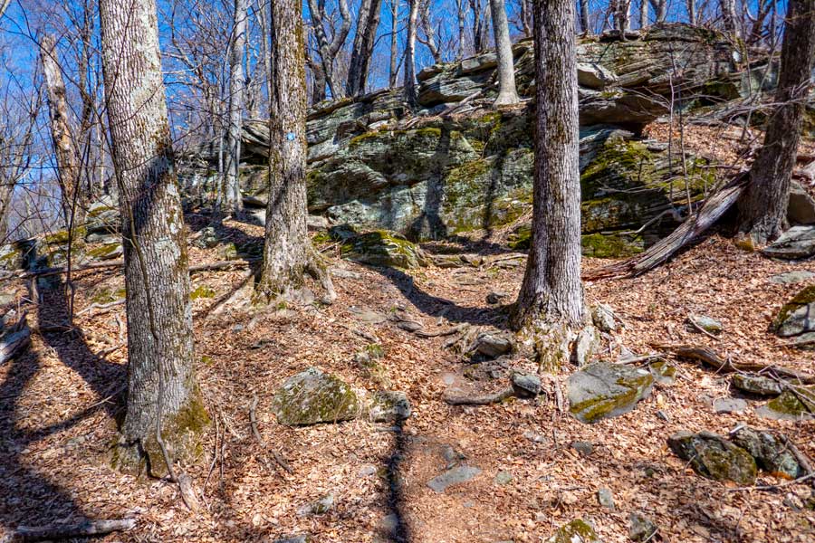 |
This is another ledge you will have to hike up on the ridge line section of the Peekamoose Table Trail. This part is much easier then it looks. It is a zig-zag up ramps of the rock.
|
|
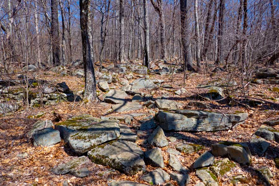 |
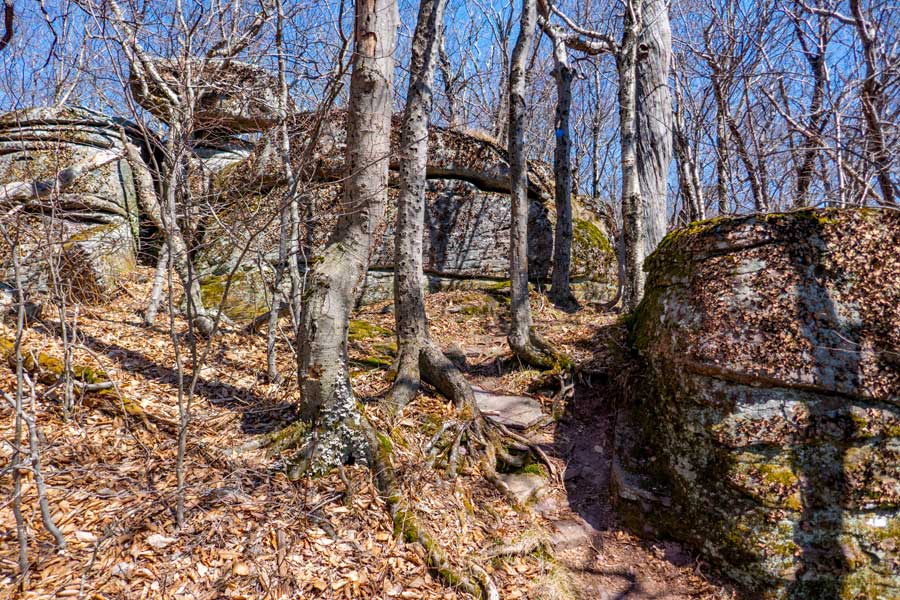
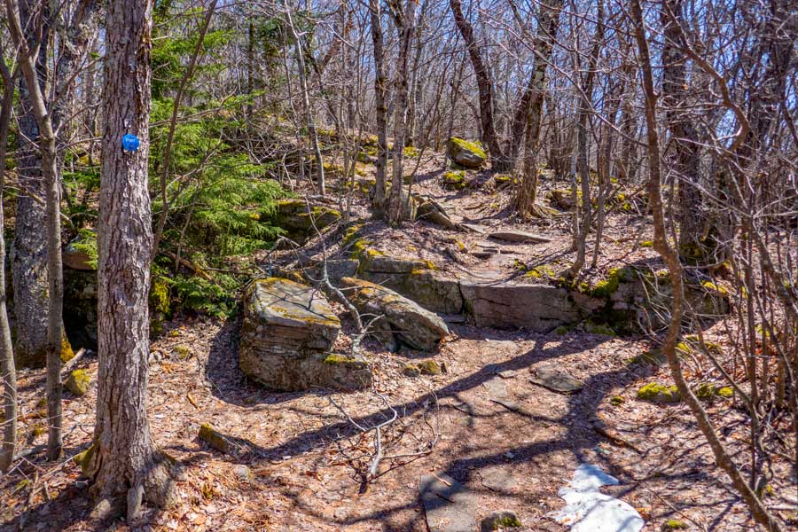
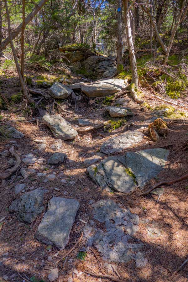
In a couple locations along the ridge line, you will find piles of these rocks that the trail goes through. They are generally short sections of rocks.
|
|
 |
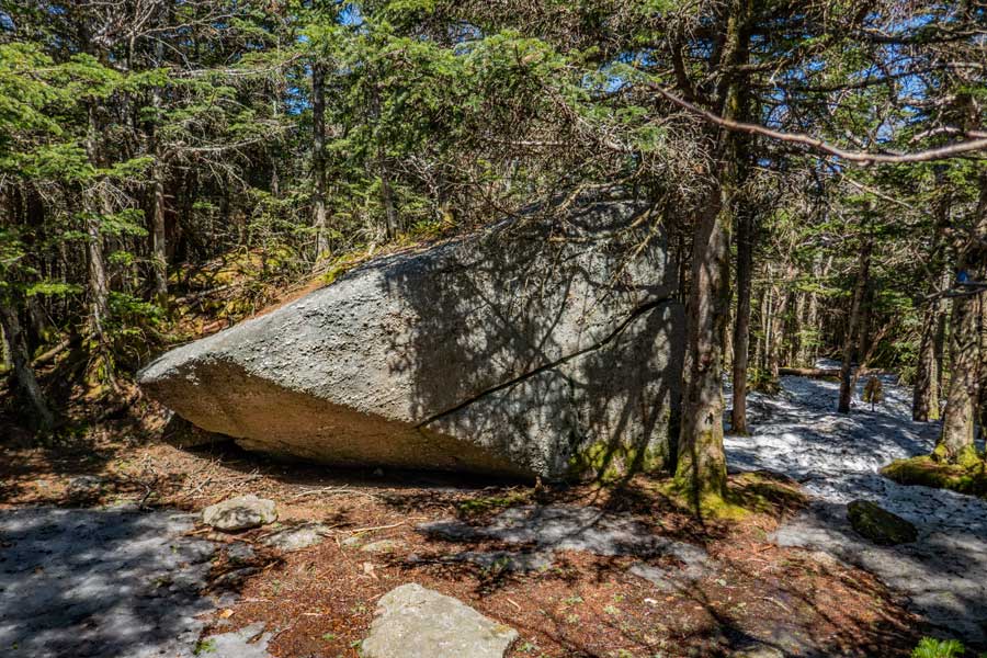
About 2.4 miles up the Peekamoose Table Trail will be this large boulder, call Reconnoiter Rock, that sits on the edge of the ledge. It is positioned like it is just about ready to fall off the ledge. Reconnoiter means to make a reconnaissance of an area.
|
|
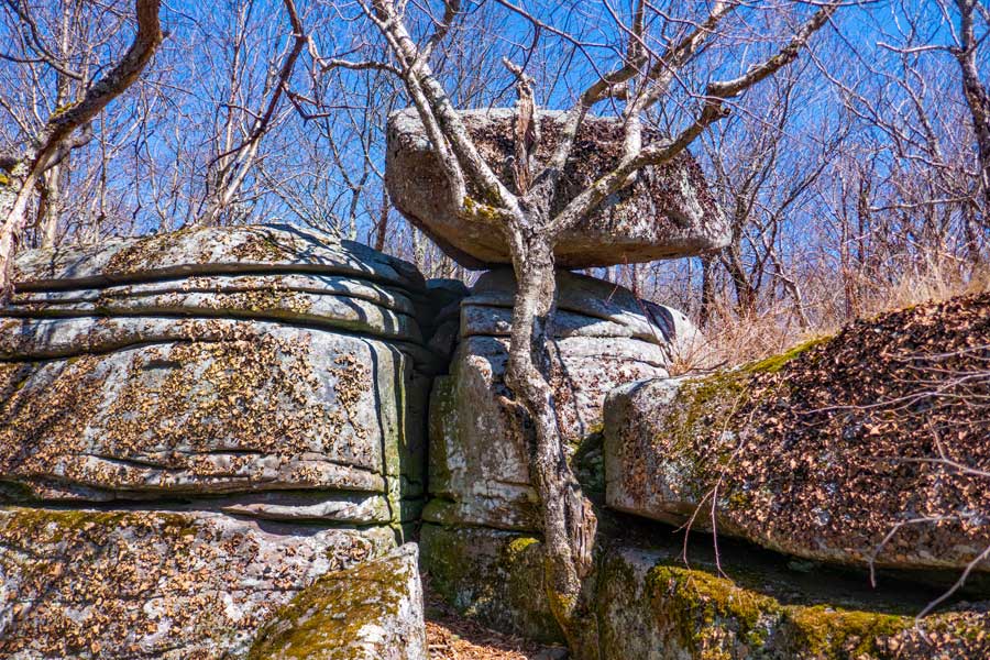 |
This is an image up close of Reconnoiter Rock. It looks like the tree is holding up the rock, but that is not the case. Behind Reconnoiter Rock is a nice place for a break or lunch.
|
|
 |
After you pass Reconnoiter Rock, the incline levels off. The trail continues for a little ways until the ridge line turns towards the east. The trail then turns 90 degrees to the right, and you will then be headed in an easterly direction. There is a nice place to view the valley where the Bear Hole Brook originates. You can also see Van Wyck Mountain and a glimpse of Table Mountain.
|
|
 |
After the ridge line of the Peekamoose Table Trail has turned 90 degrees to the right, with the trail now pointed in an easterly direction, you come to another small ledge. The Peekamoose Table Trail goes up the rocks between the big tree (with blue trail marker on it), and the large boulder on the right side of the image.
Once up on the ledge, you can look to the left for a view of Van Wyck and Table Mountain. If you go over to the edge of the ridge line (less then 50' off the trail), you can get a better view.
|
|
 |
This what the easterly ridge line of the Peekamoose Table Trail typically looks like. The incline is fairly easy. Again the ridge line is fairly narrow, but a little more rocky.
|
|
 |
At around 3.1 miles, you will come to the 3500 elevation sign high up on the tree. Once you get past the tree with the 3500 elevation marker on it, turn right. After turning right you will see your first View Spot.
|
|
 |
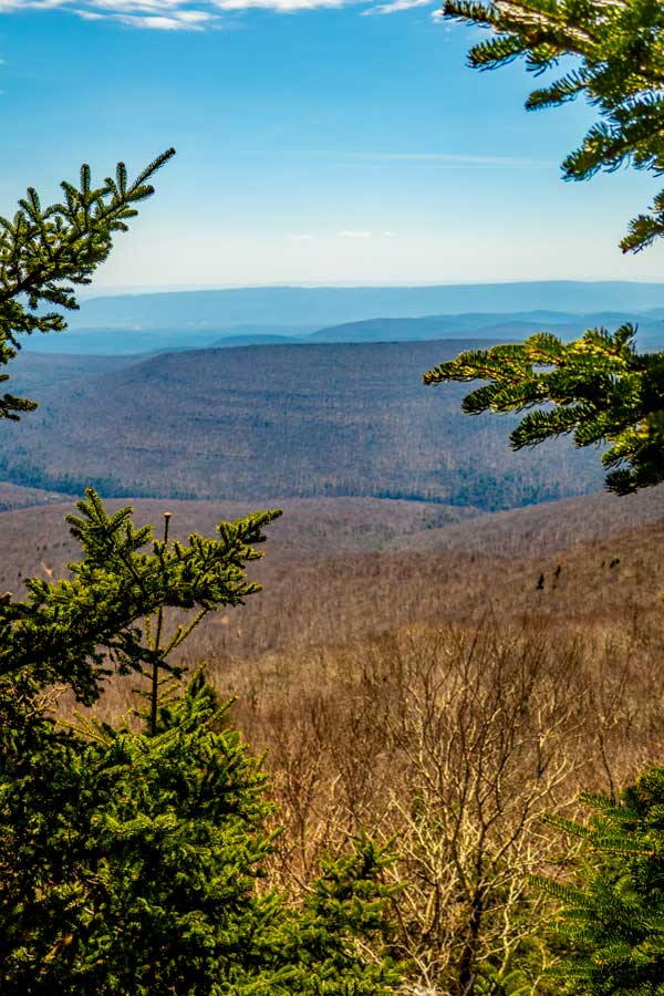
This is View Spot #1. It give you a nice view across the Peekamoose Valley. From left-to-right: Spencer's Ledge, Samson Mountain, and Bangle Hill. The north and east faces of Samson Mountain are quite steep. It also has some nice first-growth forest on the mountain. Samson Mountain is best accessed from Bangle Hill Trail off Spencer Road in the Vernooy Forest. The easterly ridge line then turns a little north to become the northeasterly ridge line.
|
|
 |
After you travel another 250' up the trail, you will come to View #2. It has another view across the Peekamoose Valley. At the center of the photo is Spencer's Ledge. On the right is Samson Mountain.
|
|
 |
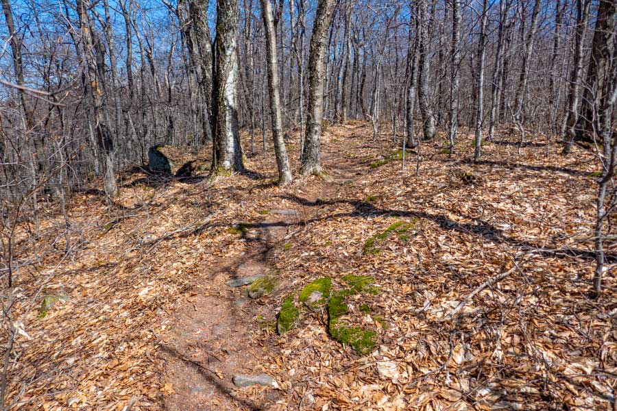
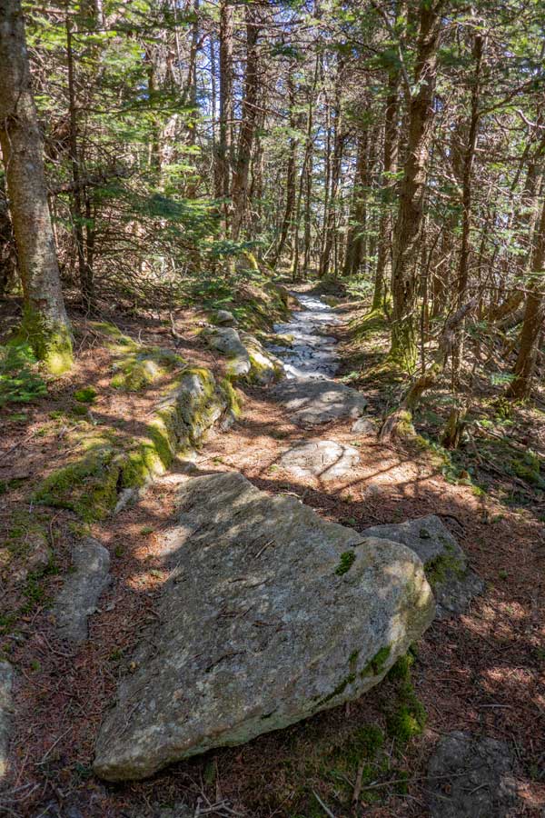
As you hike the northeasterly ridge line, the trees will get smaller. Sometime the winds along this section of the ridge line can be quite intense. Hence, the trees are not very tall, but older then they look. This section is fairly flat.
|
|
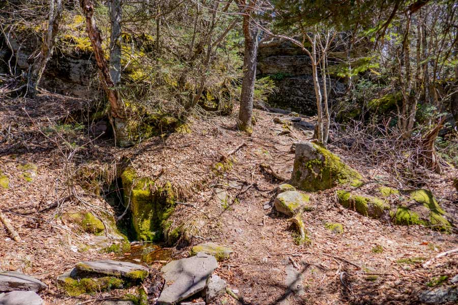 |
At 3.4 miles, you will encounter this slow flowing spring on the left. This is the only spring on the south side of Peekamoose Mountain. From this point forward, you will start to encounter a few little climbs up some ledge rock.
|
|
 |
 |
The image shows you a small little climb up the ledge rock. Maybe about 6' high. Fairly east to climb up-and-down.
There are a few smooth section of the along the section of the hike from the Spring to the summit of Peekamoose Mountain. |
|
 |
 |
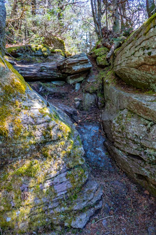
Another image of a rocky trail with small little climbs.
This image show a small little climb that looks like a mini-Cornell Crack. Again very easy to climb up |
|
 |
 |
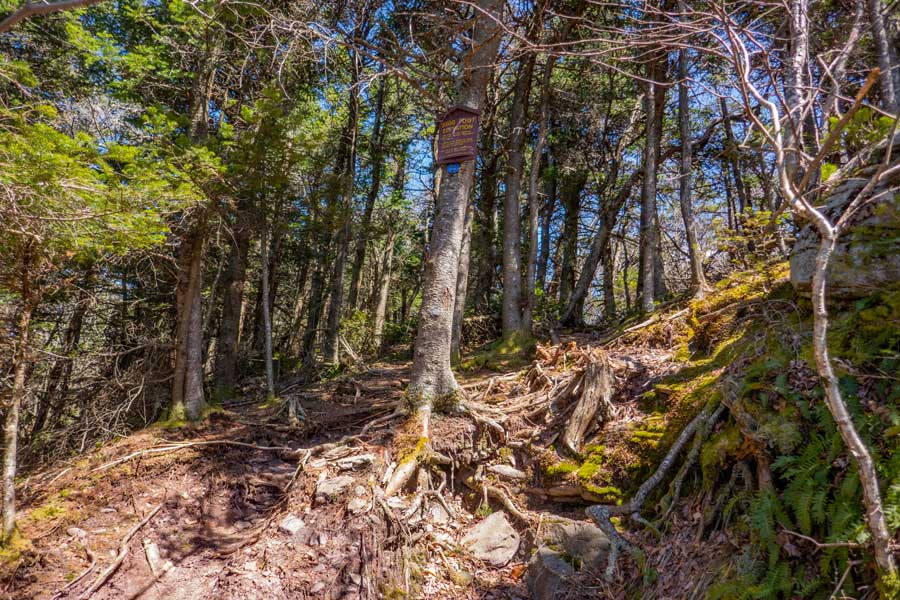
If you look carefully along the right side of the Peekamoose Table Trail, before you reach the summit, you will see a little trail on the right that takes you to a small ledge with a limited view to the east.
This is the final section of the Peekamoose Table Trail before you reach the summit of Peekamoose Mountain.
Just before you reach the large boulder that is the summit of Peekamoose Mountain, there is another large trail on the right. It is about 50' south of the summit of Peekamoose Mountain. It will take you to the fourth view spot along this hike. It is also the best view point. |
|
 |
This is the summit of Peekamoose Mountain.
If this is the end of your hike. Turn around and hike back to your car. If you want to include Table Mountain in this hike, continue further down the Peekamoose Table Trail to the north. The section of trail between Peekamoose and Table Mountain is quite nice.
|
|
|
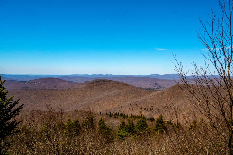
This is the view spot #4 off the summit of Peekamoose Mountain. In the near distance is Lone, Rocky, Balsam Cap, and Friday Mountain. In the far distance is the Indian Head Wilderness with the Devil's Path, Plattekill Mountain, and Overlook Mountain. You can also see the Hudson River on a clear day. This is a nice place for lunch or a good break.
|
|
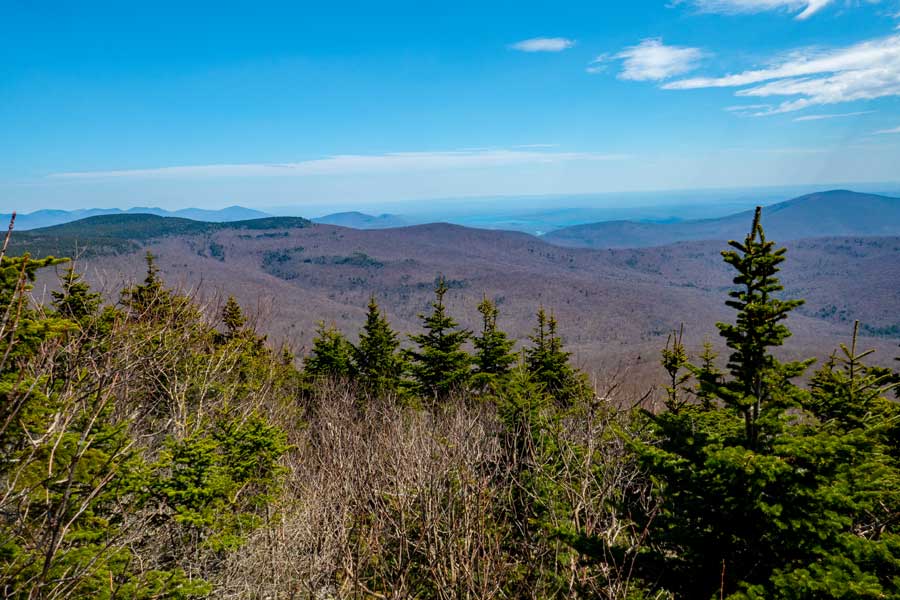 |
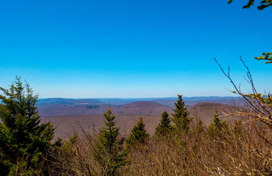
This image was taken in a more easterly direction.
|
|
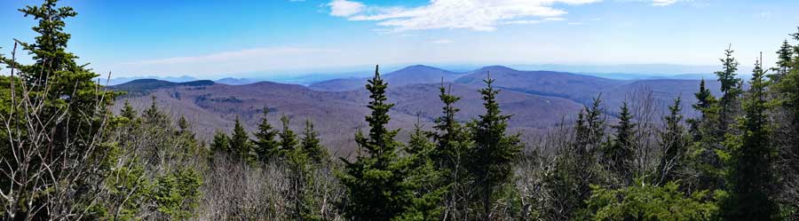 |
This is a panoramic image from the view spot off the summit of Peekamoose Mountain.
|
|
|
S E C T I O N S
|
W E A T H E R
|
O T H E R
|