Hike Romer Mountain & Mt Pleasant from Phoenicia |
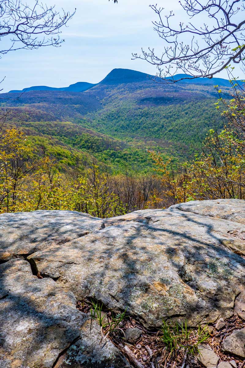 |
| View of Wittenberg Mountain from Mt Pleasant |
| |
| |
|
OVERVIEW |
| | Trail Name: |  Phoenicia East Branch Trail (Phoenicia to Trail Junction to Mt Pleasant)
 |
| | Parking Area : | Romer Mountain Parking Area on Lane Street in Phoenicia |
| | Winter Access: | Parking Area is NOT Plowed in the Winter |
| | Camp sites: | Zero Camp Site locations |
| | | |
| | | Trail Length: | 4.99 miles (one-way) or 9.98 (round-trip) |
| | Trail Type: | Single-track trail |
| | Hiking Time: | Average 6-7 hours round trip |
| | Romer Elevation: | 2,249' (A) |
| | Elevation Gain: | Gain of 1,760 feet |
| | Views : | 3 view spots |
| | Difficulty: | Easy-to-Moderate |
| | |
| | | Romer Mtn Summit: | 42.0528, -74.317533 (DEC-WGS84) |
| | Romer Mtn Summit: | N42 03 10, W74 19 03 (Degree, Min, Sec) |
| | Romer Mtn Summit: | N 42 03.168, W 74 19.052 (GPS) |
| | Romer Mtn Summit: | 18N 556474 4655864 (UTM) |
| | | |
| | | USGS Map: | USGS Phoenicia Quad Maps |
| | |
| | | DEC Trail Map: | DEC Slide Mountain Wilderness Map (free) |
| | | |
| | | Digital Mapper: |
Topo
Terrain
Satellite |
|
|
Maps for Romer Mountain & Mt Pleasant in the Slide Mountain Wilderness |
 |
|
|
|
| | Notes About Hiking to Romer Mountain & Mt Pleasant from Phoenicia |
|
| | OTHER INFORMATION |
|
| |
The trail to Romer Mountain and Mt Pleasant is very remote, and few people visit it. Maybe 1 person a day. Most visit Romer Mountain, and maybe 1 visitor a week for Mt Pleasant. Best to hike it with a friend.
The trail from Phoenicia to Wittenberg Mountain is fairly new, and follows new trail building and maintenance standards. It is very enjoyable hike. The steeper parts of the trail use rock steps.
There are ticks on this hike, so check yourself for ticks once your hike is done. We saw a number of deer on this hike, and where you see deer, you can find ticks.
There is only ONE place to get water on this hike. It is located 1/2 mile from the Romer Mountain Trailhead. If you are backpacking this section, make sure you carry enough water for the length of your stay on this section.
|
|
|
| | Directions to Romer Mountain Trail Head from Exit 19 (Kingston) |
| | Romer Mountain Parking Area WGS84 (DEC): 42.07895, -74.31915 - Elevation is approximately 874 feet |
| | Romer Mountain Parking Area Deg/Min/Sec: N42 04 44, W74 19 08 - Elevation is approximately 874 feet |
| | Romer Mountain Parking Area GPS: N 42 04.737, W 74 19.149 - Elevation is approximately 874 feet |
| | Romer Mountain Parking Area UTM: 18N 556317 4658766 - Elevation is approximately 874 feet
|
| |
|
| | Get off New York State Thruway at Exit 19 (Kingston). |
| | Take a RIGHT out of the NYS Thruway onto Route 28 West. |
| | Go approximately 22.2 miles on Rt 28 West |
| | Take a RIGHT off ramp onto Bridge Street |
| | Go approximately 0.2 miles on Bridge Street |
| | Take a LEFT onto High Street |
| | Go approximately 0.5 miles on High Street |
| | Take a LEFT onto Lane Street |
| | Go approximately 0.1 miles to the end of Lane Street |
| | Take a RIGHT on dirt road that has Romer Mountain Trailhead sign |
| | DEC Parking Area is 350' down nice dirt road. Small Parking Area - Holds 5 cars |
|
|
Mileage Chart from Romer Mountain Parking Area to Romer Mountain & Mt Pleasant |
| | Mile Point | Altitude | Notes |
| | 0.00 | 870' | Romer Mountain Parking Area (off Lane Street in Phoenicia) |
| | 0.02 | 898' | DEC Registration Box |
| | 0.47 | 1,159' | Trail to Spring |
| | 3.18 | 2,249' | Romer Mountain |
| | 4.99 | 2,597' | Mt Pleasant View Spot of Wittenberg Mountain |
|
|
Hike to Romer Mountain from Phoenicia |
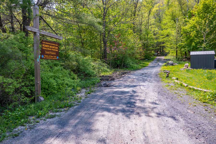 |
This is the DEC driveway that leads up to the Romer Mountain Trailhead Parking Area. It is about 350' long. Please stay on the road, because the area off the road is private property. Please be respectful of the private property owners.
|
|
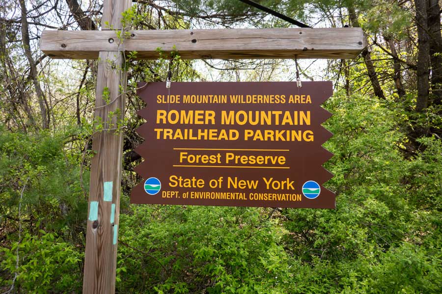 |
This is the DEC sign for the Romer Mountain Trailhead Parking Area at the entrance of the driveway from Lane Street in Phoenicia, New York
|
|
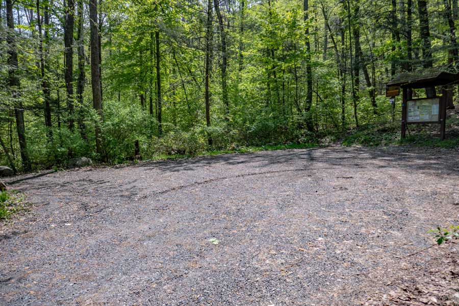 |
This is the Romer Mountain Trailhead Parking Area. Holds about 5 cars.
. |
|
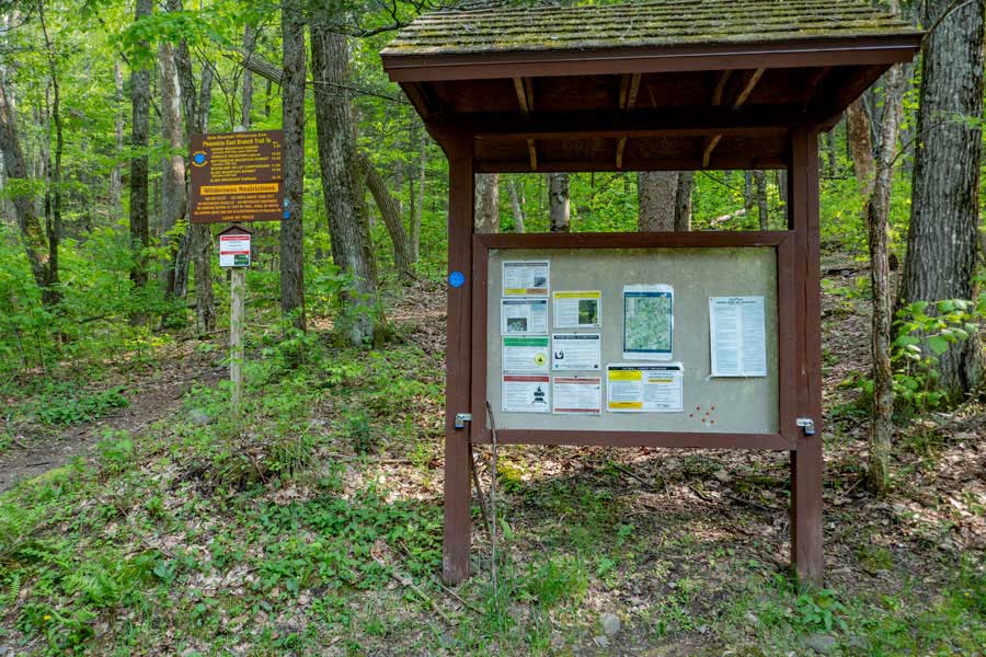 |
Take note of messages in the Kiosk for this hike. It also has the emergency contact number. On the left is the Trailhead for the Phoenicia East Branch Trail that runs from this point in Phoenicia, New York to Neversink, New York. This hike is for the first section of the trail.
|
|
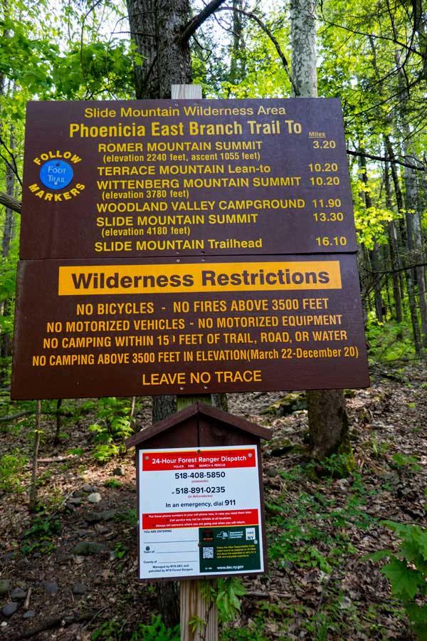 |
At the Romer Mountain Trailhead, there is this sign that contains mileage to certain points, as well as DEC Emergency Phone Number. Take a photo of the Emergency Phone Number with your cell phone. |
|
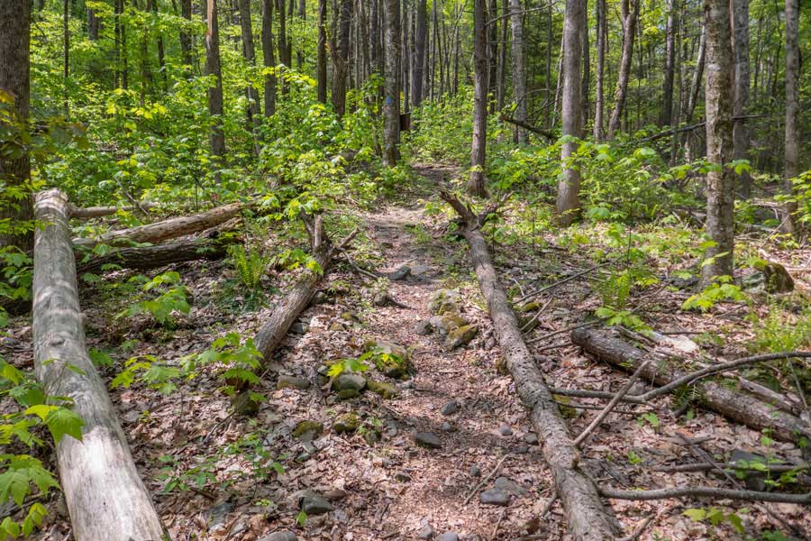 |
This is the very beginning of the Phoenicia East Branch Trail. This trail gets approximately 1 hiker per day on the trail (as of 2023). This part of the trail is considered to be very remote.
|
|
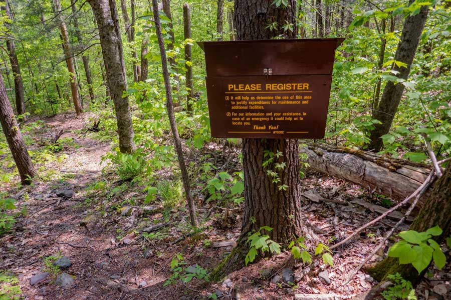 |
150' after you start up the trail, you will come to this DEC Registration Box. Please Register. If you have an emergency, the New York State Rangers will look here for information.
|
|
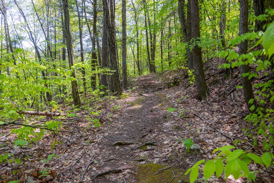 |
The beginning of the Phoenicia East Branch Trail has a fairly easy incline that goes up the mountain for approximately 1 mile. There are steps on some parts that are a little steeper then this.
|
|
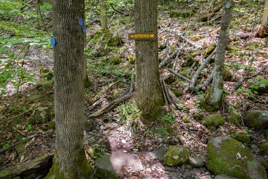 |
After you hike up approximately 1/2 mile, there is a side trail on the left that goes to the Spring. This is the ONLY water source for a very long ways. So, if you need water, please get it now.
|
|
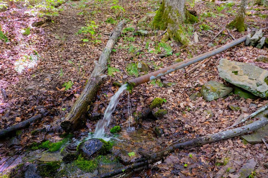 |
This is the Spring that is 150' off the Phoenicia East Branch Trail. It flows well most of the year.
|
|
 |
The first mile of the trail is the hardest part of the hike. Generally, the incline is fairly gradual. But, on steeper sections, you will find steps like you see in this photo.
|
|
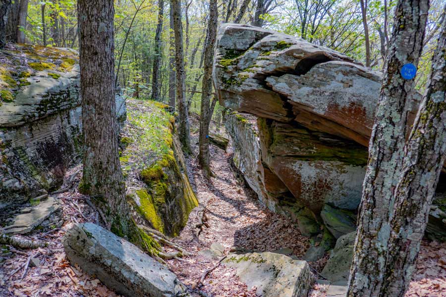 |
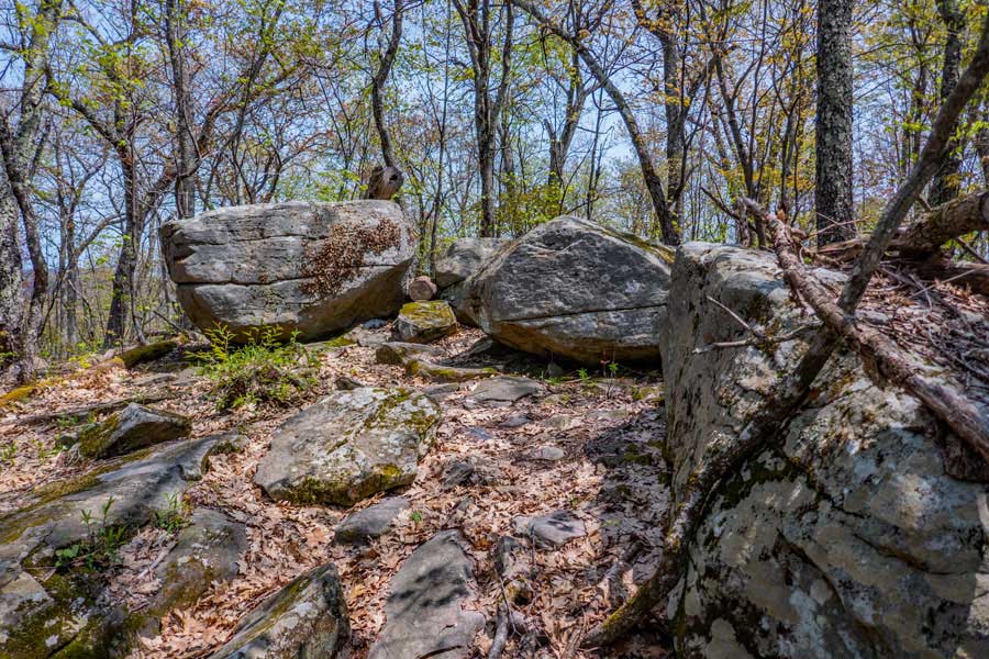
After you get up near the ridge, you will encounter this unique rock next to the trail. It is about 2 miles up the trail
|
|
 |
This is the summit of Romer Mountain. There is NO view from the summit.
You can then continue on the trail to Mt Pleasant. The trail wraps around the summit of Romer Mountain.
|
|
 |
Once you wrap around Romer Mountain, the trail heads down into the col between the two mountains.
|
|
 |
There is a side trail that goes off to a view point. The View Point gives you a glimpse of the valley floor in the summer and winter months.
|
|
 |
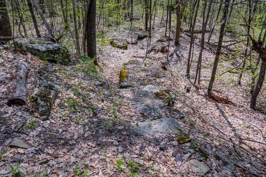
The trail then winds through the col with some interesting locations. This part of the path runs along a ledge.
|
|
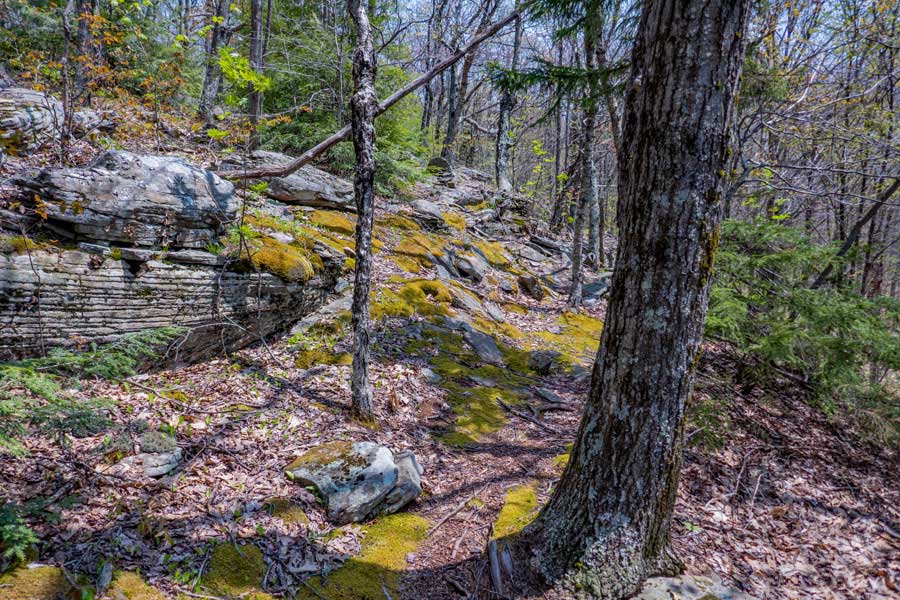 |
The trail then goes through some nice moss covered ground that is pleasing to hike on.
|
|
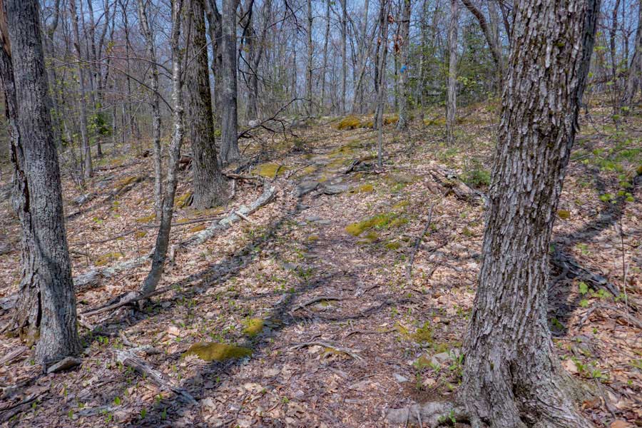 |
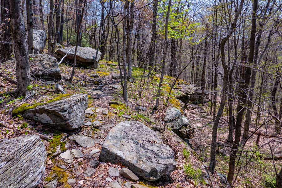
As you approach Mt Pleasant, the trail opens up a bit. This section of the path has a wide variety of terrain that is easy to hike on and enjoy
|
|
|
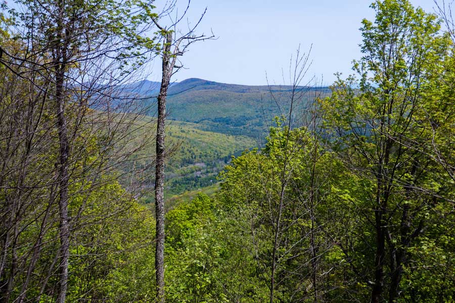
This is the view spot on the trail near Mt Pleasant. The mountain you see in the middle is Wittenberg Mountain.
On the right is Slide and Panther. Cornell is hidden from view behind Wittenberg. To the left is Friday and Balsam Cap. The valley below is Cross Mountain Hollow.
At this point, you have hiked 5 miles from the Trailhead. If this is the end of your hike, you can turn around and head back to your car.
|
|
|
S E C T I O N S
|
W E A T H E R
|
O T H E R
|