Hike Slide & Cornell Mountains |
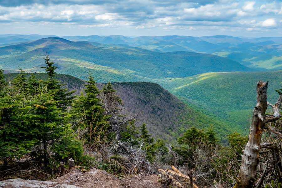 |
| View from Slide Mountain |
| |
| |
|
OVERVIEW |
| | Trail Name: |  Phoenicia East Branch Trail (Slide PA to Slide-Cornell-Wittenberg Trail)
 |
| | Trail Name: |  Slide-Cornell-Wittenberg Trail (PEB Trail to Cornell Mtn)
 |
| | | |
| | Parking Area : | Slide Mountain Parking Area off Rt 47 (Oliverea Road) |
| | Winter Access: | Parking Area is Plowed in the Winter |
| | Camp sites: | 6 Camp Site locations |
| | | |
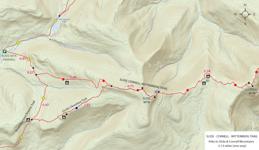
| | Trail Length: | 5.13 miles (one-way) or 10.26 (round-trip) |
| | Trail Type: | Single-track trail |
| | Hiking Time: | Average 6-7 hours round trip |
| | Slide Elevation: | 4,186' (A) |
| | Cornell Elevation: | 3,854' (A) |
| | Elevation Gain (Slide): | Gain of 1,673' |
| | Elevation Gain (Cornell): | Gain of 570' |
| | Views : | 4 view spot |
| | Difficulty: | Difficult |
| | | |
| | Slide Mtn Summit: | 41.999067, -74.38595 (WGS84) |
| | Slide Mtn Summit: | N42 00 04 W74 21 22 (Degree, Min, Sec) |
| | Slide Mtn Summit: | N 41 59.944, W 74 23.157 (GPS) |
| | Slide Mtn Summit: | 18N 550855 4649855 (UTM) |
| | | | |
| | Cornell Mtn Summit: | 42.001333,-74.356167 (WGS84) |
| | Cornell Mtn Summit: | N 42 10 05, W 74 17 22 (Degree, Min, Sec) |
| | Cornell Mtn Summit: | N 42 00.080, W 74 21.370 (GPS) |
| | Cornell Mtn Summit: | 18N 553320 4650125 (UTM) |
| | | | |
| | USGS Map: | USGS Shandaken Quad Maps |
| | | | |
| | USGS Map: | USGS Shandaken Quad Maps |
| | | | |
| | USGS Map: | USGS Shandaken Quad Maps |
| | | | |
| | DEC Trail Map: | DEC Slide Mountain Wilderness Map (free) |
| | | | |
| | Digital Mapper: |
Topo
Terrain
Satellite |
|
|
Maps for Slide & Cornell Mountains in the Slide Mountain Wilderness |
 |
|
|
|
| | Notes About Hiking to Slide & Cornell Mountains |
|
| | TRAIL NAMES |
|
| |
The names of the trails can confuse some people. The Slide-Cornell-Wittenberg Trail is sometimes called the Burroughs Trail because the trails runs over the Burroughs Range. Some people call the Phoenicia East Branch Trail, the Winnisook Trail. This is because the trail originally ran from the Never sink to Winnosook Lake. The trail now is diverted down to the Slide Mountain Parking Area. The trail to Winnisook Lake is private property, so do not hike over to the lake. You can easily see the lake from Rt 47.
| |
| | EAST SIDE OF SLIDE MOUNTAIN |
|
| |
Many hikers have hiked up to Slide Mountain. But, very few have continued on the Slide-Cornell-Wittenberg Trail down the east side of Slide Mountain. The east side of Slide Mountain is much steeper and more difficult. Usually the first time a hiker hikes up-or-down the east side of Slide Mountain they are daunted by some of the ledges and steep climbs on the trail. Once you learn the proper route and way to descend-or-ascend these obstacles, there is less anxiety for the hiker. Some are similar to the Cornell Crack.
| |
| | CAMPSITES |
|
| |
The campsites on the west side of Slide Mountain are less then ideal. Some of the tent sites have slight inclines, which can be difficult to sleep on. The campsites in the col between the east side of Slide Mountain and west side of Cornell are quite nice. The water source for both campsite regions are a long ways away and difficult to get to. So, make SURE you get water before you arrive at either region.
| |
| | PARKING |
|
| |
Parking at the Slide Mountain Parking Area off Rt 47 is often full on weekends in the summer months. The parking area is too small. So, you need to arrive early. If your backup plan is to park at the Giant Ledge Parking Area off Rt 47, you will be surprised that this parking area is even busier then the Slide Mountain Parking Area.
| |
| | VIEW POINT |
|
| |
3 of the 4 view points on this hike are excellent. The view point from Burroughs Rock is now poor because of the trees have become overgrown.
| |
| | OTHER INFORMATION |
|
| |
Around 50 years ago, Slide Mountain had a metal fire tower on the top of the mountain. At the summit you can still see some of the concrete pads the fire tower sat on. Prior to the metal fire tower, there was a wood fire tower. Many years ago, the beginning of the Slide-Cornell-Wittenberg Trail to the summit of Slide Mountain was a jeep trail for the rangers who ran the fire tower. After the fire towers closes, the DEC put a metal gate around 3,700'. Recently, the gate was removed by the DEC.
|
|
|
| | DIRECTIONS to Slide Mtn PA from Exit 19 (Kingston) |
| | Slide Mountain Parking Area WGS84 (DEC): 42.00893, -74.427704 - Elevation is approximately 2,435 feet |
| | Slide Mountain Parking Area Deg/Min/Sec: N42 00 32, W74 25 39 - Elevation is approximately 2,435 feet |
| | Slide Mountain Parking Area GPS: N 42 00.536, W 74 25.662 - Elevation is approximately 2,435 feet |
| | Slide Mountain Parking Area UTM: 18N 547390 4650926 - Elevation is approximately 2,435 feet
|
| |
|
| | Get off New York State Thruway at Exit 19 (Kingston). |
| | Take a RIGHT out of the NYS Thruway onto Route 28 West. |
| | Go approximately 30.4 miles on Rt 28 West |
| | Take a LEFT onto Rt 47 in Big Indian |
| | Go approximately 9.3 miles on Rt 47 |
| | DEC Parking Area is on the LEFT side of the road. Large Parking Area - Holds 40 cars |
|
|
MILEAGE CHART for Slide & Cornell Mtns from Slide PA |
| | Mile Point | Altitude | Notes |
| | 0.00 | 2,421' | Slide Mtn PA & Trail Head |
| | 0.41 | 2,816' | Slide Mtn TH to Trail Junction with Winnisook |
| | 0.68 | 2,877' | Winnisook Trail Junction to Slide-Cornell-Wittenberg Trail |
| | 2.08 | 3,978' | TJ for PEB/Burroughs Trail TO Curtis-Ormsbee Trail |
| | 2.79 | 4,186' | Curtis-Ormsbee Trail TO Slide Mtn TO Burroughs Rock |
| | 2.99 | 3,908' | John Burroughs Rock TO Spring (take right just before rock) |
| | 3.37 | 3,490' | DEC 3,500 Sign |
| | 3.68 | 3,294' | Col between Slide & Cornell Mountain |
| | 4.54 | 3,479' | 3,500' sign on Cornell Mountain |
| | 5.07 | 3,816' | View Spot on top of Cornell Mountain |
| | 5.09 | 3,857' | Spur Trail to Summit of Cornell Mountain |
| | 5.13 | 3,864' | Summit of Cornell Mountain |
|
|
Hike Slide & Cornell Mountain from Slide Parking Area |
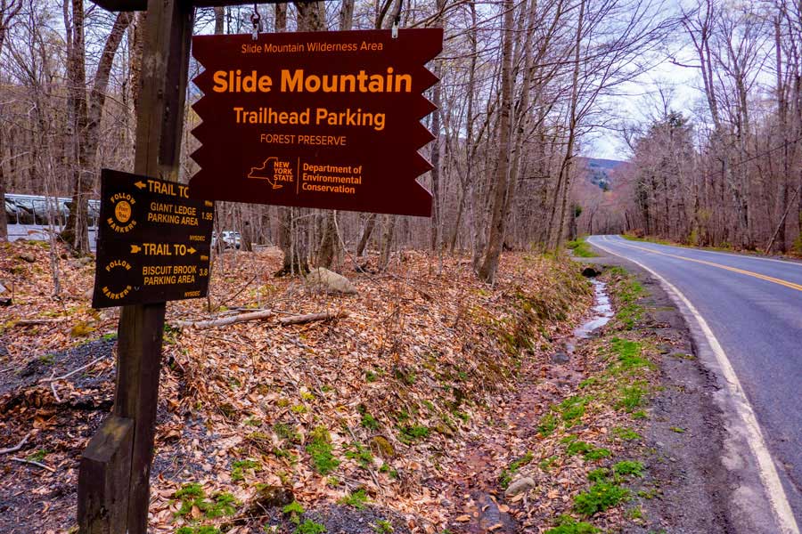 |
Once you reach the Slide Mountain Parking Area, pull into one of the two entrances and find an available parking space.
Do NOT park on the side of Rt 47. Your car will be ticketed and towed.
|
|
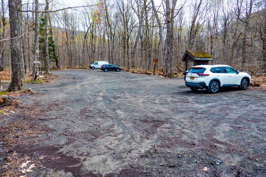 |
The Slide Mountain Parking Area has room for approximately 40 cars. This is a fairly busy parking area in the summer months. So, arriving late can be a problems.
|
|
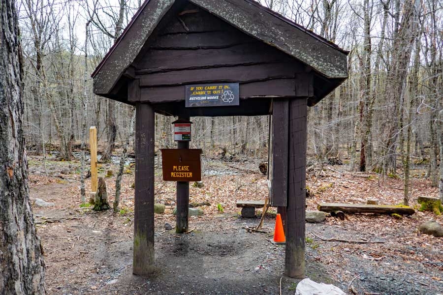 |
Go to the Slide Mountain Parking area kiosk, and register for your hike. NYS Rangers and Search-and-Rescue ("SAR") will use this information to try and find you. Additionally, maintenance funds are allocated by the the number of people who register.
Once you have registered, the Trailhead for this hike is to your left of the registration box.
|
|
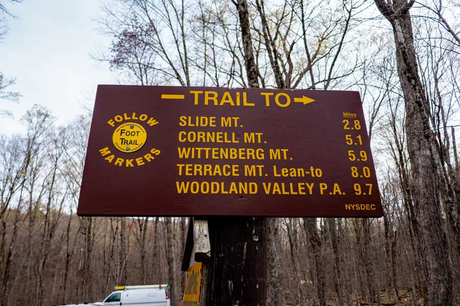 |
This is the mileage (one-way) to your hiking destination. If you plan on returning back to this parking area, the mileage will double.
|
|
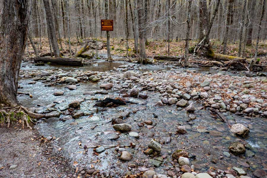 |
You will need to cross this stream to continue your hike. After storms, the water level will rise, and this might make it difficult to get across. The trail continues behind the sign you see on the other side of the stream.
If you need water for this hike, this is the best place to get it.
|
|
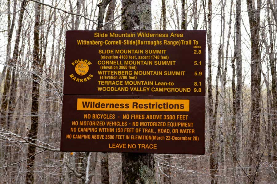 |
Please read the Rules for hiking here. NYS Rangers will ticket you if you violate the rules. Anything you bring in, you need to return with those items. You may not store items in the woods, except your camping items at primitive camp sites.
|
|
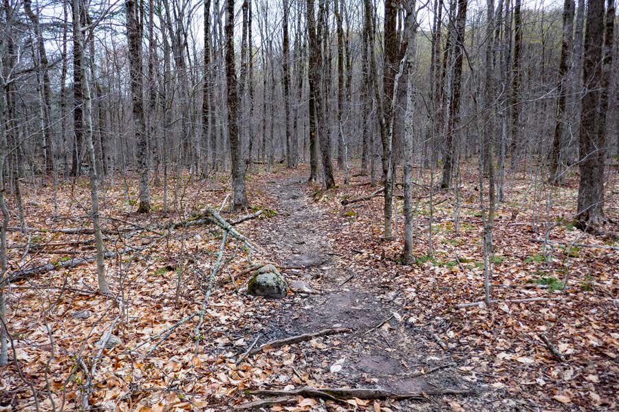 |
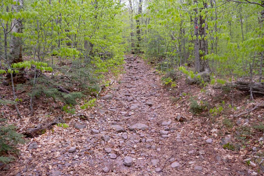
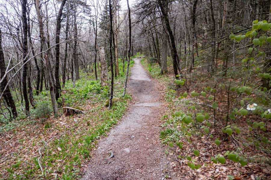
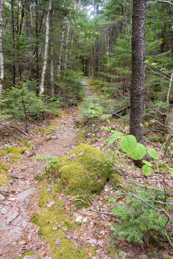
The hike will start out on fairly flat and level land. But, this is just for a short distance. This section of the trail is approximately 4/10 of a mile long.
|
|
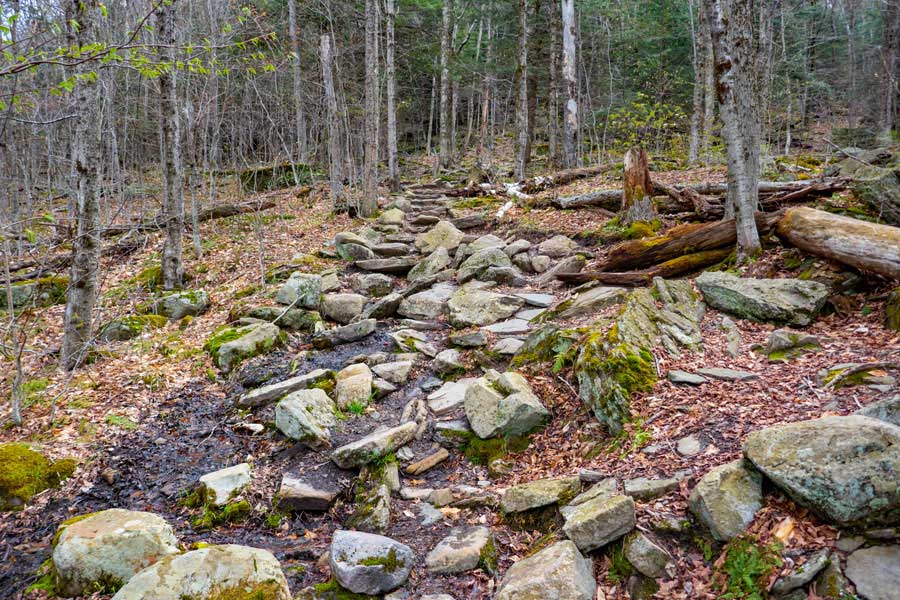 |
After a little ways, the trail will start to climb in elevation. It will also become rocky in places. In some areas there are rock steps built into the trail.
|
|
 |
After climbing up 350' of elevation, you will come to a Trail Junction. You want to take a RIGHT. This is the old Winnisook Trail, which is now called the Phoenicia East Branch Trail. You will follow this trail for approximately 1/4 mile.
|
|
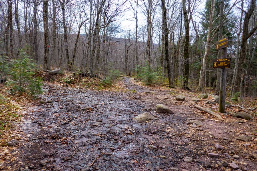 |
After approximately a 1/4 of hiking along the Phoenicia East Branch Trail, you will come to a second Trail Junction. You want to go LEFT.
LEFT will take you to the summit of Slide Mountain, Cornell Mountain, and Wittenberg Mountain.
Straight will take you to the Neversink Regions on the Phoenicia East Branch Trail. Once there, there is a trail to Table Mountain and Peekamoose Mountain.
|
|
 |
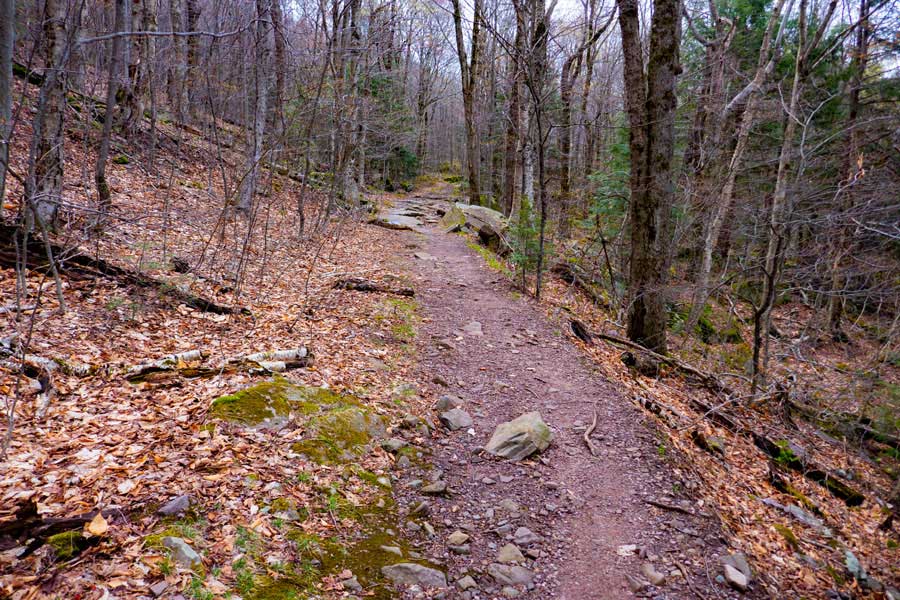
Once you turn left onto the Slide-Cornell-Wittenburg Trail, the trail will have a moderate incline, and will be rocky for the next 1-1/2 miles.
Also along this section of trail are two campsites where people can pitch their tent.
|
|
 |
This is the first campsite you will encounter on your way up to Slide Mountain Summit. It is about 1 mile up from the Trail Junction. There are a couple tent sites at this campsite. Not all of them are level.
|
|
 |
This is the second campsite on your way up Slide Mountain. It is about 1-1/4 miles up from the trail junctions. there are a couple tent sites at this campsite. They are spread apart more then campsite #1.
|
|
 |
A little ways up from both campsite is the 3,500 foot elevation DEC sign. You cannot camp above 3,500' in the Spring, Summer, or Fall.
|
|
 |
As you get up further, the trail incline will level off some, and the trail will be fairly smooth without rocks. You will come to a point in the trail, where the trail will turn 90 degrees to the left. There used to be a gate at this point years aga.
|
|
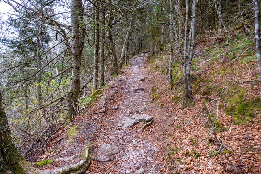 |
Once you turn 90 degrees to the left, the incline of the trail will increase slightly. After about a 1/5 of a mile the trail will again turn 90 degrees to the right. You will still have about 3/4 of a mile until you reach the summit.
|
|
 |
The trail will continue to climb at a slight incline for the next 3/4 of a mile. In some places the trail is smooth, and in other places, the trail is rough.
|
|
|
Just before you reach Slide Mountain summit, there are two view point to the north that have a very nice view. The second view spot is better then the first view spot. The view spots can be quite crowded on summer weekends.
|
|
 |
The actual summit is sometimes hard to determine. But, it is located near the old fire tower that used to be on Slide Mountain
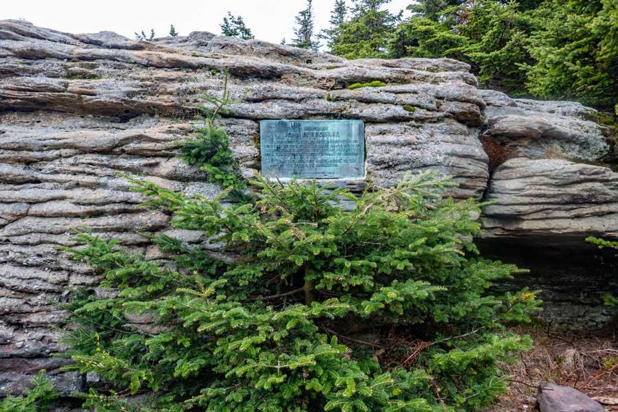
Shortly after you pass Slide Mountain summit, you will reach John Burrough's Plaque Rock. There used to be an excellent view of the Ashokan Reservoir, but the DEC did not keep the view cut open, so there is very little view left.
|
|
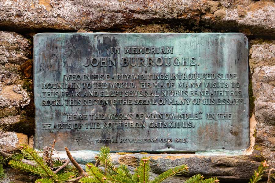 |
You can hike the side trail below John Burroughs Rock and look at the plaque that was installed in 1922 by the Winnisook Club. John Burroughs spent a lot of time on the Burroughs Range (Slide Mtn, Cornell Mtn, and Wittenberg Mtn).
|
|
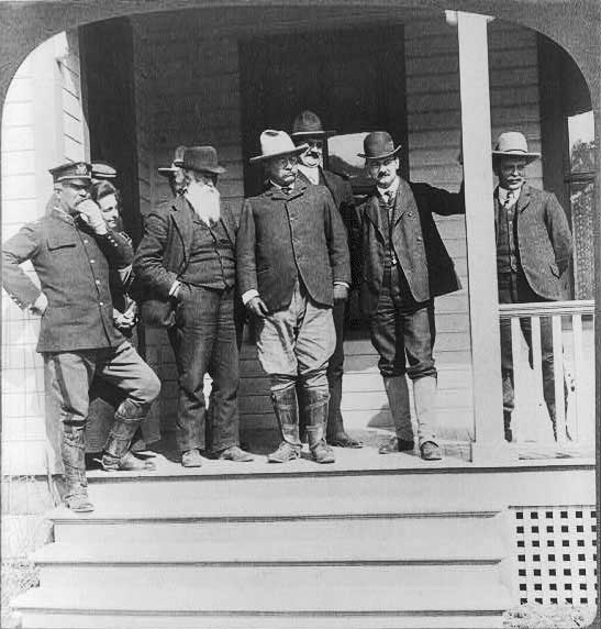 |
In this picture, John Burroughs (long white beard) is seen standing next to Teddy Roosevelt in Yellowstone National Park.
|
|
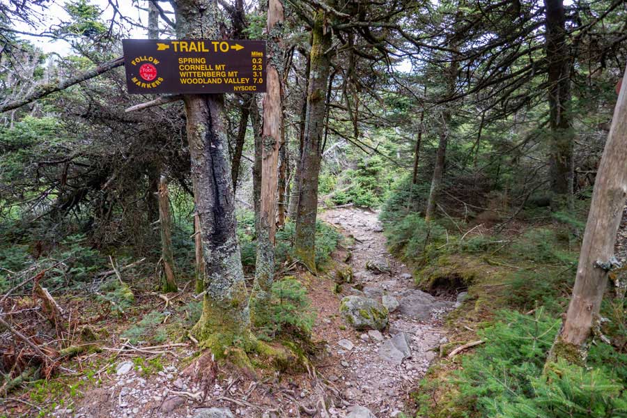 |
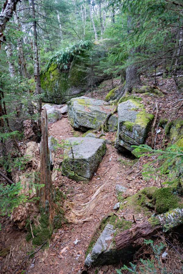
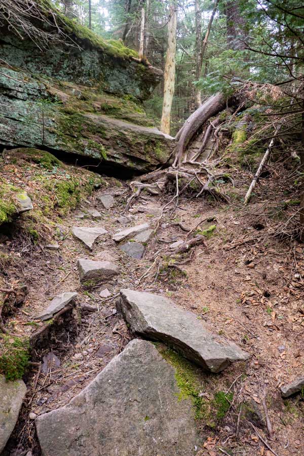
This is the beginning of the trail to Cornell Mountain. It is also part of the Slide-Cornell-Wittenberg Trail, which is sometimes call the Burroughs Trail. While the sign says that it is only 2.3 miles to Cornell Mountain. It is a long 2.3 miles to get there. From this point down to the col between Slide Mountain and Cornell Mountain, you will drop almost 1,000 vertical feet in less then 1 mile. It is steep and can be difficult for less experienced hikers.
|
|
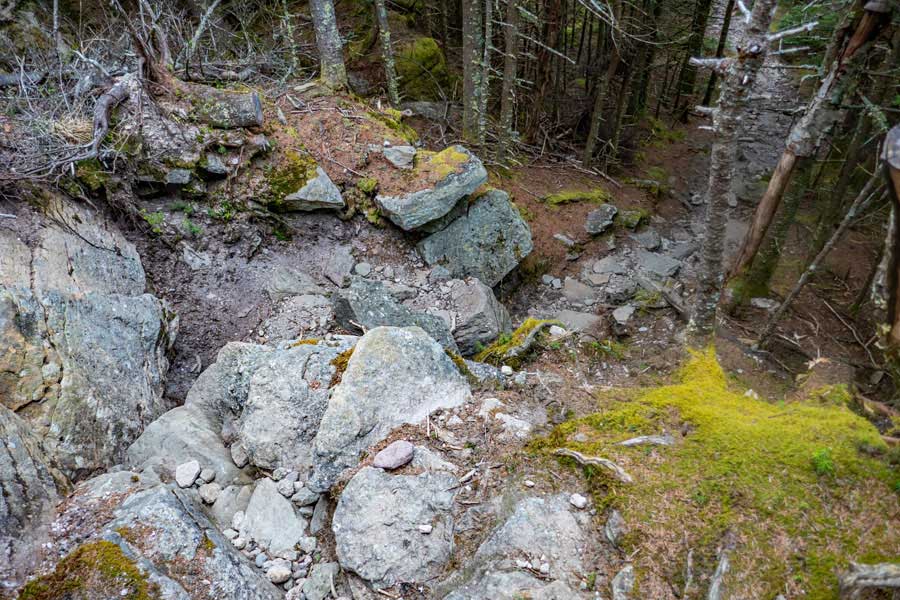 |
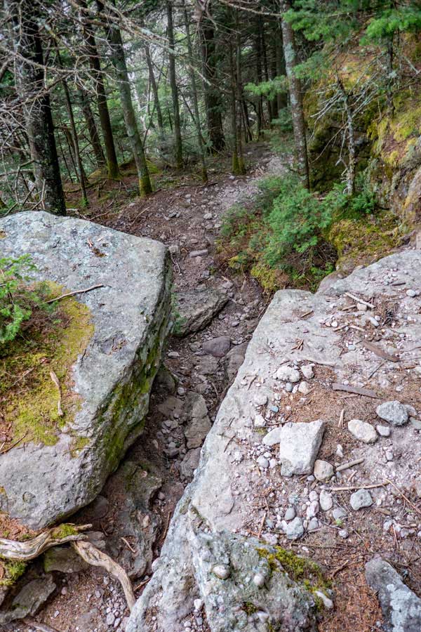
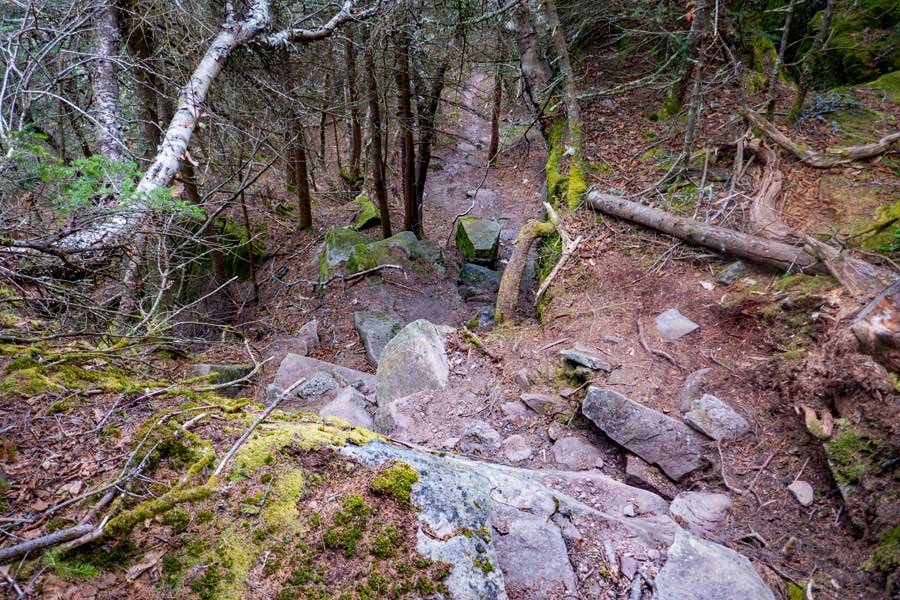
This section will require that you go down this section carefully. Most people start at the middle of the bottom of the image and move left. Then turn 90 degrees left to continue hiking.
|
|
 |
 |
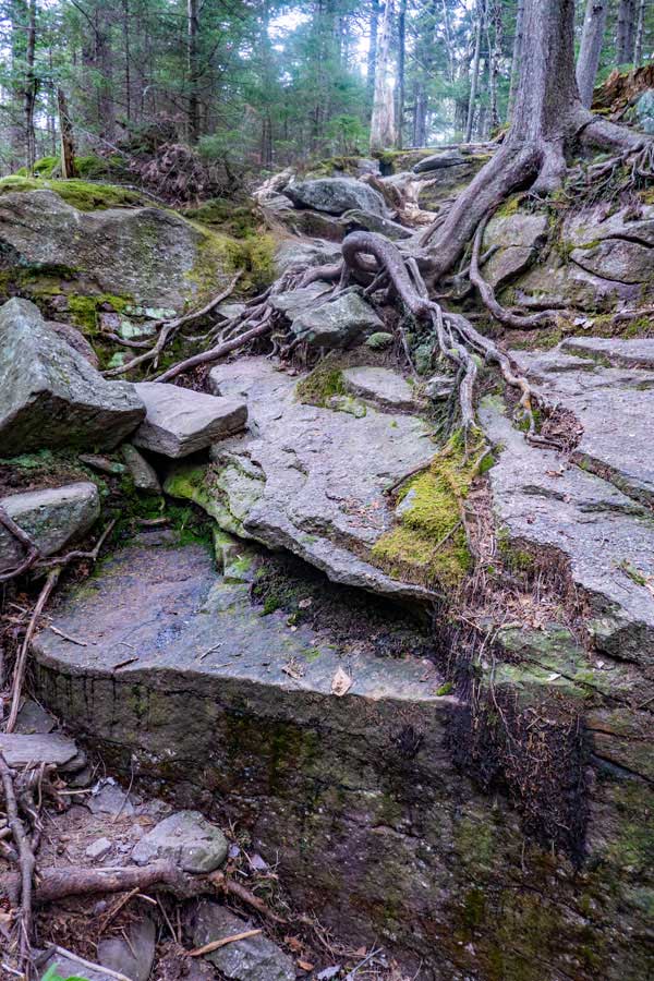
Another minor obstacle to get down. You will encounter quite a few of these as you continue down the east side of Slide Mountain.
There are a few easy flat sections. They are usually short in length, but enjoyable.
|
|
 |
 |
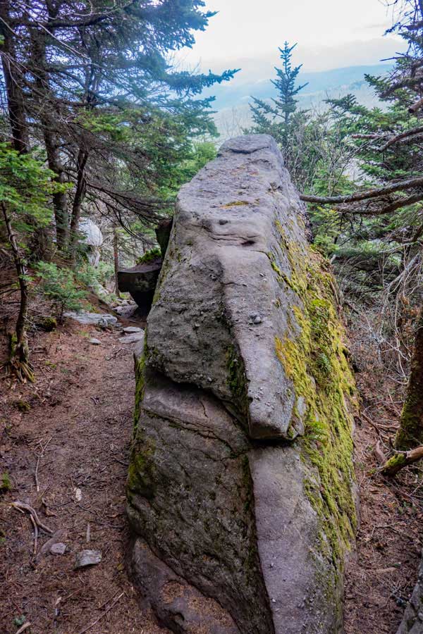
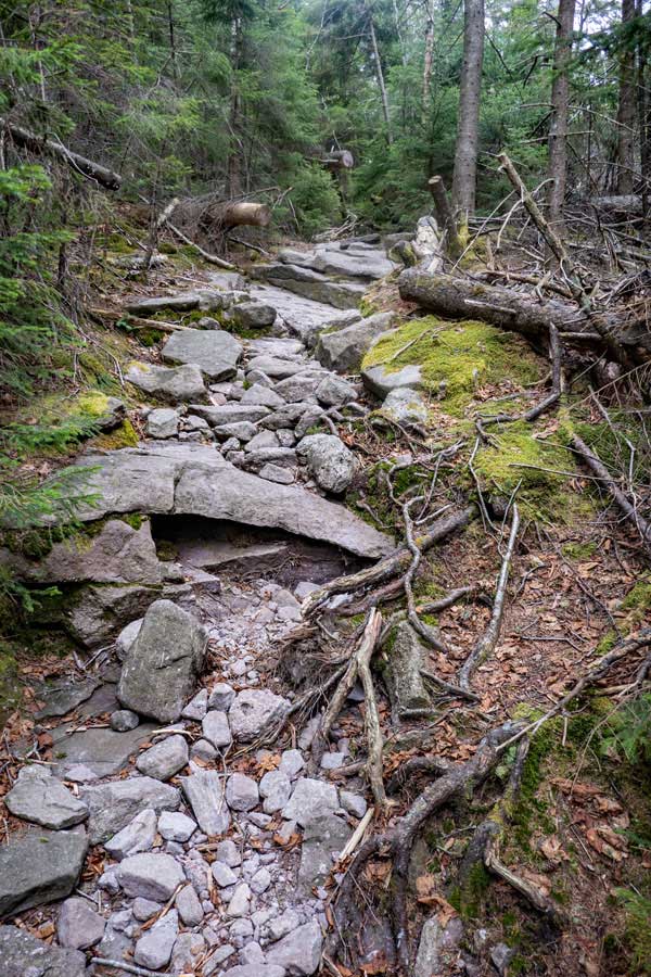
This is another enjoyable obstacle to hike around.
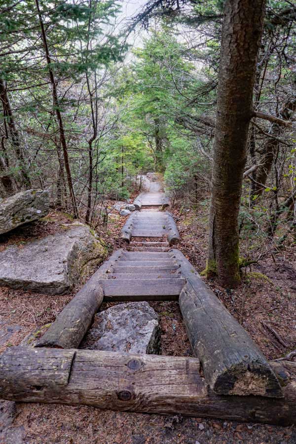
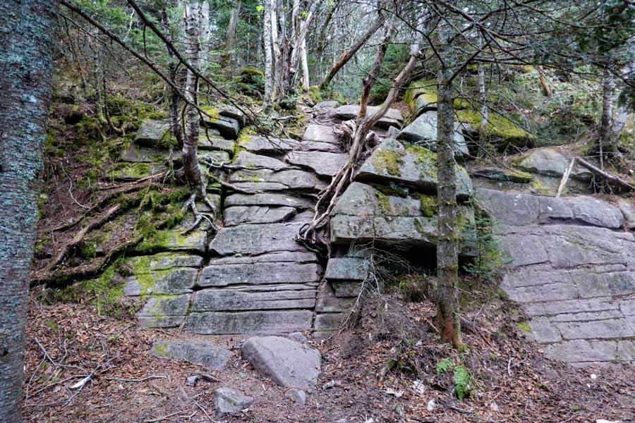
You will get to the stairs fairly early in the descent of the east side of Slide Mountain. . There are 3 sections of stairs in this picture. There are quite a few stairs in the Adirondacks, but very few in the Catskill Mountains.
|
|
 |
After the three sections of stairs, there is one short section just after it. You will then descend down the trail to the Spring.
|
|
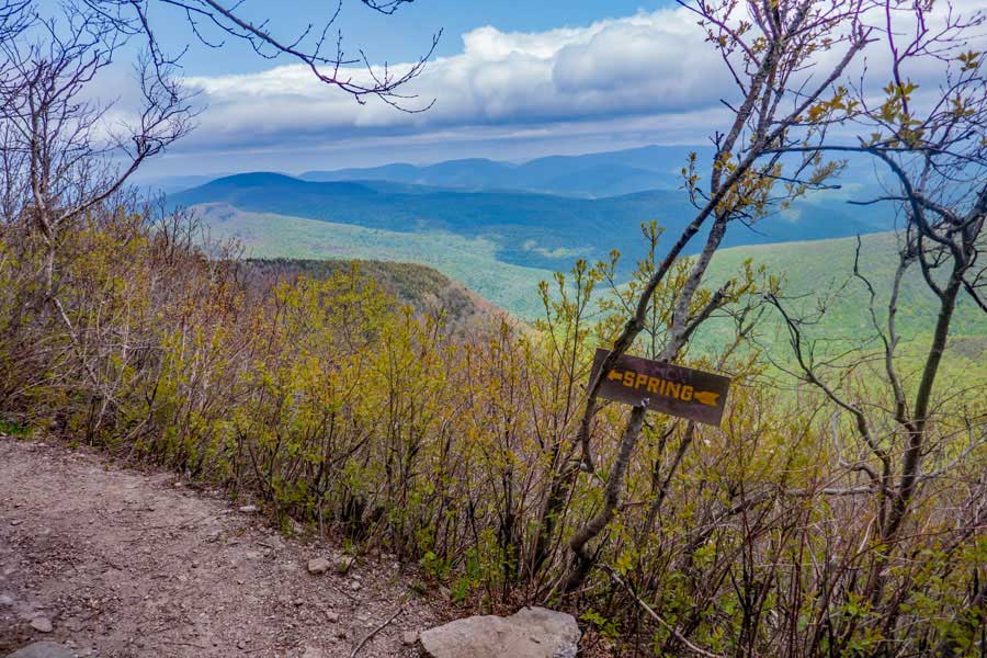 |
The Spring is located about 40-50 feet to the left. There is also an excellent view of the mountains at this point.
|
|
 |
This is the Spring on the east side of Slide Mountain. It does not flow real well. So, you may, or may not, be able to get water here. If you look under the rock, you will see a place that flows the best.
|
|
 |
If you look to the right, you will see Cornell Mountain, with Wittenberg behind it and off to the side. The Burroughs Trail continues down the east side of Slide Mountain and across the Col between Cornell and Slide Mountain. It then climbs up Cornell Mountain to the summit of Cornell Mountain.
|
|
 |
Another section of the trail that takes a little bit of time to descend. Just take your time and pick a good route down.
|
|
 |
Another section of the trail that takes a little bit of time to descend. Just take your time and pick a good route down. Most hikers use the dead tree in the middle of the picture to help them descend down this 12-15' obstacle.
|
|
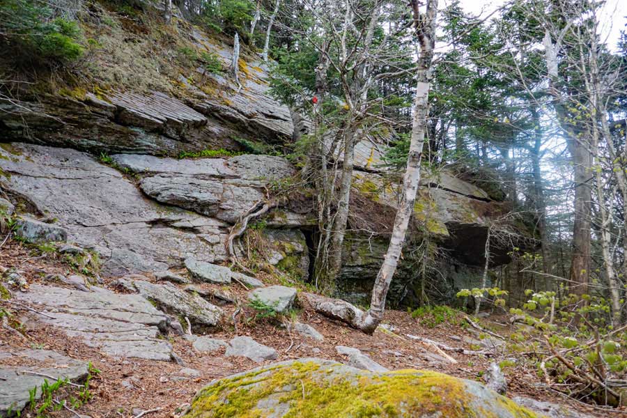 |
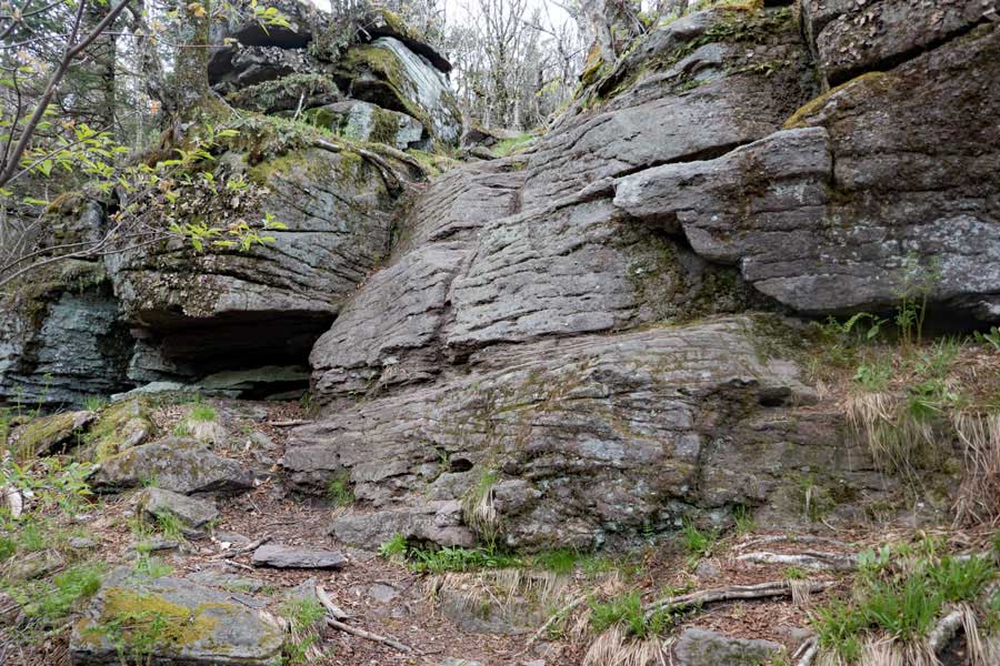
This is probably the most difficult part of the hike up or down the east side of Slide Mountain. This section is about 35' high. Most people descend down to the right side of the rock. Then follow carefully hike across the crack in the middle. The crack is about 6" wide. Once they get over to where the red trail markers is they find a way to descend down the bottom of the ledge.
|
|
 |
Another section of the trail that takes a little bit of time to descend. Just take your time and pick a good route down.
|
|
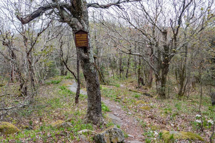 |
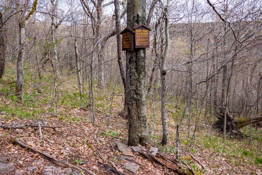
This is the 3,500' DEC sign to tell you that you can camp below this point. There are four designated campsites in the col between Cornell and Slide Mountain where you can pitch a tent.
|
|
 |
The is the lowest point in the col between Slide Mountain and Cornell Mountain. If you continue a little bit further, you will start encountering the campsites, that are located just off the trail.
|
|
 |
This is the side trail to the first campsite in the col between Cornell Mountand and Slide Mountain.
|
|
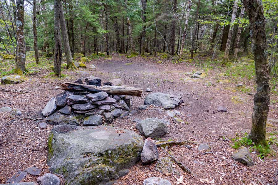 |
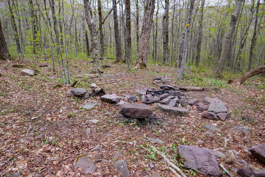
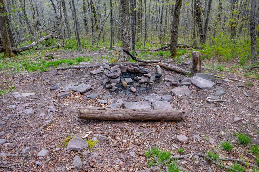
This is the first campsite in the col between Cornell Mountain and Slide Mountain. Many good places to pitch a tent. Most of the region is flat and fairly rock free. Nice campfire ring and rock to eat on. It is located on the south side of the trail.
|
|
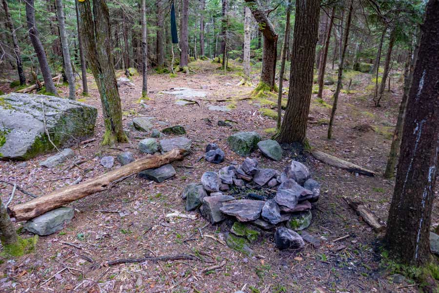 |
This is the second campsite in the col between Cornell Mountain and Slide Mountain. Many good places to pitch a tent. Most of the region is flat and fairly rock free. Nice campfire ring and rock to eat on. It is located on the south side of the trail.
|
|
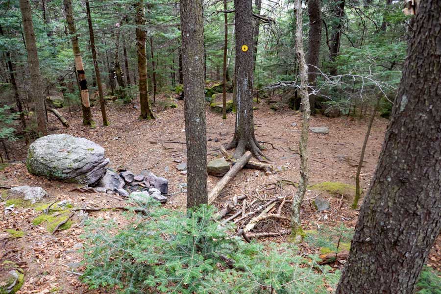 |
This is the third campsite in the col between Cornell Mountain and Slide Mountain. More limited places to pitch a tent. Most of the region is flat and fairly rock free. Nice campfire ring and rock to eat on. It is located on the NORTH side of the trail.
|
|
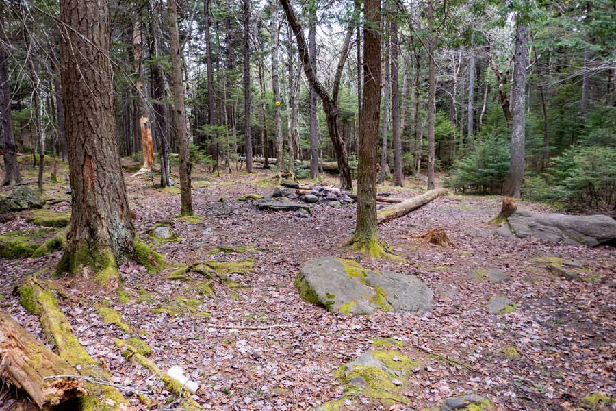 |
This is the forth campsite in the col between Cornell Mountain and Slide Mountain. Several good places to pitch a tent. Most of the region is flat and fairly rock free. Nice campfire ring and rock to eat on. It is located on the south side of the trail.
|
|
 |
 |
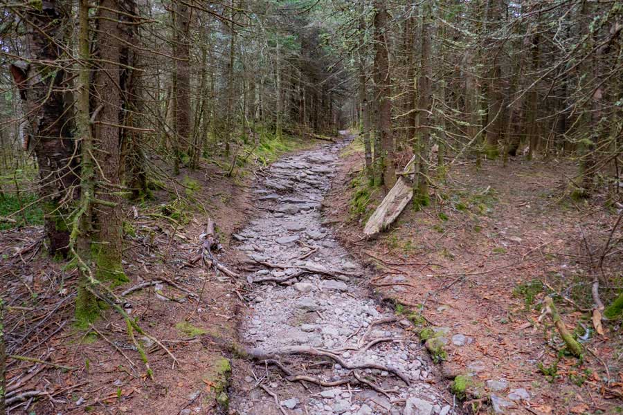
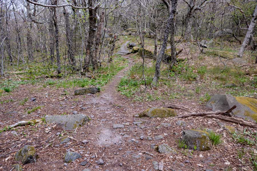
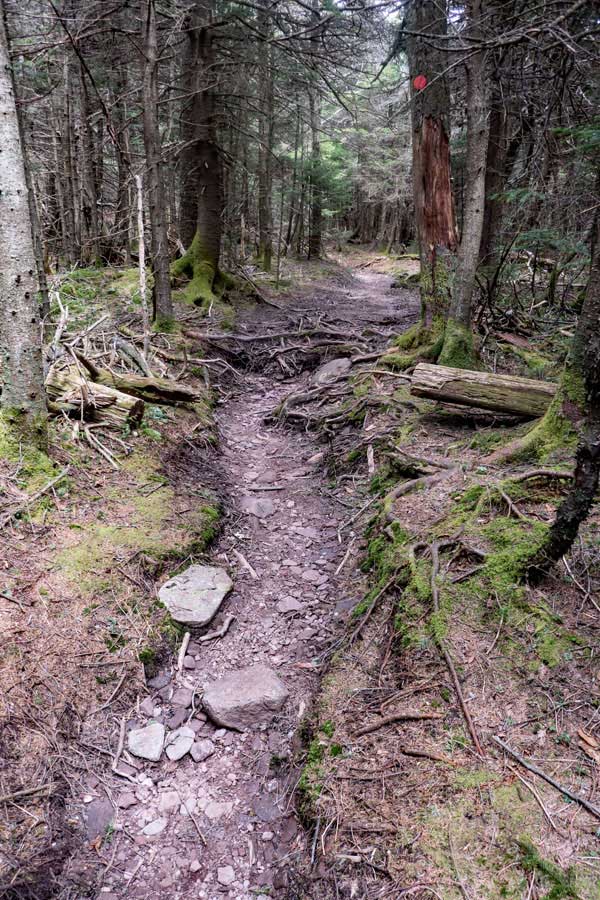
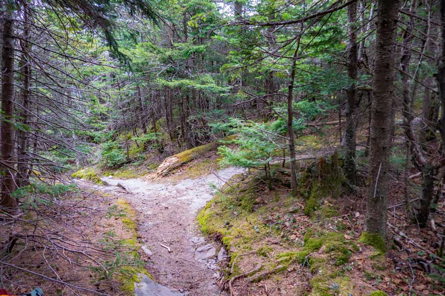
After the forth campsite, the trail starts to go through some beautiful conifer forest. It is fairly easy hiking along the col between Cornell Mountain and Slide Mountain.
As you come to the base of Cornell Mountain, you will start to see an increase in the incline of the trail, along with some interesting rocks and forest along the way.
|
|
 |
 |
When you arrive at the base of Cornell Mountain, you will start to encounter some more moderate climbs up the trail. While the image on the left looks difficult, it really is not that hard.
The trail will also start to get more rocky with the increased incline.
|
|
 |
 |
There will be a couple more moderately difficult sections to climb, but nothing like the east side of Slide Mountain.
There will also be a few sections of fairly smooth trail to hike up.
|
|
 |
 |
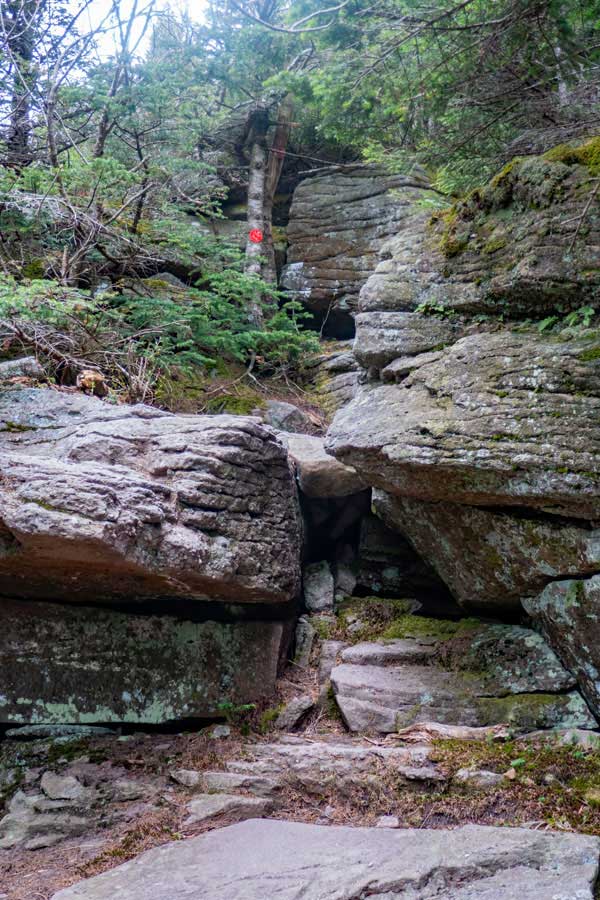
This section is probably the most difficult part of the west side of Cornell Mountain. Most hikers stand between the crack in the rock and pull themselves up. It helps if you are tall and thin. There are other ways to get up this section. Once up the lower section, you just have to hike up to the Red Trail Markers and turn right.
After you turn right, this is what you will hike up. The upper section is actually quite easy.
|
|
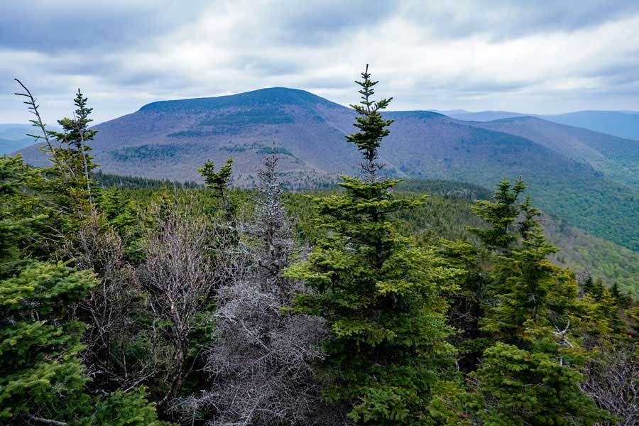 |
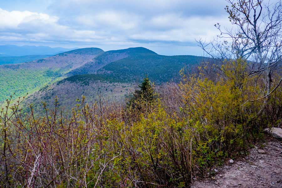
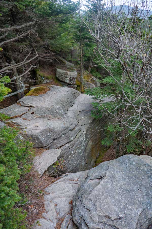
Shortly after you get past the most difficult section on the west side of Cornell Mountain, there is a very short path to an excellent view point. This image is looking west towards Slide Mountain. Some of the trees are now starting to block the view of Slide Mountain.
|
|
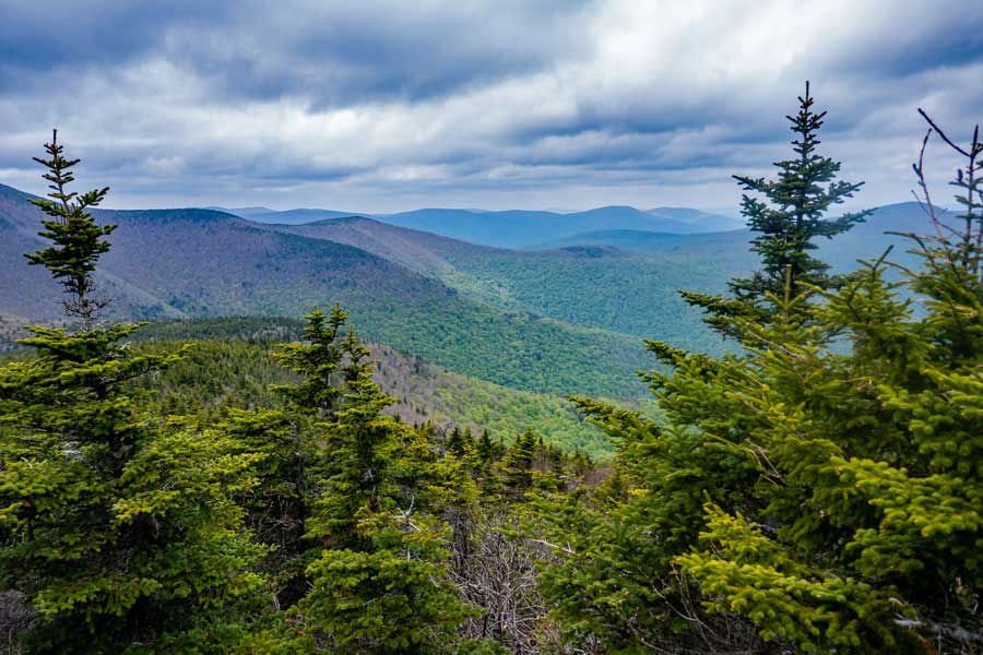 |
When looking northeast of Slide Mountain, there are a number of other mountains to view. Unfortunately some of the trees are now starting to block this view also.
|
|
 |
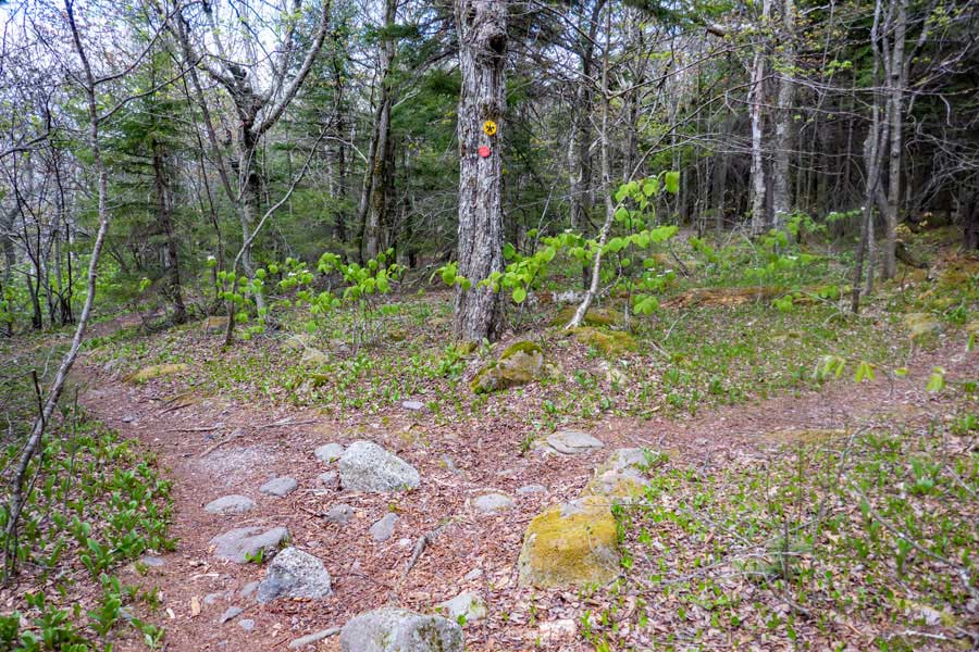
After a very short distance from the view spot, is the side trail to the summit of Cornell Mountain. You want to take a RIGHT at this trail junction.
|
|
 |
This is the summit of Cornell Mountain. There are a couple of locations on this summit that are very close in elevation. Some hikers have tried to hike there way over to Friday Mountain from here, but have found it very difficult to get through the thick Balsam Fir trees.
If you are done, just reverse your course back to your car. Hope you enjoyed the hike as much as we did.
|
|
|
S E C T I O N S
|
W E A T H E R
|
O T H E R
|