Hike Balsam Mountain from Cathedral Glen Trail |
 |
| |
| |
| |
|
OVERVIEW |
| | Trail Name: |  Bonnie View Ave
 |
| | Trail Name: |  Cathedral Glen Trail
 |
| | Trail Name: |  Belleayre Ridge Trail
 |
| | Trail Name: |
Pine Hill Trail - West Branch |
| | | |
| | Type of Trail: | 93% DEC Trails - 5% DEC Roads - 2% Railroad (Owned by Ulster County) tracks |
| | Parking Area : | DEC land for approximately 10 cars in multiple places |
| | Lean-To: | No Lean-to on this route |
| | Winter Access: | Parking Area is Plowed. |
| | Winter Access: | When snow is present, wear snowshoes |
| | | |
| | | Trail : | Cathedral Glen Trail & Pine Hill Trail - 4.61 miles (one-way) - 9.22 miles (Round-Trip) |
| | Access Methods: | Foot and Snowshoe |
| | Best Time to Hike: | Any time of year |
| | Difficulty: | Moderate |
| | | |
| | | USGS Map: | USGS Westkill Quad Maps |
| | | |
| | | USGS Map: | USGS Shandaken Quad Maps |
| | | |
| | | DEC Trail Map: | DEC Shandaken Wild Forest Map (free) |
| | | |
| | | Digital Mapper: |
Topo
Terrain
Satellite |
| | | |
| | | UTM Shandaken: | DEC Unit Management Plan for Shandaken Wild Forest |
|
|
Maps |
 |
|
|
|
NOTES ABOUT HIKING to Balsam Mountain via the Cathedral Glen Trail |
The land (just before Bonnie View Ave turns into a one-lane road) is owned by the DEC. And, all the land to the DEC pump house is New York State land.
Do NOT block or impede traffic on the road. Including the road up and over the railroad tracks. Do not prevent access to the pump house. Do NOT prevent the towns trucks from being able to turn around.
Do NOT swim in the reservoir. This is DRINKING WATER for the town! Do not go down to the water or throw things into the water.
The Railroad tracks are owned by Ulster County, and may become a rail trail in the future.
The forest from the Railroad tracks up to the ski slope are beautiful, and easy to follow.
When hiking up the two ski slopes please stay to the edge of the forest. There are Blue Trail Markers on the trees. Unfortunately, someone put them up incorrectly. So, do NOT walk into the forest when you see one.
People get confused and lost on the ski slopes because they are poorly marked. Look for a wooden DEC sign with yellow letters of "TRAIL". At that point, you can leave the ski slopes back into the forest. Many get lost here.
The last 1/4 mile from the ski slope up to Belleayre Ridge was very poorly maintain in 2023. Many people were getting lost there. As you walk into the forest, there is an established trail with Blue trail markers. But, after a couple hundred feet, the trail and markers disappear. Just keep hiking in the same direct. At some point, you will encounter a trail that goes straight up the hill. Follow that trail. Near the top the trail winds around the trees. But, you will soon reach Belleayre Ridge.
|
|
|
| | DIRECTIONS TO TRAIL HEAD from Exit 19 (Kingston) |
| | Cathedral Glen Parking Area WGS84 (DEC): 42.1371 -74.492617 - Elevation is approximately 1,642 feet |
| | Cathedral Glen Parking Area Deg/Min/Sec: N42 08 13 W74 29 33 - Elevation is approximately 1,642 feet |
| | Cathedral Glen Parking Area GPS: N 42 08.226 W 74 29.557 - Elevation is approximately 1,642 feet |
| | Cathedral Glen Parking Area UTM: 18N 541930 4665123 - Elevation is approximately 1,642 feet |
| |
|
| | Take New York State Thruway to Exit 19 (Kingston). |
| | Take a RIGHT out of the NYS Thruway to Route 28 West. |
| | Go approximately 33.2 miles |
| | Take a left onto S Main Street (Look for large "Welcome to Pine Hill" Sign on left) |
| | Go approximately 0.4 miles |
| | Take a LEFT onto Bonnie View Ave |
| | Go approximately 0.4 miles |
| | First Parking Area on LEFT for 4-5 cars |
| | If full, continue across small bridge on 1-lane road to Pump House for more parking. Do NOT block the road or pump house! |
|
|
MILEAGE CHART |
| | Mile Point | Altitude | Notes |
| | 0.00 | 1,642' | Parking Area #1 (by two wood sheds) |
| | 0.22 | 1,725' | Walk across small bridge and up one-lane road
At pump house, go LEFT up to railroad tracks
At railroad tracks, go LEFT and walk 250 feet down the tracks. |
| | 0.27 | 1,742 | Take a RIGHT towards the end of Cathedral Glen Reservoir and hike up dirt trail |
| | 0.30 | 1,769' | After walking up the trail 150 feet, stop and register at the DEC registration box |
| | 1.37 | 2,509' | Hike a little over a mile through a beautiful conifer forest until you come to your first ski slope |
| | 1.82 | 3,044' | Hike up the ski slope for 0.45 miles over two ski slopes. Always stay close to the forest.
Take a LEFT at the DEC "TRAIL" sign and continue into the forest - Trail is not well defined, so pay attention.
If the trail becomes hard to follow continue in the same direction as the path.
You will continue in the same direction from the ski slope for 1,000 feet before finding the trail again.
Once you find the trail again, turn right and head straight up the hill for a ways. |
| | 2.04 | 3,262' | Belleayre Ridge - Go LEFT to Belleayre Mountain Summit for 0.27 miles |
| | 2.31 | 3,262' | Belleayre Mountain Summit - Go RIGHT towards Balsam Mtn for 0.92 miles |
| | 3.23 | 2,988' | Trail Junction to Bellearye & Balsam Mtn - Continue STRAIGHT for 1.00 miles to Balsam Mtn |
| | 4.23 | 3,595' | False Summit - Continue STRAIGHT for 0.17 miles |
| | 4.40 | 3,521' | Great Views from small ledge - Continue STRAIGHT for 0.21 miles |
| | 4.61 | 3,601' | Summit of Balsam Mountain. |
|
|
Hike to Balsam Mountain via the Cathedral Glen Trail in the Shandaken Wild Forest |
 |
This is the first place you can park for this hike. Do NOT block the fire hydrant! You can also drive further in and park some place off the road. Do NOT block any of the roads. Do NOT park directly next to the pump house. All of this land is owned by the DEC. If you park here, hike up the DEC road you see in the next picture.
|
|
 |
This is the road leading up to the Pump House and Railroad tracks. There are some places you can park off the road along the way. In the Spring it can be muddy, so use caution. If you park somewhere along this DEC road, hike up the DEC road you see in the next picture.
|
|
 |
On your right is the pump house. Do NOT park next to the pump house, and make sure there is space for the trucks to come in and turn around. Past the telephone pole the road continues on your left. Continue to hike past the pump house, and continue up the road on the left. |
|
 |
There are some places to park off the side of the road. This road leads to Belleayre Ski Center. Do NOT block the road for the trucks that run up-and-down this road.
|
|
 |
Once you get up to the railroad tracks. Take a LEFT and walk on the right side of the tracks. There are some open holes in the railroad base.
|
|
 |
This is the Pine Hill Reservoir. It is the water supply for the town's drinking water. Do NOT SWIM in the reservoir. View it from a distance. Do NOT throw trash around the reservoir. Do NOT wash anything or touch the water.
|
|
 |
This turn-off is the Trail Head for the Cathedral Glen Trail. It is on the east side of the Cathedral Glen Reservoir. You will see this turn-off after you have walked down the railroad tracks 250 feet. Walk up the trail 150 feet to the DEC Registration Box.
|
|
 |
This is the DEC Registration Box for this hike. It is important to register. If you get lost, your registration will help Rangers find you. Once registered follow the trail uphill. It will pass through some beautiful conifer forest. On your right will be the creek.
|
|
 |
After hiking up the trail 1.07 miles, you will come to a a rope gate. Once you pass the rope gate, you will be on one of two ski slopes you will hike up for this hike.
You will hike up the ski slopes 0.45 miles. You will see blue markers on the trees. Unfortunately, the Blue Trail Markers are attached to the trees so that they are parallel to the slope. Some people have gotten lost by thinking that they need to enter the forest at that point. Do NOT leave the ski slope until you see the "Trail" sign (see in next picture). The two ski slopes you hike up will be fairly steep.
If you return back down this trail, make sure that you remember that there are two ski slopes. Always stay next to the forest.
|
|
 |
After hiking up the two ski slopes for almost a half-mile you will see a "TRAIL" sign. This is where you will leave the ski slopes. If you look at the right side of the picture, you will see the "TRAIL" sign. Many people get confused on the ski slopes and get lost.
The trail from the ski slopes to Belleayre Ridge is very poorly marked (at least in 2023). Most hikers get lost during this short part of the hike. After you walk into the forest, you will see a number of trail markers. Then the trail markers disappear, and the trail is very overgrown (at least in 2023). Keep hiking in the same direction until you see the trail turning straight uphill. Then the Trail Markers will appear again. Follow them up the hill until you reach Belleayre Ridge. Belleayre Ridge is an old logging road.
|
|
 |
As you are hiking straight up the hill to Belleayre Ridge, you will come up the trail on the right side of this picture. It is important to remember this point if you are going to return back to your car the same way. Most people going down the hill go left in the picture, and become lost. Make sure you go RIGHT if you are returning down the same path you came up.
|
|
 |
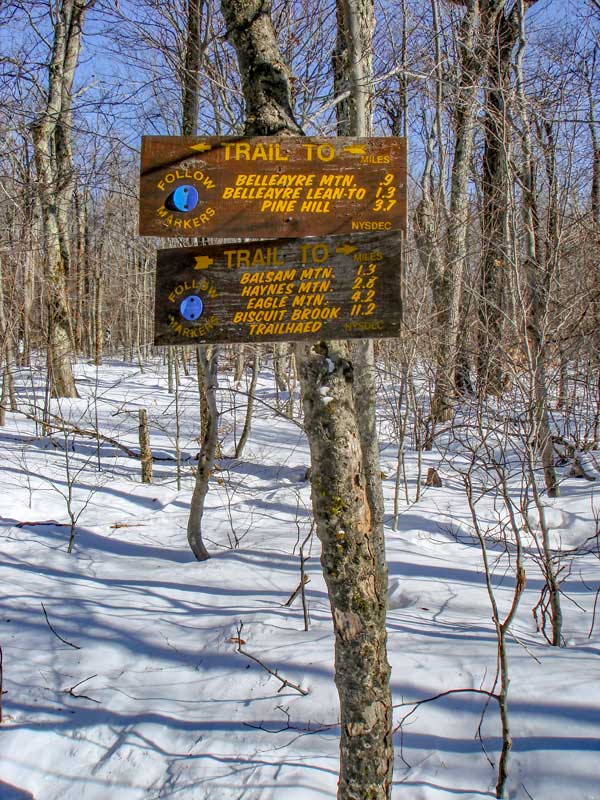
This is the top of the ridge. It is called Belleayre Ridge.
Go LEFT for 0.27 miles, towards Belleayre Mountain Summit (different then the Belleayre Ski Center).
The Belleayre Lean-to is 1/4 mile west.
|
|
 |
This is the top of Belleayre Mountain.
You want to take a RIGHT here and travel down the trail 0.92 miles to the next Trail Junction.
|
|
 |
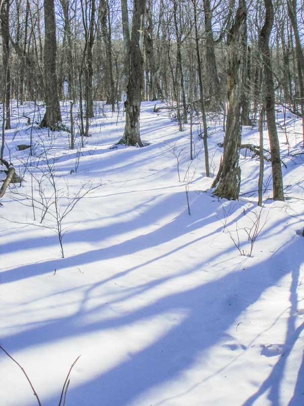 |
The picture on the left is the next trail junction. You want to go STRAIGHT. Right will take you to Rider Hollow.
The picture on the right show what the trail looks like after the trail junction. In the Winter snow drifts up here. The ridge is fairly flat so it isn't that bad. After a while you will actually go downhill for a while before heading up Balsam Mountain. |
|
 |
 |
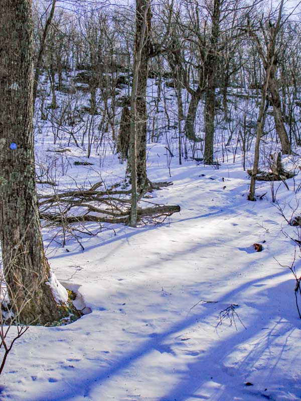
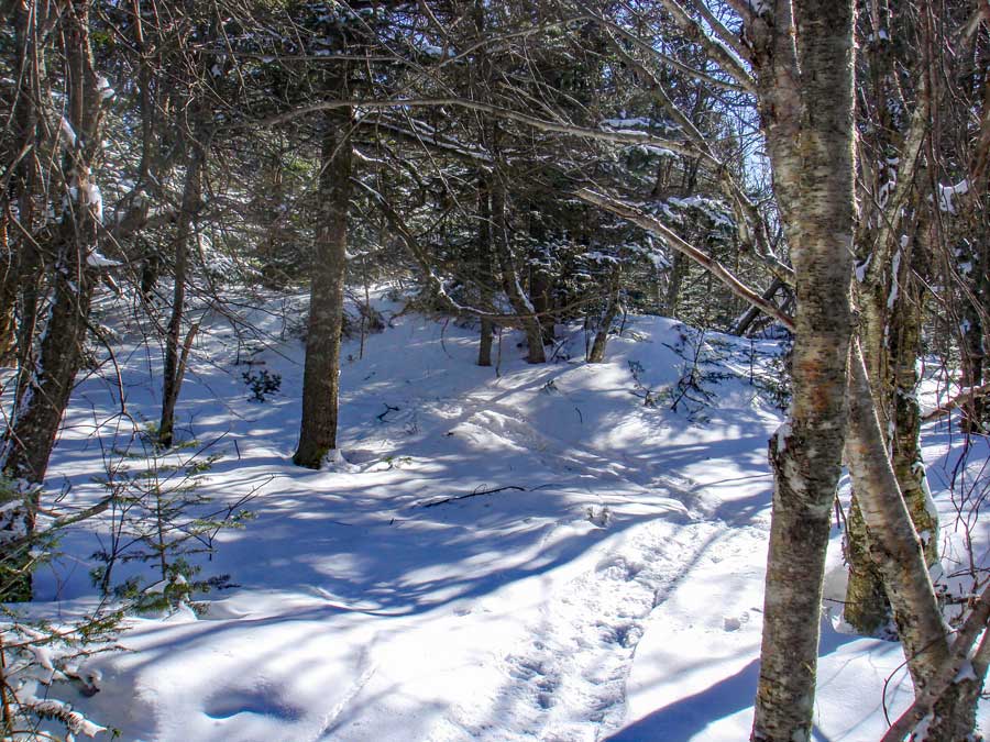
After going down hill the trail will then start to go uphill at an incline. It is the most difficult ledge during the hike. It is not that it is steep or difficult, but the trail runs up the ledge at an angle.
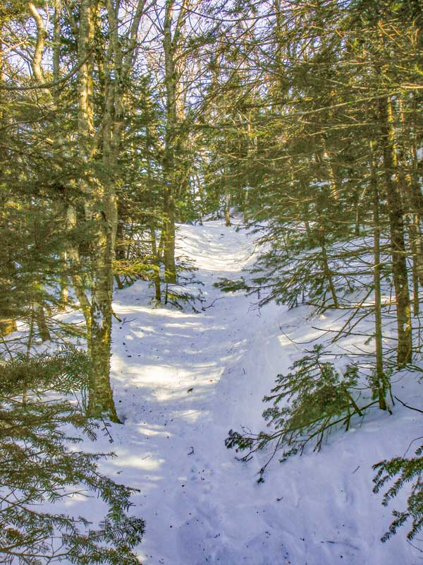
Once above the ledge, the trail continues to climb at an easy incline. You will also start to encounter Balsam Fir trees, which the mountain is named after. The trail at this point becomes quite peaceful and tranquil.
|
|
 |
This picture shows the false summit of Balsam Mountain. It is actually 8 feet below the actual peak, and looks like a peak. There is some nice areas around this point. A good place to camp in the Winter. But, you cannot camp here in the Spring, Summer, and Fall. The walk continues to be nice, with views off to the left in the Winter. Unfortunately, the sun will be in your eyes on this part of the hike. Until you pass a ledge with great views, you have not reached the summit. |
|
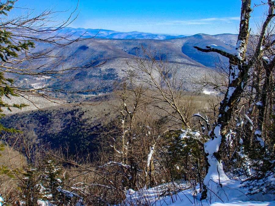 |
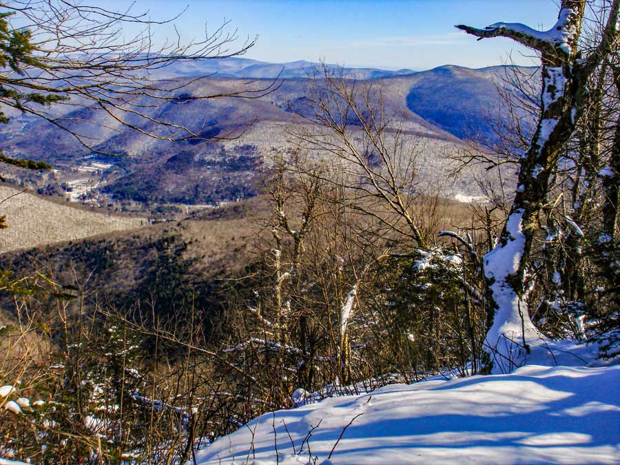
As you walk across the long summit area, you will be able to see a nice view off to the left when the leaves are not on the trees. On some parts of the summit walk, the elevation will drop about 30 feet. Enjoy the walk. This is one of the factors that makes this hike magical. |
|
 |
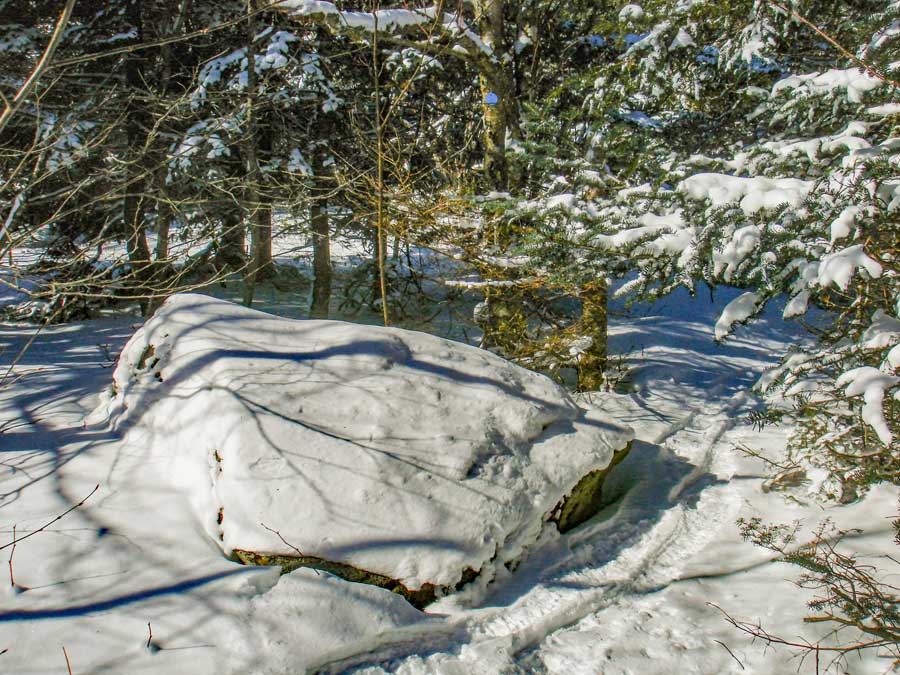
The picture on the left shows the highest point on the long summit walk. It is at mile post 2.82. It is just before you start to descend downhill. There is a pointed rock that is about 50 feet off the trail. In the winter it can be covered up by snow. |
|
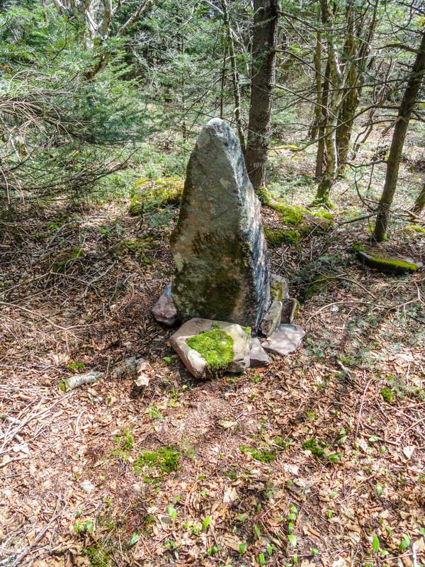 |
This pointed rock is considered to be the summit of Balsam Mountain. In the winter, deep or drifting snow can cover it up.
Once you get done you should reverse your course and return back to your car.
If you want to alter your return route, you can take the Woodchuck Hollow Trail back to your car.
|
|
|
S E C T I O N S
|
W E A T H E R
|
O T H E R
|