Windham High Peak
|

|
|
OVERVIEW |
| | Trail Name: |  Elm Ridge Trail (Peck Road to Escarpment Trail)
 |
| | Trail Name: |  Escarpment Trail (Elm Ridge to Windham High Peak)
 |
| | | |
| | Parking Area : | End of Peck Road |
| | Winter Access: | Parking Area is Plowed in the Winter |
| | Camp sites: | 1 Camp Site location |
| | Lean-to sites: | 1 Lean-to |
| | | |
| | Trail Length: | 3.19 miles (one-way) or 6.38 (round-trip) |
| | Trail Type: | Single-track trail |
| | Hiking Time: | Average 4-5 hours round trip |
| | Highest Elevation: | 3,525' (A) |
| | Elevation Gain (Slide): | Gain of 1,475' |
| | Views : | 3 view spots near summit |
| | Difficulty: | Easy |
| | Access Methods: | Foot and Snowshoeing. |
| | | |
| | USGS Map: | USGS Hensonville Quad Maps |
| | | | |
| | DEC Trail Map: | DEC Elm Ridge Wild Forest Map |
| | | | |
| | DEC Trail Map: | DEC Windham-Blackhead Wilderness Map (free) |
| | | | |
| | Digital Mapper: |
Topo
Terrain
Satellite |
|
|
Maps |
 |
|
|
| | Directions to PECK ROAD Parking Area |
| | Peck Road Parking Area WGS84 (DEC): 42.2968, -74.16925 - Elevation is about 2,050 feet |
| | Peck Road Parking Area Deg/Min/Sec: N42 17 48, W74 10 09 - Elevation is about 2,50 feet |
| | Peck Road Parking Area GPS: N 42 17.808, W 74 10.155 - Elevation is about 2,050 feet |
| | Peck Road Parking Area UTM: 18N 568480 4683065 - Elevation is about 2,050 feet
|
| |
|
| | Take New York State Thruway to Exit 21 (Catskill). |
| | Take a left out of the NYS Thruway entrance road. |
| | Go approximately 1/4 mile |
| | Take a right onto Route 23 West |
| | Go approximately 21.5 miles on Route 23. |
| | Take a left onto County Rt 65 (Main Care Gas Station on Right - Condos on left). |
| | Go approximately 0.7 miles on Route 65. |
| | Take left onto Rt 65A. |
| | Go approximately 0.3 miles on Rt 65A . |
| | Continue Straight onto Rt 40 after stop sign. |
| | Go approximately 1.8 miles on Rt 40. |
| | Take a left onto Rt 56 (3-way intersection in Maplecrest). |
| | Follow Rt 56 approximately 4.2 miles |
| | Take a LEFT onto Big Hollow Road (Rt 40) |
| | Follow Rt 40 approximately 1.8 miles |
| | Take a LEFT onto Peck Road |
| | Follow Peck Road approximately 0.8 miles to the end of Peck Road |
|
|
MILEAGE CHART for Windham High Peak (Peck Road PA) |
| | Mile Point | Altitude | Notes |
| | 0.00 | 2,050' | Peck Road Parking Area. |
| | 0.04 | 2,057' | DEC Registration Box. |
| | 0.31 | 2,131' | Elm Ridge Bike Trail Junction #1. |
| | 0.64 | 2,229' | Water Source - Can dry up in summer. |
| | 0.75 | 2,260' | Elm Ridge Bike Trail Junction #2. |
| | 0.81 | 2,291' | Elm Ridge Bike Trail Junction #3. |
| | 0.87 | 2,322' | Trail Junction - Escarpment Trail - Go RIGHT. |
| | 0.91 | 2,340' | Trail Junction - Lean-To & Campsite on right. |
| | 1.30 | 2,580' | Conifer Forest. |
| | 2.96 | 3,485' | DEC 3500' sign. |
| | 3.02 | 3,509' | View Point #1 near Windham High Peak. |
| | 3.05 | 3,512' | View Point #2 near Windham High Peak. |
| | 3.14 | 3,525' | Windham High Peak Summit - USGS Marker on top of rock |
| | 3.19 | 3,503' | View Point #3 (slightly beyond summit) |
|
|
Hike of Windham High Peak from Peck Road |
 |
This the small Parking Area at the end of Peck Road. It holds about 6 cars. It is often full on summer weekends.
|
|
 |
This is the Trailhead for the Elm Ridge Trail. Walk towards to the right side of the images, and turn left at the far right yellow sign. |
|
 |
 |
This is the beginning of the Elm Ridge Trail from Peck Road. After we have had rain, this trail can have standing water, mud, or ice. |
Register for your hike here. Registering allots money for trail maintenance and can be used by Rangers to find you if you go missing or are injured. |
|
 |
After 3/10 of a mile you will come to this Trail Junction. The side trail on the left is the Cranberry Bog Trail. It is also marked with Yellow Trail Markers. Do NOT take the Cranberry Bog Trail! The Cranberry Bog Trail is part of the mountain bike trails on Elm Ridge. You are also allowed to hike on them.
Continue STRAIGHT up the old logging road. |
|
 |
 |
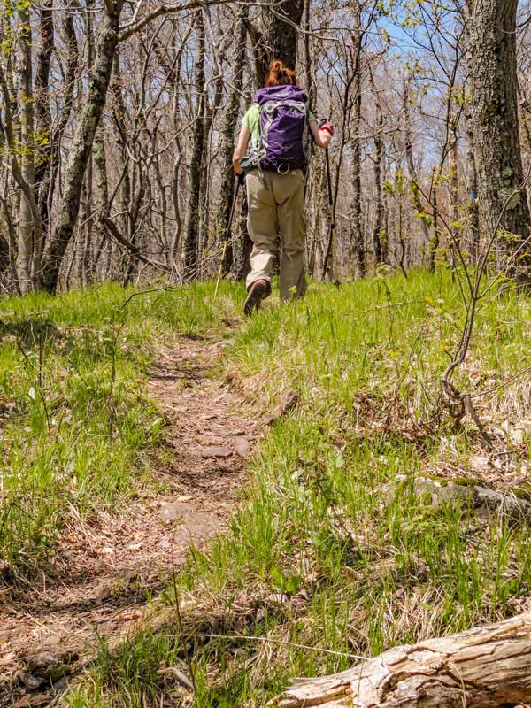
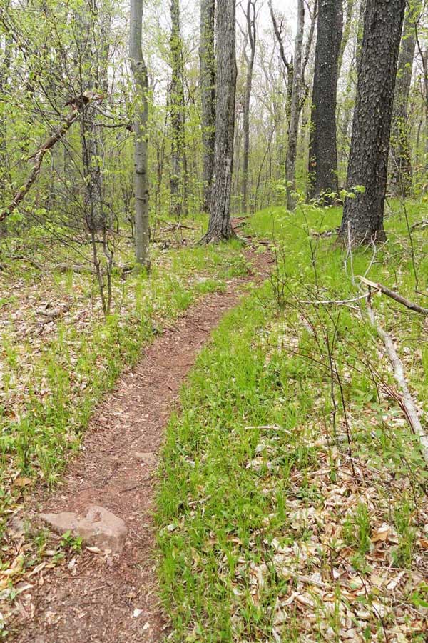
Much of the Elm Ridge Trail is fairly flat and easy hiking. When it is wet, it can be muddy, or have standing water on the trail. |
There are a couple section of the Elm Ridge Trail that have a little bit of elevation gain to them. This particular section is known to have ice flows in the Winter months. |
|
 |
After 2/3 of a mile, you will come to a water source. If you need water, this would be the time to get some. But, beware that in the summer months, this spring can dry up.
There are two additional Mountain Bike Trails that you will see on the left side of the trail. They are also marked with Yellow DEC Trail Markers. Do NOT take them for this hike. |
|
 |
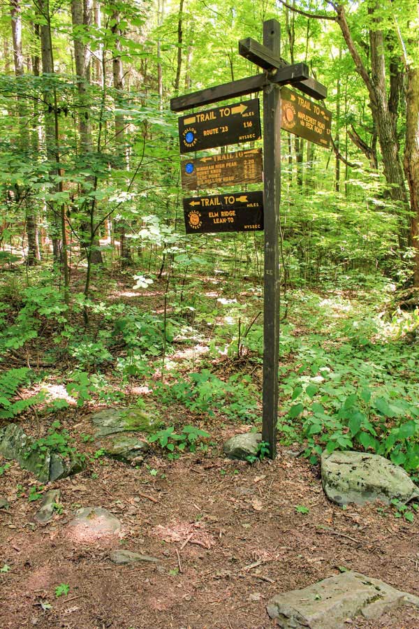
After a little less then 9/10 of a mile you will come to a major Trail Junction. This is where the Elm Ridge Trail meets the Escarpment Trail on the top of Elm Ridge. You want to go RIGHT at this trail junction. |
|
 |
 |
As you turn RIGHT at the trail junction of the Elm Ridge Trail and the Escarpment Trail, you will see this sign. You want to go RIGHT at the Trail Junction to get to the summit of Windham High Peak. Straight will take you to Peck Road Parking Area. Right will take you on the Mountain Bike Trails in Elm Ridge. |
This is the Escarpment Trail as it starts to climb up towards the summit of Windham High Peak. |
|
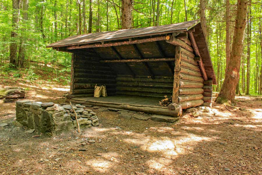 |
200 feet after turning right onto the Escarpment Trail, you will see a side trail (on your RIGHT) that goes to the Elm Ridge Lean-to. Behind the Lean-to is a primitive campsite. If there is room in the Lean-to you MUST share it with other hikers that arrive after you.
You want to continue STRAIGHT on the Escarpment Trail past the Lean-to and campsite. |
|
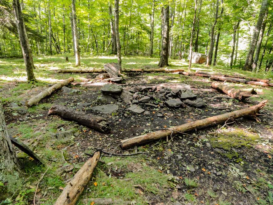 |
This is the DEC Primitive campsite behind the Elm Ridge Lean-to. |
|
 |
 |
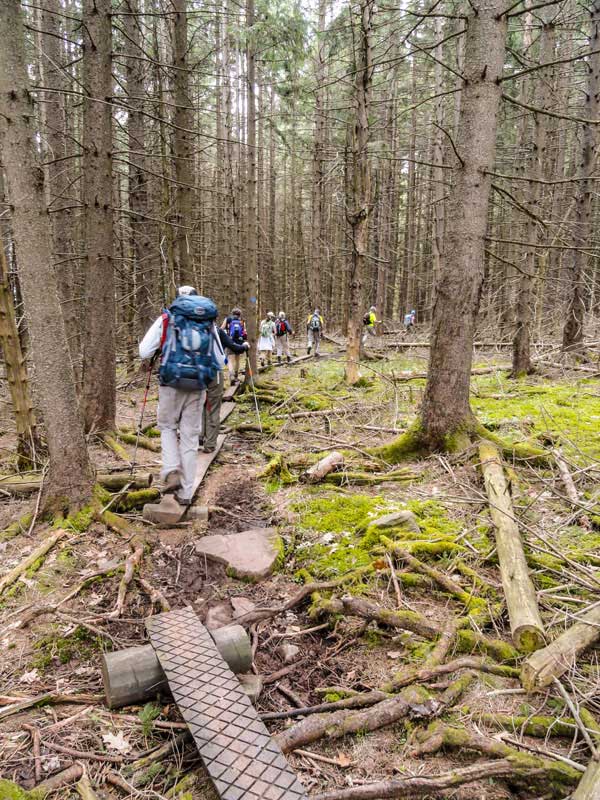
About half way to the summit of Windham High Peak, you will hike through a dense conifer forest. |
After the conifer forest, you will encounter a small steep section that goes up the south side of Windham High Peak |
|
 |
 |
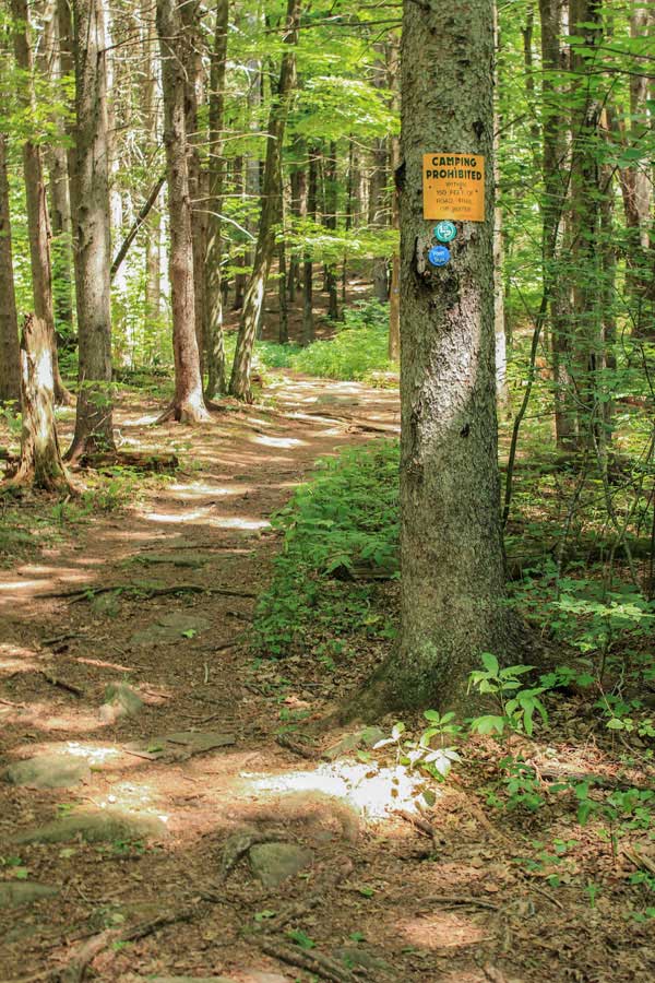
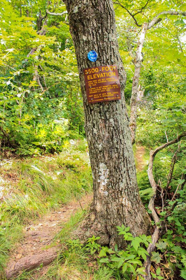
As you get close to the summit of Windham High Peak, you will see a 3500 foot elevation sign. You cannot camp above this point in the Spring, Summer or Fall. |
After the 3500 foot elevation sign, the trail will be fairly flat as you approach the summit of Windham High Peak. |
|
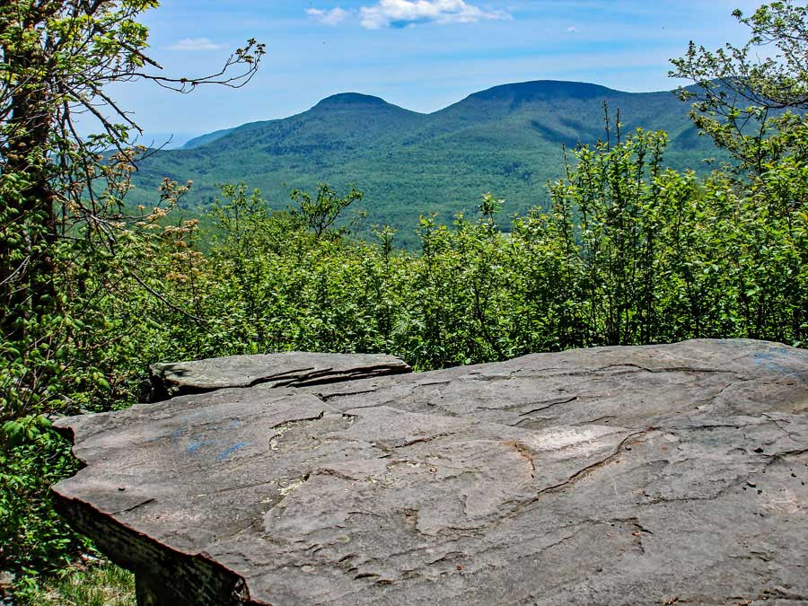 |
This is first of the three view points on the summit of Windham High Peak. The mountains in the distance are Blackhead Mountain (left), Black Dome Mountain (center), and Thomas Cole Mountain (right). On a clear day it is a very nice view. |
|
 |
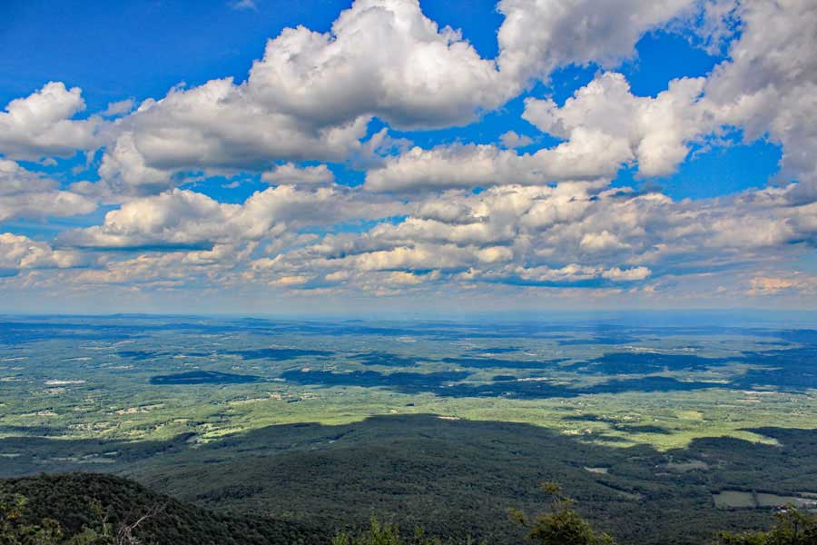
This is second of the three view points on the summit of Windham High Peak. This view looks to the north and east. Early in the morning the clouds and fog can settle on the Hudson Valley. On a clear day you can see Albany. |
|
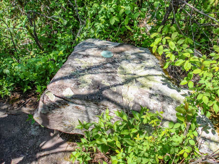 |
This is the summit of Windham High Peak. It has a USGS Bench Marker embedded in the rock. There is another USGS Bench Marker just before this rock. There are three USGS Bench Markers. |
|
 |
About 200 feet past the Windham High Peak summit (Rock with a USGS Bench Marker) is the third of 3 view points. This is the view of the Hudson Valley looking northeast. It is the last view point near the summit of Windham High Peak |
|
|
S E C T I O N S
|
W E A T H E R
|
O T H E R
|