|
Information about Paradox Falls: |
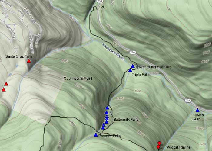
| Name: Paradox Falls (proposed name 2011) |
| County: Greene |
| Region: Kaaterskill Clove |
| Location: Buttermilk Ravine |
| Order within ravine: 1st of 10 drops (1=highest elevation) |
| Order within waterfall: 1 of 1 (1=highest elevation) |
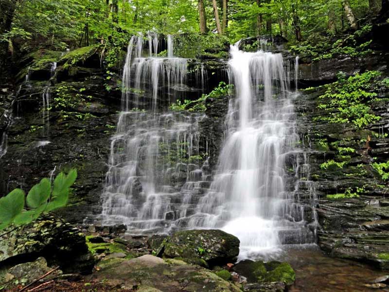
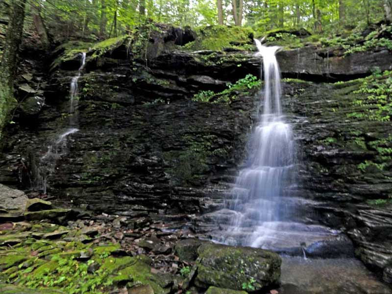
| Total Height: 61' (measured by GPS in 2011) |
| Top Elevation: 2298 |
| Bottom Elevation: 2237 |
| Type of Waterfall: |
| Number of Drops: 1 major drop with small drops thereafter |
| GPS location: N42 10.483 W74 04.364 (base of largest drop) |
| Named: 2011 |
| Previous or Alternate Names: none known |
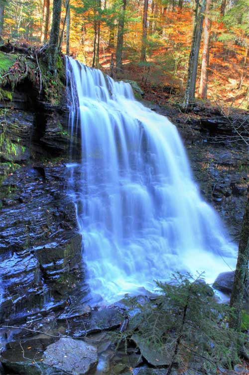
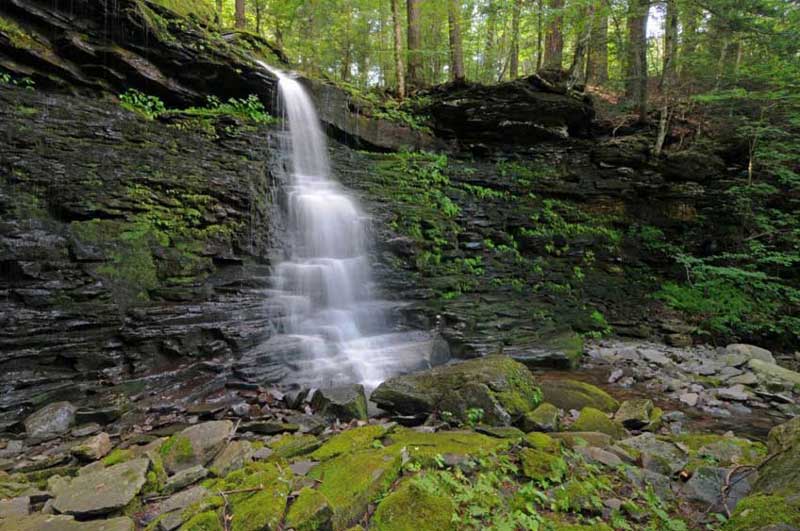
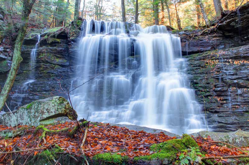
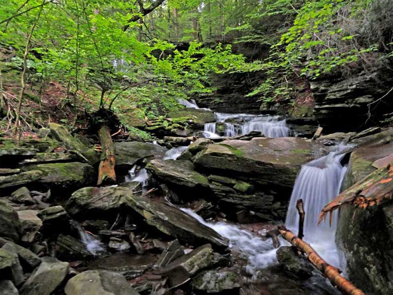
| Description: During low water in the summer, you will only see one waterfall. During a moderate amount of water, you will see two waterfalls. During high water you will see three waterfalls. During very high water, you will see one continuous waterfalls. It's a paradox!. The ledge on the right of the waterfalls has many ferns growing out of it. Some call the wall the "Fern Wall" or "Garden Wall". After the water goes over Paradox falls, it turns 90 degrees to the left and goes a very short distance then turns 90 degrees to the right again and goes over some small rambling falls. At moderate water, you can see Paradox Falls from the trail. |
| Hiking Distance: ~9 miles (round trip) from Palenville. |
| Hiking Distance from Trail: 250' south of trail - up ravine from Buttermilk Falls |
| Trail Information: Waterfalls & Poet's Ledge hike |
| Time: Average 7 hours round trip |
| Elevation Gain: 1,600 from Rt 23a. |
| Difficulty: Intermediate |
| Final access to top of waterfalls: Hike |
| Final access to bottom of waterfalls: Hike |
| Map No: VO: #19 - TC: Map #141 - NG: #19 - USGS: Kaaterskill Quad |
| Digital Mapper:
Topo
Terrain
Satellite |
| Known Access Safety: Mossy and slippery rocks |
| Known Access Safety: Very dangerous at high water (crossing Wildcat Creek) |
| Known Access Safety: Very dangerous if you fall into creek at high water - will be sweep over Buttermilk Falls (500' drop thru series of falls) |
| Access Methods: Hike |
|
Directions to Trail Head from New York State Thruway (Easist, not the shortest): |
| Take New York State Thruway to Exit 21 (Catskill). |
| Take a left out of the NYS Thruway entrance road. |
| Go approximately 1/2 mile |
| Take a right onto Route 23 West |
| Go approximately 5 miles on Route 23. |
| Take a left onto Rt 32 (McDonalds on corner). |
| Go approximately 7-8 miles on Route 32. |
| Take right onto Rt 23A. |
| Go approximately 7-8 miles on Rt 23A . |
| When you come out of Palenville, you can park in 3 different areas. (1) Park just before bridge (west bound lane); (2) Park 1/4 mile past bridge; (3) Park 4/10 mile before bridge in DEC parking lot. |
| You cannot park at the trail head! |
| Do NOT park by the red building next to the bridge. |
| Do NOT park on Malden Ave or in someones driveway on Malden Ave. |
| Do NOT drive up the dirt entrance road to the trail head - this is PRIVATE property - AND there is NO place to park or turn around once you get to the trail head. |
| Mile Point | Altitude | Notes |
| 0.00 | 680 | Parking - From Route 23A turn onto Malden Ave - Walk past double guard rails (watch out for poison ivy on left side of road). |
| 0.62 | 680 | Walk up wide dirt driveway about 250 ( look for green Long Path trail marker on tree - hard to see from Malden Ave) - Turn right and walk up narrow dirt driveway past metal gate (If gate is closed, walk around gate). |
| 1.01 | | Road branch - Go straight |
| 1.27 | | Road branch - Go Right |
| 1.33 | 1,255 | Road Branch - Go Right - leave dirt road and continue onto the foot path |
| 1.40 | | Leave private land onto public land |
| 2.13 | 1,955 | Level off for a while |
| 2.31 | 2,067 | Giant steps |
| 2.34 | 2,102 | Ledge #1 (views) |
| 2.44 | 2,264 | Rock-in-the-Path |
| 2.52 | 2,325 | Reach top of moderate ascent - Levels off after this for several miles. Total ascent of 1,661. |
| 2.57 | 2,317 | Start of Boreal Forest (Watch for black bears at this point) |
| 2.63 | 2,341 | Trail Branch - go right to Poets Ledge (0.44 miles) - Yellow trail markers |
| 2.98 | 2,187 | Mossy Notch |
| 3.07 | 2,145 | POETS LEDGE - Outstanding View! - Enjoy. Be careful of the opening between the rocks on the ledge. It is a 30 fall. There are blueberry bushes around the ledge, which bears can be very possessive of (end of June - early July). |
| 3.74 | 2,183 | Viola Falls |
| 4.29 | 2,212 | Wildcat Falls |
| 4.84 | 2,186 | Buttermilk Falls |
| 4.90 | 2,200 | Paradox Fallss |
| 9.80 | 680 | Return back to Rt 23a. |