|
Information about Wildcat Falls: |
| Name: None |
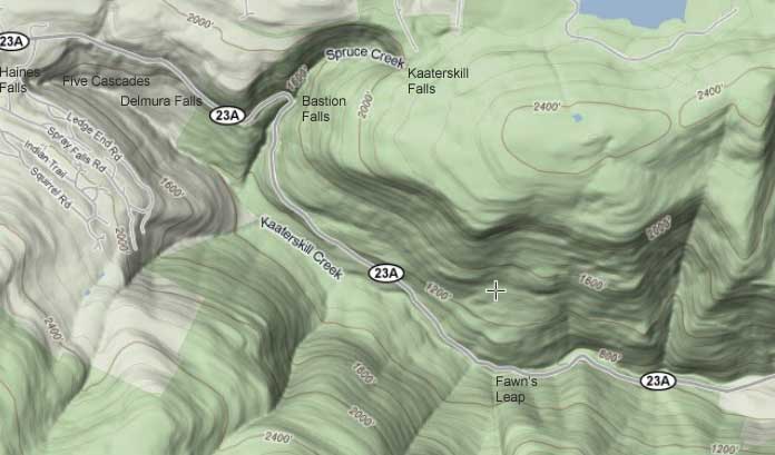
| County: Greene |
| Region: Kaaterskill Clove |
| Location: West side Kaaterskill Creek |
| Order within ravine: 3nd of 5 waterfalls (1=highest elevation) |
| Drops within waterfall: 1 |
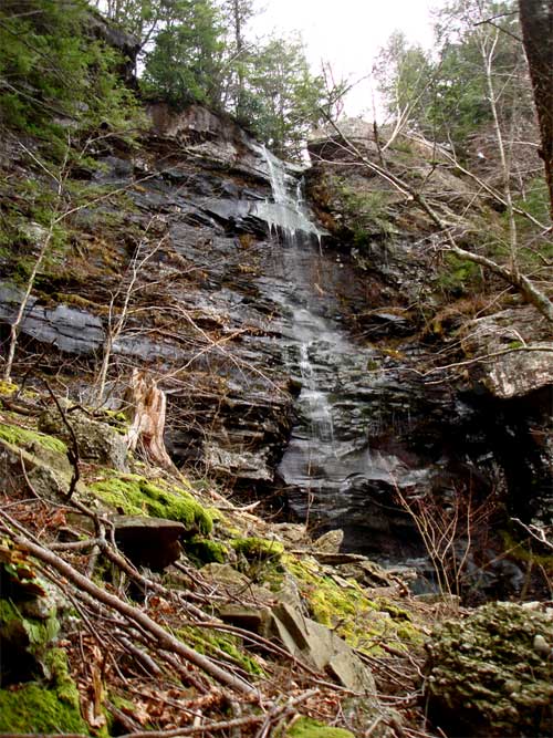
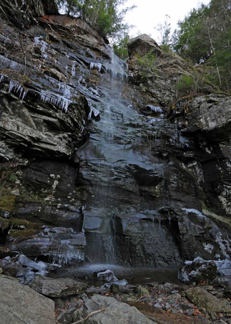
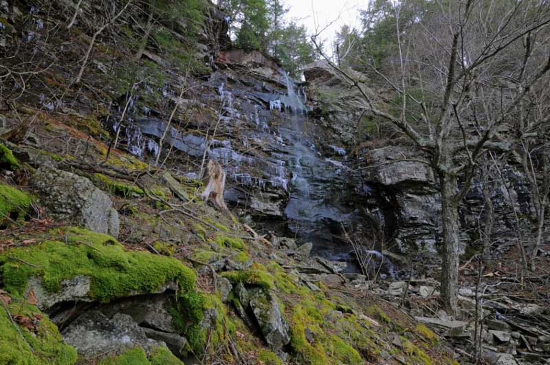
| Total Height: 102' |
| Top Elevation: 2,211' |
| Bottom Elevation: 2,109' |
| Type of Waterfall: plunge |
| Number of Drops: 1 |
| GPS location: N42 10.303 W74 03.853 |
| WGS84 location: 42.171717,-74.064217 (top of waterfall) |
| UTM location: 577291,4669266 (top of waterfall) |
| Named: 1800's |
| Previous or Alternate Names: none |
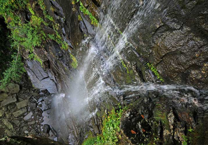
| Description: This waterfall is a single large waterfall. There are a couple small little drops just above the falls. Wildcat waterfalls is 102' high and falls directly down in one drop. The DEC trail runs across the top of Wildcat Waterfall. It is a nice place to stop for lunch. Can be crossed at low or moderate amount of water. But, at high water it is extremely dangerous. To access below the falls is very difficult. There is an old trail on the east side of the waterfalls. You can leave the trail just below a sharp drop in elevation on the trail (2200' - GPS: N42 10.293 W74 03.738). Then walk slightly west to the rim and find the access at GPS: N42 10.308 W74 03.746 at 2177'. The descent is very steep and dangerous. Then walk across the dangerous slope (45 degree pitch) until you reach the bottom of the falls. Note: This should be done with a rope and harness for safety. A tumble down this slope could kill you. You can also access it from the west side, by walking down the trail approximately 1,000 feet and hiking down below the rim. You will then have to hike down to an elevation of 1,950'. This elevation will take you to the top of Lower Wildcat Waterfalls. There is a trail that leads to the top of Lower Wildcat Waterfalls. You have to be very careful getting down to his elevation and walking to the top of the falls. It is steep and slippery. You then have to cross the creek and hike up the east side of the creek to the base of Wildcat Falls. There is a old trail on the east side that goes through the conifer trees. |
| Hiking Distance: 4 miles one-way. |
| Best time to Visit: Anytime |
| Map No: USGS: Kaaterskill Quad |
| Digital Mapper:
Topo
Terrain
Satellite |
|
Directions to Trail Head from New York State Thruway (Easist, not the shortest): |
| Take New York State Thruway to Exit 21 (Catskill). |
| Take a left out of the NYS Thruway entrance road. |
| Go approximately 1/4 mile |
| Take a right onto Route 23 West |
| Go approximately 6.6 miles to Cairo, NY |
| Take a LEFT onto Rt 32. McDonalds Rest. on corner. |
| Go approximately 7.7 miles on Rt 32 |
| Take a RIGHT onto Rt 23A |
| Go approximately 3.0 miles on Rt 23A . |
| When you come out of Palenville, you can park in 3 different areas. (1) Park just before bridge (west bound lane); (2) Park 1/4 mile past bridge; (3) Park 4/10 mile before bridge in DEC parking lot. |
| You cannot park at the trail head! |
| Do NOT park by the red building next to the bridge. |
| Do NOT park on Malden Ave or in someones driveway on Malden Ave. |
| Do NOT drive up the dirt entrance road to the trail head - this is PRIVATE property - AND there is NO place to park or turn around once you get to the trail head. |