Hike to the Long Pond Lean-to from Long Pond Parking Area |
 |
| View of the Long Pond Lean-to in the Willowemoc Wild Forest |
| |
| |
|
OVERVIEW |
| | Trail Name: |  Long Pond PA Spur Trail (From Long Pond PA TO Long Pond Trail)
 |
| | Trail Name: |  Long Pond Trail (From Long Pond PA TO Long Pond Trail)
 |
| | Trail Name: |  Long Pond Lean-to Trail (From Long Pond PA TO Long Pond Trail)
 |
| | | |
| | Forest : | Willowemoc Wild Forest |
| | Parking Area : | Long Pond Parking Area |
| | Winter Access: | Long Pond Parking Area is Plowed |
| | Camp sites: | 1 Camp Site locations |
| | Lean-to sites: | 1 Lean-to |
| | Access: | Hike, ski,snowshoe, or snowmobile |
| | | |
| | Trail Length: | 2.15 miles (one-way) or 4.30 (round-trip) |
| | Trail Type: | 17% Single-Track Trail - 83% Double-Track Trails |
| | Hiking Time: | Average 1 hours one-way |
| | Lowest Elevation: | 1,896' (A) |
| | Highest Elevation: | 3,232' (A) |
| | Views : | NO view spot |
| | Difficulty: | Easy |
| | | | |
| | USGS Map: | USGS Willowemoc Quad Maps |
| | | | |
| | DEC Trail Map: | DEC Willowemoc Wild Forest Map (free) |
| | | | |
| | Digital Mapper: |
Topo
Terrain
Satellite |
|
|
Map to Long Pond Lean-to |
 |
|
|
|
| | Notes About Hiking to Long Pond Lean-to |
|
| | TRAIL |
|
| |
This trail is not hiked often in the summer months. Quite busy in the Winter. The trail is easy hiking with a good tread.
| |
| | PARKING |
|
| |
Parking at the Long Pond Parking Area is pretty easy. Not hard to find either. The biggest problem is that this parking lot can fill up to capacity in the Winter months. The Long Pond Parking Area is accessible in the Winter.
In the summer months you can park further up Flugertown Road. But, there are only parking spaces for a couple cars. In the Winter months the road further up is NOT plowed.
| |
| | OTHER INFORMATION |
|
| |
There is NO cell phone service as of 2023.
|
|
|
| | DIRECTIONS to Flugertown Road PA from New Paltz |
| | Flugertown Road Parking Area WGS84 (DEC): 41.934083, -74.650267 - Elevation is approximately 1,896 feet |
| | Flugertown Road Parking Area Deg/Min/Sec: N41 56 02, W74 39 00 - Elevation is approximately 1,896 feet |
| | Flugertown Road Parking Area GPS: N 41 56.045, W 74 39.016 - Elevation is approximately 1,896 feet |
| | Flugertown Road Parking Area UTM: 18N 528994 4642517 - Elevation is approximately 1,896 feet
|
| |
|
| | Get off New York State Thruway at Exit 18 (New Paltz). |
| | Take a LEFT out of the NYS Thruway onto Route 299 West. |
| | Go approximately 7.3 miles on Rt 299 West |
| | Take a RIGHT onto Rt 44 |
| | Go approximately 10.3 miles on Rt 44 |
| | Take a LEFT onto Rt 209 in Kerhonkson |
| | Go approximately 4.4 miles on Rt 209 |
| | Take a RIGHT onto Rt 55 in Napanoch |
| | Go approximately 16.1 miles on Rt 55 |
| | Take a RIGHT onto Claryville Road (Rt 157) |
| | Go approximately 4.6 miles on Rt Claryville |
| | Take a LEFT onto Frost Valley Road (Rt 47) |
| | Go approximately 1.4 miles on Frost Valley Road (Rt 47) |
| | Take a LEFT onto Pond Road |
| | Go approximately 4.9 miles on Pond Road (turns into Pole Road) |
| | Take a RIGHT onto Brown Road |
| | Go approximately 0.1 miles on Brown Road |
| | Take a LEFT onto Flugertown Road |
| | Go approximately 8/10 miles on Flugertown Road |
| | Take a RIGHT into the Long Pond Parking Area |
| | In the Winter, you CANNOT park further up Flugertown Road (NOT plowed further up Flugertown Road). |
|
|
| | DIRECTIONS to Flugertown Road PA from Kingston |
| | Flugertown Road Parking Area WGS84 (DEC): 41.934083, -74.650267 - Elevation is approximately 1,896 feet |
| | Flugertown Road Parking Area Deg/Min/Sec: N41 56 02, W74 39 00 - Elevation is approximately 1,896 feet |
| | Flugertown Road Parking Area GPS: N 41 56.045, W 74 39.016 - Elevation is approximately 1,896 feet |
| | Flugertown Road Parking Area UTM: 18N 528994 4642517 - Elevation is approximately 1,896 feet
|
| |
|
| | Get off New York State Thruway at Exit 19 (Kingston). |
| | Take a RIGHT out of the NYS Thruway onto Route 28 West. |
| | Go approximately 30.4 miles on Rt 28 West |
| | Take a LEFT onto Rt 47 in Big Indian |
| | Go approximately 19.3 miles on Rt 47 |
| | Take a (180 degree) RIGHT onto Pond Road |
| | Go approximately 4.9 miles on Pond Road (turns into Pole Road) |
| | Take a RIGHT onto Brown Road |
| | Go approximately 0.1 miles on Brown Road |
| | Take a LEFT onto Flugertown Road |
| | Go approximately 8/10 miles on Flugertown Road |
| | Take a RIGHT into the Long Pond Parking Area |
| | In the Winter, you CANNOT park further up Flugertown Road (NOT plowed further up Flugertown Road). |
|
|
MILEAGE CHART - Long Pond PA TO Long Pond Lean-to |
| | Mile Point | Altitude | Notes |
| | 0.00 | 1,896' | Long Pond Parking Area |
| | 1.13 | 2,149' | Trail to Primitive Campsite |
| | 1.33 | 2,164' | Trail Junction to Long Pond Trail |
| | 1.78 | 2,188' | Trail Junction to Long Pond Lean-to |
| | 2.15 | 2,232' | Long Pond Lean-to |
|
|
Hike to Long Pond Lean-to from the Long Pond PA |
 |
This is the sign for the Long Pond Parking Area. There are two entrances for this parking area.
|
|
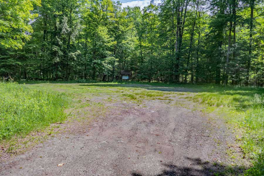 |
The Long Pond Parking Area holds about 40 cars. It can accommodate snowmobile trails. In the summer months this parking area is rarely used. But, in the Winter months, it can fill up quite quickly. So, park your vehicle appropriately so that others can use the parking area.
|
|
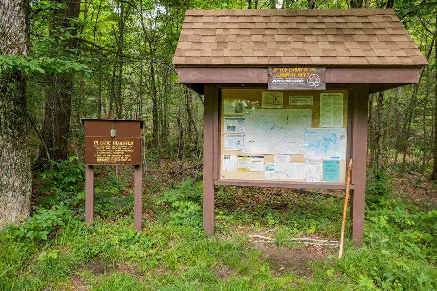 |
The Kiosk has important information about trails in this area, so always check it.
Please register for your hike/visit. Make sure you provide a good description of where you are going. If the NYS Rangers need to find you, this is the first place they will look to see where you might be in thousands of acres of forest.
Additionally, funds for trail maintenance are allocated based upon how many people register for the hike/visit over time.
If you have questions on the rules of hiking in a New York State Forest, the rules are listed in the Kiosk. The most important rule is that you cannot camp within 150' of a road, trail, building, or water source, unless it is a designated primitive campsite. Also remember that whatever you bring into the woods, you need to take back out of the woods. Leave No Trace ("LNT").
|
|
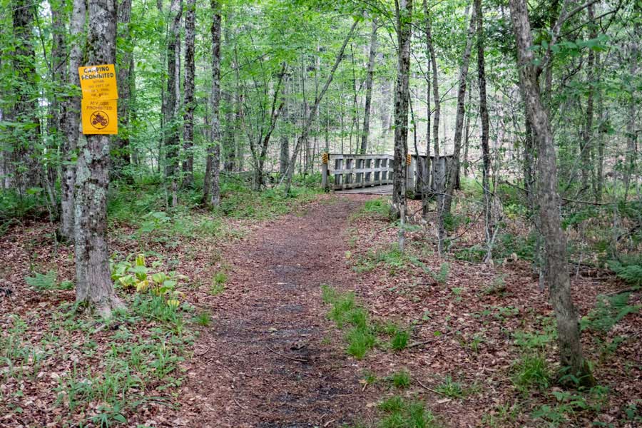 |
This is the Trailhead for the Long Pond Parking Area Spur Trail. There is a bridge about 50 feet away that can handle snowmobiles, but NOT other vehicles.
The trail will start to go uphill after the bridge. Once up higher, the trail will level out.
|
|
 |
Most of the trail is fairly level and easy to hike on. The trail uses Snowmobile Trail Markers (orange in color).
|
|
 |
After a little more then a mile up the Long Pond PA Spur Trail, you will see side trail on your right. This is a spur trail down to Long Pond where there is a Primitive campsite.
|
|
 |
This is the primitive campsite on the upper part of Long Pond.
|
|
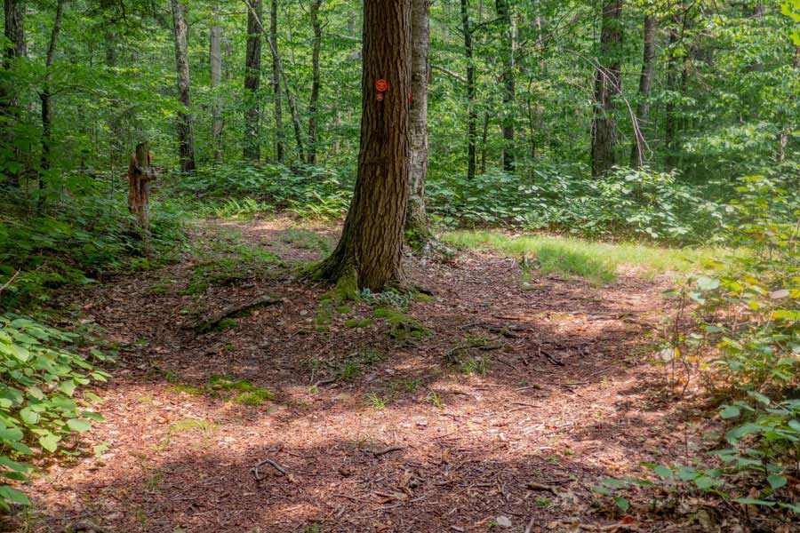 |
After 2/10 of a mile from the side trail for the primitive campsite, is a trail junction. You want to go RIGHT towards the Long Pond Lean-to Trail.
Left will take you towards upper Flugertown Road and later on to Mongaup Pond and beyond in the Willowemoc Wild Forest.
|
|
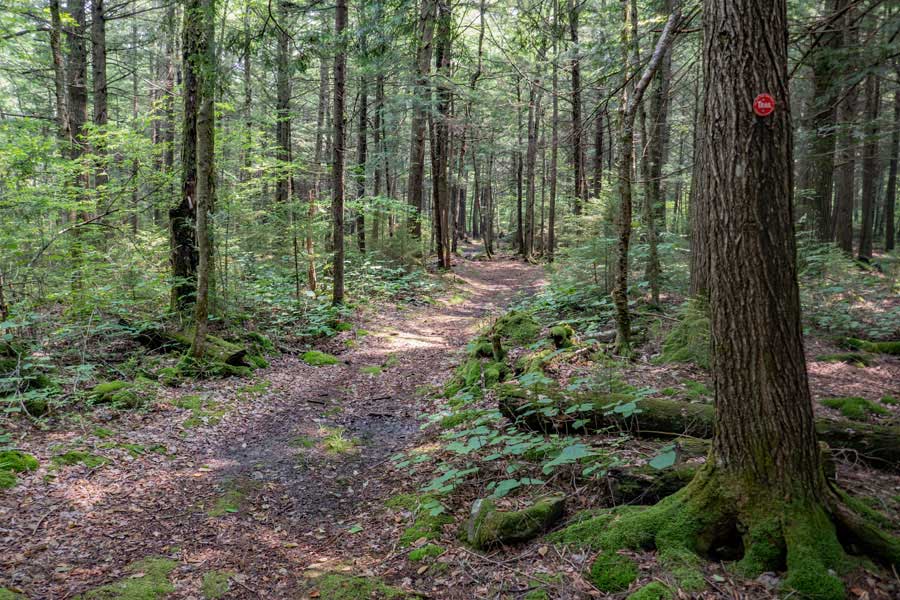 |
The Long Pond Trail is fairly level in this particular region. The trail is in condition in this region.
|
|
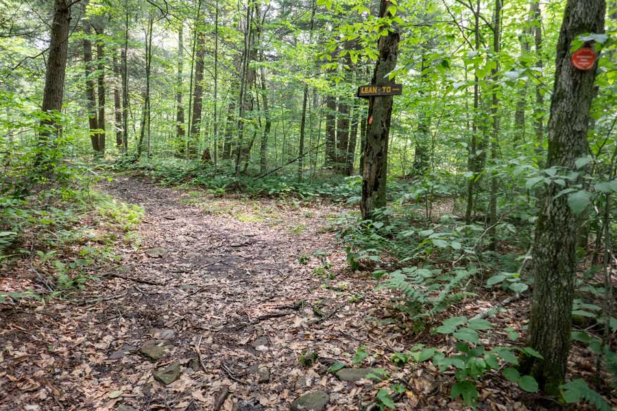 |
After almost a 1/2 mile, you will come to another side trail on your right side. This side trail is the Long Pond Lean-to Trail. You want to take a RIGHT.
Straight would take you to Gun Club Road and Basily Road. The trail beyond here is in poor condition. There are many water ponds in the trail.
|
|
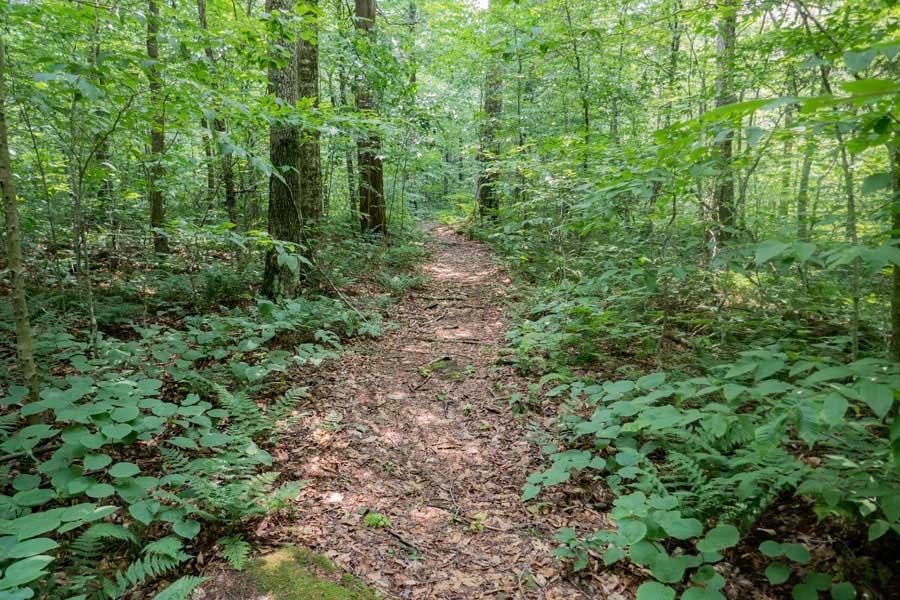 |
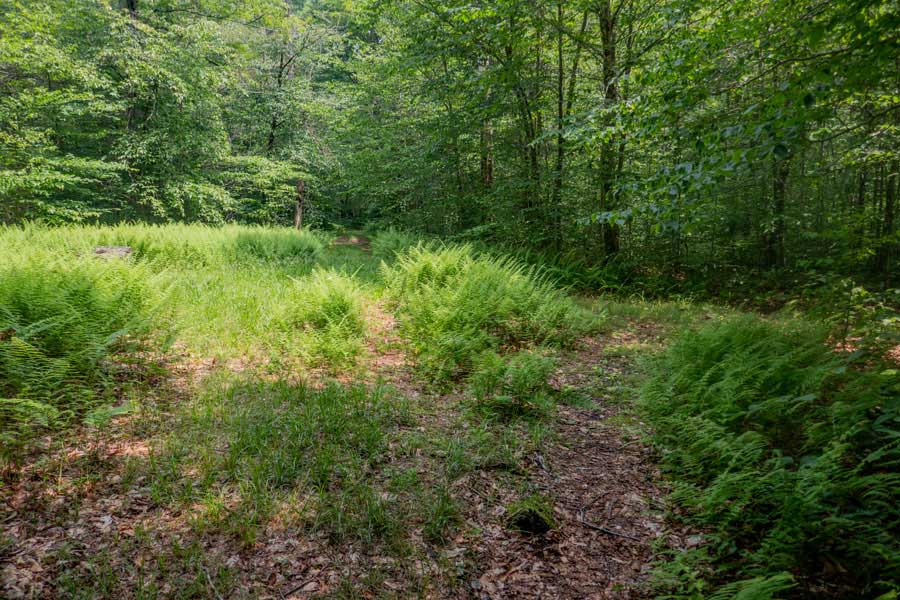
This is the condition of the Long Pond Lean-to Trail. It has a little more vegetation because it gets less use.
|
|
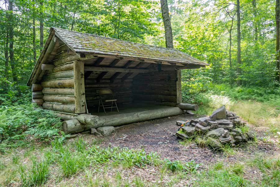 |
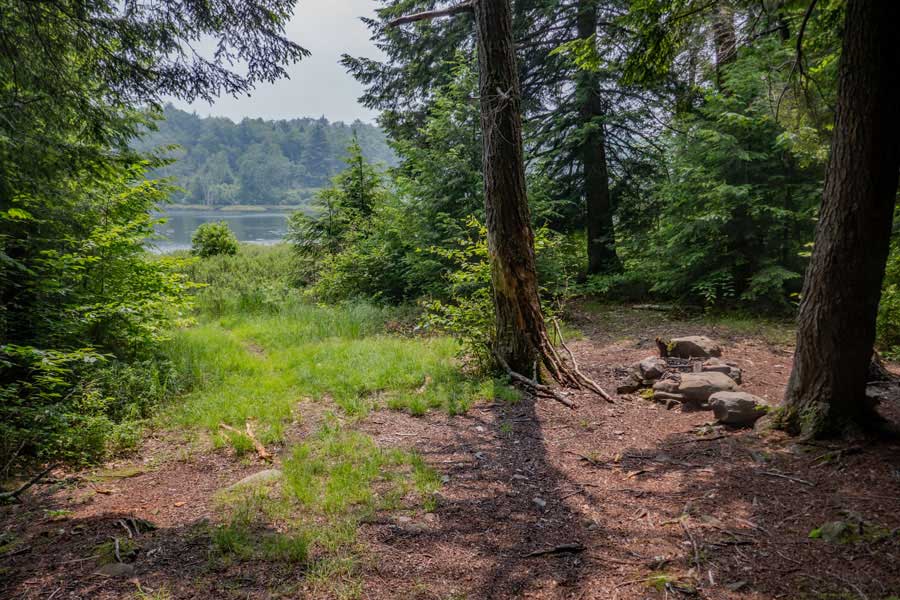
This is the Long Pond Lean-to and fire ring. It does not have a view in the summer months, but you get a limited view when the leaves are not on the trees.
To get water you need to hike downhill to Long Pond. The trail is very poorly defined.
Remember that you are required by law to share the lean-to with others that show up later.
|
|
|
S E C T I O N S
|
W E A T H E R
|
O T H E R
|