Big Indian Mountain from Biscuit Brook |
 |
| |
| |
|
|
|
Maps for Big Indian Mountain from Biscuit Brook |
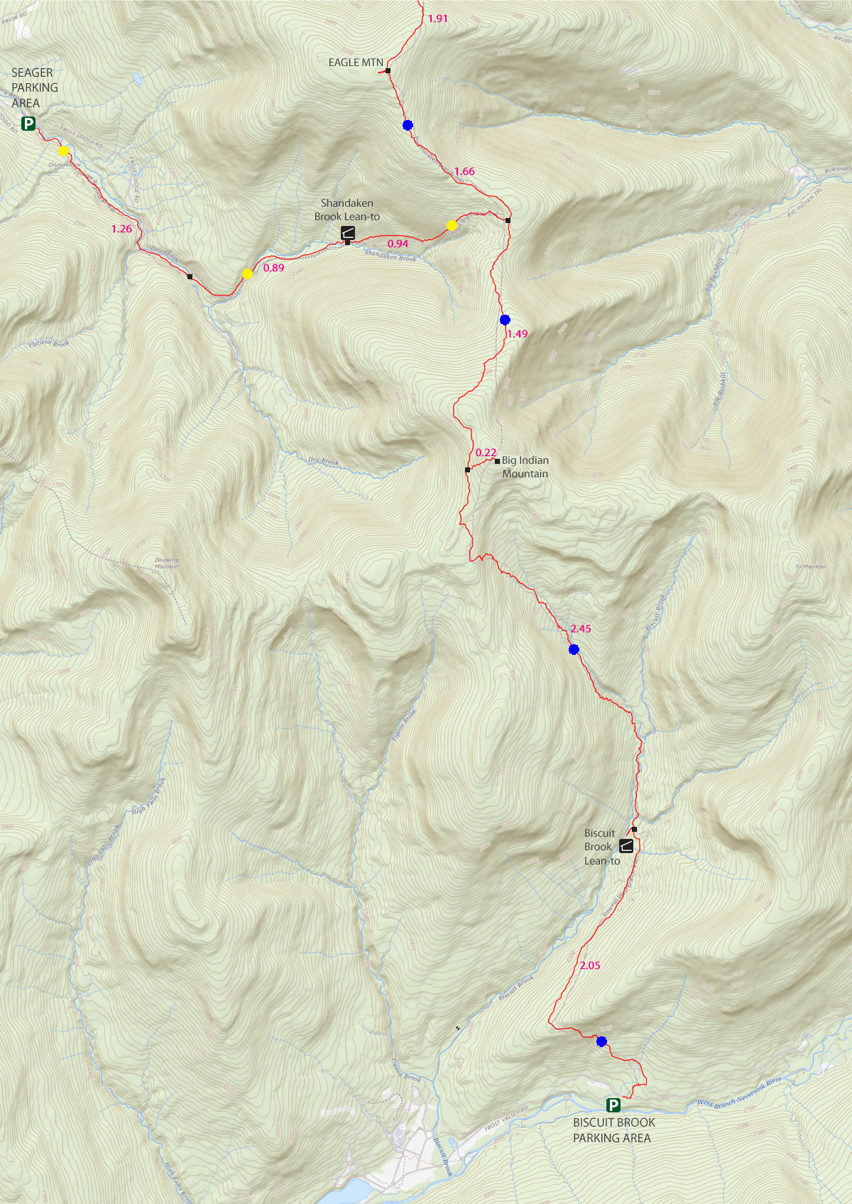 |
 (Public & Private Land Ownership around South DoubleTop Mountain
Light-Green=Private Land
Green=DEC Public Land
Dashed-Red = DEC Trail
Straight Red Lines = Bushwhack Routes |
|
|
|
| | DIRECTIONS TO TRAILHEAD |
| | GPS Coordinates to DEC Parking Lot: 41.99125, -74.484867 (DEC-WGS84) - Elevation is about 2,088 feet |
| | GPS Coordinates to DEC Parking Lot: N 41 59.475, W 74 29.092 (GPS) - Elevation is about 2,088 feet |
| | GPS Coordinates to DEC Parking Lot: 18N 542668, 4648933 (UTM) - Elevation is about 2,088 feet |
| | GPS Coordinates to DEC Parking Lot: N41 59 28, W74 29 05 (Degree, Min, Sec) - Elevation is about 2,088 feet |
| | |
| | Take New York State Thruway to Exit 19 (Kingston). |
| | Take a right out of the NYS Thruway toll booths onto Rt 28. |
| | Go approximately 30.4 miles west on Rt 28 |
| | Take a left onto Rt 47 at Big Indian |
| | Go approximately 12.4 miles South on Rt 47 |
| | The Biscuit Brook DEC Parking lot is on the LEFT side of the road. |
|
|
NOTES for hike to Big Indian Mountain |
| | The hike of Big Indian Mountain is located in Ulster county. There are a number of different routes that can be taken to get to the summit of Big Indian Mountain. Others are bushwacks from the beginning. There are pros and cons to each direction depending upon the time of year, and the experience you are looking for. The nice part of this hike is the easy climb to the summit. The hike is moderate in ability. There are numerous stream crossings on the shown route. During high water periods, they may not be crossable or safe. Some hikers find this mountain range boring, because of a lack of views. But, from a flora point-of-view this hike is a winner.
Route #1 - Hike from Biscuit Brook DEC Parking Lot - Straight Route - It is approximately 9.12 miles round trip. This route is outlined on this page. It is fairly easy hike, and moderate in ability. It does have some stream crossings that can only be crossed during normal water heights. During high water marks it can be very dangerous or impossible.This is the most common route used by most hikers.
Route #2 - Hike from Seagar Parking Lot - It is approximately 8.72 miles round trip. It is more remote then the other routes. It is very easy to get lost on this route. There are a number of side roads which can confuse people. This is probably the least used route.
Route #3 - Hike from Eagle Mountain - It is approximately 2.5 miles from Eagle Mountain. This route will only work if you have already hiked to Eagle Mountain.
Route #4 - Hike from Burnham Hill Road off Rt 47 - This route follows some old roads up the mountain, that come out near the col of Big Indian Mountain and Big Indian Mountain. See VO maps for routes up the complex of dirt roads. This is a very questionable route if you are looking for a trail.
Route #5 - Hike from Fir Mountain - It is approximately 1.5 miles from Eagle Mountain. This route will only work if you have already hiked to Fir Mountain. It is a bushwhack from Fir Mountain. Fir Mountain is 7.80 miles from Biscuit Brook Mountain.
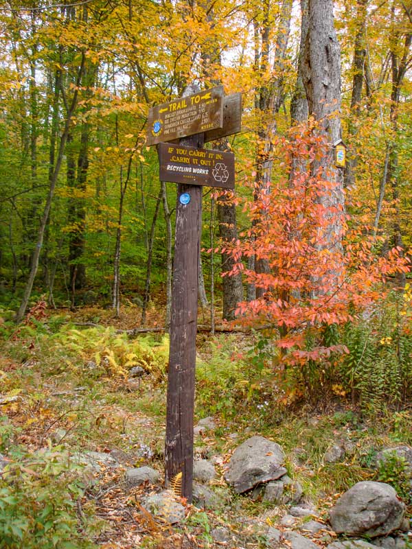
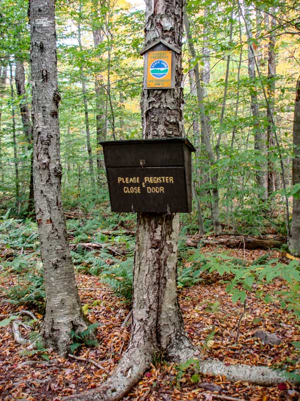
When you start out from the Biscuit Brook DEC parking lot on Rt 47. Biscuit Brook DEC parking area is about 4 miles past Slide Mountain DEC parking area. After parking your car, walk about up Rt 47 (towards slide mountain PA) about 100 feet, and you will find the trail head directly across the street. Look for a sign directly on the Rt 47. After walking up the trail about 500 feet you will see the DEC registration box. Get registered and started.
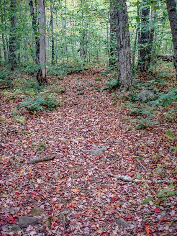
After the registration box, the incline starts to go uphill, and runs across the hillside to the south. The trail is moderate in difficulty. It is also very rocky. When you get to the top of the hill, the incline levels out, and the trail into the valley is very nice. At the top of the hill, is where you would leave the trail if you want to do Route #2.
For the next mile, the trail actually drops about 200-300 feet in elevation over the mile, so the hike is real easy. In the Winter you can see Doubletop Mountain (elevation 3868') off to your left (in the distance). You can only see the top of the mountain. Another steep looking mountain (elevation 3372') on the other side of the valley floor. It doesn't have a name. Off to the right is another un-named peak with elevation of 3211'. Straight ahead of the trail is Big Indian Mountain. This is our goal of the hike.
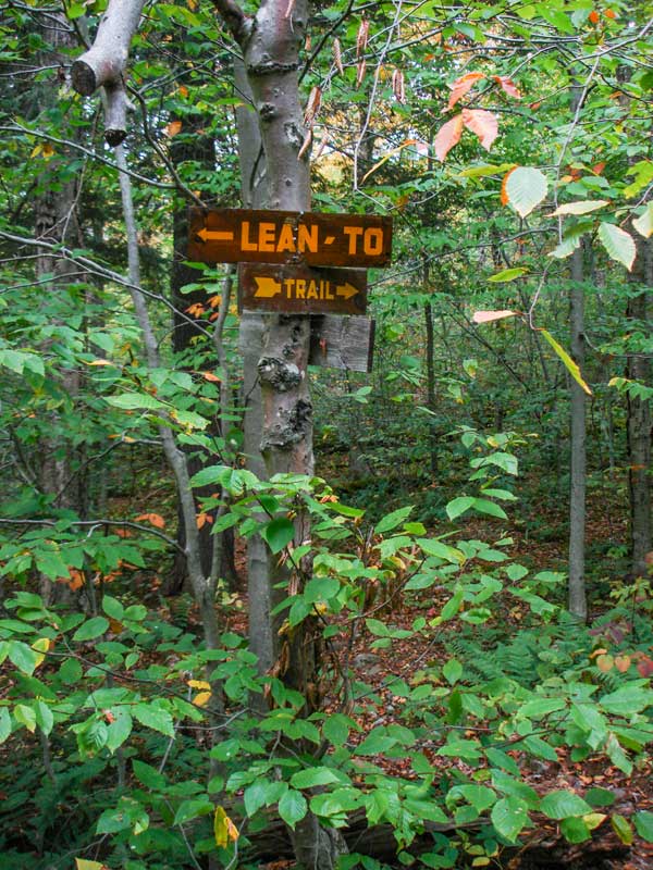
About 2 miles into the hike, you will see the Lean-to or the sign to the Lean-to on the left side of the trail. the lean-to is right next to the creek, but sits about 15-20 feet above the creek. Just after the Lean-to, you will cross a fairly good stream with steep banks down to the stream. This stream runs perpendicular to the trail. A little ways further you will cross the Biscuit Creek. This is the hardest stream crossing. In the dryness of the summer it is not a problem. But, at high water it can be impossible and dangerous. If you are to do this hike, you want to make sure that the stream levels are low. You will have to do 4-5 stream crossings. Additionally, parts of the trail run next to Biscuit Creek.
After you cross Biscuit Creek, the trail will start to climb in elevation. The further you go, the steeper it gets. The grade isn't that bad. One of the steepest grades has switchbacks, which makes it much easier. Once you get above the steep section, the grade becomes very easy. After the 3500' elevation sign, you will see a side trail on the left. This will allow you to bushwhack to Doubletop Mountain. Once you get to the west side of Big Indian Mountain, there will be an unmarked side trail on the right. After a short walk uphill, you will come to the summit of Big Indian Mountain.
The summit doesn't have any views. The canister is easy to find. Reverse your course back to the car.
|
|
|
MILEAGE CHART |
| | Mile Point | Altitude | Notes |
| | 0.00 | 2,088 | Biscuit Brook DEC Parking Lot |
| | 0.03 | 2,092 | Trail head on Rt 47. |
| | 0.70 | 2,475 | Top of hill. |
| | 2.05 | 2,389 | DEC Lean-To. (0.12 miles round trip to-and-from Lean-to) |
| | 4.22 | 3,520 | 3500 elevation sign. |
| | 4.50 | 3,553 | Leave Trail and start bushwacking. |
| | 4.72 | 3,702 | Summit of Big Indian Mountain. |
| | 9.12 | 2,088 | Biscuit Brook DEC parking lot. |
|
|
Hike to Big Indian Mountain |
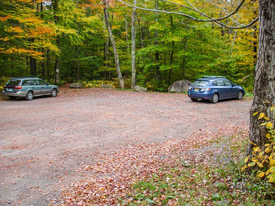 |
When driving down Rt 47, you will see this sign on the left side of the road. You want the Biscuit Brook DEC parking lot just after this sign. Remember that the Slide Mountain Parking Lot also has a similar sign before it. This parking lot is AFTER the Slide Mountain Parking lot.
This is the DEC sign next to the Biscuit Brook parking lot. |
|
 |
 |
This is the sign by the Trail Head on Rt 47.
The DEC Registration Box is a short distance from the Biscuit Brook DEC parking lot. |
|
 |
 |
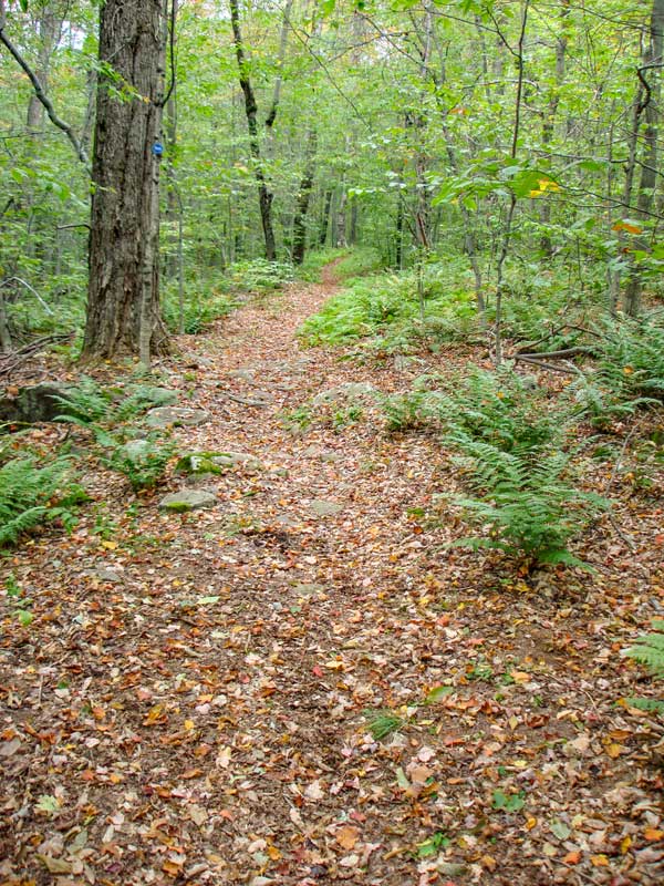
The trail starts out pretty flat and nice. But, after a short distance, it will climb up the hillside at an angle.
The trail runs across the hillside, so the climb isn't so bad. But, it is rocky. The climb is about a 1/3 to 1/2 mile up at a moderate rate. |
|
 |
 |
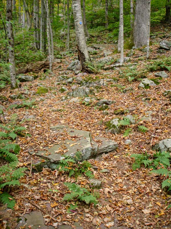
When you get to the top of the climb, the trail becomes flat. In fact, it goes downhill slightly. At this point, you are about a mile into the hike. This is an important point for one of the alternative routes to the top of Fir. If you take a right off the trail, this will follow the long ridge line to Big Indian Mountain. For this hike, we will continue straight down the DEC marked trail for now.
After walking down the marked trail into the valley, you will come to a sign in the picture. This side path will take you to the DEC Lean-to. At this point you will be at mile post 1.90. It is about 300 feet to the lean-to. The lean-to is next to the creek. |
|
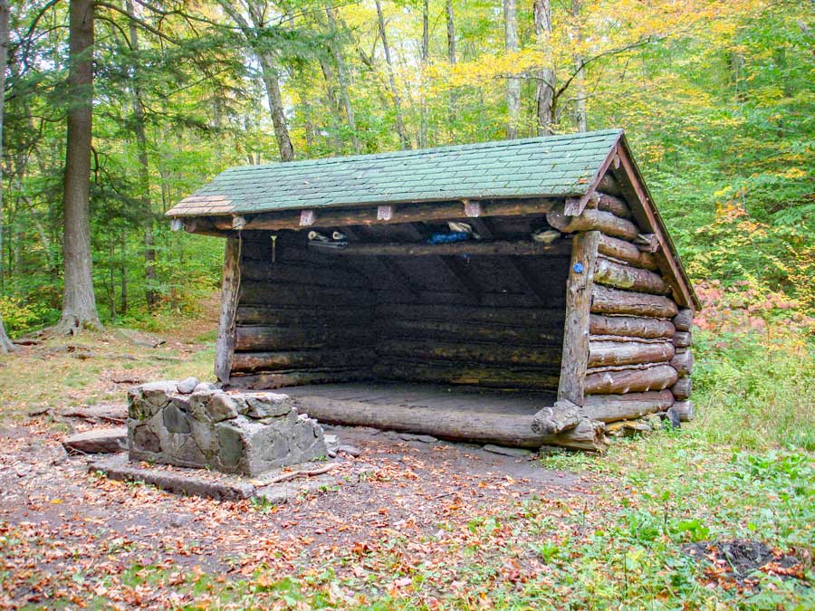 |
This is the picture of the DEC lean-to. It is right next to the creek, but it sits up about 15-20 feet above the creek. It should be safe during high water periods. |
|
 |
 |
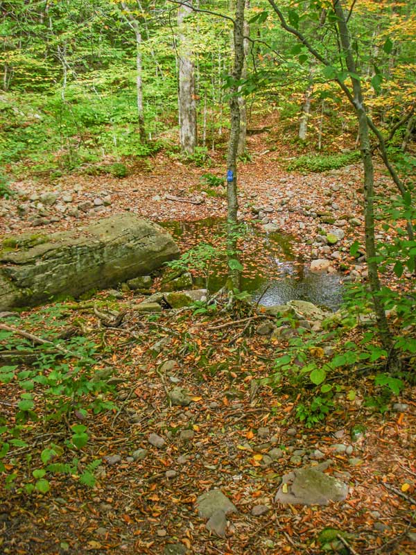
The forth stream bed is impossible to cross during high water. The stream grows to 5-6 feet deep and about 50' wide.
The path will then parallel the stream on the west side for a while. But, it will also start to climb in elevation. The trail is used less after this point. Some people will bushwhack up to Fir in between stream #3 and stream #4 . |
|
 |
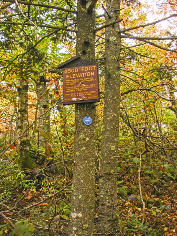
At an elevation of 3520', you will see the 3500 sign. You cannot camp or have a fire above 3500' during the spring, summer, and fall. You can camp above 3500' in the winter. Around the 3500 sign is a side trail that will allow you to bushwhack to Doubletop Mtn.
On the west side of Big Indian Mountain, you will come to a trail junction. Straight will take you to Eagle Mtn. Right will take you up an unmarked trail to Fir Mtn. |
|
|
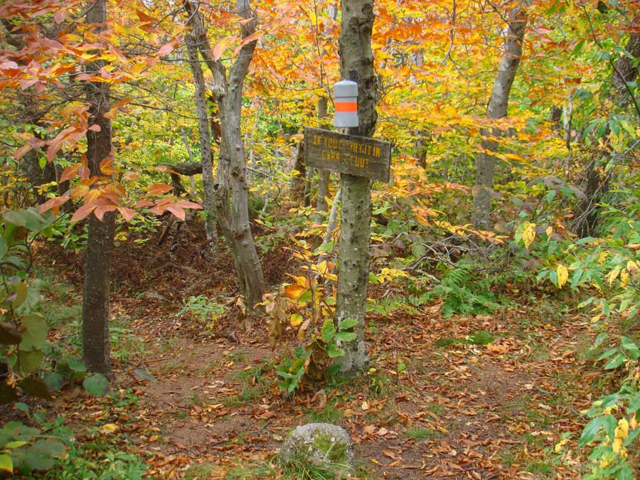
The summit of Big Indian Mountain is a small area that is unmistakable. There is a 3500 Club canister on the summit.
There is also a herd trail that goes to Fir Mountain. It is about 1.5 miles to Fir Mountain. Then another 1.5 miles bushwhack back to the trail in the valley. It is important that you plan carefully for a bushwhack to Fir Mountain. If you miss the col it can become quite difficult. The col also fills up with deep snow in the winter. |
|
|
S E C T I O N S
|
W E A T H E R
|
O T H E R
|