|
|
|
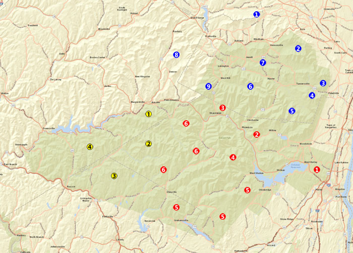
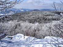
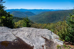
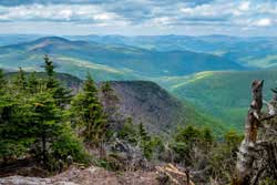
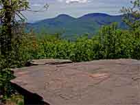
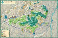
Hiking Regions of the Catskill Mountain |
 |
 Pisgah Wild Forest Pisgah Wild Forest |
 Bluestone Wild Forest Bluestone Wild Forest |
 Dry Brook Wild Forest Dry Brook Wild Forest |
 Windham - Blackhead Wilderness Windham - Blackhead Wilderness |
 Windham - Blackhead Wilderness Windham - Blackhead Wilderness |
 Balsam Lake Mtn Wild Forest Balsam Lake Mtn Wild Forest |
 North-South Lake North-South Lake |
 Shandaken Wild Forest Shandaken Wild Forest |
 Willowemoc Wild Forest Willowemoc Wild Forest |
 Kaaterskill Wild Forest Kaaterskill Wild Forest |
 Slide Mountain Wilderness Slide Mountain Wilderness |
 Delaware Wild Forest Delaware Wild Forest |
 Indian Head Wilderness Indian Head Wilderness |
 Sundown Wild Forest Sundown Wild Forest |
|
 Hunter - West Kill Wilderness Hunter - West Kill Wilderness |
 Big Indian Wilderness Big Indian Wilderness |
|
 Hunter - Windham Valley Hunter - Windham Valley |
|
|
 Bearpen Wild Forest Bearpen Wild Forest |
|
|
 Halcott Mountain Wild Forest Halcott Mountain Wild Forest |
|
|
| | |
| |
|
| | |
| |
|
Balsam Lake Mtn Wild Forest - This region has some nice hiking paths that are easy. Alder Lake, Balsam Lake Mtn, Cradle Rock Ridge, Graham, Mill Brook Ridge, Woodpecker Ridge
|
| | |
| |
|
Bearpen Wild Forest - This region has some nice old logging trails. It is a very nice place to hike in the Winter. Bearpen Mountain has numerous view points. Bearpen Mtn, Cator Roundtop, Hog Mtn, Irish Mtn, Kip Hill, North Bearpen Mtn, Montgomery Hollow Mtn, Moresville Range (peak, SE, SW), Peak 3403, Pine Mtn, Red Kill Ridge, Shutice Mtn, South Bearpen Mtn, White Man Mtn
|
| | |
| |
|
Big Indian Wilderness - This region is west of the Slide Mountain Wilderness Area. It consist of Balsam Mountain, Doubletop Mountain, Eagle Mountain, Fir Mountain, Hayes Mountain, Hemlock Mountain, High Falls Ridge, Spruce Mountain, Winnisook Lake Mountain
|
| | |
| |
|
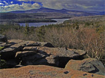
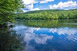
Bluestone Wild Forest & Ashokan Reservoir - Located several miles west of Kingston, NY on Route 28. This 3,018 acres has two beautiful lakes for day use. Commonly used for mountain biking, walking, snowshoeing, cross-country skiing, fishing, kayaking, and several camp sites.
|
| | |
| |
|
Delaware Wild Forest - Located about 45 miles west of Kingston, NY on Route 28 in the WESTERN Catskills. This 29,500 acres is different from the rest of the Catskills. It has a number of nice ponds and lakes that you do not see in the Catskill Mountains. There are a number of very nice hikes and great view points in the Delaware Wild Forest.
|
| | |
| |
|
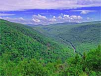
Dry Brook Ridge Wild Forest - Located about 40 miles west of Kingston, NY on Route 28 in the WESTERN Catskills. This 8,900 acres is an exceptional wild forest that few ever visit. It has one of the largest fern forest in the Catskills. Several exceptional conifer groves. No shortage of huge trees. The view points on the Dry Brook Ridge are exceptional.
|
| | |
| |
|
Halcott Wild Forest - This region has several peaks with no established trails on them. There are three mountains that are commonly used: Halcott Mountain, Sleeping Lion Mountain, and South Vly Mountain. It also includes the Vinegar Hill Wildlife Refuge.
|
| | |
| |
|
Hunter-Tannersville-Windham Valley - This region has some nice Rail Trails and Mountain Bike Parks that range from easy to difficult. Includes Kaaterskill Rail Trail, Tannersville Rail Trail, Hunter Rail Trail, Huckleberry Bike Park, Tannersville-Hathaway Bike Park
|
| | |
| |
|
Hunter - West Kill Wilderness - This region has some nice hiking paths that range from easy to difficult. Includes Balsam, Evergreen, Hunter, Leavitt Peak, North Dome, Rusk, East Rusk, Sheridan, Sherrill, West Kill
|
| | |
| |
|
Indian Head Wilderness - The Indian Head Mtn Range is one of the most difficult mountains range to hike. It is part of the Devil's path, which is one of the most difficult hiking trails in the world. Consist of Overlook Mountain, Plattekill Mountain, Indian Head Mountain, Twin Mountains, Sugarloaf Mountain, and Plateau Mountain.
|
| | |
| |
|
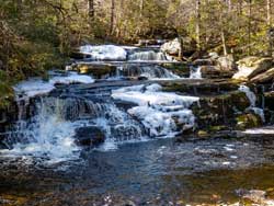
Kaaterskill Wild Forest - This mountain range has some very nice hikes in the in the Catskill Mountains. Consist of Huckleberry Point, Mohawk Indian Camp, Kaaterskill High Peak, Poet's Ledge, Waterfall hike (buttermilk, wildcat, viola falls), and Brant Fort.
|
| | |
| |
|
North/South Lake Region - This region has some beautiful hiking paths that are easy. It is also the start of the famous Escarpment Trail. The Escarpment Trail has numerous ledges and great views. Includes Kaaterskill Falls, Escarpment Trail, Boulder Rock, Palenville Overlook, North Point, North Mountain, Winter Clove, and Stoppel Point.
|
| | |
| |

|
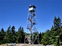
Phoenicia - Mt Tobias Wild Forest - This region covers a few mountains around Phoenicia, New York. This is one of the smaller forest, and includes Carl, Silver Hollow, Tobias, Ticetonyk, Torren's Hook, Tremper Mountain, Tremper Mountain Fire Tower
|
| | |
| |
|
| | |
| |
|
Shankaken Wild Forest - This region covers the region around Shanaken, Belleayre and Pine Hill. Includes Rochester Hollow, Giggle Hollow trail system, Giggle Hollow Trail, Woodchuck Hollow Trail, Cathedral Glen Trail, Birch Lake region, Belleayre Ski Center
|
| | |
| |
|
Slide Mountain Wilderness - This region has some of the mos prominent peaks in the Catskill Mountains. Balsam Cap, Breath, Cornell, Cross, East Wildcat, Friday, Garfield, Giant Ledge, Hanover, Lone, Panther, Peekamoose, Pleasant, Rocky, Romer, Samuals Point, Slide, Table, Terrace, Van Wyck, Wittenberg, Wildcat, Woodhull
|
| | |
| |
|
Sundown Wild Forest - This region has some nice hiking paths that are easy. Airrcraft Carrier Rock, Ashokan High Point, Balsam Swamp, Bangle Hill, Big Rosy Bone Knob, Cherrytown, Denmar, East, Flat Hill, Little Rocky, Mombaccus, Pople Hill, Red Hill, Samson , Spencers Ledge, Sugarloaf (sundown), Vernooy Falls
|
| | |
| |
|
Windham - Blackhead Mountain Wilderness - This region has a nice range of mountains to climb. It has a nice range of mountains for all difficulties. Includes Windham High Peak, Burnt Knob, Acra Point, Blackhead, Black Dome, Thomas Cole, Colgate Lake, Arizona Mountain, and Dutcher Notch.
|
| | |
| |
|
Willowemoc Wild Forest - This region is located in the southwestern section of the Catskill Mountains. Most of the trails are easy hiking. There are very few views from the trails. But, there are a lot of lakes and ponds. Camping and snowmobiling is popular in the Willowemoc Wild Forest.
|
| | |
| |
|
| | |
| |
|
Hikes above 3,500' in the Catskill Mountains - List of the 35 hikes above 3,500' in the Catskill Mountains. Includes links to all the mountains. Also includes topo map links for each of the peaks. Includes difficult, view ratings, type of trail.
|
| | |
| |
|
USGS Maps for the Entire Catskill Mountains. Quick high-resolution topographic maps to view with your browser. Download high-resolution 7.5 min (1:24,000). Also included are historic USGS maps in 15 min (1:62,500) format. This section also has a map finder to help you select which USGS topo map to view or download.
|
| | |
| |
|
|
Maps of the Catskill Mountains - Numerous maps of the Catskill Mountains. Maps from the 1800's to the present day. This also includes the rare Walton Van Loan maps
|
| | |
| |
|