Camping and Hiking the Alder Lake Loop Trail |
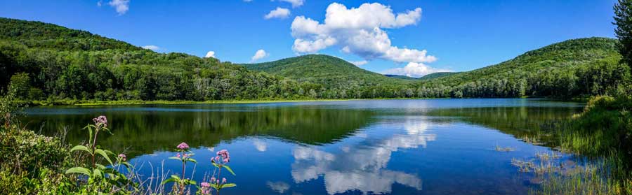 |
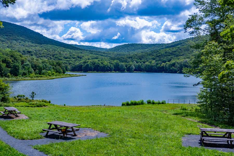
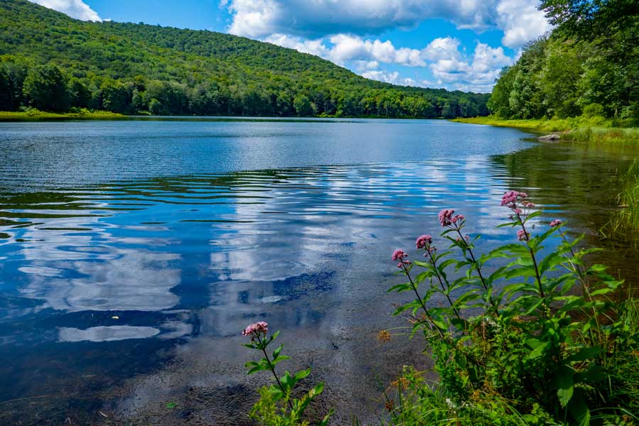
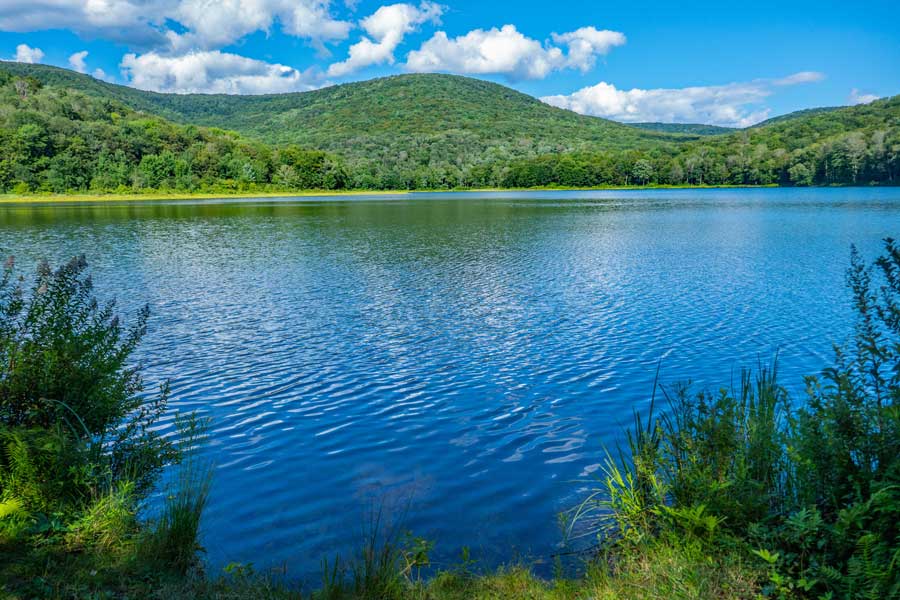
| View of the Alder Lake - Taken from the side of the dam |
| |
| |
|
OVERVIEW |
| | Trail Name: |  Alder Lake Loop Trail
 |
| | Forest: | Balsam Lake Mountain Wild Forest |
| | Parking Area : | 30+ spaces at Alder Lake |
| | Winter Access: | None - Cross Mountain Road is now plowed in the Winter |
| | Camp sites: | 11 major Camp Site locations |
| | Lean-to sites: | None near Alder Lake |
| | Access & Activities: | Hike, kayak, camp, bike, fish, picnic, backpack, and ski |
| | Cost / Reservations: | Free - no reservation system (first come - first serve) |
| | | |
| | Trail Length: | 1.73 miles |
| | Trail Type: | 45% Single-track trail - 55% Double-track trail |
| | Hiking Time: | 1 hour |
| | Lowest Elevation: | 2,209' (A) |
| | Highest Elevation: | 2,285' (A) |
| | Views : | Beautiful view of the lake near Trailhead |
| | Difficulty: | Easy |
| | | | |
| | USGS Map: | USGS Arena Quad Maps |
| | | | |
| | DEC Trail Map: | DEC Balsam Lake Mountain Wild Forest Map (free) |
| | | | |
| | Digital Mapper: |
Topo
Terrain
Satellite |
|
|
Maps to Alder Lake Loop Trail |
 |
|
|
|
| | Notes About Hiking & Camping at Alder Lake |
|
| | TRAIL |
|
| |
The trail is an easy hike for most people. The hike from the parking area to the Coykendill Lodging is very short, maybe 400 feet. If you want to hike the entire loop, we recommend hiking it in clock-wise direction. If you hike it in a counter-clock-wise direction, some people get confused on the eastern side. There is an unmaintained side trail that confuses hikers.
The Mill Brook Ridge Trail is very long. You would be looking at a 6.5 miles one-way or 13 miles round-trip. The trail is not used very much, so it can be overgrown in the summer months. It is very wild. There are no bridges over creeks. Some of the trail runs along the edge of ledges, so you need to pay attention. Some of the ledges are 100 feet high, so falling off those ledges are fatal. Much of the trail is very narrow. Many people will hike this route as a traverse. Park one car at Balsam Lake Mountain Parking Area, then drive back and hike from Alder Lake. Make sure you have reliable maps. We do have this hike listed on our site.
| |
| | CAMPSITES |
|
| |
The campsites in southwestern region has a lot of trails criss-crossing each other. Easy to get confused where each trail goes.
We have labeled each campsite region from 1 to 10. The DEC has their own numbers on the campsite region that does not match ours. The DEC has some sites marked with numbers, while others are not marked.
We do have a section on Black Bears. We very rarely see them during the day. At night, they come down to the campsites looking for food and scraps that people leave out. Make sure you read the section on Black Bears below.
| |
| | LAKE |
|
| |
Alder Lake is not that deep. The deepest section is down towards the dam. It is an excellent to kayak or canoe on. It you take water from the lake, make sure you sterilize the water.
| |
| | PARKING |
|
| |
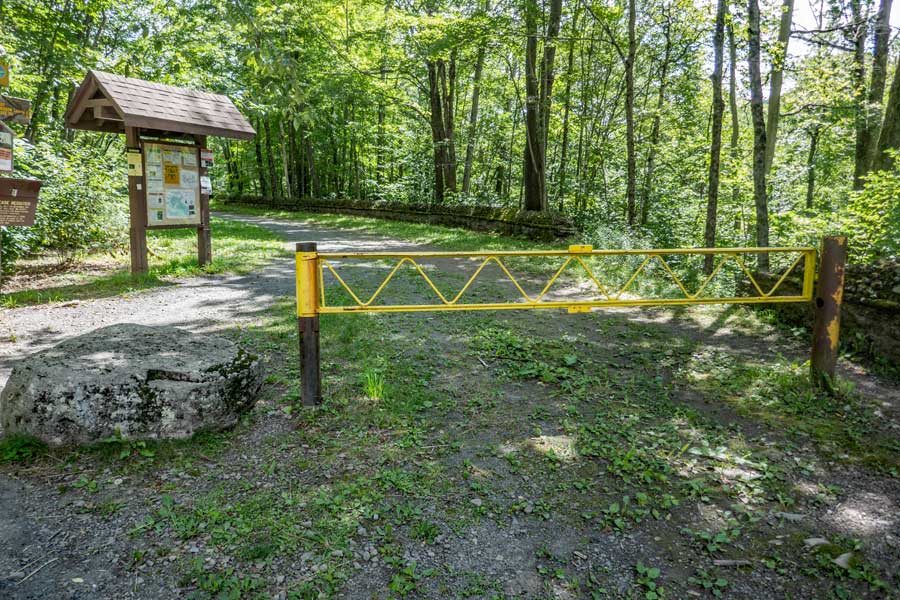
Finding the entrance to the Alder Lake Parking Area is not marked, nor are there any signs denoting that the entrance goes to Alder Lake. The entrance is basically at the end of the dirt Cross Mountain Road, and the paved Alder Road (CR 54). There is also Old Edwards Road at the intersection of Cross Mountain Road and Alder Road.
The entrance for the DEC road to Alder Lake has a yellow metal gate near Cross Mountain Road. The DEC Road to Alder Road is not marked on some maps.
In the winter months Cross Mountain Road is NOT plowed. But, Alder Road is plowed. You may be able to park on Alder Road if you want to cross country ski. We are not aware of the DEC plowing the Alder Lake Parking Area. If they do, then park in the Alder Lake Parking Area.
| |
| | OTHER INFORMATION |
|
| |
There is limited cell phone service in some parts of the region (as of 2023).
|
|
|
| | DIRECTIONS to the Alder Lake Parking Area from Exit 19 (Kingston) |
| | Alder Lake Parking Area - WGS84 (DEC): 42.049767, -74.682417 - Elevation is approximately 2,279 feet |
| | Alder Lake Parking Area - Deg/Min/Sec: N42 02 59, W74 40 56 - Elevation is approximately 2,279 feet |
| | Alder Lake Parking Area - GPS: N 42 02.986, W 74 40.945 - Elevation is approximately 2,279 feet |
| | Alder Lake Parking Area - UTM: 18N 526281 4655351 - Elevation is approximately 2,279 feet
|
| |
|
| | Get off New York State Thruway at Exit 19 (Kingston). |
| | Take a RIGHT out of the NYS Thruway onto Route 28 West. |
| | Go approximately 45.4 miles on Rt 28 West |
| | Take a LEFT onto Spur to BWS Road No 10
(Look for Brown hiking signs for Huckleberry Loop & Kelly Hollow) |
| | Take a RIGHT onto BWS Road No 10 |
| | Go approximately 3.75 on BWS Road No 10 |
| | Take a LEFT onto Millbrook Road |
| | Go approximately 1.4 miles on Millbrook Road |
| | Take a RIGHT onto "Cross Mountain Road" (DO NOT take "Old Cross Mtn Road") |
| | Go approximately 4.3 miles on Cross Mountain Road (dirt road) |
| | At almost the end of the dirt road section is a dirt road on your LEFT |
| | Take a 180 degree LEFT turn into the DEC dirt road (NO DEC sign at entrance) |
| | Go approximately 0.4 miles on The DEC road to the end |
| | DEC Parking Area is at the end of the DEC Road |
| |
|
|
|
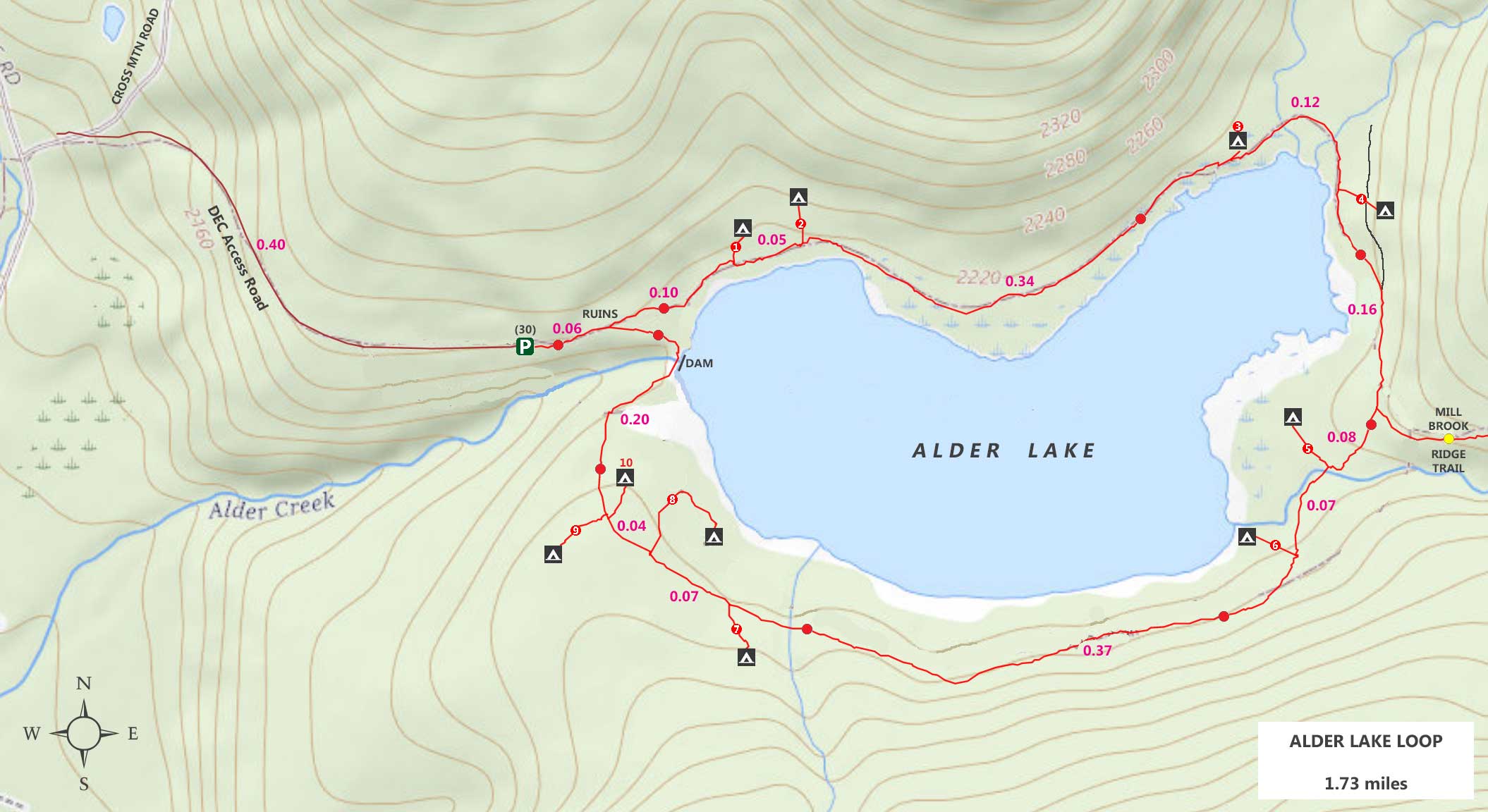
MILEAGE CHART - Alder Lake Loop |
| | Mileage |
Mile Point |
Altitude |
Notes |
| | 0.00 | 0.00 | 2,230' | Adler Lake Parking Area (30+ cars) |
| | 0.06 | 0.06 | 2,230' | Coykendill Lodge Ruins - view of lake |
| | 0.16 | 0.10 | 2,227' | Campsite #1 |
| | 0.21 | 0.05 | 2,231' | Campsite #2 |
| | 0.55 | 0.34 | 2,215' | Campsite #3 |
| | 0.67 | 0.12 | 2,215' | Campsite #4 |
| | 0.83 | 0.16 | 2,249' | Mill Brook Ridge Trail |
| | 0.91 | 0.08 | 2,232' | Campsite #5 |
| | 0.98 | 0.07 | 2,229' | Campsite #6 |
| | 1.35 | 0.37 | 2,285' | Campsite #7 |
| | 1.42 | 0.07 | 2,244' | Campsite #8 |
| | 1.46 | 0.04 | 2,263' | Campsite #9 |
| | 1.46 | 0.00 | 2,253' | Campsite #10 |
| | 1.63 | 0.17 | 2,212' | Dam |
| | 1.67 | 0.04 | 2,230' | End of Trail Loop (Coykendill Lodge Ruins) |
| | 1.73 | 0.06 | 2,230' | Parking Area |
|
|
Hiking the Alder Lake Loop Trail |
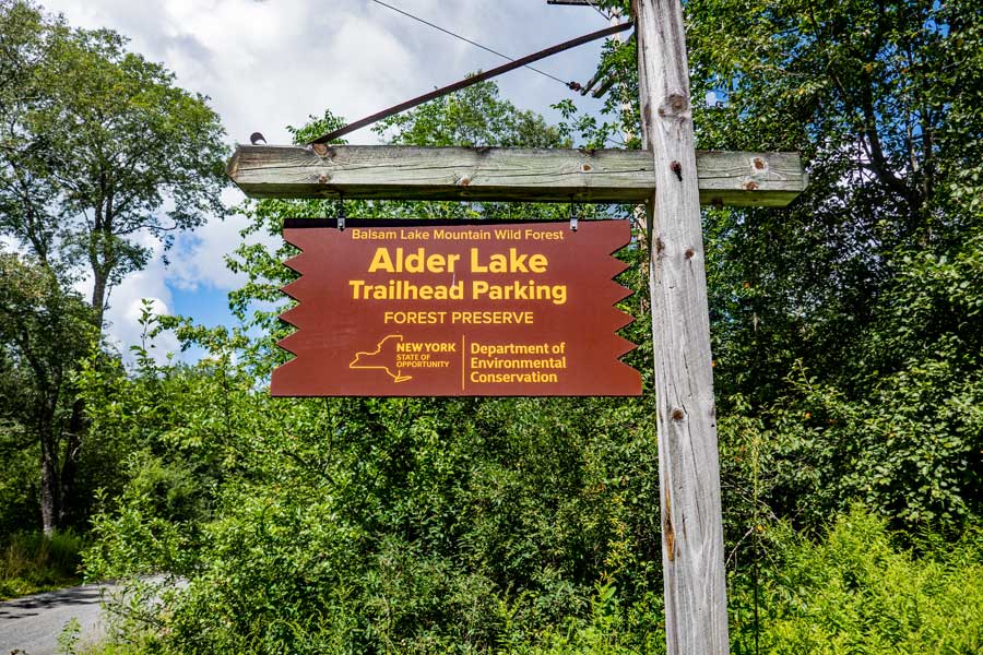 |
A DEC sign does not exist on Cross Mountain Road. But, a DEC sign can be found at the Alder Lake Parking Area.
|
|
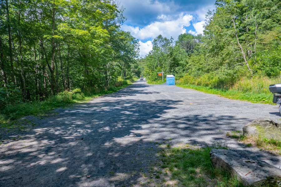 |
This is the Alder Lake Parking Area. You can see the DEC sign in the distance near the porta-a-poddy. While this parking area is large, it is completely full on summer weekends. So try to park close to other cars. Some people will back into the parking space so that it is easy to get out later. This picture was taken at the Trailhead.
|
|
 |
This is the Alder Lake Loop Trailhead. Please register in the brown DEC box on the left. If there is an emergency, the New York Rangers will use this information to find you. The number of people Registering will also allow money to be funded to maintenance and improvement of the Alder Lake Region.
Also check the Kiosk on the right of the DEC Registration Box for any information that might be important to your stay or hike here.
|
|
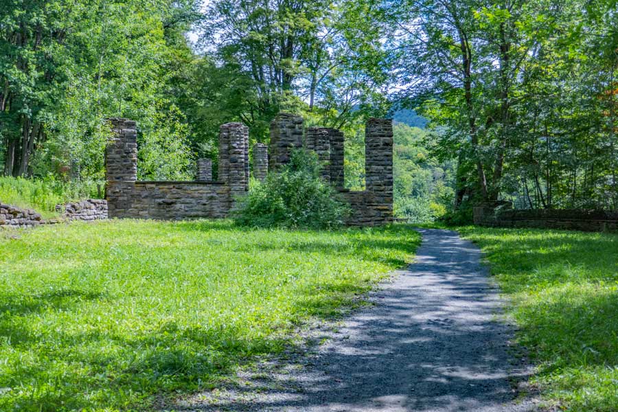 |
About 400 feet after the Alder Lake Loop trailhead, is the ruins of the Coykendill Lodge that overlooked Alder Lake. The Coykendill Lodge was 10,900 sf. The pillars were used to hold up the porch. There is a link at the bottom of the page with more information about the history of the Coykendill Lodge.
|
|
 |
This is the view from the Coykendill Lodge Ruins of the main body of Alder Lake. This is also the beginning of the Alder Lake Loop Trail. For the purpose of this page, take a LEFT at this trail junction in front the ruins of the Coykendill Lodge.
|
|
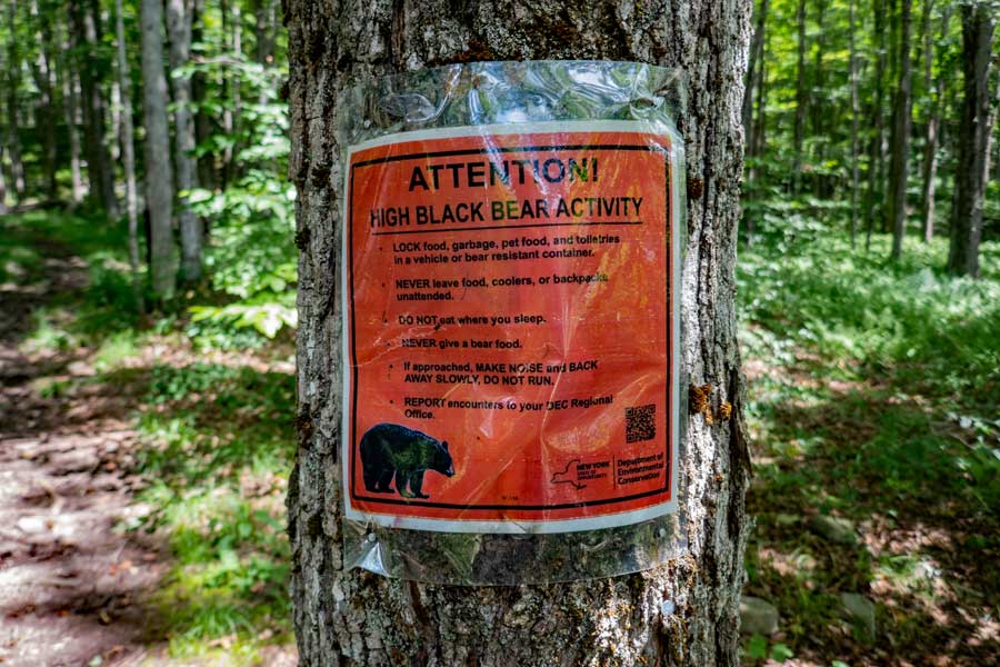 |
Since there are 11 major campsite regions around Alder Lake. Due to some campers improper handling of food, this attracts Black Bears to Alder Lake. If you follow the rules concerning food and bears, you should have an enjoyable trip. Stay away from campers who disregard the rules.
Here are a few general rules that have helped some campers: Do NOT pitch your tent near where you cook! The food odor will blow into your tent. Do NOT store any food in your tent. Store your food properly, as well as your food scraps. If you fish, do NOT discard the fish entrails. Do not get between a Black Bear Sow and it's cubs. Do not try to stop a bear from doing something, like destroying your camp. Give them distance.
As a general rule, black bears are fairly docile, but need to be respected. New York does NOT have grizzly bears, which are bigger and much more aggressive. Grizzly bears only exist in the northwestern part of the United States.
Counter Assault Bear spray is the BEST defense against a bear. If you have a significant concern about bears, you can obtain bear spray. It is far superior to a gun. Bear spray allows both you and the bear to go home. If you shoot a black bear, expect to pay a fine. Learn how to use bear spray properly. Getting bear spray on your skin will cause 2nd degree burns!
We strongly urge you to read and follow:
New York DEC's page on how to live responsibly around Black Bears
|
|
 |
This is Campsite #1 on our map. The DEC may have a different number for campsites. Plenty of room for several tents.
|
|
 |
This is Campsite #2 on our map. The DEC may have a different number for campsites. Plenty of room for several tents.
|
|
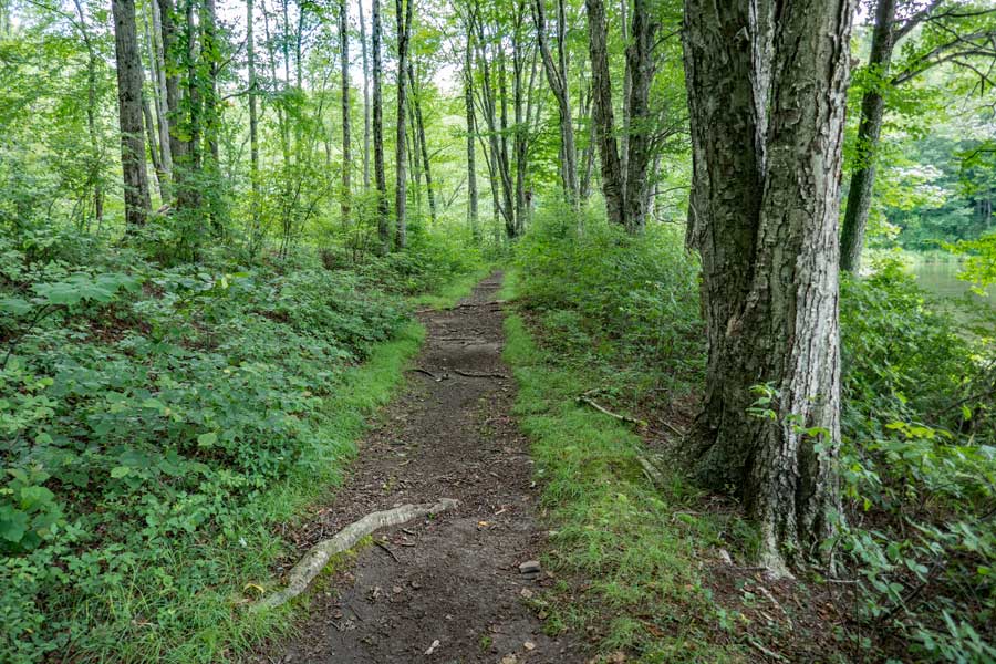 |
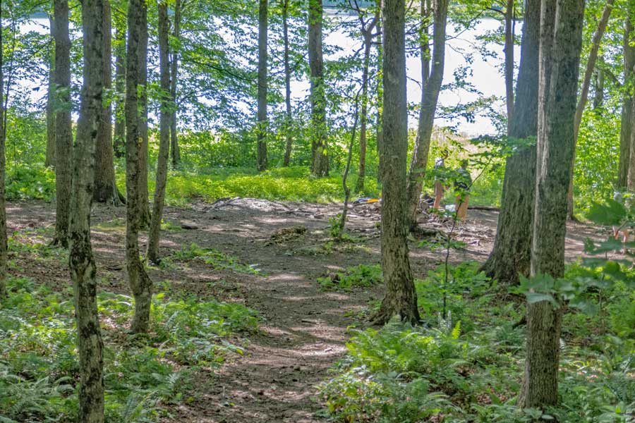
This is the Alder Lake Loop Trail on the north side of the lake. Fairly easy hiking.
|
|
 |
This is Campsite #3 on our map. The DEC may have a different number for campsites. Plenty of room for several tents. This campsite is very close to the Alder Lake Loop Trail. This campsite is also close to the inflow of the lake, so you might encounter more bugs here.
|
|
 |
This picture is very close to one of the smaller inflow to the lake. You cannot see this part of the lake from the Coykendill Lodge ruins. This part of the lake is fairly shallow.
|
|
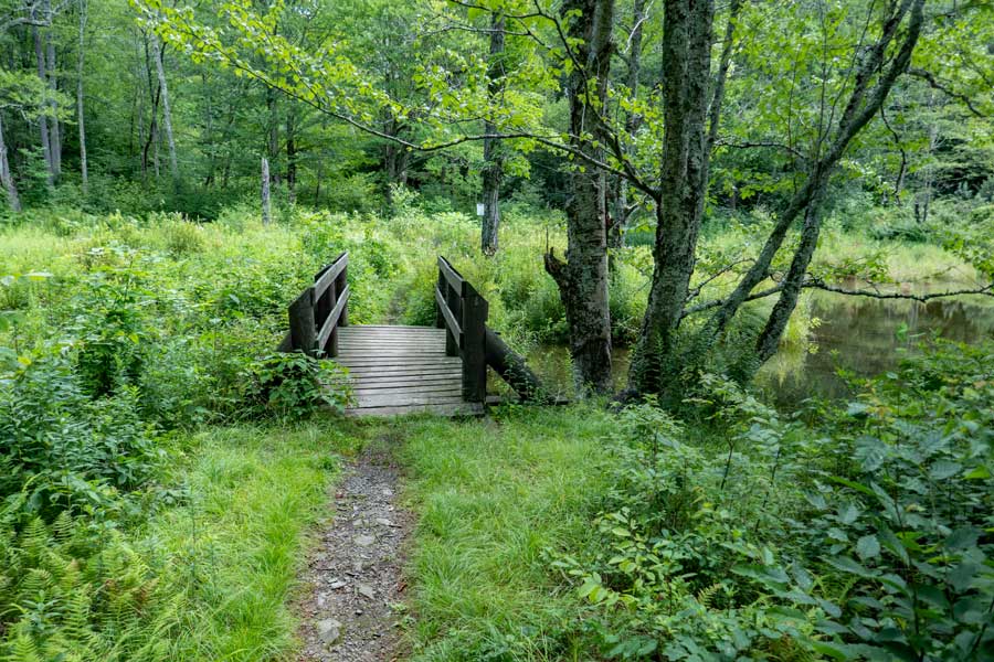 |
A bridge that goes over the inflow on the northeastern side of Alder Lake.
|
|
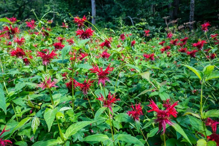 |
These wild flowers bloom around the end of July and early August. This picture was taken on August 1st, and the blooms were just past prime. This location is located on the northeast side of Alder Lake It is between Campsites #3 and Campsite #4 on our map above.
|
|
 |
This is Campsite #4 on our map. The DEC may have a different number for campsites. Plenty of room for several tents. This campsite is further away from Alder Lake Loop then most campsites. There is also an uphill climb up to the campsite from Alder Lake Loop Trail.
As you climb up the side trail to this campsite, you will cross an unmaintained trail. Continue to the campsite.
|
|
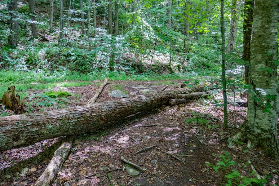 |
The unmaintained trail will come out on the Alder Lake Loop Trail a little further down the trail. When you come to this point, you want to take a RIGHT down the Alder Lake Loop Trail. Left will take you to campsite #4. The tree across the trail confuses some campers and hikers.
|
|
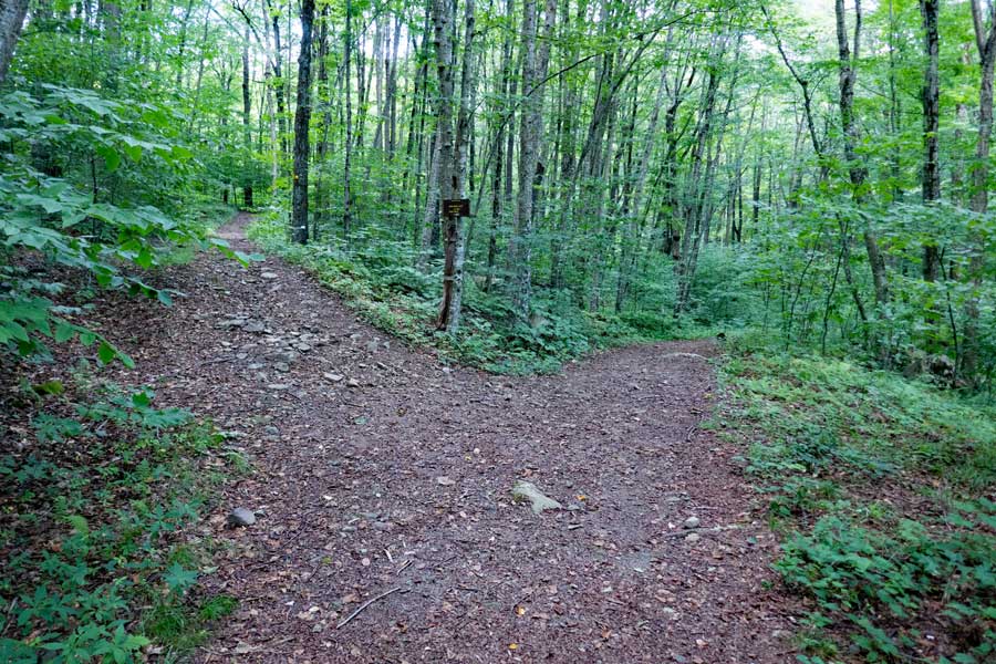 |
As you continue down the Alder Lake Loop Trail, you will encounter a trail off to the left. You want to continue STRAIGHT.
The trail on the left is the Mill Brook Ridge Trail. It is about 5 miles to the Balsam Lake Mountain Fire Tower (one-way). There is also the Beaver Meadow Lean-to about 1-1/2 miles down the trail.
If your objective is to access the Mill Brook Ridge Trail from the Alder Lake Parking Area, it is 0.83 miles if you take the northern part of the Alder Lake Loop Trail. It is 0.90 miles if you take the southern part of the Alder Lake Loop Trail. The northern trail is fairly flat, where the southern route has some elevation gain.
|
|
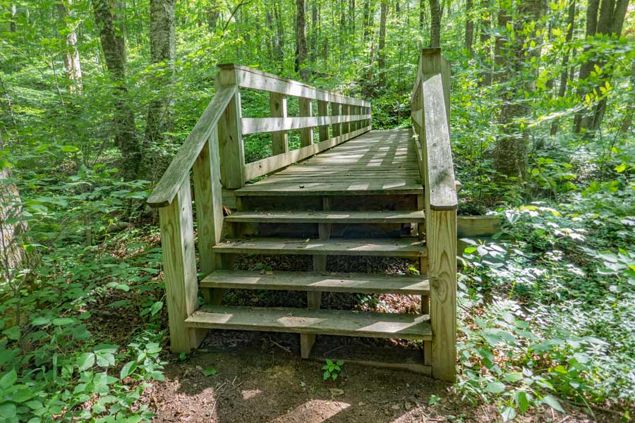 |
After a couple hundred feet past the trail junction for the Mill Brook Ridge Trail, you will encounter a bridge over the Alder Creek that is another inflow into Alder Lake.
When you exit the bridge, the trail will turn to the right for a very short distance before it turns 90 degrees to the LEFT. There is another side trail at the 90 degree turn that goes straight. That will take you to campsite #5.
|
|
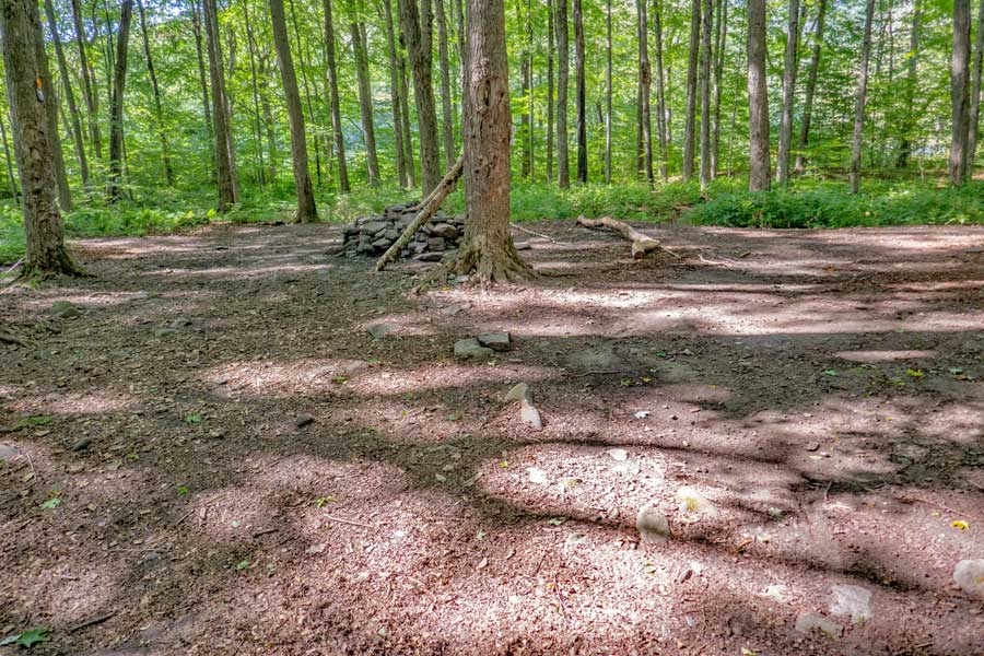 |
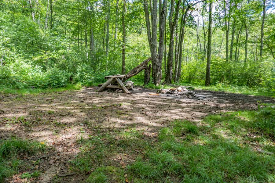
This is campsite #5 on our map above. It is fairly large and very flat. Just past the trees is Alder Lake. On your right is Alder Creek.
|
|
 |
This is campsite #6 on the map above. Not quite as flat, but nice view of Alder Lake.
|
|
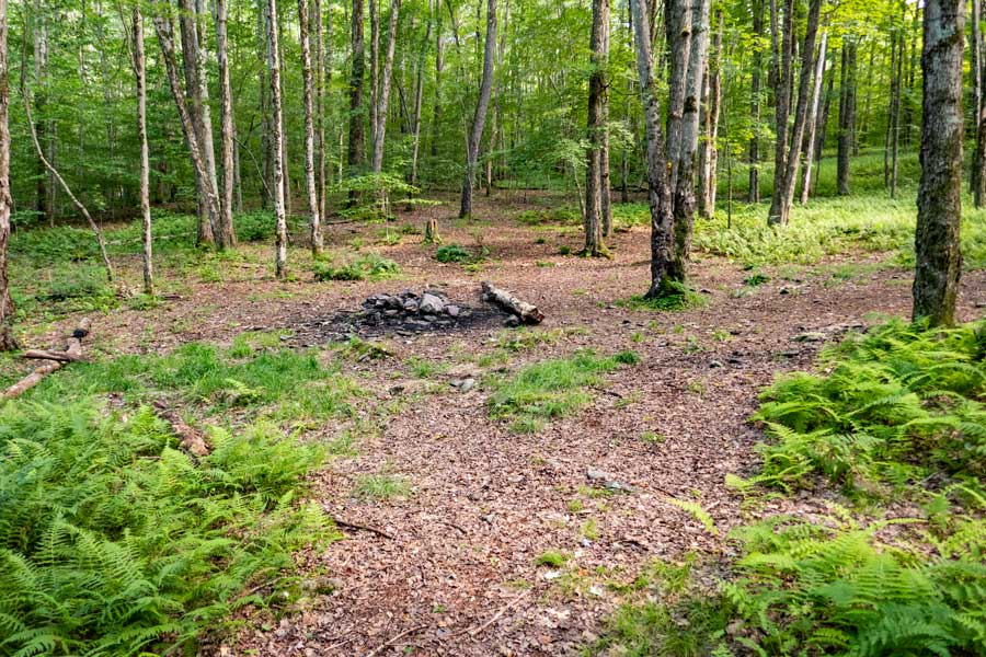 |
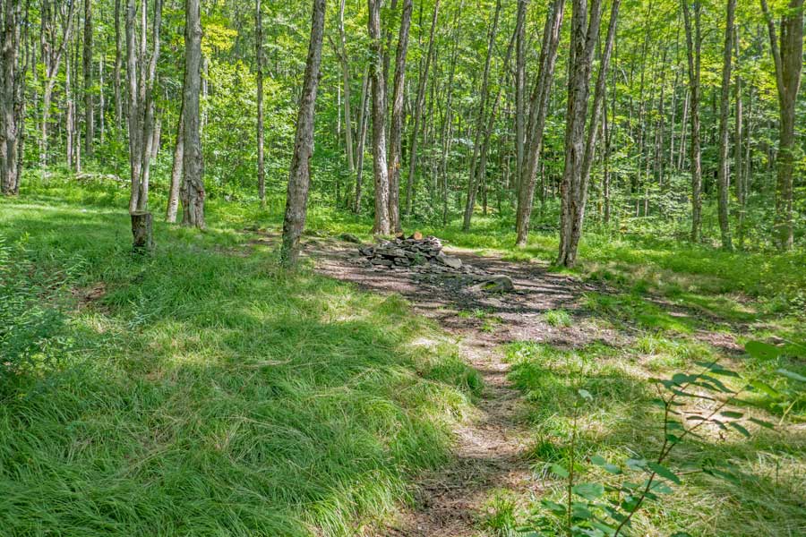
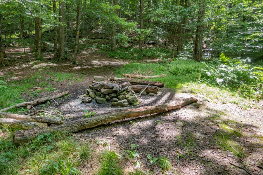
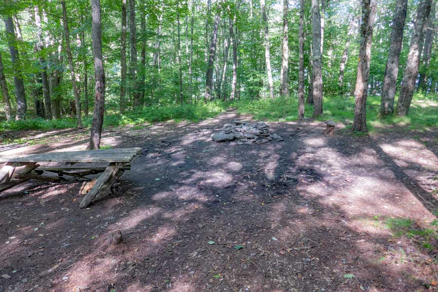
After another 1/3 of a mile, you will come to the side trail to Campsite #7 on our map. It is located on the non-lake side of Alder Lake Loop Trail. Not entirely flat, but many places to pitch a tent.
|
|
 |
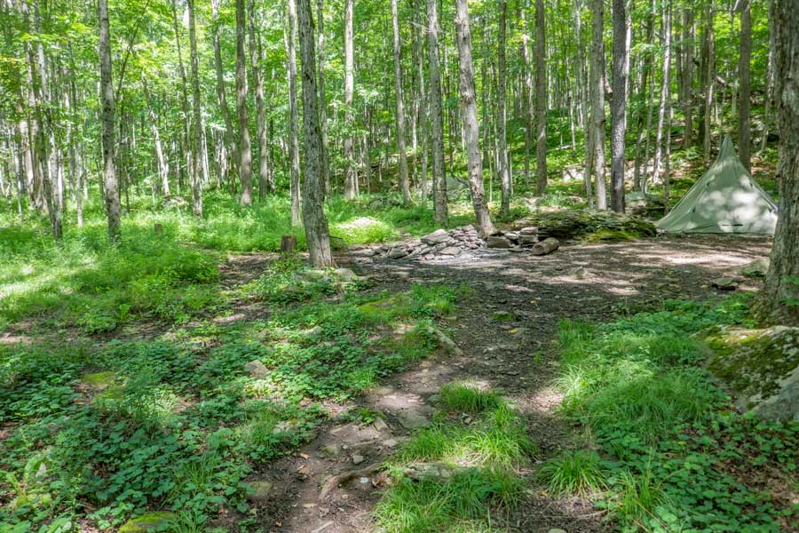
A little ways past Campsite #7 is the side trail to Campsite #8 on our map. The side trail is one of the longest side trails, with many other side trails. The firering and eating area is very close to the lake, so some camper prefer this campsite.
This campsite also has trails linking up with campsite #10 on our map.
|
|
 |
Campsite regions #8 and #10 (on our map) have a beautiful view of Alder Lake and Mill Brook Mountain in the far distance.
|
|
 |
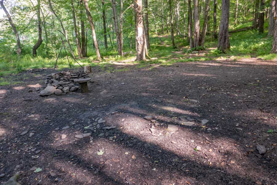
This is campsite #10 on the map above. Not quite as flat, but close to the Alder Lake Loop Trail. It also has trails that link up with campsite #8 (on our map).
|
|
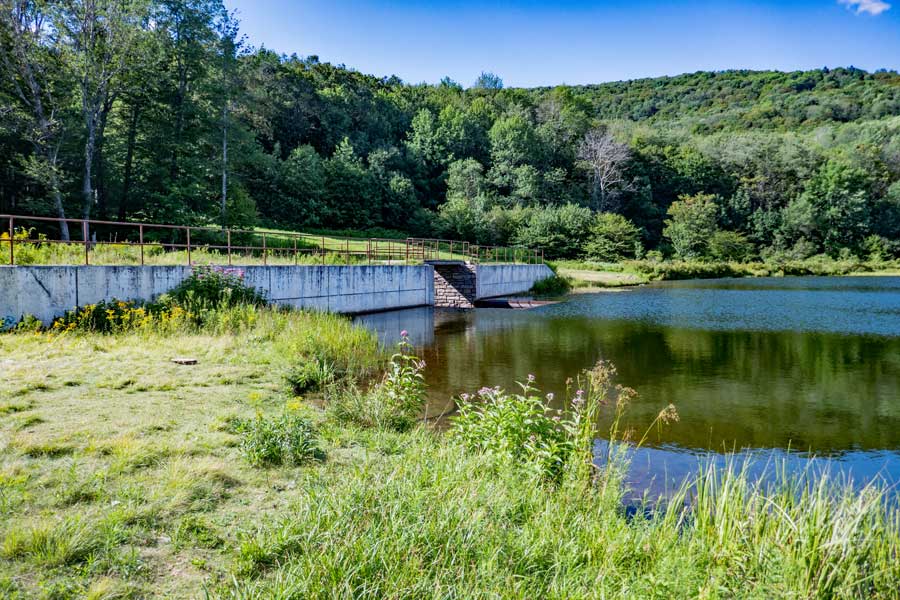 |
This is the dam on the western part of Alder Lake
|
|
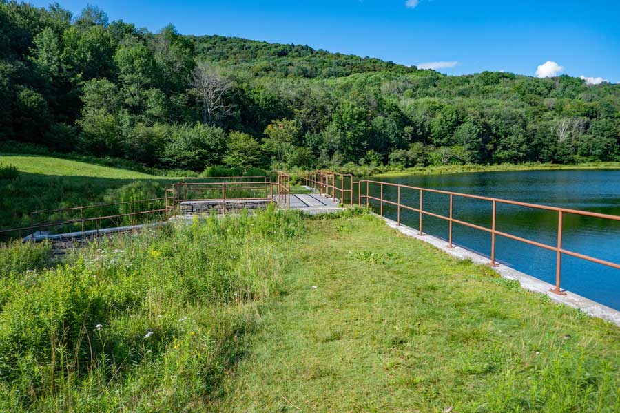 |
The Alder Lake Loop Trail goes across the top of the dam on the western side of Alder Lake.
|
|
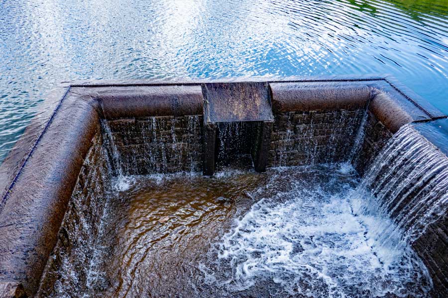 |
This is the view of the outflow of Alder Lake from the top of the Alder Lake Dam. The Alder Lake Loop Trail runs across the top of the dam.
|
|
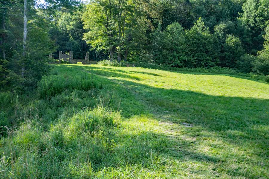 |
View of the Coykendill Lodge ruins from Alder Lake. Hike up the trail to the ruins to complete the loop of the Alder Lake Loop Trail. Then take a LEFT to go back to the Alder Lake Parking Area where your car is parked. Hope you enjoyed this little hike.
|
|
|
S E C T I O N S
|
W E A T H E R
|
O T H E R
|