Hike the Kelly Hollow Loop |
 |
| View of the Beaver Pond by the Kelly Hollow Lean-to |
| |
| |
|
OVERVIEW |
| | Trail Name: |  Kelly Hollow Loop (From Kelly Hollow Parking Area)
 |
| | Forest : | Balsam Lake Mountain Wild Forest |
| | Parking Area : | Kelly Hollow Parking Area - Plowed in the Winter |
| | Camp sites: | 3 Camp Site locations |
| | Lean-to sites: | 1 Lean-to (Kelly Hollow Lean-to) |
| | Access: | Hike, snowshoe, bike, or ski |
| | | |
| | Trail Length: | 3.71 miles (Full Loop w/o Short Loop or campsites) |
| | Side Trail Length: | 0.25 (Short Trail - one way) |
| | Trail Type: | 95% Double-track trail |
| | Hiking Time: | Average 3 hours one-way |
| | Lowest Elevation: | 1,814' (A) |
| | Highest Elevation: | 2,285' (A) |
| | Views : | NO view spots |
| | Difficulty: | Easy |
| | | |
| | USGS Map: | USGS Arena Quad Maps |
| | | |
| | DEC Trail Map: | DEC Balsam Lake Mountain Wild Forest Map (free) |
| | | | |
| | Digital Mapper: |
Topo
Terrain
Satellite |
|
|
Maps for the Kelly Hollow Loop |
 |
|
|
|
| | Notes About Hiking the Kelly Hollow Loop |
|
| | TRAIL |
|
| |
The Kelly Hollow Trail is a very easy hiking trail. This also makes it an excellent choice for cross-country skiing. It should also be noted that Mountain Bikes are allowed on the trails.
The trail can sometimes become overgrown around the Beaver Pond. If you follow the official hiking path, you will hike 3/4 of the way around the Beaver Pond. You can skip the hike around the Beaver Pond by going in the opposite direction, and you only go around a 1/4 of the pond in a counter-clockwise direction.
Almost all of the Kelly Hollow Loop Trails are double-track paths. Only the Kelly Hollow PA Trail is single track
| |
| | PARKING |
|
| |
The official parking area is the Kelly Hollow Parking Area. The Kelly Hollow Parking Area has a large DEC sign at the entrance.
About a 1/4 mile further down Mill Brook Road is another driveway that is not marked. This is a camping areas where you can drive your car to the campsite. The camping is for Privmitive Camping. All the camping areas in the Kelly Hollow region are free. You cannot park along the side of the DEC access road. You must occupy one of the campsites.
| |
| | CAMPSITES & LEAN-TO |
|
| |
All the camping areas in the Kelly Hollow region are free. There are numerous places to camp. If you use the Kelly Hollow Lean-to, you MUST share it with other hikers.
| |
| | OTHER INFORMATION |
|
| |
There is NO cell phone service.
Please Note: As of 2023, the beavers are no longer in the Beaver Pond. This has caused the pond to leak. This is why the water level is so low. The dam is leaking water. Hopefully, another pair of beavers will make it to the pond in the future.
|
|
|
| | DIRECTIONS to Kelly Hollow Parking Area from Exit 19 (Kingston) |
| | Kelly Hollow Parking Area WGS84 (DEC): 42.078267, -74.650783 - Elevation is approximately 1,815 feet |
| | Kelly Hollow Parking Area Deg/Min/Sec: N42 04 41, W74 39 02 - Elevation is approximately 1,815 feet |
| | Kelly Hollow Parking Area GPS: N 42 04.696, W 74 39.047 - Elevation is approximately 1,815 feet |
| | Kelly Hollow Parking Area UTM: 18N 528886 4658525 - Elevation is approximately 1,815 feet
|
| |
|
| | Get off New York State Thruway at Exit 19 (Kingston). |
| | Take a RIGHT out of the NYS Thruway onto Route 28 West. |
| | Go approximately 34.9 miles on Rt 28 West |
| | Take a LEFT onto Rt 49A at Highmount, NY ( Belleayre Ski Center )
| | Go approximately 5.4 miles on Rt 49A (drive to the end of Rt 49A) |
| | Take a LEFT onto Rt 49 (Dry Brook Road) |
| | Go approximately 1.3 on Dry Brook Road |
| | Take a RIGHT onto Mill brook Road |
| | Go approximately 6.4 miles on Millbrook Road |
| | Take a LEFT into Kelly Hollow Parking Area |
| | Park in the Parking Area (holds 6-8 cars) |
| |
|
|
|
|
MILEAGE CHART - Hike of the Full Kelly Hollow Loop (w/o campsites & Short Loop Trail) |
| | Mile Point | Altitude | Notes |
| | 0.00 | 1,815' | Kelly Hollow Parking Area & Trailhead |
| | 0.02 | 1,829' | Side Trail to campsite #1 |
| | 0.08 | 1,829' | DEC Gate (go around gate) |
| | 0.32 | 1,912' | Side Trail to campsite #2 |
| | 0.47 | 2,003' | Short Loop Trail (short cut to western leg of loop) |
| | 1.05 | 2,185' | Bridge |
| | 1.20 | 2,185' | Small Bridge |
| | 2.02 | 2,272' | Kelly Hollow Lean-to |
| | 2.67 | 2,065' | Short Loop Trail (western trailhead) |
| | 2.75 | 1,996' | Bridge |
| | 3.33 | 1,818' | Trailhead of Western Leg of Kelly Hollow Trail |
| | 3.46 | 1,815' | DEC Road to Mill Brook Road |
| | 3.71 | 1,815' | Kelly Hollow PA Trail to Kelly Hollow Parking Area |
|
|
Hike the Kelly Hollow Loop from Kelly Hollow Parking Area |
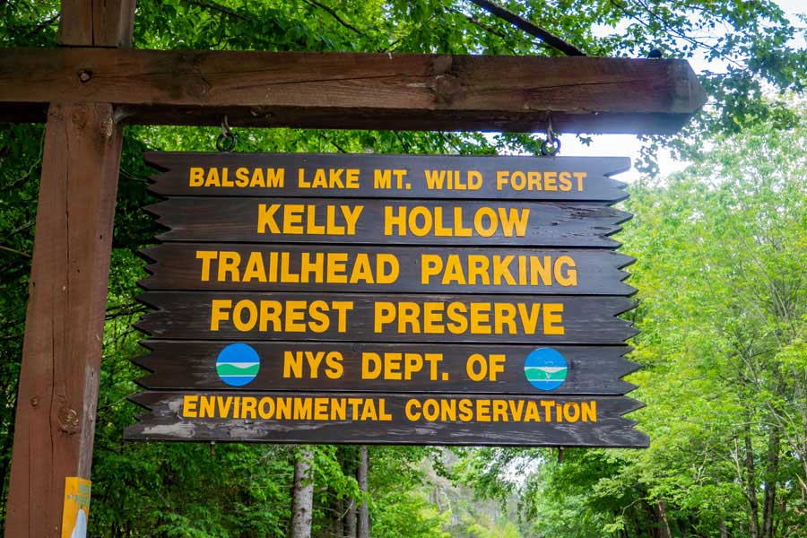 |
This is the Kelly Hollow Parking area. About another 1/4 mile down the road is a car/camping area. The other side of the loop does come out into the car/camping area.
|
|
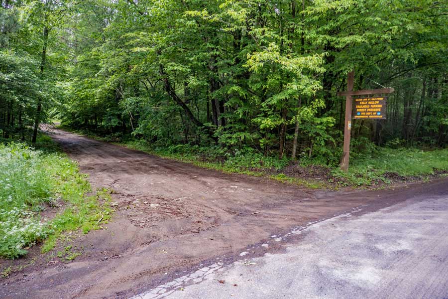 |
This is the entrance to the Kelly Hollow Parking Area. The parking area is about 100' off Mill Brook Road.
|
|
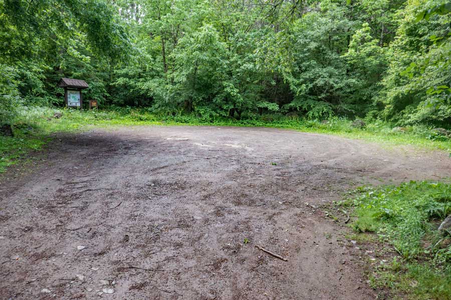 |
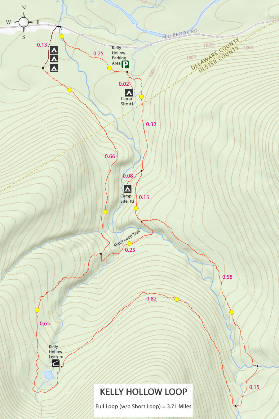
On the south end of the Kelly Hollow Parking area is the Kiosk, DEC registration box, and Kelly Hollow Loop Trailhead.
If this parking area is full, there is another place to park about 1/4 mile down Mill Brook Road.
|
|
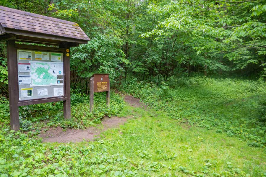 |
This is the DEC Registration box for the Kelly Hollow Loop Trail. Please register for your hike. Make sure you provide a good description of where you are going. If the NYS Rangers need to find you, this is the first place they will look to see where you might be in thousands of acres of forest.
Additionally, funds for trail maintenance are allocated based upon how many people register for the hike over time.
Once you have registered for your hike, you want to take a left by the DEC registration box. Right will take you to the car/camping location.
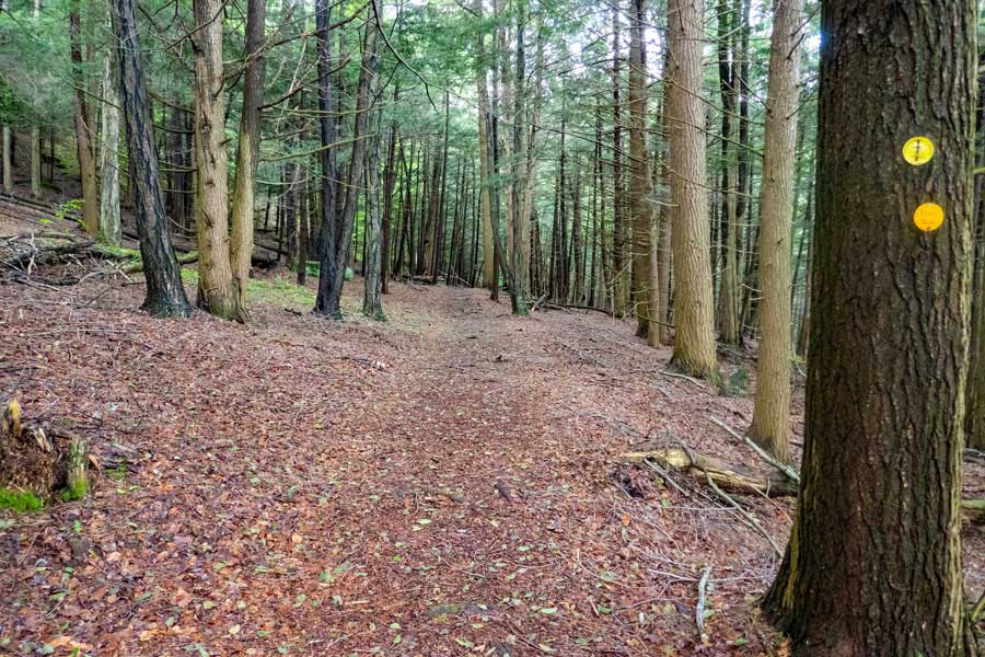
The DEC Trail Markers for the Kelly Hollow Loop are YELLOW.
|
|
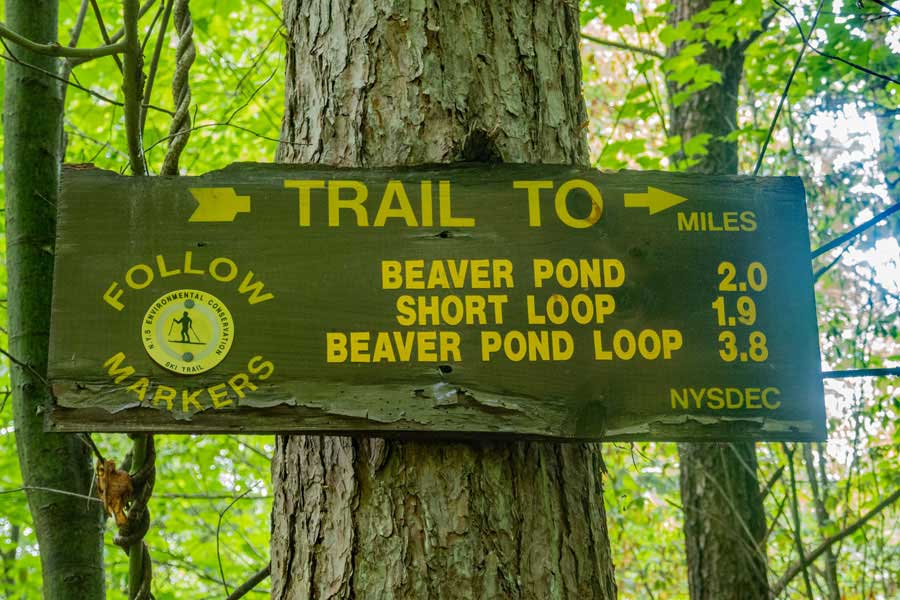 |
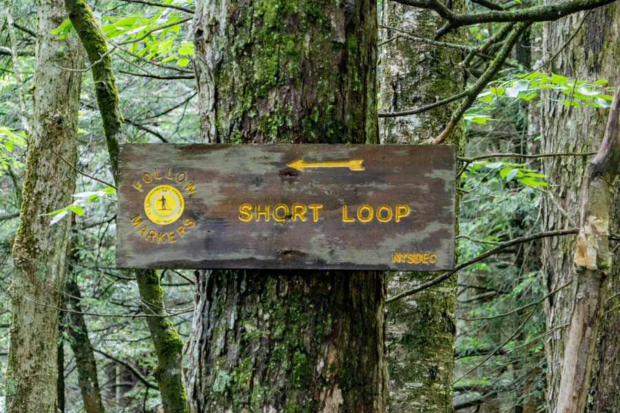
This sign has some mistakes. The Short Loop is about 2/3 of a mile up the trail.
|
|
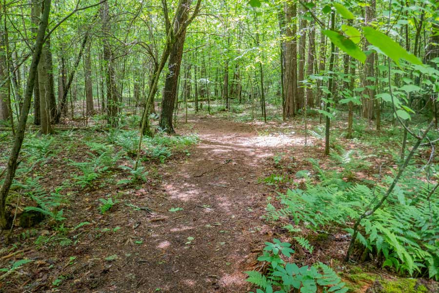 |
This is the beginning of the Kelly Hollow Loop Trail.
|
|
 |
After about 100 up the trail, you will see a side trail on your RIGHT. This side trail will take you to a DEC Primitive campsite you see in the picture. The side trail is about 150' long. To get water, you have to walk down another trail at the campsite to a small stream. This side trail is located on the right side of the picture above.
|
|
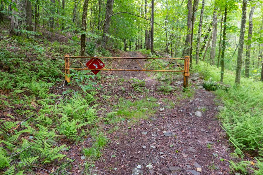 |
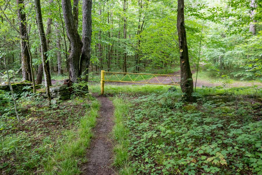
About 300 feet after the Primitive Campsite, you will encounter a DEC gate. Walk around the gate and continue up the Kelly Loop Trail. This used to be an old logging road.
|
|
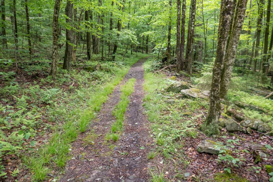 |
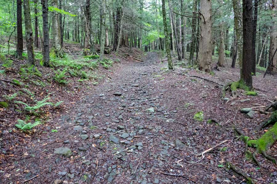
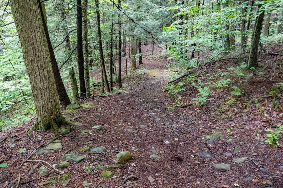
The trail then goes through the forest on a very gentle uphill incline. The trail goes up the old logging road.
|
|
 |
About 1/3 of a mile from the Kelly Hollow Trailhead, you will see a side trail on the right, named, "Short Loop Trail". This is the second Primitive Campsite. The side trail to the campsite is about 350 feet long, and ends near a brook.
|
|
 |
This is the second primitive campsite off the Kelly Hollow. The brook is less then 15 feet away. A couple tents can erected on this site.
|
|
 |
This is the trail above the side trail to the Primitive Campsite.
|
|
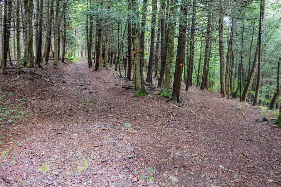 |
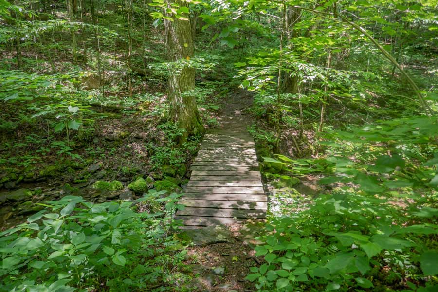
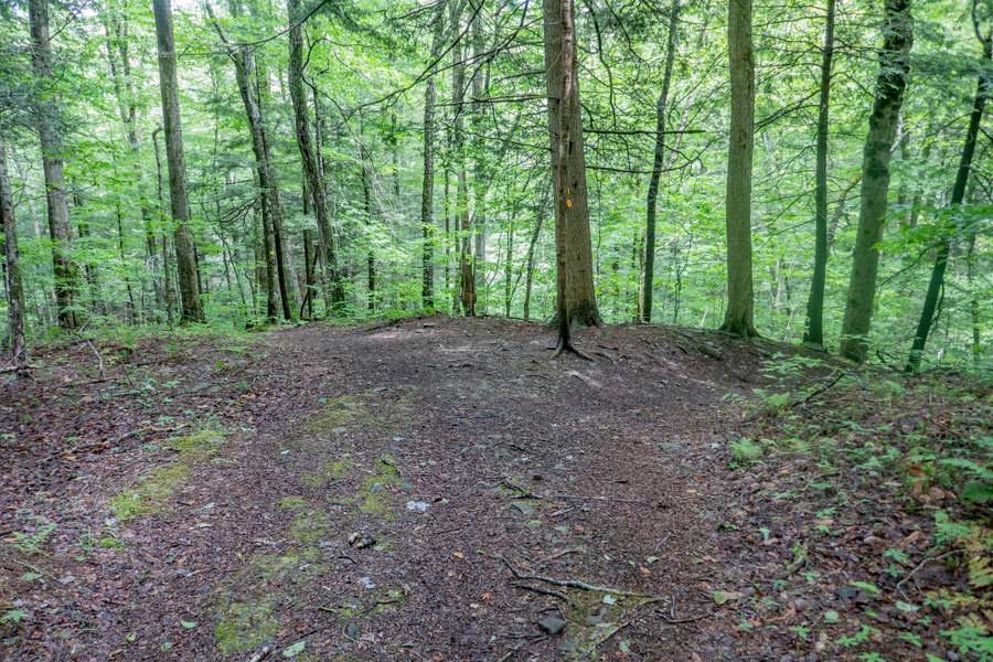
This is another trail that connects the two loop legs of the Kelly Hollow Loop Trail. It is located about 2/3 of a mile from the trailhead. The side trail that runs over to the other leg of the loop. It is about a 1/4 mile long. It has two bridges.
|
|
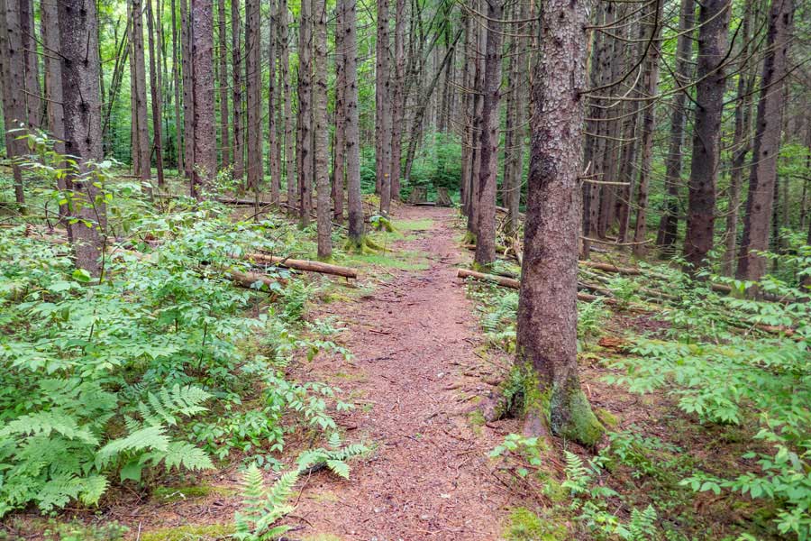 |
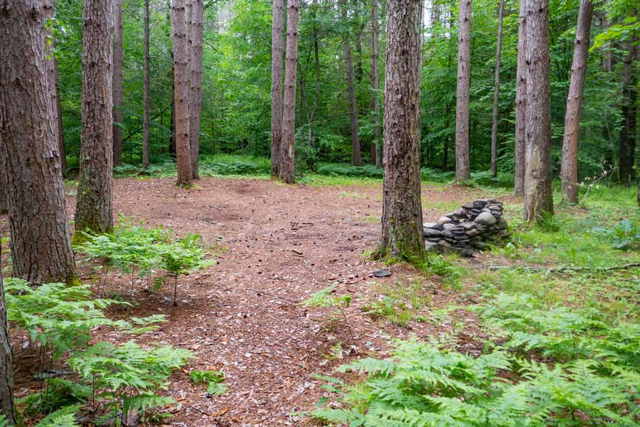
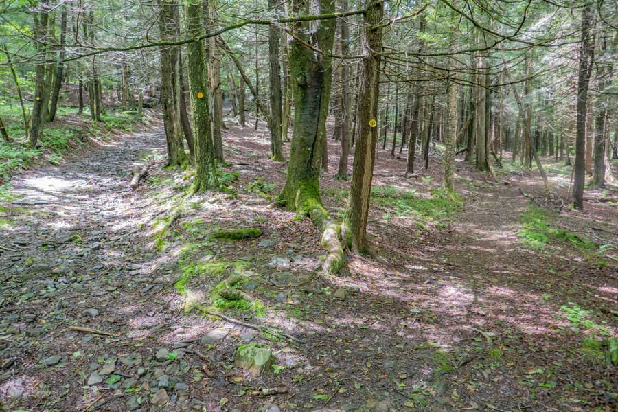
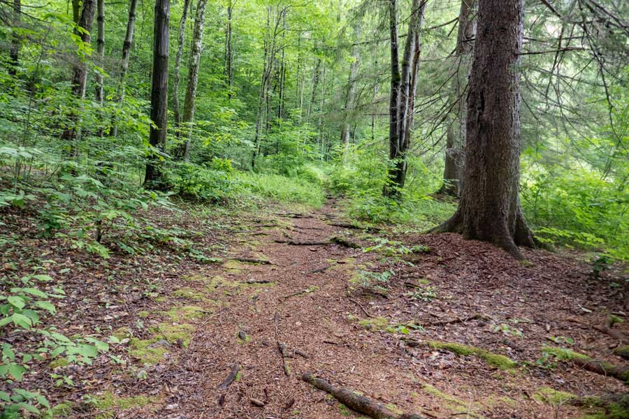
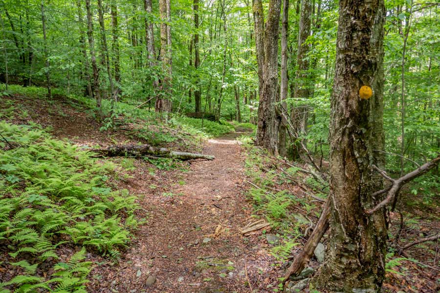
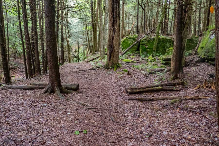
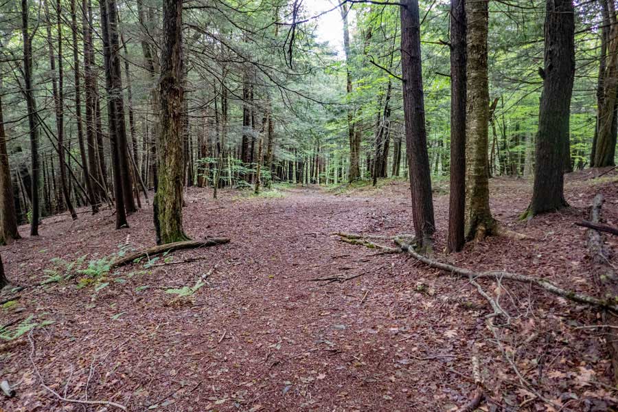
As you continue your hike up into the upper loop of the Kelly Loop Trail you will continue into a nice conifer forest.
|
|
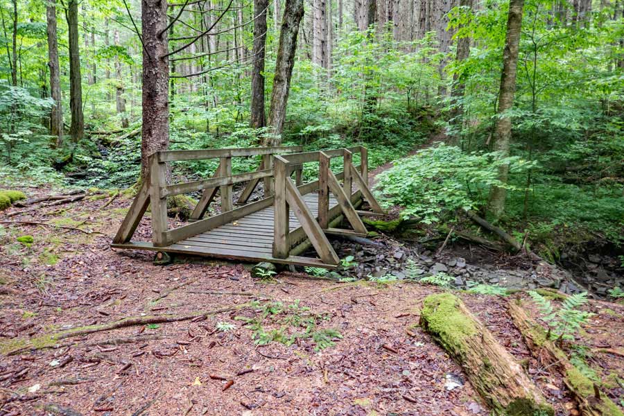 |
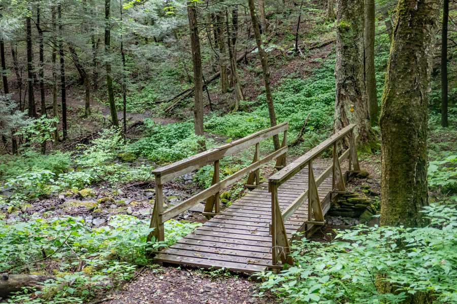
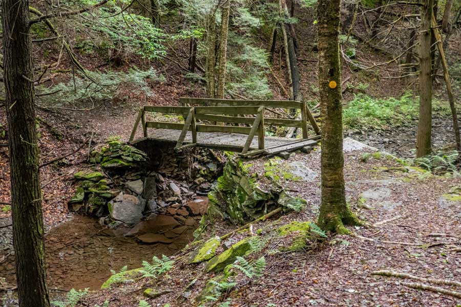
This is one of several bridges you will cross on your hike in the Kelly Hollow Loop Trail.
|
|
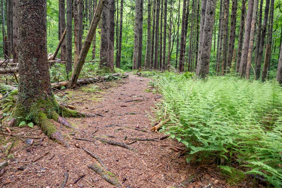 |
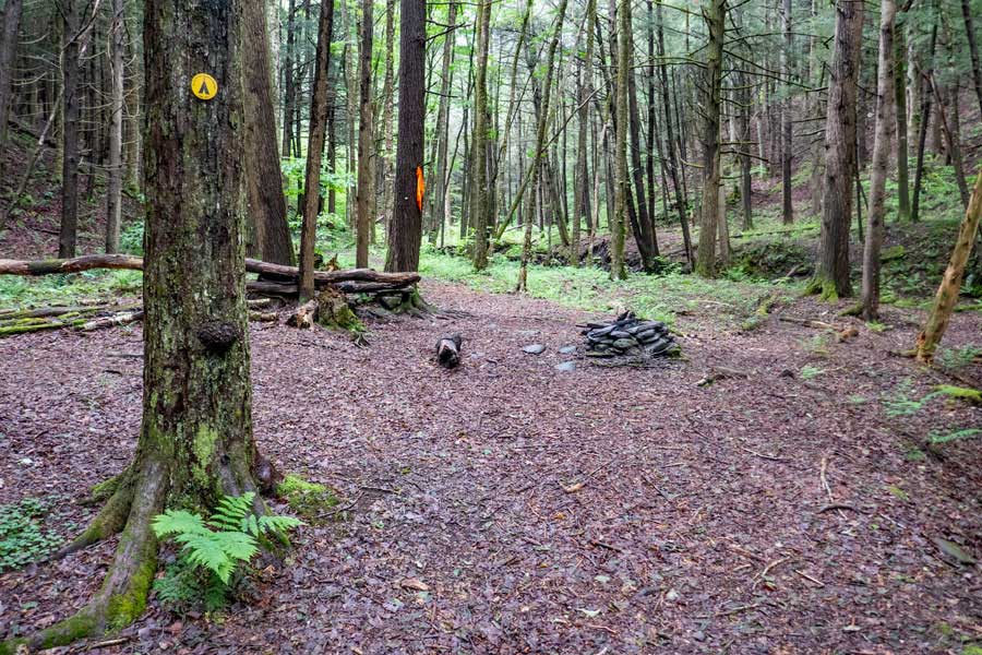
The hike continues around the loop in the conifer forest.
|
|
 |
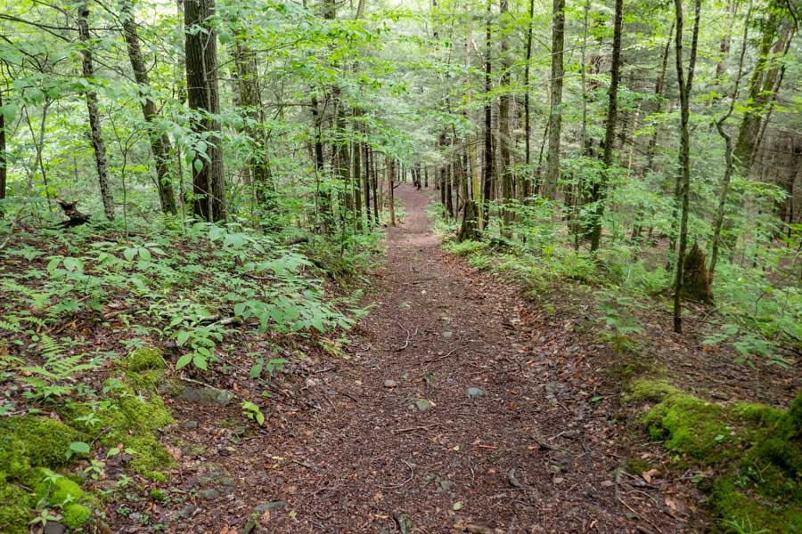
After you hike most of the way around the eastern side of the upper loop, the conifer forest will end. You will also continue into a section of forest that has some nice large Ash Trees. The Ash Trees are on decline as the Emerald Ash Borer continues to kill them at an alarming rate. As of 2023, only about 5% of the large Ash Trees were affected.
|
|
 |
This section of forest will have numerous Ash Trees mixed into the forest. This section of the trail is quite enjoyable to hike down.
|
|
 |
As you approach the tip of the western side of the upper loop, the forest will turn back into a conifer forest for a short period. In a moment, you will encounter the Kelly Hollow Lean-to.
|
|
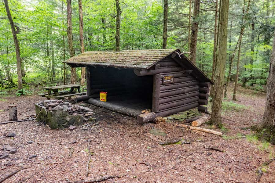 |
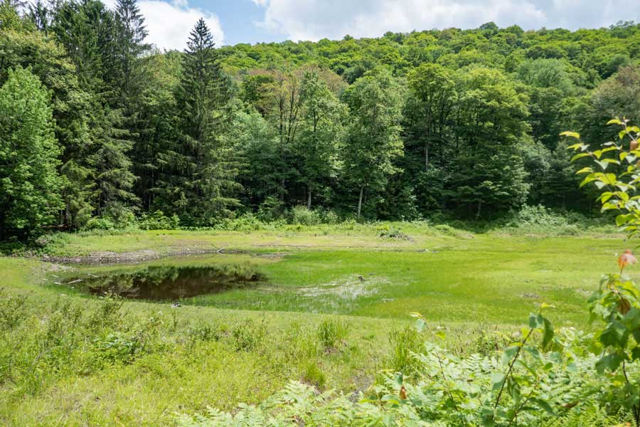
At the tip of the western side of the upper loop of the Kelly Hollow Loop Trail is the Beaver Pond with the Kelly Hollow Lean-to sitting on the edge of the pond. It is a very peaceful place to camp.
|
|
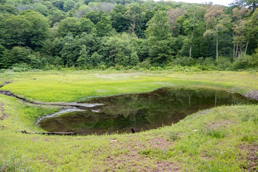 |
As of 2023, the beaver is no longer in the pond. The Beaver Pond is leaking, so the level of the water is very low.
|
|
 |
This is the official trail around the Beaver Pond. The trail actually wraps 3/4 (clockwise) of the way around the Beaver Pond before exiting downhill.
The section of the Kelly Hollow Loop Trail around the Beaver Pond can become overgrown, and some people have a difficult time following the trail. If this the case for you, you can hike around the 1/4 part of the Beaver Pond counter-clockwise and pick up the trail. The trail around the Beaver Pond has NO Yellow Trail Markers!
|
|
 |
This is what the trail looks like about 1/2 way around the Beaver Pond.
|
|
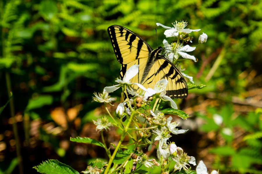 |
The trail around the Beaver Pond has other interesting things to see. This is one of several Swallowtail Butterflies we saw there in the month of June.
|
|
 |
This picture shows that we have hiked 3/4 of the way around the Beaver Pond. We started where you see the conifer tree on the edge of the pond. As you can see, you can easily hike counter-clockwise around 1/4 of the pond to skip the overgrown brush on the trail.
|
|
 |
After exiting the Beaver Pond, the trail continues downhill through some beautiful forest. This is the last leg of the western side of the upper loop.
|
|
 |
After hiking 2/3 of a mile from the Kelly Hollow Lean-to, you will encounter the other side of the "Short Loop Trail"
If you continue straight down the Western Leg of the Kelly Hollow Trail, the trail will end about a 1/3 of a mile from your car in the Kelly Hollow Parking Area. From there, you will take another trail back to your car at the Kelly Hollow Parking Area. This route is longer.
The other option is to take the "Side Trail" back over to the east side and hike down the eastern leg of the loop back to your car at the Kelly Hollow Parking Area. This route is shorter.
|
|
|
|
<--------------------- B E G I N O F "S H O R T L O O P T R A I L" ----------------------->
|
|
 |
The Short Loop Trail starts by you taking a RIGHT at the Trail Junction. The Short Loop Trail is about 1/4 miles long (one-way).
|
|
 |
SHORT LOOP TRAIL - will start by descending down the stream ravine wall to the stream valley floor.
|
|
 |
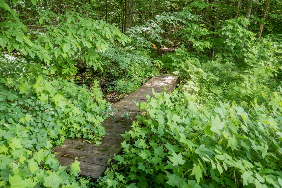
SHORT LOOP TRAIL - After arriving on the stream valley floor you will cross bridge #1
|
|
 |
SHORT LOOP TRAIL - You will then hike across the stream valley floor. It is a nice forest walk.
|
|
 |
SHORT LOOP TRAIL - You will then encounter bridge #2. After the bridge, you will then hike up stream ravine wall to the Eastern Leg of the Kelly Hollow Loop Trail.
|
|
 |
SHORT LOOP TRAIL - As you come up the stream ravine wall, you will encounter the Eastern Leg of the Kelly Hollow Loop Trail.
If you want to get back to your vehicle using the Eastern Leg of the Kelly Hollow Trail continue STRAIGHT. Just follow the trail down back to the Kelly Hollow Parking Area, About 2/3 of a mile.
If you want to return back to the Western Leg of the Kelly Hollow Trail, turn around and hike the 1/4 mile back to the Western Leg of the Kelly Hollow Trail
|
|
|
|
<------------------------- E N D O F " S H O R T L O O P T R A I L" --------------------------->
|
|
 |
After hiking back to Western Leg of the Kelly Hollow Trail, you want to continue hiking downhill once you reach the Trail Junction again.
|
|
 |
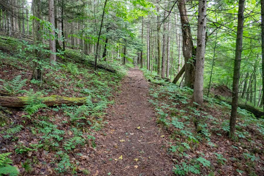
The descent down the Western Leg of the Kelly Hollow Trail is quite nice.
|
|
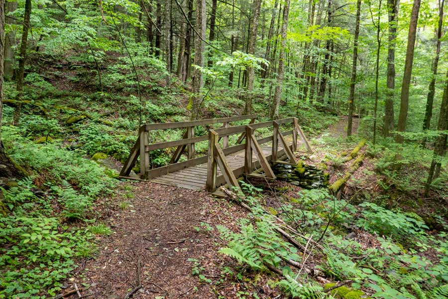 |
After a short distance down the Western Leg of the Kelly Hollow Trail, you will encounter another two bridges.
|
|
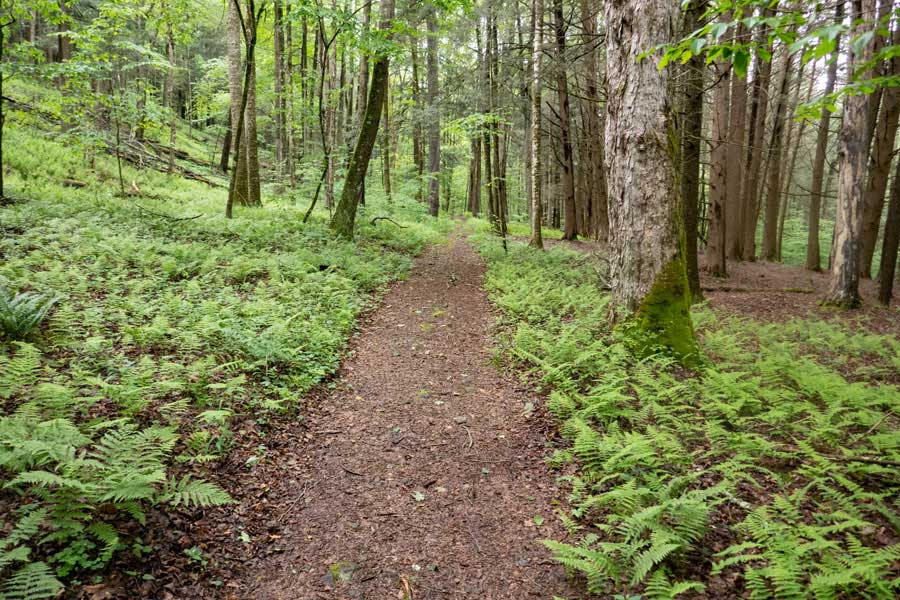 |
Continue hiking down the Western Leg of the Kelly Hollow Trail. Again, the trail is quite nice to hike on. You will also start to encounter some beautiful fern glades.
|
|
 |
About 1/4 of a mile after the Trail Junction of the Short Loop Trail, you will come to the end of the Kelly Hollow Trail.
You will be entering the car/camping area of this region.
You want to continue STRAIGHT after the DEC yellow gate. After about 100 feet, you want to continue LEFT
|
|
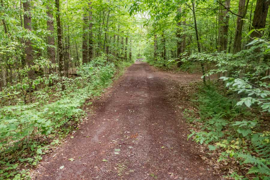 |
Walk down the DEC Road for the Primitive Car/Camping area until you reach Mill Brook Road. The DEC access road is a little over a 1/10 of a mile long.
|
|
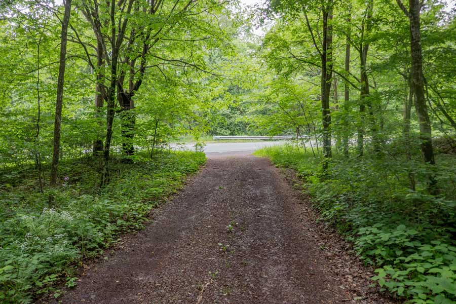 |
Once you reach Mill Brook Road, you want to take a RIGHT onto Mill Brook Road.
You then want to hike up Mill Brook Road about 50 feet, and look for the trail sign on the right side of the road.
|
|
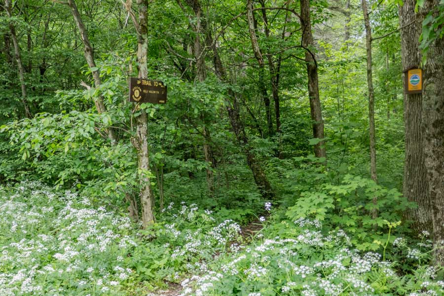 |
This is the trail entrance to the "Kelly Hollow PA Trail". It is often overgrown in the summer months.
If for some reason, you cannot find the entrance to the trail, you can just walk up Mill Brook Road to the Kelly Hollow Parking Area.
|
|
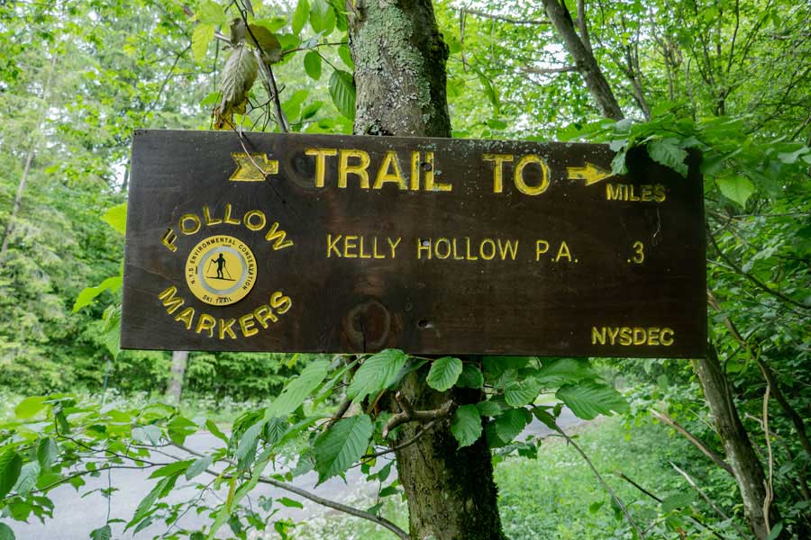 |
This is the DEC Trail sign you will be looking for as you walk up Mill Brook Road. It is about 50' from the DEC access road for the car/camping area, and the end of the Kelly Hollow Loop Trail on the Western Leg.
|
|
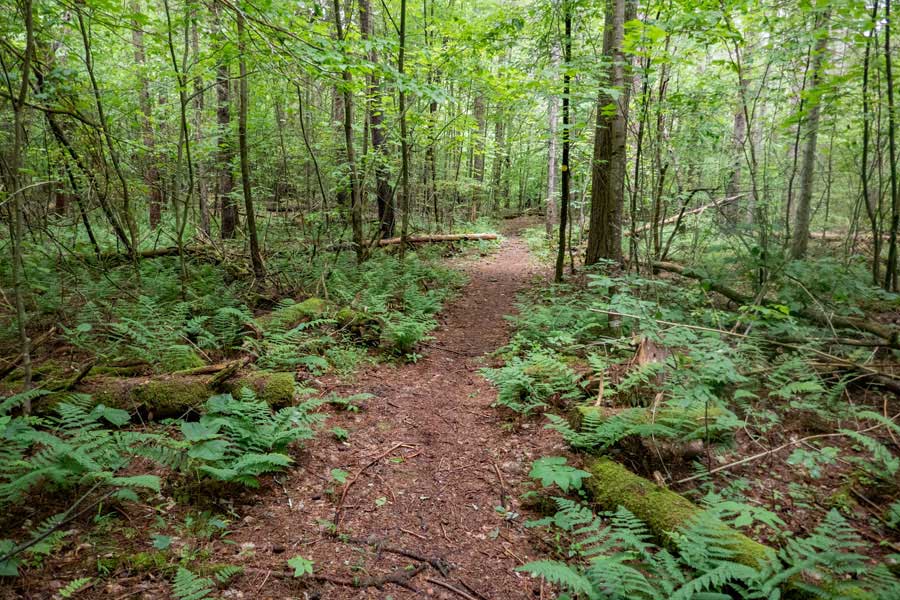 |
The hike down the Kelly Hollow PA Trail is nice easy walk. It is a little over a 1/10 of a mile long
|
|
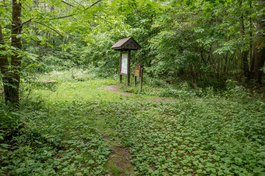 |
After a few minutes of hiking down the Kelly Hollow PA Trail, you will see the Kelly Hollow DEC Registration Box, Kiosk, and Kelly Hollow Parking area. Hope you enjoyed this hike as much as we did.
|
|
|
S E C T I O N S
|
W E A T H E R
|
O T H E R
|