Hike to the Mill Brook Lean-to from Mill Brook Road |
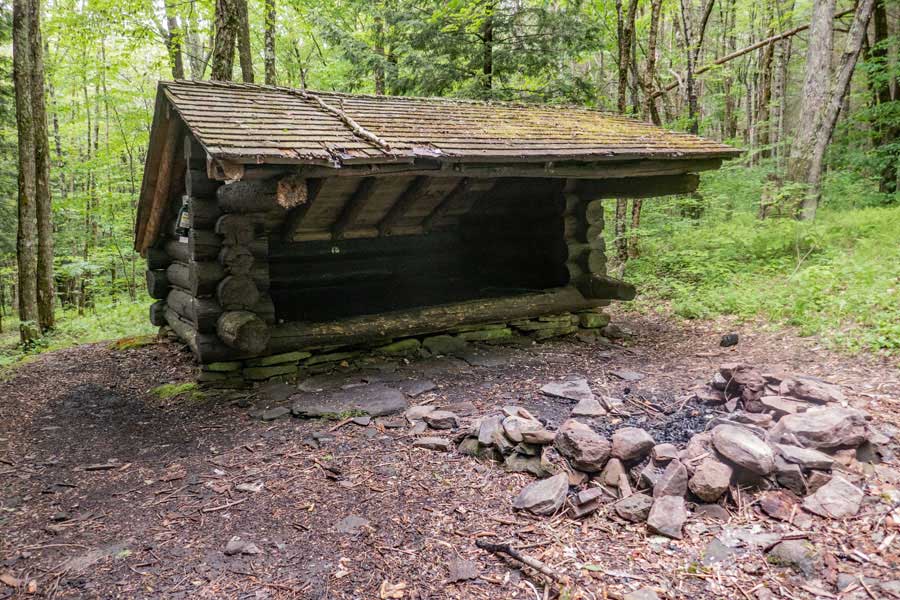 |
| View of the Mill Brook Lean-to in the Balsam Lake Mountain Wild Forest |
| |
| |
|
OVERVIEW |
| | Trail Name: |  Mill Brook Lean-to Trail (From Mill Brook Road to the Mill Brook Lean-to)
 |
| | Forest: | Balsam Lake Mountain Wild Forest |
| | Parking Area : | 1 space directly off Mill Brook Road |
| | Winter Access: | Balsam Lake Mountain Parking Area |
| | Camp sites: | NO Camp Site locations |
| | Lean-to sites: | One Lean-to |
| | Access: | Hike or snowshoe |
| | | |
| | Trail Length: | 0.13 miles (one-way) or 0.26 (round-trip) |
| | Trail Type: | 100% Single-track trail |
| | Hiking Time: | Average 5 minutes one-way |
| | Lowest Elevation: | 2,279' (A) |
| | Highest Elevation: | 2,329' (A) |
| | Views : | NO view spot |
| | Difficulty: | Easy |
| | | | |
| | USGS Map: | USGS Seager Quad Maps |
| | | | |
| | DEC Trail Map: | DEC Balsam Lake Mountain Wild Forest Map (free) |
| | | | |
| | Digital Mapper: |
Topo
Terrain
Satellite |
|
|
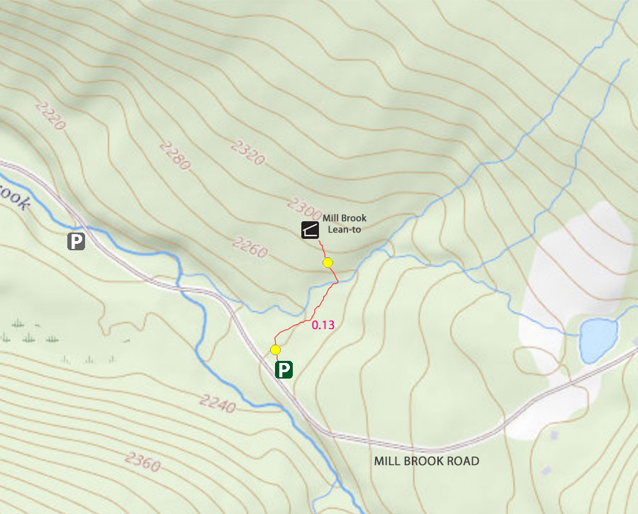
Maps to Mill Brook Lean-to from Mill Brook Road |
 |
|
|
|
| | Notes About Hiking to the Mill Brook Lean-to |
|
| | TRAIL |
|
| |
Part of this hike will follow the old Balsam Lake Camp Road for about 500 feet. It is now just a single-track trail.
| |
| | PARKING |
|
| |
Parking at the Mill Brook Lean-to is very limited. There is only 1 spot for a car to park. it is directly off Mill Brook Road.
You can also park at the parking area for Balsam Lake Mountain Trail 1 mile before this parking area.
There is also another parking area on the left side of Mill Brook Road 2/10 of a mile past this location.
If you are backpacking on the Dry Brook Ridge Trail, you can hike the 1 mile west of the trail to the Mill Brook Lean-to Trailhead.
| |
| | OTHER INFORMATION |
|
| |
There is NO cell phone service as of 2023.
|
|
|
| | DIRECTIONS to the Mill Brook Road from Exit 19 (Kingston) |
| | Mill Brook Lean-to Parking Spot - WGS84 (DEC): 42.065717, -74.588 - Elevation is approximately 2,279 feet |
| | Mill Brook Lean-to Parking Spot - Deg/Min/Sec: N42 03 56, W74 35 16 - Elevation is approximately 2,279 feet |
| | Mill Brook Lean-to Parking Spot - GPS: N 42 03.943, W 74 35.280 - Elevation is approximately 2,279 feet |
| | Mill Brook Lean-to Parking Spot - UTM: 18N 534086 4657155 - Elevation is approximately 2,279 feet
|
| |
|
| | Get off New York State Thruway at Exit 19 (Kingston). |
| | Take a RIGHT out of the NYS Thruway onto Route 28 West. |
| | Go approximately 34.9 miles on Rt 28 West |
| | Take a LEFT onto Rt 49A at Highmount, NY ( Belleayre Ski Center )
| | Go approximately 5.4 miles on Rt 49A (drive to the end of Rt 49A) |
| | Take a LEFT onto Rt 49 (Dry Brook Road) |
| | Go approximately 1.3 on Dry Brook Road |
| | Take a RIGHT onto Mill brook Road |
| | Go approximately 3.0 miles on Millbrook Road |
| | Take a RIGHT into single parking spot just off road |
| | Park in the Parking Area (holds 1 cars) |
| |
|
|
|
|
MILEAGE CHART - Hike from Mill Brook Road TO Mill Brook Lean-to |
| | Mile Point | Altitude | Notes |
| | 0.00 | 2,279' | Mill Brook Road Parking Spot (1 car) |
| | 0.13 | 2,200' | Mill Brook Lean-to |
|
|
Hike to Mill Brook Road TO Mill Brook Lean-to |
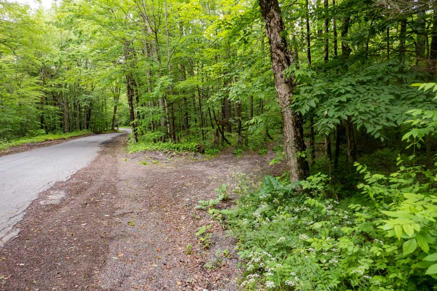 |
This where you will park to go to the Mill Brook Lean-to. There is only enough room for 1 or maybe 2 cars. You can also park at the parking area for Balsam Lake Mountain Trail 1 mile before this parking area. There is also another parking area on the left side of Mill Brook Road 2/10 of a mile past this location. If you are backpacking on the Dry Brook Ridge Trail, you can hike the 1 mile west of the trail to the Mill Brook Lean-to Trailhead.
|
|
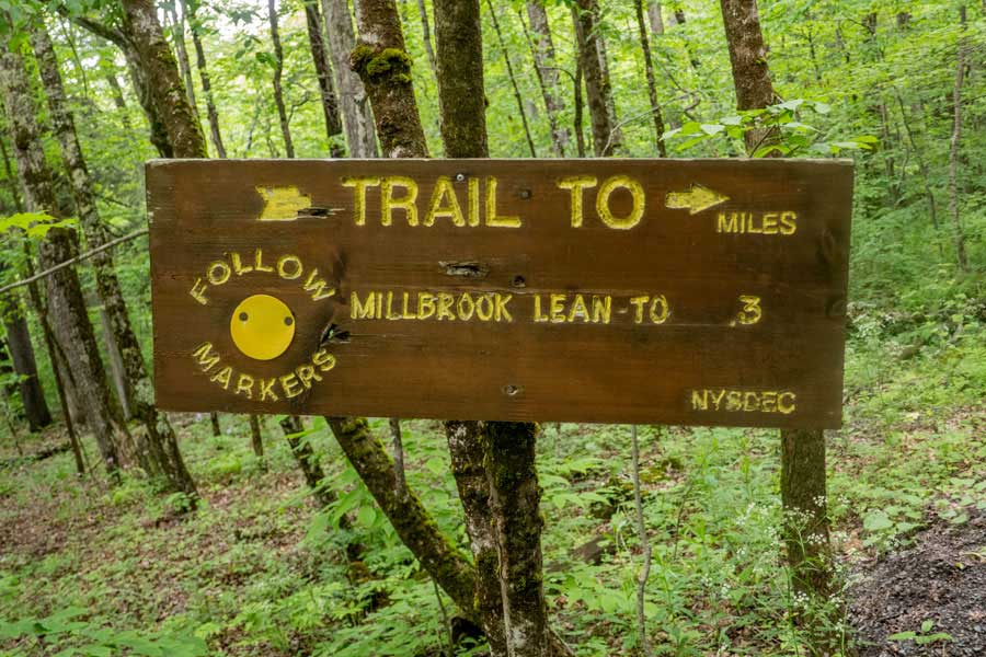 |
The DEC sign states that it is 0.3 miles to the Mill Brook Lean-to. The sign is wrong. It is 0.13 miles to the Mill Brook Lean-to.
|
|
 |
This is the trailhead for the trail to the Mill Brook Lean-to. The trailhead is located at the end of the parking spot.
|
|
 |
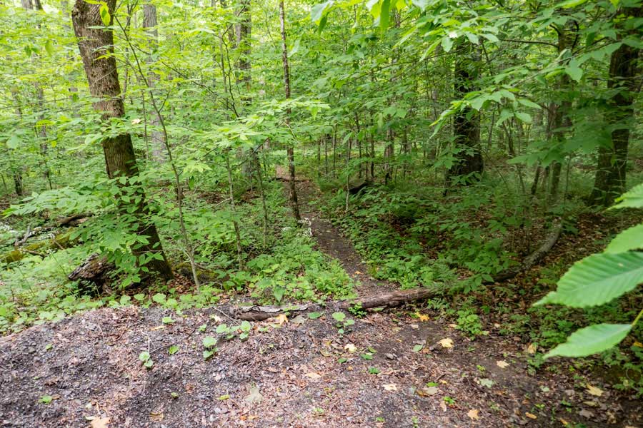
The trail is fairly flat with a very slight uphill incline. On your left is a small brook, and will be your water source for the Lean-to
|
|
 |
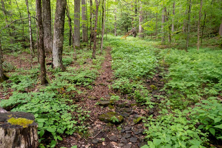
After hiking up approximately 500 feet, the trail will turn to the left and head for the stream. There are yellow Trail Markers for this short path.
|
|
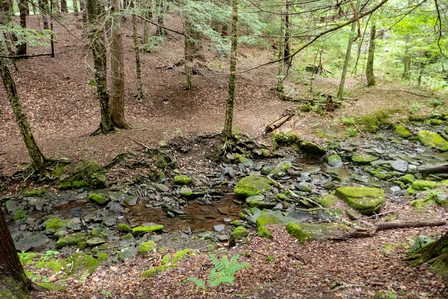 |
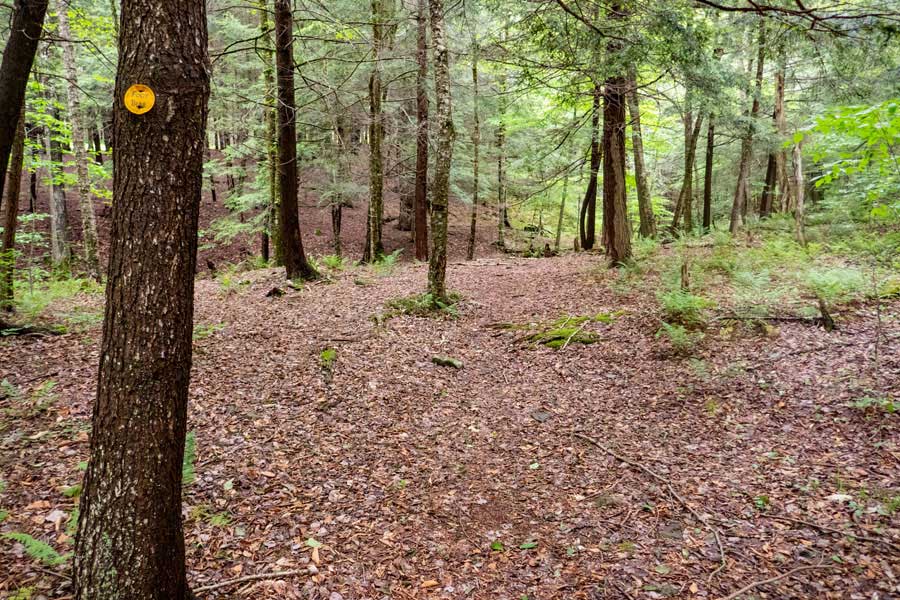
You will then hike down the small stream ravine and cross the stream. The small tree in the middle of the picture has a yellow trail marker on it.
After crossing the stream, head up the hill to the Mill Brook Lean-to.
|
|
 |
This is the Mill Brook Lean-to. The stream is about 100 feet away for your water source.
|
|
|
S E C T I O N S
|
W E A T H E R
|
O T H E R
|