Hike the Neversink HardenburghTrail from Balsam Lake Mountain |
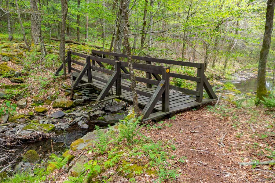 |
| View of one of the bridges on the Neversink-HardenburghTrail in the Balsam Lake Mountain Wild Forest |
| |
| |
|
OVERVIEW |
| | Trail Name: |  Neversink-HardenburghTrail (Balsam Lake Mtn PA TO Wild Meadow Road PA)
 |
| | Parking Area : | Balsam Lake Mountain Parking Area off Beaver Kill Road |
| | Winter Access: | Parking Area & part of Beaver Kill Road is NOT plowed! |
| | Camp sites: | 3 Camp Site locations |
| | Lean-to sites: | 1 Lean-to (in the Big Indian Wilderness) |
| | Access: | Hike, snowshoe, or ski |
| | | |
| | Trail Length: | 5.78 miles (one-way) or 11.56 (round-trip) |
| | Trail Length: | 6.79 miles (one-way) or 13.58 (round-trip) |
| | Side Trail Length: | 0.67 (round-trip) |
| | Trail Type: | 50% Single-track trail / 50% Double-track trail |
| | Hiking Time: | Average 3-5 hours one-way |
| | Lowest Elevation: | 2,396' (A) |
| | Highest Elevation: | 2,700' (A) |
| | Views : | 1 view spot |
| | Difficulty: | Easy |
| | | |
| | | | |
| | USGS Map: | USGS Claryville Quad Maps |
| | | | |
| | USGS Map: | USGS Seager Quad Maps |
| | | | |
| | DEC Trail Map: | DEC Balsam Lake Mountain Wild Forest Map (free) |
| | | | |
| | DEC Trail Map: | DEC Big Indian Wilderness Map (free) |
| | | | |
| | DEC Trail Map: | DEC Willowemoc Wild Forest Map (free) |
| | | | |
| | Digital Mapper: |
Topo
Terrain
Satellite |
|
|
Maps for the Neversink-HardenburghTrail |
 |
|
|
|
| | Notes About Hiking the Neversink-HardenburghTrail |
|
| | TRAIL |
|
| |
The Neversink-HardenburghTrail runs through three separate New York State Forest. At the Balsam Lake end, the trail is on the Balsam Lake Mountain Wild Forest land. Once you leave the Beaver Kill Brook, the trail moves on to the Big Indian Wilderness land. When you get to the Wild Meadow Road Parking Area, that is on Willowemoc Wild Forest land.
The Neversink-HardenburghTrail is mainly a flat forest walk. There are no mountain summits. There are NO views, with the exception of a small section of the paved Wild Meadow Road. About 50% of this trail is an old road from many years ago. The other half of the trail was created in modern times. On this trail, you may hike, snowshoe, or ski on. You may not mountain bike or snowmobile on any part of it.
The best time to hike this trail is when the leaves are not on the trees. This trail can be combine with other trails in the region to create a backpack hike.
The section of the Neversink-HardenburghTrail that can cause problems is the turn between the trail being east-and-west and north-and-south. This section around the end of the Beaver Kill Brook is where some people walk off the trail. So, just review the section below to avoid this problem. It is less of a problem when the leaves are not on the trees.
After a large rain storm, you probably will not be able to cross the Beaver Kill Brook on the east-west and north-south corner of the trail.
| |
| | OPTIONAL SIDE TRIP TO TUNIS POND |
|
| |
Finding the old road that goes up to Tunis Pond is the biggest problem that most people have. Once found, it is fairly easy to follow. The old road goes up to the upper part of Tunis Pond. The upper section is about 1/3 the size of the Tunis Pond. You would need to bushwhack over to the larger part of Tunis Pond. The road up-and-down to the Upper Tunis Pond is 2/3 of a mile.
| |
| | CAMPSITES & LEAN-TO |
|
| |
There are three primitive DEC campsites. All of them are on level ground with easy access to water. The Lean-to is fairly overgrown in the summer months. Obtaining water for the lean-to is the biggest problem. You need to hike quite a ways to get water. So, beware of the water issue before you get there.
| |
| | PARKING |
|
| |
Parking at the Balsam Lake Mountain Parking Area is pretty easy. Not hard to find either. The biggest problem is that this parking lot can fill up to capacity on summer weekends. So, getting there early would be important. The Balsam Lake Mountain Parking Area is not accessible in the Winter. The Beaver Kill Road is closed 1.88 miles before the Parking Area. But, you can park at the HardenburghParking Area and hike the 1.88 miles to the Trailhead.
In the Winter, you will have to use the HardenburghParking Area and hike the 1.88 miles down the unplowed portion of the Beaver Kill Road to the Balsam Lake Mountain Parking Area.
The Wild Meadow Road Parking Area is hard to find without instructions or by using the GPS coordinates on your cell phone to direct you there. There are NO signs up to tell you that this is the official parking area. Maybe that is good considering that there are only four parking spots.
In the Winter you may have to park at Big Bear Parking Area, which is 2.4 miles from Wild Meadow Road parking Area to access this trail.
| |
| | OTHER INFORMATION |
|
| |
There is NO cell phone service.
|
|
|
| | DIRECTIONS to BALSAM LAKE MTN Parking Area from Exit 18 (New Paltz) |
| | Balsam Lake Mtn Parking Area WGS84 (DEC): 42.0238, -74.60005 - Elevation is approximately 2,588 feet |
| | Balsam Lake Mtn Parking Area Deg/Min/Sec: N42 01 25, W74 36 00 - Elevation is approximately 2,588 feet |
| | Balsam Lake Mtn Parking Area GPS: N 42 01.428, W 74 36.003 - Elevation is approximately 2,588 feet |
| | Balsam Lake Mtn Parking Area UTM: 18N 533111 4652496 - Elevation is approximately 2,588 feet
|
| |
|
| | Get off New York State Thruway at Exit 18 (New Paltz). |
| | Take a LEFT out of the NYS Thruway onto Route 299 West. |
| | Go approximately 7.3 miles on Rt 299 West |
| | Take a RIGHT onto Rt 44 |
| | Go approximately 10.3 miles on Rt 44 |
| | Take a LEFT onto Rt 209 in Kerhonkson |
| | Go approximately 5.8 miles on Rt 209 |
| | Take a RIGHT onto Rt 52 |
| | Go approximately 19 miles on Rt 52 |
| | Take a RIGHT onto Rt 17 |
| | Go approximately 10 miles on Rt 17 |
| | Take a RIGHT on Debruce Road after getting off Rt 17 |
| | Go approximately 0.4 miles on Debruce Road |
| | Take a RIGHT onto Old Rt 17 |
| | Go approximately 1.3 miles on Old Rt 17 |
| | Take a RIGHT onto Beaver Kill Road (Rt 151) |
| | Go approximately 20.4 miles on Beaver Kill Road |
| | DEC Parking Area is at the end of Beaver Kill Road (on the RIGHT side of the road). |
| | NOTE: The Beaver Kill Road is closed 1.88 miles before the Balsam Lake Mountain Parking Area during the Winter months. In the Winter park at the HardenburghParking Area, which is located 1.88 miles from the BLM PA. |
|
|
| | DIRECTIONS to BALSAM LAKE MTN Parking Area from Exit 19 (Kingston) |
| | Balsam Lake Mtn Parking Area WGS84 (DEC): 42.0238, -74.60005 - Elevation is approximately 2,588 feet |
| | Balsam Lake Mtn Parking Area Deg/Min/Sec: N42 01 25, W74 36 00 - Elevation is approximately 2,588 feet |
| | Balsam Lake Mtn Parking Area GPS: N 42 01.428, W 74 36.003 - Elevation is approximately 2,588 feet |
| | Balsam Lake Mtn Parking Area UTM: 18N 533111 4652496 - Elevation is approximately 2,588 feet
|
| |
|
| | Get off New York State Thruway at Exit 19 (Kingston). |
| | Take a RIGHT out of the NYS Thruway onto Route 28 West. |
| | Go approximately 45.4 miles on Rt 28 West |
| | Take a LEFT onto Spur to BWS Road No 10
(Look for Brown hiking signs for Huckleberry Loop & Kelly Hollow) |
| | Take a RIGHT onto BWS Road No 10 |
| | Go approximately 3.75 on BWS Road No 10 |
| | Take a LEFT onto Millbrook Road |
| | Go approximately 1.4 miles on Millbrook Road |
| | Take a RIGHT onto "Cross Mountain Road" (DO NOT take "Old Cross Mtn Road") |
| | Go approximately 4.3 miles on Cross Mountain Road (dirt road) |
| | Cross Mountain Road (dirt) will turn into Adler Creek Road (paved) |
| | Go approximately 2.2 miles on Adler Creek Road (paved) |
| | Take a LEFT onto "Beaver Kill Road" (No street sign - bridge on right) |
| | Go approximately 8.1 miles on Beaver Kill Road (paved then dirt) |
| | DEC Parking Area is at the end of Beaver Kill Road (on the RIGHT side of the road). |
| | NOTE #1: The Beaver Kill Road is closed 1.88 miles before the Balsam Lake Mountain Parking Area during the Winter months. In the Winter park at the HardenburghParking Area, which is located 1.88 miles from the BLM PA. |
| | NOTE #2: Cross Mountain Road may be closed during the Winter months. Use an alternate route, like Barkaboom Road (further down BWS Road #10). |
| |
|
|
|
| | DIRECTIONS to WILD MEADOW ROAD Parking Area from Exit 18 (New Paltz) |
| | Wild Meadow Road Parking Area WGS84 (DEC): 41.974833, -74.578967 - Elevation is approximately 2,608 feet |
| | Wild Meadow Road Parking Area Deg/Min/Sec: N41 58 29, W74 34 44 - Elevation is approximately 2,608 feet |
| | Wild Meadow Road Parking Area GPS: N 41 58.490, W 74 34.738- Elevation is approximately 2,608 feet |
| | Wild Meadow Road Parking Area UTM: 18N 534883 4647068 - Elevation is approximately 2,608 feet
|
| |
|
| | Get off New York State Thruway at Exit 18 (New Paltz). |
| | Take a LEFT out of the NYS Thruway onto Route 299 West. |
| | Go approximately 7.3 miles on Rt 299 West |
| | Take a RIGHT onto Rt 44 |
| | Go approximately 10.3 miles on Rt 44 |
| | Take a LEFT onto Rt 209 in Kerhonkson |
| | Go approximately 4.4 miles on Rt 209 |
| | Take a RIGHT onto Rt 55 in Napanoch |
| | Go approximately 16.1 miles on Rt 55 |
| | Take a RIGHT onto Claryville Road (Rt 157) |
| | Go approximately 4.6 miles on Rt Claryville |
| | Take a LEFT onto Frost Valley Road (Rt 47) |
| | Go approximately 1.4 miles on Frost Valley Road (Rt 47) |
| | Take a LEFT onto Pond Road |
| | Go approximately 0.7 miles on Pond Road |
| | Take a RIGHT onto Wild Meadow Road |
| | Go approximately 2.7 miles on Wild Meadow Road |
| | DEC Parking Area is on the RIGHT side of the road. Small Parking Area directly off road- Holds 4 cars |
|
|
| | DIRECTIONS to WILD MEADOW ROAD Parking Area from Exit 19 (Kingston) |
| | Wild Meadow Road Parking Area WGS84 (DEC): 41.974833, -74.578967 - Elevation is approximately 2,608 feet |
| | Wild Meadow Road Parking Area Deg/Min/Sec: N41 58 29, W74 34 44 - Elevation is approximately 2,608 feet |
| | Wild Meadow Road Parking Area GPS: N 41 58.490, W 74 34.738- Elevation is approximately 2,608 feet |
| | Wild Meadow Road Parking Area UTM: 18N 534883 4647068 - Elevation is approximately 2,608 feet
|
| |
|
| | Get off New York State Thruway at Exit 19 (Kingston). |
| | Take a RIGHT out of the NYS Thruway onto Route 28 West. |
| | Go approximately 30.4 miles on Rt 28 West |
| | Take a LEFT onto Rt 47 in Big Indian |
| | Go approximately 19.3 miles on Rt 47 |
| | Take a RIGHT onto Pond Road |
| | Go approximately 0.7 miles on Pond Road |
| | Take a RIGHT onto Wild Meadow Road |
| | Go approximately 2.7 miles on Wild Meadow Road |
| | DEC Parking Area is on the RIGHT side of the road. Small Parking Area directly off road- Holds 4 cars |
|
|
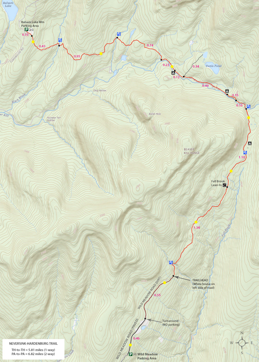
MILEAGE CHART from Balsam Lake Mountain PA to Wild Meadow Road PA |
| | Mile Point | Altitude | Notes |
| | 0.00 | 2,588' | Balsam Lake Mountain Trail Head |
| | 0.10 | 2,564' | Neversink-HardenburghDEC Registration Box |
| | 0.53 | 2,396' | DEC bridge - West |
| | 1.48 | 2,469' | DEC bridge - East |
| | 1.58 | 2,490' | Dirt Road for Vehicles - Goes to private land (north-bound) |
| | 1.66 | 2,468' | Slimy Green Stream Crossing |
| | 2.08 | 2,480' | Swamp off to the left of the trail |
| | 2.22 | 2,442' | Trail Junction - Go LEFT (right goes to Beaver Kill Road |
| | 2.35 | 2,460' | Rotting Bridge |
| | 2.45 | 2,470' | Campsite (west) |
| | 2.57 | 2,486' | Side Trail to Tunis Pond (Left of trail) |
| | 3.06 | 2,545' | Campsite (east) |
| | 3.09 | 2,565' | Trail Junction - Go LEFT (new trail) |
| | 3.21 | 2,668' | Trail Junction - Go LEFT (Back to old trail) |
| | 3.37 | 2,670' | Leave Beaver Kill Brook |
| | 4.47 | 2,660' | Fall Brook Lean-to |
| | 5.67 | 2,610' | Cross Stream |
| | 5.81 | 2,602' | Trailhead for Neversink-HardenburghTrail |
| | 6.36 | 2,635' | End of dirt Road / Beginning of Paved Road |
| | 6.82 | 2,608' | Wild Meadow Road Parking Area |
|
|
Hike the Neversink-HardenburghTrail from Balsam Lake Mountain Parking Area |
 |
At the end of the Beaver Kill Road, the Balsam Lake Mountain Parking Area is on the RIGHT. Pull into the Parking Area.
Do NOT park in the turnaround or block traffic.
Please NOTE: The Balsam Lake Mountain Parking Area is closed in the Winter months. But, you can park at the HardenburghParking Area 1.88 miles away.
|
|
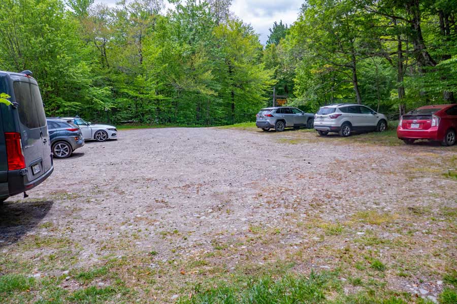 |
This is what the Balsam Lake Mountain Parking Area looks like. There are enough spaces for approximately 25 cars. Please park your car so that others can fit in tightly. This parking area fills up on Summer weekends.
|
|
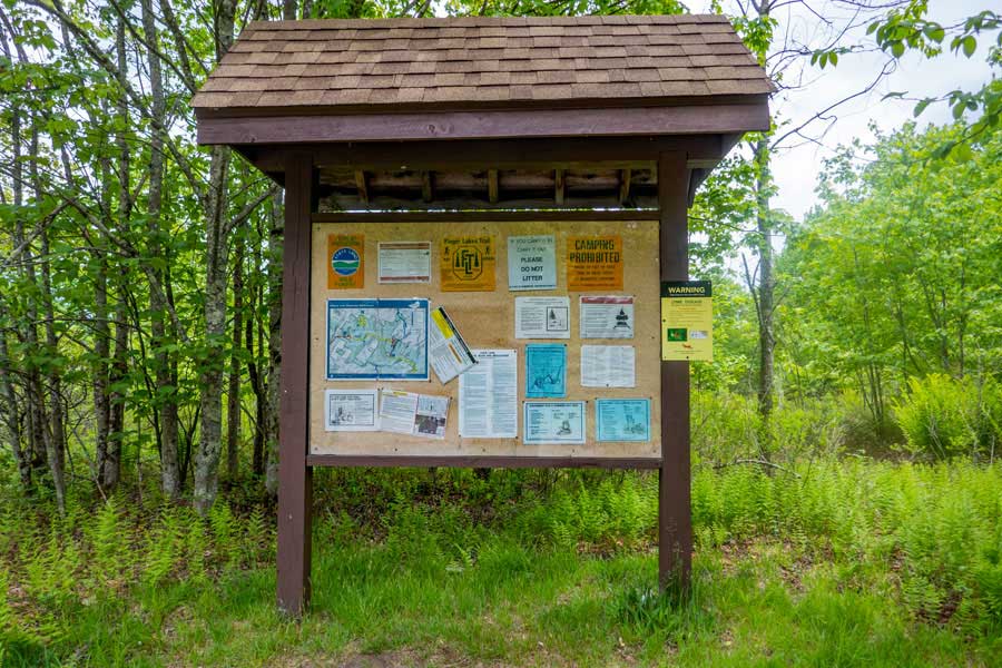 |
This is the Balsam Lake Mountain Parking Area DEC Kiosk. It hold important information about this hike and region. While there is no cell service, it does have the Ranger in charge of this trail, along with Emergency Contact Numbers.
I always take a picture of the emergency contact numbers on the kiosk with my cell phone. If there is no cell service, I put my cell phone in "Airplane" mode. As of 2023, there was not cell phone service for this hike.
|
|
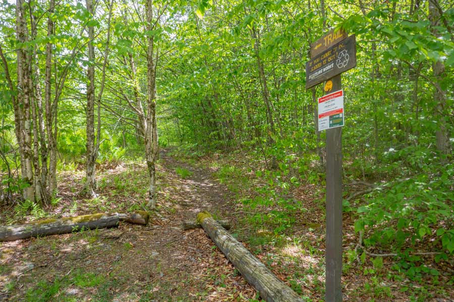 |
To the right of the Balsam Lake Mountain Parking Area DEC Kiosk, is the Trailhead for the Neversink-HardenburghTrail. This is the trailhead that you want.
Please note: There is another trailhead on the opposite side of the Balsam Lake Mountain Parking Area for the hike to Balsam Lake Mountain Fire Tower.
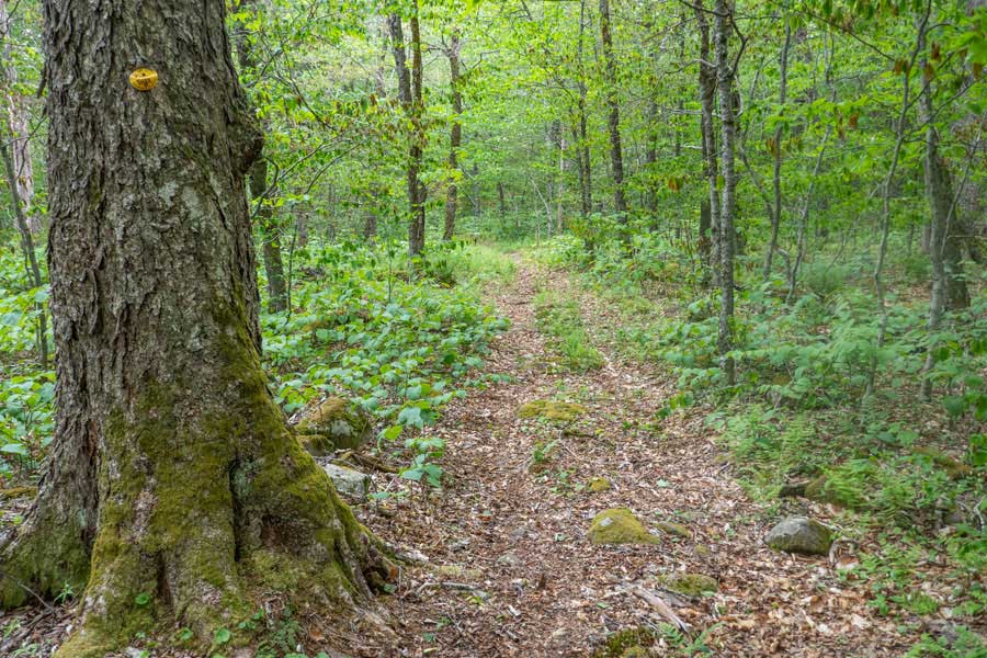
The DEC Trail Markers for the Neversink-HardenburghTrail are YELLOW.
|
|
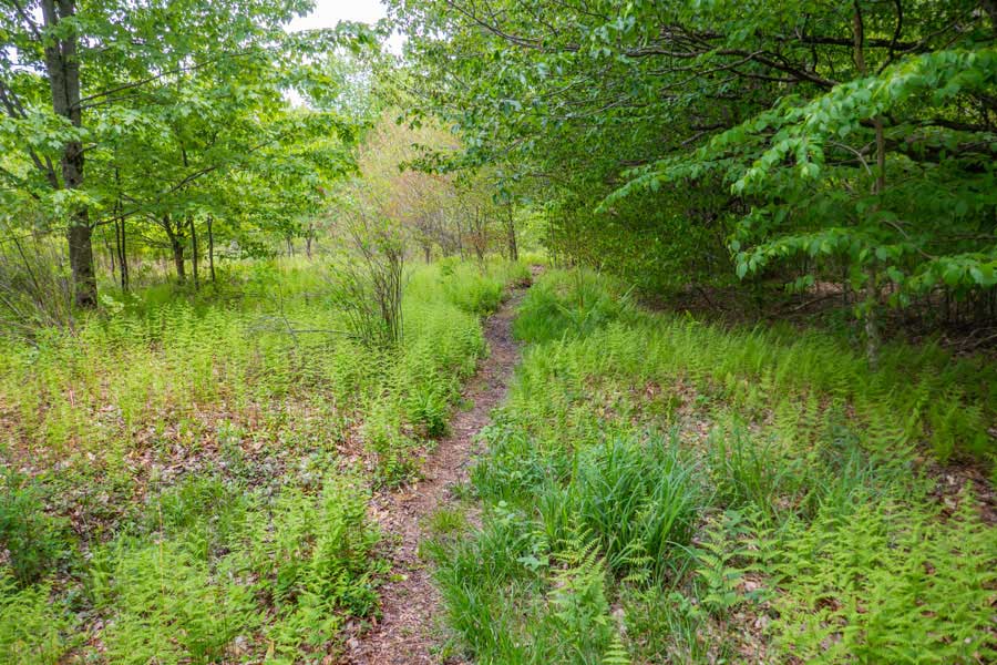 |
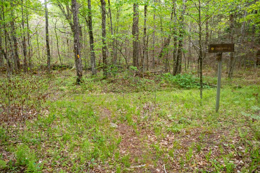
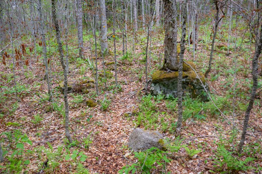
The first 1/10 of a mile goes through an old meadow that now has a fern glade. Follow the trail down to the forest edge.
|
|
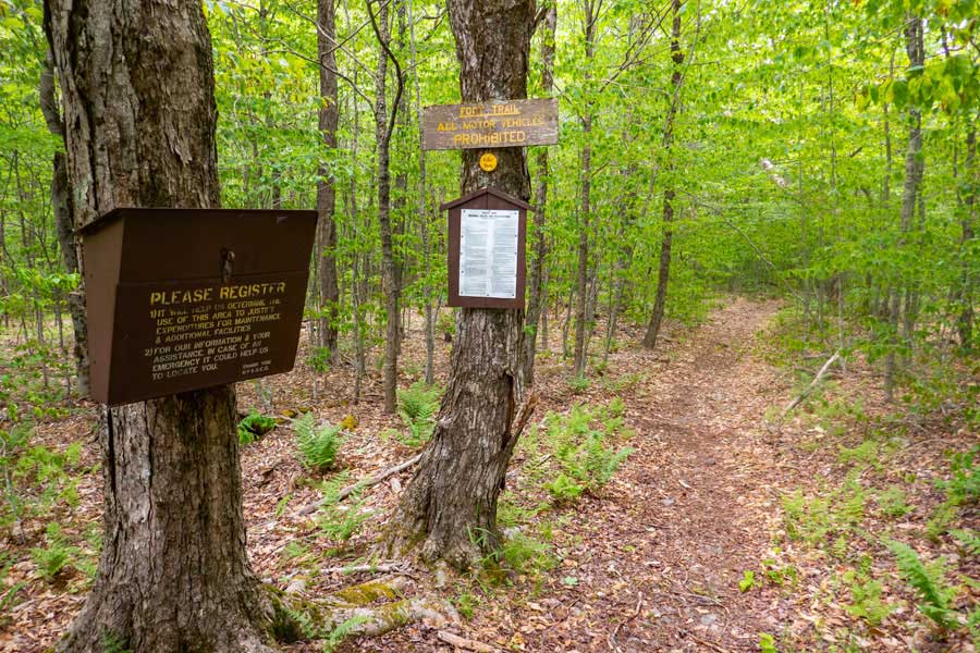 |
This is the DEC Registration box for the Neversink-HardenburghTrail. Please register for your hike. Make sure you provide a good description of where you are going. If the NYS Rangers need to find you, this is the first place they will look to see where you might be in thousands of acres of forest.
Additionally, funds for trail maintenance are allocated based upon how many people register for the hike over time.
If you have questions on the rules of hiking in a New York State Forest, the rules are listed on the tree next to the Registration Box. The most important rule is that you cannot camp within 150' of a road, trail, building, or water source, unless it is a designated primitive campsite. Also remember that whatever you bring into the woods, you need to take back out of the woods. Leave No Trace ("LNT").
|
|
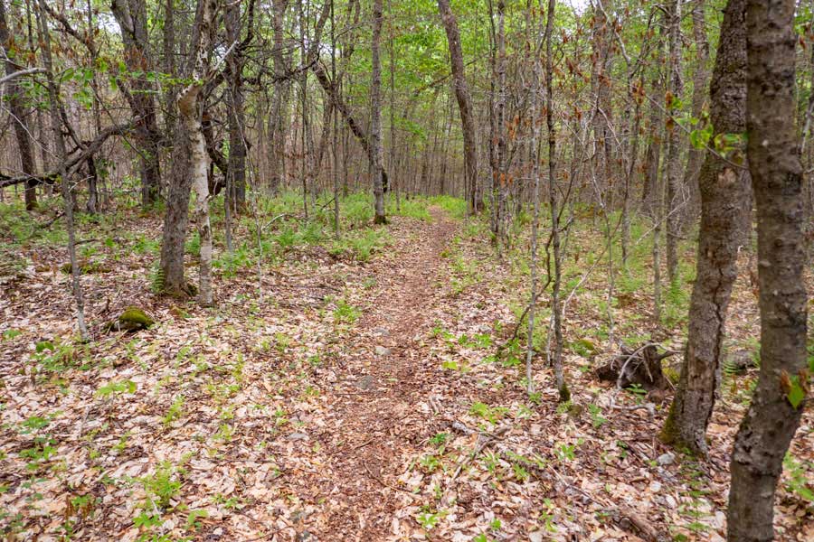 |
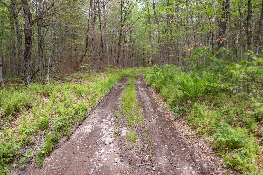
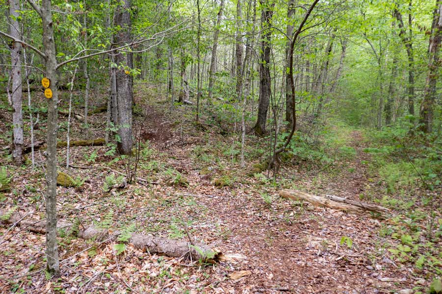
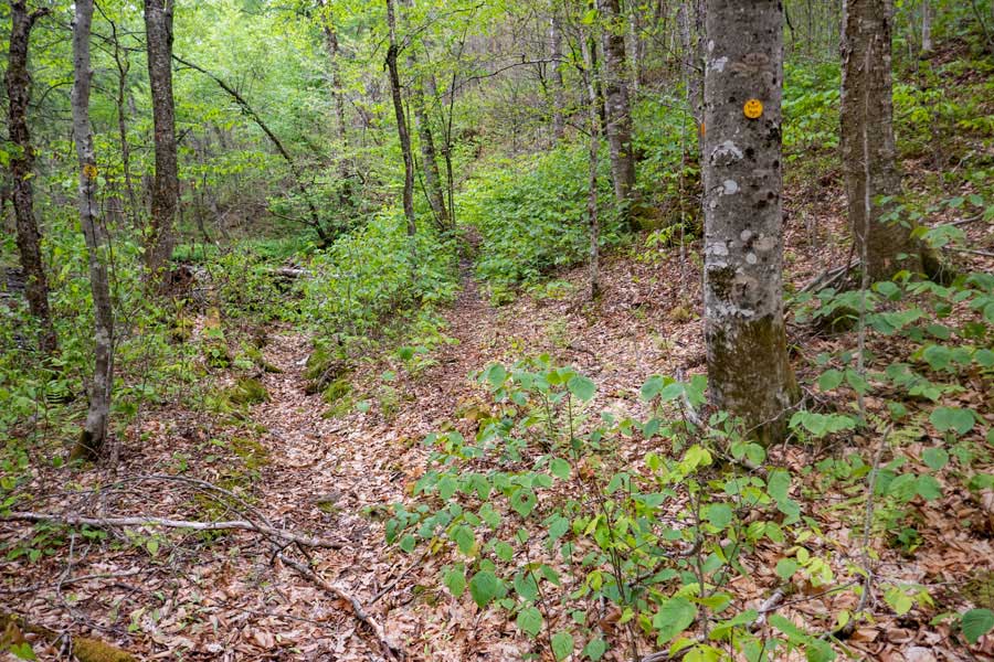
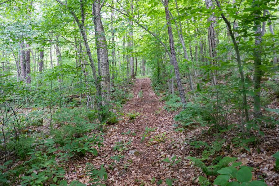
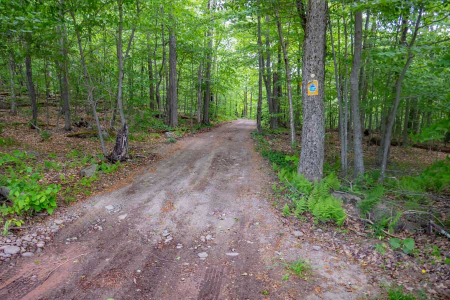
After registering for your hike, the trail will start with an easy downhill decline. Most of the trail will look like what you see in this picture.
|
|
|
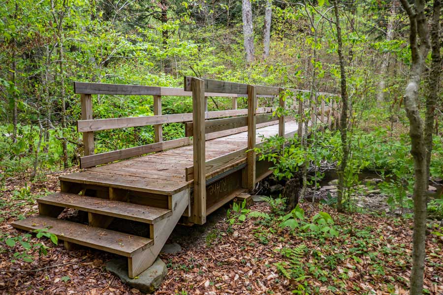
This is the first water crossing you will encounter. Black Brook has a nice bridge across it. You will come to this bridge about a 1/2 mile from the trailhead.
|
|
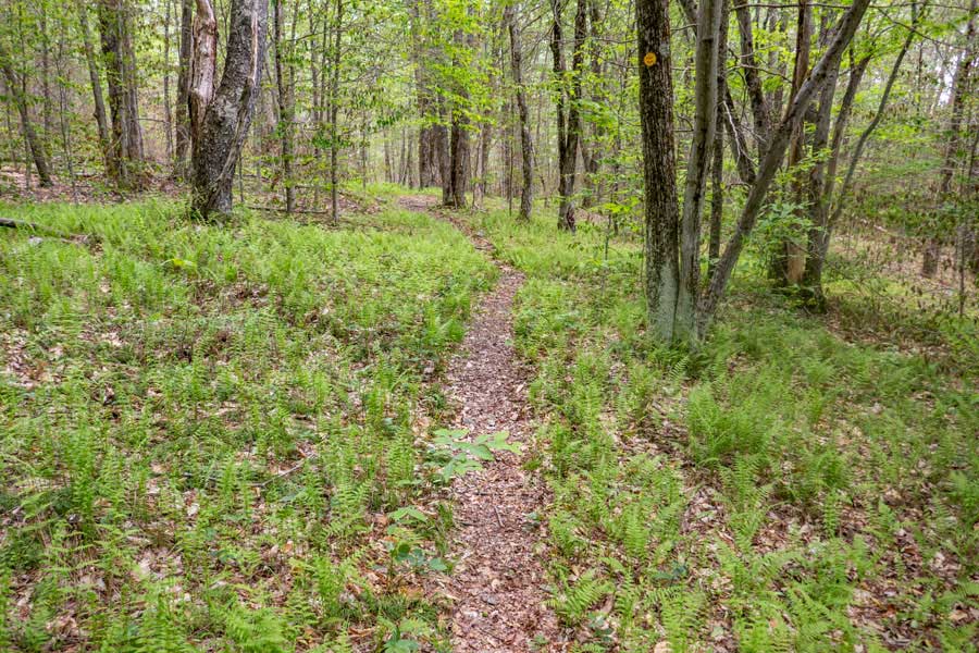 |
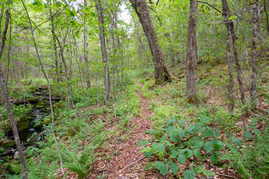
The trail then goes through the forest on an almost level ground. At this particular location of the trail has a nice fern glade.
|
|
 |
After another mile, you will come to another water crossing. The Gulf of Mexico Brook has a nice bridge across it. You are now about 1-1/2 miles down the trail.
|
|
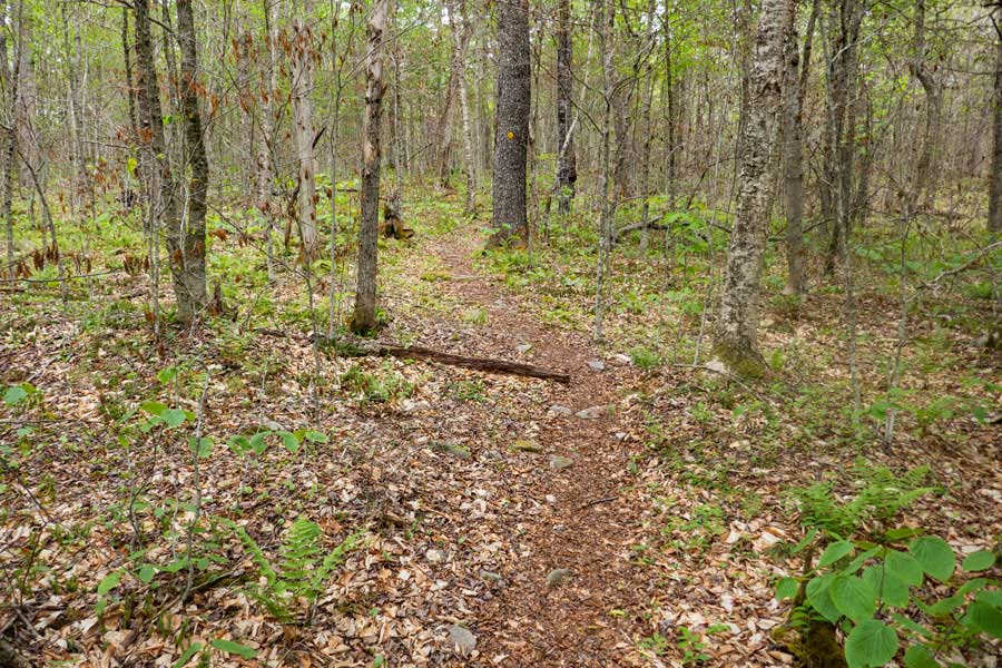 |
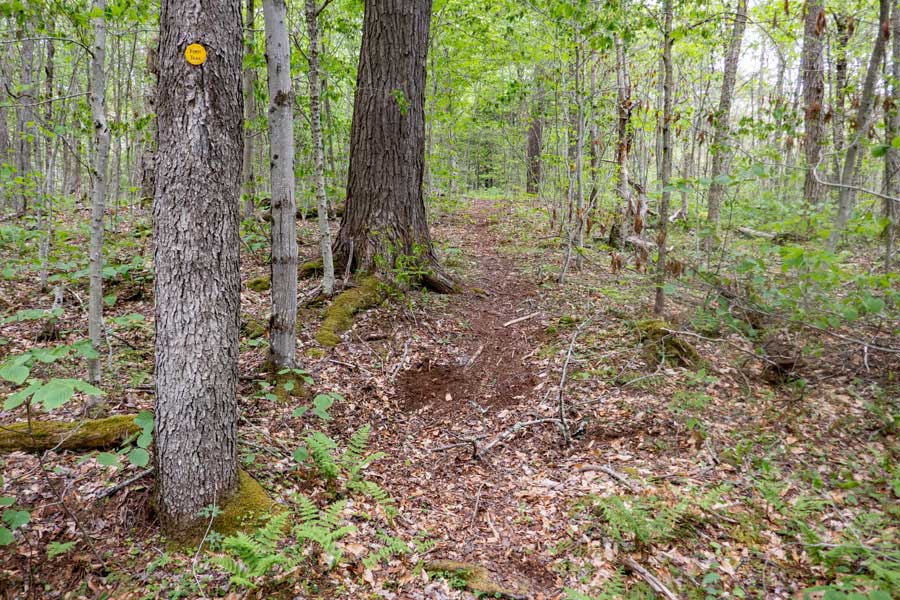
The trail will then start to have some hilly sections. But, there will still be some flat level part of the trail.
|
|
 |
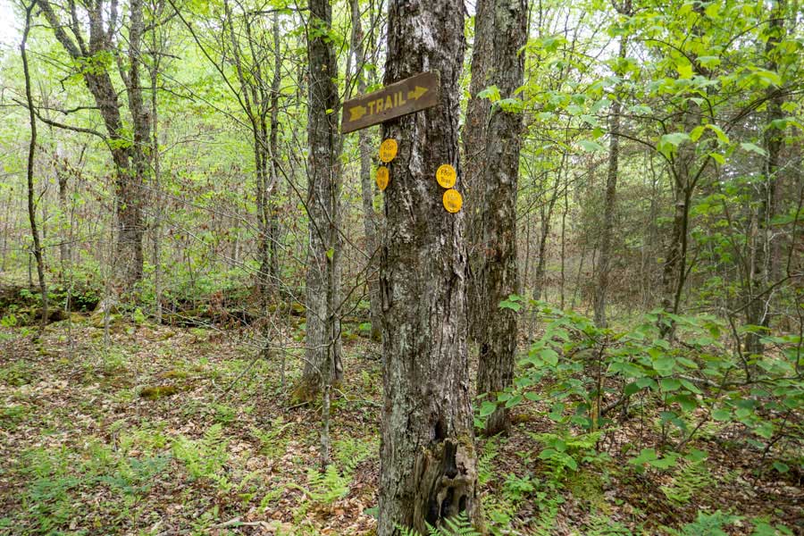
After a 1/10 of a mile past the second bridge, you will cross a vehicle road. This road goes to a private home. The downhill section of the road goes back to Beaver Kill Road.
|
|
 |
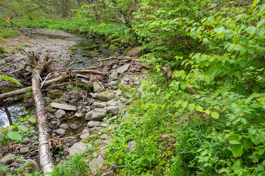
This is the third water crossing. This one does not have a bridge. But, you can cross this brook by hopping across the rocks. Some hikers refer to this water crossing as the Slimy Green Creek.
|
|
 |
After the third water crossing, the path will start to climb uphill. There are very few conifer trees on the Neversink-HardenburghTrail. But, this is one of the few sections where they do grow.
|
|
 |
This is a trail junction on the the Neversink-HardenburghTrail. You want to go LEFT.
There is also an unofficial trail that goes right. This will take you to the vehicle road you crossed, and will eventually end at Beaver Kill Road.
|
|
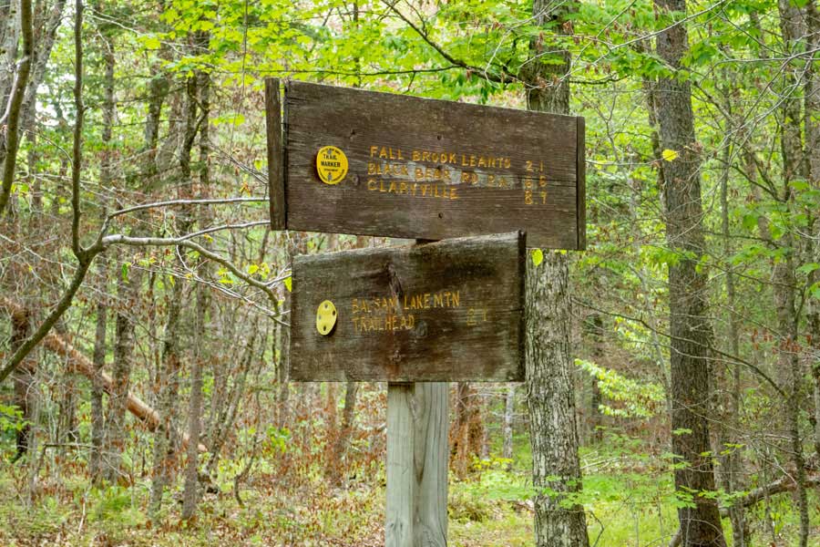 |
On your right of the trail is a trail sign for this trail junction.
|
|
 |
Across the trail is another trail sign. The dual trail markers tell you go to LEFT.
|
|
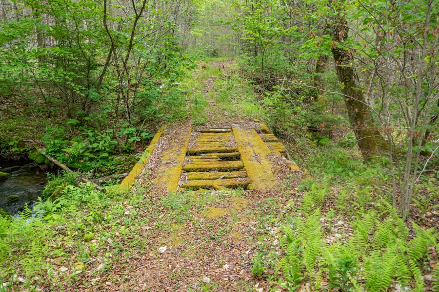 |
After turning left, and hiking up the old road/trail another 1/10 of a mile, you will come to this rotting bridge that is overdue for a new deck. Hopefully, it will get a new deck soon.
Most hikers walk up the middle of the tire tread boards where the vehicle tires roll over.
|
|
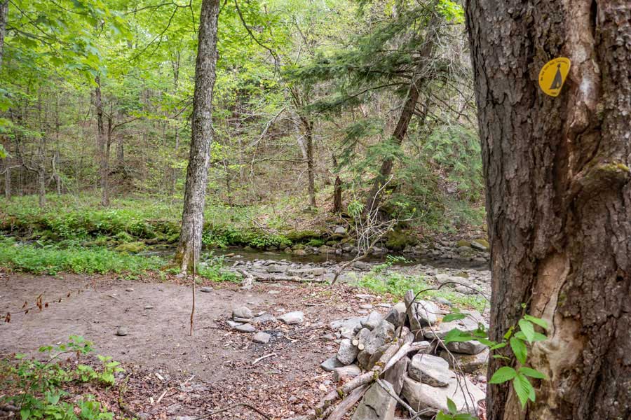 |
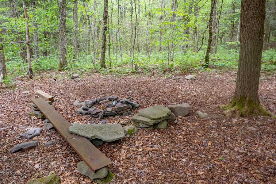
In about a 1/10 of a mile, you will see a faint trail that goes down to the Beaver Kill Brook. By the brook is a DEC Primitive campsite. The land is flat and it makes for a good campsite. It is about 150' off the trail.
There is another campsite another 2/3 of a mile further up the trail.
|
|
 |
This is an optional side trip to Tunis Pond.
In about another 1/10 of a mile past the campsite, you may see an old road on the left side of the trail. It is overgrown and slightly eroded. This road will take you up to Upper Tunis Pond. The road is not maintained.
You can also bushwhack over to the larger part of Tunis Pond you see in the distance.
When you get done, return back down the old unmaintained road to the Neversink-HardenburghTrail.
|
|
 |
In about another 1/2 mile past the optional side road to Tunis Pond, you will come to another DEC Primitive Campsite. It is located on the left side of the trail. It is about 50' off the Neversink-HardenburghTrail. It is also level.
|
|
 |
About 150 feet past the campsite, you will come to this trail junction. You want to go LEFT. The trail on the right is the old path which is partially eroded near the creek for about 25'.
In the coming years, this old path will become overgrown and disappear. Some cross-country skiers may prefer the old path.
|
|
 |
Follow the new path up the hill, where it will wind aimlessly around the top of the ravine to the Beaver Kill Brook. After a short distance it will drop back down into the Beaver Kill Brook ravine.
|
|
 |
Once you come down the ravine bank to the Beaver Kill Brook, you will hit the old path again. This picture was taken looking back towards the Ravine. If you are going to return back this way, you want to take notice of two features to ensure you don't miss the new path on your return. First is the rock next to the trail. The second is the Yellow Birch Tree growing onto of the boulder. Many hikers miss the new path when they return. Taking the old path will not cause you to get lost, but it is more difficult in one section.
This particular section of the Neversink-HardenburghTrail is easy to walk off the path. So, pay attention this region.
|
|
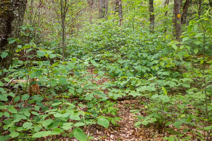 |
The trail is a little overgrown in this particular section. Just push your way through the leaves.
|
|
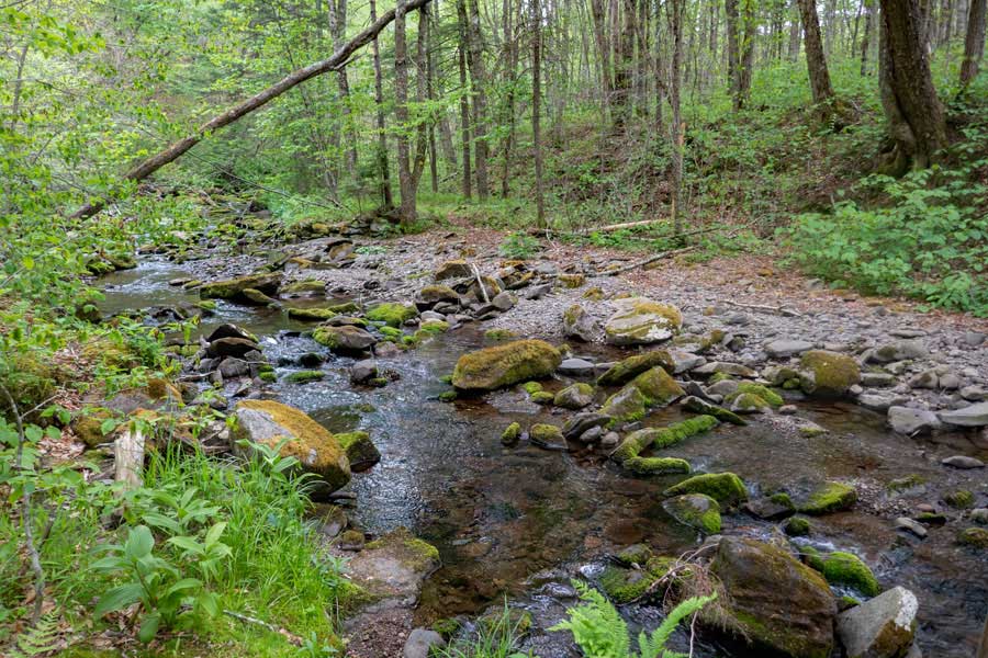 |
The trail will come to a point where you will need to cross the Beaver Kill Brook. While the mossy rocks do not look safe, the tops of the rocks are bare of moss and grippy enough. After a large rain storm, the Beaver Kill Brook may not be able to be crossed at this point. You can consider crossing further up. Just remember that the path will leave the Beaver Kill Brook shortly.
If you look just left of the upper center of the picture, you will see a tree that has a "Y" in it. If you look carefully, you can see a yellow trail marker on it. Or, you can look at the next image to see a closer look at the tree.
|
|
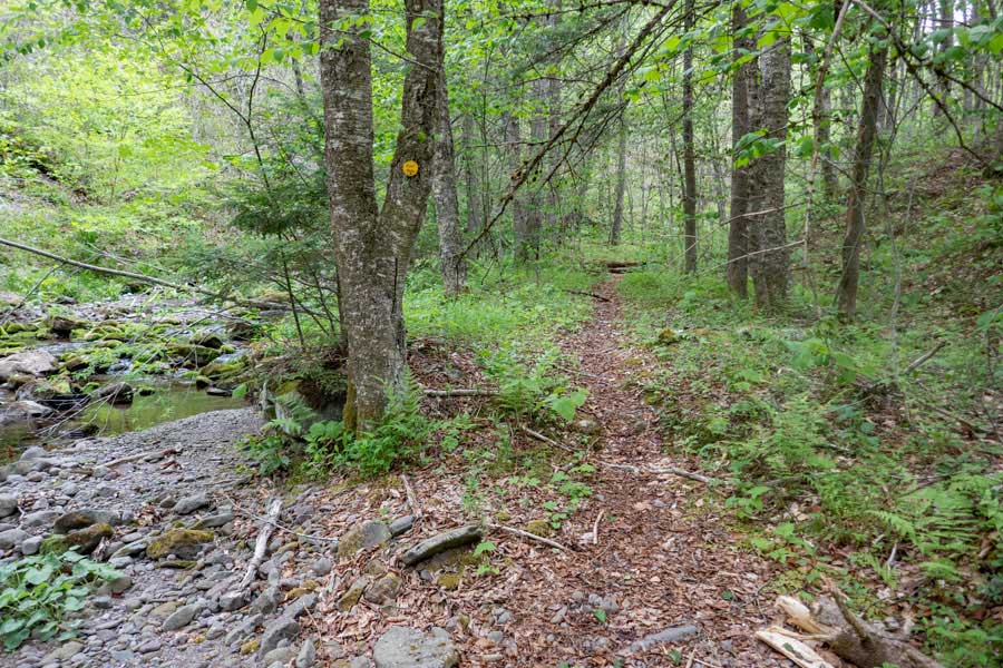 |
Here is that Y tree with the yellow trail marker on it. The Neversink-HardenburghTrail continues on the other side of Beaver Kill Brook. Just beyond this point, the Neversink-HardenburghTrail will turn to the right and continue to follow the Beaver Kill Brook.
|
|
 |
After you go around the corner, you will come to this point. If you look carefully at the picture, you will see a yellow trail marker on both side on both sides of the path. This confuses hikers. The left trail is the OLD trail, and was washed away. So, you want to take the right path up the small incline to the top.
|
|
 |
At the top of the incline you will come to a drop off. More confusion for some hikers. You want to climb down the incline to the rocky bank of the Beaver Kill Brook. Then you want to carefully hike up the rocky bank towards the grassy section of the Beaver Kill Brook bank.
|
|
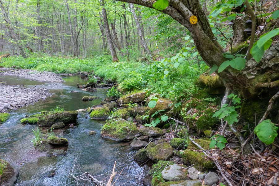 |
You want to continue along the last of the rocky bank of the Beaver Kill Brook to the grassy section.
If you look at the picture, you can clearly see the Yellow Trail Marker. Starting at the Yellow Trail Marker, go down the picture 1" and to the left 1", and look carefully for a very thin birch tree, you will see the next Yellow Trail Marker. That is where you are headed. Once you get up to the grassy area, the trail becomes obvious.
You are now leaving the Balsam Lake Mountain Wild Forest and entering the Big Indian Wilderness.
|
|
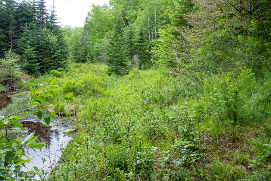 |
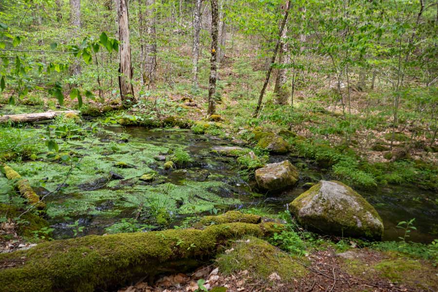
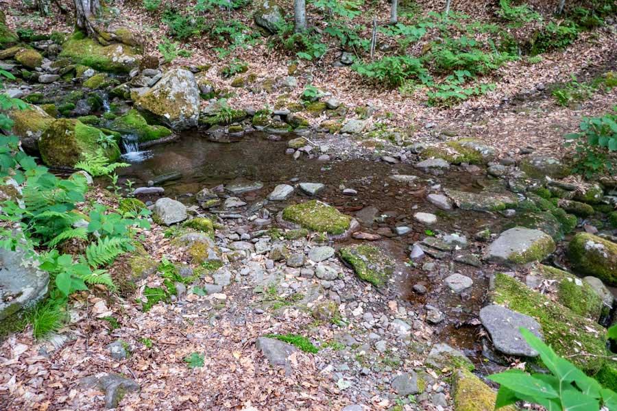
In the next 1/2 mile the trail will be easy hiking on fairly level ground. The trail will also be easy to follow. About 4/10 of a mile is another campsite. Most people cannot find it. Shortly thereafter, you will encounter a large marsh.
The image above is the outflow of the marsh. If you are going to stay at the Fall Brook lean-to, you want to get water at the outflow of the marsh.
|
|
 |
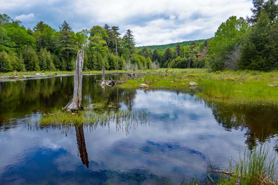
As you hike around the marsh, you will see that this is a fairly big marsh.
|
|
 |
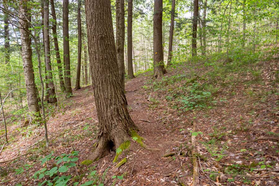
Fairly easy hiking down the Neversink-HardenburghTrail. The large tree in the picture is about 4' in diameter. It is hollow in the middle. Once past the tree, you can see a hollow about 25' up the tree. The tree is hollow up to the opening.
|
|
 |
Fairly easy hiking along the Neversink-HardenburghTrail. Along the trail, you will see fairly large trees next to the path.
|
|
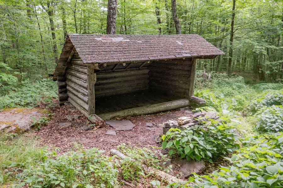 |
After leaving the Beaver Kill Brook, you will hike a little over a mile before you encounter the Fall Brook Lean-to. There is NO water near the lean-to, so make sure you get water long before you get here.
|
|
 |
After the Fall Brook Lean-to, the Neversink-HardenburghTrail continues to be an easy hike on fairly level ground with an easy trail to follow.
|
|
 |
About a 1-1/3 miles after the Fall Brook Lean-to, you will encounter a nice brook. It a reliable water source most of the year. If you are hiking down to the Big Bear Parking Area, you should get water here before continuing further.
|
|
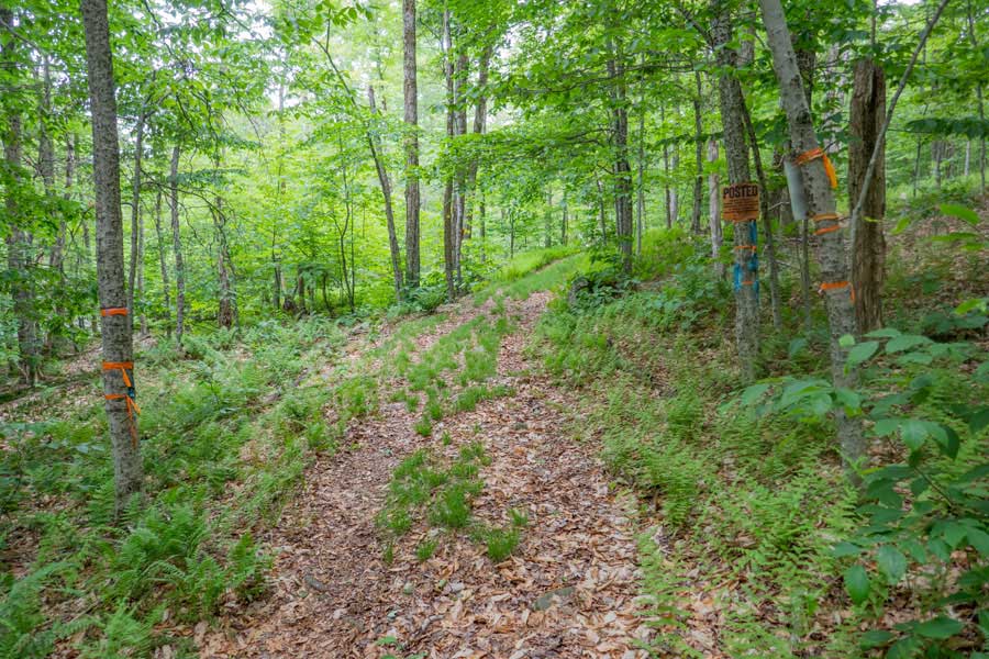 |
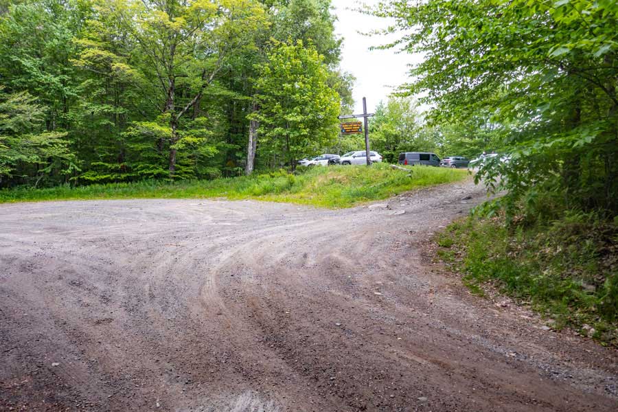
This is what most hikers consider the Trailhead for the Neversink-HardenburghTrail on the Wild Meadow Road side in the Big Indian Wilderness.
If you look carefully at the picture, you will see a No Trespassing sign staring at you. This is also the property line for NYS land and private property. You MAY continue hiking the trail/road. You may NOT leave the trail/road until you encounter NYS land again.
|
|
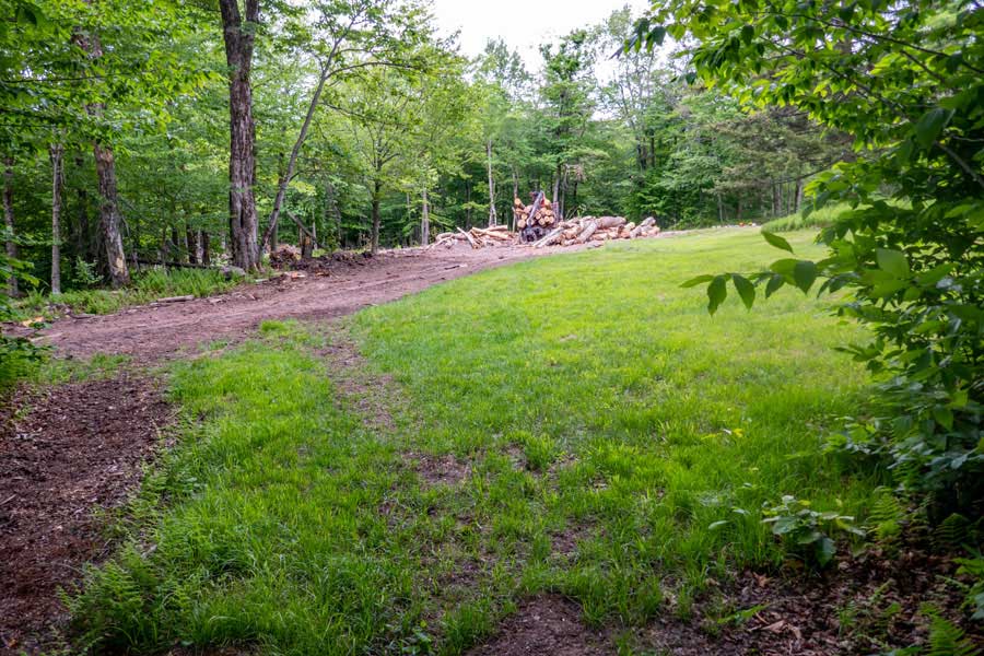 |
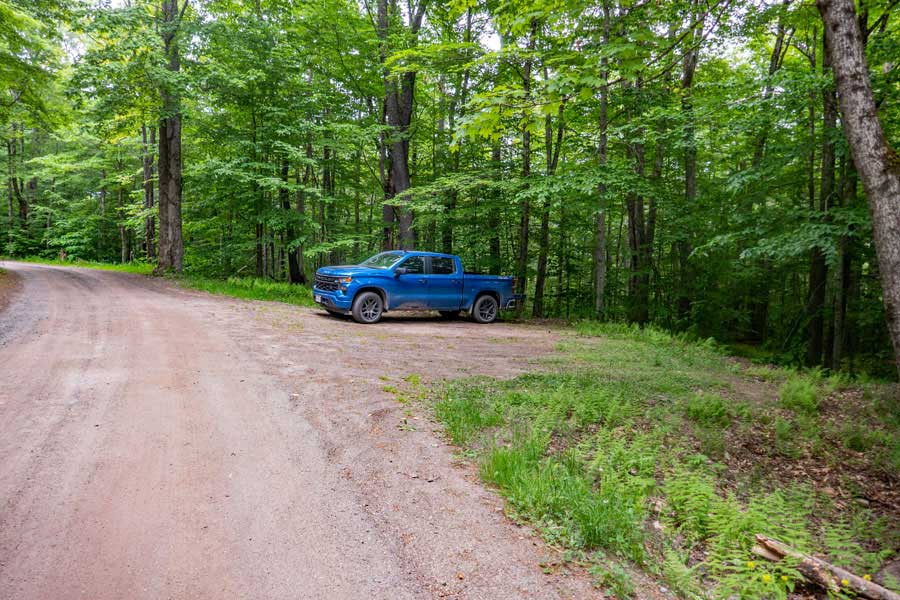
When you come off the trail, you will encounter the End of Wild Meadow Road. It is a public road that ends here. You should continue to hike up near where you see the logging truck, and continue walking up the the road. On your right, you will see a white house on private property. Please be respectful to the land owners.
As you walk down the Wild Meadow Road, you will encounter NYS land again on both sides of the road. Continue walking down the Wild Meadow Road in the forest.
|
|
 |
After walking a little over a 1/2 mile down Wild Meadow road, you will come to the end of NYS land again. The dirt section of Wild Meadow Road will turn into a paved section of Wild Meadow Road at this point. This picture was taken looking backwards where you just hiked.
|
|
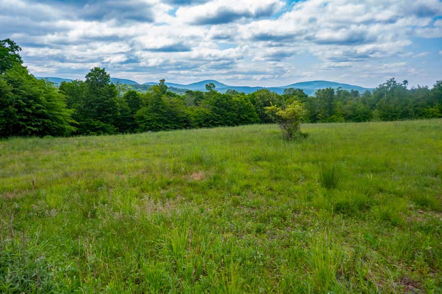 |
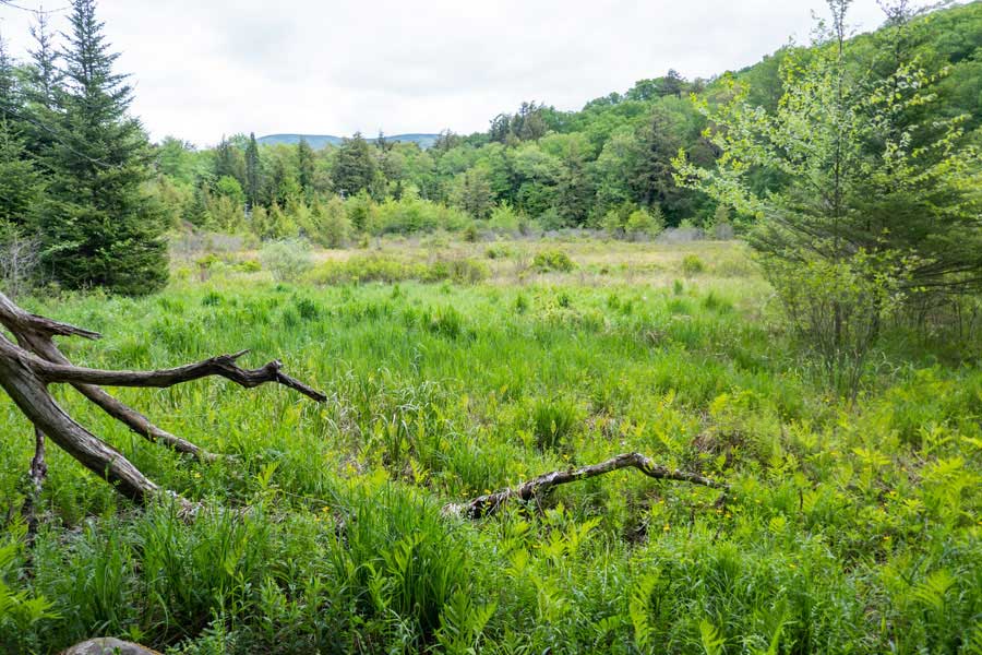
Once on the paved section of Wild Meadow Road, you will have private property on both sides of the road. There will be another house on the right side of the road. The owner is a little cranky, so stay on the road. But, you will be able to get a nice view over the meadow of the Catskill Mountains.
Continue walking down the paved section of Wild Meadow Road for almost another 1/2 mile. Part way down it will change back to a nice dirt road.
|
|
 |
After another 1/2 mile after the view over the meadow of the Catskill Mountains, you will encounter a parking area on the LEFT side of the road. It can hold about 4 cars. This parking area is called the Wild Meadow Road Parking Area. It is on NYS DEC land. This parking area is NOT marked, and there are no signs when we visited it in 2023. You may park here.
|
|
|
S E C T I O N S
|
W E A T H E R
|
O T H E R
|