Bearpen Mountain and North Bearpen Mountain |
 |
| |
| |
|
OVERVIEW |
| | Distance: | 8.23 miles round trip from the DEC Parking Lot on Ski Run Road (PA #2) off of Rt 2. |
| | Time: | Average 5.00 hours round trip in the Summer - 5.00 hours round trip in the Winter |
| | Elevation Gain: | 1,300' feet from the DEC Parking Lot to the summit of Bearpen Mountain. |
| | Best Time to Hike: | Winter. |
| | Difficulty: | Easy |
| | Catskill Highest: | #27 |
| | |
| | | Elevation North Bearpen: | 3,542' |
| | GPS North Bearpen: | 42.2734, -74.484067 (WGS84 - DEC) |
| | GPS North Bearpen: | N42 16 24, W74 29 02 (Long/Lat) |
| | GPS North Bearpen: | N42 16.404, W74 29.044 (GPS) |
| | GPS North Bearpen: | 18N 542545 4680261 (UTM) |
| | |
| | | Elevation Bearpen: | 3,612' |
| | GPS Bearpen: | 42.265233, -74.473917 (WGS84 - DEC) |
| | GPS Bearpen: | N42 15 54, W74 28 26 (Long/Lat) |
| | GPS Bearpen: | N42 15.914, W74 28.435 (GPS) |
| | GPS Bearpen: | 18N 543388 4679359 (UTM) |
| | |
| | | |
| | | USGS Official Names: | Bearpen Mountain (ID: 943334) |
| | USGS Official Elevation: | *See notes below |
| | USGS Official GPS: | *See notes below |
| | |
| | | USGS Official Map: | Prattsville Topographical Map (free) |
| | |
| | | DEC Map: | DEC Bearpen Wild Forest Map (free) |
| | |
| | | Digital Mapper: |
Topo
Terrain
Satellite |
| | |
| | | Access Methods: | Foot, ski, mountain bike, snowmobile, and snowshoe (ATV's not allowed) |
| | |
| | USGS Elevation Note: The 1903 USGS map incorrectly showed Bearpen Mountain where North Bearpen Mountain is located. The official elevation and gps location of Bearpen Mountain has never been officially resolved with USGS. Some of the newer USGS digital maps now show the summit of Bearpen Mountain moved back. To learn more about the story behind the many discrepancies, read the link listed at the bottom of this page about the Princeton Ski Bowl. |
|
|
Maps & Profile |
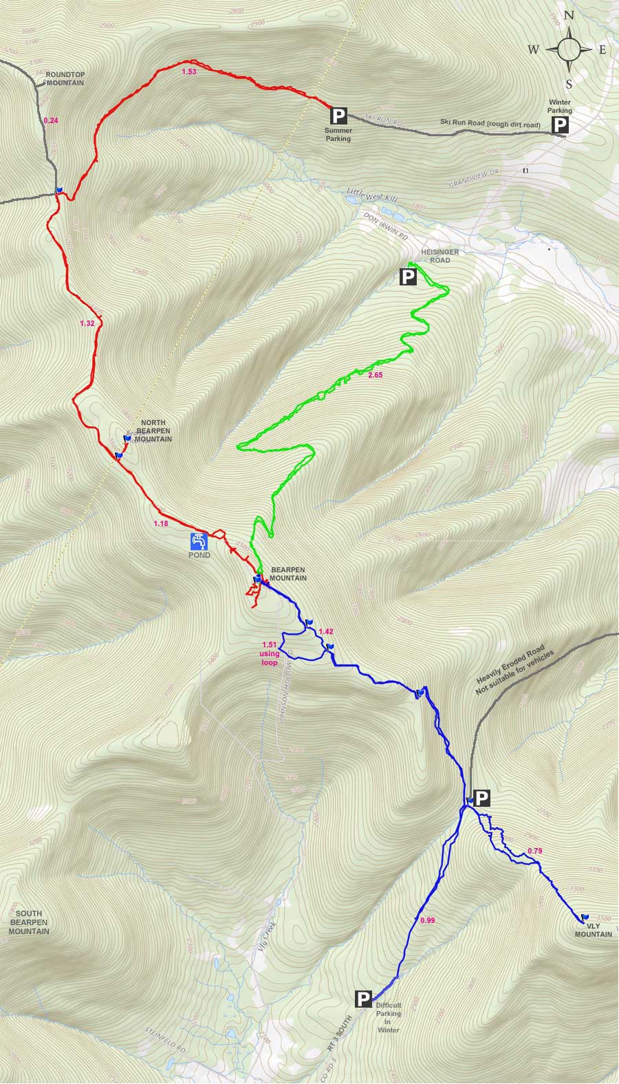
|
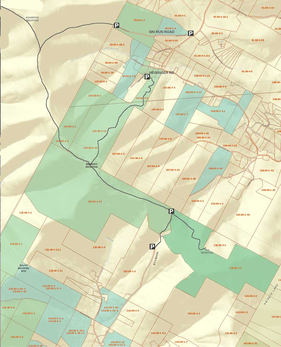 Public & Private Land Ownership around Bearpen & Vly Mountain
(Greene County Only - Delaware County not available)
Tan=Private Land
Green=DEC Public Land
Lite Blue=DEP NYC Public accessible land
* Land ownership is ONLY shown for Greene County *
|
|
|
|
|
| | DIRECTIONS TO TRAIL HEAD |
| | GPS Coordinates to DEC Parking Lot: 42.294317, -74.472383 (WGS84 / DEC) |
| | GPS Coordinates to DEC Parking Lot: N42 17 39, W74 28 20 (Long/Lat) |
| | GPS Coordinates to DEC Parking Lot: N42 17.659, W74 28.343 (GPS) |
| | GPS Coordinates to DEC Parking Lot: 18N 543494 4682589 (UTM) |
| | Take New York State Thruway to Exit 21 (Catskill). |
| | Take a LEFT out of the NYS Thruway toll booths. |
| | Take a RIGHT onto Rt 23 westbound |
| | Go 33.3 miles until the intersection of Rt 23a and Rt 23 |
| | Take RIGHT and continue on Rt 23 for another 1.5 thru Prattsville |
| | After passing thru Prattsville, you will cross over the Schoharie Creek over a Green Bridge |
| | Take LEFT onto Rt 23 as soon as you come off the bridge |
| | Go 2.7 miles on Rt 2 |
| | At the top of the hill there is a dirt unmarked driveway on the RIGHT - This is Ski Run Road. (There is a field with a great view on the left. |
| | Drive 1.1 miles up the dirt road |
| | The road is not plowed in the winter, and there are multiple parking spot along the way if you cannot make it all the way up. |
| | The Bearpen Parking Lot on Ski Run Road is on the LEFT side of the road. GPS: N42 17.659 W74 28.343 |
|
|
SPECIAL CIRCUMSTANCES ABOUT THIS HIKE |
| | This hike is located in both Delaware and Greene County. The summit of North Bearpen Mountain is the boundary line between the two counties. Most people hike up to Bearpen Mountain from Route 3. This is a quick way to the top of Bearpen Mountain. But, this hike approaches Bearpen Mountain from the opposite direction. In the Winter this hike can be magical. Especially when rime is on the trees on a bluebird day. Bearpen is known to have rime often. During the Winter, you can have a view through the trees during most of the ridge part of the hike. In some spots, you can see over the north and south valleys. Most people find the ridge from Roundtop Mountain and Bearpen Mountain a fantastic hike in the Winter. Some regard it as one of the best hikes in the Catskill Mountains. There are quite a few view points, and the numerous views from Bearpen Mountain are spectacular. This hike is also one of the easier hikes in the Catskill Mountains. It is all about enjoyment of the hike.
While this hike in the Winter is magical, it is horrible in the Summer. ATV's and some 4WD trucks have completely ruined the trail. Signs have been put up banning ATV's and Vehicles, but the signs are are ignored. The ridge is a giant mud hole and water bogs that completely fills the wide trail. And, these water and mud holes go for miles.
One of the biggest problems with this hike in the Winter is getting to the trail head. In most cases in the Winter, you will need a good 4wd. But, there are a number of places you can park if you cannot make it all the way up to the trail head. Finding Ski Run Road can be difficult because it is not marked. It looks like someone's driveway. You just need to follow our instructions. In the Summer, you can easily get up to the Trail Head in a 2wd car. But, beware that the road is very rocky with deep holes. A high clearance vehicle is recommended.
There is NO registration box. This is a wild forest, so you can find snowmobiles running around in the Winter. But, we never see many, and the few we do see, are breaking the trail for us. Bearpen Wild Forest does get more snow then most of the Catskill Mountains.
The road up to the ridge is a nice 10% incline that runs pretty steady. The road is wide enough for a truck. While climbing up to the ridge, you can see over the valley as you hike up the road. But, only in the Winter when the leaves are not on the trees. The road follows the mountain side as it climbs up at a steady rate. The road to the ridge is 1.5 miles long. Once you get on top, the terrain is mainly flat. It is one of the very few places in the Catskill Mountains where you can hike or ski on flat terrain for miles. There are a number of side roads, but you want to stay on the main road up to the ridge.
Once you reach the ridge, you will find a large opening with numerous roads going off in multiple directions. For this hike, you want to take a LEFT at the small field. This road will follow the ridge line and will only change in elevation about 250' during the next 2-1/2 miles.
The trail from the Round Top Mountain to Bearpen Mountain is one of those nice trails that follows a beautiful ridge line in the Winter. In some places the ridge is only 50 feet wide, and you can see over the valleys to the north and south in the Winter. When the trees are coated with rim, the experience can be magical.
When you approach North Bearpen Mountain, you will loop around the south side of North Bearpen mountain. It is easy to get confused on where to hike up to the summit of North Bearpen Mountain. Most people leave the trail too soon and get caught up in dense trees and bushes. The best place to leave the trail is in between to DEC Wild Forest signs that are about 50 feet apart. From there, it is a short hike to the summit of North Bearpen Mountain. There is a limited view near the summit.
After North Bearpen Mountain, the trail is very flat and in some sections very straight. When you arrive near Bearpen Mountain, you will see a small field on the right. Then you will come to a small pond. This is the northwest side of Bearpen Mountain. The summit of Bearpen Mountain is long. You want to approach it on the northern side of the point. There is a trail that leads up to the summit of Bearpen Mountain. It is probably the steepest part of the hike, which doesn't last long. Once on top, there are numerous view point.
After enjoying the views, you can take the overgrown trail to the other end of the summit. Along the way, you will have a number of nice view points. When you get to the other side of the summit, you can go to the highest point. Most of the summit of Bearpen Mountain is pretty much the same height. It really doesn't vary by much. In the Winter, you can also go to the southeast side for one last view.
|
|
|
MILEAGE CHART |
| | Mile Point | Altitude | Notes |
| | 0.00 | 2,372 | Parking Area #2 (500' from Parking Area #1) |
| | 0.11 | 2,410 | Parking Area #1 (summer, 2-3 parking spots) |
| | 1.53 | 3,207 | Major Trail Junction with 6 trails running off of it - large opening - Take LEFT trail. |
| | 2.85 | 3,483 | Leave Trail and bushwack to top of North Bearpen Mountain. |
| | 2.96 | 3,542 | Summit of North Bearpen Mountain. |
| | 3.07 | 3,483 | Return back to Trail and continue to Bearpen Mountain. |
| | 4.25 | 3,612 | Summit of Bearpen Mountain. |
| | 5.46 | 3,484 | Junction to bushwack up to North Bearpen Mountain. |
| | 6.75 | 3,187 | Major Trail Junction with 6 trails running off of it - large opening. |
| | 8.16 | 2,312 | Parking Area #1 (summer, 2-3 parking spots). |
| | 8.23 | 2,277 | Parking Area #2 (500' from Parking Area #1) |
|
|
Hike to Bearpen Mountain and North Bearpen Mountain |
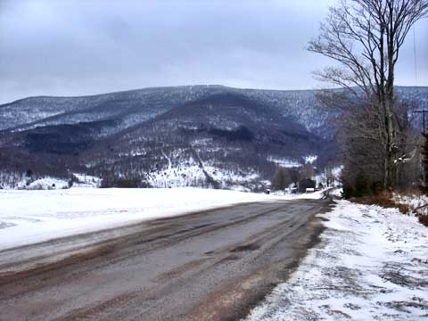 |
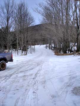
Finding Ski Run Road can be quite a challenge. The road is not mark, and it is not paved. It looks like someones primitive driveway. The picture on the right was taken from the road entrance. It is just over the top of the hill on Rt 2. The mountain in the distance is Bearpen Mountain. |
|
 |
The picture left shows what the road entrance looks like. There is NO sign telling you that it is Ski Run Road. You really need VO Maps to help you figure it out. The road is a rough dirt road. It can be done with a 2wd car in the summer. In the winter you need a 4wd. The road is NOT plowed in the Winter. There is only one lane. There are a number of parking spots along the road.
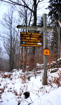
You will travel 1.1 miles up the road to the parking area #1. In the Winter most people park on the side of the road 1.0 miles at parking area #2. People with snowmobile trailers need to park next to Rt 2. There is NO place to turn around the trailer. This sign is about 1/2 way up the road. You need to keep driving past the sign to reach the furthest parking area. |
 |
|
 |
This is parking area #2, which is commonly used in the Winter. If you look down the road and up the hill is Parking Area #1. The difference in distance is about 500 feet..
This picture is taken from parking area #1 looking backwards towards parking area #2. |
 |
|
 |
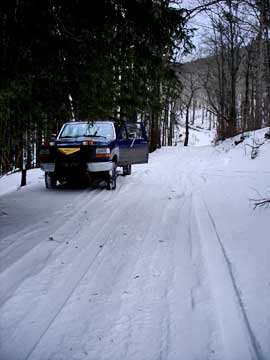
This is parking area #1. It can park about 3 cars. There is a road that goes downhill from this parking area. There is a yellow sign at this point in the road telling you that you cannot drive a motorized vehicle past this point, except for snowmobiles on snow. |
|
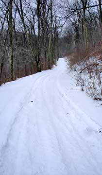 |
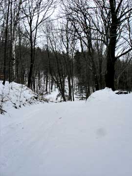
This is what the road looks like all the way up the road. The incline is fairly steady. There are a number of side roads, but you want to keep going up the main road. The road will wrap around the mountain side, and continue to steadily climb up to the col.
|
|
 |
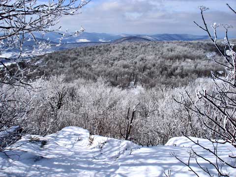
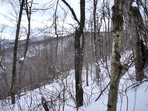
Almost the entire trip, you will have views like this one. You will only see views when the leaves are not on the trees. This makes this hike one of the best hikes in the Catskill Mountains in the Winter. |
|
 |
When get very close to the top of the col, you will have this view, which looks over the valley below. |
|
 |
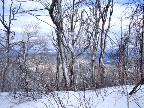
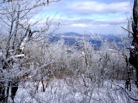
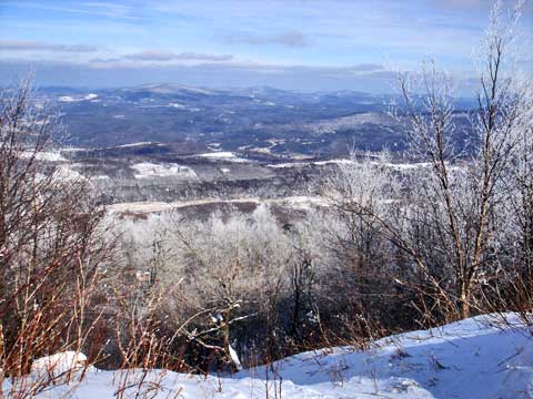
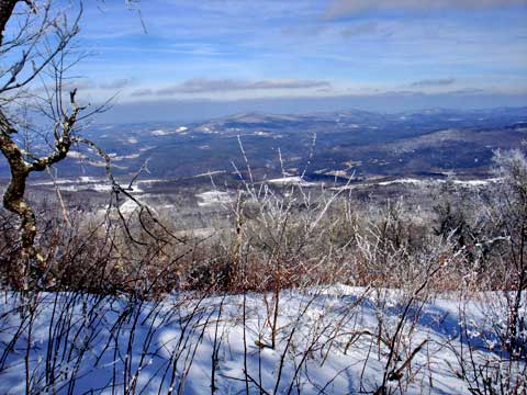
This picture is taken right next to the picture above. In the center of the picture is North Bearpen Mountain. To the left is Bearpen Mountain. On the very left edge is Vly Mountain. |
|
 |
After the vantage point in the previous pictures, you will go thru a reverse S turn to get to the col. There is a side trail, but you need to avoid it. |
|
 |
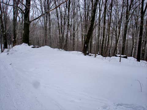
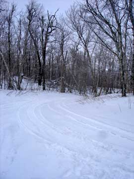
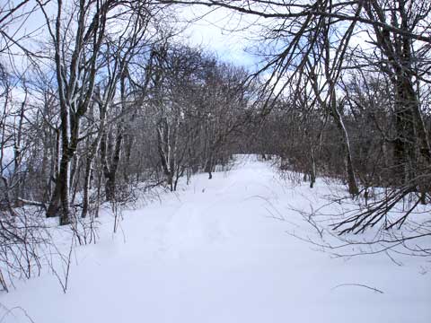
This is the major trail intersection at the col. This picture is taken from the trail to Bearpen Roundtop Mountain towards the trail to Bearpen Mountain. When you come to the col, you want to take a LEFT and take the trail all the way on the left. |
|
 |
In this picture the camera is pointed in the same direction as the last photograph, but is taken from the middle of the col. You can see the trail entrance to Bearpen Mountain on the left. |
|
 |
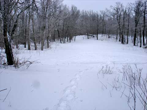
This picture is taken part way up the trail to Bearpen Mountain, but it is taken while looking backwards towards the col
In the beginning of the trail, you will have a slight incline with a couple small turns. |
 |
|
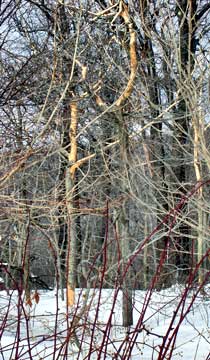 |
When you see trees like these with the bark missing it means that there are porcupines in the area. They are known to climb the trees and eat the bark as food.
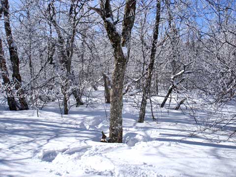
This is a typical picture of the trail to Bearpen Mountain. |
 |
|
 |
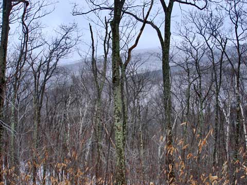
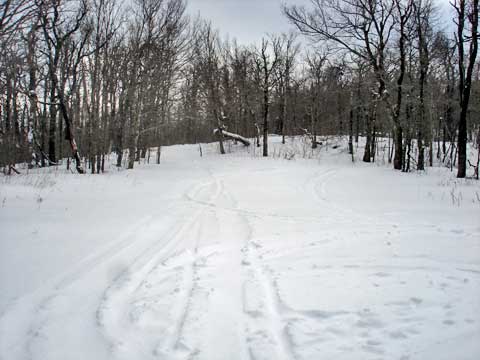
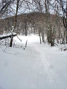
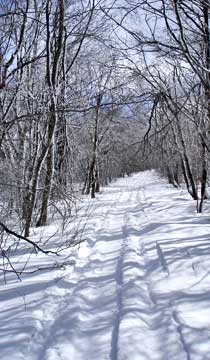
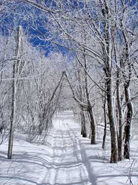
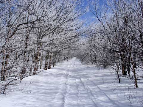
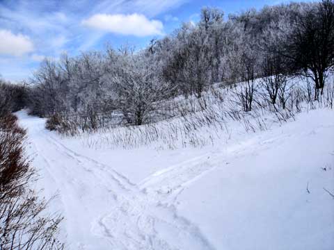
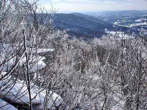
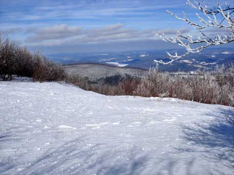
The trail is just a flat ridge that runs for the next 2-1/2 miles. In some sections the ridge is only 50 feet wide. You can one of those sections here. The best part is that in the Winter, you can catch great views on both sides of the ridge. There are views almost the entire way up to Bearpen Mountain. On a beautiful bluebird day with rime on the trees makes this hike absolutely magical. |
|
 |
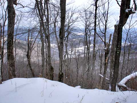
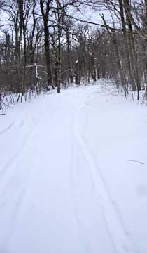
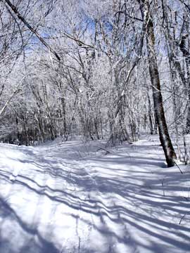
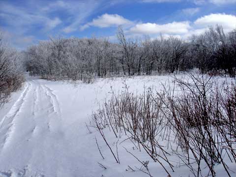
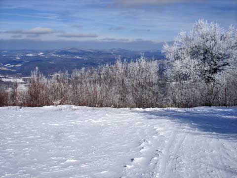
This is one of the typical views from the ridge line to Bearpen Mountain. |
|
 |
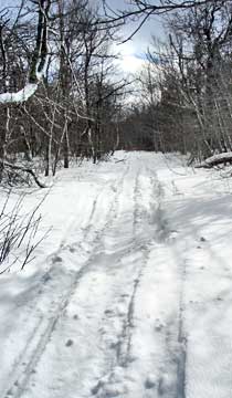
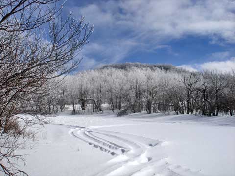
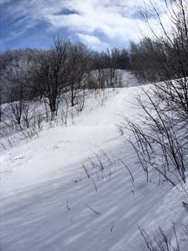
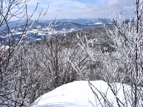
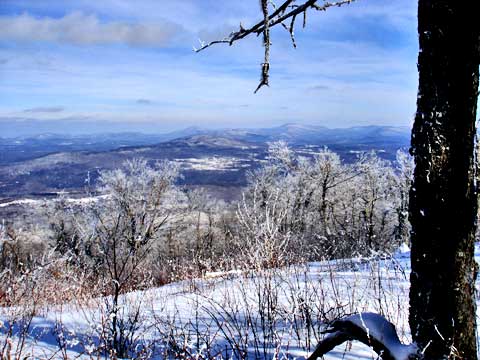
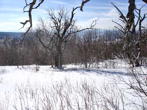
This is another typical view of the trail up to North Bearpen Mountain and Bearpen Mountain.
This is another view on the way to North Bearpen Mountain. |
 |
|
 |
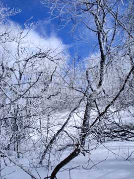
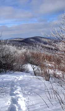
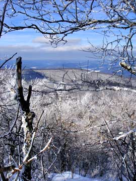
As we approached North Bearpen Mountain, the trees had rim, and it was a nice bluebird day. As you can see from the picture, the hike was magical.
As you approach North Bearpen Mountain, you start to wonder if you should start here to get to the top of North Bearpen Mountain. This would be a mistake. The top of North Bearpen Mountain is very dense with trees and bushes. Bushwacking is very difficult. Keep going. There is a better place to access the summit of Bearpen Mountain. |
 |
|
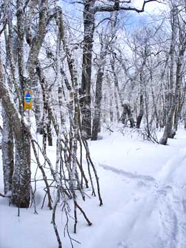 |
On your LEFT, look for two DEC Wild Forest signs. This is the best place to bushwack up to the summit of North Bearpen Mountain. If you look carefully in the picture you can see both signs. The other one is on the very right edge of the picture. From here, you can zig-zag your way up to the summit. As you climb move slightly to the left to come out at the summit. The distance to the top is about 250-300 feet, but with the zig-zagging it will be closer to 450-550' of traveled distance. |
|
 |
This is the actual summit of North Bearpen Mountain. None of the clubs include this peak as a required peak, so the summit is rarely visited. The trees are very dense and traveling can be difficult and slow. |
|
 |
About 50 feet from the summit is a view point that you can see in this picture. Once done, return back to the trail and continue to Bearpen Mountain. |
|
 |
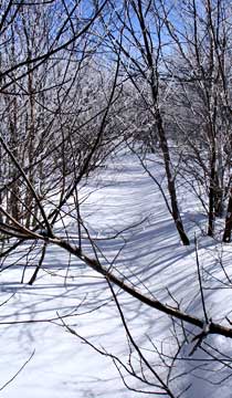
The trail from North Bearpen Mountand and Bearpen Mountain is very flat and straight. Some sections have over a 1,000 feet of flat straight paths. |
|
 |
As you approach Bearpen Mountain, you will come to this field. You can see the summit of bearpen in the near distance. |
|
 |
After this field is a pond. At this pond, you can continue left down the trail, or walk across the pond to another trail. Both will get you to the summit. In our case, we went left going to the summit, and right on the way back. |
|
 |
At this point, we want to leave the trail and go right. On the right you can see the other trail that runs by the pond. You want to climb up this path. It is a little steeper then the rest of the hike. This will bring you to the northwest side of the summit of Bearpen Mountain. There are a number of ledge with great views there. From there we will continue on a trail across the summit. |
|
 |
This is a the path up to the northwest part of the summit of Bearpen Mountain.. |
|
 |
This is the view on your way up to the summit of Bearpen Mountain. If you look at the center of the picture where the ridge is. Your car is parked about half way down the ridge. |
|
 |
Off to the left is a view of Bearpen Roundtop Mountain. Notice the false summit of Roundtop. |
|
 |
Here is the first view point from the top of Bearpen Mountain. |
|
|
About 30 feet away is the second view point from the top of Bearpen Mountain. |
|
 |
This picture was taken from the first view point looking towards the second view point. Notice the hanging ledge rock. |
|
 |
This is the third view point that looks north. It is a little enclosed and limited, but still nice.
The trail from the northwest side to the southeast side is overgrown and needs to be pruned. This is what it looks like. |
 |
|
 |
Part way across the summit is another view point. Again, it is very nice. This is one of the old ski runs. |
|
 |
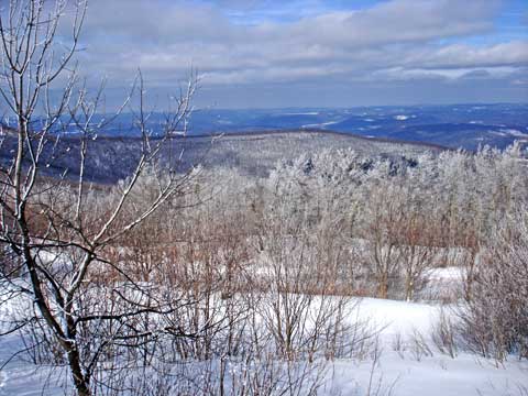
This is the next view point. It is the wides view point. Again, it is another ski run. The trail then moves further east. In the distance you can see Huntersfield Mountain, Ashland Pinnacle, and Richmond Mountain. |
|
 |
This is the same view point, but from a different angle. In the distance you can see the Schoharie Reservoir. |
|
 |
This is the last view point while heading east. Going past this point will cause you go head back down the mountain. |
|
 |
This is the same view point but slightly to the east (right). |
|
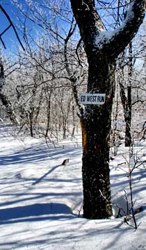 |
This is one of the few signs left marking one of the old ski trails. It was named Ed West Trail. |
|
 |
To get to the highest point in the mountain, you need to head south and slightly west. Most of the top of the mountain is very flat and doesn't change in elevation by more then a couple feet. This is a picture of the top of the mountain. The summit is at GPS: GPS: N42 15.914 W74 28.435. |
|
 |
This is the last view point. It is located on the south east side of the summit. The trees are becoming quite dense. There are loads of prickers, so visiting in the summer would be quite difficult. Off in the distance is Red Kill Ridge. You might also be able to see South Bearpen Mountain.
At this point, you just need to reverse your course back to your car. The path back to your care is pretty much downhill. |
|
|
S E C T I O N S
|
W E A T H E R
|
O T H E R
|
|
Copyright 1994-2024 www.catskillmountaineer.com
ALL RIGHTS RESERVED
|