Roundtop Mountain |
 |
| |
| |
|
OVERVIEW |
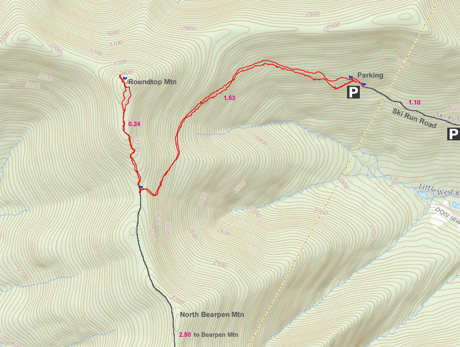
| | Distance: | 3.76 miles round trip from the DEC Parking Lot on Ski Run Road (PA #2) off of Rt 2. |
| | Time: | Average 3.00 hours round trip in the Summer - 3.00 hours round trip in the Winter |
| | Elevation Gain: | 1,011' feet from the DEC Parking Lot to the summit of Roundtop Mountain. |
| | Best Time to Hike: | Anytime. |
| | Difficulty: | Easy |
| | Catskill Highest: | #39 |
| | Peak Elevation: | 3,446' |
| | |
| | | USGS Official Names: | Roundtop (ID: 963038) |
| | USGS Official Elevation: | 3,451' |
| | USGS GPS Roundtop: | 42.293974, -74.490428 (WGS84 - DEC) |
| | USGS GPS Roundtop: | N42 17 38, W74 29 25 (Long/Lat) |
| | USGS GPS Roundtop: | N 42 17.638, W 74 29.426 (GPS) |
| | USGS GPS Roundtop: | 18N 542007 4682542 (UTM) |
| | |
| | | USGS Official Map: | Prattsville Topographical Map (free) |
| | |
| | | DEC Map: | DEC Bearpen Wild Forest Map (free) |
| | |
| | | Digital Mapper: |
Topo
Terrain
Satellite |
| | |
| | | Access Methods: | Foot, ski, mountain bike, snowmobile, and snowshoe (ATV's not allowed) |
|
|
Maps |
 |
|
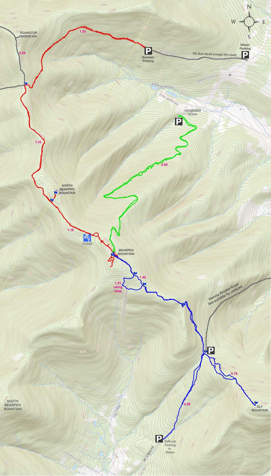
 Public & Private Land Ownership around Bearpen & Vly Mountain
(Greene County Only - Delaware County not available)
Tan=Private Land
Green=DEC Public Land
Lite Blue=DEP NYC Public accessible land
* Land ownership is ONLY shown for Greene County *
|
|
|
|
| | DIRECTIONS TO TRAIL HEAD |
| | GPS Coordinates to DEC Parking Lot: 42.294317, -74.472383 (WGS84 / DEC) |
| | GPS Coordinates to DEC Parking Lot: N42 17 39, W74 28 20 (Long/Lat) |
| | GPS Coordinates to DEC Parking Lot: N 42 17.659, W 74 28.343 (GPS) |
| | GPS Coordinates to DEC Parking Lot: 18N 543494 4682589 (UTM) |
| | DEC Parking Lot: Elevation 2,312 feet
|
| | Take New York State Thruway to Exit 21 (Catskill). |
| | Take a LEFT out of the NYS Thruway toll booths. |
| | Take a RIGHT onto Rt 23 westbound |
| | Go 33.3 miles until the intersection of Rt 23a and Rt 23 |
| | Take RIGHT and continue on Rt 23 for another 1.5 thru Prattsville |
| | After passing thru Prattsville, you will cross over the Schoharie Creek over a Green Bridge |
| | Take LEFT onto Rt 23 as soon as you come off the bridge |
| | Go 2.7 miles on Rt 2 |
| | At the top of the hill there is a dirt unmarked driveway on the RIGHT - This is Ski Run Road. (There is a field with a great view on the left. |
| | Drive 1.1 miles up the dirt road |
| | The road is not plowed in the winter, and there are multiple parking spot along the way if you cannot make it all the way up. Or, you can park at the entrance of Ski Run Road. |
| | The Bearpen Parking Lot on Ski Run Road is on the LEFT side of the road. |
|
|
SPECIAL CIRCUMSTANCES ABOUT THIS HIKE |
| | This hike is located in Delaware County. You start your hike from one of the parking areas on Ski Run Road. The hike up the road is easy and about 1.5 miles long. The hike from the col to the summit is fairly easy. But, this path is rarely traveled anymore. Just past the peak is a nice view point. You can also continue to the next peak to the west. The road to Roundtop Mountain continues to the next peak. You can also go along the ridge. There is a ledge along the ridge. This hike is also one of the easier hikes in the Catskill Mountains.
One of the biggest problems with this hike is getting to the trail head in the Winter. In most cases in the Winter, you will need a good 4wd. But, there are a number of places you can park if you cannot make it all the way up to the trail head. Finding Ski Run Road can be difficult because it is not marked. It looks like someone's driveway. You just need to follow our instructions. In the Summer, you can easily get up to the Trail Head in a 2wd car.
There is NO registration box. This is a wild forest, so you can find snowmobiles running around in the Winter. But, we never see many, and the few we see break the trail for us. Bearpen Wild Forest does get more snow then the rest of the Catskill Mountains.
The road up to the summit is a nice 10% incline that runs pretty steady. The road is wide enough for a truck. While climbing up to the ridge, you can see over the valley as you hike up the road. But, only in the Winter when the leaves are not on the trees. The road follows the mountain side as it climbs up at a steady rate. The road to the ridge is 1.5 miles long. Once you get on top, the terrain is mainly flat. It is one of the very few places in the Catskill Mountains where you can hike or ski on flat terrain for miles. There are a number of side roads, but you want to stay on the main road up to the col.
Once you reach the col, you will find a large opening with numerous roads going off in multiple directions. For this hike, you want to the a RIGHT at the col. This road is rarely traveled, so prickers can be a problem in the summer.
In the beginning the incline is moderate in steepness, but then levels off. You will come to a high point that looks like the summit. But, it is really a false summit. You need to continue further. You are only half way there.
When you approach Roundtop Mountain, the trail will come up on the right side of the summit. The trail will then turn right. You can then walk up the short incline to the summit.
|
|
|
MILEAGE CHART |
| | Mile Point | Altitude | Notes |
| | 0.00 | 2,372 | Parking Area #2 (500' from Parking Area #1) which is commonly used in the Winter - 2 spots. |
| | 0.11 | 2,410 | Parking Area #1 (summer, 2-3 parking spots) |
| | 1.53 | 3,207 | Col at the top of Ski Run Road |
| | 1.77 | 3,446 | Summit of Bearpen Roundtop Mountain. |
| | 1.81 | 3,388 | Views just west of the summit |
| | 1.86 | 3,446 | Summit of Bearpen Roundtop Mountain. |
| | 2.10 | 3,207 | Col at the top of Ski Run Road. |
| | 3.65 | 2,410 | Parking Area #1 (summer, 2-3 parking spots). |
| | 3.76 | 2,372 | Parking Area #2 (500' from Parking Area #1) which is commonly used in the Winter - 2 spots. |
|
|
Hike to Bearpen Roundtop Mountain |
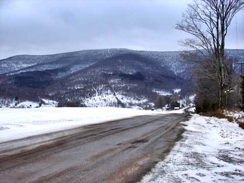 |
Finding Ski Run Road can be quite a challenge. The road is not mark, and it is not paved. It looks like someones primative driveway. The picture on the right was taken from the road entrance. It is just over the top of the hill on Rt 2. The mountain in the distance is Bearpen Mountain. |
|
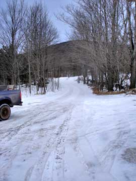 |
The picture left shows what the road entrance looks like. There is NO sign telling you that it is Ski Run Road. You really need VO Maps to help you figure it out. The road is a rough dirt road. It can be done with a 2wd car in the summer. In the winter you need a 4wd. The road is NOT plowed in the Winter. There is only one lane. There are a number of parking spots along the road.
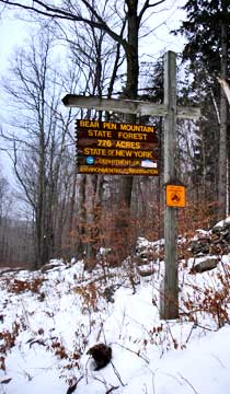
You will travel 1.1 miles up the road to the parking area #1. In the Winter most people park on the side of the road 1.0 miles at parking area #2. People with snowmobile trailers need to park next to Rt 2. There is NO place to turn around the trailer. This sign is about 1/2 way up the road. You need to keep driving past the sign to reach the furthest parking area. |
 |
|
 |
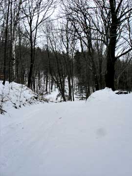
This is parking area #2, which is commonly used in the Winter. If you look down the road and up the hill is Parking Area #1. The difference in distance is about 500 feet..
This picture is taken from parking area #1 looking backwards towards parking area #2. |
 |
|
 |
This is parking area #1. It can park about 3 cars. There is a road that goes downhill from this parking area. There is a yellow sign at this point in the road telling you that you cannot drive a motorized vehicle past this point, except for snowmobiles on snow. |
|
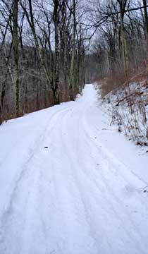 |
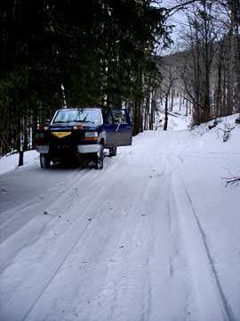
This is what the road looks like all the way up the road. The incline is fairly steady. There are a number of side roads, but you want to keep going up the main road. The road will wrap around the mountain side, and continue to steadily climb up to the col.
|
|
 |
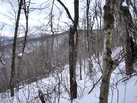
Almost the entire trip, you will have views like this one. You will only see views when the leaves are not on the trees. |
|
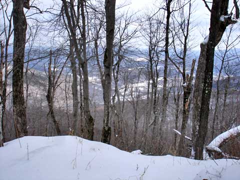 |
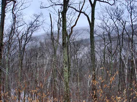
When get very close to the top of the col, you will have this view, which looks over the valley below. |
|
 |
This picture is taken right next to the picture above. In the center of the picture is North Bearpen Mountain. To the left is Bearpen Mountain. On the very left edge is Vly Mountain. |
|
 |
After the vantage point in the previous pictures, you will go thru a reverse S turn to get to the col. There is a side trail, but you need to avoid it. |
|
 |
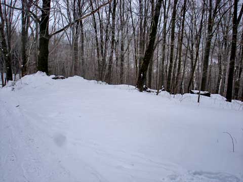
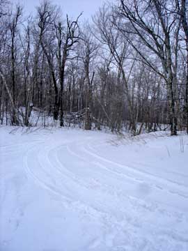
This is the major trail intersection at the col. When you get to the very top of the col, you want to take a RIGHT, and start heading up the hill. This picture is taken while looking backwards towards the Col. |
|
 |
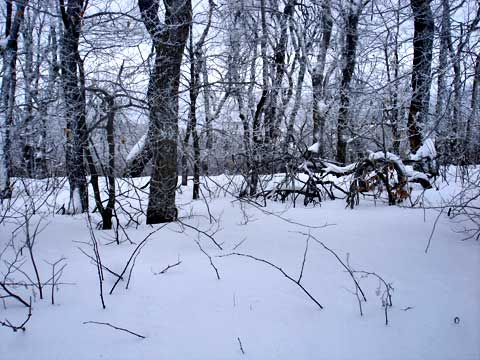
This picture is taken part way up the trail to Bearpen Mountain (in the opposite direction from the col). It shows how Roundtop got it's name. It is very round.
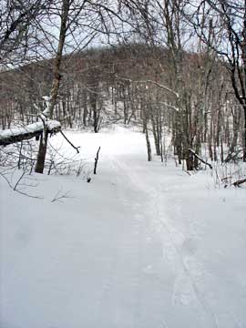
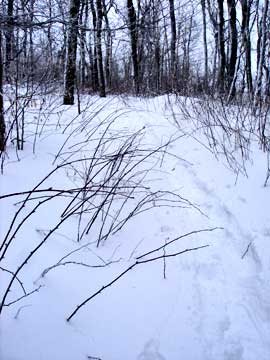
In the beginning of the trail, you will have a moderate incline with lots of prickers. In the summer they can be quite a challenge. |
 |
|
 |
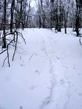
The beginning of this short trail is the steepest part of the hike. Nothing terrible, except for the prickers.
This is a typical picture of the trail to Bearpen Mountain. |
|
 |
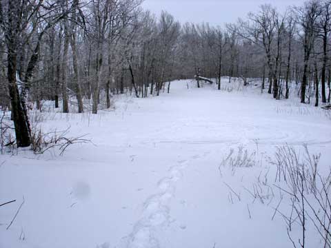
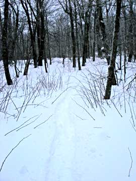
When you get to this point, you might think that you are at the summit of Roundtop Mountain. But, this is a FALSE summit! You need to continue past this point. You are only half way to the summit. |
|
 |
The trail from here is pretty flat with a very slight incline. As you approach the summit, you will have a small climb in elevation. No ledges or difficult sections to the summit. |
|
|
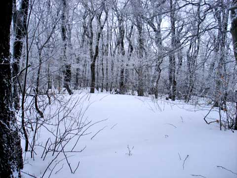
This is the summit of Bearpen Roundtop Mountain. It is actually a small section, so finding the summit is fairly easy. |
|
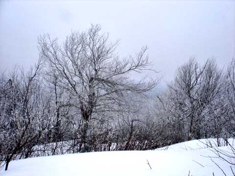 |
If you walk past the summit, there is a nice view point. Unfortunately, the day we went the view as blocked by clouds. If you visit Roundtop, make sure you continue past the summit for this nice view point. |
|
|
S E C T I O N S
|
W E A T H E R
|
O T H E R
|
|
Copyright 1994-2024 www.catskillmountaineer.com
ALL RIGHTS RESERVED
|