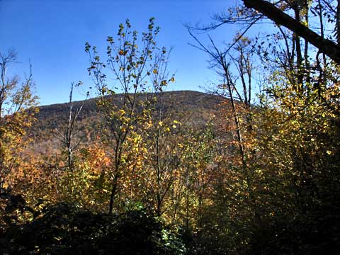
Vly and Bearpen Mountain from Rt 3 South |
 |
| |
| |
|
OVERVIEW |
| | Distance: | 6.51 miles round trip from the South side of Rt 3 from Fleischmanns. |
| | Time: | >Average 4.00 hours round trip in the Summer - 4.50 hours round trip in the Winter |
| | Elevation Gain: | 1,253' feet to Vly and another 756' to bearpen mountain. |
| | Best Time to Hike: | Anytime. |
| | Difficulty: | Difficult for Vly and Easy for Bearpen |
| | Peak Elevation: | 3,529' for Vly and 3,603' for Bearpen |
| | Catskill Highest: | #32 for Vly and #27 for Bearpen |
| |
| | USGS Official Names: | Bearpen Mountain (ID: 943334) |
| | USGS Official Elevation: | *See notes below |
| | USGS Official GPS: | *See notes below |
| | Elevation Bearpen: | 3,612' |
| | GPS Bearpen: | 42.265233, -74.473917 (WGS84 - DEC) |
| | GPS Bearpen: | N42 15 54, W74 28 26 (Long/Lat) |
| | GPS Bearpen: | N42 15.914, W74 28.435 (GPS) |
| | GPS Bearpen: | 18N 543388 4679359 (UTM) |
| | USGS Official Map: | Prattsville Topographical Map (free) |
| | |
| | | |
| | | USGS Official Names: | Vly Mountain (ID: 968592) |
| | USGS Official Elevation: | 3,530' |
| | USGS Official GPS Vly: | 42.2453645, -74.4459834 |
| | GPS Vly: | N42 14 43, W74 26 45 (Long/Lat) |
| | GPS Vly: | N 42 14.722, W 74 26.759 (GPS) |
| | GPS Vly: | 18N 545706 4677168 (UTM) |
| | USGS Official Map: | Westkill Topographical Map (free) |
| | |
| | | |
| | | DEC Map: | DEC Bearpen Wild Forest Map (free) |
| | |
| | | Digital Mapper for Bearpen Mtn: |
Topo
Terrain
Satellite |
| | |
| | | Digital Mapper for Vly Mtn: |
Topo
Terrain
Satellite |
| | |
| | | |
| | | Access Methods: | Foot, ski, snowmobile, snowshoe |
| | |
| | USGS Elevation Note: The 1903 USGS map incorrectly showed Bearpen Mountain where North Bearpen Mountain is located. This also resulted in a lawsuit between New York State and the major landowner. The official elevation and gps location of Bearpen Mountain has never been officially resolved with USGS. Some of the newer USGS digital maps now show the summit of Bearpen Mountain moved back to North Bearpen Mountain. |
|
|
Maps |
 |
|
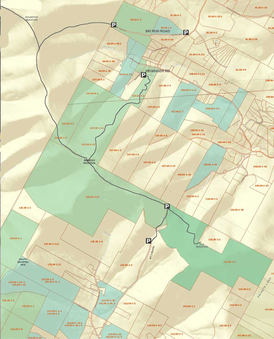 Public & Private Land Ownership around Bearpen & Vly Mountain
(Greene County Only - Delaware County not available)
Tan=Private Land
Green=DEC Public Land
Lite Blue=DEP NYC Public accessible land
* Land ownership is ONLY shown for Greene County *
|
|
|
|
|
| | DIRECTIONS TO TRAIL HEAD |
| | GPS Coordinates to DEC Parking Lot: 42.2414, -74.464933 (WGS84 / DEC) |
| | GPS Coordinates to DEC Parking Lot: N42 14 29, W74 27 53 (Long/Lat) |
| | GPS Coordinates to DEC Parking Lot: N 42 14.484, W 74 27.896 (GPS) |
| | GPS Coordinates to DEC Parking Lot: 18N 544145 4676718 (UTM) |
| | Parking Elevation is approximately 2,275 feet |
| | Take New York State Thruway to Exit 19 (Kingston). |
| | Take a right out of the NYS Thruway toll booths onto Rt 28. |
| | Go approximately 31.7 miles west on Rt 28 |
| | Take a RIGHT into Fleischmanns near bottom of hill. |
| | Go approximately 1/4 mile. |
| | Take a RIGHT onto Lake Street (by Citgo gas station). |
| | Go appoximately 4 miles - Stay LEFT at Y on Rt 3. |
| | Go approximately 3 miles - Stay RIGHT at Johnson Hollow Road. |
| | The asphalt road will end in about 1 mile and turn into a dirt road. Stop here. |
| | Continue past one of the land owners personal signs that states that the public road is a private road. |
| | Park on the RIGHT side of the road - Do not park in the snowplow turnaround in the Winter. |
|
|
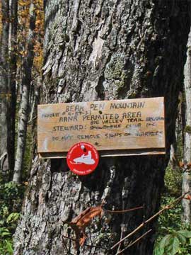
SPECIAL CIRCUMSTANCES ABOUT THIS HIKE |
| | This hike is located on the very western edge of Greene County. The hike is outside of the blue line of the Catskill Mountain Park. This is a quick way to the top of vly and bearpen mountain. There are quite a few view points, and the views from Vearpen mountain are spectacular. Vly Mountain does not have views. This hike is also one of the easier hikes in the Catskill Mountains. There are numerous trails to the summit of Bearpen Mountain. Bearpen Mountain used to be a downhill ski center. Vly Mountain is a bushwhack hike. There is a herd path to the summit. The herd path can be difficult to follow during certain times of the year. Other times it is easy to follow.
This is the shortest way to the top of vly and bearpen mountain. The road from Rt 3 from Fleischmanns is the favored route by those who want the shortest hike to the top.
There is NO registration box. This is a wild forest, so you can find snowmobiles running around in the Winter. But, we never see many, and the few we see break the trail for us. Bearpen Wild Forest does get more snow then the rest of the Catskill Mountains.
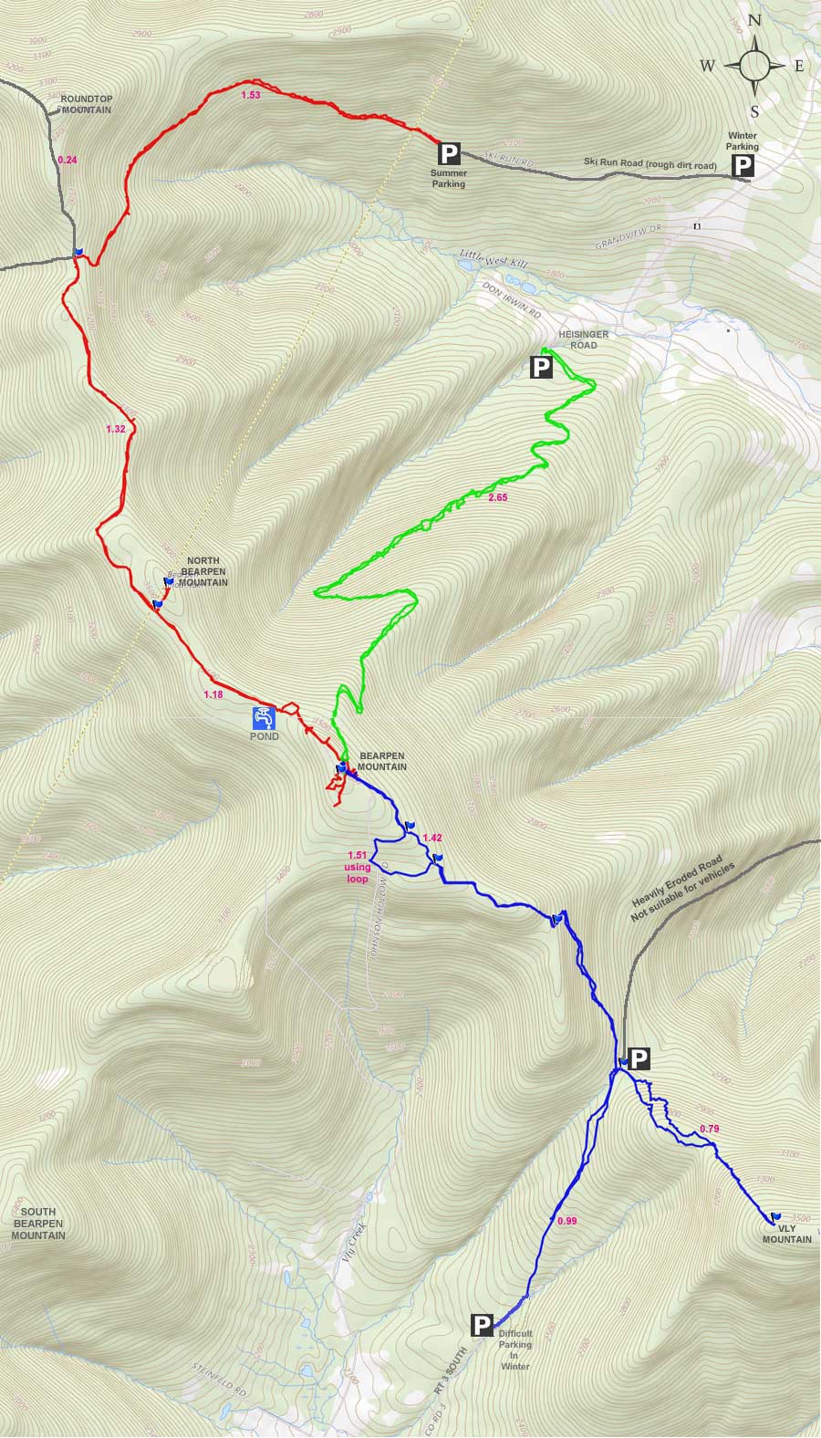
Vly Mountain can be climbed from three common routes. The first route is from Rt 3 from Fleischmanns. This route is the shortest and easist route to the top of Vly Mountain. It is about 1.78 miles to the top. Most people use this route. The difficult part of this route is the parking. You cannot park in the snowplow turnaround, but you can park on the shoulder of the road on the other side of the mountain.
The second route to Vly Mountain is from Rt 3 on the north side of the mountain range. This route is rarely used. It is longer route. Few people do use this route.
The third route is from Bearpen Mountain. In October of 2010, they put in a new snowmobile trail, which makes the hike much easter. You can access Bearpen Mountain from Ski Run Road or from Heisinger Road. Heisinger Road is easy because the parking is next to DEC land. The road to the top is nice. But, it is a longer route. The route from Ski Run Road is by far the longest route.
The road up to the summit is a nice easy incline that runs pretty steady. It is about 1 mile long. When you get to the summit, there is a Hunter's Cabin. The road is wide enough for a truck, and can be used by the public. Once at the pass, you will find the herd path on the right side of the road. It is just past the DEC Wild Forest sign. The climb up to Vly Mountain is moderate or difficult in ability. Nothing terrible. It is easy to fall off the trail, so you do have to be careful certain times of the year. Other times of the year, the path is quite well defined and easy to follow. About 3/4 of the way up the mountain there is a limited view. Once on top there is no view. Once you are done, hike back down to Rt 3 to the pass by the Hunter's Cabin.
Now, walk past the front porch of the Hunter's Cabin. This trail will lead you to Bearpen Mountain. At the trail junction, take a LEFT. Climb uphill along the steeper trail. You will come to a switchback. About 250' past the switchback is a new (2010) snowmobile trail. It is marked with NYS DEC snowmobile trail marker. You can follow this trail for about a 1/2 mile. After a 1/2 mile, there is a faint herd trail on the right. You can take this herd trail for a short cut. Or, you can follow the snowmobile trail to the end. It will come to another snowmobile trail. You then will take a LEFT. You will come to the summit of Bearpen Mountain. Once you are done you can reverse your course back to your car.
There are numerous great views from the summit of vly and bearpen mountain. Take the time to find most of them. Most of the views are spectacular. This mountain is a loved by snowshoers and cross-crountry skiers for good hiking and great views. Some find it quite magical.
|
|
|
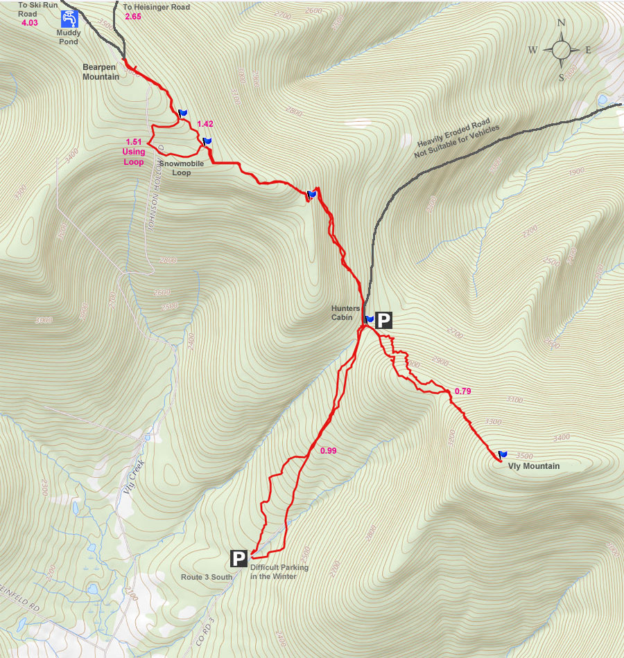
MILEAGE CHART |
| | Mile Point | Altitude | Notes |
| | 0.00 | 2,275 | Parking near the snowplow turn around on the south side of Rt 3. |
| | 0.99 | 2,816 | Pass on Rt 3 by Hunter's Cabin. |
| | 1.78 | 3,530 | Summit of vly mountain . |
| | 2.60 | 2,816 | Pass on Rt 3 by Hunter's Cabin - take trail past porch of Hunters Cabin). |
| | 2.74 | 2,885 | Trail Junction - Go LEFT up the hill. |
| | 3.13 | 3,161 | Switchback. |
| | 3.18 | 3,221 | Beginning of new NYS Snowmobile Trail. |
| | 3.67 | 3,419 | Take faint herd trail on RIGHT side of trail. |
| | 3.81 | 3,499 | End of faint herd trail - Take RIGHT on old Snowmobile Trail. |
| | 4.11 | 3,598 | Summit of Bearpen Mountain. (GPS: N42 15.914 W74 28.435) |
| | 6.52 | 2,275 | Parking near the snowplow turn around on the south side of Rt 3. |
|
|
|
Hike to Vly Mountain and Bearpen Mountain |
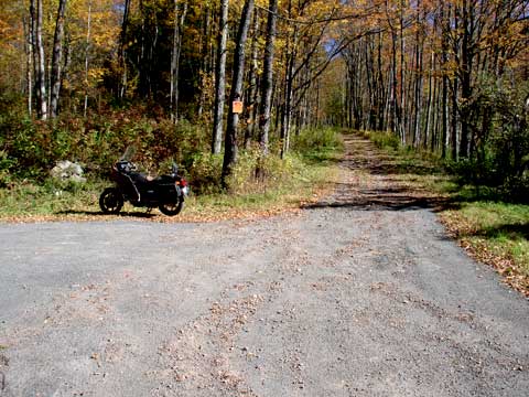 |
The image on the left is the end of the maintained Rt 3. This is where you will park. Exactly where you park is tricky. The best place to park is on the RIGHT shoulder of the road. You cannot park in the snow plow turnaround. There are No Parking signs in the Snow Plow Turnaround. Some people park in the turnaround in the summer, and they have not had a problem. You should also note that there is a driveway entrance on the southwest side of the turnaround. Do not block this driveway. One of the local landowners doesn't like people parking and hiking from this spot, and has put up private road signs in the past. |
|
 |
The image on the right is is the road going up to the pass. This is still Rt 3. But it is on unpaved and unmaintained section. While the county no longer maintains Rt 3 over the mountain range, they DO retain Right-away legal rights to the road. Officially, the road still belongs to the county. The road is not maintain, nor is it plowed in the Winter. On the way up the south side, the land on both sides of the road is privately owned. Do NOT leave the road. There is also a house up on the pass. From time-to-time you will see a truck drive up the road and over the pass. Legally, you could do the same. Once you get to the top of the pass, the land on the north side of the mountain range is New York State land. There is a place to park just below the pass on the North side. We don't recommend that you drive and park up there. |
|
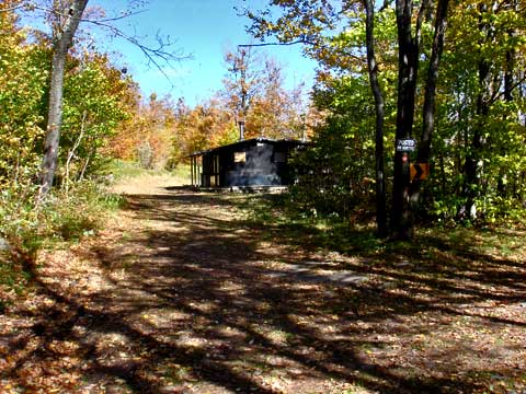 |
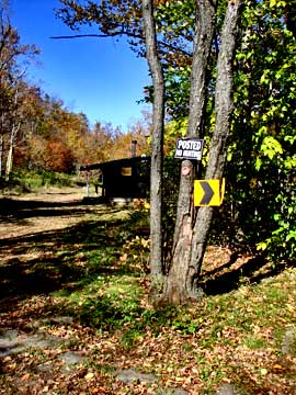
The image of the left is the Hunter's Cabin on the Pass in between Vly Mountain and Bearpen Mountain. If you go LEFT in front of the Hunter's Cabin, you will follow the NYS Snowmobile Trail to the top of Bearpen Mountain. If you continue straight on Rt 3, it will take you down the mountain range to Lexington or Prattsville. To hike to Vly Mountain, we want to continue about 50 feet past this point to find the unofficial trail to Vly Mountain. |
|
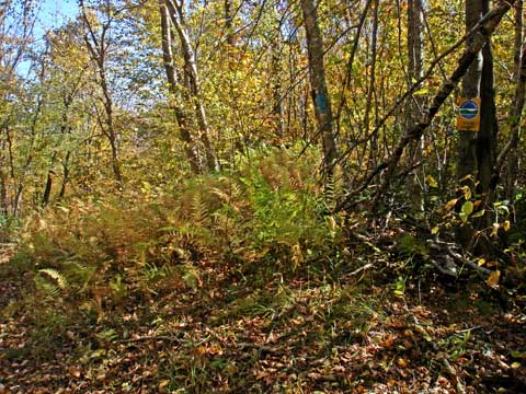 |
On the very north side of the pass between Vly and Bearpen mountain is where the State Wild Forest starts on the RIGHT side of the road. This is also where the unofficial trail to Vly Mountain starts. If you look carefully at the image you will see a blue paint mark on one of the trees. This blue mark is to mark the trail to Vly Mountain. The trail actually starts about 10-15' north of the NYS Wild Forest sign. |
|
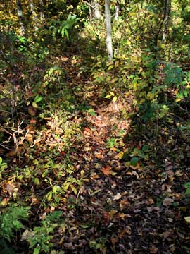 |
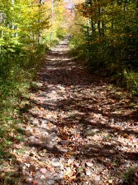
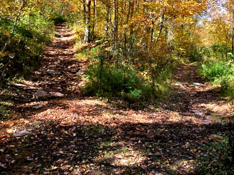
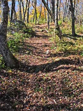
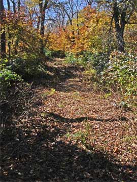
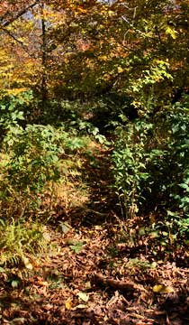
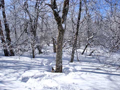
The image on the left shows the beginning of the unofficial trail to Vly Mountain. In the Summer and Winter the trail is obvious. But, in the Fall and Spring, the trail is much harder to follow. This is mainly due to the leaves covering the trail. During the Fall and Spring it is quite easy to walk off the trail. In our trip, we intentionally bushwhacked off the trail.
The image on the right is another picture of the trail in the Fall. |
 |
|
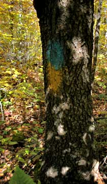 |
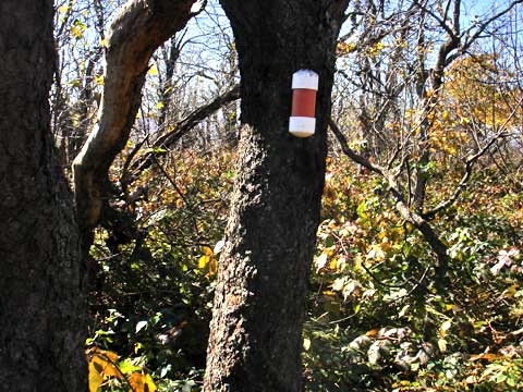
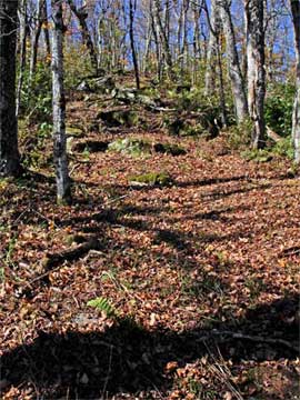
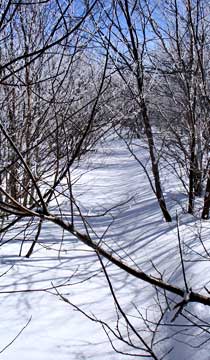
You will see blue paint on the trees as you follow the trail up to Vly Mountain. Sometimes you will also see yellow paint. But, most of the time, you will see blue paint.
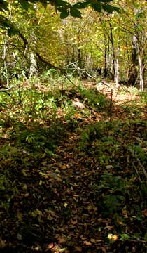
The image on the rifht shows another picture of the trail to the top of Vly Mountain. |
 |
|
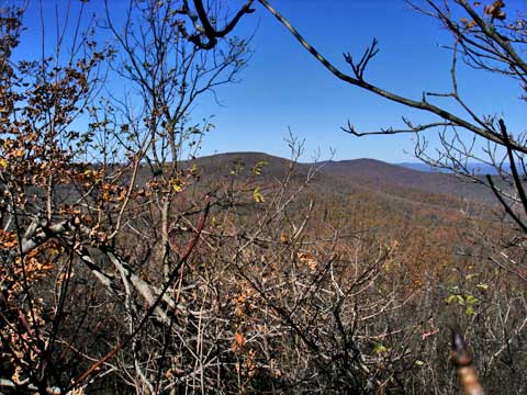 |
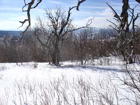
When you get about 3/4 of the way up Vly Mountain, you might be able to get a view of Bearpen Mountain. This view is only possible when the leaves are not on the trees. You never get a full view, but it is still worth seeing. |
|
 |
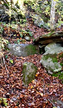
Once you get to the top of the mountain, the land will level off. You do need to follow the trail all the way to the end. At the end of the trail, you will find the Cannister. The highest point is actually just past the cannister. Once you get done, hike back down the same path you used to hike up to the top of Vly Mountain. |
|
 |
To get to Bearpen Mountain, we will take the NYS snowmobile trail. The snowmobile trail runs past the front porch of the Hunters cabin. |
|
 |
When you travel 0.14 miles past the Hunter's Cabin, you will come to an intersection. You want to take a LEFT and go up the hill. When you get to the switchback, there is a NYS Snowmobile trail 250' past the switchback on the RIGHT. |
|
 |
After 250' past the switchback, you will enter the new NYS Snowmobile Trail.
The trail is about 10' wide and starts out at a slight incline. |
 |
|
 |
Shortly after starting up the NYS Snowmobile Trail, you will come to a rocky moderate incline. Not so good for snowmobiles, but pretty good for hiking.
Once you get to the top, the trail becomes quite level. It does have an incline, but it is very mild. |
 |
|
 |
At about 1/2 mile up the NYS Snowmobile Trail, there will be a faint herd trail on the RIGHT. You can take this faint herd trail. This will save you 3/10 of a mile. |
|
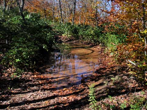 |
The old snowmobile trail is becoming rutted from the ATV's in the summer. It is not uncommon to have large water puddles. |
|
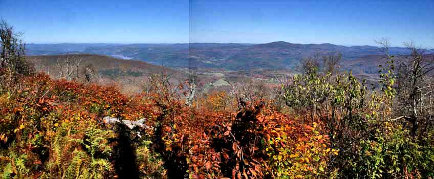 |
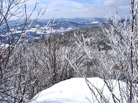
This is one of the views on the northeast side of Bearpen Mountain |
|
 |
Here is another picture from one of the ski slopes. If you look in the picture you can see Schoharie Reservoir. |
|
 |
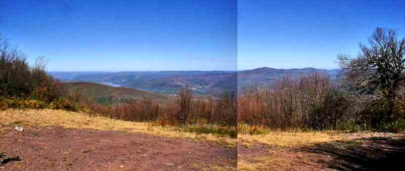
The summit is close to the previous picture. The top of vly and bearpen mountain is very flat, and finding the exact summit is a little difficult. Most of the top of the mountain is very flat and doesn't change in elevation by more then a couple feet. This is a picture of the top of the mountain. The summit is at GPS: N42 15.914 W74 28.435. From here there are a number of great view points on the summit of vly and bearpen mountain. They are listed below: |
|
 |
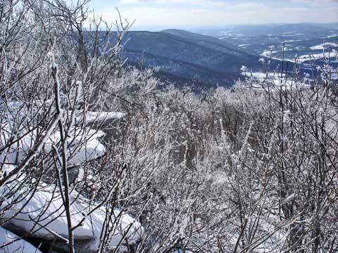
This is another view point that is rarely visited. It is located on the south east side of the summit. The trees are becoming quite dense. There are loads of prickers, so visiting in the summer would be quite difficult. Off in the distance is Red Kill Ridge. |
|
 |
There is an overgrown trail from the eastern side to the western side. On the western side, there are a number of great views. You can also walk down the trail and skirt around the summit and then walk up the hill to the western summit. |
|
 |
Here is a view point from the northwest side of bearpen mountain. |
|
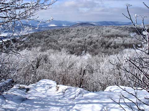 |
Here is a view point from the northwest side of bearpen mountain. |
|
 |
Here is a view point from the northwest side of bearpen mountain.
After you get done, return back to your car. |
|
|
S E C T I O N S
|
W E A T H E R
|
O T H E R
|
|
Copyright 1994-2024 www.catskillmountaineer.com
ALL RIGHTS RESERVED
|