Catskill Mountaineer

Hike the Dry Brook Ridge Trail

Dry Brook Ridge Trail
View of the Huckleberry Valley from the Dry Brook Ridge Trail


OVERVIEW

  Trail Name:  Dry Brook Ridge Trail (From Balsam Lake Mtn PA to Margaretville, NY)
   
  Forest: Balsam Lake Mountain Wild Forest (South)
  Forest: Dry Brook Ridge Trail Wild Forest (North)
  Parking Area : 30 spaces directly off Beaver Kill Road
  Winter Access: Hardenburgh Parking Area (1.8 miles away from Dry Brook Ridge Trail Parking Area)
  Camp sites: NO Camp Site locations
  Lean-to sites: Two Lean-to (Dry Brook Lean-to & Pakatakan Lean-to)
  Access: Hike or snowshoe
   
  Trail Length: 13.74 miles (traverse)
  Trail Type: 68% Single-Track Trails - 38% Double-Track Trails
  Hiking Time: Average 2-3 days
  Lowest Elevation: 1,412' (A)
  Highest Elevation: 3,470' (A)
  Views : Four view spot
  Difficulty: Moderate
   
  USGS Map: USGS Seager Quad Maps
   
  USGS Map: USGS Fleischmanns Quad Maps
   
  USGS Map: USGS Margaretville Quad Maps
   
  DEC Trail Map: DEC Dry Brook Ridge Trail Wild Forest Map (free)
   
  Digital Mapper: Topo      Terrain      Satellite

Maps for the Dry Brook Ridge Trail

Map of the Dry Brook Ridge Trail
   Dry Brook Ridge Trail - Section #1 - 1.87 miles - Balsam Lake PA Trailhead to Upper BLM Trail
   Dry Brook Ridge Trail - Section #2 - 2.15 miles - Upper BLM Trail to Dry Brook PA
   Dry Brook Ridge Trail - Section #3 - 3.47 miles - Dry Brook PA to South Huckleberry TJ
   Dry Brook Ridge Trail - Section #4 - 2.53 miles - South Huckleberry TJ to North Huckleberry TJ
   Dry Brook Ridge Trail - Section #5 - 0.96 miles - North Huckleberry TJ to German Hollow TJ
   Dry Brook Ridge Trail - Section #6 - 2.76 miles - German Hollow TJ to South Side Road Trailhead

Map of the Dry Brook Ridge Trail

Map of the Dry Brook Ridge Trail


Notes About Hiking to the Dry Brook Ridge Trail

 TRAIL
  Water sources are the biggest problem on this particular hike. While the trail can be muddy at certain points, a good water source for drinking water is a significant problem. Most hikers start at the Balsam Lake Mountain Parking Area instead of on the side of the road in Margaretville.

The section of Dry Brook Ridge Trail from the (upper trail) Fire Tower to the Dry Brook Ridge Trail goes across private property. There is also a small section of the trail after the Dry Brook Parking Area that is also on private property. Please stay on the trail while you hike in this section of the Dry Brook Ridge Trail.

Some people like to take the option of visiting the Fire Tower at the beginning of the hike. It also provides the benefit of obtaining water. It adds 0.67 miles to the hike. Many people really like the Fire Tower, and it can become quite crowded on summer weekends.

In the Winter months, the section between View Point #1 and View Point #2 would be dangerous due to ledge exposure. The most dangerous section could be avoided by hiking higher up on the ridge.

 WATER SOURCES
  One of your major concerns for this hike should be having enough water. There are very few places to obtain water on the Dry Brook Ridge Trail. So BEWARE and plan carefully! Here a few options:

1. Bring water with you to the Balsam Lake Mountain Trailhead.

2. Take the Balsam Lake Mountain Trail. Spring is about 1-1/2 miles from the Balsam Lake Trailhead. Disadvantage is that the trail is steep, and it adds 0.67 miles to your hike. Advantage is that you get to visit the Balsam Lake Mountain Fire Tower, which has nice views.

3. Stay at the Mill Brook Lean-to instead of the Dry Brook Lean-to. Advantage is that it has water. Disadvantage is that it adds 2 miles to your overall hike. the other option is to hike the 3/4 of a mile west on Mill Brook Road to obtain water at the trailhead to Mill Brook Lean-to.

4. Many people believe that they can obtain water at the Dry Brook Lean-to because a stream is close to the Lean-to. The stream is on private property, and the owner has security cameras and No Trespassing signs. You CANNOT get water at the Dry Brook Lean-to.

5. Shortly after the passing the Dry Brook Parking Area, there is a small stream that runs across the second section of the Dry Brook Ridge Trail. It can be dry in the summer months. So beware!

6. The next place you can get water is 7-8 miles away and 2.5 miles before the end of the hike. The water source is off the Dry Brook Ridge Trail on the German Hollow Trail.

 PARKING
  There are a number of parking strategies you can employee for this hike. As a general rule, this hike requires that you have two cars. Parking at Balsam Lake Mountain Parking Area is required for one of your cars to start the hike.

The problem is parking on the side of South Side Road in Margaretville, NY. Some people do not like to leave their car on the side of the road overnight.

Option #1: To get around this problem, some people will park their second car at the Dry Brook Parking Area and stay overnight at the Mill Brook Lean-to. The next morning they will retrieve their car from the Balsam Lake Mountain Parking Area and place it at the South Side Road to be retrieved later in the day.

Option #2: They will park their second car at one of the two the DEC Parking Area on Huckleberry Brook Road, or at the parking area on Hill Road. This option would require that they modify their hike. After they have visited the three view points on Dry Brook Ridge, they would exit the Dry Brook Ridge Trail about a mile after the third view point, and descend down the north side of the Huckleberry Loop Trail.

Option #3: Park your second car across the Delaware River in Margaretville, NY. The Margaretville Municipal Parking Area holds 100 cars and allows overnight parking. It is 1/3 of a mile from the Trailhead via the Margaretville Village Trail. See maps above. Picture near the bottom of the page.

 OTHER INFORMATION
  There is NO cell phone service as of 2023 at the Balsam Lake Mountain Parking Area. You may get reception at higher elevations, or further into the hike.


DIRECTIONS to the Margaretville Municipal Parking Area from Exit 19 (Kingston)

 
  • Margaretville Municipal Parking Area - WGS84 (DEC): 42.147683, -74.64835 - Elevation is about 1,345 feet
  •  
  • Margaretville Municipal Parking Area - Deg/Min/Sec: N42 08 51, W74 38 54 - Elevation is about 1,345 feet
  •  
  • Margaretville Municipal Parking Area - GPS: N 42 08.861, W 74 38.901 - Elevation is about 1,345 feet
  •  
  • Margaretville Municipal Parking Area - UTM: 18N 529055 4666233 - Elevation is about 1,345 feet

  •  
     
  • Get off New York State Thruway at Exit 19 (Kingston).
  •  
  • Take a RIGHT out of the NYS Thruway onto Route 28 West.
  •  
  • Go approximately 43.1 miles on Rt 28 West
  •  
  • Take a RIGHT onto Bridge Street
  •  
  • Go approximately 350 feet on Bridge Street
  •  
  • Take a LEFT into parking area (70 Bridge Street)
  •  
  • Drive 250 feet to back parking lot (Margaretville Municipal parking area - 746 Main Street)
  •  


    DIRECTIONS to the South Side Road in Margaretville, NY from Exit 19 (Kingston)

     
  • South Side Road parking area - WGS84 (DEC): 42.144733 -74.649417 - Elevation is approximately 1,415 feet
  •  
  • South Side Road Parking Area - Deg/Min/Sec: N42 08 41 W74 38 57 - Elevation is approximately 1,415 feet
  •  
  • South Side Road Parking Area - N 42 08.684 W 74 38.965 - Elevation is approximately 1,415 feet
  •  
  • South Side Road Parking Area - UTM: 18N 528969 4665905 - Elevation is approximately 1,415 feet

  •  
     
  • Get off New York State Thruway at Exit 19 (Kingston).
  •  
  • Take a RIGHT out of the NYS Thruway onto Route 28 West.
  •  
  • Go approximately 43.5 miles on Rt 28 West
  •  
  • Take a LEFT onto Fair Street
  •  
  • Go approximately 0.4 miles on Fair Street (to end of road)
  •  
  • Take a LEFT onto South Side Road
  •  
  • Go approximately 0.3 miles on South Side Road (Trailhead on right - Parking on left side of road)
  •  


    DIRECTIONS from Margaretville to Balsam Lake

     
  • Balsam Lake Mountain Parking Area - WGS84 (DEC): 42.147683, -74.64835 - Elevation is about 2,588 feet
  •  
  • Balsam Lake Mountain Parking Area - Deg/Min/Sec: N42 08 51, W74 38 54 - Elevation is about 2,588 feet
  •  
  • Balsam Lake Mountain Parking Area - GPS: N 42 08.861, W 74 38.901 - Elevation is about 2,588 feet
  •  
  • Balsam Lake Mountain Parking Area - UTM: 18N 529055 4666233 - Elevation is about 2,588 feet

  •  
     
  • Starting from Road Junction of Rt 28 and Bridge Street in Margaretville, NY
  •  
  • Go approximately 0.4 miles on Rt 28 West
  •  
  • Take a LEFT onto Fair Street
  •  
  • Go approximately 0.2 miles on Fair Street
  •  
  • Take a RIGHT onto South Side Road
  •  
  • Go approximately 5.6 miles on South Side Road (turns into BWS Road No 10)
  •  
  • Take a LEFT onto Millbrook Road
  •  
  • Go approximately 1.4 miles on Millbrook Road
  •  
  • Take a RIGHT onto "Cross Mountain Road" (DO NOT take "Old Cross Mtn Road")
  •  
  • Go approximately 4.3 miles on Cross Mountain Road (dirt road)
  •  
  • Cross Mountain Road (dirt) will turn into Adler Creek Road (paved)
  •  
  • Go approximately 2.2 miles on Adler Creek Road (paved)
  •  
  • Take a LEFT onto "Beaver Kill Road" (No street sign - bridge on right)
  •  
  • Go approximately 8.1 miles on Beaver Kill Road (paved then dirt)
  •  
  • DEC Parking Area is at the end of Beaver Kill Road (on the RIGHT side of the road).
  •  
  • NOTE #1: The Beaver Kill Road is closed 1.88 miles before the Balsam Lake to Alder Lake Traverse Parking Area during the Winter months. In the Winter park at the Hardenburgh Parking Area, which is located 1.88 miles from the BLM PA.
  •  
  • NOTE #2: Cross Mountain Road may be closed during the Winter months. Use an alternate route, like Barkaboom Road (further down BWS Road #10).
  •  


    DIRECTIONS to BALSAM LAKE MTN Parking Area from Exit 18 (New Paltz)

     
  • Balsam Lake Mtn Parking Area WGS84 (DEC): 42.0238, -74.60005 - Elevation is about 2,588 feet
  •  
  • Balsam Lake Mtn Parking Area Deg/Min/Sec: N42 01 25, W74 36 00 - Elevation is about 2,588 feet
  •  
  • Balsam Lake Mtn Parking Area GPS: N 42 01.428, W 74 36.003 - Elevation is about 2,588 feet
  •  
  • Balsam Lake Mtn Parking Area UTM: 18N 533111 4652496 - Elevation is about 2,588 feet

  •  
     
  • Get off New York State Thruway at Exit 18 (New Paltz).
  •  
  • Take a LEFT out of the NYS Thruway onto Route 299 West.
  •  
  • Go approximately 7.3 miles on Rt 299 West
  •  
  • Take a RIGHT onto Rt 44
  •  
  • Go approximately 10.3 miles on Rt 44
  •  
  • Take a LEFT onto Rt 209 in Kerhonkson
  •  
  • Go approximately 5.8 miles on Rt 209
  •  
  • Take a RIGHT onto Rt 52
  •  
  • Go approximately 19 miles on Rt 52
  •  
  • Take a RIGHT onto Rt 17
  •  
  • Go approximately 10 miles on Rt 17
  •  
  • Take a RIGHT on Debruce Road after getting off Rt 17
  •  
  • Go approximately 0.4 miles on Debruce Road
  •  
  • Take a RIGHT onto Old Rt 17
  •  
  • Go approximately 1.3 miles on Old Rt 17
  •  
  • Take a RIGHT onto Beaver Kill Road (Rt 151)
  •  
  • Go approximately 20.4 miles on Beaver Kill Road
  •  
  • DEC Parking Area is at the end of Beaver Kill Road (on the RIGHT side of the road).
  •  
  • NOTE: The Beaver Kill Road is closed 1.88 miles before the Dry Brook Ridge Trail Parking Area during the Winter months. In the Winter park at the Hardenburgh Parking Area, which is located 1.88 miles from the BLM PA.

  •  

    DIRECTIONS to BALSAM LAKE MTN Parking Area from Exit 19 (Kingston)

     
  • Balsam Lake Mtn Parking Area WGS84 (DEC): 42.0238, -74.60005 - Elevation is about 2,588 feet
  •  
  • Balsam Lake Mtn Parking Area Deg/Min/Sec: N42 01 25, W74 36 00 - Elevation is about 2,588 feet
  •  
  • Balsam Lake Mtn Parking Area GPS: N 42 01.428, W 74 36.003 - Elevation is about 2,588 feet
  •  
  • Balsam Lake Mtn Parking Area UTM: 18N 533111 4652496 - Elevation is about 2,588 feet

  •  
     
  • Get off New York State Thruway at Exit 19 (Kingston).
  •  
  • Take a RIGHT out of the NYS Thruway onto Route 28 West.
  •  
  • Go approximately 45.4 miles on Rt 28 West
  •  
  • Take a LEFT onto Spur to BWS Road No 10
    (Look for Brown hiking signs for Huckleberry Loop & Kelly Hollow)
  •  
  • Take a RIGHT onto BWS Road No 10
  •  
  • Go approximately 3.75 on BWS Road No 10
  •  
  • Take a LEFT onto Millbrook Road
  •  
  • Go approximately 1.4 miles on Millbrook Road
  •  
  • Take a RIGHT onto "Cross Mountain Road" (DO NOT take "Old Cross Mtn Road")
  •  
  • Go approximately 4.3 miles on Cross Mountain Road (dirt road)
  •  
  • Cross Mountain Road (dirt) will turn into Adler Creek Road (paved)
  •  
  • Go approximately 2.2 miles on Adler Creek Road (paved)
  •  
  • Take a LEFT onto "Beaver Kill Road" (No street sign - bridge on right)
  •  
  • Go approximately 8.1 miles on Beaver Kill Road (paved then dirt)
  •  
  • DEC Parking Area is at the end of Beaver Kill Road (on the RIGHT side of the road).
  •  
  • NOTE #1: The Beaver Kill Road is closed 1.88 miles before the Dry Brook Ridge Trail Parking Area during the Winter months. In the Winter park at the Hardenburgh Parking Area, which is located 1.88 miles from the BLM PA.
  •  
  • NOTE #2: Cross Mountain Road may be closed during the Winter months. Use an alternate route, like Barkaboom Road (further down BWS Road #10).
  •  


    MILEAGE CHART - Dry Brook Ridge Trail - (Balsam Lake TO Margaretville)

      Mileage Mile Point Altitude Notes
      0.00 0.00 2,575' Dry Brook Ridge Trail Parking Area (25 cars)
      0.10 0.10 2,595' DEC Registration Box
      0.90 0.80 2,938' Trail Junction for Dry Brook Ridge Trail Trail
      1.87 0.97 3,349' Side trail to BLM Fire Tower
      3.97 2.10 2,649' Mill Brook Road
      4.02 0.05 2,634' Mill Brook Road & Dry Brook PA
      4.07 0.05 2,646' Dry Brook DEC Registration Box
      5.37 1.30 2,788' Dry Brook Lean-to
      7.49 2.12 3,465' Trail Junction Huckleberry Loop Trail (southern)
      8.36 0.87 3,445' Dry Brook Ridge View Point #1
      8.85 0.49 3,389' Dry Brook Ridge View Point #2
      8.97 0.12 3,380' Dry Brook Ridge View Point #3
      10.02 1.05 3,380' Trail Junction Huckleberry Loop Trail (northern)
      10.79 0.77 2,867' Trail to Pakatakan Lean-To
      10.98 0.19 2,867' Trail Junction to German Hollow Trail
      11.96 0.98 2,438' Pakatakan Mtn & trail to view point #4
      13.74 1.78 1,412' Trailhead on South Side Road

    Hike to Dry Brook Ridge Trail from Beaver Kill Road

    South Side Road parking for the Dry Brook Ridge Trail
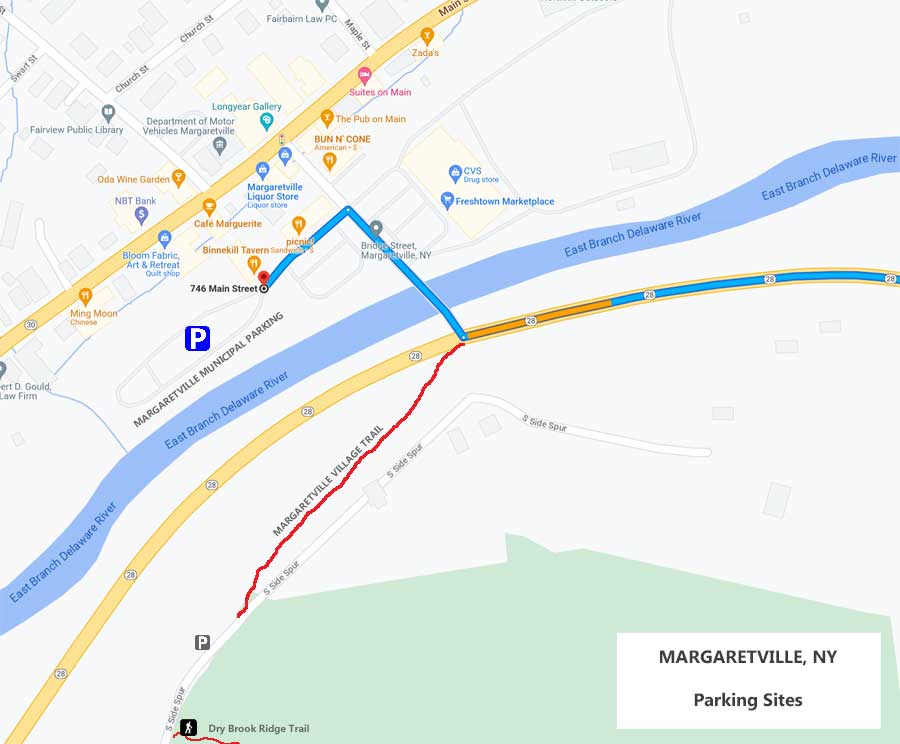
    This is the parking on the side of the South Side Road. Make sure you get all four wheels off the road. If you are parking overnight, I would suggest parking at the Margaretville Municipal Parking Area. Most people use the South Side Road for day hiking.
    Margaretville Municipal Parking Area
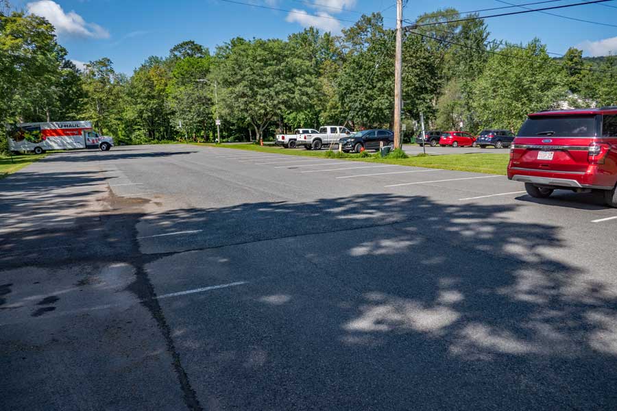
    This is the Margaretville Municipal Parking Area. It can hold 100 cars, and there is overnight parking here. This parking area is about 1/3 of a mile from the Dry Brook Ridge Trail. It is a safer place to park your car overnight. See the ending of the pictures for how to get from the Margaretville Municipal Parking Area to the Dry Brook Ridge Trailhead on South Side Road.
    Balsam Lake Mountain Parking Area from Beaver Kill Road
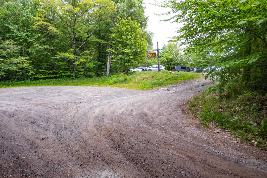
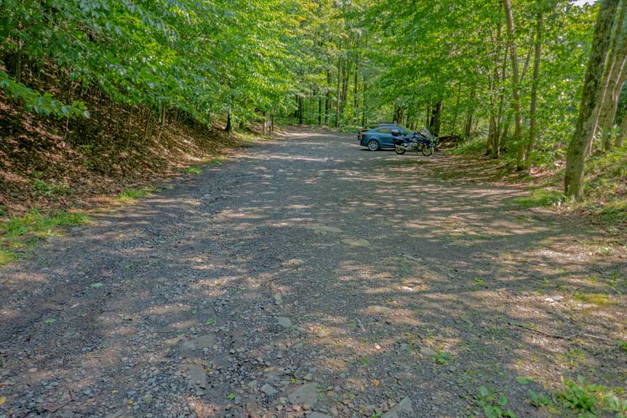
    As you come to the end of Beaver Kill Road, you will see the Balsam Lake Mountain Parking Area on the RIGHT side of the road. That is where you will park.

    On the left side of the Beaver Kill Road is the entrance to the PRIVATE Balsam Lake Club. Do NOT drive in there!
    DEC sign at the Balsam Lake Mountain Parking Area
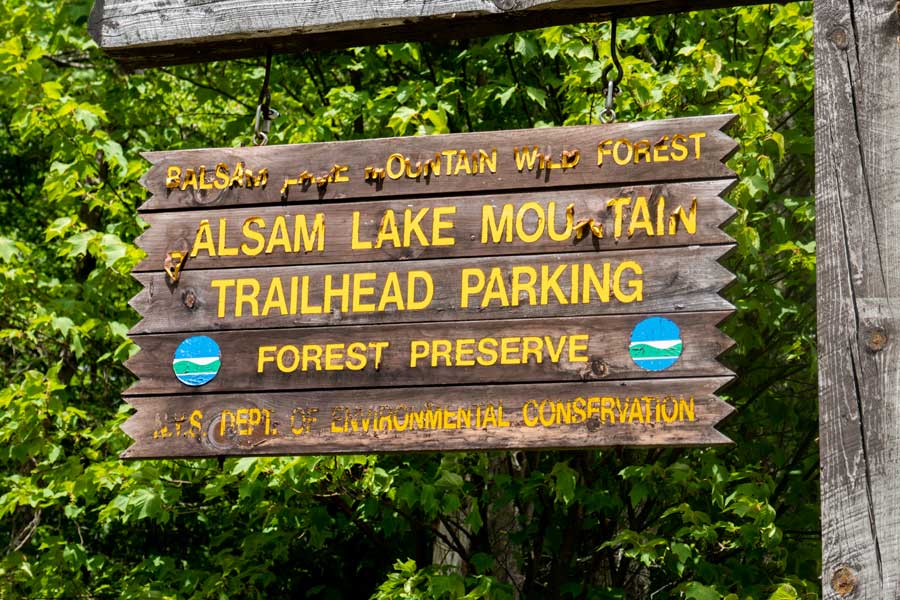
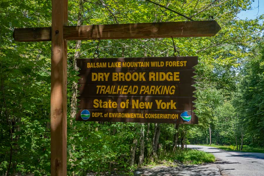
    At the entrance of Balsam Lake Mountain Parking Area is the DEC sign marking the public parking area.
    DEC Kiosk for the Balsam Lake Mountain Parking Area
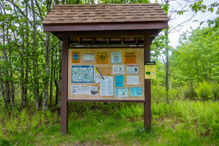
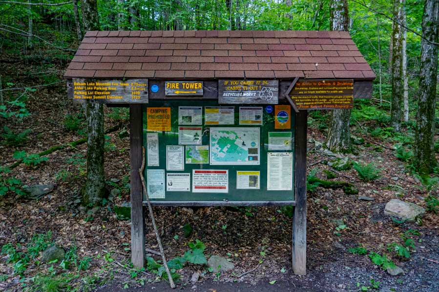
    This is the DEC Kiosk for the Balsam Lake Mountain Parking Area. The trailhead is located to the LEFT of the Kiosk. The trail on the right of the kiosk is the Neversink-Hardenburgh Trail.
    Trailhead for the Dry Brook Ridge Trail at Balsam Lake Mountain
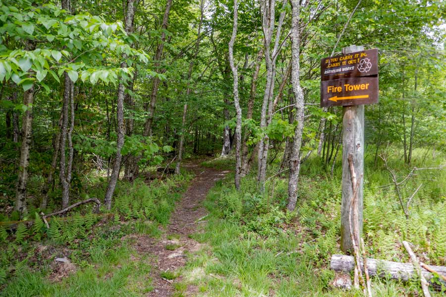
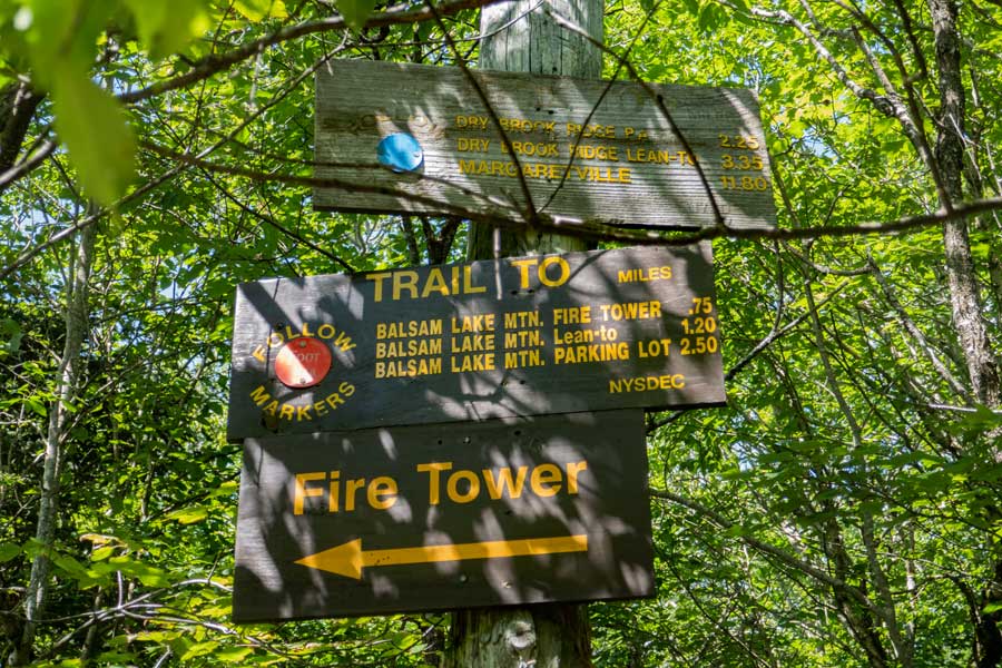
    This is the trailhead for the Dry Brook Ridge Trail. This trailhead is located at the end of the parking area.

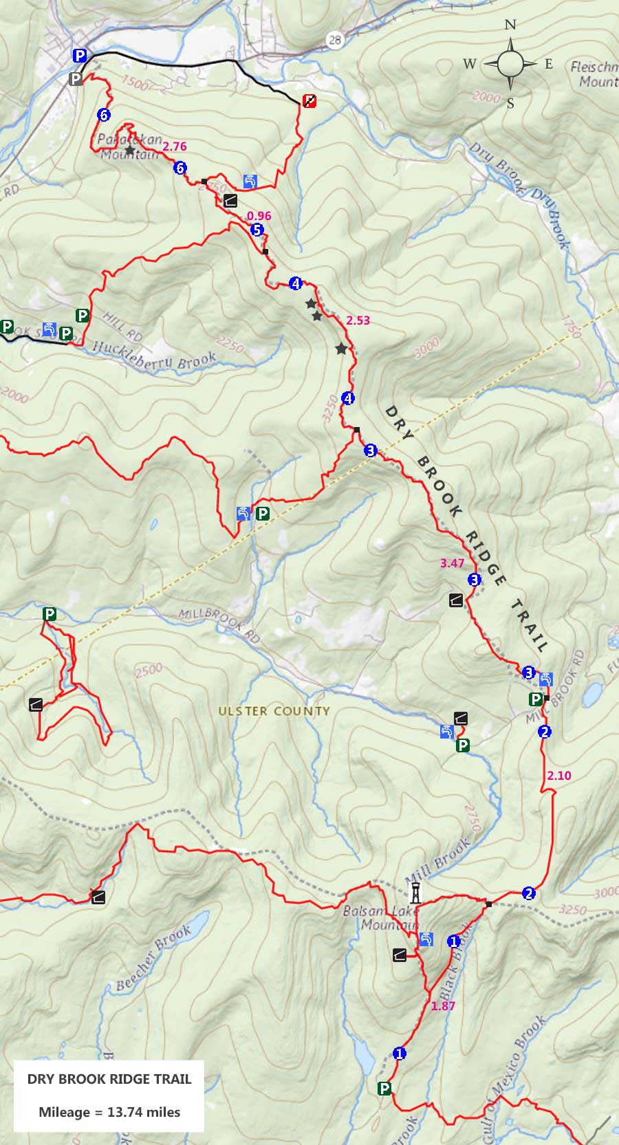
    The first section of the Dry Brook Ridge Trail will take you to the Mill Brook Parking Area, which is 4 miles away. The trail then continues to the Dry Brook Mountain Range, and finally ends close to Rt 28 in Margaretville, NY. The entire Dry Brook Ridge Trail runs about 13-to-14 miles long.
    The beginning of the Dry Brook Ridge Trail
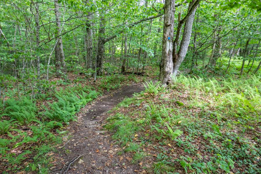
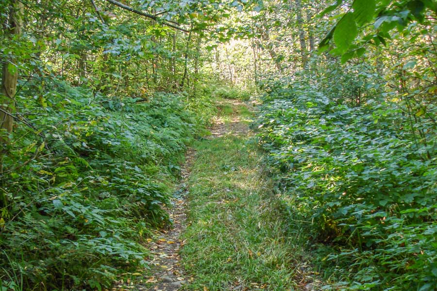
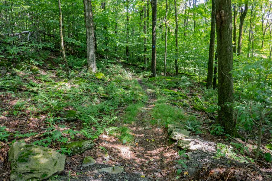
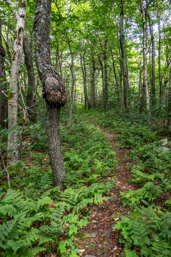
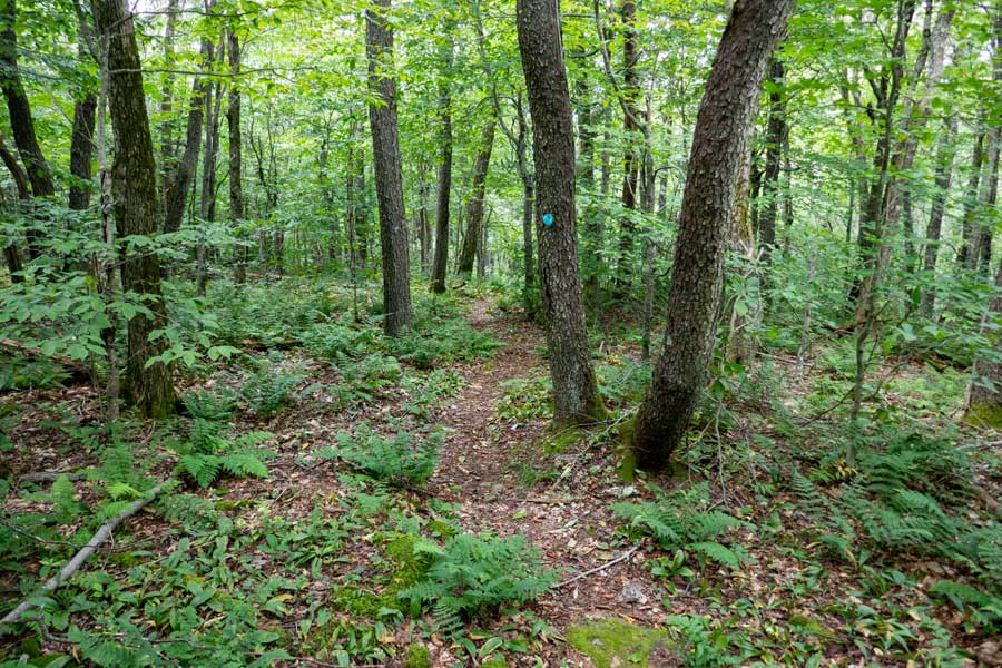
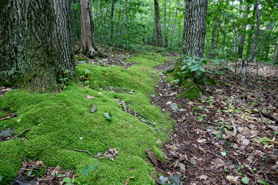
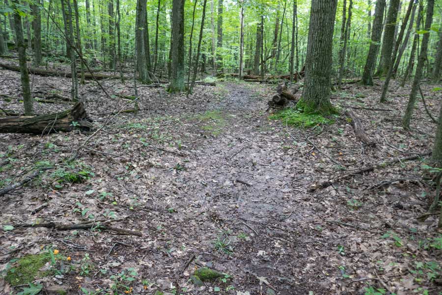
    The beginning of the Dry Brook Ridge Trail, which starts out level, and then starts to climb elevation at a mild incline
    Dry Brook Ridge Trail DEC registration box
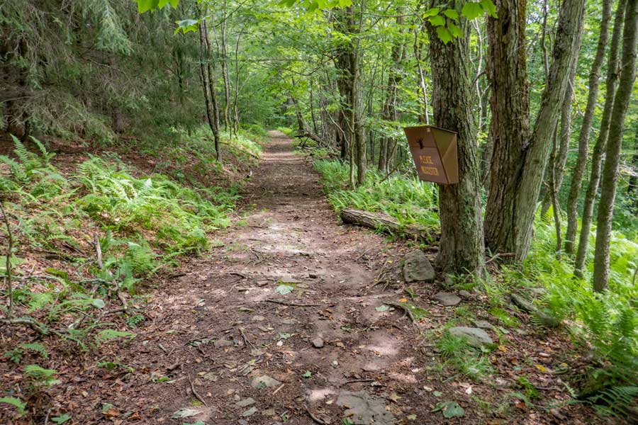
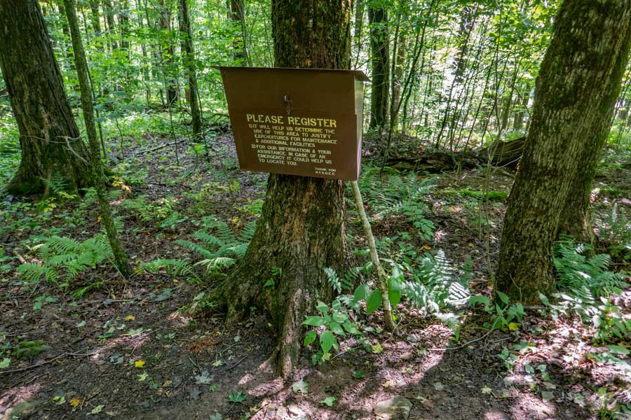
    Around 500 feet from the Trailhead is the DEC Registration Box. Funds for maintenance of the regional trails depends upon how many people register for a hike in this region. Additionally, if you or someone else in your party have an emergency, Rangers and SAR will use the information in the registration box to find and help you. If someone goes missing, Rangers may call you to determine if you saw someone missing. Your life and someone else life may depend up you registering.
    The beginning of the Dry Brook Ridge Trail
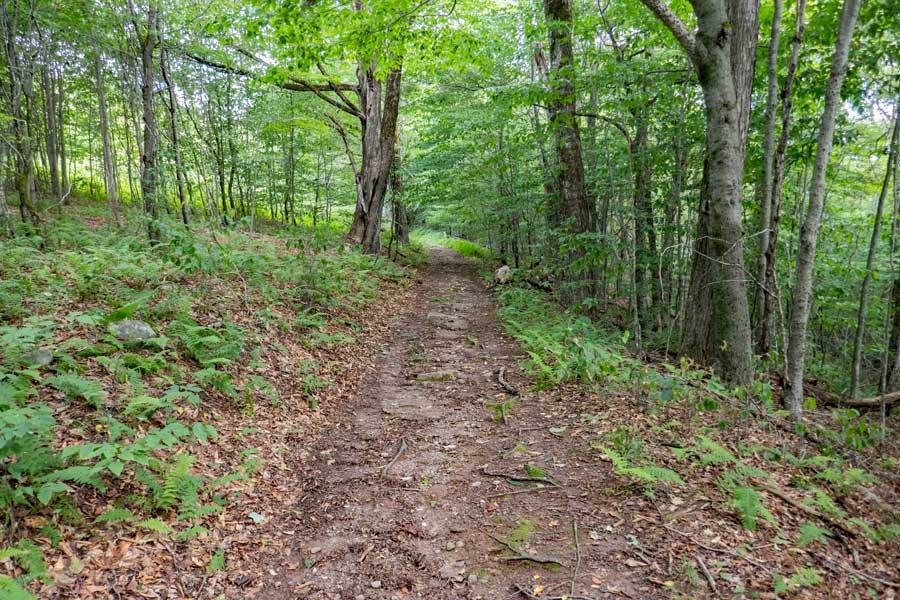
    The Dry Brook Ridge Trail (former logging road) will have a mild incline up the base of Balsam Lake Mountain.
    Trail Junction for Dry Brook Ridge Trail and the Balsam Lake Mountain Trail
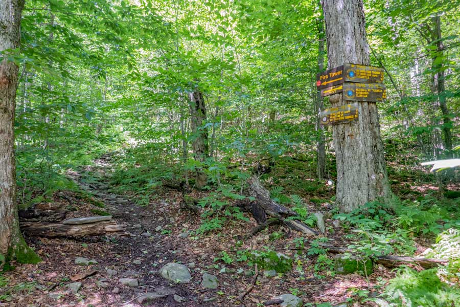
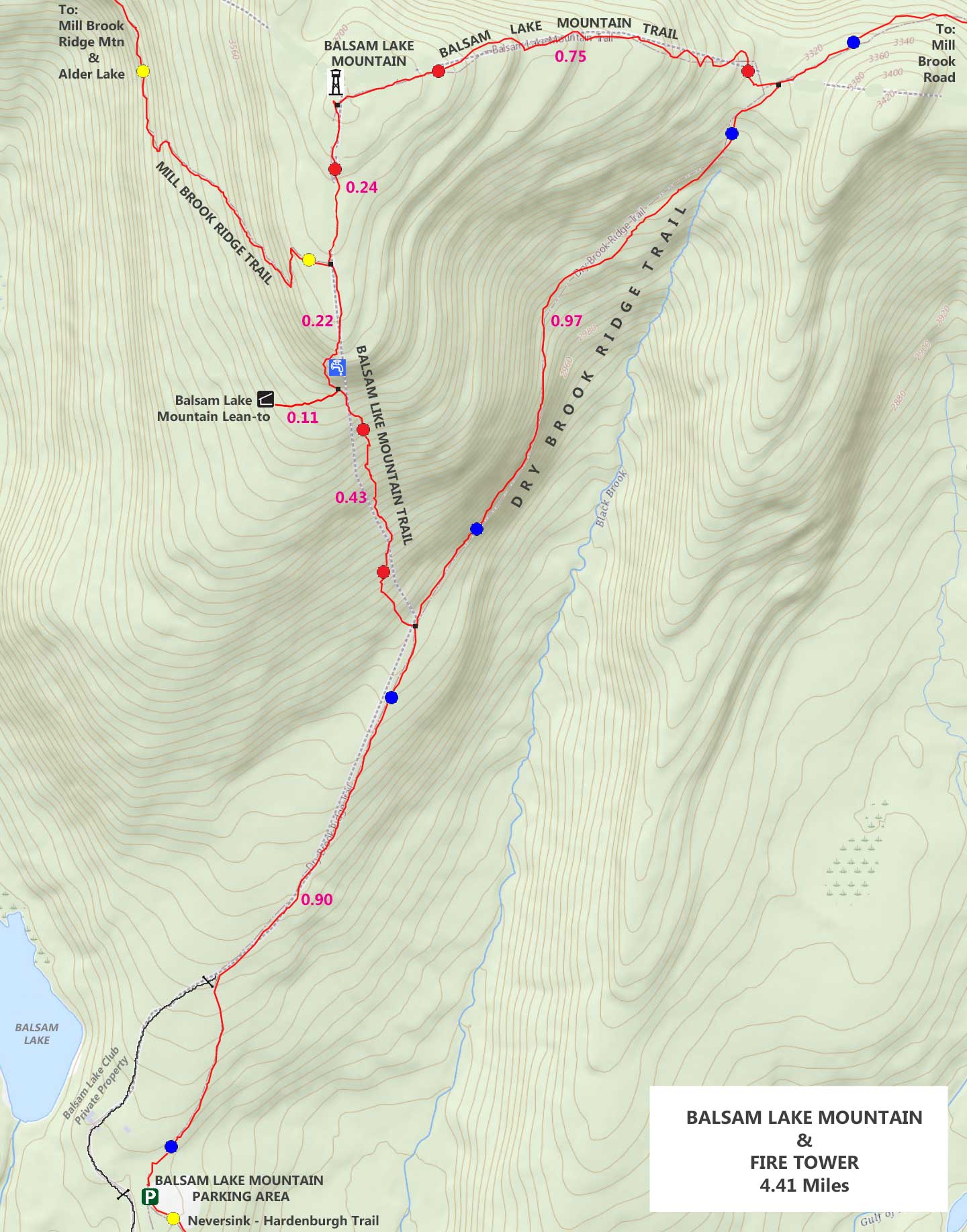
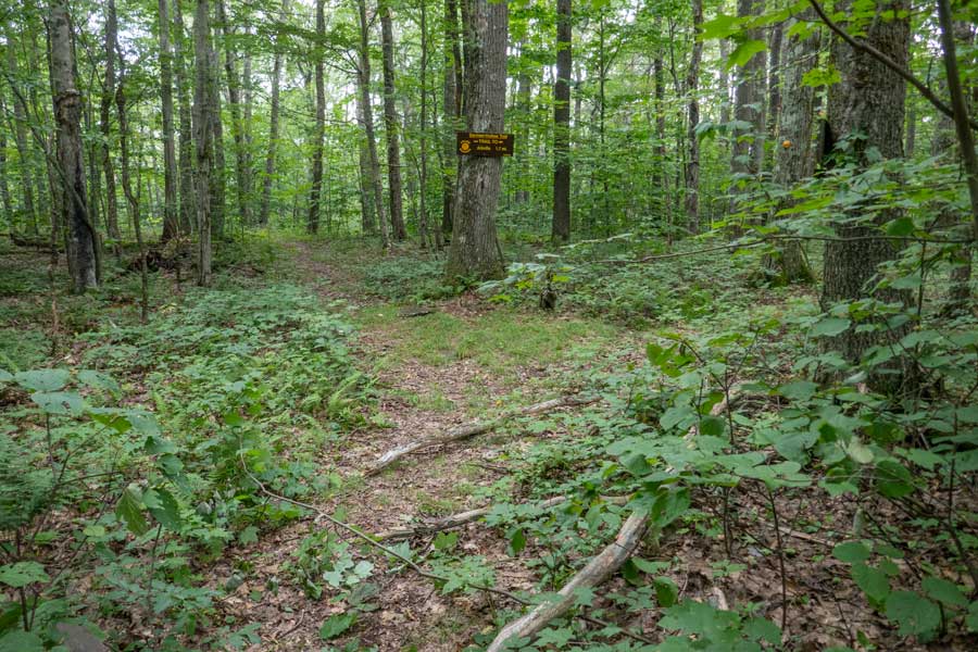
    About 9/10 of a mile from the Trailhead is a Trail Junction. You want to continue STRAIGHT past the Trail Junction on the Dry Brook Ridge Trail.

    The Balsam Lake Mountain Trail will take you to the Balsam Lake Mountain Fire Tower, and then come back down to the Dry Brook Ridge Trail about a mile further up the Dry Brook Ridge Trail.

    If you plan on taking a detour to the Balsam Lake Mountain Fire Tower and come back to the Dry Brook Ridge Trail further up, beware that the Balsam Lake Mountain Trail is steeper then the Dry Brook Ridge Trail. It is 1.64 mile detour will add 0.67 miles to your overall hike. If you arrived at the Balsam Lake Mountain Trailhead late, you can stay at the Balsam Lake Mountain Lean-to, which is 0.54 miles up the Balsam Lake Mountain Trail.

    There is also a Spring a little less then a 1/2 miles up the Balsam Lake Mountain Trail. There are very few places to get water on this hike!
    end of public land onto private property on the Dry Brook Ridge Trail
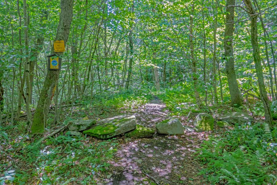
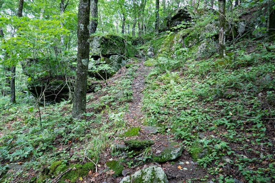
    About another mile up the Dry Brook Ridge Trail, you will come to some rocks across the trail. You will then be entering onto private property. Please stay on the trail! You will also come to the other side of the Balsam Lake Mountain Trail (to the fire tower).
    side trail to the Balsam Lake Mountain Fire Tower off the Dry Brook Ridge Trail
    Within a minute you will be at the trail junction to the Balsam Lake Mountain Trail (to the fire tower. You want to continue STRAIGHT on the Dry Brook Ridge Trail!
    The Dry Brook Ridge Trail to the Dry Brook Parking Area
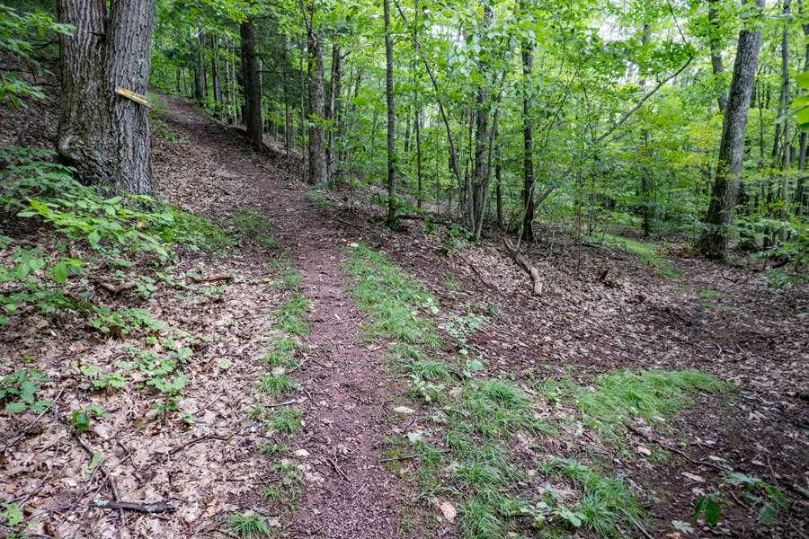
    You will continue straight down the Dry Brook Ridge Trail for the next 2.2 miles
    Dry Brook Ridge Parking Area on Dry Brook Ridge Trail
    After hiking over two miles, you will come to Mill Brook Road. You want to cross Mill Brook Road into the Dry Brook Ridge Parking Area.

    If you are going to stay at the Mill Brook Lean-to for the night, or obtain water, take a LEFT and hike west on Mill Brook Road for 3/4 of a mile. When you return hike into the parking area across Mill Brook Road (in the picture).
    Dry Brook Ridge Parking Area
    Once in the Dry Brook Ridge Parking Area, you want to hike to the bottom left of the parking area to continue on the Dry Brook Ridge Trail. You are still on Private Property, so do NOT wander out of the parking area.
    DEC sign for the Dry Brook Ridge Parking Area
    This is the DEC Dry Brook Ridge Parking Area sign off Mill Brook Road.
    Dry Brook Ridge Parking Area Kiosk
    This is the Kiosk in the Dry Brook Ridge Parking Area. The Dry Brook Ridge Trail continues 25' RIGHT of the Kiosk.
    Dry Brook Ridge Trail from the Dry Brook Ridge Parking Area towards the Dry Brook Lean-to
    This is the beginning of the Second Section of the Dry Brook Ridge Trail. For a short distance, you will still be on Private Property. So, please stay on the Dry Brook Ridge Trail.

    Once you get a little ways down this path, you will NOT have any water sources for the next 6-7 miles. Make sure you have enough water.
    Dry Brook Ridge Trail DEC Registration box near the Dry Brook Ridge Parking Area
    After about 250 feet, you will encounter the DEC Registration Box. Please register AGAIN! By registering again, Rangers will be able to narrow down what region you might be in. This is for your benefit.
    Dry Brook Ridge Trail beyond the DEC registration box
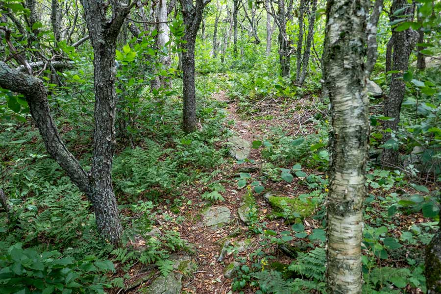
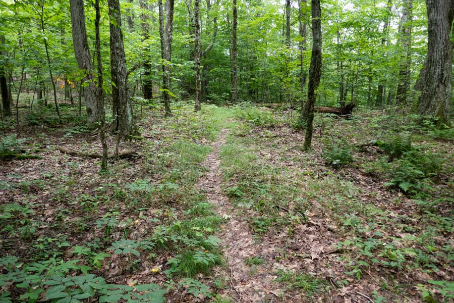
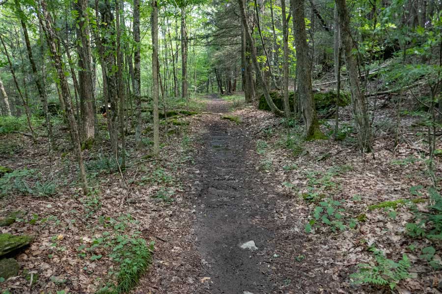
    The second section of the Dry Brook Ridge Trail starts out fairly easy hiking. And, it will stay that way for the next 3-1/2 miles.
    fern glades on the Dry Brook Ridge Trail
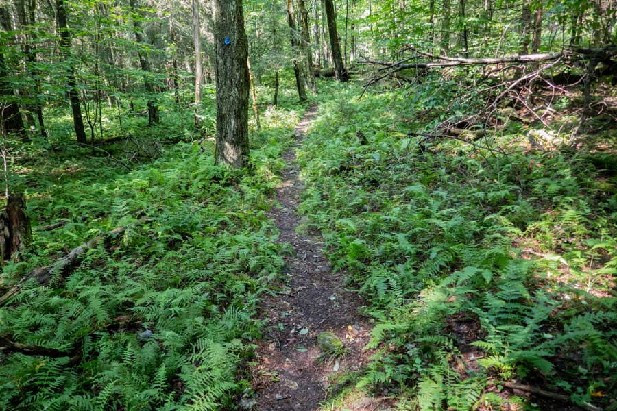
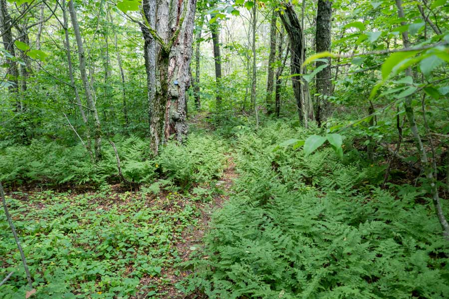
    No shortage of beautiful fern glades on the Dry Brook Ridge Trail in this region.
    Dry Brook Lean-to on the Dry Brook Ridge Trail
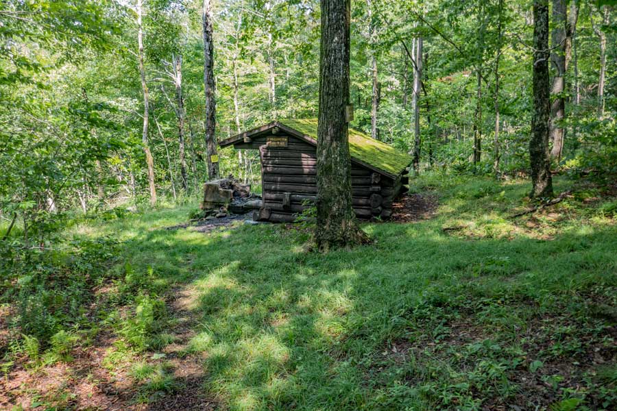
    After hiking north on the Dry Brook Ridge Trail for about 1-1/3 miles, you will come to the Dry Brook Lean-to. The Dry Brook Lean-to sits on the edge of Public and Private Property. If you look at the tree just beyond the fire place, you will see one of many No Trespassing signs. The owner of the private property has security cameras on this property.

    The Dry Brook Ridge Trail turns right where this picture was taken. It follows the edge of public and private property. So, stay on the trail!
    dry brook lean-to on the Dry Brook Ridge Trail in the Balsam Lake Mountain Wild Forest
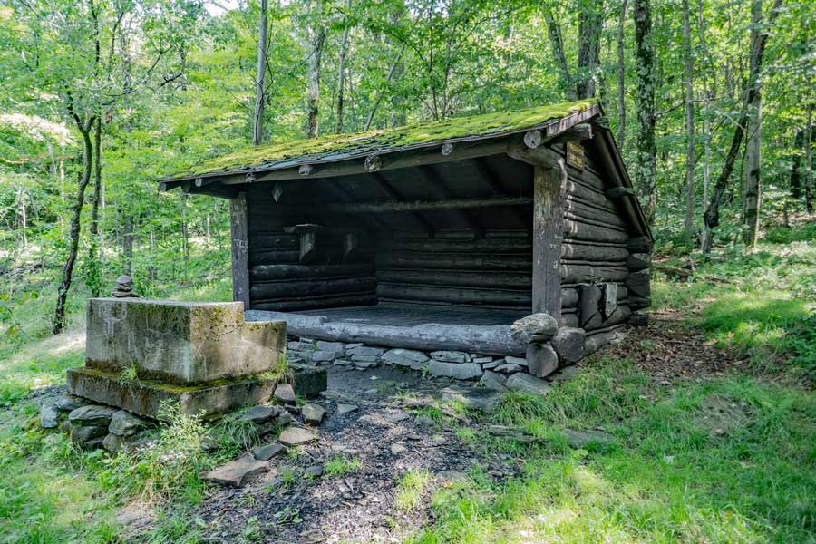
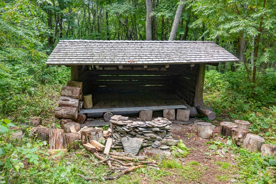
    This is the Dry Brook Lean-to and fireplace.
    crossing from Balsam Lake Mountain Wild Forest onto Dry Brook Wild Forest
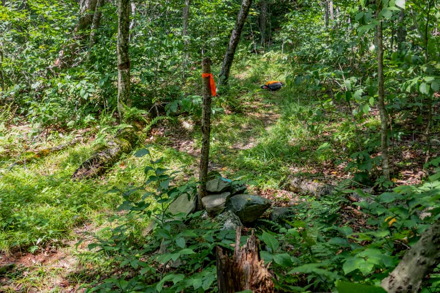
    In the middle of this picture is a stick stuck in a rock cairn. This is the property border of two opposing blocks of public and private property.

    You will also be crossing from the Balsam Lake Mountain Wild Forest into the Dry Brook Wild Forest. Once you are about 500 feet down the trail, you should be able to to leave the trail without worrying about walking onto private property.
    fern glade on the Dry Brook Ridge Trail
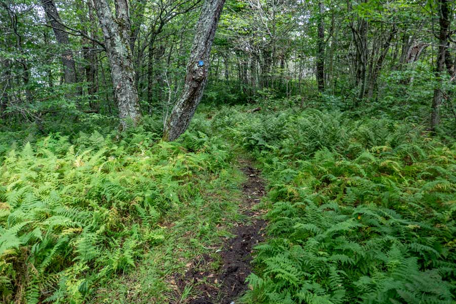
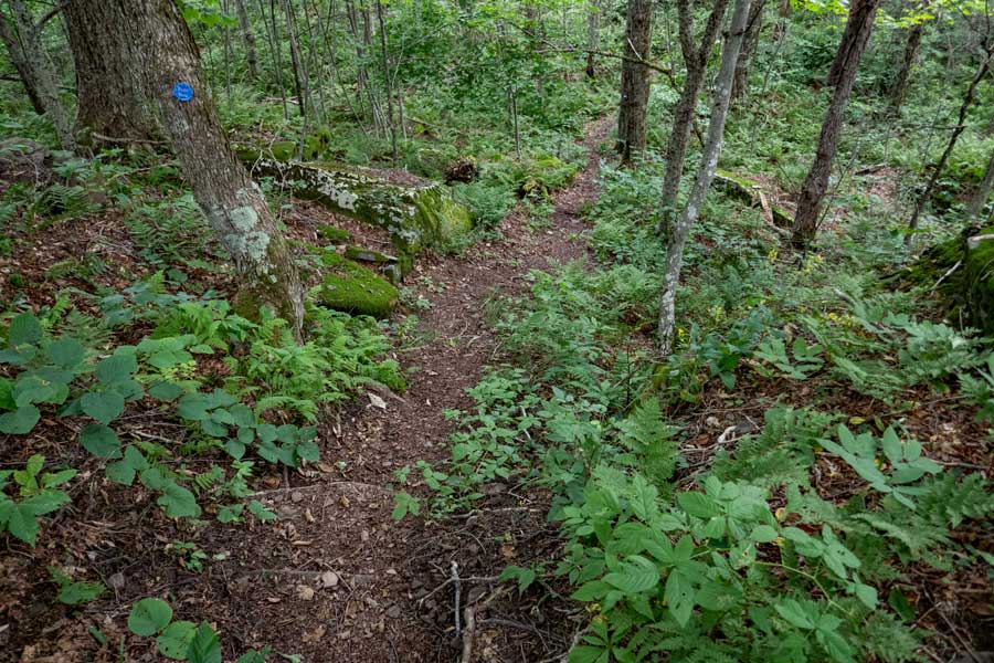
    You will continue to walk through many fern glades.
    approaching the Dry Brook Ridge
    As you approach the Dry Brook Ridge, you will start to climb in elevation. Once you get on top, you will be at one of the high elevation points on this hike.
    trail junction with Dry Brook Ridge Trail Trail
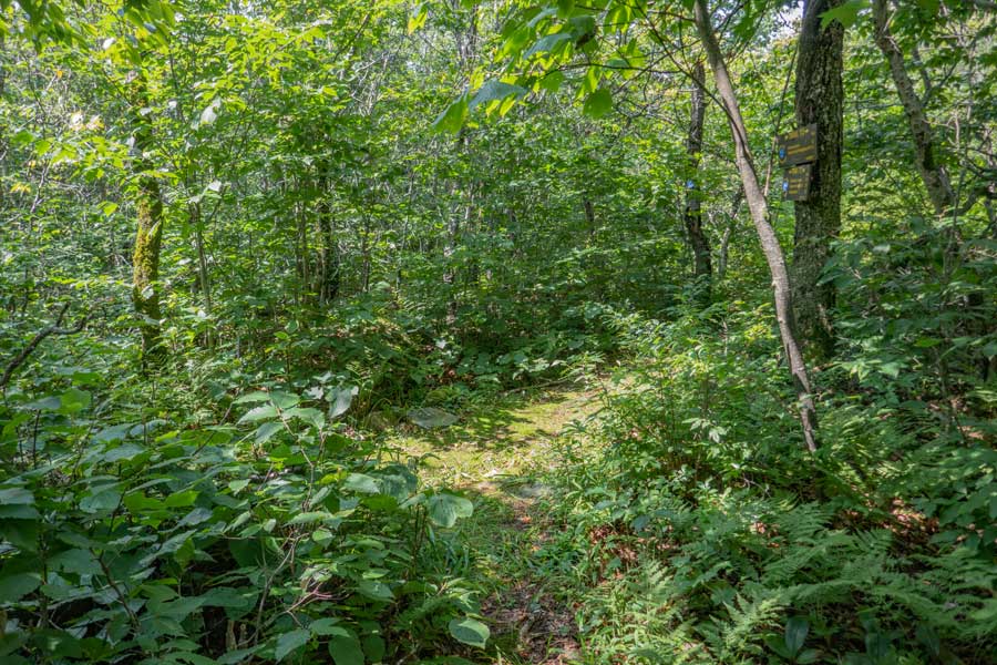
    After almost 3-1/2 miles, you will encounter the trail junction for the Huckleberry Loop Trail. You want to continue STRAIGHT. Left would take you down into the Huckleberry Valley.

    This location of the trail is considered one of the high elevation spots on the Dry Brook Ridge Trail at 3,461'.

    You will also be leaving section #2 of the Dry Brook Ridge Trail, and be entering Section #3. Section #3 is considered the actual Dry Brook Ridge. On the ridge there are three known view spots that look out over the Huckleberry Valley.
    fern glades and muddy sections on the Dry Brook Ridge
    No shortage of fern glades on the Dry Brook Ridge. There are short ferns and tall ferns. With the name, "Dry Brook Ridge", you might think that the ridge is dry. Although it is true there is no water to collect, there is plenty of muddy sections of this trail. During a drought, it might dry up.
    approaching view point #1 on the Dry Brook Ridge
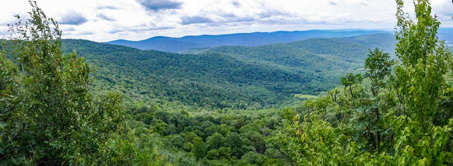
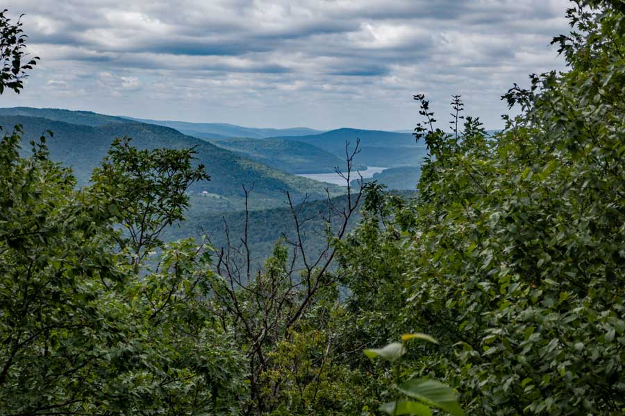
    After almost 3/4 of a mile on the Dry Brook Ridge, you will come to the first View Point that overlooks the Huckleberry Valley. Be careful around the open section. Easy to fall off.
     view point #1 on the Dry Brook Ridge
    This is a panorama picture from View Point #1. On a nice clear day, you can far into the distance. Be careful around the open section. Easy to fall off one of the rock ledges.
    Trail between view point #1 and view point #2 on the Dry Brook Ridge Trail
    After you get done enjoying the views from View Point #1, the trail will then move back up on the ridge line. The trail will wind up-and-down the ridge for another 1/2 mile.
    dangerous ledge just before View Point #2 on the Dry Brook Ridge ledge just before View Point #2 on the Dry Brook Ridge
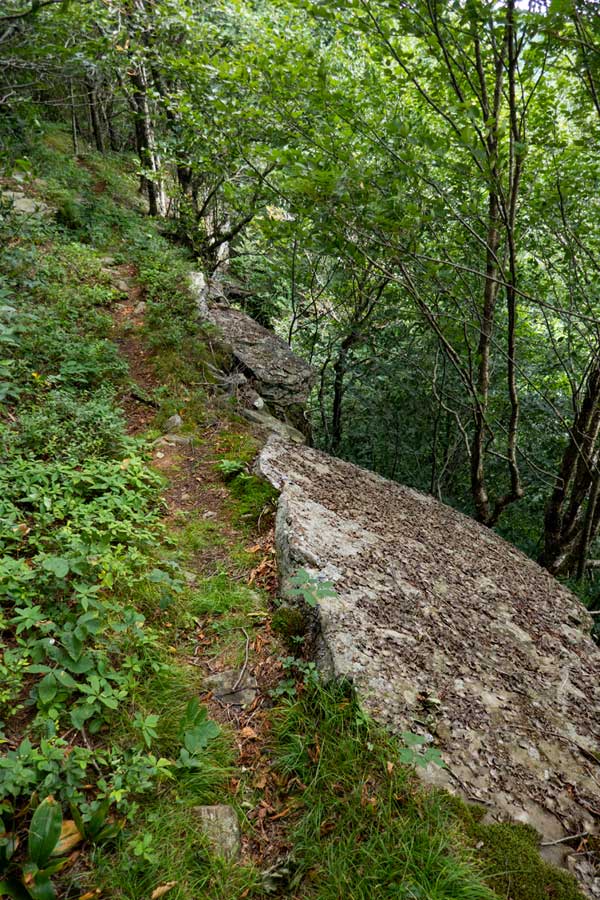
    As you come back down off the ridge after about a 1/2 mile, it will come down to the very edge of the ledge. The ledge drops 40-50 feet. So, walk carefully here. If you fall here, you die.
    view Point #2 on the Dry Brook Ridge
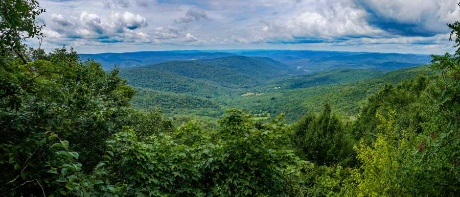
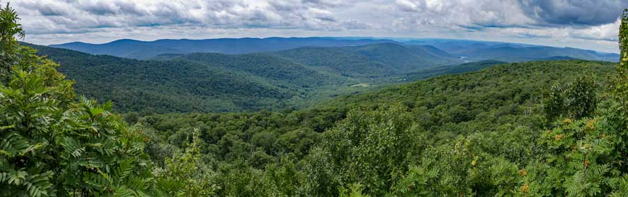
    Here is another panoramic image of View Point #2 on the Dry Brook Ridge. It has a slightly different view of the Huckleberry Valley along with the Mill Brook Ridge in the distance.
    Trail to View Point #3 on the Dry Brook Ridge Trail
    After you done enjoying View Point #2 on the Dry Brook Ridge, the trail climbs back up towards the ridge. You will hike another almost another 1,000 feet, you will see a trail on your left. This short trail will take you to View Point #3. You need to be careful hiking out to View Point #3. There is some exposure and danger. Many consider View Point #3 the best view on the Dry Brook Ridge.
     Dry Brook Ridge Trail Trail
    This is another panoramic images of the Huckleberry Valley with the Mill Brook Ridge in the background. Once done, head back to the Dry Brook Ridge Trail.
    Sliver Rock on the Dry Brook Ridge Trail more fern glades on the Dry Brook Ridge Trail
    After leaving View Point #3 on the Dry Brook Ridge, the trail will start to drop in elevation. The image on the left is called Sliver Rock. It is a very unusual rock.
    The image on the right show you some more fern glades.
    hiking off the Dry Brook Ridge towards the trail junction for the Huckleberry Loop
    The trail will start to drop more in elevation as you descend downhill. You will slowly descend in elevation for the next mile.
    trail junction to the Huckleberry Loop Tran off the Dry Brook Ridge Trail
    After a little over a mile from View Point #1 on the Dry Brook Range, you will come to the Trail Junction for the other side of the Huckleberry Loop Trail. You want to go STRAIGHT. You will drop over 200 feet in elevation between those two points.
    DEC signs at the Huckleberry Loop Trail Junction with the Dry Brook Ridge Trail
    There are some old DEC Trail signs. The distance on them is very accurate. Hopefully they will be replaced in the future.
    train between huckleberry loop and the Pakatakan Lean-to on the Dry Brook Ridge Trail
    Not long after leaving the trail junction to the Huckleberry Trail, the trail will descend another 200 vertical feet as it winds through the forest.
    trail near the Pakatakan Lean to on the Dry Brook Ridge Trail
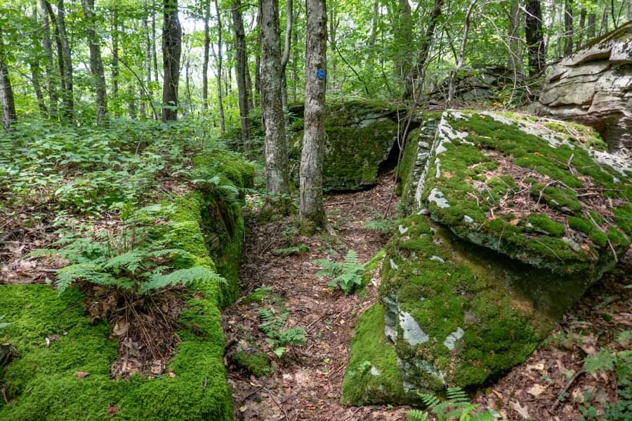
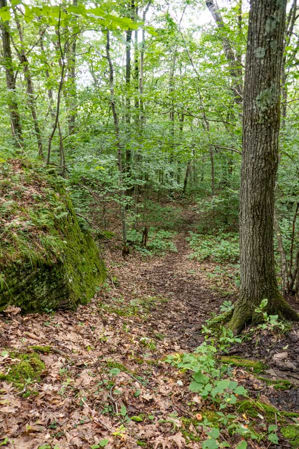
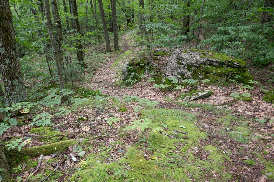
    At the bottom of the elevation drop, you will hike through some large erratic rocks on the forest floor. After the rocks, the trail will turn 90 degrees to the right. But, the trail will remain at a level elevation.
    side trail to the Pakatakan Lean-to off the Dry Brook Ridge Trail
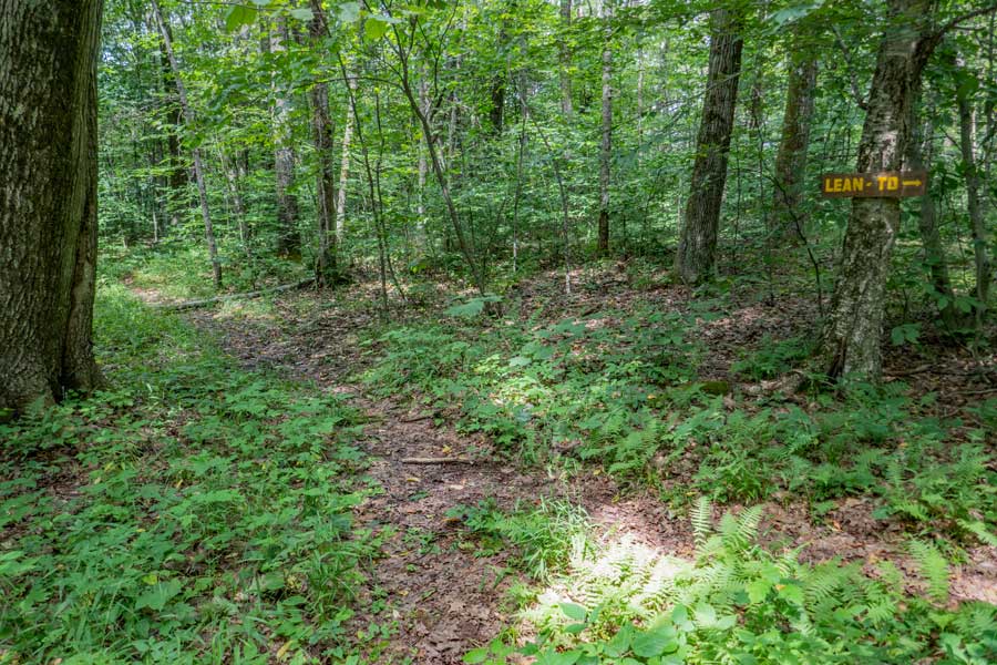
    After about 3/4 of a mile, you will see a side trail on the right. This side trail will take you to the Pakatakan Lean-to. The Pakatakan Lean-to is about 200-250 feet off the Dry Brook Ridge Trail.
    Pakatakan Lean-to off the Dry Brook Ridge Trail
    This is the Pakatakan Lean-to. There is a water source about a mile away. It is located about 2/3 of a mile down the German Hollow Trail.
    Trail Junction for the German Hollow Trail on the Dry Brook Ridge Trail
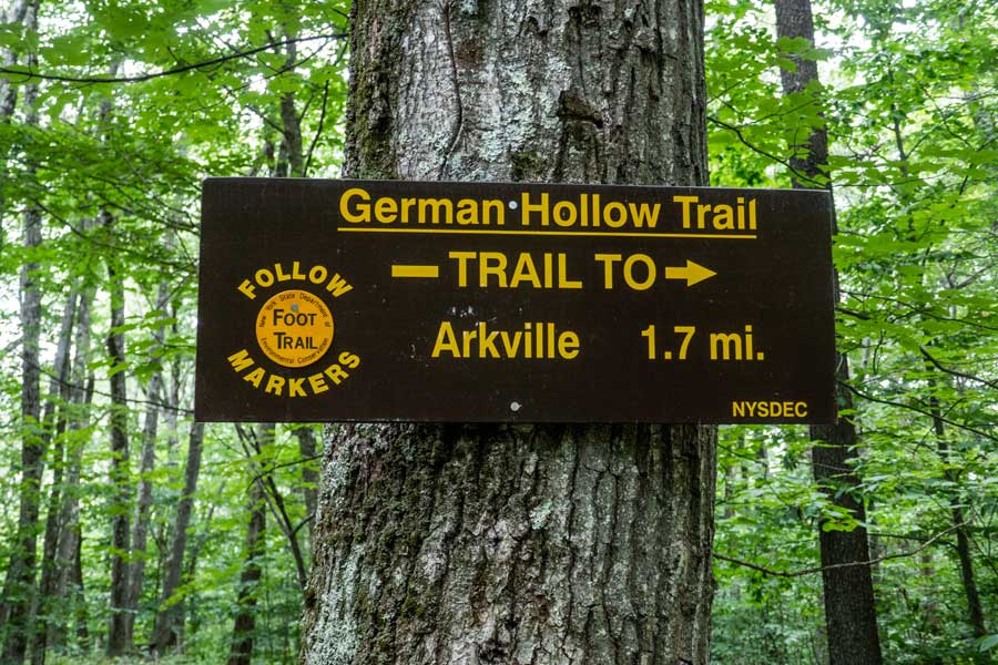
    About 1,000 feet past the side trail to the Pakatakan lean-to is the Trail Junction for the German Hollow Trail
    Dry Brook Ridge Trail
    Dry Brook Ridge Trail
    trail after the trail junction to German Hollow on the Dry Brook Ridge Trail more fern glades as you descend to Pakatakan mountian on the Dry Brook Ridge Trail
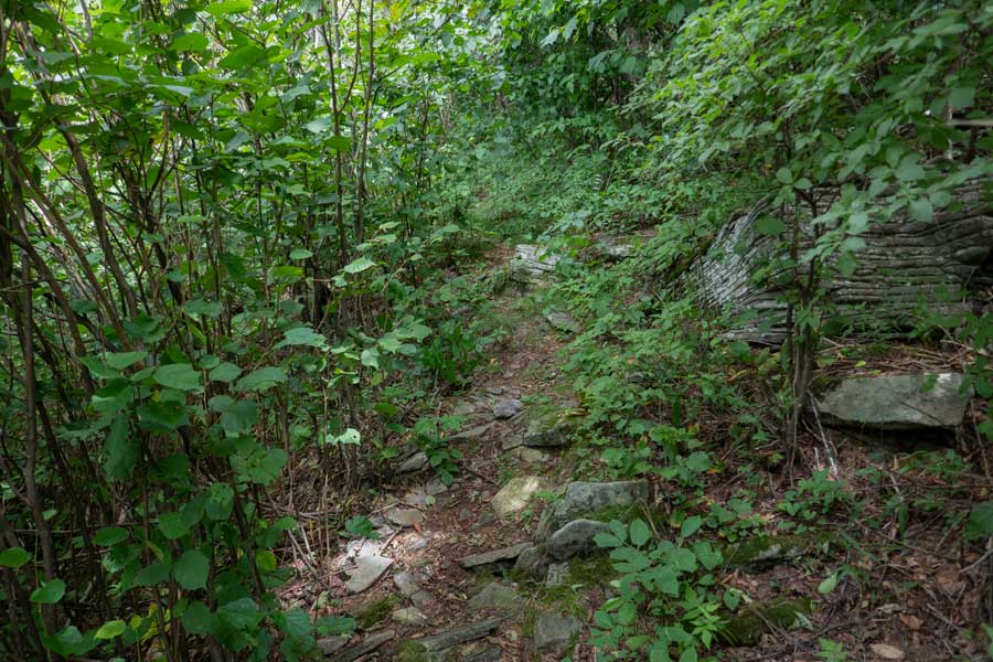
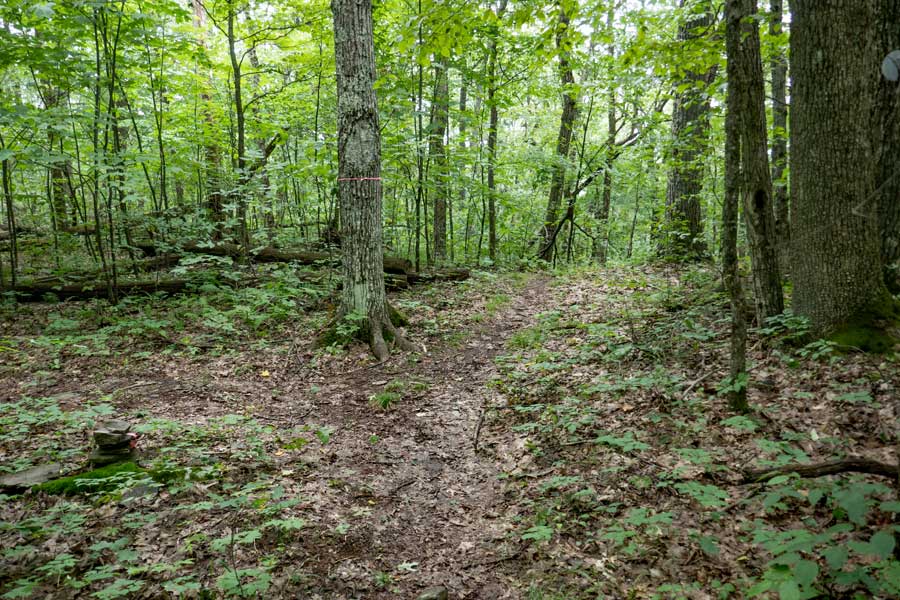
    After continuing straight past the trail junction to the German Hollow Trail, the trail will start to descend again.
    There will also be sections with Fern Glades lining the trail as you continue to descend towards Patatakan Mountain and finally to Margaretville.
    mossy sections of the Dry Brook Ridge Trail towards Pakatakan Mountain
    Some sections will have mossy sections of the trail. And, there will be certain sections where you will have some minor uphill climbs. But, the majority of this section of the Dry Brook Ridge Trail will be descending down the ridge to Margaretville.
    Dry Brook Ridge Trail between German Hollow Trail and Pakatakan Mountain
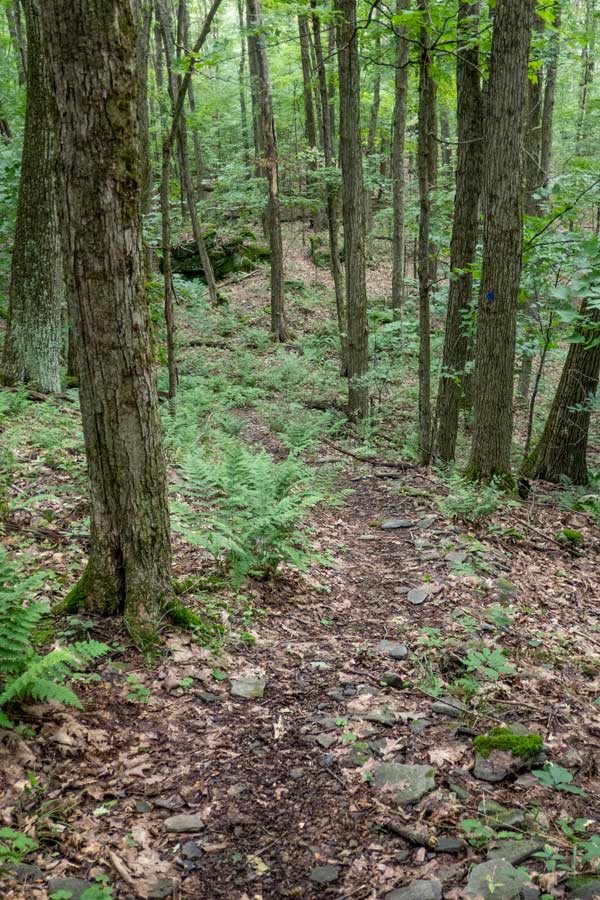
    There will be sections of flat inclines that provide nice walks across the descending ridge line.
    approaching Pakatakan Mountain summit and view point
    More gradual descents as you approach Pakatakan Mountain Summit on the west side of the ridge
    Pakatakan Mountain Summit and trail to the view point #4 on the Dry Brook Ridge Trail
    This is the summit of Pakatakan Mountain. It isn't really a true mountain summit. Although, it resides on a section after a grueling uphill descent.

    On the left is a side trail. This short trail of 375 feet (one-way) will take you to view point #4 on the Dry Brook Trail.
    This is View Point #4 on the Dry Brook Ridge Trail, that sits on the side of the summit of Pakatakan Mountain Summit. Sadly, this view point is severely overgrown.

    There is a limited view spot that overlooks the Pepacton Reservoir. You will also get a limited view when the leaves are not on the trees. Sad, that it is overgrown.

    Some people do camp here because this side trail is not an official trail.
    view of the Pepacton Reservoir from the Dry Brook Ridge Trail from view point #4
    This is the limited view of the Pepacton Reservoir from View Point #4 on the Dry Brook Ridge Trail. By 2024 it will become completely overgrown.
    trail below Pakatakan Mountain Summit
    Once you return from View Point #4 on the Dry Brook Trail, you can continue to descend the trail. The trail will wrap around Pakatakan Mountain, and some sections will have a mild or flat incline. After you pass this flat section, the trail will descend at a rapid decline.
    side trail below Pakatakan Mountain
    As you come to the bottom of the steep descent, you will see a trail on your left (picture was taken looking backwards to show side trail). This trail goes to private property. Some hikers climbing the mountain think that it will take them to View Point #4. But, it doesn't
    approaching the trailhead on South Side Road and between Pakatakan Mountain
    On below the steep descent, the trail will switch from flat walks below ledges to more steeper descents. Enjoy the flat sections.
    approaching the trailhead of the Dry Brook Ridge Trail trailhead for the Dry Brook Ridge Trail in Margaretville NY
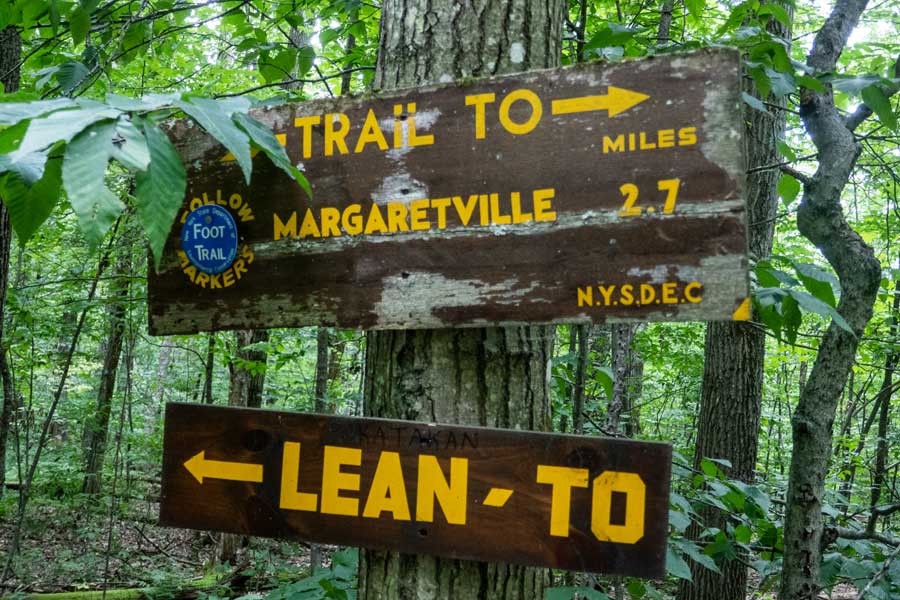
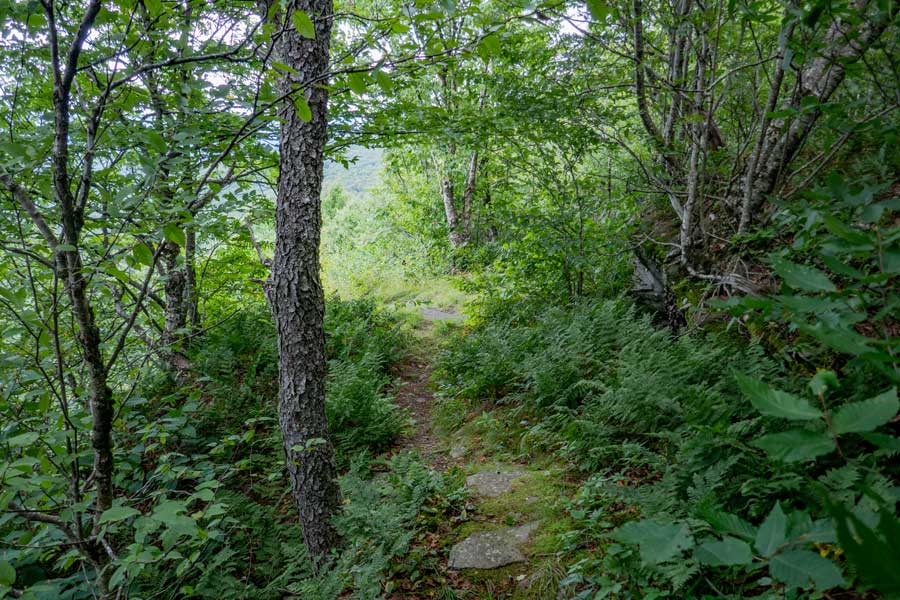
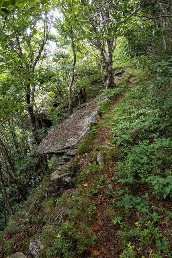
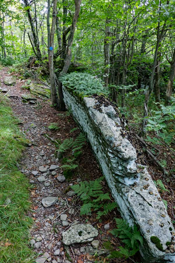
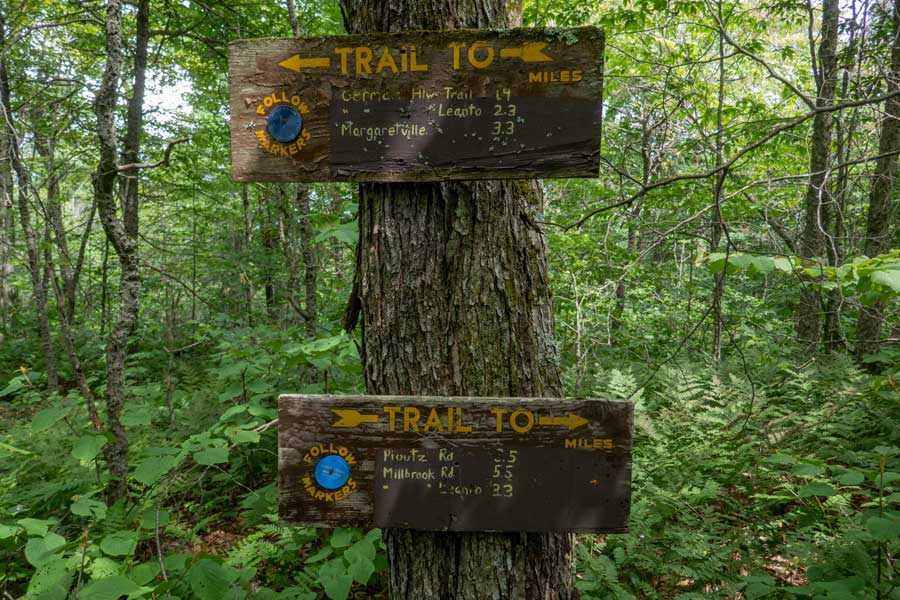
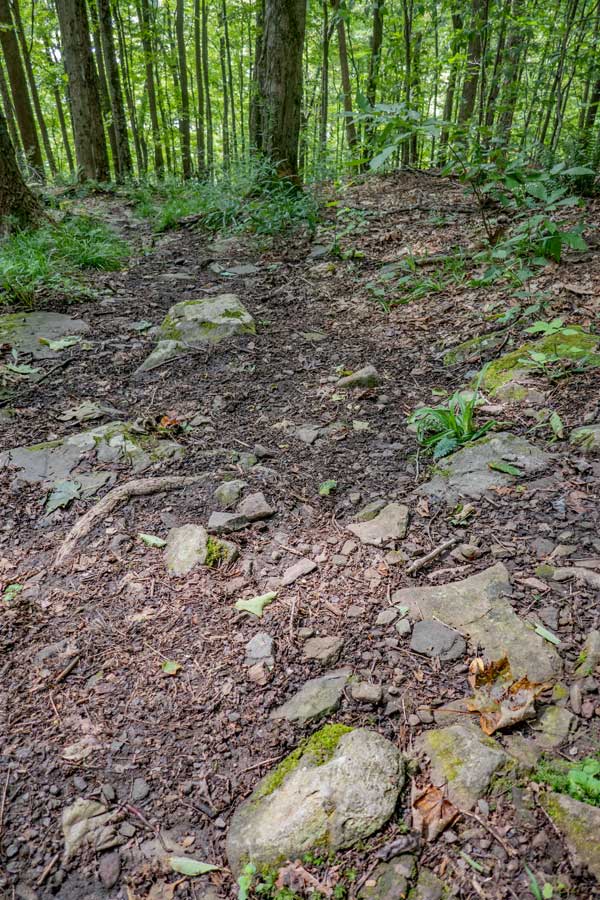
    This is the final descent down to South Side Road. A minor steep section.
    This is the end of the trail. It is the trailhead for the Dry Brook Ridge Trail on the Margaretville, NY side of the trail
    End of the Dry Brook Ridge Trail and the road side parking area on South Side Road
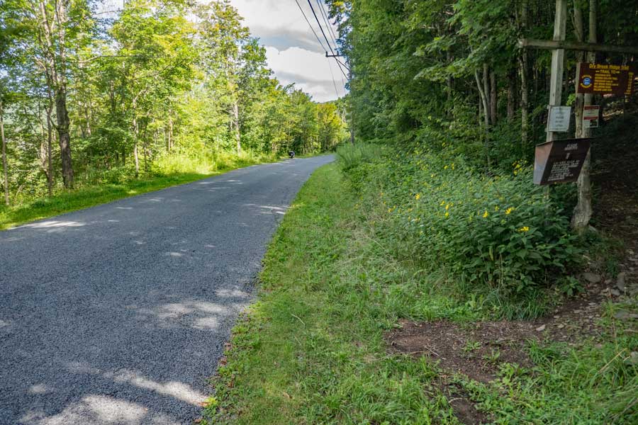
    When you come to the end of the trail, you should take a RIGHT and walk the 250 feet up South Side Road to the parking area.

    If you parked in the Margaretville Municipal Parking Area head in the same direction.
    road side parking on South Side Road for the Dry Brook Ridge Trail
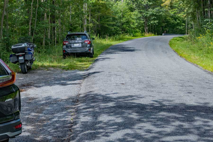
    The is the road side parking South Side Road. If you do park here, make sure all 4 tires are off the road.

    If you parked in the Margaretville Municipal Parking Area continue walking up South Side Road to the end of the Guard Rail you see in the top left of the picture. Once there, you will walk on the left of the guard rail and take the Margaretville Village Trail down to Rt 28.
    trailhead to the Margaretville Village Trail from south side road to Rt 28.
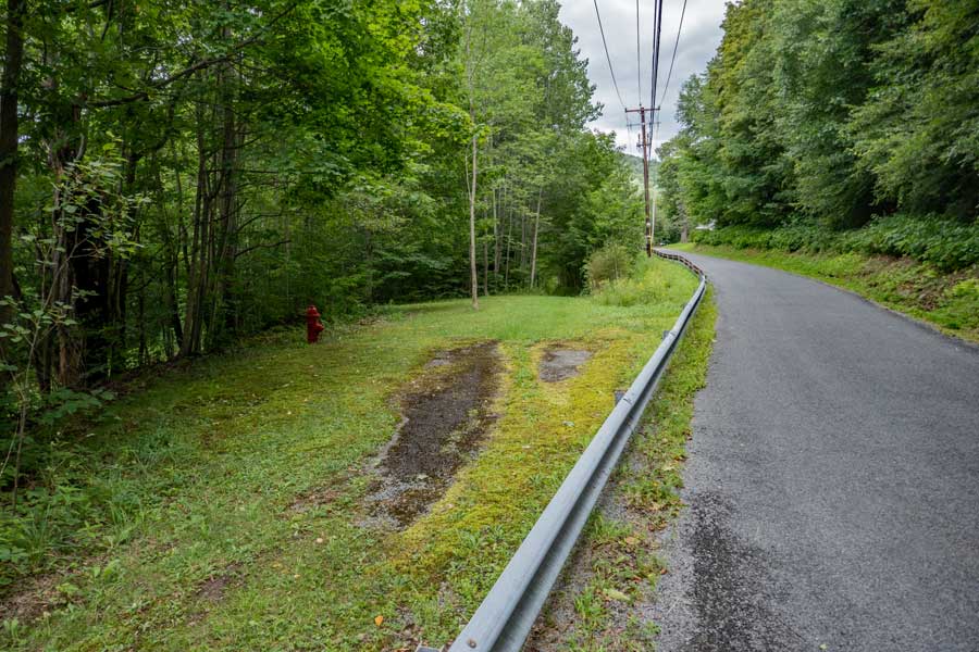
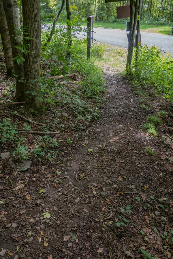
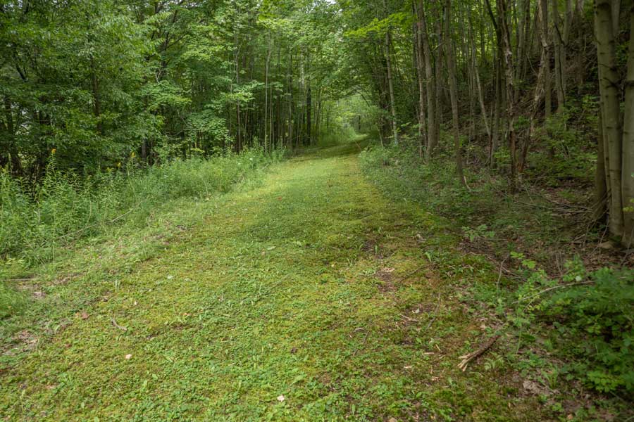
    This is the beginning of the Margaretville Village Trail. The village even keeps it mowed in the summer months. Look for the Red Fire Hydrant on the left. The Village of Margaretville owns this trail. Please stay on the trail.

    the Margaretville Village Trail from South Side Road to Rt 28
    The Trail is about 8-10 feet wide. This trail will end in about 600 feet where it comes to an end on Rt 28. At the end of the trail is a small 1 foot wide short trail about 15 feet long that takes you to the shoulder on Rt 28.

    Walk across Rt 28 and take Bridge Street into Margaretville, NY. After walking about 1/10 of a mile, take a left into the parking lots. The Margaretville Municipal parking area is at the very back.
    Margaretville Municipal parking area
    This is the Margaretville Municipal parking area. It is about 1/3 of a mile from the Dry Brook Ridge Trailhead.
    Links and References:

    USGS Topo Map of the Seager Quad

    USGS Topo Map of the Fleischmanns Quad

    USGS Topo Map of the Margaretville Quad

    NY DEC map of the Dry Brook Ridge Trail Wild Forest (free)

    DEC Information on the Dry Brook Ridge Trail Wild Forest


      S E C T I O N S


      W E A T H E R


      O T H E R

    Copyright 2001-2024 www.catskillmountaineer.com ALL RIGHTS RESERVED