Catskill Mountaineer

Hike the Huckleberry Loop

Huckleberry Loop
View of the Cold Spring Valley from View Spot #1 on the Dry Brook Ridge


OVERVIEW

  Trail Name:  Huckleberry Loop (South leg of Huckleberry Loop Trail)
  Trail Name:  Huckleberry Loop (Dry Brook Ridge Trail)
  Trail Name:  Huckleberry Loop (North leg of Huckleberry Loop Trail)
   
  Forest: Dry Brook Ridge Wild Forest
  Parking Area : 3 spaces directly off Huckleberry Brook Road (Lower PA)
  Parking Area : 5 spaces directly off Huckleberry Brook Road (Upper PA)
  Parking Area : 5 spaces directly off Hill Road
  Parking Area : 3 spaces directly off Ploutz Road
  Winter Access: Huckleberry Brook Road or Hill Road
  Camp sites: NO Camp Site locations
  Lean-to sites: No (Dry Brook Lean-to & Pakatakan Lean-to)
  Access: Hike or snowshoe
   
  Trail Length: 13.10 miles (traverse)
  Trail Type: 89% Single-Track Trails - 6% Double-Track Trails - 5% paved roads
  Hiking Time: 1-2 days
  Lowest Elevation: 1,495' (A)
  Highest Elevation: 3,479' (A)
  Views : Three view spot
  Difficulty: Moderate
   
  USGS Map: USGS Arena Quad Maps
   
  USGS Map: USGS Seager Quad Maps
   
  DEC Trail Map: DEC Huckleberry Loop Wild Forest Map (free)
   
  Digital Mapper: Topo      Terrain      Satellite

Maps for the Huckleberry Loop

Map of the Huckleberry Loop


Notes About Hiking to the Huckleberry Loop

 TRAIL
  FIRST SECTION: From the Southern Huckleberry Loop Trailhead, near Parking Area #1, the trail starts climbing up the mountain through a series of switchbacks. The climbing and switchbacks goes for about a mile until you reach the ridge line. The ridge line then goes for almost 4 mile. During this beautiful section of the hike, you will encounter a very wild forest. This section has one of the largest fern glades in the Catskill Mountains. There are many other fern glades to enjoy during this hike. There is also a two fields you will encounter along this hike. You will encounter the first field once you reach the ridge line. It is not directly on the trail, but you can see it from the trail. This field also has a nice water spring on it. It does not have a pipe sticking out of the ground. The second field is an old homestead. It is quite large and unexpected. About a mile before you reach Ploutz Road, there is a beautiful conifer forest. The trail then descends down to another water source (stream). Shortly after you leave the stream, you will come to Ploutz Road. This is the end of Section #1.

SECOND SECTION: This section starts at Ploutz Road and continues up to the Trail Junction with the Dry Brook Ridge Trail. In the beginning, there is a nice conifer forest. As you climb up the base of the Dry Brook Ridge, the trail will become more overgrown. This section of the hike is mainly uphill to the Dry Brook Ridge. Once you reach the Dry Brook Ridge Trail, the climbing will be over.

THIRD SECTION: This section has three great view points over the Cold Spring Hollow and well beyond. There are fern glades along the way. The three view points have dangerous ledge exposures, so use caution! In the Winter, they can be very dangerous. But, the views from the view points are exceptional. The ridge to the three view points is mainly flat with the exception of some ups-and-downs around the western ledges. If you are a view junkie, you are going to love this section. Once past the third view point, the trail descends 200+ feet the last mile before you reach the Northern part of the Huckleberry Loop Trail.

FORTH SECTION: From the Trail Junction of the Dry Brook Ridge Trail and the Northern Huckleberry Loop Trail, the rest of the hike back to your car is all downhill. The beginning of the trail is fairly flat, but the trail can be overgrown. The path isn't not difficult to follow, but you need to pay attention. About 1-1/2 miles down the trail, you will start to encounter conifer forest and the trail will widen up nicely.

You will then arrive at Hill Road Parking Area #3. The Southern part of the Huckleberry Loop Trail will continue up Hill Road about 200 feet before it turns right and descends down the mountain for another 1/2 mile. Once down to the Huckleberry Brook and the Huckleberry Brook Road, turn right and follow the creek to the green building with white trim. The green building and barn are owned by the DEC and are on public land. Once you see the short bridge, cross it to Huckleberry Brook Road. Next to the bridge is Parking Area #2 on Huckleberry Brook Road. You will then hike down the Huckleberry Brook Road 2/3 of a mile to the DEC dirt access road to the Parking Area #1.

Another note: This hike has a significant number of large old-grown trees on it. Many of them are 3-4 feet in diameter. Few places in the Catskill Mountains have so many large trees.


 WATER SOURCES
  One of your major concerns for this hike should be having enough water. There are very few places to obtain water on the Huckleberry Loop. There are NO water sources on the Dry Brook Ridge and Northern Huckleberry Loop Trail. So BEWARE and plan carefully! Here a few options:

1. Bring water with you to the Trailhead.

2. Filter water at the Trailhead (Southern Huckleberry Loop Trail). Then obtain water at the Ploutz Road for the rest of the trip. Needs to be filtered.

Hiking the two miles down to the Dry Brook Lean-to will result in NO water. The only water source down there is on private land, and the land owner is not friendly. This is a terrible option.

Hiking down to the Pakatakan Lean-to will require an extra mile. Then you have to hike 3/4 of a mile down the German Hollow Trail to obtain water. Not a good option.

While the Dry Brook Ridge might have some muddy trails during WET years, we have never found a water source there. The Dry Brook Ridge gets it's name from being DRY.


 PARKING
  There are a number of parking strategies you can employee for this hike.

OPTION #1: Park at Parking Area #1 on Huckleberry Brook Road. It is very close to the Trailhead. Not plowed in the Winter, and even if it was, it not a safe to drive down when there is snow or ice on the DEC access road. Only room for 3 cars.

OPTION #2: Park at Parking Area #2 on Huckleberry Brook Road. This parking area is directly off the road and has room for 5 cars. Good any time of year. This is a good parking option.

OPTION #3: Park at Parking Area #3 on Hill Road. This parking area is directly off the road and has room for 5 cars. Good any time of year. This is a good parking option.

OPTION #4: Park at Parking Area on Ploutz Road. This parking area is 1.2 miles up Ploutz Road. The first 6/10 of a mile of Ploutz road is a 2-lane dirt road. The second 6/10 of a mile is a 1-lane rough dirt road. It would be difficult for a 2WD car to get up the road, but possible. No problem for an AWD or 4WD vehicle. The road is rocky, but not deeply rutted. Not plowed in the Winter and not safe when there is snow or ice. The owner at the very end of Ploutz Road does not like hikers. Most people who park here for the complete Huckleberry Loop Trail, hike it in clockwise direction. Doing it in a counter-clockwise direction means climbing 1500 feet of vertical at the end of the hike. That section is something you want to hike when your legs are not tired.

Some people consider staying at the Pakatakan Lean-to overnight to turn this long hike into a nice two day hike. If you consider this, I would park at the Parking Areas #1, #2, or #3 and hike the trail in a clockwise direction.


 OTHER INFORMATION
  There is NO cell phone service as of 2023 at the Huckleberry Loop Parking Areas. You may get reception at higher elevations, or further into the hike.


DIRECTIONS to Parking Area #1 on Huckleberry Brook Road from Kingston, NY

 
  • Huckleberry Brook Road Parking Area #1 - WGS84 (DEC): 42.115367, -74.66415 - Elevation 1,525 feet
  •  
  • Huckleberry Brook Road Parking Area #1 - Deg/Min/Sec: N42 06 55, W74 39 50 - Elevation 1,525 feet
  •  
  • Huckleberry Brook Road Parking Area #1 - GPS: N 42 06.922, W 74 39.849 - Elevation 1,525 feet
  •  
  • Huckleberry Brook Road Parking Area #1 - UTM: 18N 527764 4662640 - Elevation 1,525 feet

  •  
     
  • Get off New York State Thruway at Exit 19 (Kingston).
  •  
  • Take a RIGHT out of the NYS Thruway onto Route 28 West.
  •  
  • Go approximately 45.4 miles on Rt 28 West
  •  
  • Take a LEFT onto 50' Spur to South Side Road & BWS Road No 10
       (Look for Brown hiking signs for Huckleberry Loop & Kelly Hollow)
  •  
  • Take a LEFT onto South Side Road
  •  
  • Go approximately 0.2 miles on South Side Road
  •  
  • Take a RIGHT onto Huckleberry Brook Road
  •  
  • Go approximately 0.2 miles on Huckleberry Brook Road
  •  
  • Go RIGHT when the road splits for Huckleberry Brook Road and Hill Road
  •  
  • Go approximately 0.6 miles on Huckleberry Brook Road
  •  
  • Go Sharp LEFT onto DEC dirt road for Parking Area #1 (200 feet past Trailhead for Huckleberry Loop Trail - Wood Bridge)
  •  
  • Go approximately 0.1 miles on DEC dirt road to parking area at end
  •  


    DIRECTIONS to Parking Area #2 on Huckleberry Brook Road from Kingston, NY

     
  • Huckleberry Brook Road Parking Area #1 - WGS84 (DEC): 42.112967, -74.651183 - Elevation 1,716 feet
  •  
  • Huckleberry Brook Road Parking Area #1 - Deg/Min/Sec: N42 06 46, W74 39 04 - Elevation 1,716 feet
  •  
  • Huckleberry Brook Road Parking Area #1 - GPS: N 42 06.778, W 74 39.071 - Elevation 1,716 feet
  •  
  • Huckleberry Brook Road Parking Area #1 - UTM: 18N 528837 4662378 - Elevation 1,716 feet

  •  
     
  • Get off New York State Thruway at Exit 19 (Kingston).
  •  
  • Take a RIGHT out of the NYS Thruway onto Route 28 West.
  •  
  • Go approximately 45.4 miles on Rt 28 West
  •  
  • Take a LEFT onto 50' Spur to South Side Road & BWS Road No 10
       (Look for Brown hiking signs for Huckleberry Loop & Kelly Hollow)
  •  
  • Take a LEFT onto South Side Road
  •  
  • Go approximately 0.2 miles on South Side Road
  •  
  • Take a RIGHT onto Huckleberry Brook Road
  •  
  • Go approximately 0.2 miles on Huckleberry Brook Road
  •  
  • Go RIGHT when the road splits for Huckleberry Brook Road and Hill Road
  •  
  • Go approximately 1.2 miles on Huckleberry Brook Road
  •  
  • Take a LEFT into DEC Parking Area #2 (2/3 of a mile past Trailhead for Huckleberry Loop Trail - Wood Bridge)
  •  


    DIRECTIONS to Parking Area #3 on Hill Road from Exit 19 (Kingston)

     
  • Hill Road Parking Area #3 - WGS84 (DEC): 42.116517, -74.647633 - Elevation 1,979 feet
  •  
  • Hill Road Parking Area #3 - Deg/Min/Sec: N42 06 59, W74 38 51 - Elevation 1,979 feet
  •  
  • Hill Road Parking Area #3 - GPS: N42 06.991, W74 38.858 - Elevation 1,979 feet
  •  
  • Hill Road Parking Area #3 - UTM: 18N 529129 4662773 - Elevation 1,979 feet

  •  
     
  • Get off New York State Thruway at Exit 19 (Kingston).
  •  
  • Take a RIGHT out of the NYS Thruway onto Route 28 West.
  •  
  • Go approximately 45.4 miles on Rt 28 West
  •  
  • Take a LEFT onto 50' Spur to South Side Road & BWS Road No 10
       (Look for Brown hiking signs for Huckleberry Loop & Kelly Hollow)
  •  
  • Take a LEFT onto South Side Road
  •  
  • Go approximately 0.2 miles on South Side Road
  •  
  • Take a RIGHT onto Huckleberry Brook Road
  •  
  • Go approximately 0.2 miles on Huckleberry Brook Road
  •  
  • Go LEFT when the road splits for Huckleberry Brook Road and Hill Road
  •  
  • Go approximately 1.3 miles on Hill Road
  •  
  • Take a RIGHT into Parking Area #3
  •  


    MILEAGE CHART - Huckleberry Loop - (Balsam Lake TO Margaretville)

      Section Mileage Mile Point Altitude Notes
       0.00 0.00 1,495' Huckleberry Loop Trailhead near Parking Area #1
       1.50 1.50 2,475' First Field off trail with Spring
       1.70 0.20 2,447' Second Field (larger)
       5.60 0.97 2,423' Stream near Ploutz Road
       5.73 2.10 2,456' Ploutz Road
       
       1.41 1.41 3,461' Trail Junction with Dry Brook Ridge Trail
       
       0.87 0.87 3,445' Dry Brook Ridge View Point #1
       1.36 0.49 3,389' Dry Brook Ridge View Point #2
       1.48 0.12 3,380' Dry Brook Ridge View Point #3
       2.53 1.05 3,445' Trail Junction with Northern Huckleberry Loop Trail
       
       2.31 2.31 1,979' Parking Area #3 on Hill Road
       2.76 0.45 1,716' Parking Area #2 on Huckleberry Brook Road
       3.43 0.67 1,525' Parking Area #1 on Huckleberry Brook Road

    Hike to Huckleberry Loop from Beaver Kill Road

    P A R K I N G       O P T I O N S
    huckleberry Loop Trail Parking Area #1 off Huckleberry Brook Road
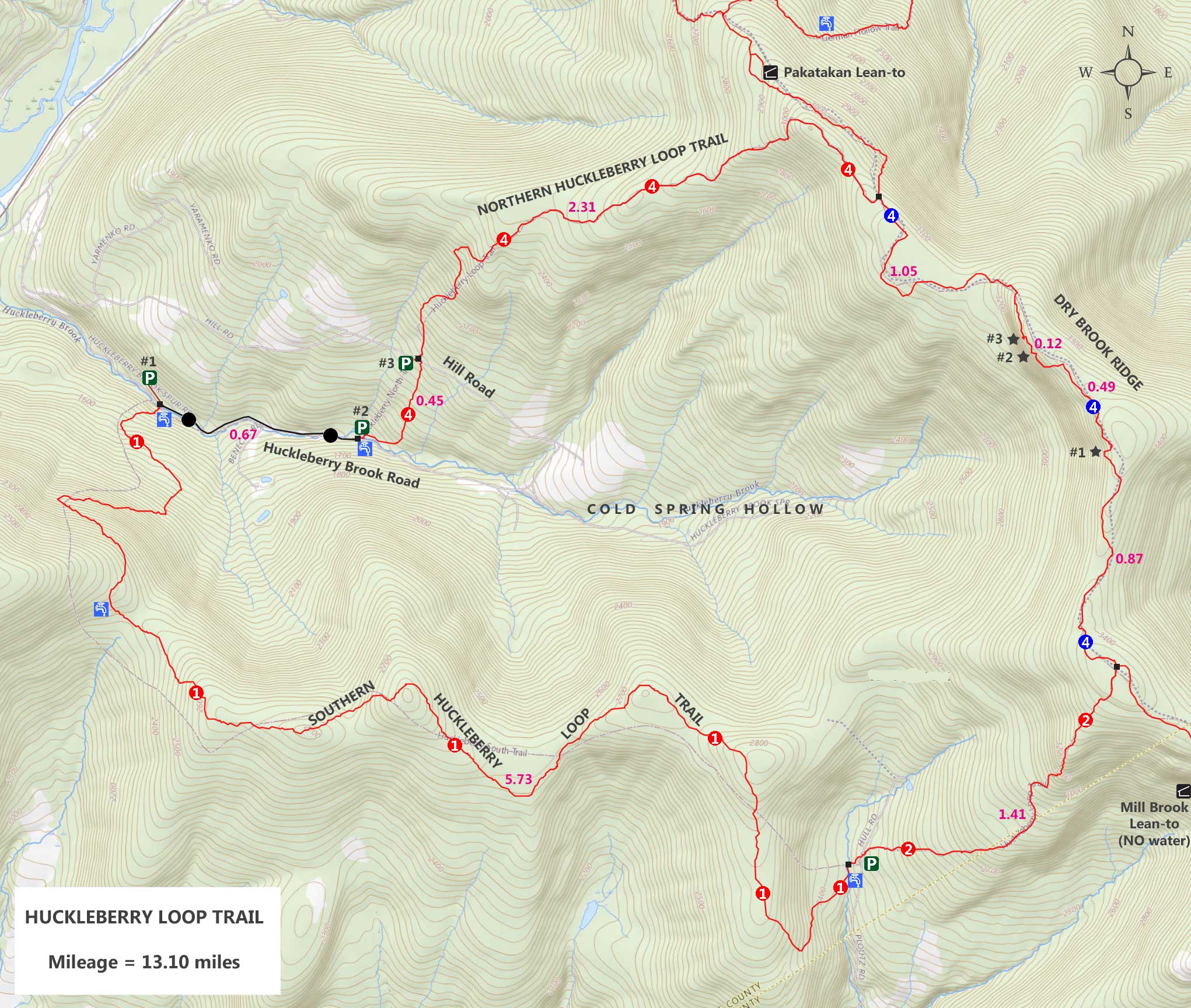
    This is the Parking Area #1 for the beginning of the Huckleberry Loop Trail. It holds 3 cars. It is the closest parking area to the Huckleberry Loop Trailhead. It has a 750 feet driveway off Huckleberry Brook Road. The driveway is located on the LEFT side of Huckleberry Brook Road as you drive up the valley. Not a good place to park when there may be ice or snow on the ground.
    huckleberry Loop Trail Parking Area #2 off Huckleberry Brook Road
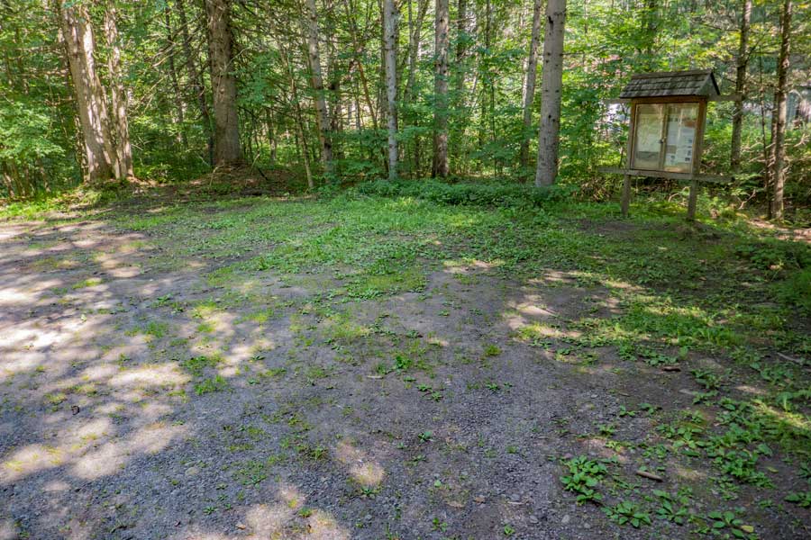
    This is the Parking Area #2 for the beginning of the Huckleberry Loop Trail. It holds 5 cars. Suitable for Winter Parking (if plowed). To start the hike, walk down Huckleberry Brook Road 0.67 miles to the Trailhead.
    huckleberry Loop Trail Parking Area #3 off Hill Road
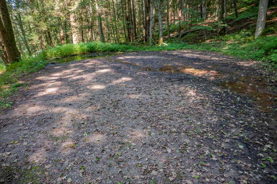
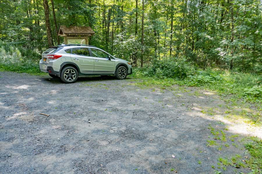
    This is the Parking Area #3 for the beginning of the Huckleberry Loop Trail. It is located on Hill Road. It holds 5 cars. Suitable for Winter Parking (if plowed). To start the hike, walk up Hill Road 200 feet and take a RIGHT on the trail. Hike down the trail a little over 0.44 miles to Parking Area #2. Then hike down Huckleberry Brook Road 0.67 miles to the Trailhead.
    Driveway for the Huckleberry Loop Trail Parking Area #1 and Huckleberry Brook Road
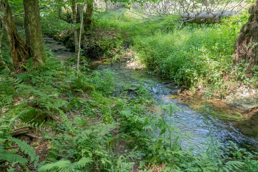
    This is the entrance to the driveway for Parking Area #1 off Huckleberry Brook Road (looking down the road). If you look at the picture, you can see the bridge over the Huckleberry Creek to the Trailhead
    S E C T I O N       # 1
    The bridge over Huckleberry creek to the Huckleberry Loop Trailhead
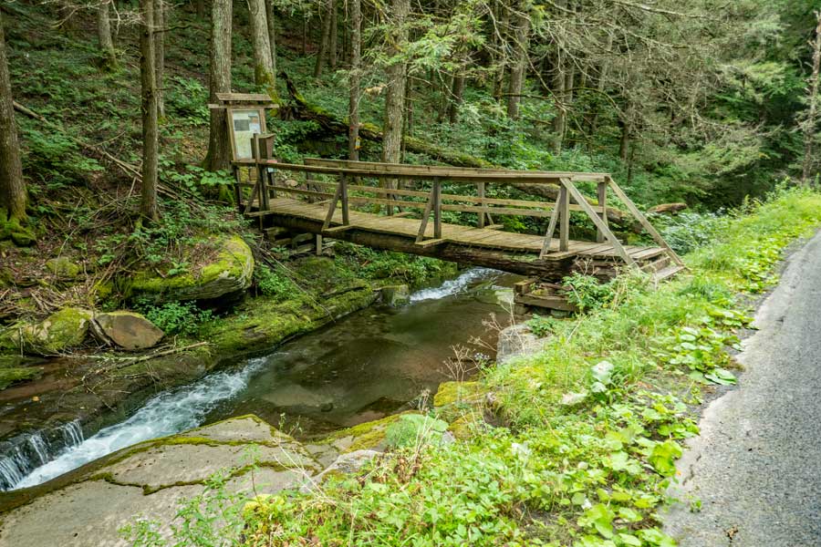
    Take a LEFT onto this wooden bridge over the Huckleberry Creek to the Huckleberry Loop Trailhead.
    Huckleberry Loop Trailhead and DEC registration box
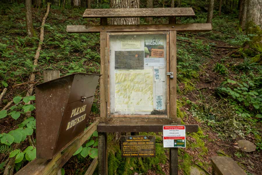
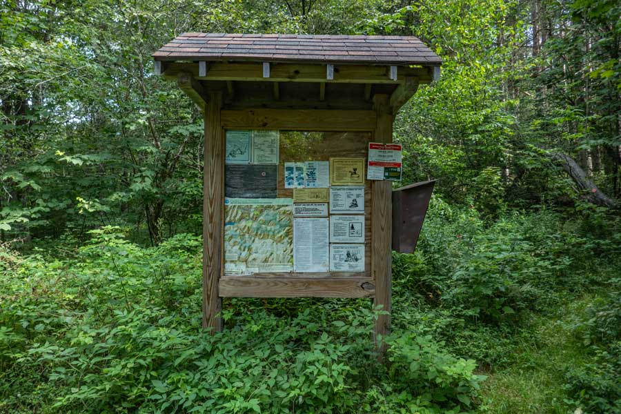
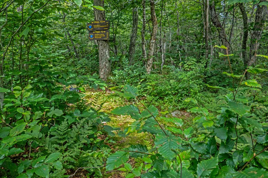
    The DEC Registration Box is directly at the Trailhead for the Huckleberry Loop Trail.

    Funds for maintenance of the regional trails depends upon how many people register for a hike in this region. Additionally, if you or someone else in your party have an emergency, Rangers and SAR will use the information in the registration box to find and help you. If someone goes missing, Rangers may call you to determine if you saw someone missing. Your life and someone else life may depend up you registering.
    The beginning of the Huckleberry Loop Trail
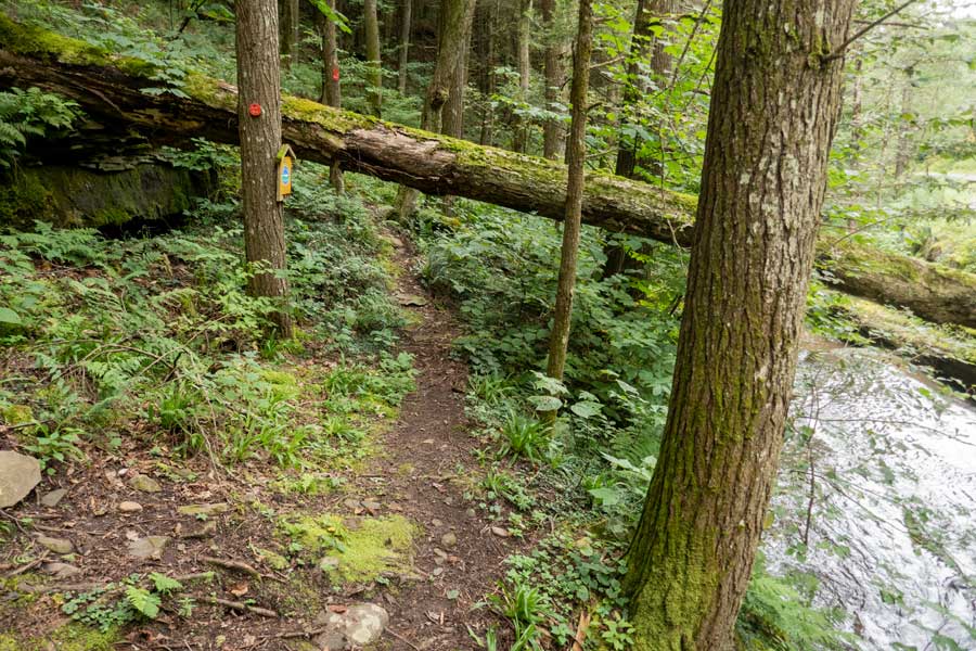
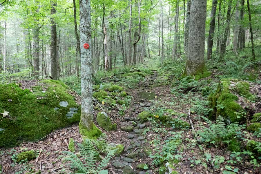
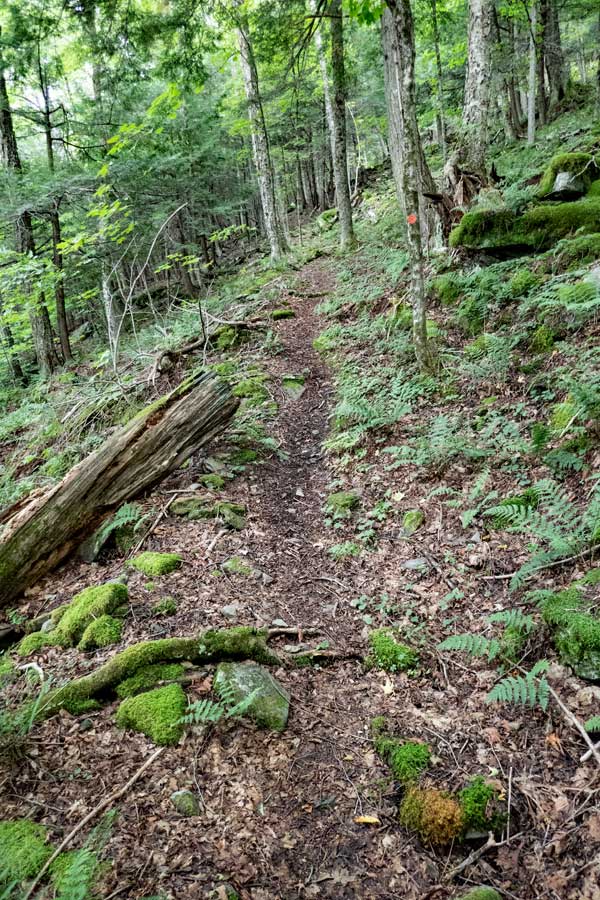
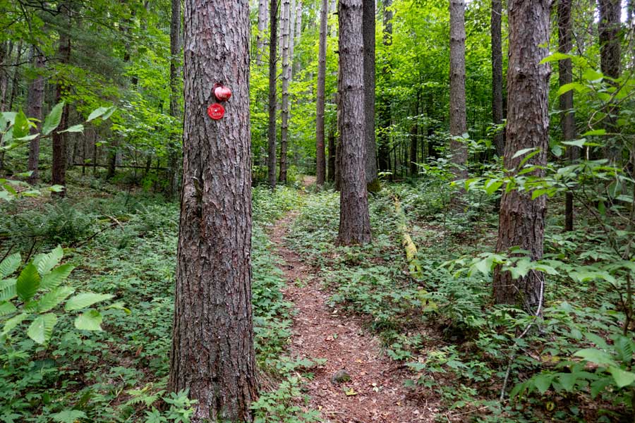
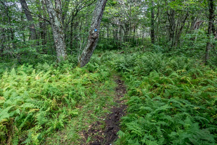
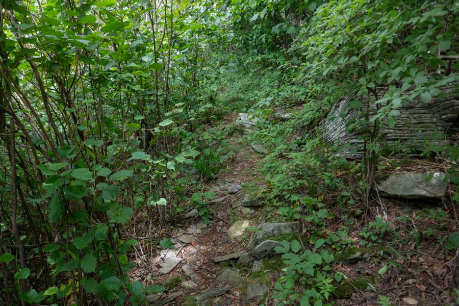
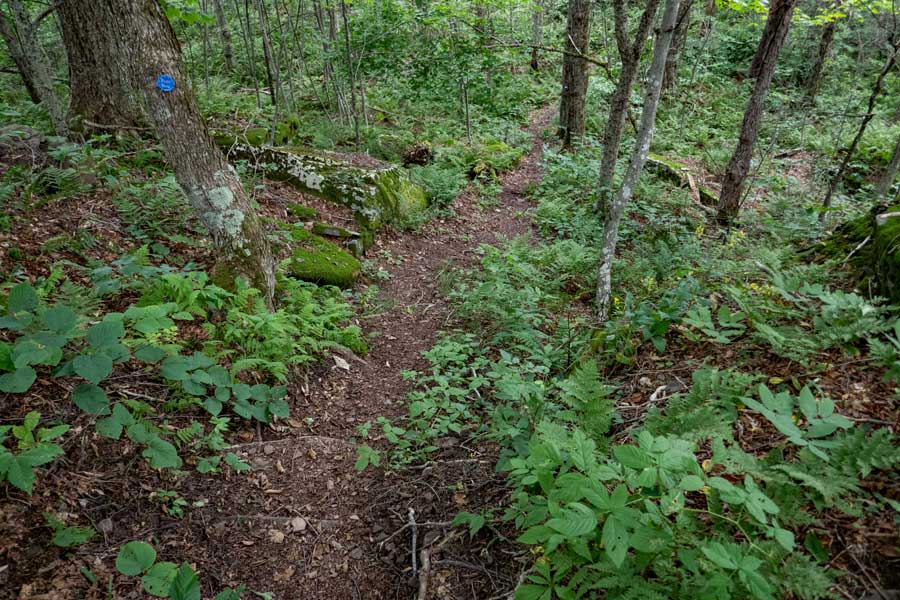
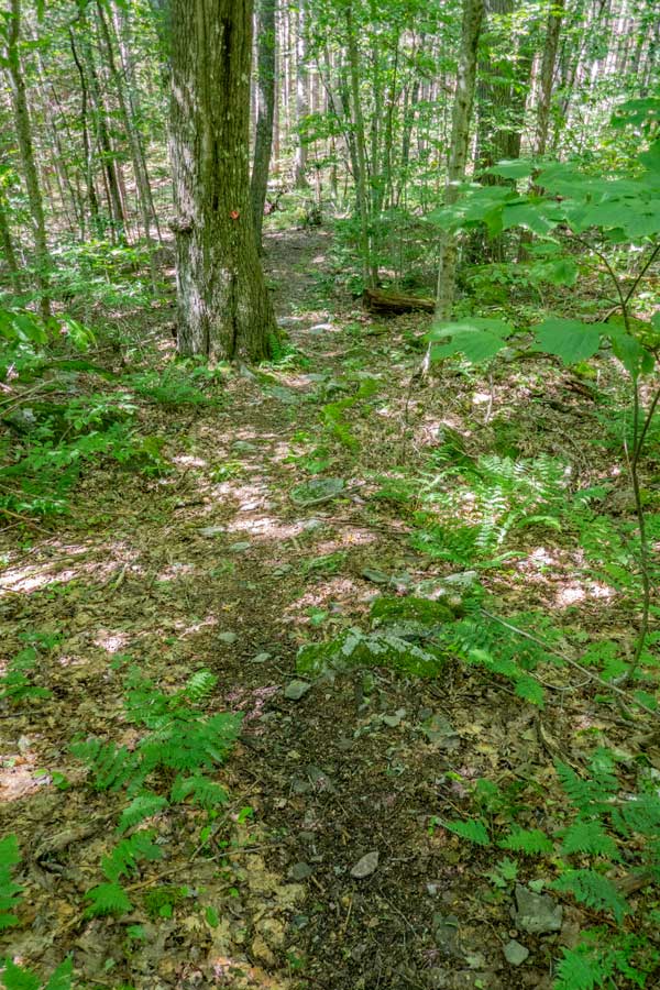
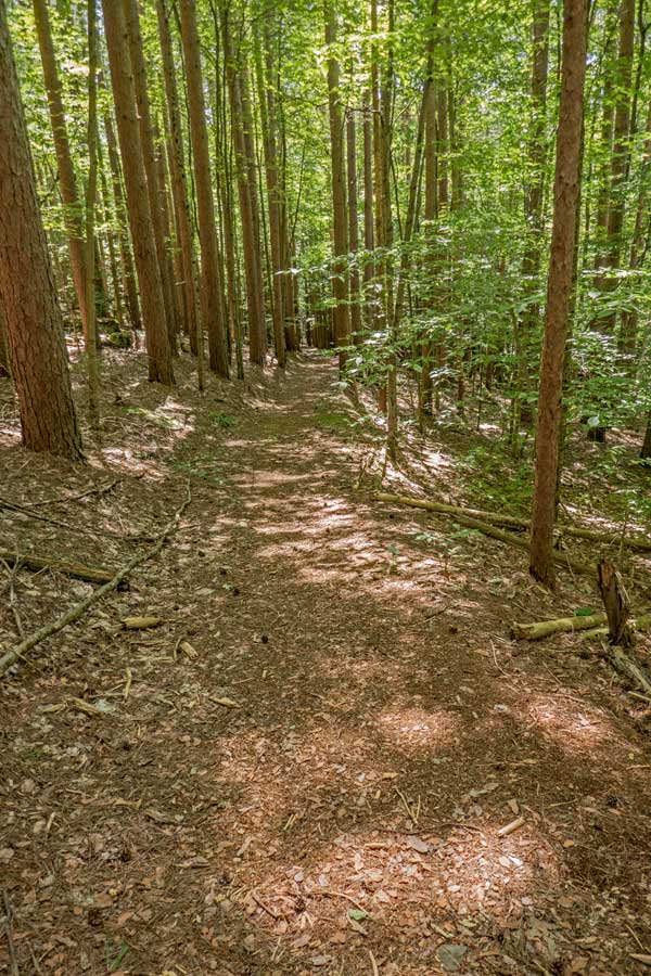
    The beginning of the Huckleberry Loop Trail runs along the Huckleberry Creek for a short distance. The trail then start going through a series of switchbacks up to the ridge line.
    Trail Junction for Huckleberry Loop and the Balsam Lake Mountain Trail
    This one of the sections that goes straight up towards the ridge line. After a short distance it will turn to a fairly level trail before the next switchback
    switchback Huckleberry Loop Trail
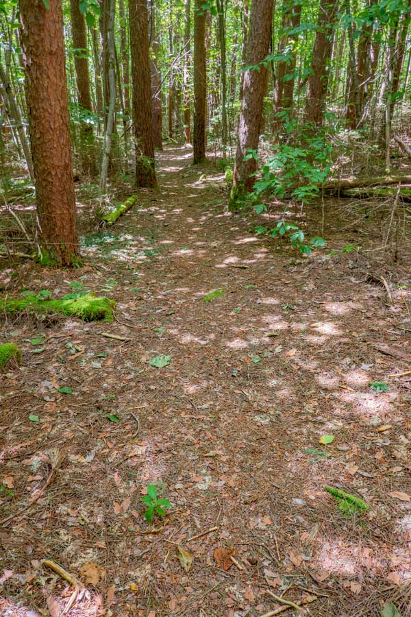
    This is another section of the switchbacks up the mountain to the ridge line. This one has water running down it after a rainstorm.
    switchbacks on the Huckleberry Loop Trail
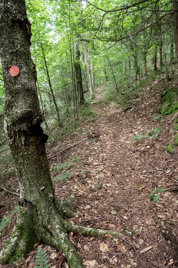
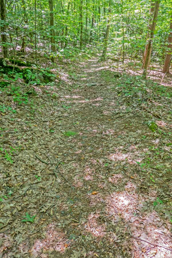
    After hiking up the trail 3/10 of a mile, you will turn RIGHT and head straight up the mountain again.
    The Huckleberry Loop at the beginning of the hike The Huckleberry Loop where the ferns start showing up
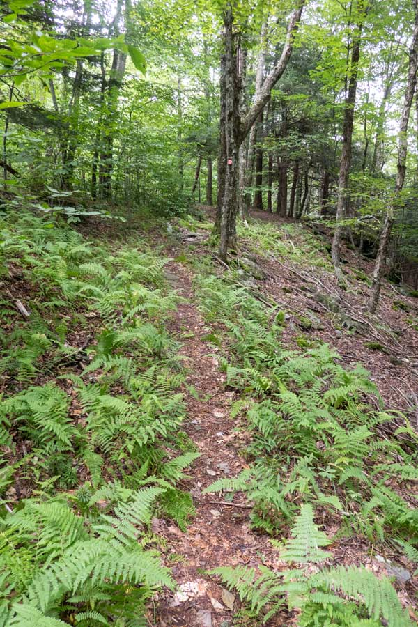
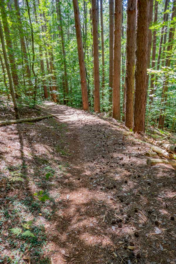
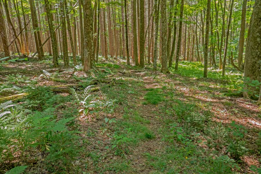
    This images shows the trail going straight uphill again.
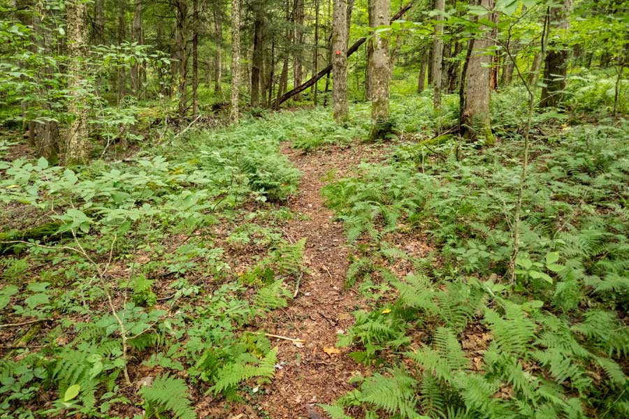
    Again the trail turns again to a flatter section. As you start to ascend higher in elevation you will start to see ferns.
    ascending the first section of the Huckleberry Loop trail from the trailhead. ascending the first section of the Huckleberry Loop trail from the trailhead.
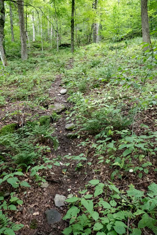
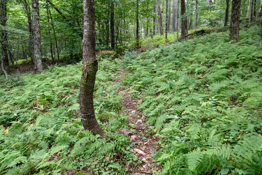
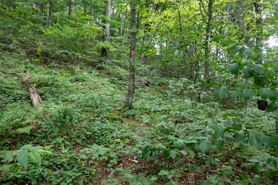
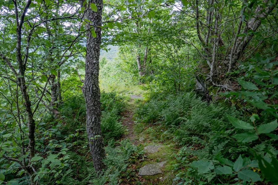
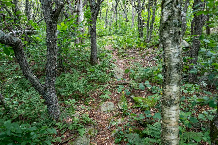
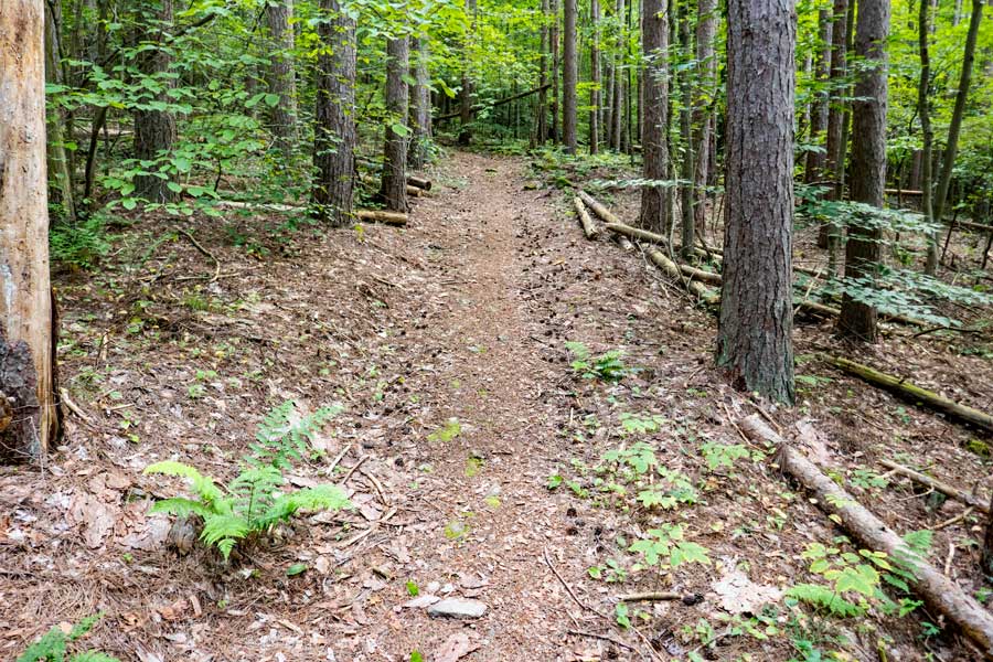
    As you continue to ascend the mountain the trail will become more narrow.
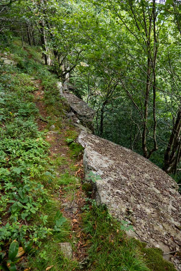
    As you start to approach the ridge line, the trail will cross the steep slope.
    glacier erratic rock near the ridge line on the first section of the huckleberry loop trail
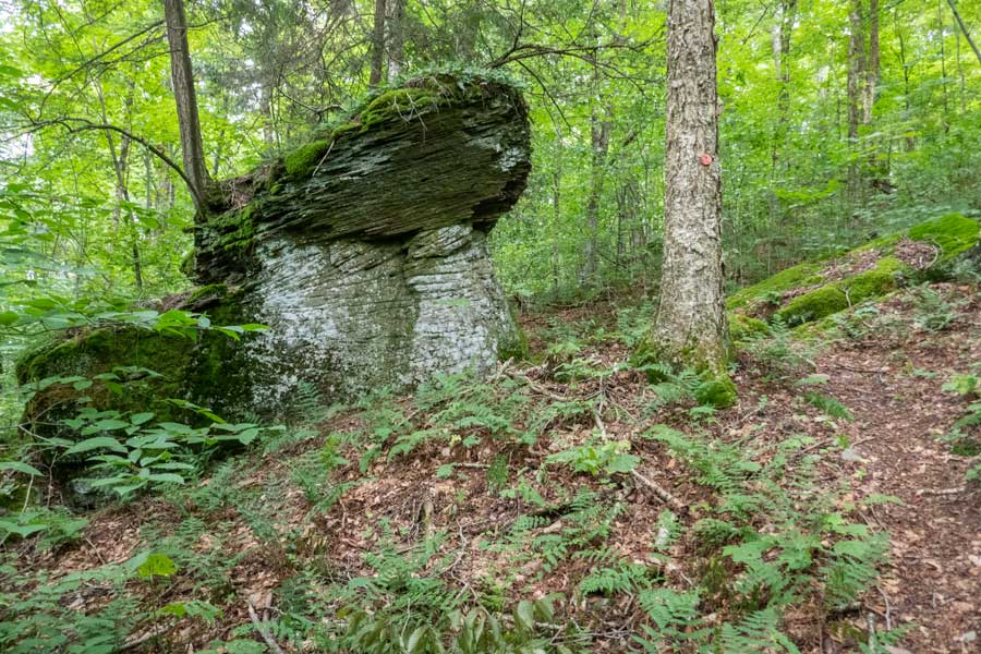
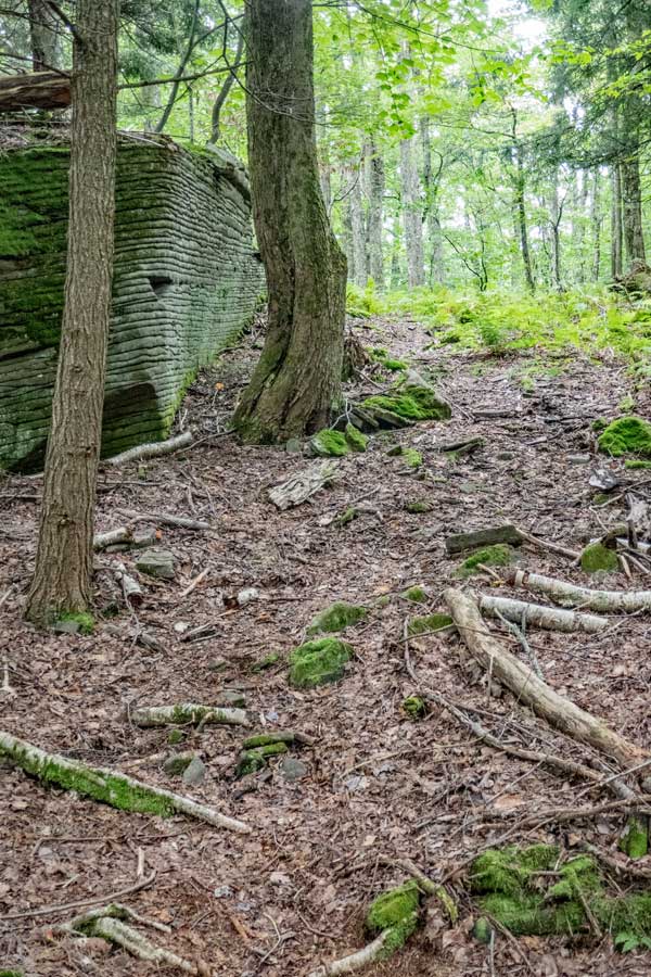
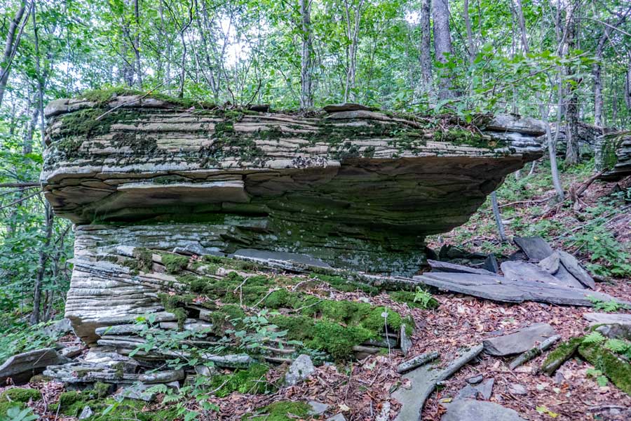
    Once you get to this unique rock, you will be close to the ridge line. This particular rock has a glacier erratic rock on bottom, and a different erratic rock that landed on top of the first rock after the glacier melted.
    approaching the ridge line on the first section of the huckleberry loop trail
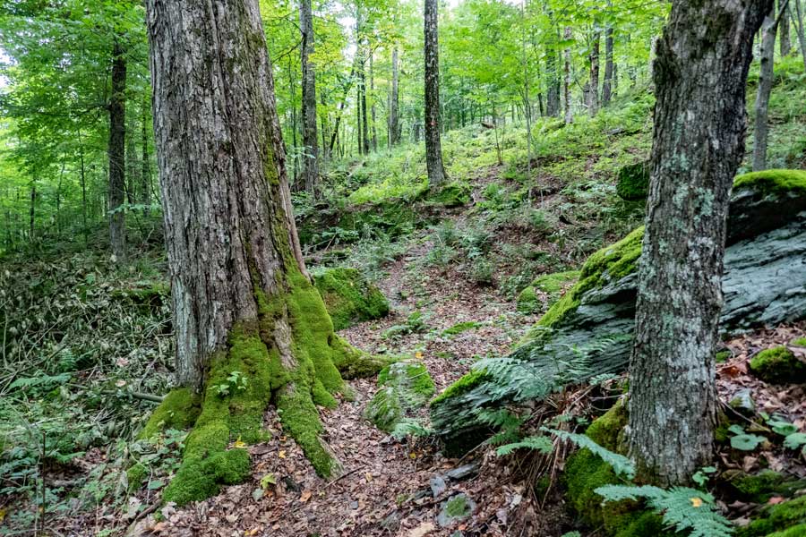
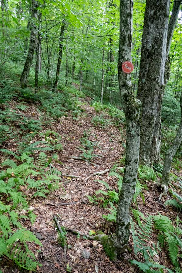
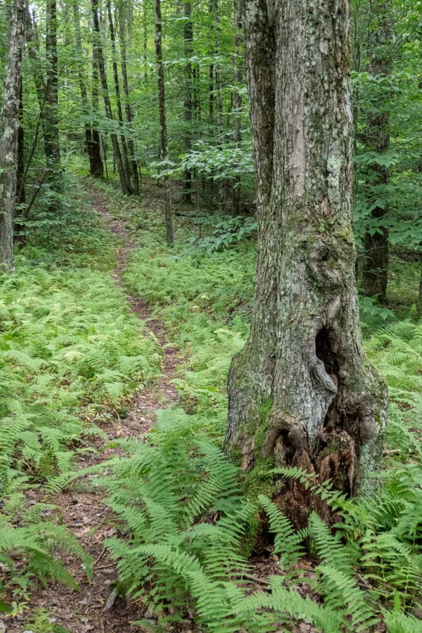
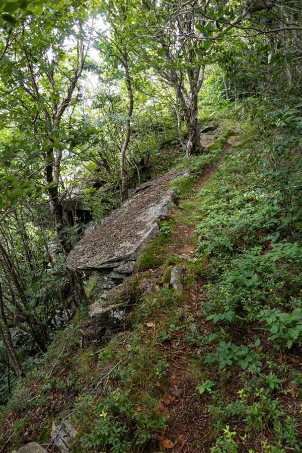
    At this point, this is the last of the long climb up the mountain to the ridge line. You will also notice that there a large number of very large trees on this hike. It will become common to see trees 3-4 feet in diameter.
    fern glade near the ridge of the first section of the huckleberry loop trail
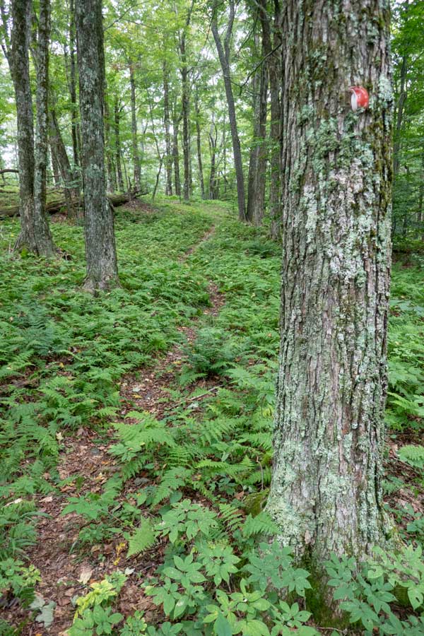
    Once you are on the ridge of the first section of the Huckleberry Loop Trail, you will encounter fern glades on a regular basis.
    open field at the top of the ridge line of the first section of the huckleberry loop trail
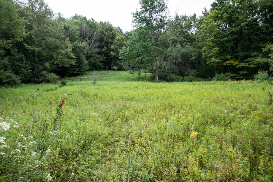
    Shortly after you reach the ridge line, you will see a field on you right. You have a hike 150 feet off the trail to see this field. There is a spring behind the the tree in the middle of the field. There was also a home close by.
    large field that once had a homestead on it along the first section of the huckleberry loop trail.
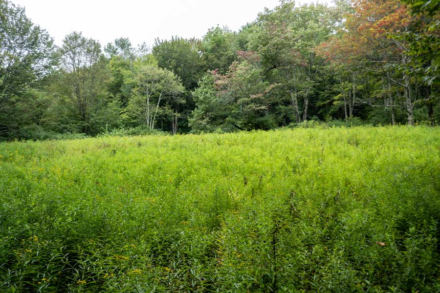
    Shortly after seeing the first field on your right, you will come to a second field which is significantly larger. There was once a home located where this picture was taken. There was also a road that ran from the Huckleberry Valley up the mountain to this point, and then descended down the other side to the Mill Brook Valley. There were a number of homes along the road. This road can be seen on the 1904 USGS topo map on our site.

    The next issue is where did the trail go. In the summer months the trail becomes overgrown here in this field. You want to stay close to the treeline on your LEFT. There is a rock cairn that sticks out of the weeds in the field that helps guide you. It is there for a purpose, so do not knock it down. About 3/4 of the way across the field the trail will exit to the LEFT side of the tree line.
    The Huckleberry Loop after the large field The Huckleberry Loop trail will be deciduous and fern glades
    After the fields the trail will run along the ridge line for quite a ways.
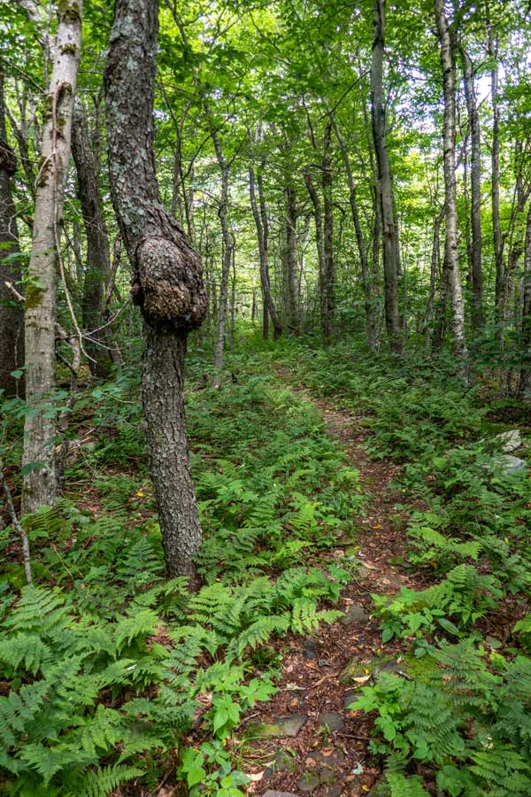
    Most of the forest on this section of the trail will be deciduous trees and small and large fern glades.
    Unique large glacier erratic rock sitting on the forest floor of The Huckleberry Loop Trail another large fern glade filling the forest floor around the trail on The Huckleberry Loop
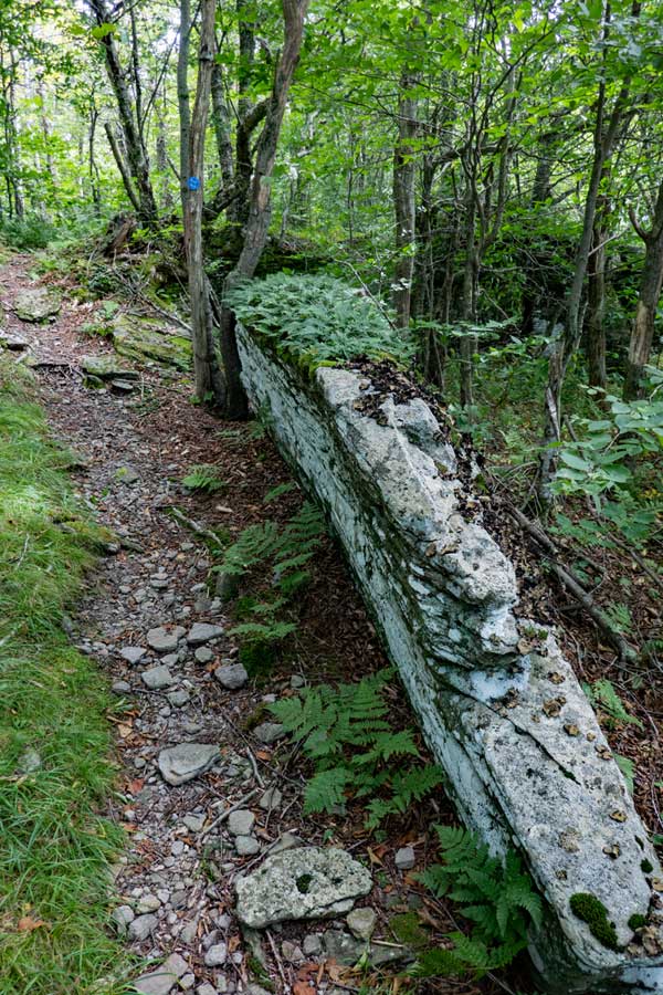
    Along the way, you will encounter this very unique rock. The rock is actually much larger then the pictures shows. The curved section near the forest floor was formed by glaciers dripping and flowing over it. This is probably an erratic glacier rocked dropped here by the glacier.
    Another fern glade filling the forest floor with a slightly windy path through the ferns to keep you entertained with the forest beauty .
    largest fern glade in the catskill mountains on the huckleberry loop trail
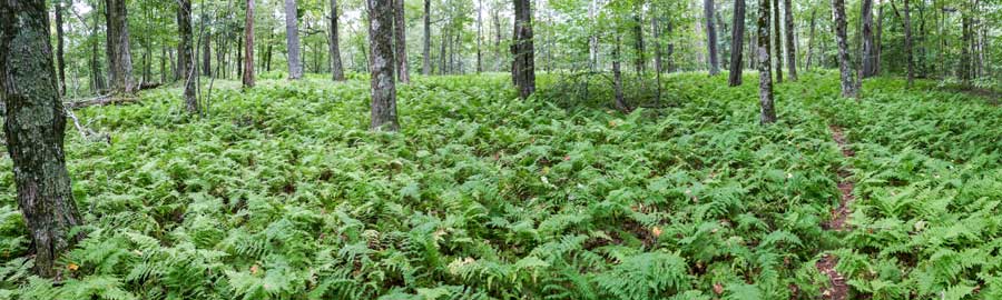
    This is one of the largest fern glades in the Catskill Mountains on the Huckleberry Loop Trail. This panoramic picture shows that the fern glade goes as far as the eye can see. This is only showing part of the fern glade. Many hikers visit the Huckleberry Loop Trail just to visit this amazing fern glade.
    conifer forest near Ploutz Road on the huckleberry loop trail in the dry brook ridge wild forest
    After hiking 4+ miles from the trailhead, you will encounter a beautiful conifer forest. The pictures do not do it justice.
    mossy conifer forest on the upper part of the Huckleberry Loop Trail
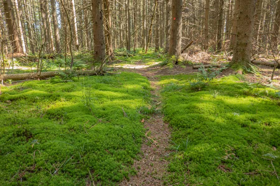
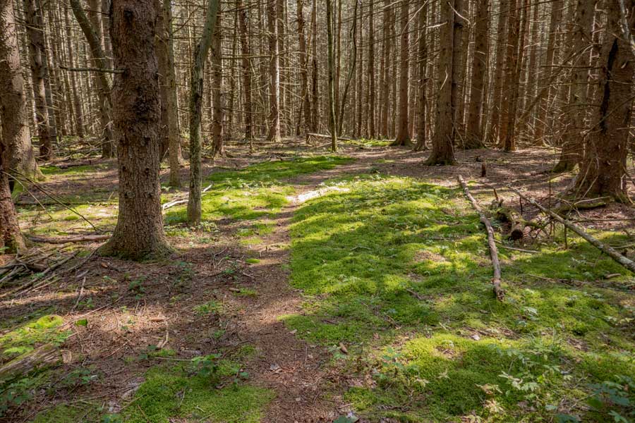
    The conifer forest is carpeted with beautiful moss in many sections. You will be sad when the conifer forest ends on the upper part of section 1 of the Huckleberry Loop Trail.
    trail down off the ridge after the conifer forest on The Huckleberry Loop in the Dry Brook Wild Forest trail off the ridge line down to a tributary of the Mill Brook Creek on The Huckleberry Loop
    Once out of the beautiful conifer forest the trail will head down off the ridge towards Ploutz Road. It is about a mile to Ploutz Road.
    The trail will turn to the left and head down to a tributary of the Mill Brook Creek and the DEC Ploutz Road Parking Area.
    water source near Ploutz Road on the Huckleberry Loop Trail
    This is one of many tributaries of the Mill Brook Creek. It is one of the few locations where you can obtain water for your hike.

    After crossing the creek, head up the trail to Ploutz Road. Ploutz Road and the DEC Parking Area/Trailhead is a few minutes away.
    S E C T I O N       # 2
    ploutz road trailhead for the second section of  the Huckleberry Loop trail
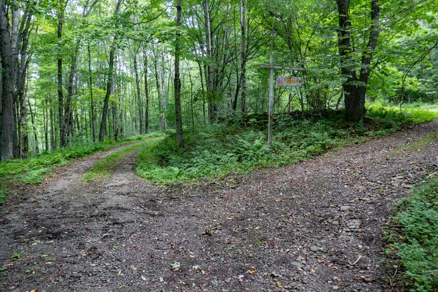
    This is the beginning of the Second Section of the Huckleberry Loop. The road on the left is Ploutz Road. The road on the right is the driveway up to the DEC Ploutz Road Parking Area and registration box.
    Huckleberry Loop DEC sign at the entrance of the Parking Area
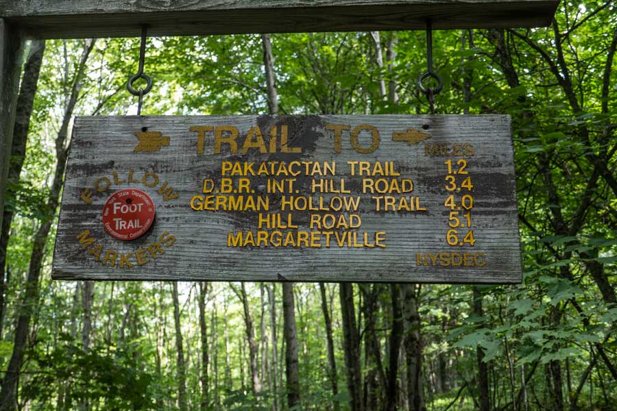
    This is the DEC sign on the entrance of the Ploutz Road Parking Area. The mileage on the sign is not acccurate.
    Huckleberry Loop parking area
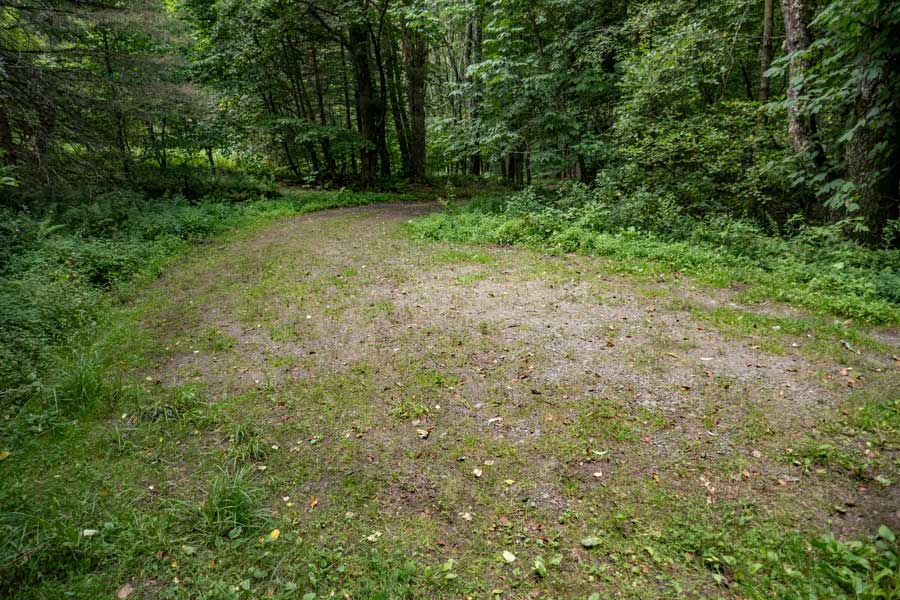
    This is the parking area for the Huckleberry Loop Trail at the Ploutz Road Trailhead. It holds 3 cars.
    The beginning of the Dry Brook Ridge Trail
    This is the Ploutz Road Parking Area Kiosk. The DEC Registration Box is attached to the Kiosk. .

    Please register at the DEC Registration Box. Funds for maintenance of the regional trails depends upon how many people register for a hike in this region. Additionally, if you or someone else in your party have an emergency, Rangers and SAR will use the information in the registration box to find and help you. If someone goes missing, Rangers may call you to determine if you saw someone missing. Your life and someone else life may depend up you registering. Remember that this area is remote, and you will likely not see another person all day. On our visit no one had been here in the past week.
    Trail after the DEC registration box on the Huckleberry Loop Trail
    The trail starts out with an easy incline that winds through a nice conifer forest. This section of the Huckleberry Loop Trail will climb almost a 1,000 vertical feet in 1.4 miles, between Ploutz Road and Dry Brook Ridge Trail.
    The typical view of the Dry Brook Ridge Trail
    As you climb up towards the Dry Brook Ridge trail on the Huckleberry Loop Trail, the vegetation will increase. So, pay attention to the Trail Markers. Most people can follow the path through the thick vegetation. In the higher elevations of the mountain, the conifer trees will almost completely disappear.
    Huckleberry Loop Trail near the ridge
    Just one of several unique rocks you will encounter along the way on this hike.
    end of public land onto private property on the Dry Brook Ridge Trail
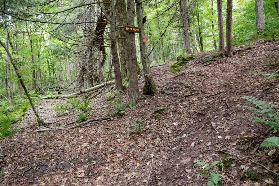
    Just before you reach the Dry Brook Ridge Trail, the vegetation will get thick. There are a few braided trails, so just keep pushing forward. The Dry Brook Ridge Trail is close by. At 1-1/3 miles from Ploutz Road. You want to take a LEFT onto the Dry Brook Trail. Right would take you to Mill Brook Road. It is about 3-1/2 miles to Mill Brook Road.
    S E C T I O N       # 3
    fern glades and muddy sections on the Dry Brook Ridge
    No shortage of fern glades on the Dry Brook Ridge. There are short ferns and tall ferns. With the name, "Dry Brook Ridge", you might think that the ridge is dry. Although it is true there is no water to collect, there is plenty of muddy sections of this trail. During a drought, the trail might be dry.
    approaching view point #1 on the Dry Brook Ridge
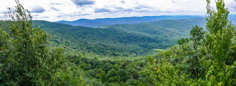
    After almost 3/4 of a mile on the Dry Brook Ridge, you will come to View Point #1 that overlooks the Huckleberry Valley. Be careful around the open section. Easy to fall off.
     view point #1 on the Dry Brook Ridge
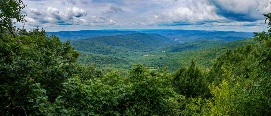
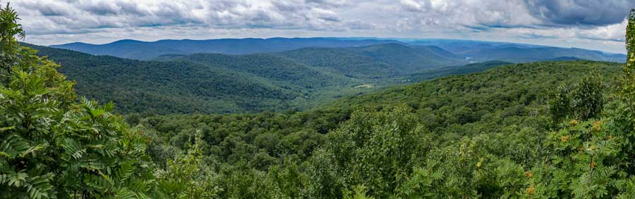
    This is a panorama picture from View Point #1. On a nice clear day, you can far into the distance. Be careful around the open section. Easy to fall off one of the rock ledges.
    Trail between view point #1 and view point #2 on the Huckleberry Loop
    After you get done enjoying the views from View Point #1, the trail will then move back up on the ridge line. The trail will wind up-and-down the ridge for another 1/2 mile.
    dangerous ledge just before View Point #2 on the Dry Brook Ridge ledge just before View Point #2 on the Dry Brook Ridge
    As you come back down off the ridge after about a 1/2 mile, it will come down to the very edge of the ledge. The ledge drops 40-50 feet. So, walk carefully here. If you fall here, you die. This section of the trail is not recommended for children. Picture was taken looking backwards.
    After you carefully hike up this small hill, you will reach View Point #2
    view Point #2 on the Dry Brook Ridge
    Here is another panoramic image of View Point #2 on the Dry Brook Ridge. It has a slightly different view of the Huckleberry Valley along with the Mill Brook Ridge in the distance.
    Trail to View Point #3 on the Huckleberry Loop
    After you done enjoying View Point #2 on the Dry Brook Ridge, the trail climbs back up towards the ridge. You will hike close to 1,000 feet, before you reach the trail to View Point #3. You will see a trail on your left. This short trail will take you to View Point #3. You need to be careful hiking out to View Point #3. There is some exposure and danger. Many consider View Point #3 the best view on the Dry Brook Ridge. Again, this ledge is not recommended for children.
     Huckleberry Loop Trail
    This is a panoramic image from View Point #3 of the Huckleberry Valley with the Mill Brook Ridge in the background. Once done, head back to the Huckleberry Loop.
    Sliver Rock on the Huckleberry Loop more fern glades on the Huckleberry Loop
    After leaving View Point #3 on the Dry Brook Ridge, the trail will start to drop in elevation. The image on the left is called Sliver Rock. It is a very unusual rock.
    The image on the right show you some more fern glades.
    hiking off the Dry Brook Ridge towards the trail junction for the Huckleberry Loop
    The trail will start to drop more in elevation as you descend downhill. You will slowly descend in elevation for the next mile.
    trail junction to the Huckleberry Loop Tran off the Huckleberry Loop
    After a little over a mile from View Point #3 on the Dry Brook Range, you will come to the Trail Junction for the other side of the Huckleberry Loop Trail.

    You want to go LEFT down the North section of the Huckleberry Loop Trail.
    S E C T I O N       # 4
    top section of the northern leg of the Huckleberry Loop Trail
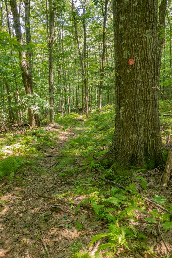
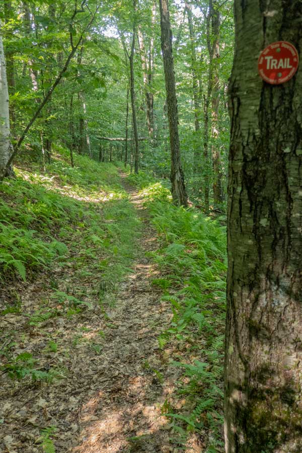
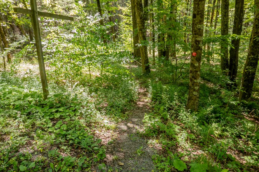
    The top part of the Northern section of the Huckleberry Loop Trail tends to be overgrown. While most hikers do not have a problem following the path, you do need to pay attention to the Trail Markers and the path.
    upper part of the northern Huckleberry Loop Trail large trees along the way on the Huckleberry Loop Trail
    After the top section of the northern part of the Huckleberry Loop Trail, the trail will start to open up more.
    Again you start to see very large trees along the path as you descend into the Huckleberry Valley This tree is around 4 feet in diameter.
    conifer forest on the northern section of the Huckleberry Loop Dediuous forest on the northern section of the Huckleberry Loop Trail
    As you descend further down the northern part of the Huckleberry Loop, you will start to encounter some conifer forest.
    Then there will be another deciduous forest before hitting the larger conifer forest further down the trail. The trail will become wider as you descend further.
    large conifer forest on the Huckleberry Loop Trail large conifer forest on the northern section of Huckleberry Loop trail
    Once you reach the middle section of the Northern section of the Huckleberry Loop Trail, the trail will open up to the beautiful conifer forest.
    The path has a beautiful base void of any rocks or roots. Very nice hiking.
    conifer forest continues on the northern section of the huckleberry loop trail to Hill Road.
    The conifer forest will continue to the Parking Area #3 on Hill Road. Very enjoyable hiking
    Hill Road connecting the upper and lower sections of the northern section of the Huckleberry Loop Trail
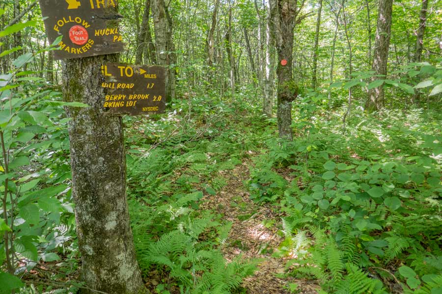
    When you arrive at Hill Road, you will have completed 2/3rd of the Northern section of the Huckleberry Loop Trail.

    When you reach Hill Road, take a LEFT and hike up Hill Road 200 feet. On the RIGHT side of the road, the lower 1/3 of the Northern Section of the Huckleberry Loop Trail will continue.
    trail junction to the lower 1/3 of the northern section of the huckleberry loop trail on Hill Road
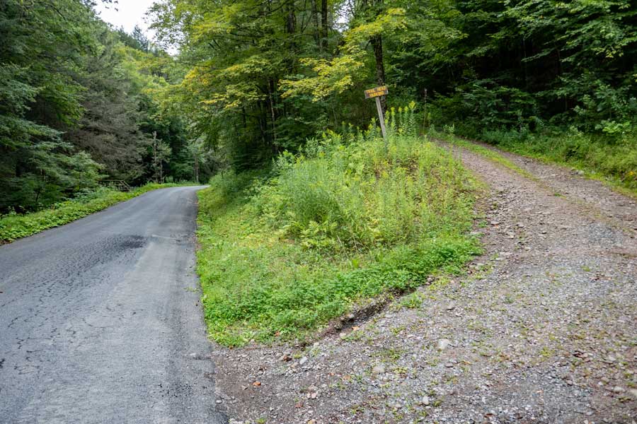
    After hiking UP Hill Road 200 feet, you will see an old trail post (without the sign) on the RIGHT side of Hill Road. The lower part of the Northern section of the Huckleberry Loop Trail will continue here.
    huckleberry loop trail between Hill Road and Huckleberry Brook Road
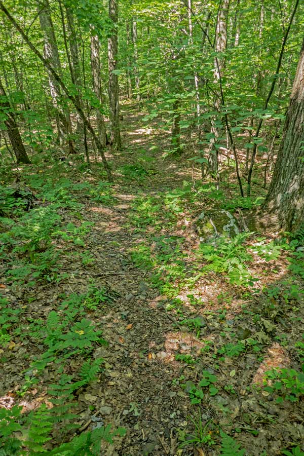
    The lowere section of the northern Huckleberry Loop Trail, between Hill Road and Huckleberry Brook Road will be a conifer forest.

    After the conifer forest, the forest will change to a deciduous forest. The overgrown on the trail will thicken. This thick vegetation section will not last that long.
    huckleberry loop trail next to the green DEC building on Huckleberry Brook Road
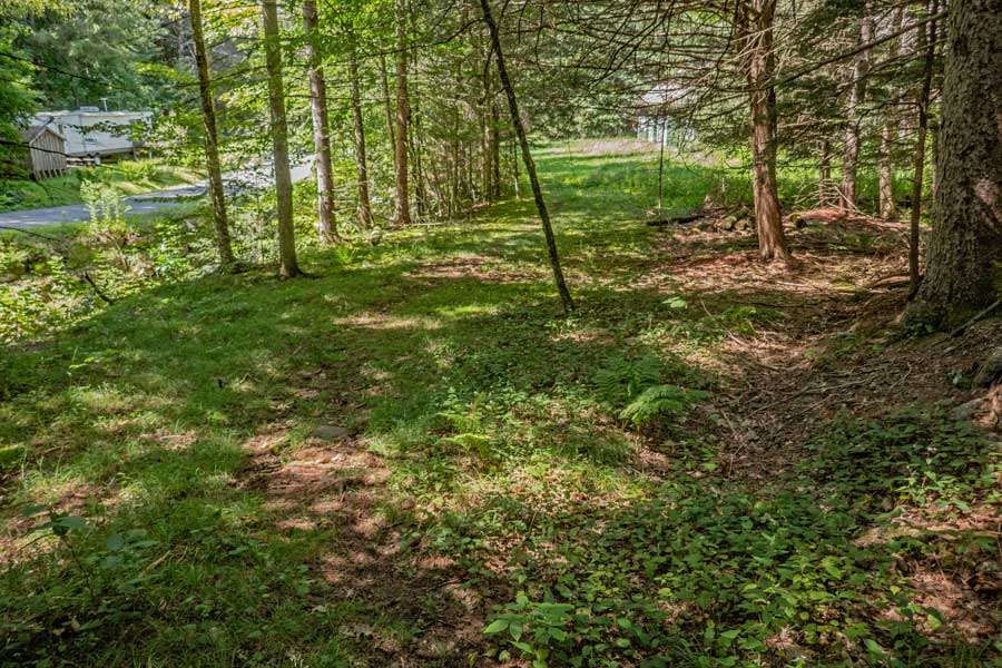
    Once you reach the Huckleberry Brook and Huckleberry Brook Road, the trail will turn to the RIGHT. When you look ahead, you will see an opening with a green building with white trim. The land and building is owned by the DEC. Just continue hiking past the building on the lawn.

    Once past the building, you will see a barn on your right. On your left will be a short bridge.
    bridge over the Huckleberry Brook to Huckleberry Brook Road
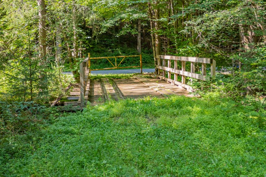
    You want to take a LEFT over the bridge to the Yellow DEC gate to Huckleberry Brook Road.
    trailhead to parking area #2 on Huckleberry Brook Road
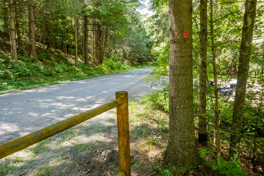
    Once at the DEC gate, you want to go around the gate. Then turn RIGHT and hike DOWN Huckleberry Brook Road. On your right you will see Parking Area #2. You want to hike down Huckleberry Brook Road 2/3 of a mile.
    End of the Huckleberry Loop and the DEC access dirt road to parking area #1
    As you hike down Huckleberry Brook Road 2/3 of a mile, you will see the DEC Parking Area on your RIGHT. If your car is parked up there, you want to walk down the road 600-700 feet to your car.

    If you look down Huckleberry Brook Road, you can see the bridge across the creek to the Huckleberry Loop Trailhead on the left of the road. This completes the Huckleberry Loop Trail. Hope you enjoyed this hike.
    Links and References:

    USGS Topo Map of the Arena Quad

    USGS Topo Map of the Seager Quad

    NY DEC map of the Huckleberry Loop Wild Forest (free)

    DEC Information on the Huckleberry Loop Wild Forest


      S E C T I O N S


      W E A T H E R


      O T H E R

    Copyright 2001-2024 www.catskillmountaineer.com ALL RIGHTS RESERVED