Halcott Mountain & Sleeping Lion Mountain |
 |
| |
| |
|
OVERVIEW |
| | Distance: | ~5.00 miles from the DEC parking lot on Rt 42. |
| | Time: | Average 4.5 hours round trip in the Winter - 3 hours in the summer |
| | Elevation Gain: | 1,726 feet from the DEC Parking Lot and the summit. |
| | Best Time to Hike: | Anytime, but most prefer to hike it in the Winter. |
| | Difficulty: | Moderate |
| | Catskill Highest: | #34 & 47 |
| | Peak Elevation: | 3,520' (Halcott) & 3,408' (Sleeping Lion) |
| | |
| | | USGS Halcott Elevation: | 3,524' (USGS) |
| | USGS Halcott Peak-GPS: | 42.1800882, -74.4379281 (DEC-WGS84) |
| | USGS Halcott Peak-GPS: | N 42 10.805, W 74 26.276 (GPS) |
| | USGS Halcott Peak-GPS: | 18N 546418, 4669924 (UTM) |
| | USGS Halcott Peak-GPS: | N42 10 48, W74 26 16 (Degree, Min, Sec) |
| | |
| | | USGS Topo Map: | Westkill Topographical Map (free) |
| | |
| | | Digital Mapper for Halcott: |
Topo
Terrain
Satellite |
| | |
| | | Digital Mapper for Sleeping Lion: |
Topo
Terrain
Satellite |
| | |
| | | Access Methods: | Foot and snowshoe |
|
|
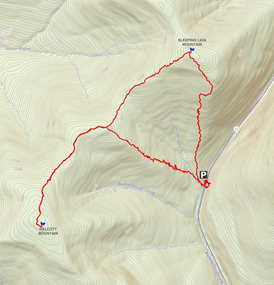
Map |
 |
|
|
| | DIRECTIONS TO TRAIL HEAD |
| | Parking Lot (DEC-WGS84: 42.185153°N, 74.414912°W) - Parking Lot Elevation is approximately 1,794 feet |
| | Parking Lot (GPS: N 42 11.109, E 74 24.895) - Parking Lot Elevation is approximately 1,794 feet< |
| | Parking Lot (Lat-Long: N42 11 06 E74 24 53) - Parking Lot Elevation is approximately 1,794 feet< |
| | Parking Lot (UTM: 43N 451685 4670500) - Parking Lot Elevation is approximately 1,794 feet |
| | |
| | | Take New York State Thruway to Exit 21 (Catskill) See NOTE #1. |
| | Take a left out of the NYS Thruway entrance road. |
| | Go approximately 3/4 mile |
| | Take a right onto Route 23 West |
| | Go approximately 6.6 miles to Cairo, NY |
| | Take a LEFT onto Rt 32. McDonalds Rest. on corner. |
| | Go approximately 7.7 miles on Rt 32 |
| | Take a RIGHT onto Rt 23A |
| | Go appoximately 22.2 miles to the intersection of Rt 23a and Rt 42 . |
| | Go approximately 0.3 miles - Take LEFT and go over bridge (over Schoharie Creek) |
| | Go approximately 6-7 miles on Rt 42 (from Rt 23a) |
| | Small parking lot directly on Rt 42 on the right side of the road (west side of road). |
| | There are 8 parking spaces. |
| | |
| | | Note #1 - If traveling from south of the Catskill Mountains, get off Exit 19 (Kingston). Take Rt 28 West for 28.5 miles. Turn Right onto Rt 42. Go north on Rt 42 for 4.5 miles (PA on left side of road). |
|
|
|
SPECIAL CIRCUMSTANCES ABOUT THIS HIKE |
| | The hike up to Halcott Mountain does not have a view from the summit. There is a limited view from the summit to the south in the Winter. It is considered a bushwacking hike. The summit of Sleeping Lion Mountain also does not have a view from the summit.
The hike starts from the Parking Area directly on Rt 42. After you walk up the right side of Halcott Falls you want to follow the stream up the mountain. You will climb the moderate incline up 1,200 vertical feet to reach the saddle between Halcott Mountain and Sleeping Lion Mountain. There are no ledges up the incline.
Once you get to the top of the saddle between Halcott Mountain and Sleeping Lion Mountain the hiking will be easy. You want to take a left and walk down the middle of the saddle to the summit of Halcott Mountain.
Once you get to the summit of Halcott Mountain you can sign the notebook in the canister. There is a very limited view to the south from the summit. The view is only available in the Winter. Once you get done, head back down the trail to the middle of the saddle between Halcott Mountain and Sleeping Lion Mountain.
Instead of going down the moderate incline you want to continue on the saddle. As you approach the summit of Sleeping Lion Mountain, the incline will start to go up hill. The incline is easy.
The summit of Sleeping Lion Mountain is a fairly flat top. It is a little hard to find the actual summit. There is nothing on top to tell you where the summit is. There is NO view from the summit of Sleeping Lion Mountain.
From the summit, you can go one of three ways. You can continue on the ridge line to South Vly Mountain. It is several miles to South Vly Mountain. You can reverse your course back to the saddle and go down to the parking lot. The third way is the way we went. You can go down the steeper incline to the parking lot. This way is the shortest route back to the car.
|
|
|
MILEAGE CHART |
| | Mile Point | Altitude | Notes |
| | 0.00 | 1,852 | DEC Parking Lot - GPS: N42 11.070 W74 24.885 |
| | 2.10 | 3,520 | Halcott Mountain Summit. |
| | 4.05 | 3,408' | Sleeping Lion Mountain Summit |
| | 5.51 | 1,852 | DEC Parking Lot |
|
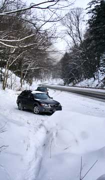 |
This DEC parking lot is directly on Rt 42. It is about a mile past the summit of Rt 42. It is located on the right side of the road. It can park about 8 cars. The GPS of the parking lot is: N42 11.070 W74 24.885
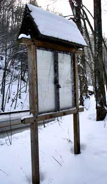
After leaving your car, you want to head towards Halcott Falls, and past this DEC board. Once you get to the Falls, you want to walk up the right side of the Falls. |
 |
|
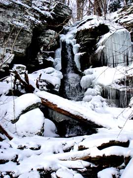 |
The picture on the left is Halcott Falls. It is a small water fall.
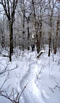
When you get to the top of the Falls, you want to follow the stream uphill. You will climb up a moderate incline to the top of the saddle. This moderate incline will continue for 1,200 vertical feet. |
 |
|
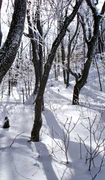 |
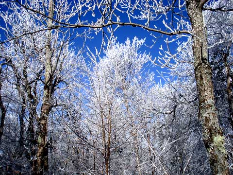
Once you get to the top of the saddle, the uphill hiking will be easy thereafter. The hike across the ridgeline is easy and nice. |
|
|
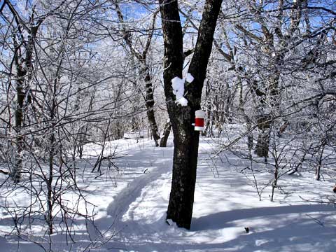
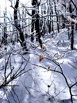
Around mile post 2.10, you will reach the summit of Halcott Mountain. The summit is on the right side of the ridge. There is a limited view in the Winter to the south.
After enjoying the summit, head back down the path the middle of the saddle between Halcott Mountain and Sleeping Lion Mountain. |
|
 |
Follow the the ridge line up to the summit of Sleeping Lion Mountain. The hike up the ridge line is pretty easy.
|
|
 |
The top of Sleeping Lion Mountain is fairly flat, so finding the exact top of the mountain can be a little difficult. There are NO views from the summit.
|
|
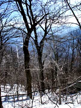 |
You can reverse your course back to the parking lot. On this particular hike, we took a short-cut, and came down the south face of Sleeping Lion Mountain. Down around 3,100' there is a ledge that can offer some views. The picture on the left shows a limited view to the south from the south face of Sleeping Lion Mountain. It should be noted that the east face is extremely steep with ledges. It is commonly used by ice climbers in the Winter. Some people head west to South Vly Mountain along the ridge line.
|
|
|
S E C T I O N S
|
W E A T H E R
|
O T H E R
|
|
Copyright 1994-2024 www.catskillmountaineer.com
ALL RIGHTS RESERVED
|