South Vly Mountain |
 |
| |
| |
|
OVERVIEW |
| | Distance: | ~5 miles round trip from Condon Hollow Road. |
| | Time: | >Average 4.00 hours round trip |
| | Summit Elevation: | 3,355' |
| | Elevation Gain: | 1,267' feet to South Mountain. |
| | Best Time to Hike: | When the leaves are not on the trees. |
| | Difficulty: | Moderate |
| | Catskill Highest: | #50 |
| |
| | USGS Unofficial Names: | South Vly Mountain |
| | USGS Unofficial Elevation: | 3,360' |
| | USGS Unofficial WGS84 (DEC) | 42.229967, -74.43845 |
| | USGS Unofficial GPS | N 42 13.798, W 74 26.307 |
| | USGS Unofficial UTM | 18N 546338, 4675462 |
| | USGS Unofficial Dec, Min, Sec | N42 13 47, W74 26 18 |
| |
| | USGS Official Map: | Westkill Topographical Map (free) |
| |
| | DEC Trail Map: | DEC Halcott Mountain Wild Forest Map (free) |
| |
| | Digital Mapper for South Vly Mtn: |
Topo
Terrain
Satellite |
| |
| | Access Methods: | Foot, ski, snowmobile, snowshoe |
| |
| USGS Note: This is not an official mountain listed with the USGS. |
|
|
Maps |
 |
|
 |
|
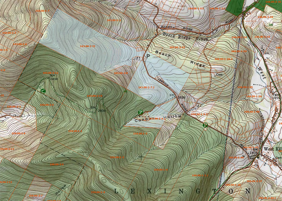
Public & Private Land Ownership around South Vly Mountain
Lite Green or White=Private Land
Green=DEC Public Land
Lite Blue=DEP NYC Public accessible land
|
|
|
| | DIRECTIONS TO TRAIL HEAD |
| | DEC Parking Lot WGS84 (DEC): 42.215717, -74.416517 - Elevation is approximately 1,799 feet |
| | DEC Parking Lot GPS: N 42 12.943, W 74 24.991 - Elevation is approximately 1,799 feet |
| | DEC Parking Lot UTM: 18N 548159 4673892 - Elevation is approximately 1,799 feet |
| | DEC Parking Lot Deg, Min, Sec: N42 12 56, W74 24 59 - Elevation is approximately 2,088 feet |
| | Take New York State Thruway to Exit 21 (Catskill). |
| | Take a left out of the NYS Thruway entrance road. |
| | Go approximately 3/4 mile |
| | Take a right onto Route 23 West |
| | Go approximately 6.6 miles to Cairo, NY |
| | Take a LEFT onto Rt 32 (McDonalds Rest. on corner) |
| | Go approximately 7.7 miles on Rt 32 |
| | Take a RIGHT onto Rt 23A (Red Light) |
| | Go approximately 22.2 miles to the intersection of Rt 23a and Rt 42 . |
| | Go approximately 0.3 miles - Take LEFT and go over bridge on Rt 42 (over Schoharie Creek) |
| | Go approximately 4.2 miles - Take RIGHT onto Beech Ridge Road (0.1 miles past Spruceton Road) |
| | Go approximately 1.2 miles - Take LEFT onto Condon Hollow Road (dirt) |
| | There are TWO parking areas along this road. PA #1 is 0.3 miles up the road. PA #2 is 0.5 miles up the road at the dead end. Use PA #1 in the Winter, or when PA #2 is full. Use PA #2 outside of Winter or when PA #1 is full.
|
|
|
SPECIAL CIRCUMSTANCES ABOUT THIS HIKE |
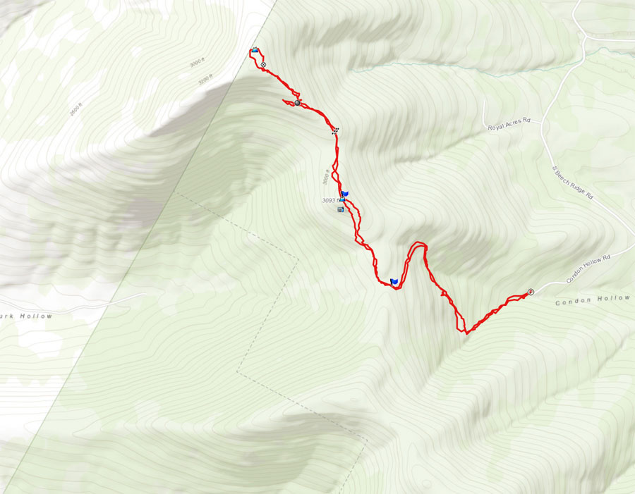
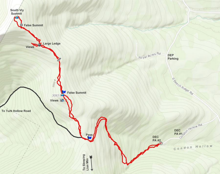
| | There are three ways to get to the summit of Vly Mountain.
The FIRST route is hike to the summit from Condon Hollow Road. The route up to the pass is an old road that is no longer used. The road has a 15% grade, but is easy walking. The first 1/4 mile sometimes has water running down it. About 1/3 of a mile up, the road is quite smooth, and very easy walking. Once on the pass, you will need to bushwhack up to the summit.
The SECOND route is to hike to the summit from Turk Hollow Road. Condon Hollow Road turns into Turk Hollow Road once you reach the pass. The road has a 10% grade, and the walking is easy. It is a little bit longer then the other side. Once on the pass, you will need to bushwhack up to the summit. Another alternate route, could be done by starting to bushwhack on the large right hand turn on Turk Hollow Road. You would bushwhack up to the col between the False Summit and South Vly Mountain. Steep, but the shortest hike.
The THIRD route is to hike to the summit from Beech Ridge Road. You will start from the old closed off road named, "Royal Acres Road". The road now has a locked gate across it. On this route, you will be hiking over DEP (NYC property). The beginning is an old road, but then you will have to bushwhack up to South Vly Mountain. It is steeper and more difficult then the other two routes. But, the mileage is shorter. You will have to park on the side of the highway.
If you hike from Condon Hollow Road or Turk Hollow Road, you will have to bushwhack to South Vly from the pass. Once you leave the road on the pass, you will follow the ridge up to the False Summit. The False Summit has an elevation of 3,111' high. If you look past there you can see South Vly in the distance. On your left, and down the side of the ridge, you can find a limited view point when the leaves are not on the trees.
Once you hike past the false summit you want to move to the right. If you don't, you will find some ledges. You will also be descending downward for a while. The ridge to the summit of South Vly Mountain is also located on the right side of the ridge line.
Once you reach the col between the false summit and South Vly Mountain, you will find the property line for DEP land. You will be on DEP land to the summit of South Vly Mountain. As you start to climb the ridge line, you will start to move to the left a bit. After a short distance, you will encounter a very large flat ledge. It is one of the larges flat ledges in the Catskill Mountains. Most consider this ledge the best part of the hike. To your left, you can get a limited view towards Plattekill Ski Center. But, you will only find a view when the leaves are not on the trees.
After you are done exploring the large ledge, move to the north side of the ledge. Then bushwhack up the ridge to the northwest. After a short distance you will find an old logging road that will take you the flat top of South Vly Mountain.
Once on top, you will see a large road that appears to be the highest point. But, it isn't. The highest point, by about 5', is all the way across the top of the summit of South Vly Mountain. There is a round rock that is maybe about 1-1/2' high. This is the highest point. Just past there is private property. At this point reverse your course back to your car.
I should note that you cannot hike from South Vly Mountain to Vly Mountain. That entire section of land is private property.
|
|
|
MILEAGE CHART |
| | Mile Point | Altitude | Notes |
| | 0.00 | 2,088 | Parking Area #2. WGS84: 42.215717, -74.416517 |
| | 0.90 | 2,909 | Condon Hollow Pass WGS84: 42.216033, -74.427617. |
| | 2.53 | 3,355 | Summit of South Vly Mountain - WGS84: 42.229967, -74.43845. |
| | 5.06 | 2,088 | Parking Area #2 |
|
|
|
Hike to Vly Mountain and Bearpen Mountain |
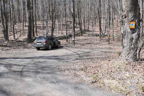 |
The image on the left is Parking Area #2 at the end of Condon Hollow Road. If this lot is full, there is another parking area 2/10 of a mile back down the road. You cannot park in the Parking Aread #2 in the Winter. The snow plows need the space to turn around. |
|
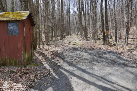 |
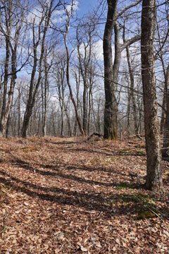
Next to Parking Area #2 is the start of the hike. The image on the right shows the start of the hike. On the left is the old Toll House. The first 1/4 to 1/3 of a mile can have water on the trail. Thereafter, the road is in excellent shape. |
|
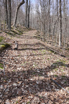 |
The image of the left shows what the road looks like up to the pass. The grade is about 15% incline. The road can be used as a cross-country ski trail on both sides of the pass. The bushwhack to the summit of South Vly Mountain cannot be used with cross-country skis. |
|
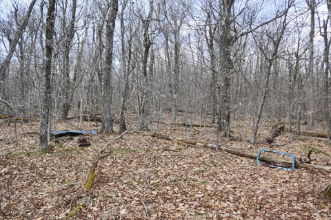 |
Once you reach the pass, you will see old car parts and appliances laying on the side of the trail. |
|
 |
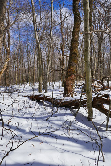
The image on the left shows the pass. On the north side is Condon Hollow Road, and on the south side it is Turk Hollow Road.
At this point, you will take a right, and leave the road. You will bushwhack up up approximately five ledges before reaching false summit. Most of the ledges are easy climbs, with the exception of one that takes a little more energy to get up. |
|
 |
This is the false summit of the south vly mountain. It has an elevation of 3,111'. In the distance you can see South Vly Mountain when the leaves are not on the trees. After you leave this summit, you want to move to the right side of the ridge to avoid the ledges as you approach the col between the False Summit and South Vly Mountain. |
|
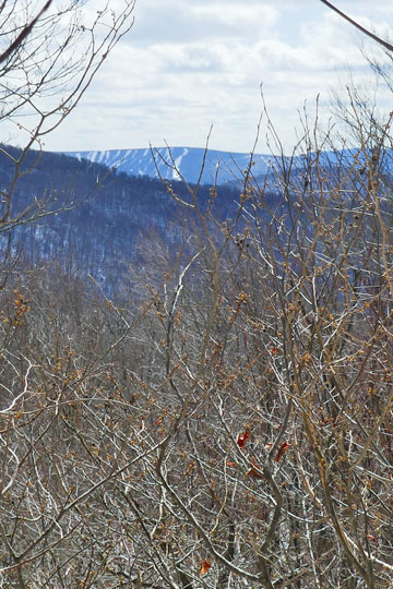 |
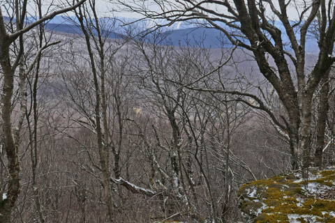
While at the False Summit of South Vly Mountain, there is a limited view point. It is on the south side (to your left). You have to climb down a little ways to some ledges. The view point is only available when the leaves are not on the trees. In the distance you can see Plattekill Ski Center.
The same view will be available again in about 15 minutes after you leave the col and start climbing up South Vly Mountain. It is located at the giant ledge. |
|
 |
As you exit the col, you will start to turn slightly to the left. You will also be exiting DEC Forest for DEP land owned by NYC. You are allowed to hike on this DEP land without a permit. Continue to climb up the ridge line towards the summit of South Vly Mountain. |
|
|
After a little ways you will encounter a very large flat ledge. Off to the south is another opportunity to get a limited view. Once you get done exploring at the ledge, move back towards the north side (right side) and climb up the ridge to the northwest. After a short ways you will find an old logging road. Follow the logging road up the ridge. |
|
 |
This is the limited view from south side of the giant ledge. Again, there is only a view when the leaves are not on the trees. |
|
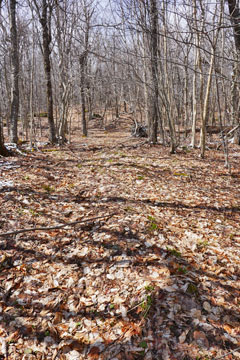 |
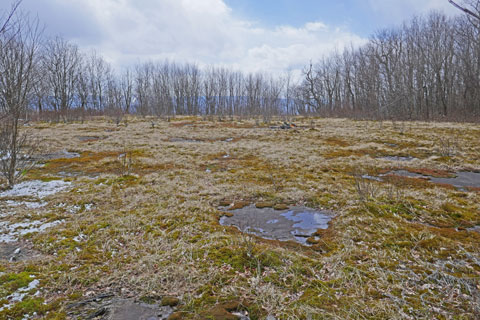
This is a view of the logging road. Follow the logging road until it splits. The split is just a loop to turn around. You can follow it either way. At the top of the loop is the flat summit of South Vly Mountain.
You will see a large rock with a flat top (about 4' high). It will appear to be the highest point. But, it isn't. It is 5' short of the actual summit. You need to continue to walk across the flat summit to the other side. There you will find a smaller rock that is the actual summit with an elevation of 3,355'. Less then 100' away is the property line between DEP land and Private Property. |
|
|
S E C T I O N S
|
W E A T H E R
|
O T H E R
|
|
Copyright 1994-2024 www.catskillmountaineer.com
ALL RIGHTS RESERVED
|