Hunter Mountain Loop |
 |
| |
| |
|
OVERVIEW |
| | Trail Name: | Spruceton Trail
 (Spruceton Road to Spruceton Valley Lookout)
 |
| | Trail Name: | Hunter Mountain Trail
 (Spurceton Valley Lookout to Devil's Path)
 |
| | Trail Name: | Devil's Path
 (Hunter Mtn Trail to West Kill Falls)
 |
| | Trail Name: | Diamond Notch Trail
(West Kill Falls to Spruceton Road) |
| | |
| | | Distance: | 8.16 miles from the DEC Parking Lot on Spruceton Road |
| | Time: | Average 5.75 hours round trip |
| | Elevation Gain: | 1,898 feet from the DEC Parking Lot and the summit. |
| | Best Time to Hike: | Morning |
| | Difficulty: | Moderate |
| | Summit Elevation: | 4,046' |
| | Access Methods: | Foot, ski, and snowshoe |
| | |
| | | USGS Official Names: | Hunter Mountain (ID: 973354) |
| | USGS Past Names: | Greenland Mountain |
| | USGS Summit-Elevation: | 4,045' (USGS) |
| | USGS Fire-Tower-Elevation: | 4,026' (USGS) |
| | USGS Hunter-Summit-WGS84: | 42.1778662, -74.2304216 (DEC-WGS84) |
| | USGS Hunter-Summit-GPS: | N 42 10.672 W 74 13.825 (GPS) |
| | USGS Hunter-Summit-UTM: | 18N 563557 4669811 (UTM) |
| | USGS Hunter-Summit-Deg, Min, Sec: | N42 10 40 W74 13 49 (Degree, Min, Sec) |
| | |
| | | USGS Official Map: | Hunter Topographical Map (free) |
| | |
| | | USGS Official Map: | Lexington Topographical Map (free) |
| | |
| | | DEC Trail Map: | DEC Hunter-Westkill Wilderness Map (free) |
| | |
| | | Digital Mapper: |
Topo
Terrain
Satellite |
|
|
Maps |
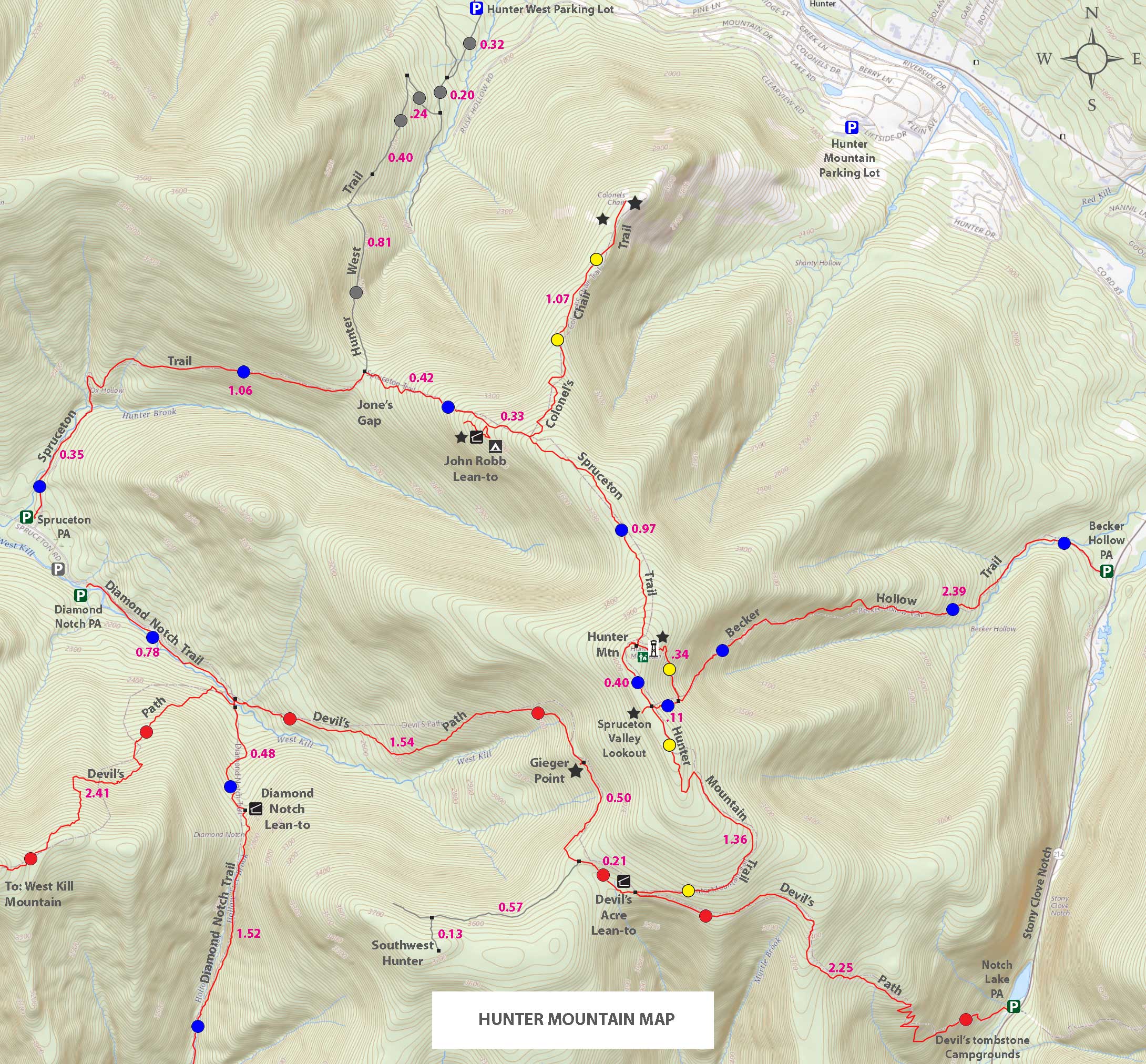 |
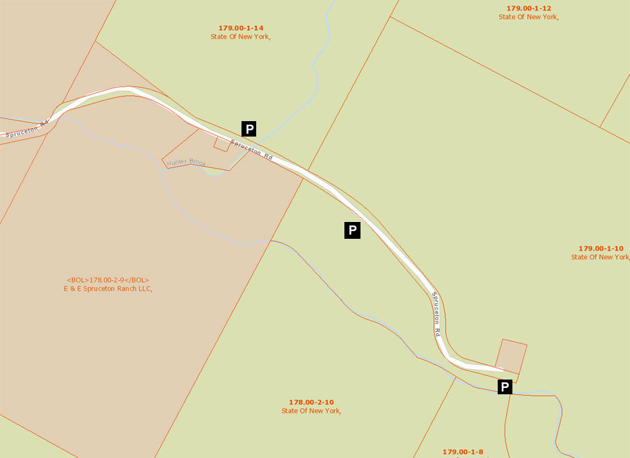
Public & Private Land Ownership near the end of Spruceton Road
Red=Private Land
Green=Public Land (DEC, DEP, NYS Parks, etc) |
|
|
| | DIRECTIONS TO TRAIL HEAD |
| | DEC Parking Lot WGS84 (DEC): 42.184717, -74.27175 - Elevation is approximately 2,117 feet |
| | DEC Parking Lot Deg/Min/Sec: N42 11 04, W74 16 18 - Elevation is approximately 2,117 feet |
| | DEC Parking Lot GPS: N42 11.083 W74 16.305 - Elevation is approximately 2,117 feet |
| | DEC Parking Lot UTM: 18N 560137, 4670542 - Elevation is approximately 2,117 feet |
| | Take New York State Thruway to Exit 21 (Catskill). |
| | Take a left out of the NYS Thruway entrance road. |
| | Go approximately 3/4 mile |
| | Take a right onto Route 23 West |
| | Go approximately 6.6 miles to Cairo, NY |
| | Take a LEFT onto Rt 32. McDonalds Rest. on corner. |
| | Go approximately 7.7 miles on Rt 32 |
| | Take a RIGHT onto Rt 23A |
| | Go approximately 22.2 miles to the intersection of Rt 23a and Rt 42 . |
| | Go approximately 0.3 miles - Take LEFT and go over bridge (over Schoharie Creek) |
| | Go approximately 4.1 miles on Rt 42 (from Rt 23a) to Rt 6 (Spruceton Road) |
| | Go approximately 6.7 miles on Rt 6 (Spruceton Road). |
| | About 4 miles down Rt 6 the road will go from a 2-lane road into a 1-lane road. The 1-lane road looks like a private driveway. Continue down the 1-lane road. |
| | There are a number of parking lots along this road. The parking lot you are looking for has a horse loading ramp. G |
| |
|
| | PARKING NOTICE: THE THREE PARKING LOTS FOR THIS HIKE ARE WOEFULLY TOO SMALL. THEY FILL UP VERY QUICKLY ON WEEKENDS. THERE ARE HOMES IN THIS AREA. DO NOT BLOCK THEIR DRIVEWAY, OR PARK ON THEIR LAND. |
|
|
Notes about hiking the Hunter Loop Trail |
There are five routes to get to the summit of Hunter Mountain. This route is the most popular with most hikers. It passes two Lean-to's and one campsite. It is a fairly easy hike that provides great views from Hunter Mountain Fire Tower. Many also like to picnic at the Hunter Mountain Fire Tower. There is a Ranger Station at the top of Hunter Mountain, but it is rarely open to the public.
Some hikers may only want to hike to the summit and back on this hike. This would shorten your hike from 8.16 miles to 6.26 miles. But, doing this cause you to miss the Spruceton Valley Lookout. Or, you could add it to your hike. It would add 6/10 of a mile to the hike (6.86 miles).
Hikers can also bushwhack to Rusk Mountain or Southwest Hunter Mountain for locations on the Hunter Loop Trail. Both peaks are common hikes for 3500 club members.
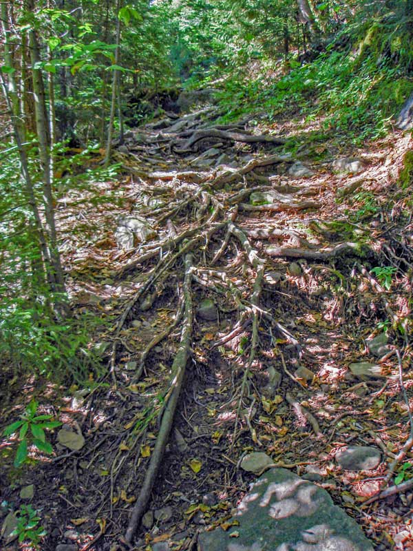
The trail from Spruceton Parking Area up to the Hunter Mountain Fire Tower is a jeep trail that is easy to hike up. The loop on the southern side is a single-track trail that can be rocky in places. In the summer months the brush encroaches into the trail.
The John Rob Lean-to is considered a favorite of some hikers. It has a nice view of Spruceton Valley. It is starting to become overgrown. There is also a campsite just above the lean-to.
The water source on the north side of the loop is always flowing well. There are two sources close to each other. On the southern side you should get water at the Diamond Notch Falls. |
|
|
MILEAGE CHART |
| | Mile Point | Altitude | Notes |
| | 0.00 | 2,117 | DEC Parking Lot |
| | 0.02 | 2,117 | DEC Registraion Box is just past the road barrier with the stop sign on it. |
| | 0.35 | 2,315' | Unmarked Trail to Rusk & East Rusk Mountain (on horseshoe turn). |
| | 1.41 | 2,905' | Trail Junction. Straight will take you down the East side of East Rusk near the West side of Hunter Mtn Ski Bowl. Right will take you to the summit of Hunter Mountain. Go RIGHT and leave Jeep Trail, and go up the foot path. |
| | 1.82 | 3,291 | Water source on Right side of Trail - Pipe sticking out of ground. |
| | 1.83 | 3,301 | Side trail to the John Robb Lean-To. |
| | 1.94 | 3,400 | First good view of Rusk Mtn - Flat spot. |
| | 2.16 | 3,550 | Trail Junction. Left will take you to the top of the Hunter Mtn Ski Bowl. |
| | 2.65 | 3,671 | View Point off the left side of the trail |
| | 3.09 | 3,980 | Trail Junction to Fire Tower - Can see fire tower from trail junction. |
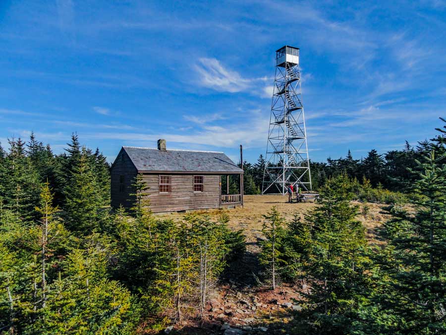
| | 3.13 | 4,026 | Hunter Mountain Fire Tower |
| | 3.43 | 4,006 | Trail Junction (4-way). Right will take you to an excellent view point (Yellow Marker). Straight will take you down the Loop Trail (Yellow Marker). Left will take you down the Becker Hollow Trail & summit loop (Blue Marker). Take RIGHT to view ledge. Then reverse back and continue straight down the Yellow Trail. |
| | 4.79 | 3,560 | Trail Junction. Left will take you to Stony Clove (Rt 214). Straight (or Right) to continue on the Hunter Loop Trail. Continue STRAIGHT. |
| | 4.89 | 3,531 | Lean-To |
| | 5.50 | 3,450 | Great views of Spruceton Valley from Geiger Point. |
| | 7.04 | 2,380 | Trail Junction. Left to West Kill Mtn & West Kill Falls. Straight will continue you to the end of the Hunter Loop Trail. After viewing Falls (next to trail) continue STRAIGHT. |
| | 7.79 | 2,023 | DEC Registration Box |
| | 7.82 | 2,018 | Road Barrier by Trail Head. |
| | 8.16 | 2,160 | DEC Parking lot where your car is parked. |
|
|
Hike to Hunter Mountain Loop |
 |
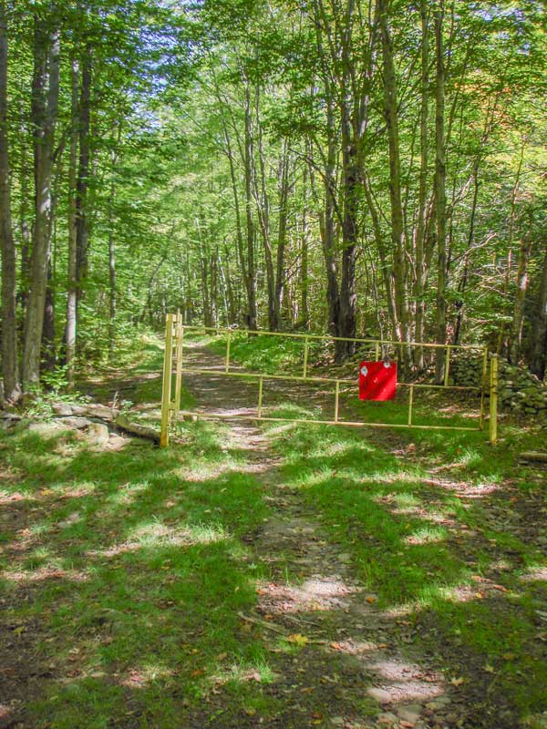 |
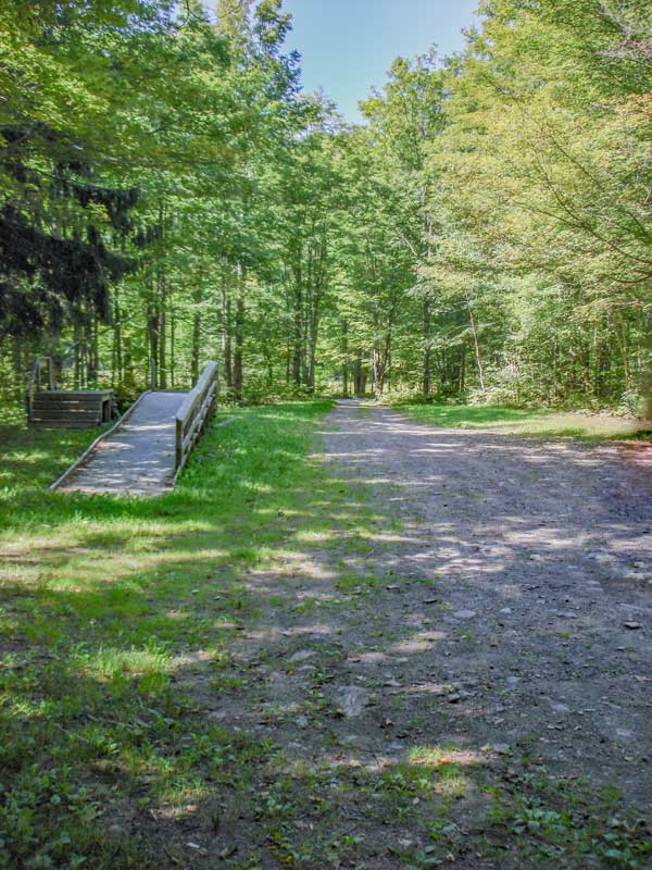
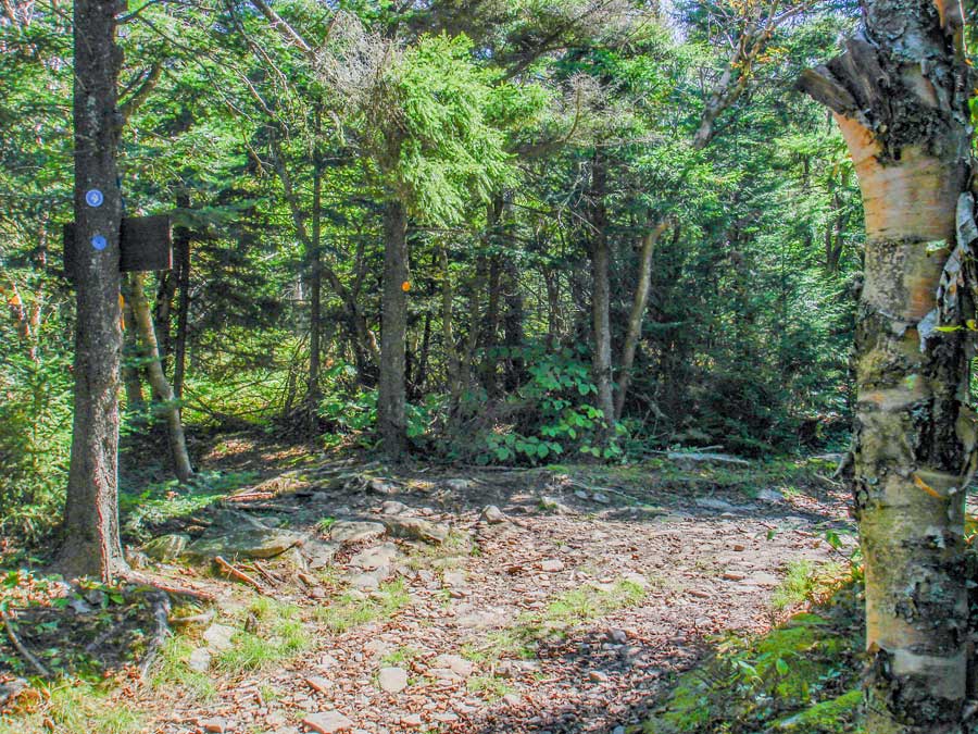
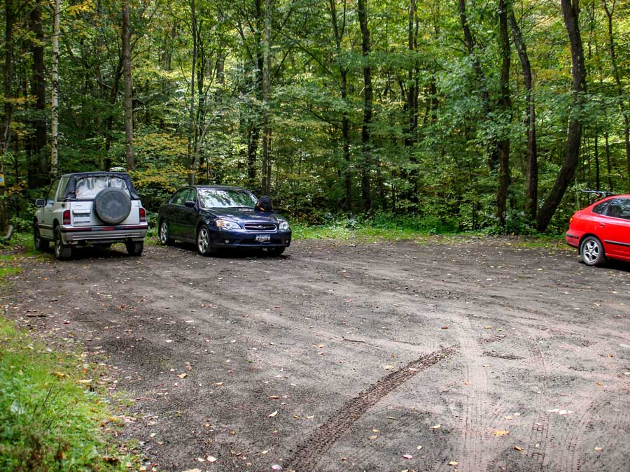
The picture on the left is where you can park off Spruceton Road (Rt 6). The parking lot is fairly large. This particular parking area has a horse loading ramp. If this parking lot is full, there are two more parking lots further down the road.
The trailhead is right next to the parking lot. Look for the steel road barrier with the stop sign on the barrier. |
|
 |
 |
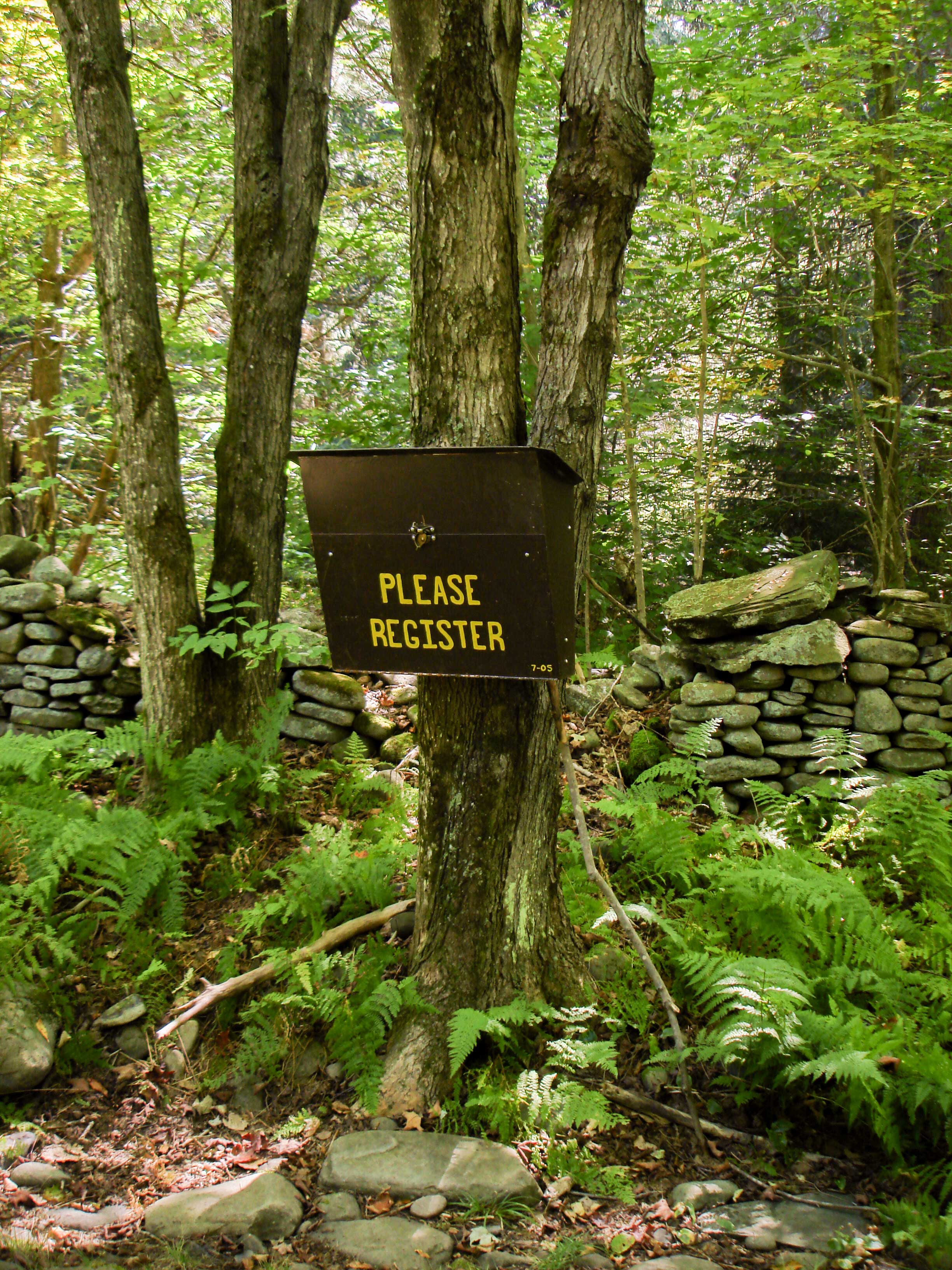
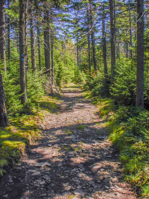
The registration box is about 50 feet past the steel barrier. It is always good to register your hike. It helps provide funds for hikers, and can help save your life should you get lost.
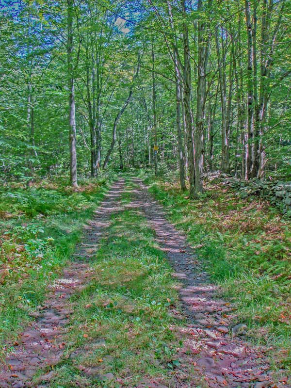
The picture on the right shows you what the trail looks like at the beginning of the hike. In the beginning, the trail incline is almost flat. |
|
 |
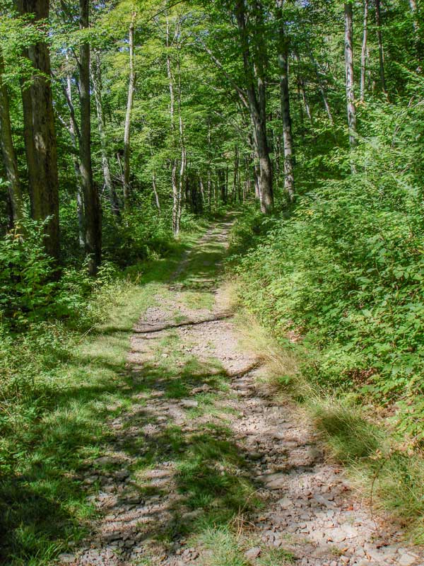 |
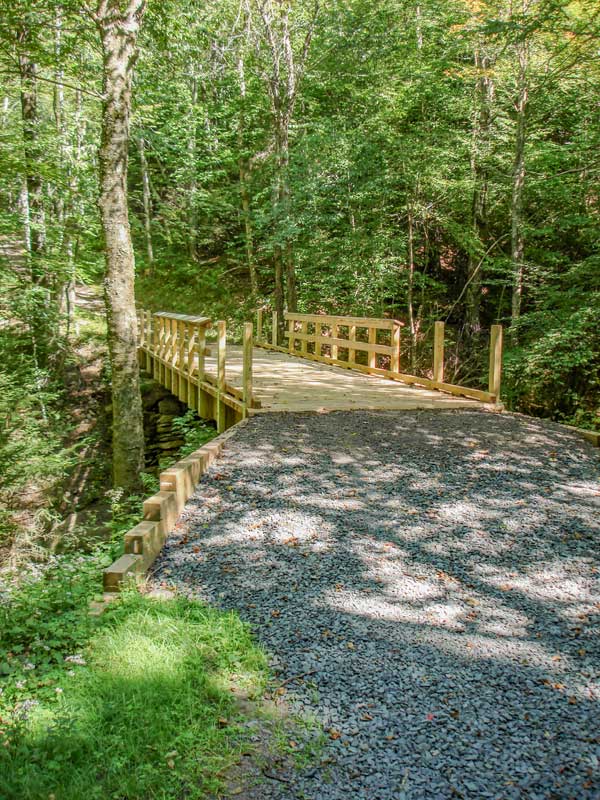
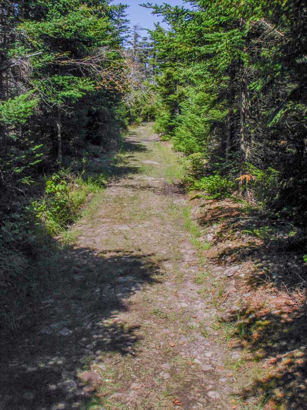
As you enter the Ox Hollow area, you will cross the bridge that passes over Hunter Brook. After you cross the bridge the grade will start to increase. The uphill grade is around 10%.
The picture on the right shows you what the uphill section of this hike looks like. About a steady 10% grade uphill. |
|
 |
After 1.4 miles will come to this 3-way Trail Junction. Going Right will take you to Hunter Mountain Fire Tower. Go RIGHT.
Continuing straight will take you down to the west side of Hunter Mountain Ski Center (separate hike). If you go left (bushwacking), this is the most common route up to East Rusk Mountain. You want to go RIGHT. |
|
 |
 |
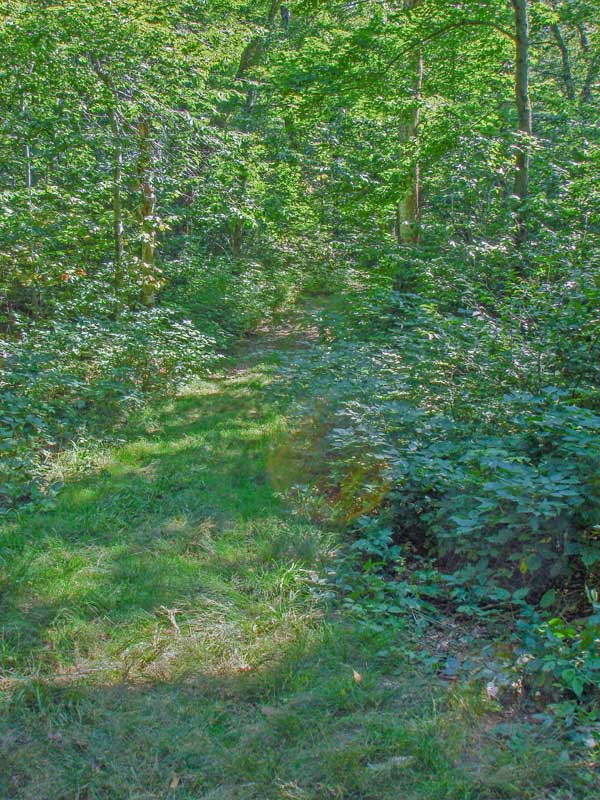
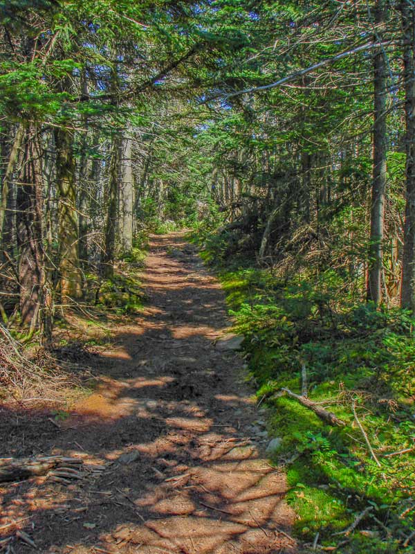
The picture on the right shows the entrance to the trail to the Hunter Mountain Fire Tower. It is part of the old Jeep Trail. It climbs the mountain at a slightly steeper rate. In the beginning it will go through a number of switchbacks.
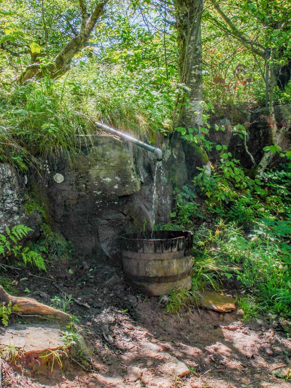
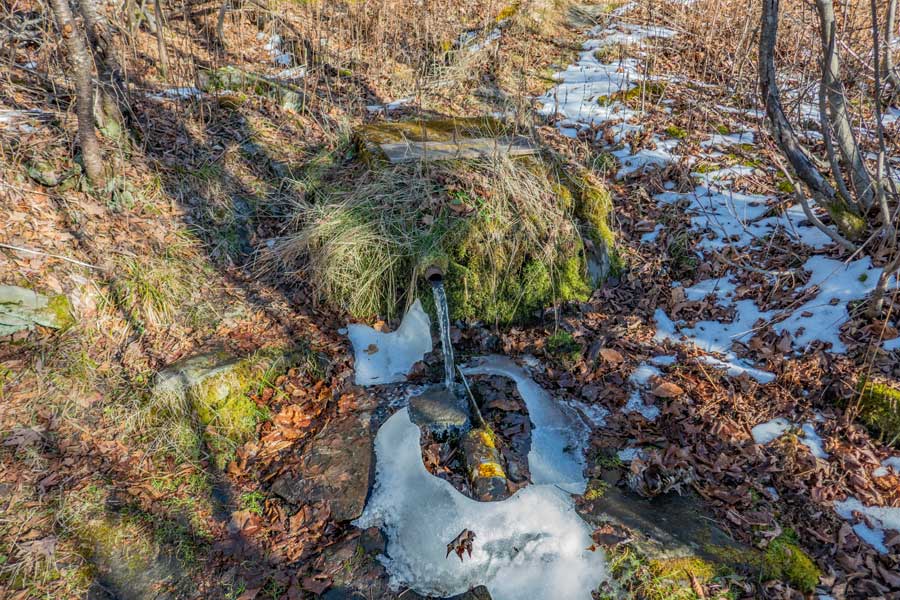
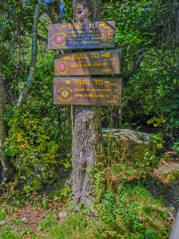
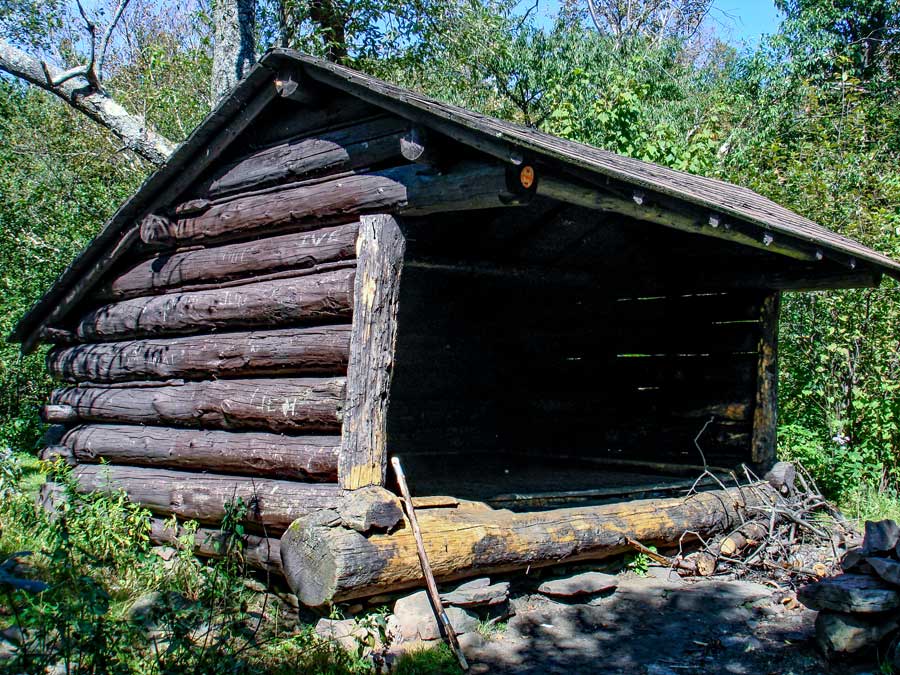
The picture on the RIGHT show an excellent water source. You can find this water source about 4/10 of a mile from the col at elevation 3291'. Just above the water pipe you will see the side trail that will take you to the John Robb Lean-to. This lean-to probably has the best views of any lean-to in the Catskills. It has a spectacular view over the Spruceton Valley.
|
|
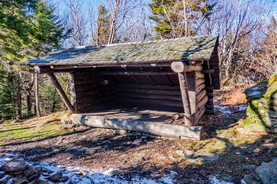 |
This is the John Robb Lean-to. It sits about 15-20 from the edge of a ledge. |
|
 |
The view on the right side of this picture is Rusk Mountain and East Rusk Mountain. On the left is Westkill, St Anne, North Dome, Sherrill, Balsam, etc. |
|
 |
This is the camping area just above the John Robb Lean-to. |
|
 |
This is the second water source near the John Robb Lean-to and camping area. If you follow the small trail west (downhill) from the Lean-to, you will eventually come to the water source. |
|
 |
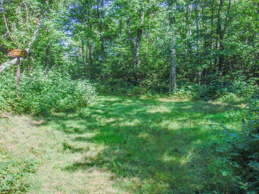
At mile post 2.16 (elev 3550') you will come to a Trail Junction. Going left will take you to the top of Hunter Mountain Ski Bowl. It is 1.04 miles to the top of the ski lifts. Hunter Mountain Ski Bowl also runs the ski lifts in the summer for hikers who want a very easy way to Hunter Mtn Fire Tower. You want to continue STRAIGHT. |
|
 |
 |
Here is another picture of the road to Hunter Mountain Fire Tower.
The picture on the right shows the trail just before it reaches the Hunter Mountain Fire Tower.
|
|
 |
This is the summit of Hunter Mountain Fire Tower and Ranger station. The Fire Tower actually sits a little below the the actual summit. The Becker Hollow Trail comes out on the other side if the Fire Tower.
|
|
 |
 |
The picture on the left shows the trail past the fire tower.
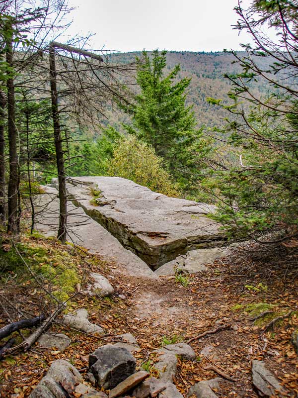
The picture on the right shows the next trail junction. It is about 4/10 of a mile from the Hunter Fire Tower. It is a 4-way intersection. Left will take you down to Becker Hollow (most difficult access to Hunter Mtn). Right will take you to a ledge with an excellent view of the Spruceton Valley. I strongly recommend that you check out the view. It is the best view of the hike. Continuing straight will continue you along the Hunter Loop Trail. First we will check out the ledge, so go RIGHT.
|
|
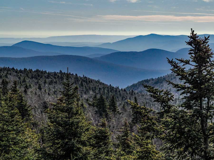 |
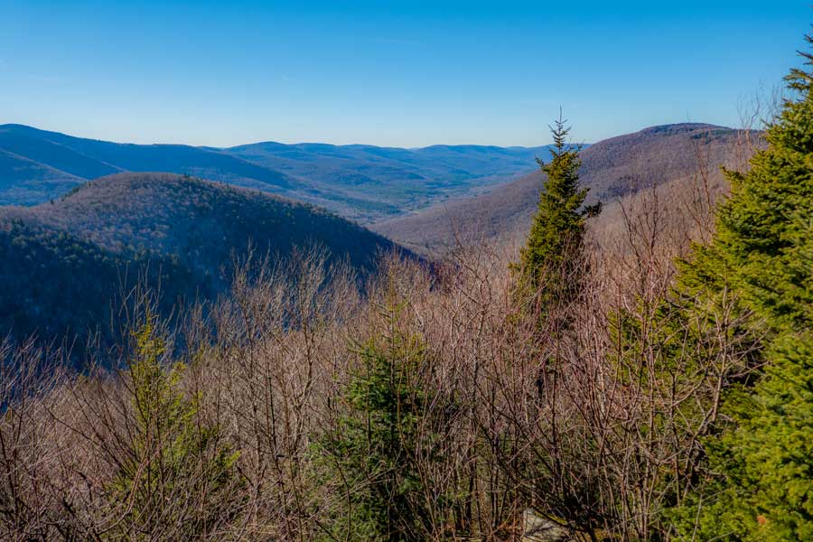
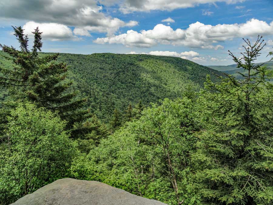
This a picture looking south from the Spruceton Valley Lookout. |
|
 |
This picture is look up the Spruceton Valley. |
|
 |
This picture is slightly different then the previous picture. |
|
 |
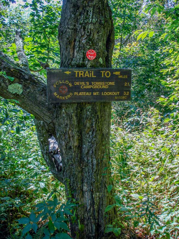 |
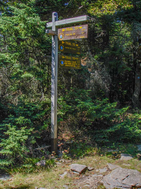
The picture on the left shows the trail sign at this Trail Junction for the Devil's Path to Stony Clove Notch. Continue to your right (straight).
|
|
 |
About 1/10 of a mile past the Trail Junction is a DEC Devil's Acre Lean-To. There is some running water near the lean-to, but it doesn't come from a pipe. It is just running water on the ground.
|
|
 |
 |
The picture on the left shows the trail sign at this Trail Junction.
Just past the Lean-to is a small unmarked trail junction on the left. This is the trail to the summit to Southwest Hunter (Leavitt's Peak). Taking the trail to Southwest Hunter and back will add 1.40 miles to your hike (round trip). This is an option hike, and not part of the mileage listed above. It is a very peaceful hike. There are no views from the summit.
About 200 feet after the umarked trail junction to Southwest Hunter, the trail will start to descend in elevation.
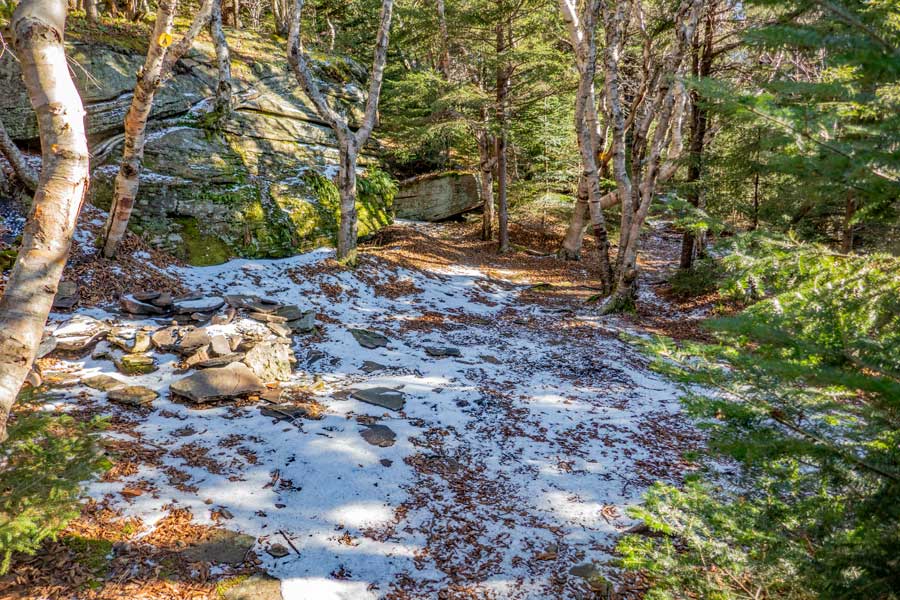
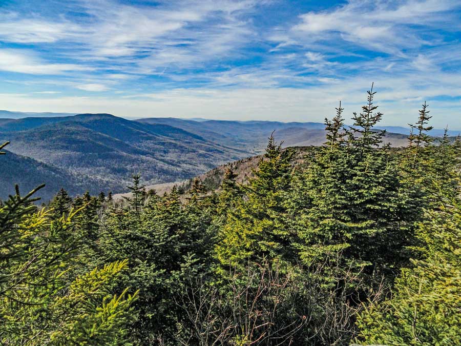
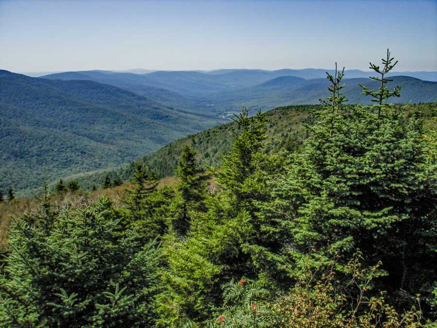
The picture on the left is Geiger Point. Nice place for a break. After enjoying the view, continue to descend down the rocky trail for another 1.5 miles.
|
|
 |
A picture taken from Geiger Point. Nice place for a break. After enjoying the view, continue to descend down the rocky trail for another 1.5 miles. |
|
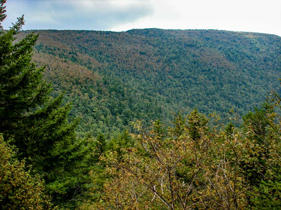 |
Another picture from Geiger Point. |
|
 |
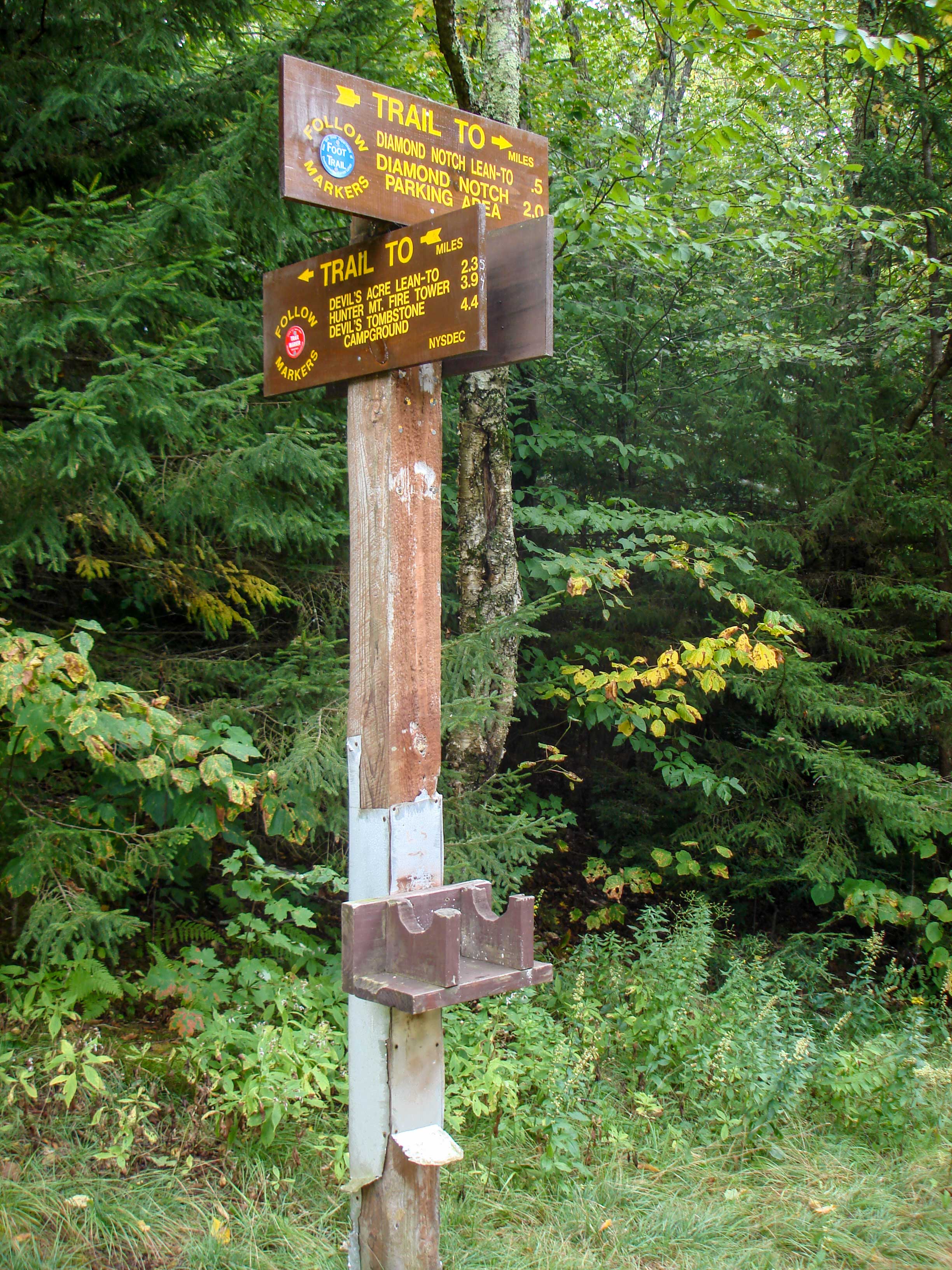 |
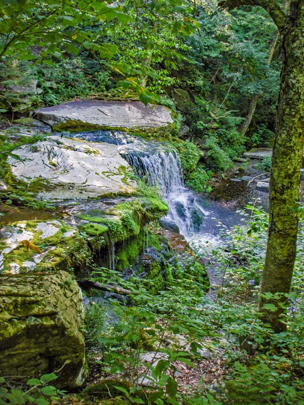
The picture on the right is a sign for the Trail Junction. Left will take you to Diamond Notch to Lanesville and West Kill Mountain. Also at this trail junction is Diamond Notch Falls. Continuing straight will take you back to your car.
The picture on the left shows the trail sign at this Trail Junction.
|
|
 |
After enjoying the Falls, continue down the trail. When you arrive at the end of the trail, you will see a parking lot. But, you still need to walk another 1/4 mile down the road to the parking lot for Hunter Mountain. Remember there are 3 parking areas. |
|
|
S E C T I O N S
|
W E A T H E R
|
O T H E R
|
|
Copyright 1994-2024 www.catskillmountaineer.com
ALL RIGHTS RESERVED
|