Leavitt's Peak |
 |
| |
| |
|
OVERVIEW |
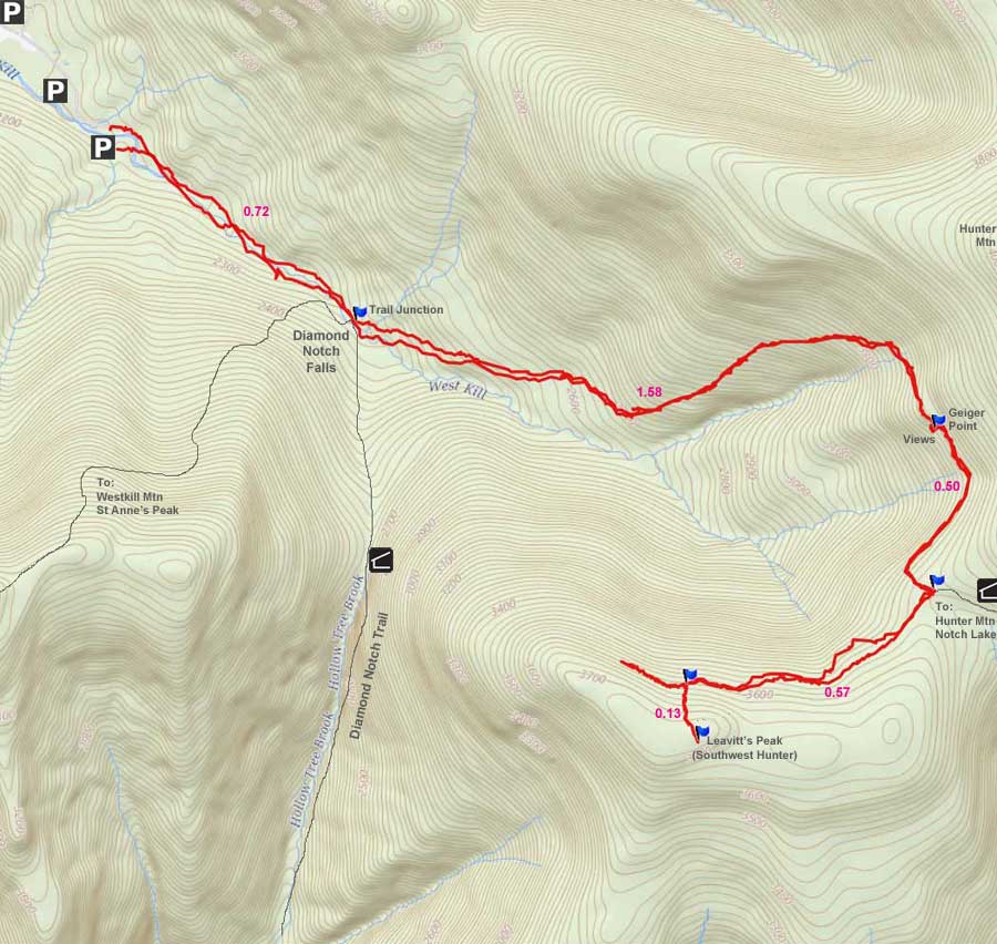
| | Distance: | 7.07 miles from the very end of Spruceton Road. |
| | Time: | Average 5.75 hours round trip |
| | Elevation Gain: | 1,635 feet from the DEC Parking Lot and the summit. |
| | Best Time to Hike: | Anytime. |
| | Difficulty: | Moderate |
| | Catskill Highest: | #15 |
| | Peak Elevation: | 3,740' |
| | |
| | | USGS Unofficial Names (See Note below): | Leavitt's Peak |
| | USGS Past Unofficial Names: | Southwest Hunter |
| | USGS Summit-Elevation: | 3,740' |
| | Canister Leavitt-Summit-WGS84: | 42.162333, -74.2436 (DEC-WGS84) |
| | Canister Leavitt-Summit-GPS: | N 42 09.740, W 74 14.616 (GPS) |
| | Canister Leavitt-Summit-UTM: | 18N 562484, 4668077 (UTM) |
| | Canister Leavitt-Summit-Deg, Min, Sec: | N42 09 44, W74 14 36 (Degree, Min, Sec) |
| | |
| | | USGS Official Map: | Hunter Topographical Map (free) |
| | |
| | | USGS Official Map: | Lexington Topographical Map (free) |
| | |
| | | DEC Trail Map: | DEC Hunter-Westkill Wilderness Map (free) |
| | |
| | | Digital Mapper: |
Topo
Terrain
Satellite |
| | |
| | | Access Methods: | Foot and snowshoe |
| | |
| NOTES: The USGS Geoname data base once held Leavitt's Peak as an official USGS summit. The past unofficial name was called Southwest Hunter. A request was submitted to the USGS to change the name to "Leavitt's Peak", and to make it an official summit". The name was used for a quite a few years. But, in 2014 the USGS lost all funding for maintaining names on USGS maps, and this mountain is no longer listed as an official USGS mountain. We hope that someday in the future funding will occur, and this mountain will again be listed as an USGS official mountain with an ID number. Some people still call it "Leavitt's Peak" because this is the only official name used by the USGS. While others call it "Southwest Hunter" which was used by the community prior to the request.
|
|
|
Maps |
|
Public & Private Land Ownership near the end of Spruceton Road
Red=Private Land
Green=Public Land (DEC, DEP, NYS Parks, etc) |
|
|
| | DIRECTIONS TO TRAIL HEAD |
| | DEC Parking Lot WGS84 (DEC): 42.184717, -74.27175 - Elevation is approximately 2,117 feet |
| | DEC Parking Lot Deg/Min/Sec: N42 11 04, W74 16 18 - Elevation is approximately 2,117 feet |
| | DEC Parking Lot GPS: N42 11.083 W74 16.305 - Elevation is approximately 2,117 feet |
| | DEC Parking Lot UTM: 18N 560137, 4670542 - Elevation is approximately 2,117 feet |
| | |
| | Take New York State Thruway to Exit 21 (Catskill). |
| | Take a left out of the NYS Thruway entrance road. |
| | Go approximately 3/4 mile |
| | Take a right onto Route 23 West |
| | Go approximately 6.6 miles to Cairo, NY |
| | Take a LEFT onto Rt 32. McDonalds Rest. on corner. |
| | Go approximately 7.7 miles on Rt 32 |
| | Take a RIGHT onto Rt 23A |
| | Go appoximately 22.2 miles to the intersection of Rt 23a and Rt 42 . |
| | Go approximately 0.3 miles - Take LEFT and go over bridge (over Schoharie Creek) |
| | Go approximately 4.1 miles on Rt 42 (from Rt 23a) to Rt 6 (Spruceton Road) |
| | Go approximately 7 miles on Rt 6 (Spruceton Road). |
| | About 4 miles down Rt 6 the road will go from a 2-lane road into a 1-lane road. The 1-lane road looks like a private driveway. Continue down the 1-lane road. |
| | There are a number of parking lots along this road. The parking lot you are looking is at the very end of the road. GPS: N42 11.083 W74 16.305 |
| |
|
| | PARKING NOTICE: THE THREE PARKING LOTS FOR THIS HIKE ARE WOEFULLY TOO SMALL. THEY FILL UP VERY QUICKLY ON WEEKENDS. PEOPLE HAVE RESORTED TO PARKING ON THE SIDE OF RT 6 (WHICH IS A ONE-LANE ROAD). PRESENTLY THE TOWN OF HUNTER ALLOWS HIKERS TO PARK ON THE SIDE OF THE ROAD. IF YOU DO PARK ON THE SIDE OF THE ROAD YOU MUST GET YOUR CAR ALL THE WAY OFF THE ROAD! IF YOU DO NOT LEAVE ENOUGH ROOM FOR EMERGENCY VEHICLES (LIKE LARGE FIRE TRUCKS), YOUR CAR WILL BE TICKETED OR TOWED. ALSO, THERE ARE HOMES IN THIS AREA. DO NOT BLOCK THEIR DRIVEWAY, OR PARK ON THEIR LAND, OR PARK IN FRONT OF THEIR HOUSE. IF HIKERS CONTINUE TO CAUSE PROBLEMS, THE TOWN OF HUNTER WILL BAN HIKERS FROM PARKING ON THE SIDE OF THE ROAD. |
|
|
SPECIAL CIRCUMSTANCES ABOUT THIS HIKE |
| |
| |
This hike does not have a view from the summit. There is a very limited view from the road just below the summit in the winter. There is a very nice view from Geiger Point on the way up to the summit around 3,450'. The walk from Hunter Loop Trail to the summit is a very nice walk. That part of the hike is exceptional. Some people like to "bag" this peak while doing the Hunter Loop Trail. |
|
|
MILEAGE CHART |
| | Mile Point | Altitude | Notes |
| | 0.00 | 2,105 | DEC Parking Lot - N42 11.083 W74 16.305 |
| | 0.02 | 2,110 | DEC Registraion Box is just past the road barrier. |
| | 0.72 | 2,298' | West Kill Falls and Trail Junction to West Kill Mtn. |
| | 2.30 | 3,498' | Geiger Point - Nice views of Leavitt's Peak and West Kill Mtn. |
| | 2.77 | 3,547 | False Trail. |
| | 2.80 | 3,553 | Unmarked Trail Junction to Leavitt's Peak. |
| | 3.37 | 3,635 | Trail Junction - climb hill to peak. |
| | 3.50 | 3,764 | Leavitt's Peak Summit & 3500 Club Canister |
| | 3.64 | 3,635 | Return to Level road/trail - take left up trail for limited views |
| | 4.53 | 3,510 | Trail Junction to Hunter Loop - Take Left back to car |
| | 6.40 | 2,298 | West Kill Falls |
| | 7.03 | 2,110 | DEC Registration Box |
| | 7.07 | 2,105 | DEC Parking lot where your car is parked. |
|
 |
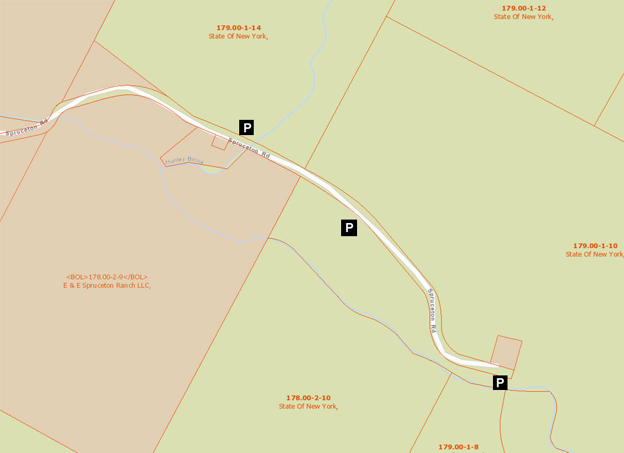
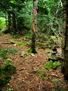
If space is available you can park right by the trail head in this picture. If space is not available, then you can park down in the parking lot 1/4 mile back down the road. The gate at the trail head is part of the old Spruceton Road that goes all the way to Lanesville (Rt 214). When you sign in look down at the creek and you can find the old bridge pillars where the road used to be many years ago. Make sure you sign in at the registration box. Registration helps bring dollars to the trail you are hiking.
At mile post 0.72 miles, you will come to a Trail Junction. Right will take you to two trails: (1) will take you to the summit of West Kill Mtn; (2) Will take you down the old Carriage Road to Lanesville, NY (Rt 214). Years ago this was one of the major roads thru the Catskill Mountain. It will take you thru Diamond Notch. Going straight will take you up to Hunter Mtn and Leavitt's Peak. Go STRAIGHT. |
 |
|
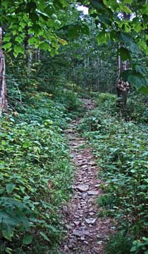 |
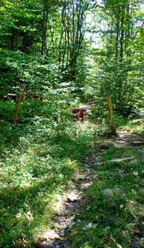
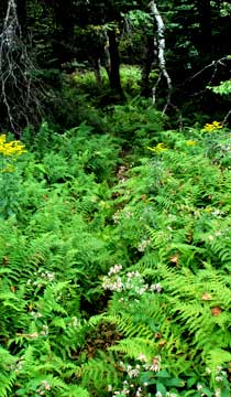
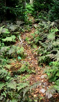
The picture on the left show you what the trail looks like at the beginning of the trail up to Leavitt's Peak. The trail starts out fairly level, and will increase in steepness until around 3,500 feet. The rock has a lot of loose and round rocks on it. It is a real ankle twister.
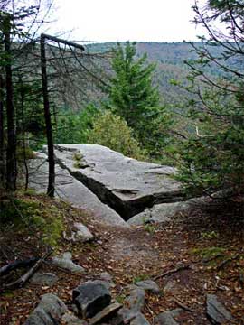
At mile post 2.30 miles (elev 3498') you will come to a small unmarked side trail. If you take a right, you will find Geiger Point about 25 feet from the trail. Geiger point is a small rock ledge with an excellent view of Leavitt's Peak and West Kill Mountain. The drop off Geiger Point is around 75 feet, so don't fall off. If the rock is wet be careful walking on it. It does have a slope off one side. After getting done with the views, continue down the trail. After another 50 vertical feet, you will be on level walking surface. |
 |
|
 |
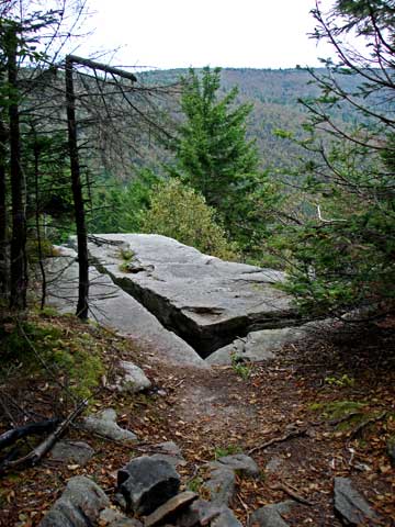
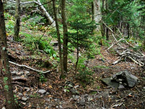
At mile post 2.77 miles (elev 3,547') you will come to this picture. After climbing up a hill, you will come to level ground. That is where this picture is. If you look on the right directly after the climb, you will see a "False" trail. Do NOT take the false trail! |
|
 |
The picture on the left shows the "False" Trail. Do NOT take this trail. Continue down the trail another 200 feet for the real trail.
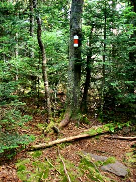
The picture on the right shows the real trail to Leavitt's Peak. It is at mile post 2.80. It is an unmarked Trail Junction. Look for a trail marker on the tree with a small rock cairn. This is the trail to Leavitt's Peak. |
 |
|
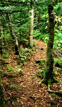 |
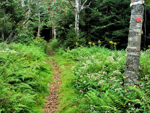
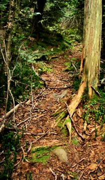
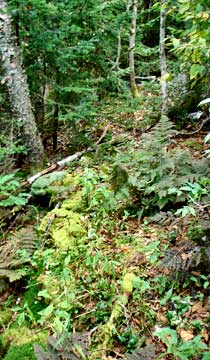
The picture on the left show you what the trail looks like to Leavitt's Peak.
The picture on the right is another picture of the trail to Leavitt's Peak. The distance from the Hunter Loop Trail to the next trail Junction is 0.57 miles.
|
 |
|
 |
The picture on the right is the trail junction. It is at mile post 3.77 miles (elev 3,635'). Going left will take you to the summit of Leavitt's Peak. Continuing straight will take you further down the old road. The fairly level path you have been walking on is an old road. You might have noticed the rock walls for the road bed. Go LEFT up the hill to the summit. |
|
 |
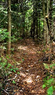
The picture on the left show you what the trail looks like on the uphill climb.
The picture on the right shows you another picture of the trail to the summit.
|
 |
|
 |
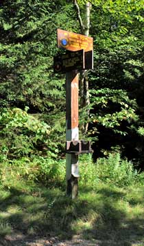
The picture on the left show you the summit with the 3500 club canister. Go ahead and register with the pad in the canister.
After you return back to the Trail Junction, you can take an optional side trip. LEFT will take you on a short optional side trip for some limited views. RIGHT will take you back to the Hunter Loop Trail. You can then return to your car.
|
 |
|
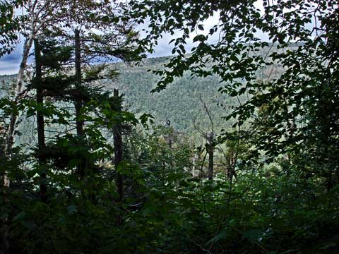 |
The road further along Leavitt's Peak is rough, but very nice. At points shortly after the trail junction have limited views all year long. The views are better in the winter when the leaves are not on the trail.
The road comes to an end when you encounter a rock in the middle of the road. This is where they stopped building the road. You can bushwack past the rock to find more views. Once done, you can return back to your car. |
|
|
S E C T I O N S
|
W E A T H E R
|
O T H E R
|
|
Copyright 1994-2024 www.catskillmountaineer.com
ALL RIGHTS RESERVED
|