Rusk Mountain |
 |
| |
| |
|
OVERVIEW |
| | Distance: | ~3.60 miles from the DEC parking lot on Sprucetown Road. |
| | Time: | Average 3.0 hours round trip in the Winter - 2 hours in the summer |
| | Summit Elevation: | 3,680' |
| | Elevation Gain: | 1,595 feet from the DEC Parking Lot and the summit. |
| | Best Time to Hike: | Anytime. |
| | Difficulty: | Moderate |
| | Catskill Highest: | #21 |
| | |
| | | USGS Official Name: | Rusk Mountain (ID: 963108) |
| | USGS Summit-Elevation: | 3,678' (from USGS map) |
| | USGS North Dome-Summit-WGS84: | 42.2006434, -74.2770897 (DEC-WGS84) |
| | USGS North Dome-Summit-GPS: | N 42 12.039, W 74 16.625 (GPS) |
| | USGS North Dome-Summit-UTM: | 18N 559681, 4672307 (UTM) |
| | USGS North Dome-Summit-Deg, Min, Sec: | N42 12 02, W74 16 37 (Degree, Min, Sec) |
| | USGS Official Map: | Lexington Topographical Map (free) |
| | |
| | | DEC Trail Map: | Rusk Mountain Wild Forest Map (free) |
| | |
| | | Digital Mapper: |
Topo
Terrain
Satellite |
| | |
| | | Access Methods: | Foot and snowshoe |
|
|
Maps |
 |
|
|
|
|
|
|
| | DIRECTIONS TO TRAIL HEAD |
| | DEC Parking Lot WGS84 (DEC): 42.184717, -74.27175 - Elevation is approximately 2,117 feet |
| | DEC Parking Lot GPS: N42 11.083, W74 16.305 - Elevation is approximately 2,117 feet |
| | DEC Parking Lot UTM: 18N 560137, 4670542 - Elevation is approximately 2,117 feet |
| | DEC Parking Lot Deg, Min, Sec: N42 11 04, W74 16 18 - Elevation is approximately 2,117 feet |
| | |
| | Take New York State Thruway to Exit 21 (Catskill). |
| | Take a left out of the NYS Thruway entrance road. |
| | Go approximately 3/4 mile |
| | Take a right onto Route 23 West |
| | Go approximately 6.6 miles to Cairo, NY |
| | Take a LEFT onto Rt 32. McDonalds Rest. on corner. |
| | Go approximately 7.7 miles on Rt 32 |
| | Take a RIGHT onto Rt 23A |
| | Go appoximately 22.2 miles to the intersection of Rt 23a and Rt 42 . |
| | Go approximately 0.3 miles - Take LEFT and go over bridge (over Schoharie Creek) |
| | Go approximately 4.1 miles on Rt 42 (from Rt 23a) to Rt 6 (Spruceton Road) |
| | Go approximately 6.7 miles on Rt 6 (Spruceton Road). |
| | About 4 miles down Rt 6 the road will go from a 2-lane road into a 1-lane road. The 1-lane road looks like a private driveway. Continue down the 1-lane road. |
| | There are a number of parking lots along this road. The parking lot you are looking for has a horse loading ramp. |
| |
|
| | PARKING NOTICE: THE THREE PARKING LOTS FOR THIS HIKE ARE WOEFULLY TOO SMALL. THEY FILL UP VERY QUICKLY ON WEEKENDS. PEOPLE HAVE RESORTED TO PARKING ON THE SIDE OF RT 6 (WHICH IS A ONE-LANE ROAD). PRESENTLY THE TOWN OF HUNTER ALLOWS HIKERS TO PARK ON THE SIDE OF THE ROAD. IF YOU DO PARK ON THE SIDE OF THE ROAD YOU MUST GET YOUR CAR ALL THE WAY OFF THE ROAD! IF YOU DO NOT LEAVE ENOUGH ROOM FOR EMERGENCY VEHICLES (LIKE LARGE FIRE TRUCKS), YOUR CAR WILL BE TICKETED OR TOWED. ALSO, THERE ARE HOMES IN THIS AREA. DO NOT BLOCK THEIR DRIVEWAY, OR PARK ON THEIR LAND, OR PARK IN FRONT OF THEIR HOUSE. IF HIKERS CONTINUE TO CAUSE PROBLEMS, THE TOWN OF HUNTER WILL BAN HIKERS FROM PARKING ON THE SIDE OF THE ROAD. |
|
|
SPECIAL CIRCUMSTANCES ABOUT THIS HIKE |
| |
| |
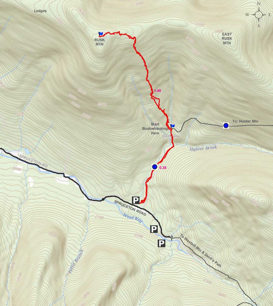
The hike up to Rusk Mountain does not have a view from the summit. There is a limited view in the Winter from several places. The the view is poor and limited. This hike is considered a bushwacking hike. This is a fairly short hike, but it does have close to 1,600 feet of vertical climb. There are several routes to the top. .
The most common route is to follow the stream up the side of the mountain and come out on the saddle between East Rusk and Rusk Mountain. Following the stream makes the hike fairly easy. The primary problem with this route is that when you approach the saddle, the incline becomes quite steep. We find this route less desirable then some of the other routes.
Another route is to follow the ridge line from the col between Hunter Mountain and East Rusk. This way is probably the easiest route, but also the longest. There are some prickers at the bottom of the col, and you will encounter some thick conifer trees on the summit of East Rusk. The walk from East Rusk Mountain to Rusk Mountain is fairly easy.
We believe that the best route is outlined on this page. We suggest that you leave the Hunter Loop trail after the wooden bridge and just before the horseshoe turn. Then hike up in between the two streams coming down Rusk Mountain. The climb is a constant climb, but no real ledges to negotiate. The incline is moderate in difficulty.
Another route is to cross both streams by the horseshoe turn, and follow up the ridge line. Some people take this route to visit the Big Ledges first.
The last route is to climb Evergreen Mountain first, and then follow the ridge across to Rusk Mountain. By going this way, you can visit the Big Ledges along the way. If you have two cars, this can be a nice hike.
While the hike starts out on an old Fire Tower Road to the top of Hunter Mountain from the DEC parking lot off Spruceton Road. There are several DEC parking lots. The one you want is the one with the horse loading ramp. In the beginning, the incline is very easy. It follows Hunter Brook. You will cross a wooden bridge, which goes over Hunter Brook. The wooden bridge is good enough for a truck to drive over.
After you cross the bridge, you will come to a sharp turn, where you will then start heading east bound. This is where you want to leave the trail. Just before the horseshoe turn, you want to walk perpendicular to the trail, and head to the stream. You want to cross the stream, and then turn right and walk up in between the two streams.
The route goes up in a fairly steady incline. There is quite a bit of blow down in some section, so you may have to zig-zag up the mountains. But, otherwise, it is a fairly easy hike uphill. When you approach the top, you will start to encounter larger rocks. But, most are easy to navigate. Just below the saddle, you will encounter conifer trees. In some sections, they are pretty thick, so you might have to walk horizontal until you find a good section to get on top of the saddle.
Once on the top of the saddle, there are quite a few herd paths, and the walk thru the conifer trees is very easy. After a short distance, you will leave the conifer forest and enter deciduous trees and openings. There are some prickers in the openings.
Just before the summit of Rusk Mountain, you will come to a small ledge, which is maybe 15 feet high. You can easily get up on the ledge on the left or right of the ledge. Once on top of the ledge, it is a short hike to the summit and canister. There is no view from the summit. Just off the summit, there are some limited view points in the Winter. In the summer, you will see nothing.
If you like good views, you can continue further, and then move south to the Big Ledges. There you can get a good view of the Spruceton Valley. Then reverse your course back to the car.
If you want to visit Evergreen Mountain it is west of Rusk Mountain. East Rusk is east of Rusk Mountain.
|
|
|
MILEAGE CHART |
| | Mile Point | Altitude | Notes |
| | 0.00 | 2,085 | DEC Parking Lot |
| | 0.35 | 2,315 | Unmarked Trail to Rusk & East Rusk Mountain (on horseshoe turn). |
| | 1.83 | 3,680 | Summit of Rusk Mountain. |
| | 3.66 | 1,560' | DEC Parking Lot |
|
|
Hike to Hunter Mountain Loop |
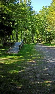 |
The picture on the left is where you can park on Spruceton Road (Rt 6). The parking lot is fairly large. It is the parking lot with the horse loading ramp.
The trailhead is right next to the parking lot. Look for the steel road barrier with the stop sign on the barrier. |
 |
|
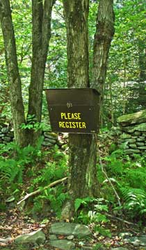 |
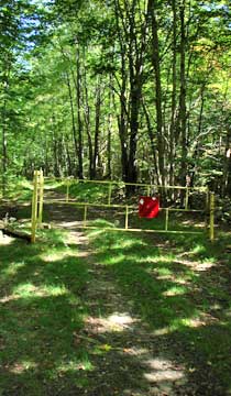
The registration box is about 50 feet past the steel barrier. It is always good to register your hike. It helps provide funds for hikers, and can help save your life should you get lost.
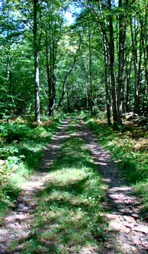
The picture on the right shows you what the trail looks like in the beginning of the hike. In the beginning, the trail is very mellow. |
 |
|
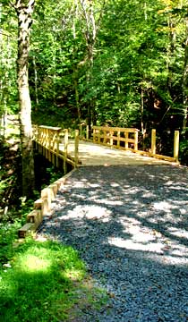 |
As you enter the Ox Hollow area, you will cross the new bridge that passes over Hunter Brook. After you cross the bridge the grade will start to increase. The uphill grade is around 10%.
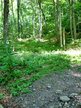
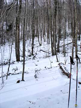
The picture on the right is at the "Horseshoe Turn" on the trail. There is an unofficial trail that will take you to the top of Rusk Mountain and East Rusk Mountain. |
 |
|
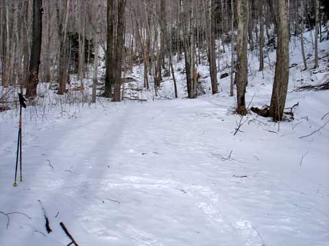 |
The picture on the left is in the same spot as the picture above, but in the Winter.
If you look carefully, you will see ski poles on the left side and snowshoe tracks. This is the direction you want to go. |
|
 |
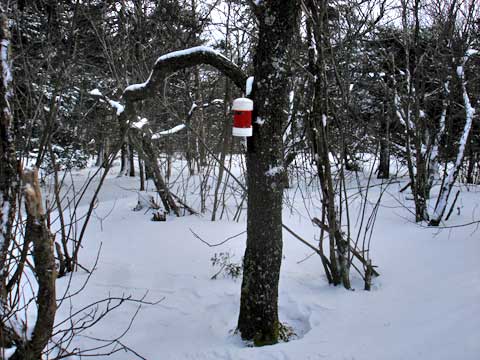
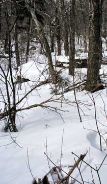
This pictures shows you what it looks like next to the ski poles. Most people follow the path in between the two streams. You will have one stream on the left and one on the right.
The picture on the right shows the grade at the beginning of the hike..
|
 |
|
 |
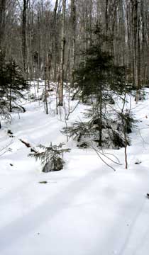
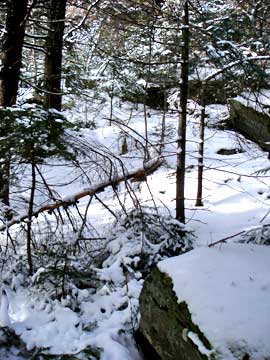
As you climb further up, the incline becomes more difficult.
As you get further up towards the ridge, you will find more large rocks.
|
 |
|
 |
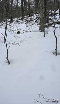
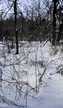
Near the top of the ridge, you will encounter some conifer trees. You may have to walk horizontal to find a good opening to get on top of the ridge.
Once you get on the ridge, take a left and head towards Rusk Mountain. This picture on the right shows what it looks like. There are some prickers here-and-there. As you approach the summit, you will come to a small ledge. You can easily get up it from the left or right..
|
 |
|
|
On the summit is the canister for Rusk Mountain. If you are doing the 3500 list, you can enter your name in the notebook inside the canister.
Please note that the canisters are moved from time-to-time. |
|
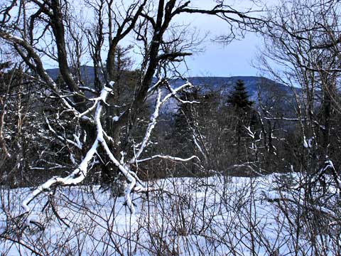 |
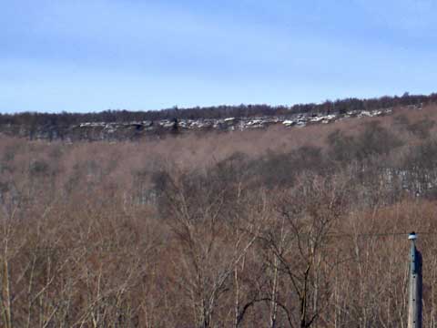
On the summit, you can walk around and find some limited views on the Southwestern side. |
|
 |
If you walk west of the summit, you can find some large ledges that overlook the Spruceton Valley. They are rarely visited. You can also continue to Evergreen Mountain. |
|
|
S E C T I O N S
|
W E A T H E R
|
O T H E R
|
|
Copyright 1994-2024 www.catskillmountaineer.com
ALL RIGHTS RESERVED
|