Mount Sherrill |
 |
| |
| |
|
OVERVIEW |
| | Distance: | ~5.75 miles from the parking lot directly Rt 42. |
| | Time: | Average 4.50 hours round trip |
| | Elevation Gain: | 1,998 feet from the Parking Lot to the summit. |
| | Best Time to Hike: | Anytime. |
| | Difficulty: | Moderate |
| | Catskill Highest: | #31 |
| | Peak Elevation: | 3,549' |
| | |
| | | USGS Official Name: | Mount Sherrill (ID: 1829070) |
| | USGS Historical Naming: | Named for Eliakim Sherrill, a tanner in the Shandaken area in the mid-1800's. Official name approved August 12, 1969 |
| | USGS Summit-Elevation: | 3,550' |
| | USGS North Dome-Summit-WGS84: | 42.175644, -74.372926 (DEC-WGS84) |
| | USGS North Dome-Summit-GPS: | N 42 10.539, W 74 22.376 (GPS) |
| | USGS North Dome-Summit-UTM: | 18N 551790, 4669468 (UTM) |
| | USGS North Dome-Summit-Deg, Min, Sec: | N42 10 32, W74 22 22 (Degree, Min, Sec) |
| | |
| | | USGS Official Map: | Lexington Topographical Map (free) |
| | |
| | | USGS Official Map: | Westk
ill Topographical Map (free) |
| | |
| | | DEC Trail Map: | DEC Hunter-Westkill Wilderness Map (free) |
| | |
| | | Digital Mapper for Halcott: |
Topo
Terrain
Satellite |
| | |
| | | Access Methods: | Foot and snowshoe |
|
|
Maps |
 |
|
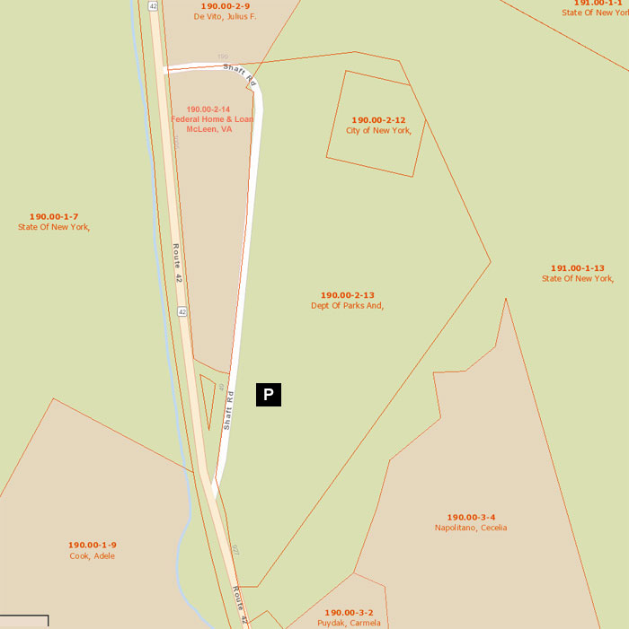
Public & Private Land Ownership for NYS Parking Area around Shaft Road.
Red=Private Land
Green=Public Land (DEC, DEP, NYS Parks, etc) |
|
|
|
|
| | DIRECTIONS TO TRAIL HEAD |
| | DEC Shaft Road Parking Lot: 42.165933, -74.408867 (WGS84 DEC) |
| | DEC Shaft Road Parking Lot: N42 09.956, W74 24.532 (GPS) |
| | DEC Shaft Road Parking Lot: N42 09 57, W74 24 31 (Deg, Min, Sec) |
| | DEC Shaft Road Parking Lot: 18N 548829, 4668369 (UTM) |
| | | |
| | DEC Parking Area Elevation is approximately 1,551 feet |
| | Take New York State Thruway to Exit 21 (Catskill). |
| | Take a left out of the NYS Thruway entrance road. |
| | Go approximately 3/4 mile |
| | Take a right onto Route 23 West |
| | Go approximately 6.6 miles to Cairo, NY |
| | Take a LEFT onto Rt 32. McDonalds Rest. on corner. |
| | Go approximately 7.7 miles on Rt 32 |
| | Take a RIGHT onto Rt 23A |
| | Go appoximately 22.2 miles to the intersection of Rt 23a and Rt 42 . |
| | Go approximately 0.3 miles - Take LEFT and go over bridge (over Schoharie Creek) |
| | Go approximately 7-8 miles on Rt 42 (from Rt 23a) |
| | Take a LEFT onto Shaft Road. |
| | Continue STRAIGHT up into the DEC parking lot (cannot see from Rt 42 or Shaft Road). |
| | There are 25 parking spaces. |
|
|
SPECIAL CIRCUMSTANCES ABOUT THIS HIKE |
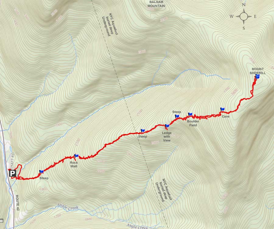
| | The hike up to Sherrill Mountain does not have a view directly from the summit. There is a limited view part way up the mountain in the winter. There are also views from the south eastern side of the summit, which is NOT marked on our map. This hike is considered a bushwacking hike. There are multiple ways of getting to the summit, and this hike just represents one possible way.
This hike follows up the ridge line to the summit. The hike starts out at the very end of the ridge line. Ironically, the start of the ridge line, which is 50 feet away fromt the small creek, is probably the steepest part of the hike. After a large rain storm, or during the Spring with significant amounts of snow melting it is possible that you may not be able to cross the stream. In the Spring, the creek will rise from melting snow as the day progresses, so keep this in mind when planning your trip. But, you will know this at the very beginning of the hike. After getting across the stream there is nothing to stop you from getting to the top. It should also be noted that during high winds it can be dangerous to be on this ridge. It should also be noted that water sources might be limited or not running. Bring all the water you will need to get to the summit.
From the summit of Sherrill Mountain, you can also walk over to Balsam Mountain or North Dome. You can also descend down from Balsam Mountain if you are worried about crossing the stream.
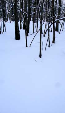
From the DEC parking lot, the ridge starts right next to the DEC parking lot. Instead of hiking down to the green barrier, you can walk over the mound of dirt and be right at the beginning of the ridge. Once you walk up the steep hill, the ridge will level off to almost flat grade. The ridge is often 500 feet wide, and can get as small as 200 feet wide. Just keep track of where the middle of the ridge is and keep moving up the ridge.
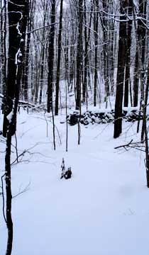
After approximately a 1/2 mile you will see a nice well built rock wall run directly across the ridge. The easiest way over the wall is by moving to the left side of the ridge. Like most mountains in the Catskill Mountains, this one runs in steps of ledges. You will have a flat section followed by a steeper section, which then changes back to a flat section again. This repeats many times during this hike.
After 1-3/4 miles at approximately 2,800' you will see a nice view all the way over on the right. Worth checking out. It is a small ledge that has a limited view in the Winter. It is also a nice camping site. It is flat, cleared off, and has a nice view to the East.
Another 1/4 mile up around 3,000' you will come to a large boulder field. Some of the boulders are 10-20' in diameter. It is interesting. In the Winter, the snow drifts can get deep around the rocks. Naturally, the landscape after the rocks is another steeper incline.
At 2-1/2 miles at 3,400' you will come to some very thick brush. In the summer it may be hard to find your way thru the brush. Fortunately, the thick brush does not last long. There is a Cave just after the flat section of brush. It can provide you with shelter if needed. Just make sure that a bear is not sleeping in there.
Just above the Cave, you will need to start drifting to the left, as the ridge line changes direction. The landscape will also change. You will run into sections that actually go downhill. It is easy to think that you are on the top of Sherrill Mountain. But, these are just false summits. Keep going.
When you get close to the summit, you will start to see trails. Most of which lead to the summit. The summit is fairly flat, with a lot of trails. There is a mixture of Balsam trees and deciduous trees. If you have a GPS, you will find that the actual peak is 4 feet higher then where the canister is located. You may have to wonder around a bit to find it. Some of the canisters are moved from time-to-time.
There are also some views from the south eastern side of the summit. You may have to wonder around a bit to find it. We did not mark it on the map.
You can camp on top only in the Winter Months.
|
|
|
MILEAGE CHART |
| | Mile Point | Altitude | Notes |
| | 0.00 | 1,555 | DEC Parking Lot: 42.165933, -74.408867 (WGS84 DEC) |
| | 0.00 | 1,555 | DEC Parking Lot: N42 09.956, W74 24.532 (GPS) |
| | 0.00 | 1,555 | DEC Parking Lot: N42 09 57, W74 24 31 (Deg, Min, Sec) |
| | 0.00 | 1,555 | DEC Parking Lot: 18N 548829, 4668369 (UTM) |
| | | |
| | 0.02 | 1,551 | Walk past the green road barrier at the end of Shaft Road. |
| | 0.05 | 1,560' | Take right onto small trail after walking up hill. |
| | 0.06 | 1,558' | Take a right onto old dirt road. |
| | 0.07 | 1,558 | Continue STRAIGHT past the concrete post in road another 100-200 feet. |
| | 0.09 | 1,550 | When you see a break in the bob-wire fence, cut across the stream and up the hill - Follow the center of the ridge upward. |
| | 0.43 | 1,864 | Go thru break in stone wall |
| | 0.66 | 2,037 | Steeper Section |
| | 0.82 | 2,155 | Steeper Section |
| | 1.53 | 2,675' | Steeper Section |
| | 1.77 | 2,833' | Ledge with limited view - nice camping site! |
| | 1.77 | 2,833 | Steeper Section |
| | 1.90 | 2,912 | Steeper Section |
| | 2.05 | 3,033 | Large Boulder Field |
| | 2.49 | 3,401' | Thick Brush |
| | 2.54 | 3,410' | Cave |
| | 3.02 | 3,549' | Summit of Sherrill Mountain - Canister on top |
| | 5.71 | 1,555' | Return to parking lot |
|
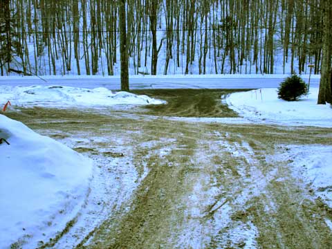 |
This DEC parking lot can be easily missed. If you are heading from Rt 23, and heading south on Rt 42, the access to Shaft Road is on the LEFT side of the road. If you are heading north from Rt 28, Shaft Road is on the RIGHT side of the road. Shaft road just loops back to Rt 42. The picture shows Rt 42, and Shaft Road. Once you come in from Shaft road, continue until you come to the NYS parking area. It is not obvious. Continue until you see the green steel gate in the next section. Then continue into the NYS parking area. This parking area is not always plowed right away after a snow storm. |
|
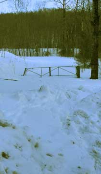 |
The picture on the left show you the green steel gate at the start of the trailhead.
The picture on the RIGHT shows the DEC parking (unplowed). They usually do plow it in the Winter. |
 |
|
 |
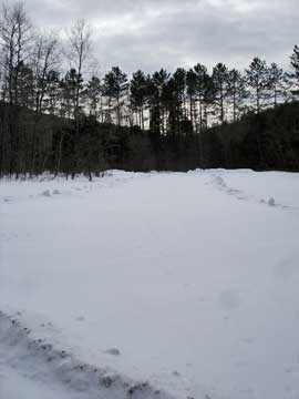
After walking up the hill from the green gate, look for a small trail on the right. The picture on the left shows what the trail looks like. Take a RIGHT onto the very short trail. After about 50 feet, you will come to another logging road. Take a RIGHT onto the logging road.
The picture on the right shows the next intersection. If you look carefully, you will see two concrete post on each side of the road. At this point you want to continue another 100-200 feet down the path until you see a break in the barb-wire fence on the left. At this point cross the stream and start your hike up the steep hill. This is probably the steepest part of the hike. |
 |
|
 |
The picture on the left shows the hike up the steep hill. It is steeper then it looks in the picture.
At mile post 0.43, you will see a rock wall running across the ridge. On left side of the ridge you will see a break in the rock wall. This is the easiest place to get over the rock wall. |
 |
|
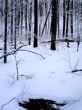 |
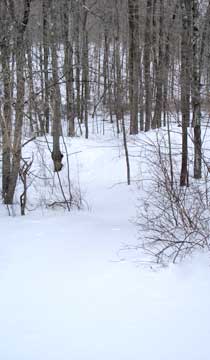
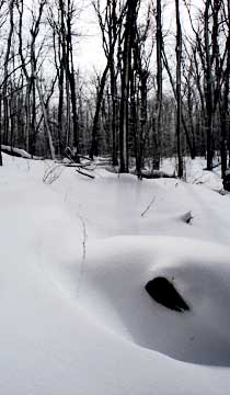
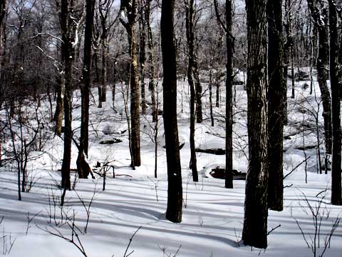
The picture on the left show you the kind of terrian you will encounter on this hike. You will have a flat section, and you will then come to a steeper section. You can see this well in this picture.
The picture on the right shows another steeper section.
|
 |
|
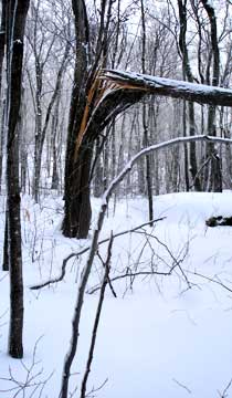 |
This picture shows the risk you can take by hiking on this ridge during high winds.
As a general rule, we found that the left side of the ridge had more snow drifts then the right side.
|
 |
|
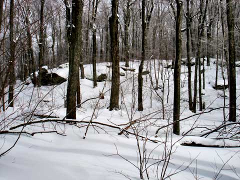 |
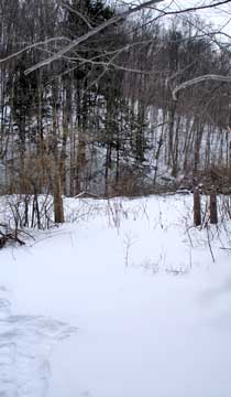
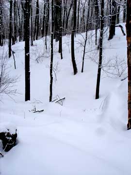
The picture on the left shows another steeper section. |
|
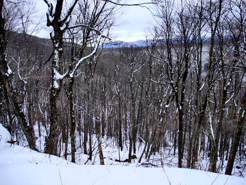 |
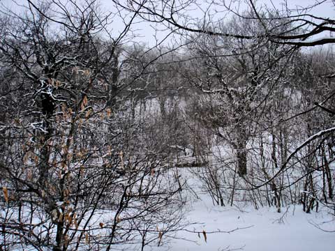
The picture on the left shows the views from the ledge. The views are limited, but still good in the winter. The ledge is around 20-30' high. The mountains in the background are Sheridan and the two un-named peaks north of Sheridan. This is an excellent place for a camp site. It is clear of brush, flat, and has a good view to the east.
|
|
 |
The picture on the left shows a steeper section right next to the ledge with a view. Most of the steeper sections had larger boulders mixed on the landscape. |
|
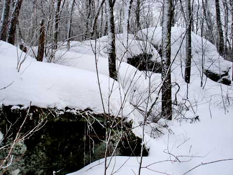 |
200 feet above the ledge with a view is the giant boulder field. Most of the large boulders are between 10-20 feet in diameter. In the Winter they can have a significant amount of snow inbetween them, so don't get stuck in the snow. |
|
 |
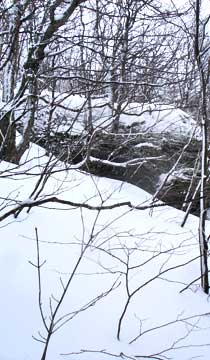
Around 3,400' you will come to some very thick brush. In the summer it can be quite difficult to get thru. But, it doesn't last long. If you look thru the brush in the picture you can see a large rock. This rock as a large cave. It would be a good place to stay during bad weather. Just make sure that it does not have a bear in it. |
|
 |
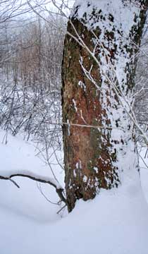
This picture shows the cave from the side of the steeper bank.
From the tree, you can see where bears scratch their nails on the tree.
|
 |
|
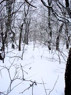 |
Once you get past the cave, the woods mellow out in elevation gain. There are quite of few places where you will start going downhill. You are NOT at the summit yet. These are just false summits. Expect this to happen twice. When you get to the summit, you will see quite a few paths on the summit.
|
|
|
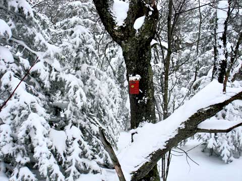
The summit is fairly flat. It is large enough that you can take a little while to find the canister. The canister is NOT directly at the highest point on the mountain. It is actually about 4 feet lower then the highest spot. Make sure you sign the book showing you visited the summit. When you put the notebook back, make sure that it is protected well against moisture. Please note that the canisters are moved from time-to-time. |
|
|
S E C T I O N S
|
W E A T H E R
|
O T H E R
|
|
Copyright 1994-2024 www.catskillmountaineer.com
ALL RIGHTS RESERVED
|