Sugarloaf Mountain Loop |
 |
| |
| |
|
OVERVIEW |
| | Distance: | 7.12 miles round trip from DEC parking lot from Dale Lane and back to the parking lot. |
| | Time: | Average 5.50 hours round trip |
| | Elevation Gain: | 1,788 feet from parking lot to the summit of Sugarloaf Mountain. |
| | Best Time to Hike: | Morning. |
| | Difficulty: | Very Difficult |
| | Catskill Highest: | #13 |
| | Summit Elevation: | 3,810' |
| | |
| | | USGS Official Names: | Sugarloaf Mountain (ID: 968056) |
| | USGS Previous Names: | Mink Mountain. Changed from Mink Mtn to Sugarloaf Mtn in 1928.
Also known in the past as Brown Mountain, Dibble Mountain, and Twin Mountain. |
| | USGS Summit-Elevation: | 3,806' |
| | USGS Sugarloaf-WGS84: | 42.131201, -74.150141 (DEC-WGS84) |
| | USGS Sugarloaf-GPS: | N 42 07.872, W 74 09.008 (GPS) |
| | USGS Sugarloaf-UTM: | 18N 570239, 4664693 (UTM) |
| | USGS Sugarloaf-Deg, Min, Sec: | N42 07 52, W74 09 00 (Degree, Min, Sec) |
| | |
| | | USGS Official Map: | Hunter Topographical Map (free) |
| | |
| | | Digital Mapper: |
Topo
Terrain
Satellite |
| | |
| | | Access Methods: | Foot and snowshoe only |
|
|
Maps |
 |
|
|
| | DIRECTIONS TO TRAIL HEAD |
| | Roaring Kill Parking WGS84 (DEC): 42.150983, -74.13115 - Elevation is approximately 2,022 feet |
| | Roaring Kill Parking Deg/Min/Sec: N42 09 03, W74 07 52 - Elevation is approximately 2,022 feet |
| | Roaring Kill Parking GPS: N 42 09.059, W 74 07.869 - Elevation is approximately 2,022 feet |
| | Roaring Kill Parking UTM: 18N 571786 4666905 - Elevation is approximately 2,022 feet |
| | Take New York State Thruway to Exit 21 (Catskill). |
| | Take a left out of the NYS Thruway entrance road. |
| | Go approximately 3/4 mile |
| | Take a right onto Route 23 West |
| | Go approximately 6.6 miles to Cairo, NY |
| | Take a LEFT onto Rt 32. McDonalds Rest. on corner. |
| | Go approximately 7.7 miles on Rt 32 |
| | Take a RIGHT onto Rt 23A |
| | Go approximately 2.2 miles on Rt 23a |
| | Take a RIGHT into Palenville |
| | Go approximately 6.8 miles to Tannersville NY. |
| | Take a LEFT onto South Main Street (If you miss this road then take a LEFT on to Rail Road Ave |
| | Go approximately 4.3 miles on Rt 16 (Platteclove Road) |
| | Take a RIGHT onto Dale Lane |
| | Go approximately 0.5 miles on Dale Lane |
| | Take a RIGHT onto Roaring Kill Road |
| | Go approximately 0.6 miles on Roaring Kill Road |
| | NOTE: Parts of Roaring Kill Road is NOT plowed in the Winter |
|
|
NOTES ABOUT THIS HIKE |
| | Most hikers like to hike the Sugarloaf Loop in a clockwise direction. There is a 600 foot elevation climb over steep and difficult terrain on the eastern side of Sugarloaf Mountain. There is a 1,000 foot elevation climb over steep and difficult terrain on the western side of Sugarloaf Mountain. The terrain on the western side is considered to be more difficult.
If you are looking for the shortest hike up Sugarloaf Mountain, you could start at the Northern side of the Mink Hollow Trail. This will allow you to get to the top of Sugarloaf Mountain in less then two miles. But, you will have to hike up-and-down the difficult western side of Sugarloaf Mountain. You will also miss the beautiful view point at Dibble's Quarry.
The Stone Chairs at Dibble's Quarry is a destination all on it's own, and includes a beautiful view point of the upper Platte Clove Valley.
Years ago, there was a very large beaver pond about a 1/2 mile beyond Dibble's Quarry. The beavers are gone, along with the pond.
On the western side of Sugarloaf Mountain on the Mink Hollow Trail is a very nice little waterfall. And just beyond the waterfall is a view point of Plateau Mountain that is becoming overgrown.
Parking on Dale Lane can be difficult in the Winter Months. Part of Dale Lane is now plowed in the Winter months.
This hike is part of the Devil's Path. The Devil's Path is one of the most difficult and dangerous hiking paths in the world. There is a good reason why they call it the Devil's Path. You better be a skilled hiker who is in good shape.
In the Winter months when Dale Lane is closed, some hikers will hike Sugarloaf Mountain From Mink Hollow Road.
The fastest known time (FKT) for the entire Devil's Path (24.2 miles) was done in 4h 35m 57s on June 1, 2020 by Ja Shua Ried (male). The FKT for a female is Krista Rynkowski and Celia Keim Patel who did it in 8h 38m 34s on May 5, 2019. The FKT for the entire Devil's Path and back (48.4 miles) was done by Alexander Galasso in 13h 43m 10s on September 9, 20197. All unsupported.
|
|
|
MILEAGE CHART |
| | Mile Point |
Mileage |
Altitude |
Notes |
| | 0.00 | 0.00 | 2,022' | DEC Parking Lot on Dale Lane. |
| | 0.30 | 0.30 | 2,127' | Trail Junction - Take LEFT. |
| | 1.02 | 0.72 | 2,353' | Dibble's Quarry (Stone Chairs) & views of Platte Clove. |
| | 1.22 | 0.20 | 2,380' | Stream Crossing. |
| | 1.60 | 0.38 | 2,507' | Large Beaver Pond (now empty) |
| | 2.05 | 0.45 | 2,821' | Pecoy Notch - Go RIGHT. |
| | 2.35 | 0.30 | 3,298' | Ledge with limited views. |
| | 2.46 | 0.11 | 3,405' | Good views off side trail on the left. |
| | 3.11 | 0.65 | 3,780' | Summit of Sugarloaf Mountain - not obvious - easy to miss. |
| | 3.22 | 0.15 | 3,741' | Trail on LEFT (Yellow Markers) to best view on hike. |
| | 3.26 | 0.04 | 3,743' | Ledge with views (see above) |
| | 3.30 | 0.04 | 3,741' | Return back to Devil's Path (Red markers). |
| | 4.14 | 0.84 | 2,686' | Trail Junction for Mink Hollow Trail |
| | 4.73 | 0.59 | 2,569' | Wooden Bridge of nice moss covered stream. |
| | 5.00 | 0.27 | 2,707' | Ledge with views of Plateau Mountain. |
| | 6.82 | 1.82 | 2,127' | Trail Junction (close loop). Take LEFT. |
| | 7.12 | 0.30 | 2,022' | DEC Parking Lot on Dale Lane. |
|
|
Hike to Sugarloaf Mountain |
 |
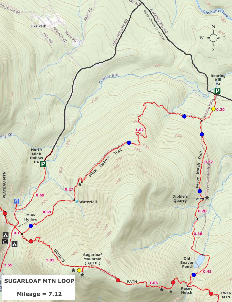
The picture is the Roaring Kill DEC parking lot. You can park on both sides of the road. lot can probably hold 15 to 20 cars. |
|
 |
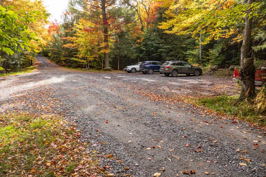
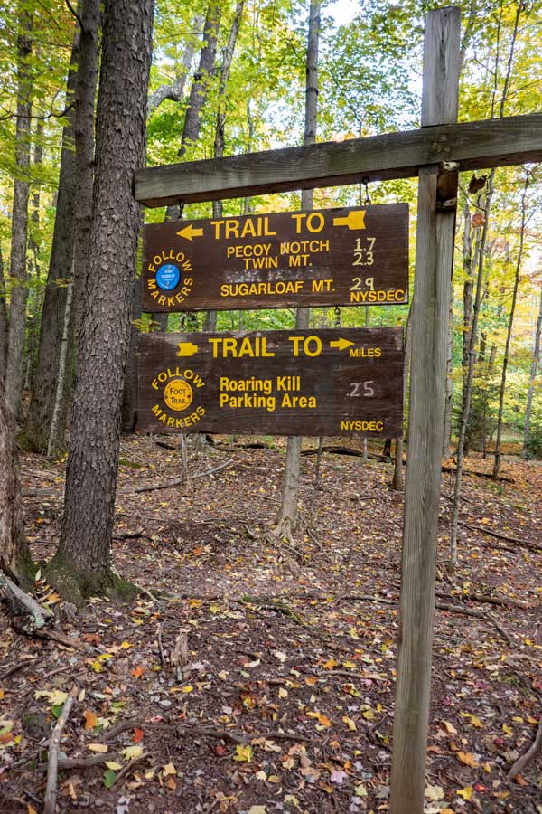
This is the Trailhead to both Twin (west) and Sugarloaf (east & west). The trail begins between the Kiosk and the sign. Just hike past the large rocks. |
|
 |
 |
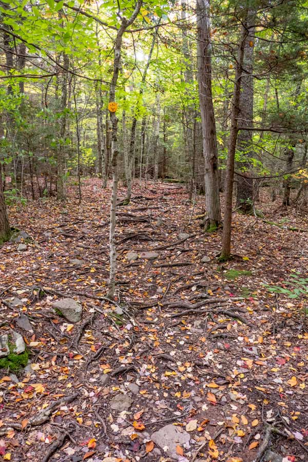
This is the Roaring Kill Trail. It is only about 1/4 mile like and is a littly rooty. |
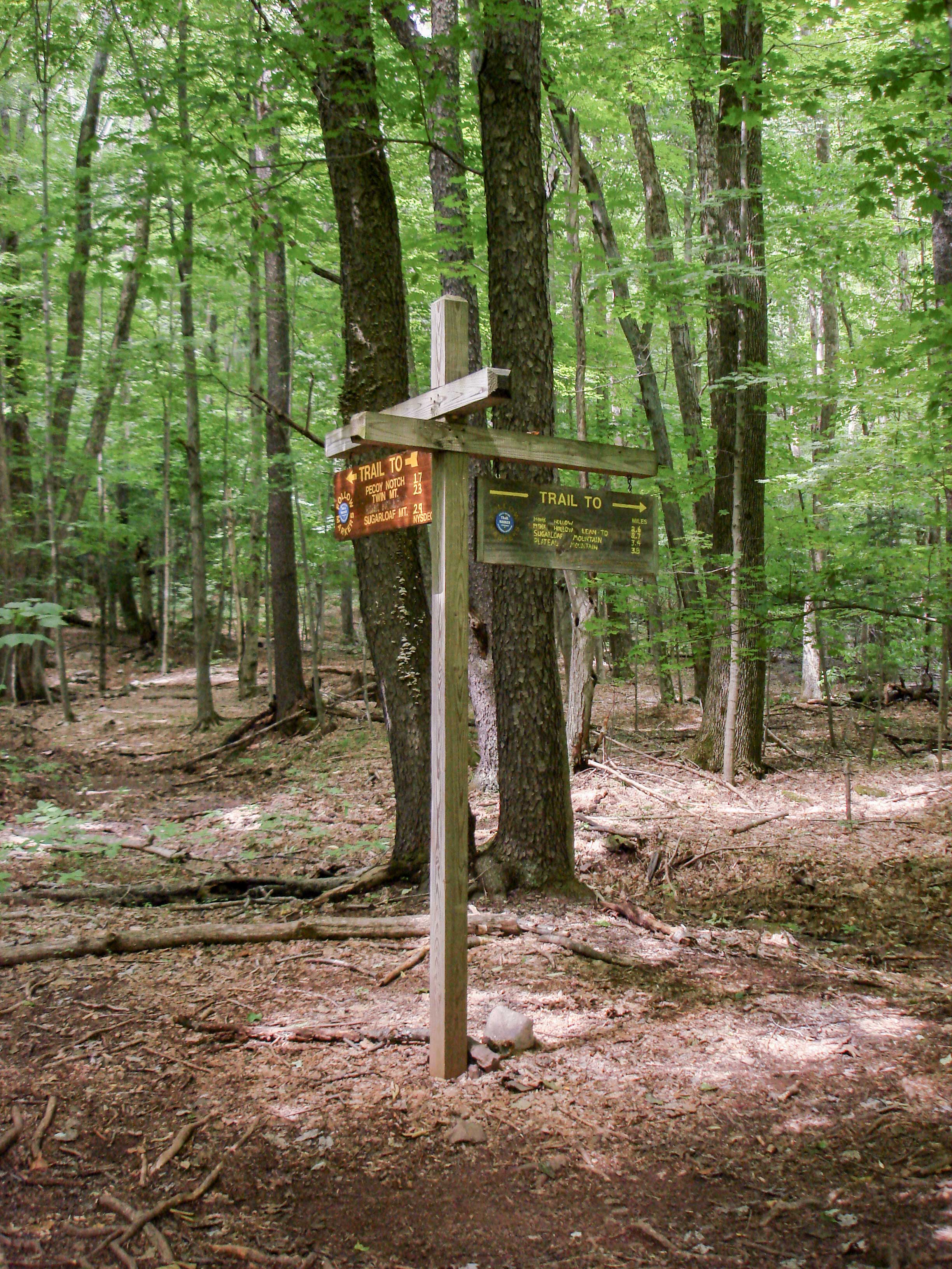
At this trail junction, you want to go LEFT on the Pecoy Notch Trail towards Pecoy Notch between Sugarloaf Mountain and Twin Mountain. Right will put you on the Mink Hollow Trail and take you to the west side of Sugarloaf Mountain and Plateau Mountain. |
|
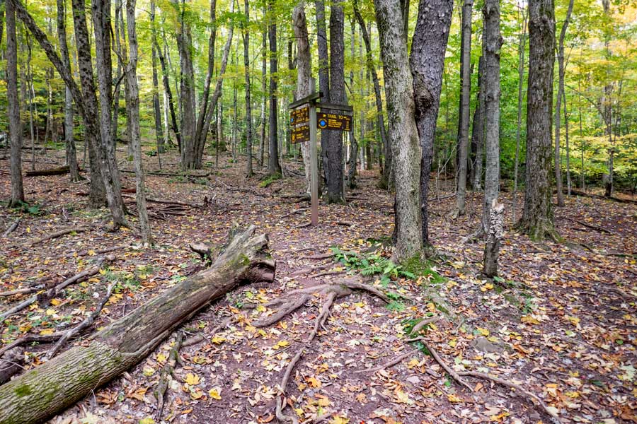 |
This is another view of the trail junction for the Pecoy Notch Trail and the Mink Hollow Trail. You want to continue left (straight). |
|
 |
 |
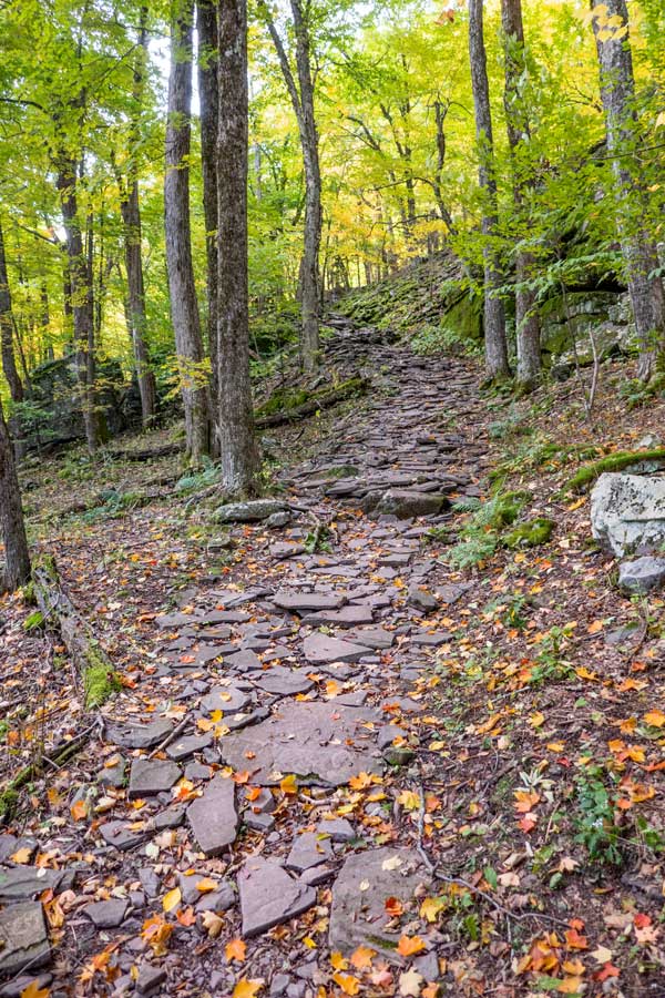
From the Trail Junction to Dibble's Quarry, you will climb several hundred feet in elevation over about It is about 3/4 of a mile from the Trail Junction, or a mile from the Roaring Kill Parking Lot. |
After coming up the hill, you will come to the Entrance of Dibble's Quarry. Off to your left will be a view toward Platte Clove. |
|
 |
Once in Dibble's Quarry, you will see a number of stone chairs, and a little village that people have built over time. It has a beautiful view over the Platte Clove Valley. |
|
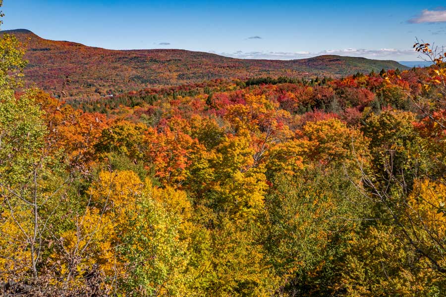 |
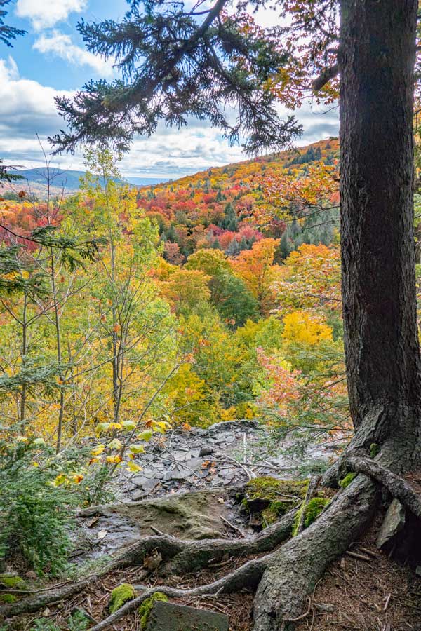
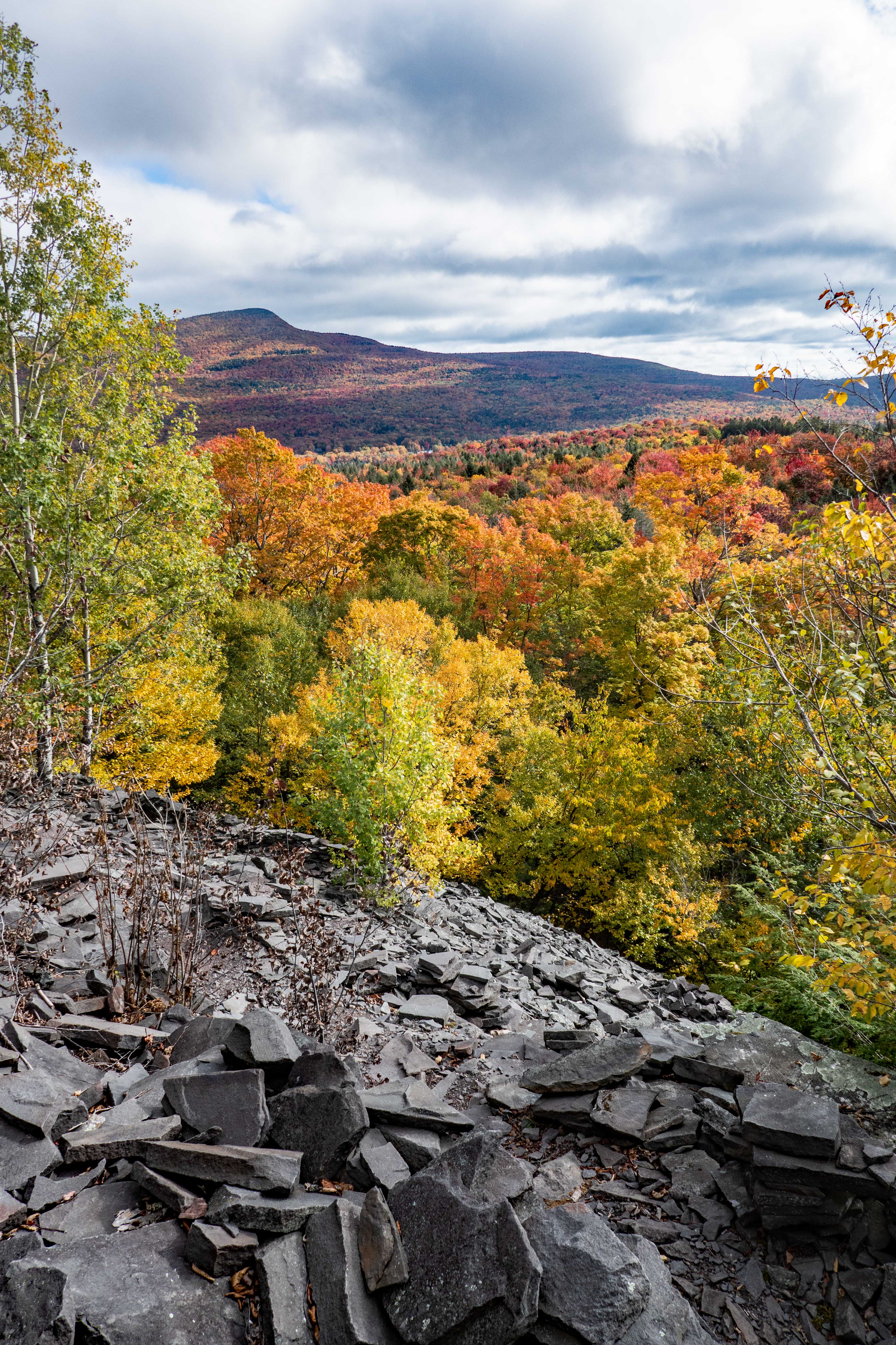
This is the beautiful view over the Platte Clove Valley. You have Kaaterskill High Peak on the left and Huckleberry Point on the right. |
|
 |
To your right of the main view over the Platte Clove Valley is the summit of Twin Mountain. |
|
 |
 |
Just before you leave Dibble's Quarry, you will get one last view of Kaaterskill High Peak |
After the last view point, you will start to enter the forest again. You will walk through parts of the old Dibble's Quarry. |
|
 |
 |
About 2/10 of a mile past Dibble's Quarry, you will come next to a creek that crosses the trail. There is also a nice 10' waterfall. |
From the waterfalls to the old Beaver Pond, the trail can get a little rooty. |
|
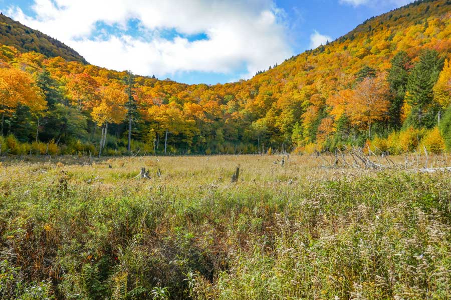 |
This is the old Beaver Pond. As of 2023, the beavers are no longer there, and the beaver pond has drained out. It is about a 1/2 mile beyond Dibble's Quarry. |
|
 |
After a little over 2 miles, you will reach Pecoy Notch. You want to go RIGHT to the summit of Sugarloaf Mountain. LEFT will take you to the summit of Twin Mountain. |
|
 |
 |
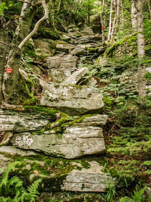
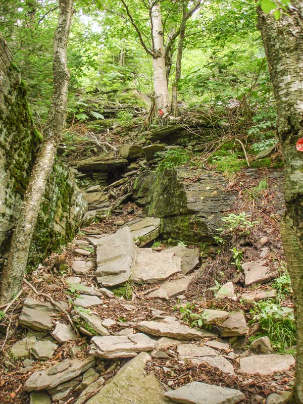
The trail starts climbing steeply almost immediately. The picture on the LEFT shows the beginning of the trail where it turns steeper. The next 1/2 mile will be one of the most difficult sections you will probably ever hike on. Take your time, and be careful.
Now you will be on the Devil's Path. This entire path is difficult. There is nothing easy about this path. It has every possible kind of difficult hiking obstacle. Dangerous cliffs, big rocks to climb, cliffs to climb, deep mud, chimneys, loose rocks, trees, slippery rocks, moss covered rocks, water running over the path, etc. You will swear that only the devil could make a trail this difficult. Hence, the name, "Devil's Path". |
The picture on the RIGHT shows one of many difficult sections. The camera is tilted upward, so the slope is actually steeper then it looks in the picture. You need to hang onto the roots to climb this section. This climb is about 30 vertical feet. |
|
 |
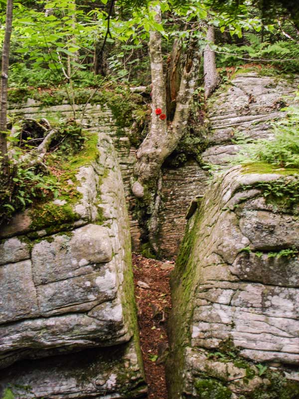 |
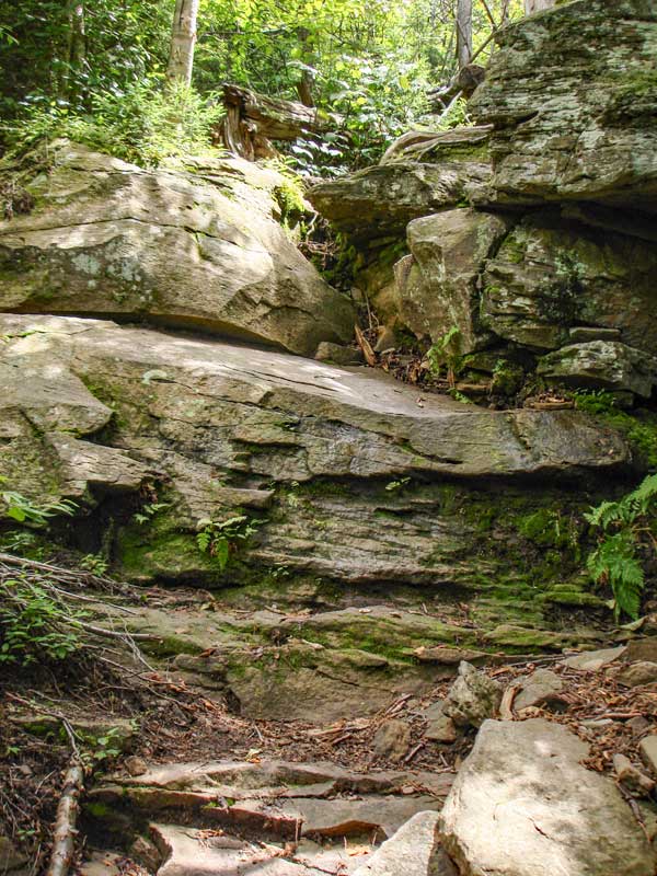
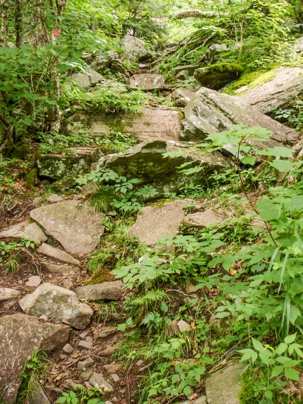
This another one of the difficult sections. The section has a vertical climb of about 50-60 vertical feet. You need to take your time and choose the best path for climbing up this section.
This is an interesting section and fun section of the Devil's Path. You walk through the cracks between the two rock. | |
|
 |
 |
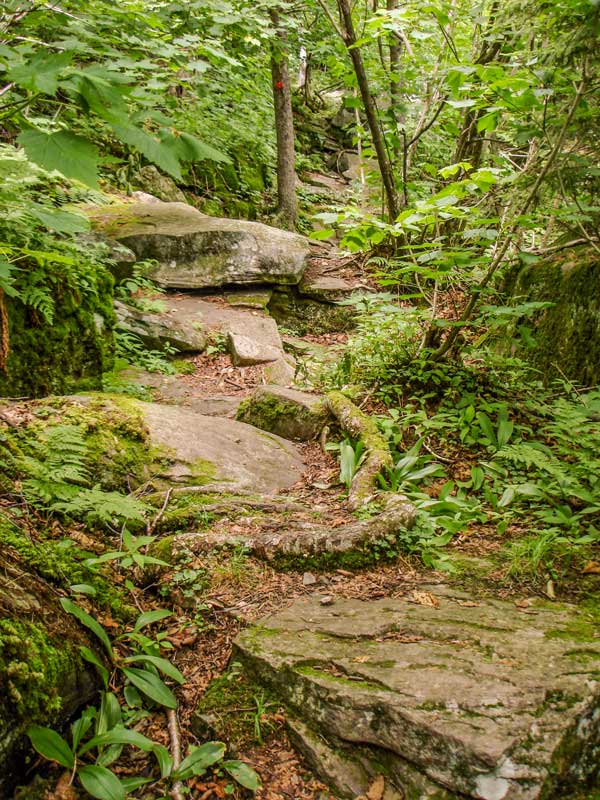
When you get to an elevation of 3,405 feet (mile post 2.16). There is a side trail that will take you to the view point. It is a nice place to stop and catch your breath, and get a little reward for your efforts.
From this point forward, the steepness of the trail will level off and the hike become much easier. The next 300 vertical feet will be much easier. You will still have a few harder sections, but nothing as difficult as you just climbed. You will also start to see animals again. Mainly birds, porcipines, etc. |
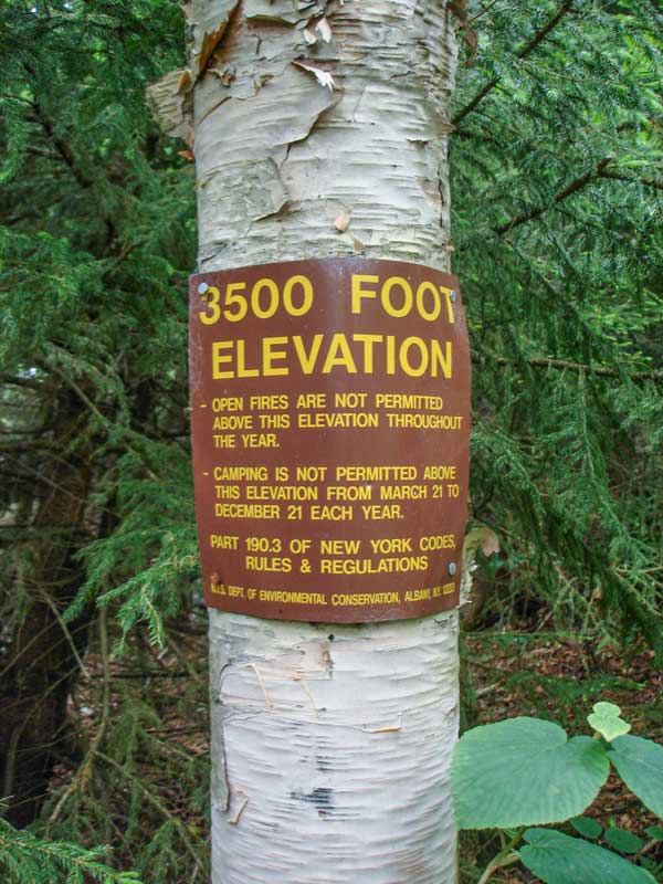
At an elevation of 3,450' you will encounter this sign. You cannot camp above 3,500' feet between March 21 and December 21. |
|
 |
At mile post 3.11 (elevation 3780' - GPS: N42 07.883 W74 09.004) you will reach the summit. The summit is not obvious, and very easy to miss. It is very level on the top of Sugarloaf Mtn, so it is very easy to miss. NO views from the summit peak. But, good views 550' down the trail, so don't worry!
At mile post 3.22 (elevation 3741') you will encounter a Trail Junction on your LEFT. This trail is about 200' feet long and has a Yellow trail marker. Go LEFT.
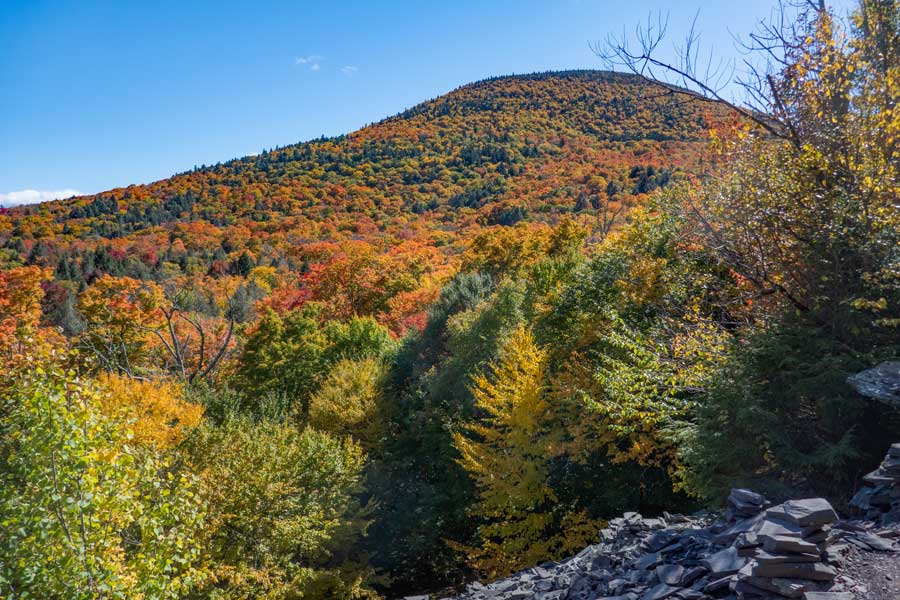
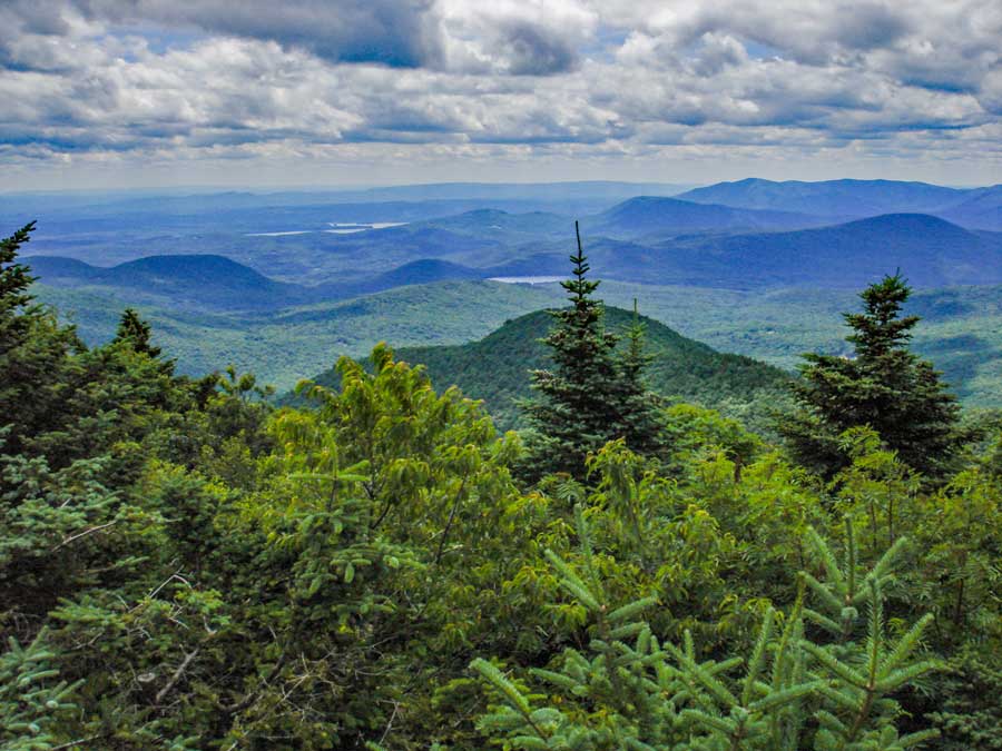
At mile post 3.26, you will reach the ledge in the picture on the above. This is the best view point on Sugarloaf. A good place for lunch or a well-deserved break. The lake in the picture is Cooper's Lake in Woodstock, and Ashokan Reservoir in the background. On your right is Plateau Mtn.
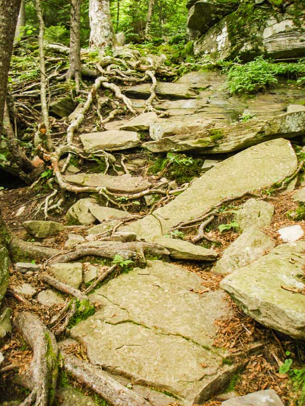
At mile post 3.30 you will return back to the Devil's Path. The trail steadily gets steeper-and-steeper as you go down. The steep downhill grade on this side of the mountain is about 1,000 vertical feet. |
|
 |
 |
One of the many difficult section on the west side of Sugarloaf Mountain on the Devil's Path. |
This is another one of the many difficult section on the west side of Sugarloaf Mountain on the Devil's Path. |
|
 |
 |
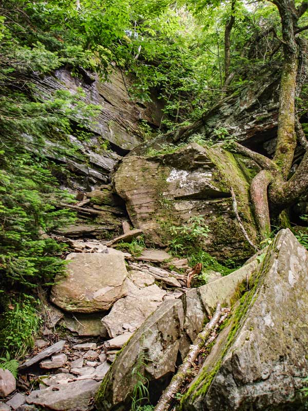
One of the many difficult section on the west side of Sugarloaf Mountain on the Devil's Path. |
This is another one of the many difficult section on the western side of Sugarloaf Mountain on the Devil's Path. Some consider this section the scariest part. The picture doesn't really show it well. |
|
 |
 |
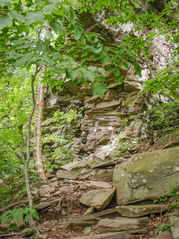
You don't have to climb this cliff, but you will walk under it. There is a considerable overhang. |
This is another one of the many difficult section on the west side of Sugarloaf Mountain on the Devil's Path. |
|
 |
 |
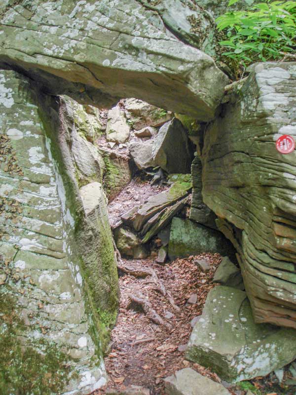
This is a "fun" section of this hike. You have to duck under this natural rock bridge. The trail continues do descend after the Natural Rock Bridge. |
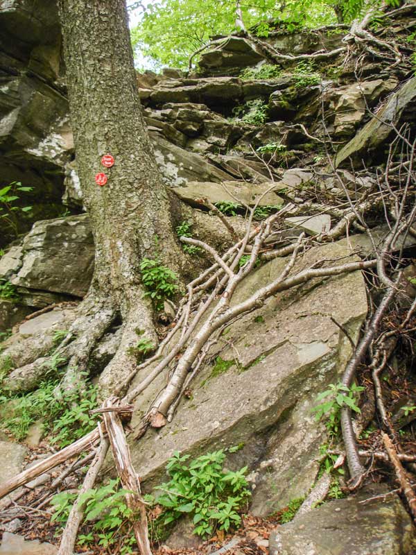
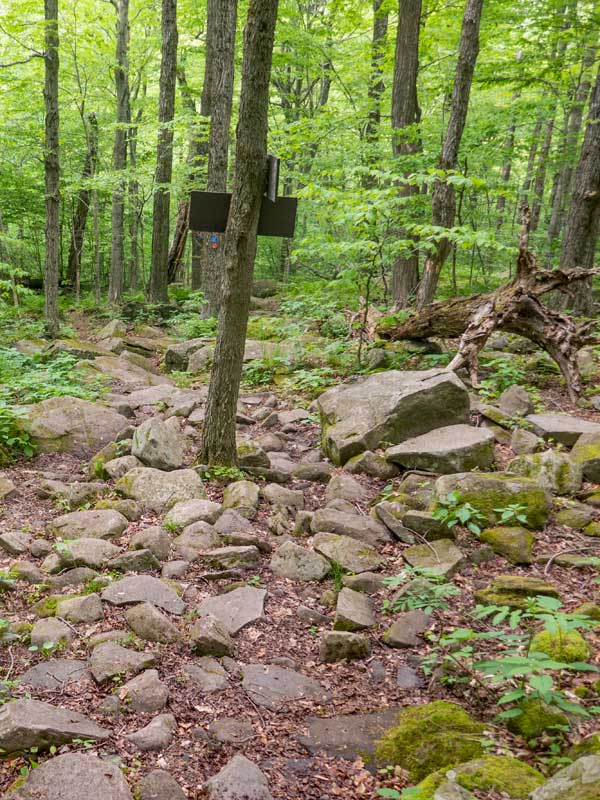
At mile post 4.14 (elevation 2,780') you will come to this trail junction. Go RIGHT onto Mink Hollow Trail. The sign for the Mink Hollow Trail is on the other side of this tree. The Mink Hollow Trail will take you back to your car at the Roaring Kill Parking Lot. Straight will take you to the Mink Hollow Road and Plateau Mountain, and the continuation of the Devil's Path. From the summit to this Trail Junction, the trail dropeds 1,000' in elevation over 1 mile long. |
|
 |
 |
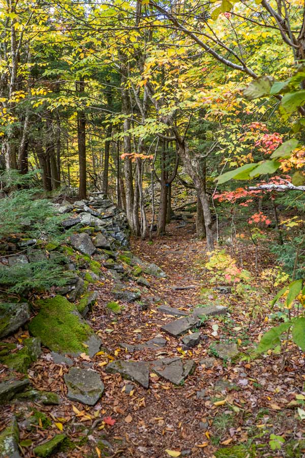
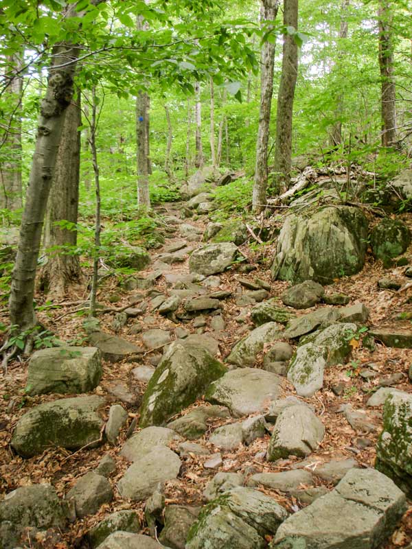
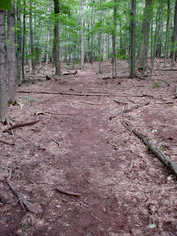
This is the trail back to your car. The beginning section of this trail is a little rocky. But, for the most part it is fairly easy hiking when compared to the Devil's Path. The trail is long, but has many beautiful sections and features. | >
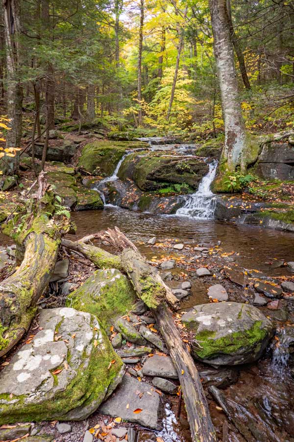
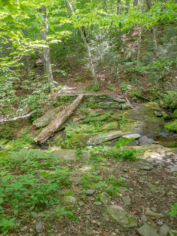
At mile post 4.73 (elevation 2,569') you will come to stream crossing. There used to be a wooden bridge here. You see part of the old bridge in the creek. You will need to cross this stream. During large rainstorms this will not be able to be crossed safely. It has a very beautiful stream with moss covered rocks below it. |
|
 |
 |
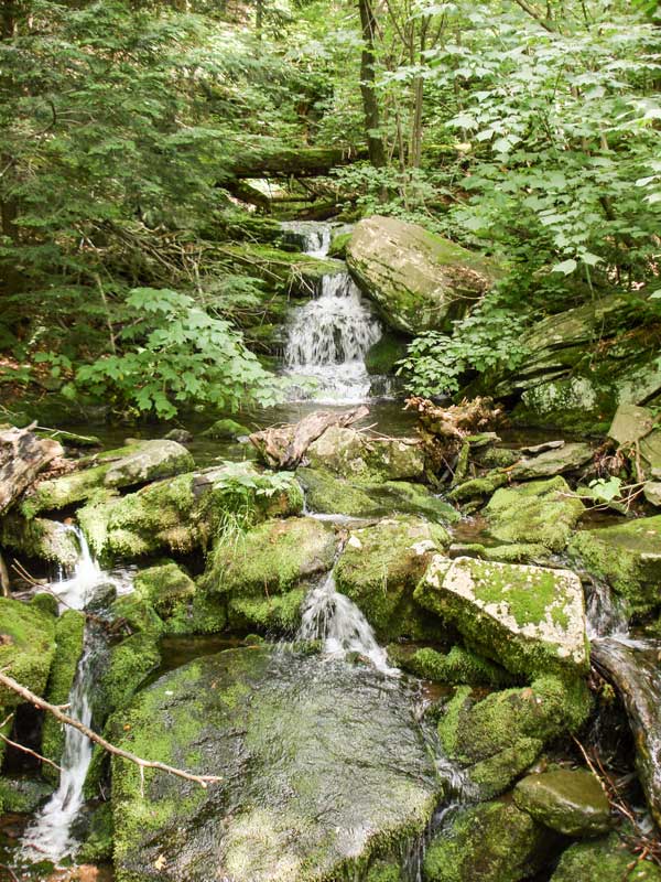
As you cross the creek, you will see the stream and small waterfall. Some hikers like to stop here for a break to enjoy the stream and scenery. It is also a good place to get water because most of the mountain have few water sources. |
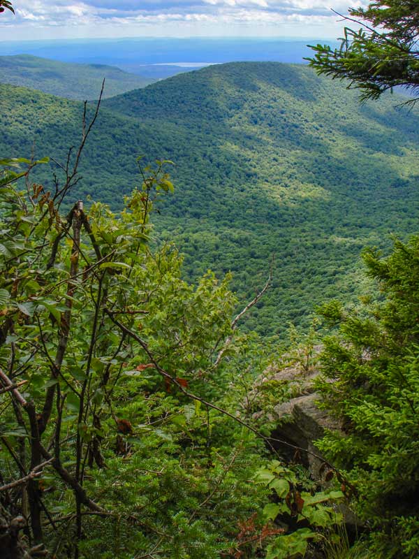
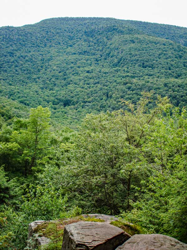
At mile post 5.00 (elevation 2,707') you will see a very small ledge off the trail with this view. Unfortunately, this view is becoming more overgrown. The view from the ledge is of Mink Hollow with Plateau Mtn in the background. |
|
 |
 |
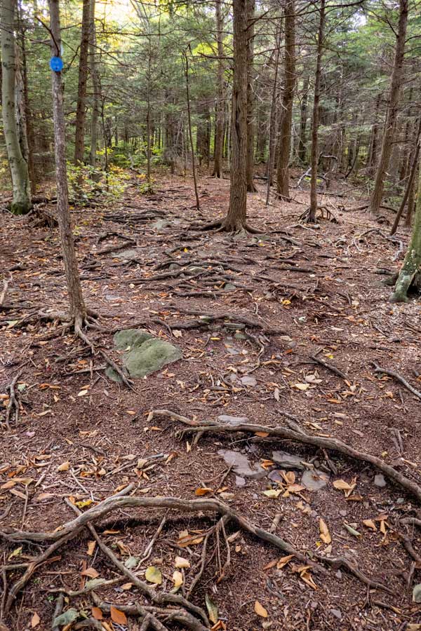
Just before you get back to the Trail Junction that will complete the loop, you will come to a section of the forest floor that has little vegetation. |
At mile post 6.82, you will come back to the Trail Junction in the picture. You have now completed the loop. Take a LEFT back to your car. |
|
|
At mile post 7.12, you will arrive back at your car. Hope that you enjoyed this challenging hike. |
|
|
S E C T I O N S
|
W E A T H E R
|
O T H E R
|