Kaaterskill Amphitheater and Hawkeye Ledge |
 |
| |
| |
|
OVERVIEW |
| | Distance: | 7.55 miles from Platte Clove to Palenville. |
| | Notice: | This hike requires two cars and you will be BUSHWHACKING for part of this hike. |
| | Time: | 5.0 hours |
| | Elevation Gain: | 1,163' feet from parking lot to Kaaterskill Amphitheater |
| | Elevation Loss: | 2,419' feet from Kaaterskill Amphitheater to Malden Ave |
| | Best Time to Hike: | When the leaves are not on the trees (late Fall to early Spring). |
| | Side Trips: | Viola Falls and Poet's Ledge. |
| | Difficulty: | Moderate (route finding required) |
| | | | |
| | USGS Official Map: | Kaaterskill Topographical Map (free) |
| | | | |
| | DEC Trail Map: | DEC Kaaterskill Wild Forest Map (free) |
| | | | |
| | Digital Mapper: |
Topo
Terrain
Satellite |
| | | | |
| | Access Methods: | Foot and snowshoe. |
|
|
Maps |
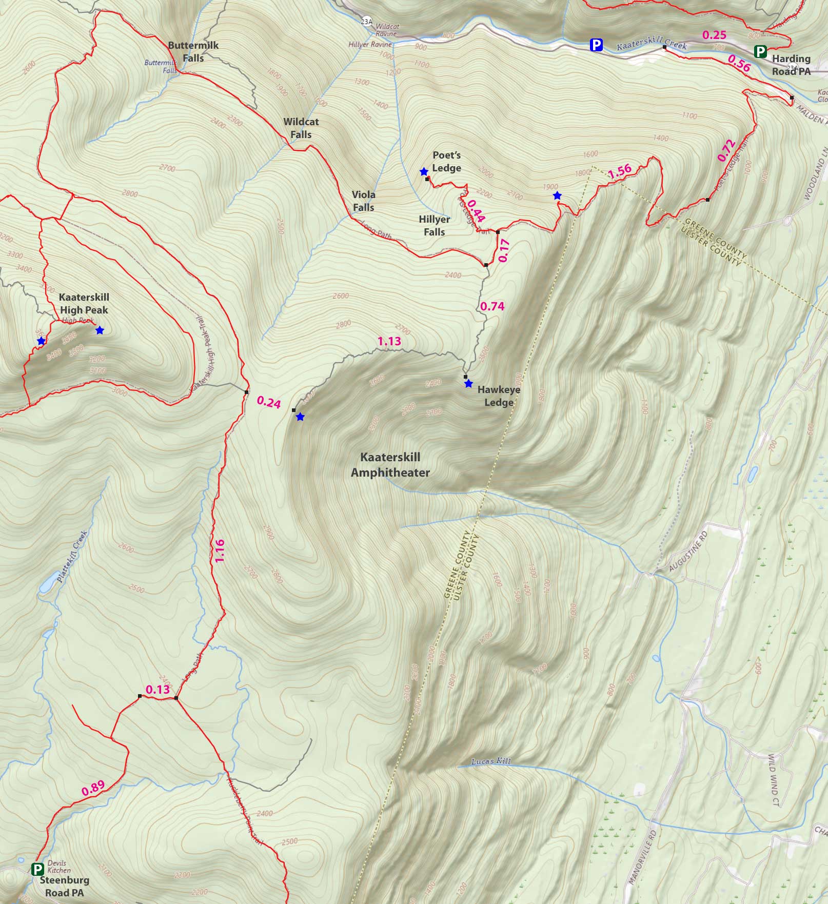 |
|
|
| | Directions to HARDING ROAD Parking Area |
| | Harding Road Parking Area WGS84 (DEC): 42.176236,-74.030495 - Elevation is about 680' feet |
| | Harding Road Parking Area Deg/Min/Sec: N42 10 34, W74 01 49 - Elevation is about 680' feet |
| | Harding Road Parking Area GPS: N 42 10.574 W 74 01.830 - Elevation is about 680' feet |
| | Harding Road Parking Area UTM: 18N 580071 4669799 - Elevation is about 680' feet |
| | Harding Road Parking Area (Palenville, NY) (Google Maps) |
| |
|
| | Take New York State Thruway to Exit 21 (Catskill). |
| | Take a left out of the NYS Thruway entrance road. |
| | Go approximately 1/4 mile |
| | Take a right onto Route 23 West |
| | Go approximately 6.6 miles on Route 23. |
| | Take a LEFT onto Rt 32 (McDonalds on corner). |
| | Go approximately 7.7 miles on Route 32. |
| | Take RIGHT onto Rt 23A. |
| | Go approximately 2.6 miles on Rt 23A . |
| | Take a Right into the DEC Harding Road Parking Area in Palenville - leave one car here! |
| | Some people have parked at the Fernwood Resturant (with permission - they eat there once they are done with the hike). |
| | You cannot park at the trail head! |
| | Do NOT park by the red building next to the bridge. |
| | Do NOT park on Malden Ave or in someone's driveway on Malden Ave. |
| | Do NOT drive up the dirt entrance road to the trail head - this is PRIVATE property - AND there is NO place to park or turn around once you get to the trail head. |
|
| | Directions to STEENBURG Parking Area |
| | DEC Parking Lot WGS84 (DEC): 42.133667, -74.0827 - Elevation is approximately 1,872 feet |
| | DEC Parking Lot Deg/Min/Sec: N42 08 01, W74 04 57 - Elevation is approximately 1,872 feet |
| | DEC Parking Lot GPS: N 42 08.020, W 74 04.962 - Elevation is approximately 1,872 feet |
| | DEC Parking Lot UTM: 18N 575810 4665024 - Elevation is approximately 1,872 feet |
| | Steenburg Road Parking Area (Platte Clove) (Google Maps) |
| |
|
| | Go approximately 4-5 miles further on Rt 23A in the second car. |
| | When you come into Tannersville, take LEFT at the red light onto RailRoad Ave (Rt 16), which will turn into Spruce Street, which will turn into Platte Clove Road. Follow this road approximately 7-8 miles |
| | The DEC parking lot is on the LEFT side of the road. |
| | It is approximately 1/2 mile past Josh Road (on left side of the road). |
| | If you start to go down the hill to the valley, then you have gone too far. The downhill section of the road is closed in the winter. |
| | Do NOT block the gate entrance - there is a house at the end of this road. |
| | Do NOT drive up the dirt entrance road to the trail head - this is PRIVATE property - AND there is NO place to park or turn around once you get to the trail head. |
|
|
SPECIAL CIRCUMSTANCES ABOUT THIS HIKE |
| | The hike to Kaaterskill Amphitheater and Hawkeye is one rarely ever hiked. But, the trail is probably one of the oldest trails in the Catskill Mountains. The Mohawk Indians used it to climb up to their Indian Camp between the Amphitheater and Kaaterskill High Peak. Today only a couple people a year hike this route. Hawkeye is a special place. Years ago, there was a spectacular view from Hawkeye Ledge. Today, it is overgrown with trees. There is also a beautiful flat ledge rock. It is populated with rare Pitch Pine trees. You can also make a side trip to Poet's Ledge.
Poet's Ledge is best viewed in the morning, as the sun shines in from east and fills up the Kaaterskill Clove with sunlight. Later in the day, the view is very disappointing. The path to Poet's Ledge is well marked DEC trail.
It is best to start this hike from the DEC Steenburg Road Parking Area in Platte Clove (Rt 16 - Platte Clove Road). Going this way will save you 1,300 vertical feet of climbing. The parking lot in Platte Clove is around 1900' and the parking in Palenville is around 600'. You will need to put one car in the DEC Harding Road Parking Area, which is 1/4 mile before the bridge on the west end of Palenville on Rt 23a. There is one other places on Rt 23a you can park. It is 1/4 mile west of the bridge. Do NOT park on Malden Ave. The local people get very upset, and will have your car towed. Some people have parked at the Fernwood Restaurant with permission (ie, eat dinner when you come back later). Then with a second car drive back to the DEC parking area in Platte Clove on Platte Clove Road (Rt 16).
Register your hike in the DEC registration box in Platte Clove. If you get lost or hurt while bushwhacking you need to give search and rescue some idea where you are. Your life might depend upon it. Hike up the road from the Parking Area in Platte Clove. After 9/10 of a mile, you will turn RIGHT off the road onto a DEC trail. After another 1/5 mile, you will take a LEFT and hike up the Long Path route. After a total of 2.4 miles, you will come to a level hiking area. At this point, you want to take a RIGHT into the woods. You will then BUSHWHACK about 0.15 miles to the rim of the Kaaterskill Amphitheater. Once you reach the Amphitheater you will take a LEFT and head down hill towards Hawkeye Ledge.
The old Indian Path is evident in some places and gone in other areas. Just stay within visual distance to the rim. But, don't get too close to the rim. It is easy to fall down the steep bank and off the cliff. So, you need to be careful when approaching the rim. It should be noted that there is not a safe place anywhere on the Amphitheater where you can get a clear view. While it is disappointing that you cannot get a clear picture, you will have a limited view almost the entire way down to Hawkeye. Still very enjoyable. There is one ledge you have to climb down, but it really isn't difficult when compared to other areas in the Catskills.
Once you get down near Hawkeye Ledge, you should stick close to the rim. Hawkeye Ledge is on the rim. The easy route is to stick close to the rim. The trees on the edge of Hawkeye Ledge are now overgrown. But, when the leaves are not on the trees, you can still get a good view. After a short distance, you will see a faint trail that will ledge you to the large flat rock. There are scrub pines (Pitch Pines) growing out of the cracks in the rock. Pitch Pine trees only exist in a couple areas in the Catskills. You will also see a fire ring. This fire ring was used 50 to 100 years ago. Nice place to camp. But, beware that there are a lot of bears in the Kaaterskill Wild Forest.
When you get done, walk down the water drainage from the fire ring. Stay in the hardwood trees. NOTE: If you stick to the rim on Hawkeye Ledge, you will encounter thick Mountain Laurel. The conifer trees will lead you to a rock ledge. Soon the drainage will turn into a stream. Follow the stream until you run into the DEC trail. Once you reach the trail, take a RIGHT and follow the route down to Palenville. It is a 2.25 mile hike from the trail junction from Poet's Ledge to Malden Ave. When you get to Red Rock Road (rough dirt road), stay on the road. This is private property. Once you reach Malden Ave, take a LEFT. Then walk up Malden Ave. When you get to the guard rails blocking the rest of Malden Ave, walk around the guard rails. When you get to Rt 23a, you want to walk down the shoulder of Rt 23a to the DEC Parking Area (about 1/4 mile). If you parked on the parking area on the west side of the bridge, then you want to walk up (west) Rt 23a to your car (about 1/4 mile) |
|
|
MILEAGE CHART |
| | Mile Point | Altitude | Notes |
| | 0.00 | 1,872' | DEC Parking Lot. |
| | 0.89 | 2,366' | Road & Trail Junction - On Right side of road - easy to miss this junction - N42 08.553 W74 04.467. |
| | 1.02 | 2,412' | Trail Junction - Left goes to Kaaterskill High Peak - Right goes to Huckleberry Point - N42 08.544 W74 04.325. Go LEFT. |
| | 2.18 | 2,977' | Trail Junction - Left on unmarked trail goes to Mohawk Indian Camp - Straight continues on the Long Path. As soon as you stop climbing in elevation, start looking for a faint trail on the left. It will have a small rock cairn next to it. N42 09.502 W74 04.006 . After several hundred feet, you will come to a round circle of about 150' in diameter. This is the old Mohawk Indian Camp. |
| | 2.42 | 3,055' | Kaaterskill Amphitheater Rim |
| | 3.55 | 2,482' | Hawkeye Ledge GPS N 42 09.550 W 74 03.084 |
| | 4.29 | 2,389' | Trail Junction - take right on DEC trail. |
| | 4.46 | 2,397' | Trail Junction to Poet's Ledge |
| | 6.02 | 1,254' | Dirt Road (Red Rock Road) - Take left |
| | 6.84 | 636' | Malden Ave - Take left |
| | 7.55 | 680' | Parking off of RT 23a |
|
|
Hike to Kaaterskill Amphitheater and Hawkeye Ledge |
 |
The image above is the entrance to the Upper Platte Clove DEC Parking Lot. This is also the old Steenburg Road. Presently, you can only travel by motorized vehicle up to the DEC Parking Area. You are NOT allowed to drive past the gates!
The Upper Platte Clove Parking Area does fill up fast during the summer months and on some weekends. Make sure you park so that other cars will have a placed to park.
Do NOT park on the side of Platte Clove Road (Rt 16). Your car WILL be towed by the Town of Hunter!
Across the street are two parking spaces for access to Hell's Hole. If you drive past Steenburg Road on Platte Clove Road, there is another parking area around the corner called the Bridal Veil Lookout Parking area, which is now CLOSED to public parking. Further down Platte Clove Road (Rt 16) is Middle Platte Clove Parking Area for the unofficial Huckleberry Quarry Trail (2 parking spaces). Near the bottom of the clove is the Lower Platte Clove Parking Area (1 space) for access to Platte Clove.
|
|
 |
This is the sign for the DEC Upper Platte Clove Parking Area on Rt 16 in Platte Clove.
|
|
 |
After a short drive up Steenburg Road, you will come to the Upper Platte Clove Parking Area. Make sure you park so that other cars will have a placed to park. |
|
 |
This is the Trailhead for Kaaterskill High Peak and Huckleberry Point. You cannot drive past this gate. Only the landowner and emergency vehicles can drive past the gate. Further up Steenburg Road, the land will cross over into private land.
If a vehicle comes up or down Steenburg Road, please move over so that they can get past.
Make sure that you register for your groups hike here. Registering allows more money for trail maintenance, enlarging the parking area, and allocation of funds for this area. Furthermore, if you get lost, the Rangers will use this information to find you. |
|
 |
 |
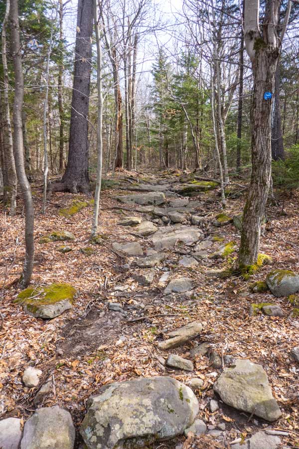
The picture on the LEFT show a picture of the trail (Steenburg Road) after the Trail Head. The beginning of the trail is the steepest part of the road. |
As you get further up, the incline of Steenburg Road becomes more level, and easier hiking. |
|
 |
After a little less then 9/10 of a mile, you will leave Steenburg Road. Take a RIGHT at this point and follow the trail another 1/10 of a mile until you reach the trail junction for Huckleberry Point. |
|
 |
After a little more then 1/10 of a mile, you will come to a trail junction. You want to go LEFT towards Kaaterskill High Peak (Blue Trail Markers). Right will take you to Huckleberry Point (RED Trail Markers). |
|
 |
 |
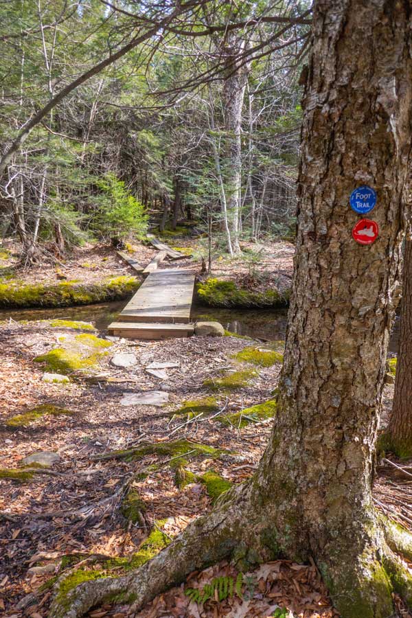
The picture on the LEFT show a picture of a small bridge over a water crossing. It is not that far from the trail junction for Huckleberry Point. |
Soon after crossing the small bridge you will start to climb up the base of Kaaterskill High Peak. The trail will start to increase in elevation, along with the trail becoming rocky. It will remain that way until you reach the top of the Kaaterskill Amphitheater. |
|
 |
 |
As you approach the top of the Kaaterskill Amphitheater, the trail incline will start to level off. On your left you will see Hell's Hole Creek ravine. After the ravine disappears you will near the top of the Kaaterskill Amphitheater. |
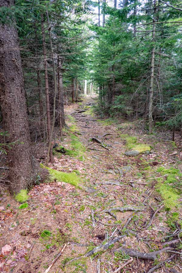
Not long after you reach the top of the Kaaterskill Amphitheater, the trail will change to a conifer forest. In the beginning you will walk through a beautiful section of the trail. But, that will end shortly. |
|
 |
Once you reach the Amphitheater, you can take a LEFT and head north along the rim. It takes about 0.15 miles to reach the Amphitheater from the Long Path. |
|
|
 |
 |
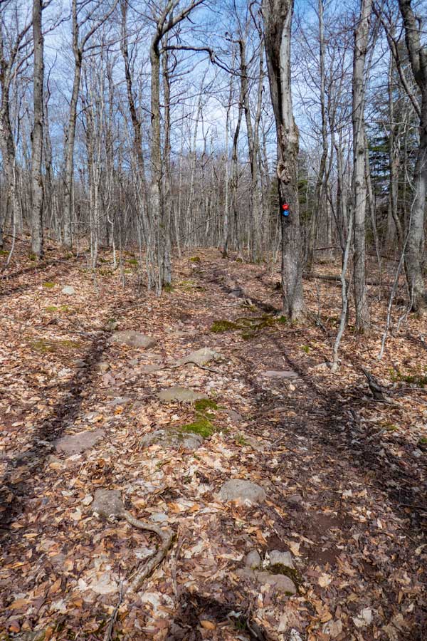
This is one of the areas where the old Indian trail is visible. Sometimes the trail will disappear. Other times, the trail will be quite visible.
| This is one of the areas where the old Indian trail is visible. Sometimes the trail will disappear. Other times, the trail will be quite visible. |
|
 |
There are a few steep sections with ledges. But, they are not too bad. This is the most difficult ledge, which isn't that difficult.
As you get down towards Hawkeye, you want to keep closer to the rim of the Amphitheater. If you drift too far away from the Rim, you will get stuck wading through Mountain Laurel. They are quite thick near Hawkeye Ledge. Once you get the the Mountain Laurel, move close to the rim of the Amphitheater to avoid the difficult wading through the Mountain laurel. |
|
|
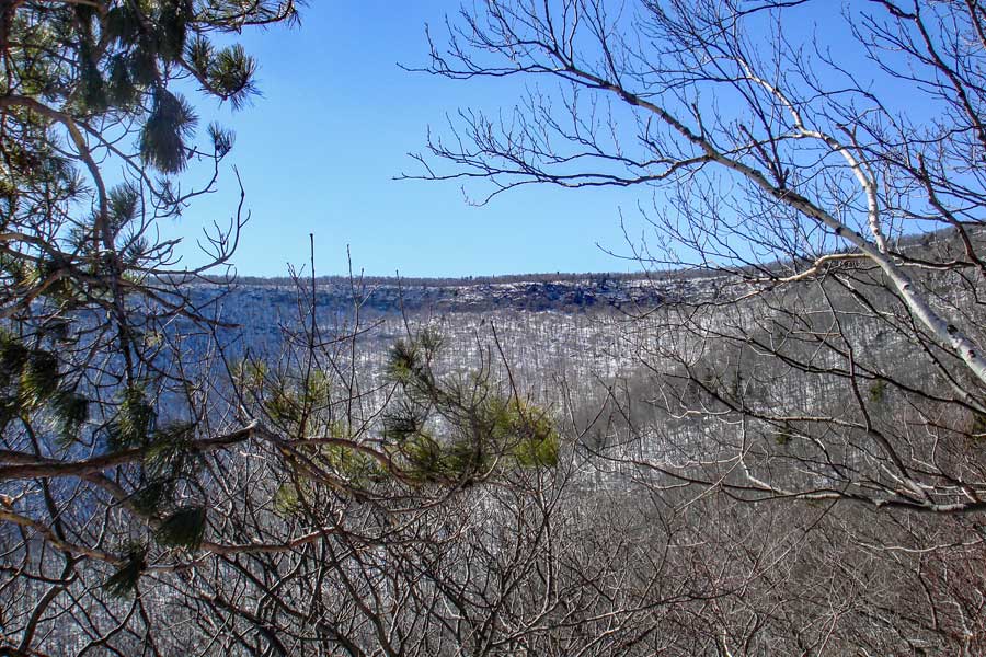
This picture was taken from Hawkeye Ledge. Unfortunately the trees have now overgrown the view from the ledge. But, you can still see the Amphitheater when the leaves are not on the trees.
After you get done, walk north. Stick to the right and walk around the Mountain Laurel. After walking north for a little while, you will see a trail that will take you to Hawkeye. It is a very large flat rock ledge. This is one of the few areas in the Catskills where you will find scrub pines (Pitch Pine). |
|
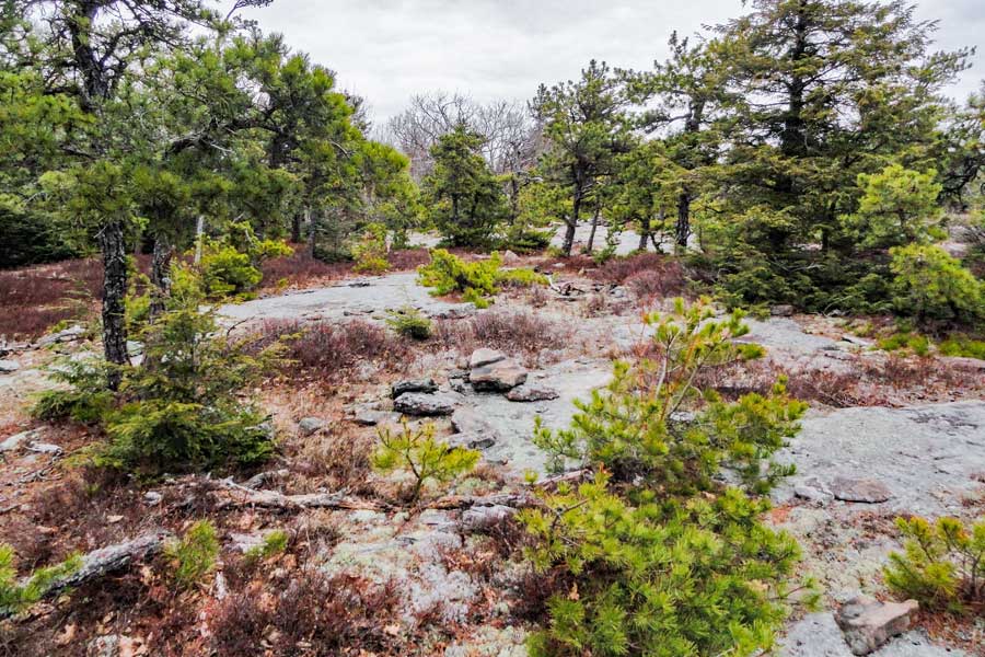 |
This is Hawkeye. This is one of the few areas in the Catskills where you will find scrub pines (Pitch Pine). It is a very interesting area. Worth walking around to explore. Here is another picture of the flat ledge rock that was ground smooth by the glaciers. |
|
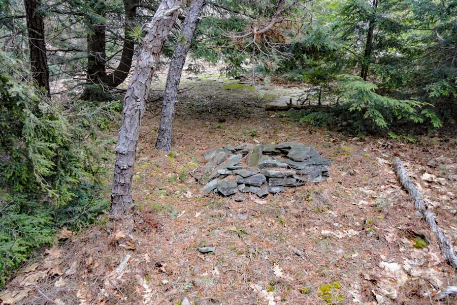 |
This is an old fire ring from 50-100 years ago. Probably has not been used in decades. From here, I usually walk north west down the drainage to exist Hawkeye. It is an excellent place to camp for the night. |
|
 |
 |
This is a picture of the Scrub Pines on Hawkeye. It is growing out of the crack of the rock. |
TThis is the beginning of the drainage. Soon, it will turn into a stream and flow over Viola Falls. Once you reach the trail, take a RIGHT on the trail. |
|
POET'S LEDGE (Optional) |
 |
 |
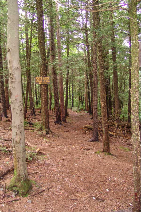
OPTIONAL SIDE TRIP: At Mile post 2.63 (elevation 2,341) you will encounter a Trail branch. If you go right it will lead to Poet's Ledge. The trail is marked with Yellow Trail Markers. The detour to Poet's Ledge is 0.44 miles one way or 0.88 miles round trip. Most consider Poet's Ledge the best part of the hike. If this is the end of your hike, your round trip mileage will be 6.14 miles. The trail will be a 196' drop in elevation from the trail junction down to Poet's Ledge. |
This is what the beginning of the trail to Poet's Ledge looks like |
|
 |
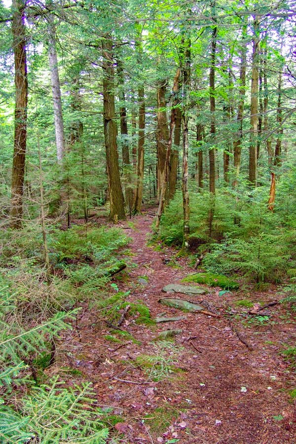
About 2/3 of the way down to Poet's Ledge, you will encounter two ledges. Neither of these ledges are Poet's Ledge. Continue on the path until the path absolutely ends. Then you will be at Poet's Ledge. |
|
 |
This is the view of Poet's Ledge. While the photo is beautiful, it really does not do justice to the view you will get. On a clear crisp day, the vistas are awe inspiring.
Safety Note: There is a benign looking crack in the ledge. If you look carefully, there is a 30' drop into a cave.
The best time to arrive at Poet's Ledge is around noon time to 2 PM in the afternoon. Late in the afternoon is the worst time. The photo above was taken at 10 AM. It takes 2 hours and 15 minutes to get there.
The mileage from the Long Path to Poet's ledge is 0.44 miles, and the elevation at Poet's Ledge is 2,145'. There is a 197' drop in elevation.
After you return back to the original trail, take a RIGHT and continue down the path.
Optional side-trip (minor bushwhacking) - After you get back on the trail, you will cross a small little stream (Hillyer). Maps from 50-60 years ago show a trail branch by the stream that will lead up to Hawkeye Ledge. The trail to Hawkeye is now overgrown and not visible. If you follow the stream uphill, it will lead you to Hawkeye Ledge. Hawkeye Ledge is located on the corner of the eastern escarpment and Kaaterskill Amphitheater. There is a large flat ledge with some views into the Amphitheater. Most of the view is now overgrown. When the leaves are not on the tree, the view is nice. Some people do camp on the ledge. Great place to camp for the night. |
|
\ DOWNHILL TO PALENVILLE |
 |
 |
After leaving (or bypassing) the Poet's Ledge Trail, and heading downhill, you will encounter this view point From this ledge you can clearly see Indian Head Ledge, Palenville Overlook Ledge, and Boulder Rock. You will also be able to see down into Palenville and the Hudson Valley. |
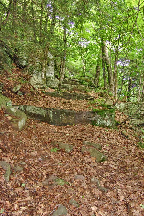
Shortly thereafter, you will encounter the Giant Steps. |
|
 |
 |
Continue downhill. There are some sections where it is an old logging road, and other areas where it is just a trail. |
When You come down the trail, and you come to a road junction, go LEFT. Then follow the road all the way down until you reach Malden Ave. |
|
 |
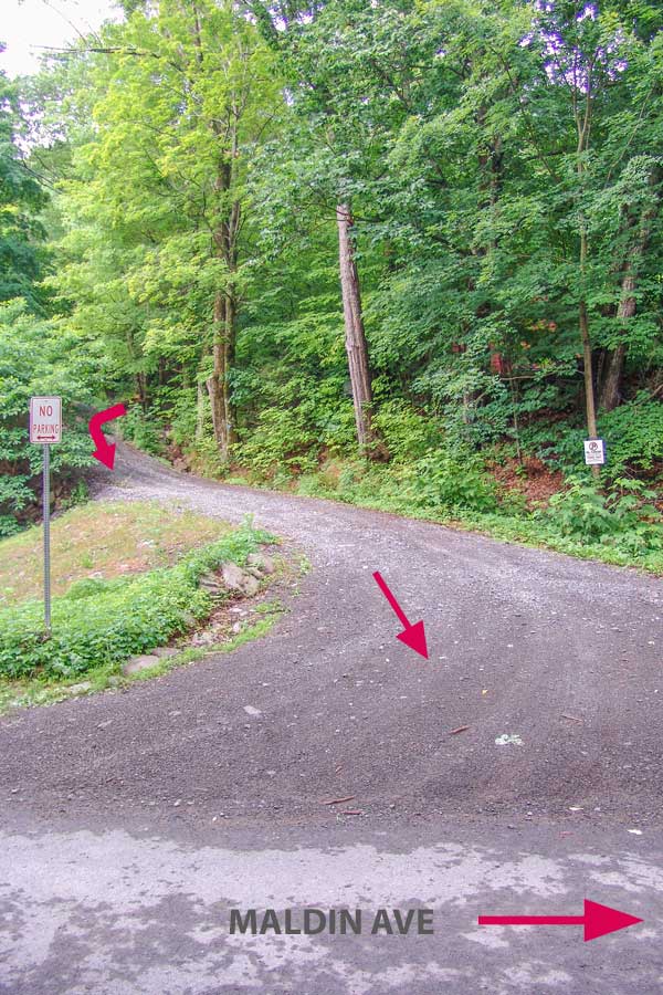 |
Take a LEFT onto this driveway . Malden Ave is 150 feet away. |
After walking 150 feet down this driveway, turn LEFT and walk up Malden Ave. You will have to walk around two barriers. The barriers block cars from driving down the closed section of Malden Ave. |
|
 |
If you look to your right as you walk up Malden Ave, you can see waterfalls on Kaaterskill Creek. You cannot access Kaaterskill Creek here, so please respect the private property of the land owners. |
|
 |
 |
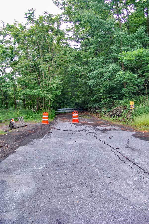
This is the second barrier. Just walk around the barrier. Beware of poison ivy.
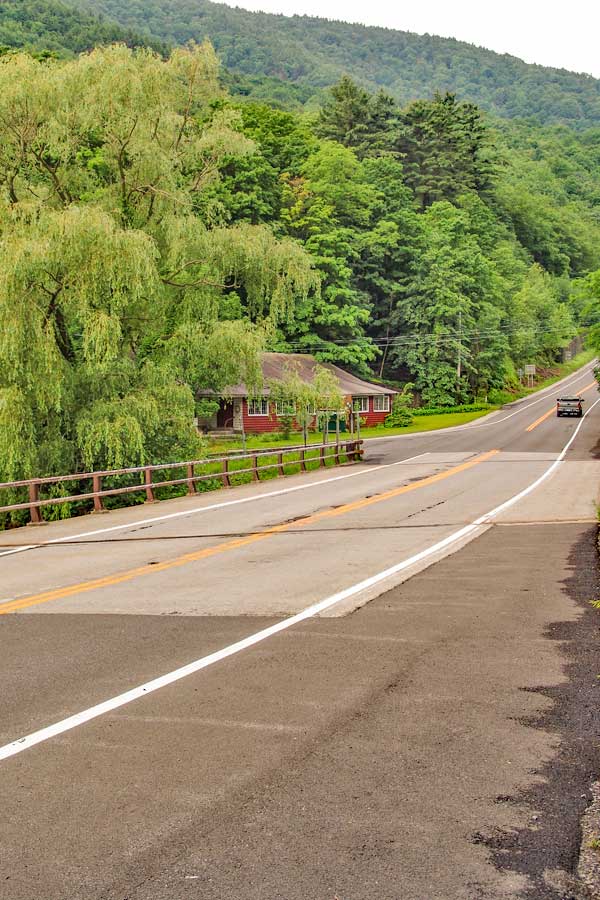
Walk past the red building on the end of Malden Ave.
The mileage for this hike starts where you see the red building. It is the closest place to the trail head. |
Once you reach Rt 23a, take a RIGHT and carefully walk up the road to the DEC Harding Road Parking Area.
NOTE: Malden Ave is a PUBLIC road from Rt 23a to 32a. In spite of a section of Malden Ave being closed to vehicle traffic, it is still a public road. You are legally allowed to walk around the barrier. This has been verified by Greene County Records office that holds the deeds. There is one particular land owner that wants the public to think that he owns Malden Ave. He does not own any part of Malden Ave! |
|
 |
Park at the DEC Harding Road Parking Area in Palenville. GPS (WGS84): 42.176236,-74.030495 (type in this GPS coordinate into your iPhone Maps program in the search box.
There is another off-road parking area about 1/2 mile up Rt 23a. But, it almost always fills up before the DEC Harding Road Parking Area in Palenville. |
|
|
S E C T I O N S
|
W E A T H E R
|
O T H E R
|
