Brant Fort Camp - Kaaterskill Mountain Range - Catskill Mountains
|
|
|
|
Overview of this Hike: |
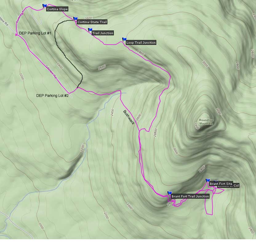
| Distance: 7.30 miles round trip from DEP parking lot #1 on Gillespie Road. |
| Time: Average 5.0 hours round trip |
| Elevation Gain: 574 feet from parking lot to highest point in hike. |
| Best Time to Hike: Anytime. Afternoon will provide light into the Col by Brant Fort Camp. |
| Difficulty: Easy |
| VO Map No: 99 |
| Catskill Highest: no summit |
| Peak Elevation: 2,640' |
| |
| Digital Mapper:
Topo
Terrain
Satellite |
| |
| Access Methods: Foot, snowshoe, and snowmobile. Very good snowshoe trail. Fair-to-Good cross-country ski trail. |
|
Directions to Trail Head from New York State Thruway (Easist, not the shortest): |
| GPS Coordinates to DEC Parking Lot: N42 08.020 W74 04.962 - Elevation is approximately 2,230 feet |
| Take New York State Thruway to Exit 21 (Catskill). |
| Take a left out of the NYS Thruway entrance road. |
| Go approximately 1/2 mile |
| Take a right onto Route 23 West |
| Go approximately 5 miles on Route 23. |
| Take a left onto Rt 32 (McDonalds on corner). |
| Go approximately 7-8 miles on Route 32. |
| Take right onto Rt 23A. |
| Go approximately 7-8 miles on Rt 23A . |
| When you come into Tannersville, take LEFT at the red light onto RailRoad Ave (Rt 16), which will turn into Spruce Street, which will turn into Platt Clove Road. Follow this road approximately 2 miles |
| Take a Left onto Clum Hill Road |
| Go approximately 1-1/2 miles |
| Go Straight onto Gillespie Road. |
| Parking Lot #1 is 4/10 mile - Parking Lot #2 is 1 mile |
| Do NOT drive up Cortina Lane - This road goes onto Private Property. |
|
Special Circumstances about this Hike |
| The parking lots, road, and land on Gillespie Road is owned NYC Department Environment Protection. They are opening up the land to hikers. If there are problems, they will CLOSE this land. So be respectful to them. The primary concern is the quality of the water. Do NOT use the bathroom near any streams or water sources. Do not litter or polute the land. Do NOT drive off the road or past the parking lots. Do NOT drive ATVs or snowmobiles on their land. |
|
| Mile Point | Altitude | Notes |
| 0.00 | 2,230 | DEP Parking Lot #1. N42 10.644 W74 07.267 |
| 0.13 | 2.317 | Leave Cortina Road and continue straight on rough dirt road. You will pass two trails on right, which you can take. |
| 0.30 | 2,442' | Take RIGHT up Cortina slope to the top of the ski trail by chair lift |
| 0.30 | 2,506' | Junction of Chair lift and beginning of DEC trail |
| 0.71 | 2,590' | Junction of Trail to Rt 23A - Stay RIGHT up the hill |
| 0.92 | 2,676' | Junction of Trail to Round Top - This is the old trail |
| 1.23 | 2,772' | Junction of Trail to Snowmobile Loop Trail - Go RIGHT |
| 3.00 | 2,767' | Junction of Loop Trail to old trail to Brant Fort Camp - Take RIGHT down hill |
| 2,590' | At bottom of hill trail leave trail and go LEFT - Hug the bank and move towards the col between Round Top and Kaaterskill High Peak - You can almost make out the trail because of missing small trees - When you come to a rocky section keep going |
| 3.65 | 2,640 | The old Brant Fort Camp is actually 100' above the bottom of the Col. Some believed that the camp was actually 2,540' but this section is extremely wet, and has not sign of a previous camp. N42 09.733 W74 05.672 |
| 4.85 | 2,711 | Optional Shortcut. You should not attempt this short cut unless you have a TOPO GPS or you are very good at following a map. If in doubt do NOT take this shortcut. It is much easier to follow on the way back from Brant Fort. Leave Loop Trail (Where there is a hook in the trail that goes UP the hill) and bushwack back Gillespie Road - GPS N42 10.047 W74 06.234 - This will save you 1.07 miles - You will encounter a ledge shortly after the descent. Move along the ledge until you find an acceptable opening - After descending down the slope after the ledge you will come to an old logging road - Take a RIGHT onto the logging road. Follow Road until you come to the end - Take a left to DEP parking lot #2 - Then walk down the road to DEP parking lot #1 - |
| 7.30 | 2,230 | Return to Parking Lot #1 |
| 6.21 | 2,230 | Bushwack shortcut - Return to Parking Lot #1 |
|
|
Hike to Brant Fort Camp - Kaaterskill Mountain Range |
 |
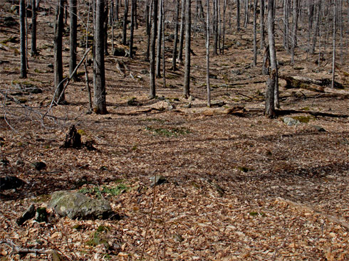
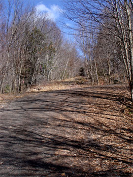
The image on the LEFT is the NY City DEP Parking Lot #1 with off-road parking. This space will hold only about 3 cars. The rocks will not be there when you go on the hike. You can also park at NYC DEP parking lot #2 about 6/10 mile further up the road. The road is rough! |
|
 |
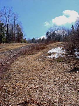
After leaving Parking Lot #1, walk across the Gillispie Road and walk UP Cortina Lane. About 0.13 miles up the road the road turns 90 degrees right. Instead of going right up the road, you want to leave Cortina Lane and keep going straight up the hill. The road will be a rough road. It will lead you up to a ski slope. From the ski slope go to the top of the mountain where the chair lift ends. This is the beginning of the DEC Trail.
While walking up the rough road to Cortina Mountain Ski Area, you will see two trails on the right. Both should lead you to the top of Cortina Mountain Ski Area. Or, you can continue up the hill and follow the slope up to the top. |
 |
|
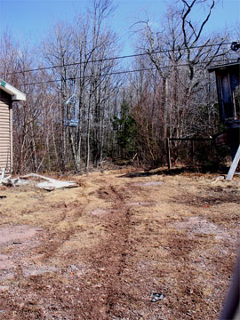 |
The picture on the LEFT show a picture of the top of the ski center chair lift. Walk between the two small structures.
The picture on the RIGHT shows the view after walking inbetween the two buildings. This is the beginning of the trail. On the left you will see a DEC sign and trail marker. There is NO registration box on this part of the trail. |
 |
|
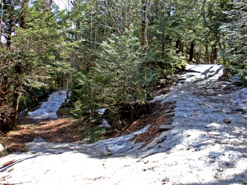 |
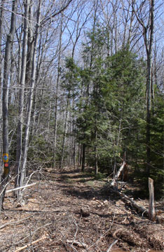
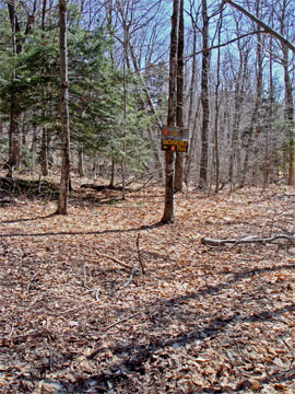
At Mile marker 0.71 you will come to this trail junction. Left will take you down to Rt 23A. Right will take you to the Snowmobile Loop Trail. You want to go RIGHT.
|
|
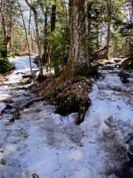 |
At Mile Marker 0.92 you will come to this trail junction. Left will put you on the old trail that runs North of Round Top Mountain, and leads up to Kaaterskill High Peak. Right will take you to the Snowmobile Loop Trail. You want to go RIGHT.
At Mile Marker 1.23 you will come to this trail junction. This is the trail junction to the Snowmobile Loop Trail Left will run on the North side of Round Top and Kaaterskll High Peak. Right will take you on the south North side of Round Top and Kaaterskll High Peak. You want to go RIGHT. |
 |
|
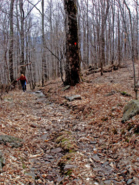 |
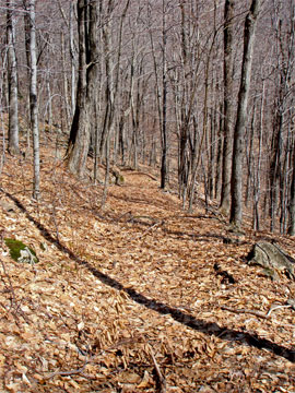
At Mile Marker 3.00 you will come to this trail junction. The picture was made AFTER we walked past the trail junction. On the right is the Loop trail you will be walking down. The trail on the left is the old horse trail that will lead you down to the Col. You want to take a 180 degree RIGHT turn down the hill. It is easy to miss the trail so keep looking for it as you come around Round Top Mountain. The person you see in the picture is the trail you want to walk down.
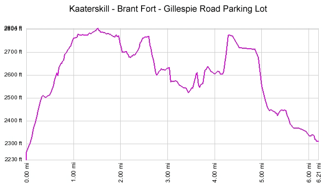
The image on the right is the old horse trail from the Loop trail to the Col inbetween Round Top Mountain and Kaaterskill High Peak. Once you get to the bottom, you want to take a LEFT and hug the North bank of Round Top Mountain. The "trail" to the Col has large trees, but very few small trees. Probably this section was used by the Mohawk Indians for camping. You will come to a section of a lot of rocks on the ground. Just past this section is Brant Fort Camp. |
 |
|
|
At Mile marker 3.65 you will encounter Brant Fort Camp. On the right of the camp (east), it will drop in elevation another 70-100' feet. During wet weather, this lower section has a lot of water running down it. GPS = N42 09.733 W74 05.672
|
|
S E C T I O N S
|
W E A T H E R
|
O T H E R
|