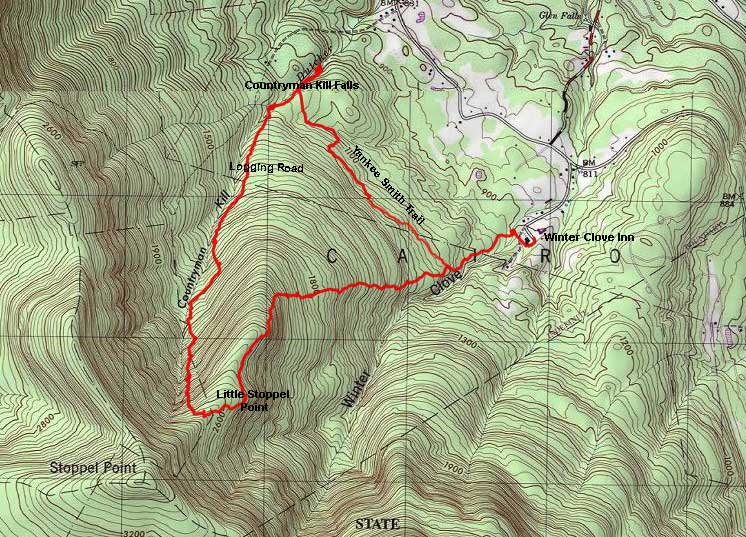
Little Stoppel Point & Countryman Kill Waterfalls |
 |
|
|
Overview of this Hike: |
| Distance: 7.25 round trip from the Winter Clove Inn in Round Top. |
| Time: 5-6 hours round trip (hiking time) - Add 1 hour if you want to wonder around the waterfalls |
| Elevation Gain: 1,764' |
| Best Time to Hike: Any time of day. In the Spring and Fall when the leaves are not on the trees. |
| Difficulty: Moderate |
| Highest Elevation: 2,714' |
| Digital Mapper:
Topo
Terrain
Satellite |
|
| Access Methods: Foot and snowshoeing. |
|
Maps, Profile, and GPS files |
 |
|
|
Directions to Trail Head from New York State Thruway (Easist, not the shortest): |
| Take New York State Thruway to Exit 21 (Catskill). |
| Take a left out of the NYS Thruway entrance road. |
| Go approximately 1/4 mile |
| Take a right onto Route 23 West |
| Go approximately 10.7 miles on Rt 23 (past Cairo, NY and up the hill towards Windham) |
| Take a LEFT onto Rt 31 to Round Top, NY. |
| Go approximately 3.7 miles on Rt 31 |
| Take a RIGHT onto Maple Lawn Road (Fire House is on the corner) |
| Go approximately 1.3 up Maple Lawn Road. |
| At the top of the hill take a LEFT onto Floyd Hawver Road. |
| Go approximately 1.0 mile |
| At the Stop sign continue STRAIGHT. |
| At the Y in the road - go RIGHT. |
| At the end of the road you will come to Winter Clove Inn. |
| Go into the Hotel and ask for permission at the front desk. If they want you to park your car in a special spot, they will let you know. |
| GPS: N42 14.445 W74 01.868 WGS84: 42.24075, -74.031133 UTM: 579936, 4676961 for Parking Lot of Winter Clove Inn |
| Mile Post | Altitude | Notes |
| 0.00 | 950 | Parking lot at Winter Clove Inn (GPS: N42 14.447 W74 01.858) - Walk down the road to the pool. At the intersection of the public road and the dirt road is the Trail Head. Walk up the hill on the dirt trail (not the dirt road). |
| 0.05 | 967' | Wooden Covered Bridge over Artist Falls |
| 0.06 | 974' | The trail comes to the end about 50' past the covered bridge. You want to take a RIGHT and walk up the trail. |
| 0.07 | 980' | As you walk up the trail, you want to go STRAIGHT. You will see some side trails. Stay on the main trail. |
| 0.25 | 1069' | You will come to a Y in the road. You want to go LEFT on the smaller and rockier trail. There is a wooden sign at the intersection of the trail. |
| 0.40 | 1,125' | You will come to another Y in the road. Left will take you to Little Stoppel Point. Right will take you to Countryman Kill Waterfalls. You want to go RIGHT. This is the Yankee Smith Trail. |
| 0.52 | 1,181 | After you walk up the hill, there will be a conifer forest on the left. Part of the way down the flat section, the trail will move LEFT into the conifer forest. It is very easy to miss this turn-off. So, pay attention. |
| 1.39 | 1,100 | You will walk across a mainly flat section on the edge of DEC and Private Land. After a while, you will see the trail turn 90 dgrees and head downhill over a rock wall. You will then follow another rock wall down the same hill. At the end, you will come to another road. You want to take a LEFT onto a dirt road. This road is easy to hike on. |
| 1.74 | 1,131 | As you come down a long straight section, you will see a rock wall on both side of the road. You will also see an old settlement in a beautiful conifer forest. At the end of the road you can take a right down to Countryman Kill Waterfalls #4 & #5. Left will take you to Countryman Kill Waterfalls #1 & #2. Straight across the road is Countryman Kill Waterfalls #3. |
| 1.74 | 1,131 | Add a 1/4 to 1/2 mile for exploring the waterfalls. When done walk up the logging trail |
| 2.85 | 1,866 | Logging Trail ends (N42 14.324 W74 03.4930). Bushwhack in the same direction and stay parallel to the creek. You will need to bushwhack 4/10 of a mile until you run into a new logging road. |
| 3.25 | 2,020 | Run into a new Logging Road (N42 14.084 W74 03.648). Follow the new logging road up the hill. The new logging road will be eroded, so you may need to walk on the sides. The logging road will get quite steep. When you get close to the top of the ridge the logging road will end. Bushwhack to the top of the ridge. Then head down into the conifer forest. |
| 3.86 | 2,714 | You will reach to the top of the ridge after a steep climb up the logging road. Turn LEFT and hike DOWN the ridgeline into the conifer forest. Drift over to the southern side of the conifer forest. You will see Mountain Laurel on your right. This is Little Stoppel Point. There is a view point near the eastern end of the point. It is best to hike down until the point pulls back in. Then hike in a little ways, and you will find two small clearings where you can get some views of Winter Clove Valley. |
| 4.36 | 2,586' | Arrive at Little Stoppel Point (N42 13.825 W74 03.355). Be careful around the ledges. After you get done, hike back towards the conifer forest. After walking a little ways into the conifer forest, start looking for a trail. It can be a little hard to find. The trail will run along the southern part of the ridge ( Don't drop down to the sub ledge after Little Stoppel Point. |
| 4.91 | 2,431' | Just before you start dropping off the ridge, you will see a small looking view point (N42 14.062 W74 03.250). If you walk over, you will see a nice ledge with a good view point over Winter Clove Valley. Go back to the trail. The trail will then drop off the ridge line. It will then head back to Winter Clove Inn. Pay attention to the side trails as you approach Winter Clove Inn property. Follow the same route you did on the way in. |
| 6.85 | 950' | Arrive back at Winter Clove Inn. |
|
Notes about this Hike |
The hike to Countryman Kill Falls and Little Stoppel Point is in Greene county. It is important to understand that this hike is on unofficial trails, and parts of the hike will not have hiking trails. Or, the trails are difficult to find. You should have good route finding skills. A GPS would be helpful.
The beginning of the hike is on a fairly level trail that takes you from Winter Clove Inn to Countryman Kill Falls. The trail is called the Yankee Smith Trail. The trail is fairly easy to hike. You can walk off the trail if you are not paying attention. Once you get to Countryman Kill Falls there are five waterfalls. They are not very tall, but they are very beautiful. The shoreline on the north side is private property, so stay on the south side.
You will then follow the old logging road up hill. Some parts of the old logging road is eroded, so you may have hike next to the road. About a mile up the road the old logging road will come to an end. You will continue to hike in the same direction. After about 4/10 of a mile, you will run into another logging road. Again, you will follow the logging road uphill. As you move uphill, it will get steeper. Just before you get to the top of the ridge, the second logging road will end again. But, you will almost be on the top of the ridge. There are some thick saplings, so I usually hike around them to reach the ridge.
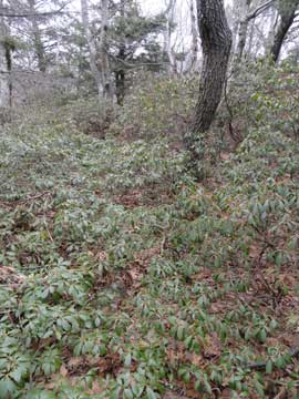
Once on the ridge, you will then hike downhill towards the conifer forest. Start looking for trees that have paint on them. These are the trail markers. You will enter the conifer forest. I then slowly move to the south side of the ridge. On your right you will see Little Stoppel Point. It will be out of the conifer forest and is loaded with Mountain Laurel. You want to hike to the lowest part of the point.
Once you are on the bottom of Little Stoppel Point, I bushwhack into the point. Don't climb down the steep parts of the point. If you look carefully, you will find a small view point. There are some large rocks you can sit on for lunch. I then hike back to the conifer forest. Finding the trail again can be difficult. You don't want to hike down to a lower section, but you want to stay on the south side. If you go too far north you will get into thick and tall Mountain Laurel. Once, you find the trail, you can follow it. Look for the paint marks on the trees.
Just before you drop off the ridge, there is a second view point. It is about 50' off the trail to the south. There is a rock with a good view, but you cannot see it from the trail.
As you drop off the ridge line, the trail goes down some steeper sections. It then levels out. When you get closer to Winter Clove Inn, you will complete the loop. You wil then return back to Winter Clove Inn.
|
|
Hike to Countryman Kill Waterfalls and Little Stoppel Point from Winter Clove Inn |
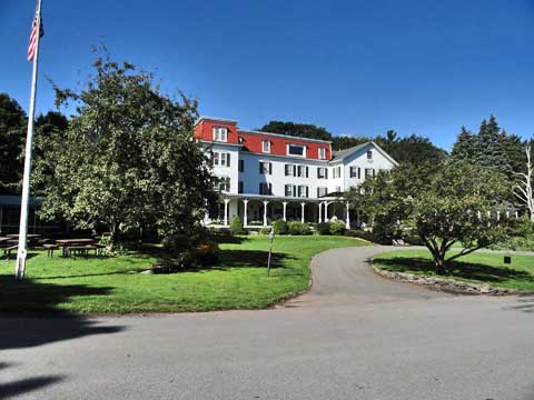 |
The picture above is Winter Clove Inn. Make sure you get permission from the front desk. If they ask you to park in a certain spot, please do so. If you are coming in from out-of-town, this is a great place to stay. If you forgot to bring this page with you, ask the front desk for a map. There are many turns, and it is almost impossible to figure out on your own. If you are coming to the Catskill Mountains and need a places to stay, Winter Clove Inn is a great place to stay.
|
|
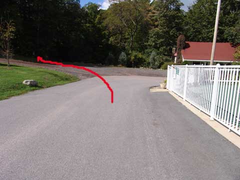 |
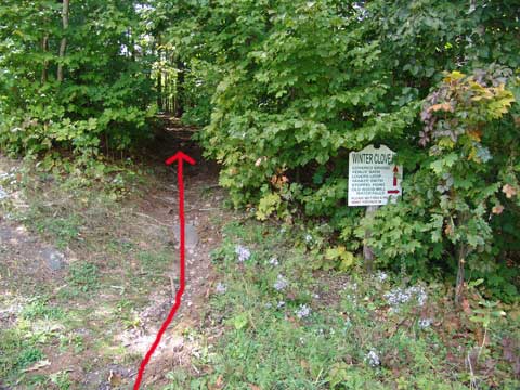
To start the hike, you need to walk down the road past the swimming pool. On the left you will see a white sign, with a small break in the woods. This is the start of the hiking trail called the Yankee Smith Trail. It will take you to the Countryman Kill Falls. |
|
 |
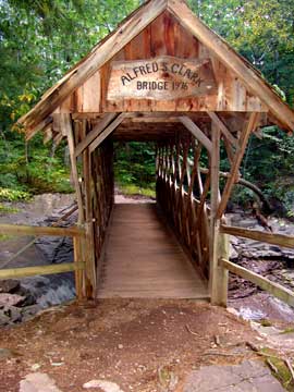
After you walk up the trail about 100 feet you will come to the wooden covered bridge. This bridge goes over the top of Artist Falls. . |
|
 |
You want to walk over the bridge. About 50' past the wooden covered bridge, the trail will come to an intersection. You want to take a RIGHT and head up the trail.
As you walk up the trail, you will see a few side trails. Stay on the main trail.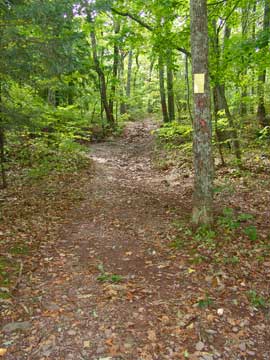 | |
|
 |
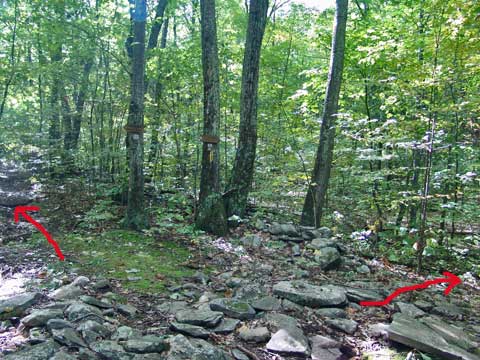
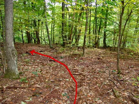
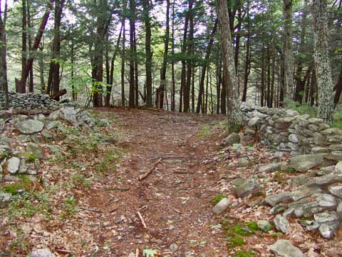
After a short distance, you will come to an intersection in the picture. You want to take a LEFT onto the smaller and rockier trail. This smaller trail will take you to the Yankee Smith Trail and the trail to Little Stoppel Point. |
|
 |
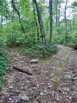
After you walk up the trail you will come to a trail junction. Left will take you up the steep path to Little Stoppel Point. Right will take you down the Yankee Smith Trail and to the Countryman Kill Waterfalls. You want to take a RIGHT. At this point you will have walked 4/10 of a mile.
|
|
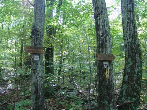 |
If you look at the trees, you will see two signs showing the direction to the appropriate trails. Left will take you up the steep path to Little Stoppel Point. Right will take you down the Yankee Smith Trail and to the Countryman Kill Waterfalls. You want to take a RIGHT.
|
|
 |
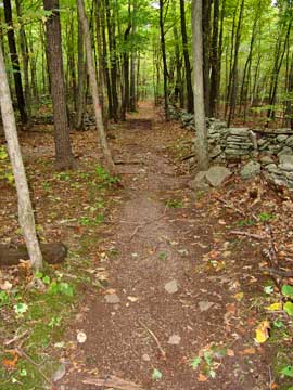
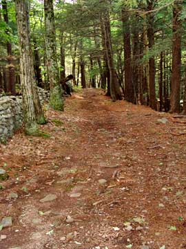
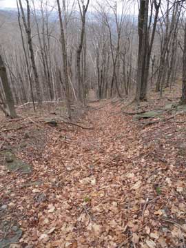
This is the beginning of the Yankee Smith Trail that will take you to the Countryman Kill Waterfalls.
As you walk down the trail, you will walk up a small hill to a conifer forest. Here the trail is fairly well defined. The trail will continue on the edge of the conifer forest.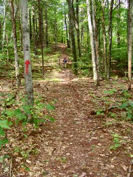 | |
|
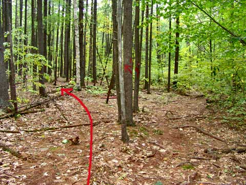 |
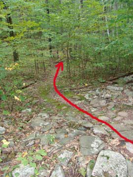
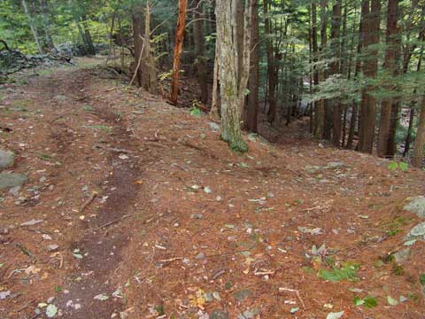
After about a 1,000' from the trail head the trail will leave the well defined path and move into the conifer forest. NOTE: You can easily miss this LEFT turn into the conifer forest. So pay attention.
From this point, the trail will get smaller. |
|
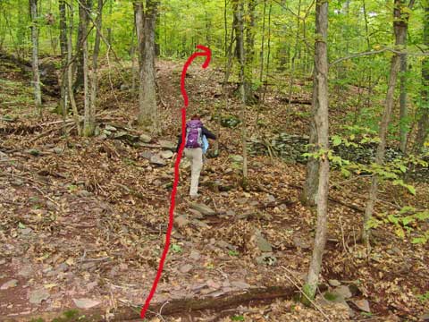 |
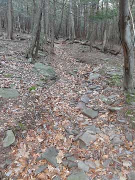
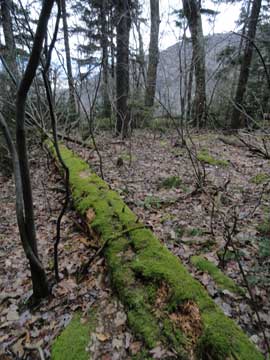
The trail will be small, so you need to pay attention to where the trail goes. The trail will follow the border of State and Private Land.
Once you get about 1-1/4 to 1-1/2 miles, the trail will slowly take a RIGHT turn and move down the hill. As it moves downhill you will go over a stone wall, and the follow another stone wall down the hill. |
|
 |
When you get down the hill, you will come to a trail junction. You want to take a LEFT onto a larger trail. If you went right, it would immediately lead you onto private land. You then want to follow the trail. |
|
 |
When you come close to the Countryman Kill Stream, you will come down a long straight road with a stone walls on both sides of the trail. In this region there are a lot of stone walls where there was once a settlement. |
|
 |
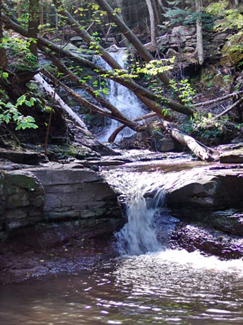
At the end of this straight road, you will have reached the Countryman Kill Creek. Directly across the trail will be waterfall #3. To the right is waterfalls #4 and #5. To the left is waterfalls #1 and #2. We want to go LEFT. |
|
 |
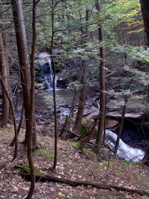
As you walk up the logging road, you will walk parallel to the Countryman Kill Creek. The ravine is fairly deep. This logging road will lead all the way up to Little Stoppel Point and Stoppel Point. But, to get to Waterfall #1 is only a short distance. This logging trail is actually a very pretty trail. . |
|
 |
As you walk up the old logging road, you will see two smaller roads that lead down into the ravine. The first one will take you to the bottom of Countryman Kill Waterfalls #2. The second small road will take you to the top of Countryman Kill Waterfalls #2. For right now, you want to continue up the logging road. After a short distance you will have to walk over to the ravine to find Waterfall #1. |
|
 |
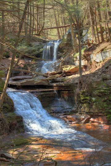
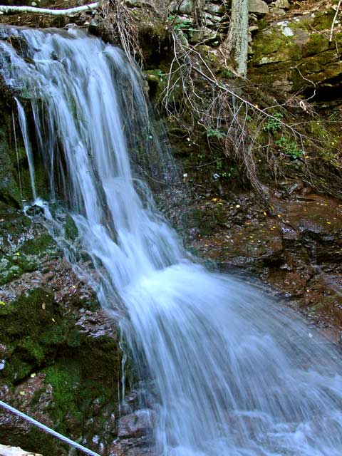
This picture shows you Countryman Kill Waterfalls #1. This waterfall is about 15' high. When you get done return back down the logging trail to the two side roads. These side roads will take you to Countryman Kill Falls #2 |
|
 |
This is a picture of Countryman Kill Waterfalls #2. It is about 14' high. It is a pretty waterfall. Unfortunately during Hurricane Irene, it pulled down the trees. The trees have a steel cable holding them back. So, they now block the view of the waterfalls. |
|
 |
This is another picture of Countryman Kill Waterfalls #2. This picture was taken from the second small road. |
|
 |
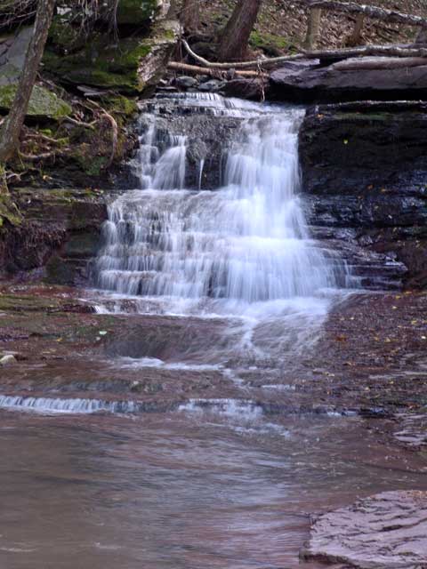
This is Countryman Kill Waterfalls #3. It is about 15' high. This waterfalls is a little more difficult to get down to. So be careful descending down the ravine. |
|
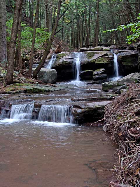 |
This is another picture of Countryman Kill Waterfalls #3. |
|
 |
This is a picture of Countryman Kill Waterfalls #3 from the logging road. |
|
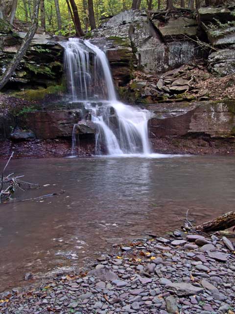 |
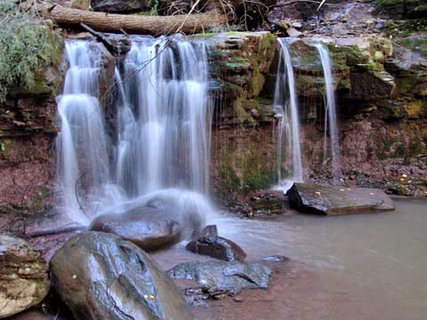
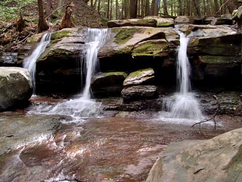
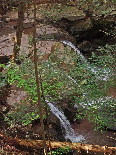
Countryman Kill Waterfalls #4. It is 26' high. It has a nice large pool at the bottom. At end of the pool is Countryman Kill Waterfall #5, which is 19' high. |
|
 |
This is Countryman Kill Waterfall #5, which is 19' high. It is the most difficult waterfall to get to the bottom. Just below this waterfall is another 10' cascade, which I believe is on Private Land. |
|
 |
This shows the connection between Countryman Kill Waterfalls #4 and Countryman Kill Waterfalls #5. These two waterfalls are considered one waterfall of about 55' high of 3 drops. When you get done, reverse your course back to Winter Clove Inn. It is also possible to follow the Logging Road up to the base of Stoppel Point. But, the logging trail gets more difficult when you get closer to Stoppel Point. It also gets quite steep and rugged. Once at the base of Stoppel Point, you can hike down the ridge to Little Stoppel Point. Make sure you stick to the Right side of the ridge, or you will get stuck in some large Mountain Laurel. The trail follows the south side of the ridge. |
|
 |
After looking at the waterfalls, start hiking uphill following the old Logging Road. You will follow the old Logging Road for about 1 mile. When the logging road ends, continue hiking in the same direction. I usually move more towards the creek. You will bushwhack for 4/10 of a mile.
After you come out of the conifer forest, you will run into another Logging Road. This one will run perpendicular to your direction. Follow the new Logging Road uphill. The trail will get quite steep. Due to the erosion, you may need to walk next to the trail.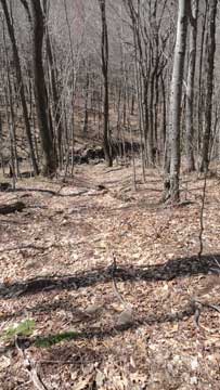 | |
|
 |
As you approach the top of the ridge, the trail will be steep. Then the new logging road will end. Ahead of you will be thick saplings. I generally move to left to get around most of the saplings. I then hike up to the top of the ridge.
I then start to hike down the ridge. Ahead of you will be a conifer forest. Sometimes you may see paint marks on the trees marking the trail. .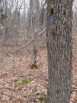 | |
|
 |
As you enter the conifer forest, I generally move towards the right side of the ridge. If you look over to the right you will see Little Stoppel Point. Little Stoppel Point has a lot of Mountain Laurel. The
I
I generally hike to the bottom of Little Stoppel Point and then hike in. I follow the trail which will move towards the south side of the ridge. When you get to the right place, you will start to come out of the conifer forest. There is a view point on the southeastern side of Little Stoppel Point.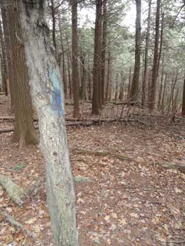 | |
|
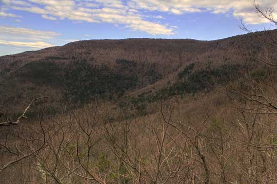 |
Looking for the view point can be difficult. As you walk onto Little Stoppel Point there are places where the ledges are dangerous. It is maybe 150-250' into Little Stoppel Point. If the ledges look dangerous, you are not in the correct spot. |
|
 |
When you get done, hike back to the trail. Finding the trail again can be a little difficult. A little route finding is necessary. If you move to the center of the ridge, you will encounter difficult and large Mountain Laurel. You want to be near the south side of the ridge, but not too south of the ridge. There is a sub ledge below Little Stoppel Point. You do NOT want to hike down there. It is too far south of the trail.
Once on the trail, the trail will become more obvious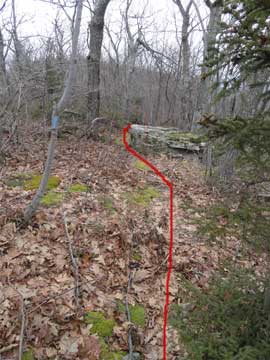 | |
|
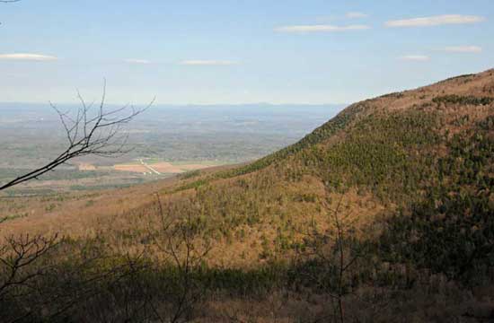 |
A little ways down, you will see a good view point on the south side of the ridge. If you hike about 40-50' off the trail, you will see a nice ledge with a good view. Then you will hike down off the ridge and head back to Winter Clove Inn |
|
|
S E C T I O N S
|
W E A T H E R
|
O T H E R
|