Rip's Ledge |
 |
|
|
Overview of this Hike: |
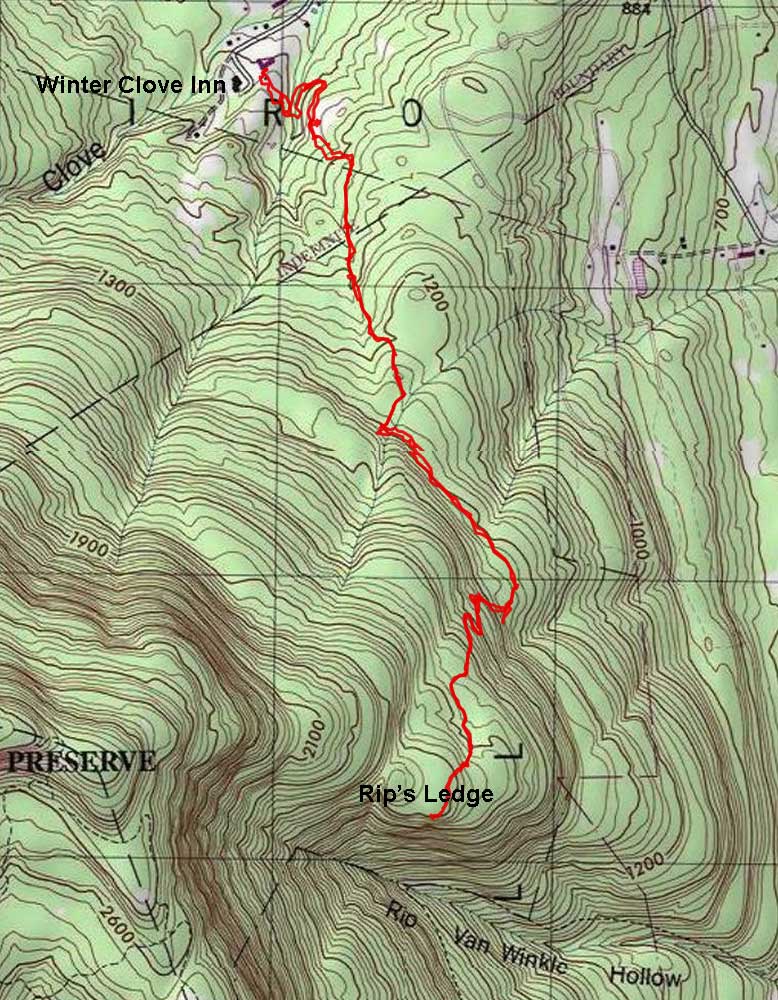
| Distance: 5.25 round trip from the Winter Clove Inn in Round Top. |
| Time: 3.5 hours round trip (hiking time) |
| Elevation Gain: 970' |
| Best Time to Hike: Morning - Not recommended in the Winter or when icy. |
| Difficulty: Easy to Moderate |
| Highest Elevation: 1,866' |
| Digital Mapper:
Topo
Terrain
Satellite |
| Access Methods: Foot and snowshoeing. |
|
Maps |
 |
|
|
Directions to Trail Head from New York State Thruway (Easist, not the shortest): |
| Take New York State Thruway to Exit 21 (Catskill). |
| Take a left out of the NYS Thruway entrance road. |
| Go approximately 1/4 mile |
| Take a right onto Route 23 West |
| Go approximately 10.7 miles on Rt 23 (past Cairo, NY and up the hill towards Windham) |
| Take a LEFT onto Rt 31 to Round Top, NY. |
| Go approximately 3.7 miles on Rt 31 |
| Take a RIGHT onto Maple Lawn Road (Fire House is on the corner) |
| Go approximately 1.3 up Maple Lawn Road. |
| At the top of the hill take a LEFT onto Floyd Hawver Road. |
| Go approximately 1.0 mile |
| At the Stop sign continue STRAIGHT. |
| At the Y in the road - go RIGHT. |
| At the end of the road you will come to Winter Clove Inn. |
| Go into the Hotel and ask for permission at the front desk. If they want you to park your car in a special spot, they will let you know. |
| GPS: N42 14.445 W74 01.868 WGS84: 42.24075, -74.031133 UTM: 579936, 4676961 for Parking Lot of Winter Clove Inn |
| Mile Post | Altitude | Notes |
| 0.00 | 896 | Parking lot at Winter Clove Inn (GPS: N42 14.447 W74 01.858) - Go down road until you are past Winter Clove Inn - Take right into dirt parking lot next to Game Building. Then walk south across field towards the woods. |
| 0.13 | 932' | Enter woods at end of field - Look for logging road - Walk down hill - Take side trail down to wooden bridge. |
| 0.27 | 917' | As you walk down logging road parallel to the stream, you will see a small trail going off the road. Take a RIGHT onto this smaller trail and walk up the hill. |
| 0.28 | 926' | After walking 50', you will come to another trail junction. Take a RIGHT. |
| 0.45 | 981' | You will come to a field. The worn trail will take a left up the hill. Do NOT follow the trail up the hill. Instead continue STRAIGHT across the field. Look for a trail at the edge of the forest. Follow rough trail up hill. |
| 0.64 | 1,088' | You will come to a Y trail Junction. Continue straight onto the new trail. |
| 0.81 | 1,098 | You will see a trail on the left that will take you to Lost Pond. Continue STRAIGHT. |
| 0.90 | 1,122 | You will come to a stream. Cross the stream (might be dry in the summer). Right after the stream there is a trail junction. Take a LEFT. |
| 0.95 | 1,147 | There is a trail on the right. This will take you to the golf course through a series of trails. You want to continue STRAIGHT across the stream and up the hill. |
| 1.16 | 1,282 | There is a trail off to the left. This trail will take you to Lost Bridge. You want to continue STRAIGHT. |
| 1.35 | 1,349 | You will come to a major trail junction. If you continue straight, it will take you up the upper trail to Rip's Ledge. Most people get lost on this route. I would strongly recommend taking a LEFT down the lower trail to Rip's Ledge. (GPS: N42 13.777 W74 01.538) |
| 1.84 | 1,389 | You will come to a T trail junction. Left will take you down to a private road. You want to take a RIGHT and head uphill. |
| 1.89 | 1,361 | At trail junction, you want to go RIGHT. |
| 2.44 | 1,801' | You will come to the end of an ATV trail. You will then need to take a right and head up to some ledges. You will then climb up the ledges. the trail will be faint in spots. Once on top of the ledge continue to follow the faint trail until you reach Rip's Ledge. (GPS: N42 13.147 W74 01.328) |
| 2.61 | 1,866' | Once on Rip's Ledge, you want to be careful. There is some exposure and dangerous spots, so pay attention. (GPS: N42 13.047 W74 01.407) |
| 5.22 | 896' | Reverse course back to Winter Clove Inn. |
|
Notes about this Hike |
The hike to Rip's Ledge is in Greene county. The hike starts on Private Land of Winter Clove Inn. At some point it will go onto NYS land. It is important to understand that this hike is on unofficial trails. You do not have to be a guest at the Inn, but you should ask for permission at the front desk.
The beginning of the hike starts on one of the lawns of Winter Clove Inn and goes into the forest. The hikes has a lot of side trails, and there are a lot of turns on this hike, so you need to pay attention. Most of the trails are well defined. But, there are few signs to guide you to the final destination.
When you get to about 1,300' you will start to see blueberry bushes. And, you will continue to see blueberry bushes all the way to Rip's Ledge. When the berries are rip, expect to see Black Bears.
The trail has a gentle grade almost all the way to Rip's Ledge. About 1,000' before you reach Rip's Ledge, you will have to climb up one small ledge. The trail becomes much less defined just before reaching the ledge.
It is rare to see other hikers on the trail. If you like solitude, you will like this hike. This route is hundreds of years old, so there is some history associated with the hike. When you get to Rip's Ledge, you need to pay attention. If you fall off this ledge, you will most likely be killed. The ledge is known to get good gust of wind on a windy day. Once you get done, you can use the same trail to hike back to Winter Clove Inn.
|
|
Hike to Rip's Ledge from Winter Clove Inn |
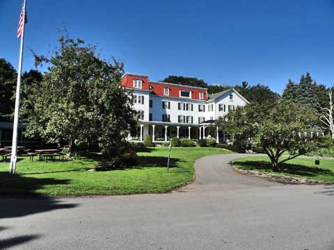 |
To get to the trail, you want to walk past the front of the hotel (south), and when you come to the end of the road, you want to take a LEFT into a side parking lot next to the Game Building. From the side parking lot, you want to walk across the field (south).
|
|
 |
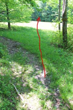
As you start to walk across the field, Winter Clove Inn will be on your RIGHT and slightly in back of you. You will be heading SOUTH when you walk across the field. |
|
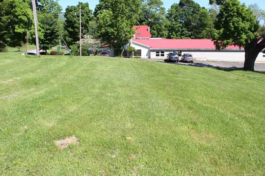 |
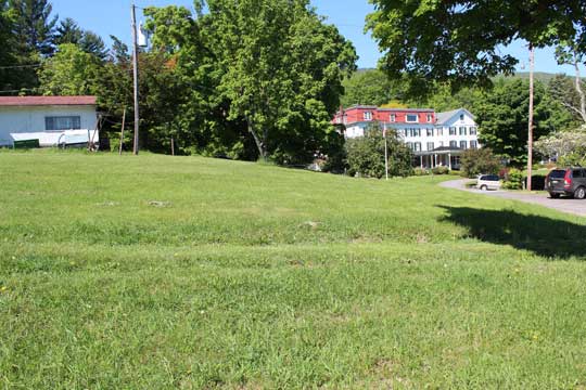
As you start to walk across the field, and if you looked BACK, you can see the Game Building. You can't see the Winter Clove Inn in the picture, but it would be on the left if you were looking backwards. |
|
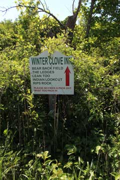 |
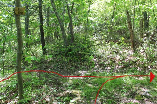
As you are walking across the field there is a clump of business with this sign. It will be on your left.
This is the view you will have as you walk across the field/lawn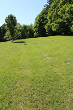 | |
|
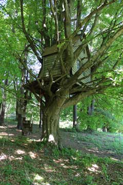 |
You can't see this tree house from the field, but if you hike uphill (right) and look into the tree line, you will see this tree house.
At the end of the field / lawn you will see a wagon road that goes into the forest and goes downhill.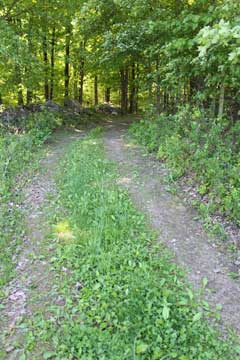 | |
|
 |
About 100' down the hill, there is a side trail the goes off to the LEFT. You want to take the LEFT and walk down to the bridge that goes across the stream.
|
|
 |
Bridge over creek - Go over bridge and walk east along the creek
While walking down the wagon road that is running parallel to the creek. After about 1,000' you will see a small trail on your RIGHT. You want to take this small trail on the RIGHT.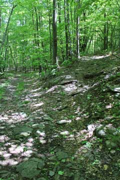 | |
|
 |
After walking about 50' up the side trail, you will come to another trail junction. You want to go RIGHT. |
|
 |
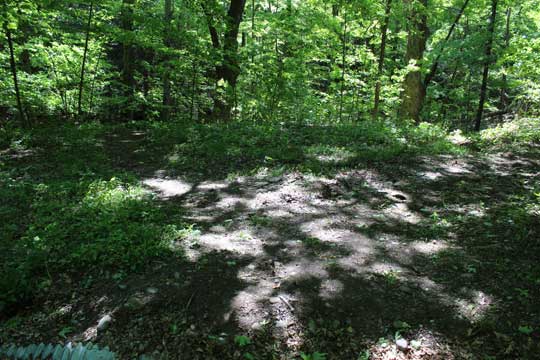
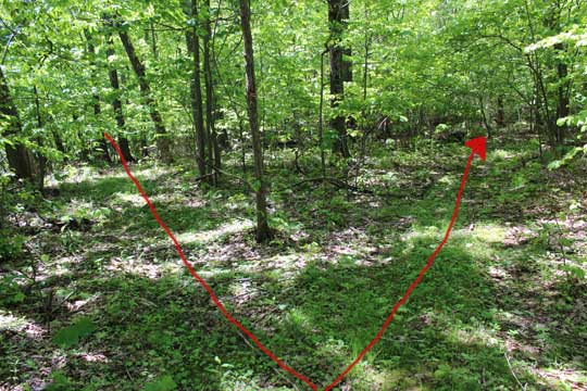
When you come to this field, you will see the trail turn left and go up the hill. Do NOT follow the worn trail. Instead, walk STRAIGHT across the field and find the trail that continues into the woods.
Find the trail on the other side of the field. Follow it into the woods, and follow it uphill.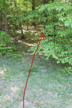 | |
|
 |
After walking up the hill, you will come to a trail junction. You want to continue on the more established trail. At this point you have gone approximately 2/3 of a mile. |
|
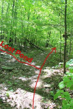 |
After about hiking moving onto the more established trail (about 750'), you will come to a side trail on the left. It will take you to Lost Pond.
You will come to a stream. In the summer, it will most likely be dry. After crossing the stream, you will come to another trail junction (see next picture). You want to take a LEFT at the trail junction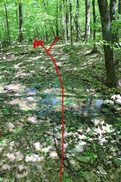 | |
|
 |
After crossing the stream and walking about 50' up the hill there will be another trail junction. You want to stay LEFT. |
|
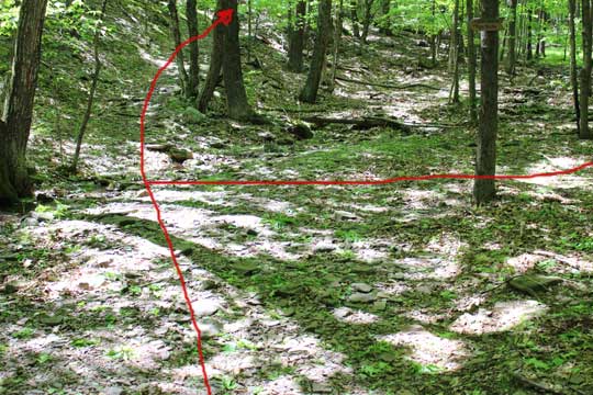 |
After about another 250' you will come to another trail junction. If you take a right it would take you to the golf course, Winter Clove Falls, or North Mtn (lookout #2). You want to continue STRAIGHT up the hill. |
|
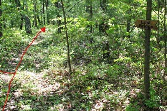 |
After about another 1,000' you will see a side trail off to the left. This side trail will take you to Lost Bridge. You want to continue STRAIGHT. |
|
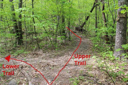 |
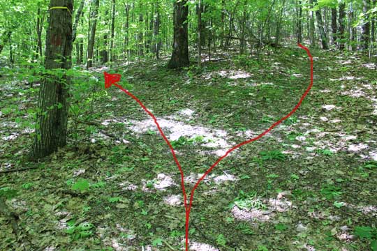
This is a major trail junction. Continuing straight will put you on the upper trail to Rip's Ledge. Many people get lost this way, so we don't recommend this route. If you take a LEFT, this will put you on the LOWER Trail. Take a LEFT for the LOWER TRAIL. |
|
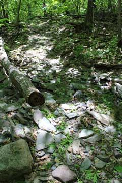 |
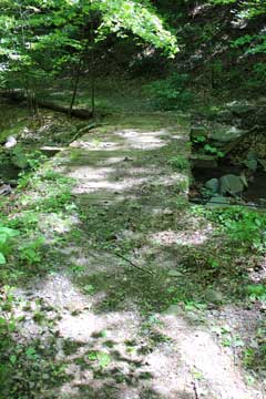
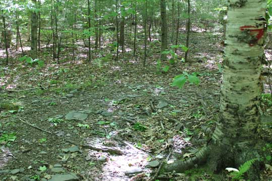
About 50-100' down the Lower Route, you will come to a stream crossing. In the summer it can be dry.
As soon as you cross the stream, you will encounter water on the trail some parts of the year. I just walk on the edge of the trail. The water only last a couple hundred feet, so it isn't so bad. 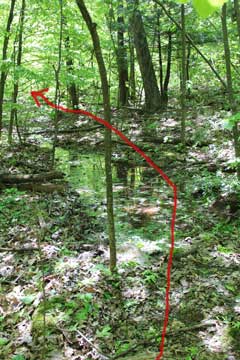 | |
|
 |
The trail will come to an end. Left will take you downhill several hundred vertical feet until you hit an old dirt. You want to take a RIGHT and head up hill. |
|
 |
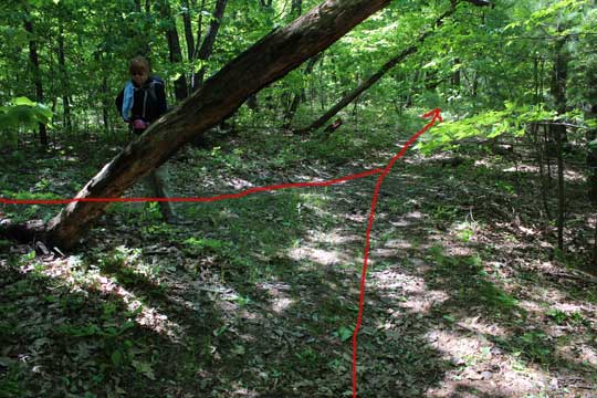
When you come to this Y in the trail, you want to go RIGHT. There is a small red arrow on the tree. |
|
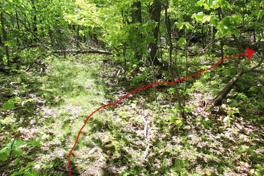 |
As you hike up the trail, the trail will start to become more overgrown. Sudden the trail will appear to come to an end. Many people get confused here. But, you are very close to Rip's Ledge. You want to take a 90 degree right and head towards some rock ledges. There is a trail there, but it is hard to follow. You want to climb up the ledges. |
|
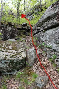 |
These are the ledges you need to climb up. In the Summer there are more leaves then what you see in the picture. But, you are very close to Rip's Ledge, so don't be discouraged. Once you get to the top of the ledge, just follow the trail through the blueberry bushes. You will then suddenly come to Rip's Ledge. The view is spectacular. |
|
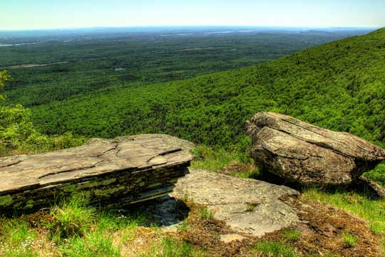 |
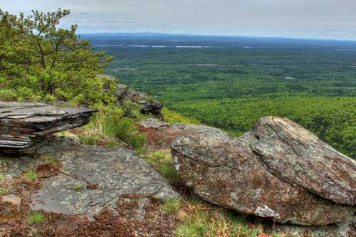
This is the view from Rip's Ledge (or sometimes called Rip's Rock). This is looking left from the ledge. In this distance you can see the Hudson River. There is a 180 degree view. The ledges are quite high. Be very careful near the edges. The views are spectacuar and quite dramatic. |
|
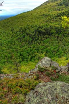 |
This is the view looking straight from Rip's Ledge. Just below you is the site of the Rip Van Winkle House. You cannot easily get to the old site from Rip's Ledge.
The picture on the right is looking west towards North Point (Lookout #1). It is actually below North Point.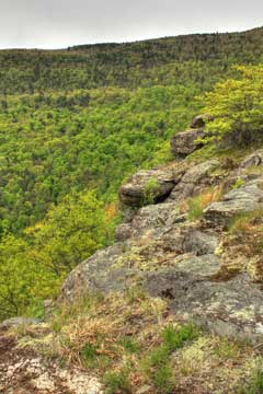 | |
|
|
S E C T I O N S
|
W E A T H E R
|
O T H E R
|