Hike to Tremper Mountain Fire Tower |
 |
| Tremper Mountain Fire Tower |
| |
| |
|
OVERVIEW |
| | Trail Name: |  Willow Trail (From Willow PA to Warner Creek Trail)
 |
| | Trail Name: |  Warner Creek Trail Trail (From Willow Trailhead to Tremper Fire Tower)
 |
| | | |
| | Forest : | Phoenicia - Mt Tobias Wild Forest |
| | | |
| | Parking Area : | Willow Parking Area off Jessop Road |
| | Winter Access: | Parking Area is NOT plowed |
| | Primitive Camp sites: | NO Camp Site locations |
| | Lean-to sites: | 1 Lean-to ( summit of Tremper Mountain ) |
| | Access: | Hike or snowshoe |
| | | |
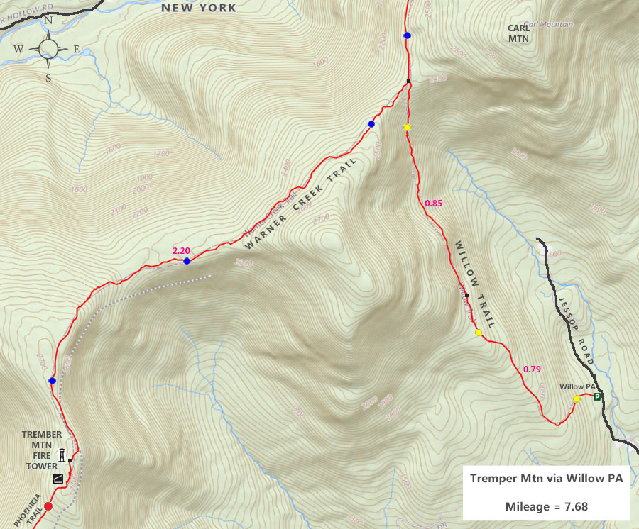
| | Trail Length: | 7.68 miles (round-trip) |
| | Trail Type: | 21% Double-track - 79% Single-track trail |
| | Hiking Time: | 4-5 hours |
| | Lowest Elevation: | 1,352' (A) |
| | Highest Elevation: | 2,741' (A) |
| | Views : | 1 view spot |
| | Difficulty: | Moderate |
| | | |
| | USGS Map: | USGS Phoenicia Quad Maps |
| | | |
| | USGS Map: | USGS Bearsville Quad Maps |
| | | |
| | DEC Trail Map: | DEC Phoenicia - Mt Wild Forest Map (free) |
| | | | |
| | Digital Mapper: |
Topo
Terrain
Satellite |
|
|
Maps for the Tremper Mountain Trail |
 |
|
|
|
| | Notes About Hiking the Tremper Mountain Trail |
|
| | TRAIL |
|
| |
NOTE: There are Timber Rattlesnakes in this area. They can be found anywhere along this hike. So, keep an eye for them. As a general rule, they do not come out of their den when temperatures are below 52F.
The trails to the Tremper Mountain Fire Tower runs through the Phoenicia - Mt Tobias Wild Forest.
The best time to hike this trail is when the leaves are not on the trees.
| |
| | CAMPSITES & LEAN-TO |
|
| |
The Tremper Mountain Lean-to is very close to the Mt Tremper Fire Tower. Obtaining water for the lean-to is the biggest problem. You need to bring water with you on this hike.
| |
| | PARKING |
|
| |
Parking at the Willow Parking Area is pretty easy. Not many people know about this parking area.
The land around the Willow Parking Area is owned by the NYC DEP. That land is RESTRICTED LAND. Which means that you cannot hike on the land. Even if you have a DEP permit.
| |
| | OTHER INFORMATION |
|
| |
|
|
|
| | DIRECTIONS to WILLOW Parking Area from Exit 19 (Kingston) |
| | Willow Parking Area WGS84 (DEC): 42.078133, -74.243517 - Elevation is approximately 1,352 feet |
| | Willow Parking Area Deg/Min/Sec: N42 04 41, W74 14 36 - Elevation is approximately 1,352 feet |
| | Willow Parking Area GPS: N 42 04.688, W 74 14.611 - Elevation is approximately 1,352 feet |
| | Willow Parking Area UTM: 18N 562574 4658728 - Elevation is approximately 1,352 feet
|
| |
|
| | Get off New York State Thruway at Exit 19 (Kingston). |
| | Take a RIGHT out of the NYS Thruway onto Route 28 West. |
| | Go approximately 6.0 miles on Rt 28 West |
| | Take a RIGHT onto Rt 375 to Woodstock, NY |
| | Go approximately 2.9 miles on Rt 375 |
| | Take a LEFT onto Rt 212 into and past Woodstock |
| | Go approximately 7.4 miles on Rt 212 |
| | Take a RIGHT onto Eighmey Road |
| | Go approximately 0.4 miles on Eighmey Road |
| | Continue STRAIGHT onto Jessop Road at 4-way Intersection |
| | Go approximately 1.1 miles on Jessop Road |
| | DEC Parking Area is on the LEFT side of the road. Holds 6 cars |
|
|
|
MILEAGE CHART - Hike for the Tremper Mountain Fire Tower |
| | Distance | Mile Point | Altitude | Willow Parking Area to Tremper Mountain Fire Tower |
| | 0.00 | 0.00 | 1,352' | Willow Parking Area |
| | 0.79 | 0.79 | 1,980' | Leave Logging Road for Trail |
| | 0.85 | 1.64 | 2,410' | Trail Junction for Willow Trail & Warner Creek Trail |
| | 2.20 | 3.84 | 2,741' | Tremper Mountain Fire Tower |
|
Hike to the Tremper Mountain Fire Tower from Willow Parking Area |
|
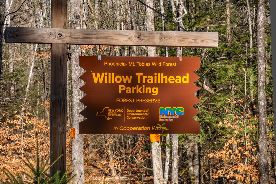 |
The Willow Parking Area is located about 50 feet off Jessop Road. This sign is located on the left side of Jessop Road.
|
|
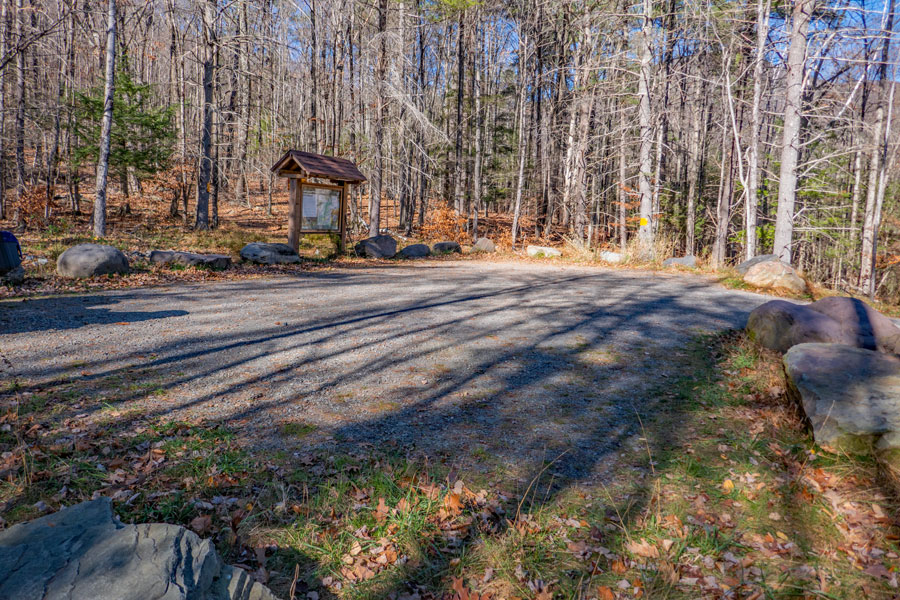 |
When you drive up the Willow Parking Area, there are approximately 6 parking spaces for cars.
Some of the land surrounding the Willow Parking Area is RESTRICTED DEP LAND. This means that you cannot go on the land past the yellow No Trespassing signs around the parking area. Even if you have a DEP permit, you cannot hike on Restricted DEP land.
|
|
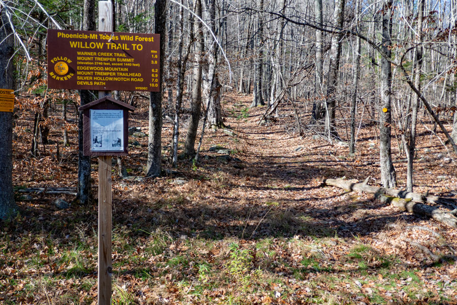 |
This is the Willow Trailhead. It is a double-track road for the first 8/10 of a mile. The incline is fairly easy in most places.
|
|
 |
 |
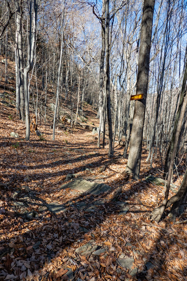
After about 8/10 of a mile, the trail leaves the old logging road and climbs up Hoyt Hollow. The incline of the trail increases to a moderate incline for the next 8/10 of a mile.
The LEFT side of the Willow Trail is on DEC land. The right side of Willow Trail is on Private Property until you reach the Warner Creek Ridge Line.
As you approach the top of the Willow Trail, the incline starts to level off.
|
|
 |
 |
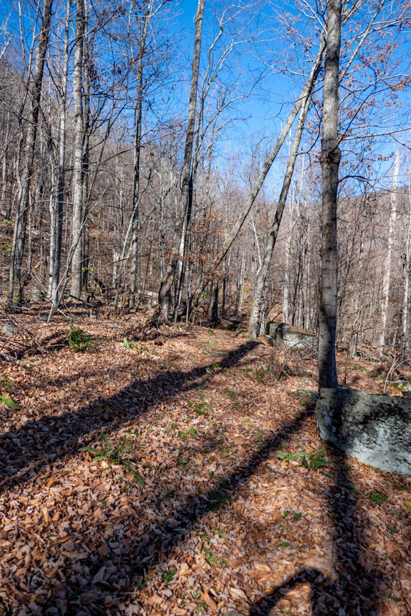
The incline on the upper section of Willow Trail is fairly easy. As you get near the end of the trail, it levels off completely.
At the end of the Willow Trail will be a Trail Junction with the Warner Creek Trail. You want to go LEFT towards Mt Tremper Fire Tower. About 2.2 miles away.
Right would take you down to Warner Creek. Carl Mountain is also off to the right. To get to the summit of Carl Mountain, you would have to leave the trail and bushwhack up to the summit. The southwest side of Carl Mountain is pretty easy hiking. The northeast side of the Carl Mountain is difficult with many ledges.
|
|
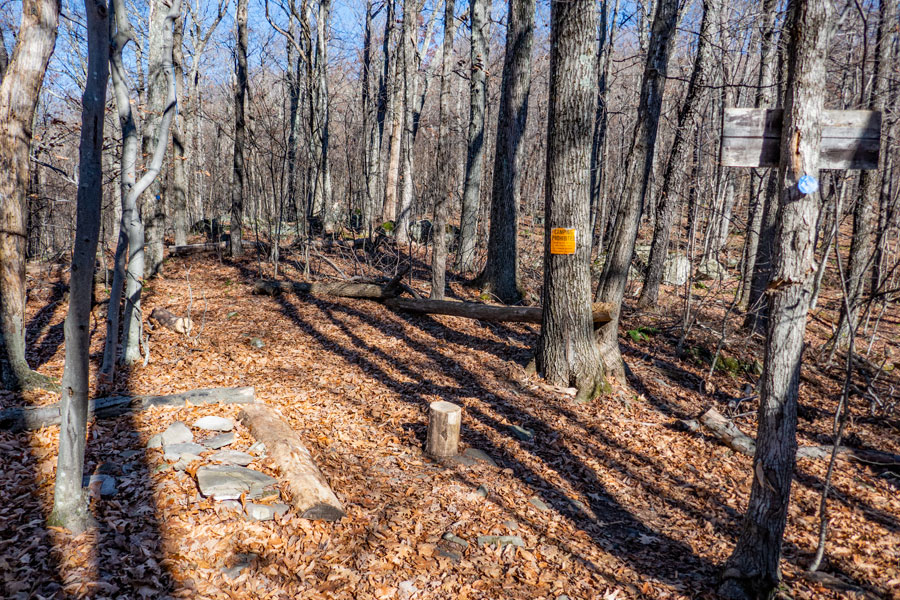 |
This is the actual trail junction for the Willow Trail and Warner Creek Trail. You cannot camp here. There is a lean-to by the Mt Tremper Fire Tower (about 2.2 miles away).
|
|
 |
 |
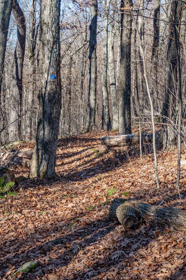
The trail from Willow Junction to Mt Tremper Fire Tower is pretty easy with only a mild incline. Over the next 2.2 miles, you will gain a little over 300 feet. Easy hiking. Unfortunately no views along this ridge walk.
The trail does get a little windy in some places. When the leaves are off the trees, you do get a very limited view of the valleys.
When you reach the Mt Tremper Fire Tower, you will see this old sign attached to an old telephone pole.
|
|
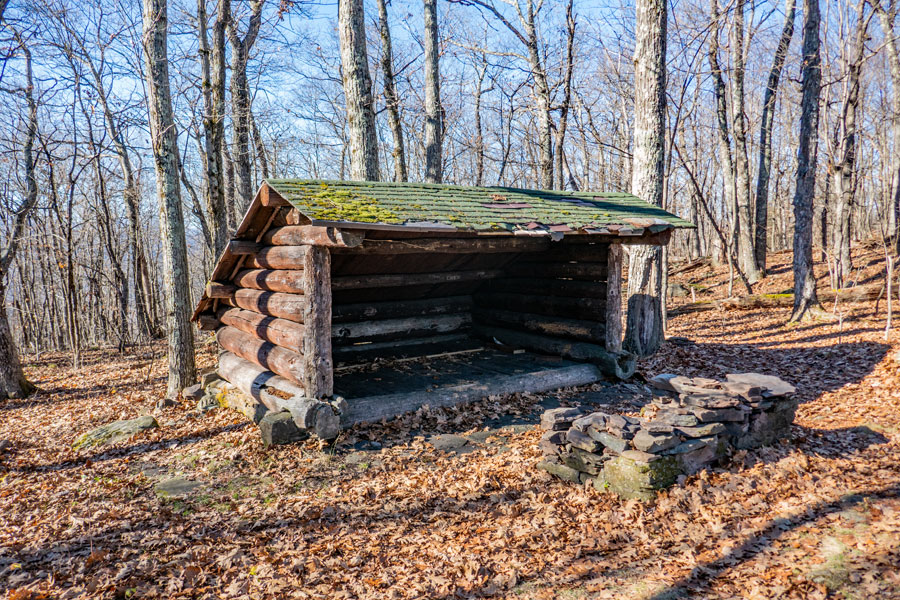 |
This is the Tremper Mountain Lean-go. There is NO water source near this lean-to. So, you need to bring water with you.
|
|
|
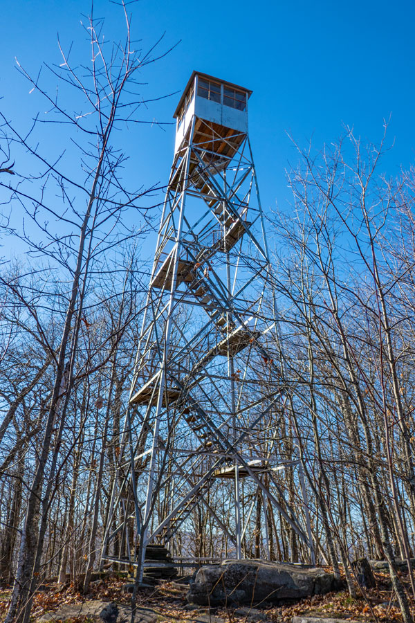
This is the Tremper Mountain Fire Tower.
You have to climb fairly high up the fire tower to get any views over the valley. The cabin on top is closed most of the year, but open on some weekends in the summer.
|
|
|
S E C T I O N S
|
W E A T H E R
|
O T H E R
|